TcpTunnel
•Download as PPT, PDF•
0 likes•402 views
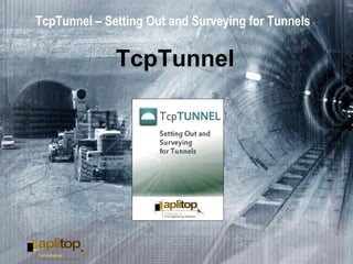
This application, installed in a mobile device, provides users with the most common options for setting out tunnels and gathering data from them with either motorized or conventional total stations.
Report
Share
Report
Share

Recommended
Modelling structures in fire using OpenSees - An integrated approach
Liming Jiang developed SIFBuilder, an integrated solution for modeling structure in fire within OpenSees. SIFBuilder provides a user-friendly interface for creating structural models and considering realistic fire effects. It allows for heat transfer analysis, thermo-mechanical analysis, and integrated computation using OpenSees. SIFBuilder supports various fire models, materials, sections, and elements to simulate structural response to fire until the point of collapse. The tool is being developed to advance research on structural fire safety.
Graph500 and Green Graph500 benchmarks on SGI UV2000 @ SGI UG SC14
The document discusses Graph500 and Green Graph500 benchmarks for evaluating graph processing performance on the SGI UV2000 system. It provides an overview of the benchmarks and describes testing various graph workloads, including social networks and road networks, on different hardware from smartphones to supercomputers. The authors aim to optimize breadth-first search (BFS) graph algorithms on the NUMA-based SGI UV2000 without using MPI through NUMA-aware techniques.
ES_SAA_OG_PF_ECCTD_Pos
This document proposes a generalized division-free architecture and compact memory structure for resampling in particle filters. It aims to avoid the high hardware cost of traditional multinomial resampling by using accumulators and comparators instead of division and normalization. The architecture is independent of the number of particles and can be used for different resampling methods. Memory usage is optimized by accumulating weights and random numbers on-the-fly instead of storing cumulative sums, reducing area by up to 45% and memory usage by up to 50%. The architecture achieves resampling without ordering, normalization or generating ordered random numbers.
cloud_futures_2.0_Papazachos
This document proposes using cloud computing to rapidly generate earthquake shake maps through stochastic simulations. It describes implementing a map-reduce model on the Microsoft Azure cloud to parallelize simulations for many receivers after an earthquake. Results like peak ground acceleration maps could be produced within minutes to aid scientists and emergency responders. The method was tested in Greece and provides a cost-effective way to process simulations as needed without dedicated computing resources.
TcpScancyr
This application computes cross sections of tunnels for roads and railroads, from laser scanner data.
Underground water tunnel
The main role of this tunnel is to fulfill the water supply demands in safe and uninterrupted manner in future
Tunneling Construction - NATM
The New Austrian Tunneling Method (NATM) involves:
1) Creating initial support on tunnel openings to prevent deterioration.
2) Excavating in short sections and applying shotcrete and metal supports.
3) Monitoring deformation with various instruments to ensure tunnel stability.
Transportation in a supply chain management
The document discusses transportation in supply chains. It describes the key factors in transportation decisions, various modes of transportation including their characteristics and considerations, and designing transportation networks. The roles of shippers and carriers are defined. Details are provided on transportation via air, truck, rail, water, pipeline, intermodal, and their trade-offs and issues in planning transportation.
TcpET
This application, installed in a pocket PC, allows the user to survey and stake out topographical data using a wide range of total stations, connected through a standard cable or through wireless Bluetooth technology. In motorised stations, the software will automatically direct the device to the desired location. The program provides numerous options and may be used for traditional mapping or surveying, and for projects involving linear works.
ORFEO ToolBox at CS-SI From research to operational applications
1. CS-SI uses Orfeo ToolBox (OTB) as a development framework for image processing research and operational applications. OTB supports research projects for space agencies and customers in areas like pansharpening, automatic image analysis, and hyperspectral data analysis.
2. OTB is integrated into several operational Sentinel-2 ground segment processing systems developed by CS-SI, including the Level-0 and Level-1 Instrument Processing Facility and the Mission Performance Assessment system.
3. CS-SI also develops end-user applications for agriculture using OTB, including a composite product, LAI retrieval, and crop mask and type classification using Sentinel-2 and Landsat-8 data.
CHSurvey introduce
Chung-Hsing Surveying Co. is a surveying company founded in Taichung, Taiwan in 1969. It was the first private surveying company in Taiwan. The company has 6 departments and 82 employees. It specializes in control surveying, digital terrain modeling, engineering surveying, urban planning, and hydrographic surveying using innovative technologies like terrestrial, mobile, and airborne LiDAR systems as well as hyperspectral imaging. Chung-Hsing was also the first company to adopt GPS in 1992, establish an airborne LiDAR system in 2003, and acquire a commercial hyperspectral imager in 2011.
INDUSTRIAL_TRAINING_PRESENTATION_REPORT.pptx
The document provides a report on a topographic surveying project in Nzega District, Tanzania. It was prepared by two industrial training students and details the objectives, location, instrumentation used, data acquisition process, analysis and processing. Key steps included reconnaissance, establishing control points using RTK GPS, collecting profile and feature data, exporting to CAD software, and creating surfaces and alignments. Challenges included signal loss and equipment issues, while recommendations focused on critical thinking, time management and teamwork.
Software architecture of wheeled mobile robots
This document summarizes the key aspects of software architecture for wheeled mobile robots. It discusses common architectures including those without an OS, with a real-time OS, and with an embedded OS. It also covers important components like motion control using PID regulators, localization using odometry and lidar, and motion planning algorithms like A* and RRT Connect. The document provides advantages and disadvantages of the different approaches.
Speeding up information extraction programs: a holistic optimizer and a learn...
A wealth of information produced by individuals and organizations is expressed in natural language text. Text lacks the explicit structure that is necessary to support rich querying and analysis. Information extraction systems are sophisticated software tools to discover structured information in natural language text. Unfortunately, information extraction is a challenging and time-consuming task.
In this talk, I will first present our proposal to optimize information extraction programs. It consists of a holistic approach that focuses on: (i) optimizing all key aspects of the information extraction process collectively and in a coordinated manner, rather than focusing on individual subtasks in isolation; (ii) accurately predicting the execution time, recall, and precision for each information extraction execution plan; and (iii) using these predictions to choose the best execution plan to execute a given information extraction program.
Then, I will briefly present a principled, learning-based approach for ranking documents according to their potential usefulness for an extraction task. Our online learning-to-rank methods exploit the information collected during extraction, as we process new documents and the fine-grained characteristics of the useful documents are revealed. Then, these methods decide when the ranking model should be updated, hence significantly improving the document ranking quality over time.
This is joint work with Gonçalo Simões, INESC-ID and IST/University of Lisbon, and Pablo Barrio and Luis Gravano from Columbia University, NY.
Origo mdn 2015
The document describes Origo, a new metadata-driven architecture for broadcast media developed by NRK. It aims to improve on current linear workflows by keeping all versions and metadata for a story together across planning, production, archiving and publishing. Key aspects include using a graph-based data model and standards like EBU Core, storing metadata from all stages to describe the storytelling, and integrating with production systems while being modular and based on open principles. Some early results have integrated Origo with production and quality assurance systems, provided administrative interfaces, and developed a graph-based datamodel using global authority registers and ontologies to update and share metadata.
RFCS Project - TeleRescuer
TeleRescuer is an innovative system for inspecting coal mine roadways, especially those affected by catastrophes such as fire, explosion of methane or coal dust, and the others.
The system allows virtual teleportation of a mining rescuer to those areas of a coal mine, in which he could not remain due to hazards for life or health.
Syallabus Discussion Python.pptx
This document outlines a computer programming course in civil engineering. The course introduces Python programming basics and teaches how to write Python codes to solve various civil engineering problems. The course objectives are to understand Python programming fundamentals and develop Python programs for civil engineering applications. Students will learn Python syntax, data structures, functions, and libraries. The term work involves completing 10 mandatory Python programming assignments on topics like open channel flow, hydrology, structural analysis, transportation, and more. Students will be assessed on their ability to write original Python codes to solve assigned civil engineering problems.
Piping Engineering Subject Areas
The document outlines the divisions of a piping engineering department, including piping engineering basics, analysis, construction, and 3D integrated design. It details the areas of piping material selection, codes, equipment arrangement, routing, drawings, analysis using line lists and software for strength and flexibility calculation, welding, testing, 3D CAD software for modeling, and training on various piping design programs.
Spark Summit EU talk by Miha Pelko and Til Piffl
1) NorCom is an IT company that provides consulting services for big data and information management, with customers in automotive, public, media, and finance sectors.
2) Time series analysis of sensor data from vehicles is important for automotive R&D, but requires parallel processing due to the large volumes of data.
3) NorCom developed a Spark API called DaSense to simplify working with multi-sensor time series data at scale, and explored parallelizing state machine analysis on vehicle data using Spark.
Automated Sys. Design.11-For LinkedIn
This document provides details of a project to design an automated pick and place system for components of a CNC lathe machine. It includes sections on the objectives, literature review, methodology, modeling using Solidworks, fabrication, static and dynamic FE analysis, optimization, and conclusions. The objectives are to reduce lead time, optimize design for cost and productivity, and evaluate the new design using simulation. The literature review covers various papers on robotics, pick and place systems, dynamic analysis, and multi-robot coordination. The methodology describes the components to be used, cycle time calculations, and assembly. FE analysis and optimization are performed to validate the design meets requirements. The conclusions are that automation increased productivity and reduced cycle times.
ハイブリッドLoRa-BLEモジュールとTTN対応キャリアグレードLoRaWANゲートウェイの紹介
This document introduces LoRa-BLE modules and TTN-compatible carrier-grade LoRaWAN gateways from 144Lab. It summarizes the key features of the InsightSiP LoRa-BLE module, including that it uses an InsightSiP design with SX1261 and nRF52832 chips. It also summarizes the key features of 144Lab's Samaritaine.01 gateway, including that it uses the LoRa-BLE module and can be powered by two AA batteries for long-term operation. Finally, it thanks the audience for their attention.
ProSIM engineering consultancy offerings to nuclear power sector
ProSIM has been providing engineering design, and R&D services to OEMs, Operators, EPC contractors, System Integrators and vendors of nuclear power sector. ProSIM has assisted in the design and seismic evaluation/ analysis of systems, structures and components (SSCs) of nuclear power plants (NPP). Driven by its competence and focus on quality and project management processes, ProSIM has delivered value to its customers. ProSIM has interacted with regulatory bodies and code committees related to nuclear design codes. Methodologies for seismic analysis of mechanical equipment (rotary and static), electrical engineering, instrumentation and control, and structures have been developed by ProSIM using ASME boiler and pressure vessel (B&PV), RCC, IEEE, ASCE and similar codes. Several hundreds of reports of seismic analysis/ evaluation submitted by ProSIM have been approved by the operators or regulatory bodies. ProSIM has taken up several detailed engineering projects. Worked on design optimisation of structures/ equipment, pipelines, supports etc. ProSIM has also supported seismic qualification of equipment/ systems by physical testing by coordinating with agencies.
In addition to the seismic analysis during engineering stage for structural integrity assessment, ProSIM has worked on seismic margin assessment, seismic re-evaluation, fitness for service (FFS), remaining life assessment and extension (RLA/RLE), and failure analysis.
Feeder Separation Project
This document proposes an economical and efficient approach to electrical survey data collection and network topology creation using GIS survey tools and network analysis software. Key offerings include tools for GIS surveying, data conversion from surveys to network analysis, network analysis services, and diagram/BOQ generation. The approach is estimated to save 35-60 man-days per 100-feeder project compared to conventional methods. Deliverables would include network models, analysis reports, diagrams, and bills of quantities.
Working Experience_V5.0
The document describes several projects involving traffic data collection and analysis, vehicle detection systems, wireless network infrastructure setup tools, a sports gambling platform, and customized demo kits. Key details include using C#, Java, PostgreSQL, Oracle databases and analyzing real-time traffic and vehicle data to provide routing recommendations, classify vehicle types, and detect objects passing under sensors.
WP4 - Deployment of "smart" services toolkit
This document summarizes Work Package 4 (WP4) which focuses on deploying a "smart" services toolkit. WP4 is led by MOSS and involves 9 tasks from July 2012 to January 2014. It aims to develop smart city services, platforms, and clients. Current achievements include establishing the 3D technology platform and prototypes for solar energy potential assessment and noise mapping services. Next steps involve further integrating core platform infrastructure, services, and clients.
최신 3차원 이미지 스캔 역설계 기술 전망 및 건설 활용
The document discusses 3D image scan-based reverse engineering and its applications in construction. It provides an overview of trends in 3D scanning technologies, the reverse engineering process from 3D point clouds to BIM, potential benefits and case studies. It also considers factors like precision, density and the automation potential of integrating machine learning for more intelligent and real-time 3D scanning. The research aims to develop methods for automated extraction of construction objects from point clouds to generate infrastructure and building models.
lecture1.ppt
This document provides an introduction and overview of key concepts in software development and data structures. It discusses the software development process, performance analysis using Big O notation, abstract data types, and introduces common data structures. Some key topics covered include specification and design of problems, implementation principles, testing and debugging, complexity analysis, preconditions and postconditions, and object-oriented programming as it relates to data structures.
C++ Notes PPT.ppt
C++ Is One Of The widely used programming language. Here is the complete presentation PPT notes of C++ programming language. hope it will be helpful to you.
TcpScancyr. PowerPoint Presentation
This document describes TcpScancyr software for generating tunnel cross-sections from 3D scanned point cloud data. The software allows users to import point cloud data, define the tunnel template and alignment, calculate and edit cross-sections, and generate reports on areas, volumes, alignment deviations and other metrics. Key features include point filtering and selection tools, visualization of cross-sections and the point cloud, and exporting of drawings, videos and data.
Tcp imagen
TcpImage is image management and transformation software that allows users to perform the following functions:
It supports common raster and vector file formats and allows adjustment of images through tools for brightness, contrast, saturation, etc. The software includes batch tools for resizing, renaming, and converting multiple images. Images can also be georeferenced using control points and reference drawings. Drawings can define layers and split images into sheets.
More Related Content
Similar to TcpTunnel
TcpET
This application, installed in a pocket PC, allows the user to survey and stake out topographical data using a wide range of total stations, connected through a standard cable or through wireless Bluetooth technology. In motorised stations, the software will automatically direct the device to the desired location. The program provides numerous options and may be used for traditional mapping or surveying, and for projects involving linear works.
ORFEO ToolBox at CS-SI From research to operational applications
1. CS-SI uses Orfeo ToolBox (OTB) as a development framework for image processing research and operational applications. OTB supports research projects for space agencies and customers in areas like pansharpening, automatic image analysis, and hyperspectral data analysis.
2. OTB is integrated into several operational Sentinel-2 ground segment processing systems developed by CS-SI, including the Level-0 and Level-1 Instrument Processing Facility and the Mission Performance Assessment system.
3. CS-SI also develops end-user applications for agriculture using OTB, including a composite product, LAI retrieval, and crop mask and type classification using Sentinel-2 and Landsat-8 data.
CHSurvey introduce
Chung-Hsing Surveying Co. is a surveying company founded in Taichung, Taiwan in 1969. It was the first private surveying company in Taiwan. The company has 6 departments and 82 employees. It specializes in control surveying, digital terrain modeling, engineering surveying, urban planning, and hydrographic surveying using innovative technologies like terrestrial, mobile, and airborne LiDAR systems as well as hyperspectral imaging. Chung-Hsing was also the first company to adopt GPS in 1992, establish an airborne LiDAR system in 2003, and acquire a commercial hyperspectral imager in 2011.
INDUSTRIAL_TRAINING_PRESENTATION_REPORT.pptx
The document provides a report on a topographic surveying project in Nzega District, Tanzania. It was prepared by two industrial training students and details the objectives, location, instrumentation used, data acquisition process, analysis and processing. Key steps included reconnaissance, establishing control points using RTK GPS, collecting profile and feature data, exporting to CAD software, and creating surfaces and alignments. Challenges included signal loss and equipment issues, while recommendations focused on critical thinking, time management and teamwork.
Software architecture of wheeled mobile robots
This document summarizes the key aspects of software architecture for wheeled mobile robots. It discusses common architectures including those without an OS, with a real-time OS, and with an embedded OS. It also covers important components like motion control using PID regulators, localization using odometry and lidar, and motion planning algorithms like A* and RRT Connect. The document provides advantages and disadvantages of the different approaches.
Speeding up information extraction programs: a holistic optimizer and a learn...
A wealth of information produced by individuals and organizations is expressed in natural language text. Text lacks the explicit structure that is necessary to support rich querying and analysis. Information extraction systems are sophisticated software tools to discover structured information in natural language text. Unfortunately, information extraction is a challenging and time-consuming task.
In this talk, I will first present our proposal to optimize information extraction programs. It consists of a holistic approach that focuses on: (i) optimizing all key aspects of the information extraction process collectively and in a coordinated manner, rather than focusing on individual subtasks in isolation; (ii) accurately predicting the execution time, recall, and precision for each information extraction execution plan; and (iii) using these predictions to choose the best execution plan to execute a given information extraction program.
Then, I will briefly present a principled, learning-based approach for ranking documents according to their potential usefulness for an extraction task. Our online learning-to-rank methods exploit the information collected during extraction, as we process new documents and the fine-grained characteristics of the useful documents are revealed. Then, these methods decide when the ranking model should be updated, hence significantly improving the document ranking quality over time.
This is joint work with Gonçalo Simões, INESC-ID and IST/University of Lisbon, and Pablo Barrio and Luis Gravano from Columbia University, NY.
Origo mdn 2015
The document describes Origo, a new metadata-driven architecture for broadcast media developed by NRK. It aims to improve on current linear workflows by keeping all versions and metadata for a story together across planning, production, archiving and publishing. Key aspects include using a graph-based data model and standards like EBU Core, storing metadata from all stages to describe the storytelling, and integrating with production systems while being modular and based on open principles. Some early results have integrated Origo with production and quality assurance systems, provided administrative interfaces, and developed a graph-based datamodel using global authority registers and ontologies to update and share metadata.
RFCS Project - TeleRescuer
TeleRescuer is an innovative system for inspecting coal mine roadways, especially those affected by catastrophes such as fire, explosion of methane or coal dust, and the others.
The system allows virtual teleportation of a mining rescuer to those areas of a coal mine, in which he could not remain due to hazards for life or health.
Syallabus Discussion Python.pptx
This document outlines a computer programming course in civil engineering. The course introduces Python programming basics and teaches how to write Python codes to solve various civil engineering problems. The course objectives are to understand Python programming fundamentals and develop Python programs for civil engineering applications. Students will learn Python syntax, data structures, functions, and libraries. The term work involves completing 10 mandatory Python programming assignments on topics like open channel flow, hydrology, structural analysis, transportation, and more. Students will be assessed on their ability to write original Python codes to solve assigned civil engineering problems.
Piping Engineering Subject Areas
The document outlines the divisions of a piping engineering department, including piping engineering basics, analysis, construction, and 3D integrated design. It details the areas of piping material selection, codes, equipment arrangement, routing, drawings, analysis using line lists and software for strength and flexibility calculation, welding, testing, 3D CAD software for modeling, and training on various piping design programs.
Spark Summit EU talk by Miha Pelko and Til Piffl
1) NorCom is an IT company that provides consulting services for big data and information management, with customers in automotive, public, media, and finance sectors.
2) Time series analysis of sensor data from vehicles is important for automotive R&D, but requires parallel processing due to the large volumes of data.
3) NorCom developed a Spark API called DaSense to simplify working with multi-sensor time series data at scale, and explored parallelizing state machine analysis on vehicle data using Spark.
Automated Sys. Design.11-For LinkedIn
This document provides details of a project to design an automated pick and place system for components of a CNC lathe machine. It includes sections on the objectives, literature review, methodology, modeling using Solidworks, fabrication, static and dynamic FE analysis, optimization, and conclusions. The objectives are to reduce lead time, optimize design for cost and productivity, and evaluate the new design using simulation. The literature review covers various papers on robotics, pick and place systems, dynamic analysis, and multi-robot coordination. The methodology describes the components to be used, cycle time calculations, and assembly. FE analysis and optimization are performed to validate the design meets requirements. The conclusions are that automation increased productivity and reduced cycle times.
ハイブリッドLoRa-BLEモジュールとTTN対応キャリアグレードLoRaWANゲートウェイの紹介
This document introduces LoRa-BLE modules and TTN-compatible carrier-grade LoRaWAN gateways from 144Lab. It summarizes the key features of the InsightSiP LoRa-BLE module, including that it uses an InsightSiP design with SX1261 and nRF52832 chips. It also summarizes the key features of 144Lab's Samaritaine.01 gateway, including that it uses the LoRa-BLE module and can be powered by two AA batteries for long-term operation. Finally, it thanks the audience for their attention.
ProSIM engineering consultancy offerings to nuclear power sector
ProSIM has been providing engineering design, and R&D services to OEMs, Operators, EPC contractors, System Integrators and vendors of nuclear power sector. ProSIM has assisted in the design and seismic evaluation/ analysis of systems, structures and components (SSCs) of nuclear power plants (NPP). Driven by its competence and focus on quality and project management processes, ProSIM has delivered value to its customers. ProSIM has interacted with regulatory bodies and code committees related to nuclear design codes. Methodologies for seismic analysis of mechanical equipment (rotary and static), electrical engineering, instrumentation and control, and structures have been developed by ProSIM using ASME boiler and pressure vessel (B&PV), RCC, IEEE, ASCE and similar codes. Several hundreds of reports of seismic analysis/ evaluation submitted by ProSIM have been approved by the operators or regulatory bodies. ProSIM has taken up several detailed engineering projects. Worked on design optimisation of structures/ equipment, pipelines, supports etc. ProSIM has also supported seismic qualification of equipment/ systems by physical testing by coordinating with agencies.
In addition to the seismic analysis during engineering stage for structural integrity assessment, ProSIM has worked on seismic margin assessment, seismic re-evaluation, fitness for service (FFS), remaining life assessment and extension (RLA/RLE), and failure analysis.
Feeder Separation Project
This document proposes an economical and efficient approach to electrical survey data collection and network topology creation using GIS survey tools and network analysis software. Key offerings include tools for GIS surveying, data conversion from surveys to network analysis, network analysis services, and diagram/BOQ generation. The approach is estimated to save 35-60 man-days per 100-feeder project compared to conventional methods. Deliverables would include network models, analysis reports, diagrams, and bills of quantities.
Working Experience_V5.0
The document describes several projects involving traffic data collection and analysis, vehicle detection systems, wireless network infrastructure setup tools, a sports gambling platform, and customized demo kits. Key details include using C#, Java, PostgreSQL, Oracle databases and analyzing real-time traffic and vehicle data to provide routing recommendations, classify vehicle types, and detect objects passing under sensors.
WP4 - Deployment of "smart" services toolkit
This document summarizes Work Package 4 (WP4) which focuses on deploying a "smart" services toolkit. WP4 is led by MOSS and involves 9 tasks from July 2012 to January 2014. It aims to develop smart city services, platforms, and clients. Current achievements include establishing the 3D technology platform and prototypes for solar energy potential assessment and noise mapping services. Next steps involve further integrating core platform infrastructure, services, and clients.
최신 3차원 이미지 스캔 역설계 기술 전망 및 건설 활용
The document discusses 3D image scan-based reverse engineering and its applications in construction. It provides an overview of trends in 3D scanning technologies, the reverse engineering process from 3D point clouds to BIM, potential benefits and case studies. It also considers factors like precision, density and the automation potential of integrating machine learning for more intelligent and real-time 3D scanning. The research aims to develop methods for automated extraction of construction objects from point clouds to generate infrastructure and building models.
lecture1.ppt
This document provides an introduction and overview of key concepts in software development and data structures. It discusses the software development process, performance analysis using Big O notation, abstract data types, and introduces common data structures. Some key topics covered include specification and design of problems, implementation principles, testing and debugging, complexity analysis, preconditions and postconditions, and object-oriented programming as it relates to data structures.
C++ Notes PPT.ppt
C++ Is One Of The widely used programming language. Here is the complete presentation PPT notes of C++ programming language. hope it will be helpful to you.
Similar to TcpTunnel (20)
ORFEO ToolBox at CS-SI From research to operational applications
ORFEO ToolBox at CS-SI From research to operational applications
Speeding up information extraction programs: a holistic optimizer and a learn...
Speeding up information extraction programs: a holistic optimizer and a learn...
ProSIM engineering consultancy offerings to nuclear power sector
ProSIM engineering consultancy offerings to nuclear power sector
More from aplitop
TcpScancyr. PowerPoint Presentation
This document describes TcpScancyr software for generating tunnel cross-sections from 3D scanned point cloud data. The software allows users to import point cloud data, define the tunnel template and alignment, calculate and edit cross-sections, and generate reports on areas, volumes, alignment deviations and other metrics. Key features include point filtering and selection tools, visualization of cross-sections and the point cloud, and exporting of drawings, videos and data.
Tcp imagen
TcpImage is image management and transformation software that allows users to perform the following functions:
It supports common raster and vector file formats and allows adjustment of images through tools for brightness, contrast, saturation, etc. The software includes batch tools for resizing, renaming, and converting multiple images. Images can also be georeferenced using control points and reference drawings. Drawings can define layers and split images into sheets.
Tcp Imagen
TcpImage is software for managing and transforming raster and vector images. It allows users to perform operations on individual images like adjustment of brightness, contrast, and saturation. It also provides batch tools for resizing, renaming, and converting multiple images at once. Additionally, TcpImage supports georeferencing of images using control points and transformation methods. Drawings can be used to divide images into sheets or reference images during georeferencing.
TcpTunnel CAD
Este documento presenta TcpTunnel CAD, un software para el postproceso de datos de túneles. Explica los requisitos del software, los componentes de un proyecto de túnel como ejes en planta y alzado, secciones y puntos, y las funciones del software como el análisis de puntos, cálculo de perfiles, edición y dibujo de perfiles, y generación de informes y modelos 3D.
TcpTunnel CAD
This software, working under AutoCAD, BricsCAD and ZWCAD, allows to process data gathered from total stations running TcpTunnel or other programs. Every project is compound of an horizontal and vertical alignment, superelevation, templates and point files, supporting different formats.
TcpScancyr
Esta aplicación informática tiene por objeto la generación de secciones transversales de túneles para carreteras y ferrocarriles, a partir de los datos del láser escáner.
TcpImagen
With this application all kind of operations can be performed on digital images, georreferenced or not, in a wide variety of formats. It is specially designed for projects in which are frequent to work with aerial photographies, orthophotos and scanned maps in combination with vectorial drawings, as in Topography, Civil Engineering, Architecture, Archaeology, etc.
Its powerful interface is very easy to control, allows the user to open multiple documents on which diverse controls of visualization can be applied. It is possible to obtain detailed information of the images, as well as print them with diverse controls.
TcpGPS
Esta aplicación, instalada en un dispositivo móvil, facilita al usuario la elaboración de trabajos topográficos de toma de datos y replanteo con una amplia gama de receptores GNSS, integrados o bien conectados por cable serie o Bluetooth. También soporta conexión a sistemas de referencia virtuales a través de GPRS/3G. El programa incluye numerosas opciones tanto para los trabajos de mediciones y replanteos tradicionales como para los proyectos de obras lineales.
TcpGPS
This application, installed in a mobile device, allows the user to survey and stake out topographic data using a broad range of GNSS receivers, integrated or connected through serial cable or Bluetooth. Also it allows user to connect with virtual reference station through GPRS/3G. The program provides many options for traditional surveys and setting out, and for all kind of linear works projects as well.
TcpET
Esta aplicación, instalada en un PC de bolsillo, facilita al usuario la elaboración de trabajos topográficos de toma de datos y replanteo con una amplia gama de estaciones totales, conectadas a través de un cable serie o mediante comunicación inalámbrica Bluetooth. En las estaciones motorizadas el programa orienta automáticamente el aparato al punto deseado. El programa incluye numerosas opciones tanto para trabajos de mediciones y replanteos como para proyectos de obras lineales.
TcpControl
This powerful application allows a real-time monitoring over control points using robotic total stations and other devices. Among the practical applications are the control of slopes, dams, buildings, bridges and other structures.
TcpControl
Esta potente aplicación permite realizar una auscultación en tiempo real sobre puntos de control empleando estaciones totales robotizadas y otros dispositivos. Entre las aplicaciones prácticas destacan el control de taludes, presas, edificios, puentes y otras estructuras, etc.
MDT PointCloud
Aplicación integrada en TcpMDT que permite la visualización y explotación de nubes de puntos capturadas con tecnología LiDAR o escáners convencionales. Es capaz de calcular perfiles longitudinales y transversales, así como la obtención de superficies, mallas y curvados.
MDT PointCloud
This application enables the users to view and process point clouds created by LIDAR technology or conventional scanners. The software generates profiles and cross sections, in addition to surfaces, meshes and contours.
MDT7
El documento describe la versión 7 del software MDT-TCP para modelado digital del terreno. Incluye módulos para gestión de puntos topográficos, generación de superficies y mallas 3D, diseño de alineaciones y perfiles, cálculo de volúmenes, y gestión de imágenes y nubes de puntos LiDAR. El software es compatible con AutoCAD y BricsCAD, y cuenta con herramientas para importar/exportar datos de GPS, estaciones totales y escáneres láser 3D.
MDT7
MDT Version 7 is a software for surveying, terrain modeling, and civil engineering projects. It has modules for standard, professional, surveying, images, and point cloud uses. It supports Windows and AutoCAD platforms. Key features include management of surveying points, terrain modeling, contours, alignments, templates, volumes, setting out, georeferencing of images, LiDAR data processing, and project management tools.
Aplitop - Aplicaciones de Topografia e Ingenieria Civil
Este documento presenta la información sobre una compañía de software llamada Aplitop. Aplitop desarrolla aplicaciones de topografía e ingeniería civil desde 1987. Ofrece soluciones para proyectos de topografía, captura de datos con GPS y estación total, fotogrametría, túneles y monitoreo. Cuenta con más de 8,000 clientes en España y otros 40 países. Aplitop mantiene una red de 82 distribuidores en España y 25 en otros países.
More from aplitop (18)
Aplitop - Aplicaciones de Topografia e Ingenieria Civil
Aplitop - Aplicaciones de Topografia e Ingenieria Civil
Recently uploaded
Safelyio Toolbox Talk Softwate & App (How To Digitize Safety Meetings)
Consistent toolbox talks are critical for maintaining workplace safety, as they provide regular opportunities to address specific hazards and reinforce safe practices.
These brief, focused sessions ensure that safety is a continual conversation rather than a one-time event, which helps keep safety protocols fresh in employees' minds. Studies have shown that shorter, more frequent training sessions are more effective for retention and behavior change compared to longer, infrequent sessions.
Engaging workers regularly, toolbox talks promote a culture of safety, empower employees to voice concerns, and ultimately reduce the likelihood of accidents and injuries on site.
The traditional method of conducting safety talks with paper documents and lengthy meetings is not only time-consuming but also less effective. Manual tracking of attendance and compliance is prone to errors and inconsistencies, leading to gaps in safety communication and potential non-compliance with OSHA regulations. Switching to a digital solution like Safelyio offers significant advantages.
Safelyio automates the delivery and documentation of safety talks, ensuring consistency and accessibility. The microlearning approach breaks down complex safety protocols into manageable, bite-sized pieces, making it easier for employees to absorb and retain information.
This method minimizes disruptions to work schedules, eliminates the hassle of paperwork, and ensures that all safety communications are tracked and recorded accurately. Ultimately, using a digital platform like Safelyio enhances engagement, compliance, and overall safety performance on site. https://safelyio.com/
Top Benefits of Using Salesforce Healthcare CRM for Patient Management.pdf
Salesforce Healthcare CRM, implemented by VALiNTRY360, revolutionizes patient management by enhancing patient engagement, streamlining administrative processes, and improving care coordination. Its advanced analytics, robust security, and seamless integration with telehealth services ensure that healthcare providers can deliver personalized, efficient, and secure patient care. By automating routine tasks and providing actionable insights, Salesforce Healthcare CRM enables healthcare providers to focus on delivering high-quality care, leading to better patient outcomes and higher satisfaction. VALiNTRY360's expertise ensures a tailored solution that meets the unique needs of any healthcare practice, from small clinics to large hospital systems.
For more info visit us https://valintry360.com/solutions/health-life-sciences
ALGIT - Assembly Line for Green IT - Numbers, Data, Facts
Presentation from Ghazal Aakel and Eric Jochum at the GSD Community Stage Meetup on June 6th, 2024
一比一原版(UMN毕业证)明尼苏达大学毕业证如何办理
UMN硕士毕业证成绩单【微信95270640】购买(明尼苏达大学毕业证成绩单硕士学历)Q微信95270640代办UMN学历认证留信网伪造明尼苏达大学学位证书精仿明尼苏达大学本科/硕士文凭证书补办明尼苏达大学 diplomaoffer,Transcript购买明尼苏达大学毕业证成绩单购买UMN假毕业证学位证书购买伪造明尼苏达大学文凭证书学位证书,专业办理雅思、托福成绩单,学生ID卡,在读证明,海外各大学offer录取通知书,毕业证书,成绩单,文凭等材料:1:1完美还原毕业证、offer录取通知书、学生卡等各种在读或毕业材料的防伪工艺(包括 烫金、烫银、钢印、底纹、凹凸版、水印、防伪光标、热敏防伪、文字图案浮雕,激光镭射,紫外荧光,温感光标)学校原版上有的工艺我们一样不会少,不论是老版本还是最新版本,都能保证最高程度还原,力争完美以求让所有同学都能享受到完美的品质服务。
#毕业证成绩单 #毕业証 #成绩单 #學生卡 #OFFER录取通知书 #雅思#托福等……
国外大学明尼苏达大学明尼苏达大学毕业证offer制作方法(一对一专业服务)
1客户提供办理信息:姓名生日专业学位毕业时间等(如信息不确定可以咨询顾问:我们有专业老师帮你查询);
2开始安排制作毕业证成绩单电子图;
3毕业证成绩单电子版做好以后发送给您确认;
4毕业证成绩单电子版您确认信息无误之后安排制作成品;
5成品做好拍照或者视频给您确认;
6快递给客户(国内顺丰国外DHLUPS等快读邮寄)
— — 制作工艺 【高仿真】— —
凭借多年的制作经验本公司制作明尼苏达大学明尼苏达大学毕业证offer《激光》《水印》《钢印》《烫金》《紫外线》凹凸版uv版等防伪技术一流高精仿度几乎跟学校100%相同!让您绝对满意。
— — -公司理念 【诚信为主】— — —
我們以質量求生存.以服务求发展有雄厚的实力专业的团队咨询顾问为您细心解答可详谈是真是假眼见为实让您真正放心平凡人生,尽我所能助您一臂之力让我們携手圆您梦想!
此贴长年有效【贴心专线/微-信: 95270640】敬请保留此联系方式以备用!如有不在线请给我们留言!我们将在第一时间给您回复!上散发着一抹抹的光晕而这每处自然形成的细节融合在一起浑然天成的美实在令人心生愉悦小道的周边无秩序的生长着几株艳丽的野花红的粉的紫的虽混乱无章却给这幅美景更增添一份性感夹杂着一份纯洁的妖娆毫无违和感实在给人带来一份悠然幸福的心情如果说现在的审美已经断然拒绝了无声的话那么在树林间飞掠而过的小鸟叽叽咋咋的叫声是否就是这最后的点睛之笔悠然走在林间的小路上宁静与清香一丝丝的盛夏气息吸入身体昔日生活里的繁忙多
在线购买加拿大英属哥伦比亚大学毕业证本科学位证书原版一模一样
原版一模一样【微信:741003700 】【加拿大英属哥伦比亚大学毕业证本科学位证书】【微信:741003700 】学位证,留信认证(真实可查,永久存档)offer、雅思、外壳等材料/诚信可靠,可直接看成品样本,帮您解决无法毕业带来的各种难题!外壳,原版制作,诚信可靠,可直接看成品样本。行业标杆!精益求精,诚心合作,真诚制作!多年品质 ,按需精细制作,24小时接单,全套进口原装设备。十五年致力于帮助留学生解决难题,包您满意。
本公司拥有海外各大学样板无数,能完美还原海外各大学 Bachelor Diploma degree, Master Degree Diploma
1:1完美还原海外各大学毕业材料上的工艺:水印,阴影底纹,钢印LOGO烫金烫银,LOGO烫金烫银复合重叠。文字图案浮雕、激光镭射、紫外荧光、温感、复印防伪等防伪工艺。材料咨询办理、认证咨询办理请加学历顾问Q/微741003700
留信网认证的作用:
1:该专业认证可证明留学生真实身份
2:同时对留学生所学专业登记给予评定
3:国家专业人才认证中心颁发入库证书
4:这个认证书并且可以归档倒地方
5:凡事获得留信网入网的信息将会逐步更新到个人身份内,将在公安局网内查询个人身份证信息后,同步读取人才网入库信息
6:个人职称评审加20分
7:个人信誉贷款加10分
8:在国家人才网主办的国家网络招聘大会中纳入资料,供国家高端企业选择人才
How to write a program in any programming language
How to write a program in any programming language
一比一原版(USF毕业证)旧金山大学毕业证如何办理
USF硕士毕业证成绩单【微信95270640】一比一伪造旧金山大学文凭@假冒USF毕业证成绩单+Q微信95270640办理USF学位证书@仿造USF毕业文凭证书@购买旧金山大学毕业证成绩单USF真实使馆认证/真实留信认证回国人员证明
#一整套旧金山大学文凭证件办理#—包含旧金山大学旧金山大学本科毕业证成绩单学历认证|使馆认证|归国人员证明|教育部认证|留信网认证永远存档教育部学历学位认证查询办理国外文凭国外学历学位认证#我们提供全套办理服务。
一整套留学文凭证件服务:
一:旧金山大学旧金山大学本科毕业证成绩单毕业证 #成绩单等全套材料从防伪到印刷水印底纹到钢印烫金
二:真实使馆认证(留学人员回国证明)使馆存档
三:真实教育部认证教育部存档教育部留服网站永久可查
四:留信认证留学生信息网站永久可查
国外毕业证学位证成绩单办理方法:
1客户提供办理旧金山大学旧金山大学本科毕业证成绩单信息:姓名生日专业学位毕业时间等(如信息不确定可以咨询顾问:我们有专业老师帮你查询);
2开始安排制作毕业证成绩单电子图;
3毕业证成绩单电子版做好以后发送给您确认;
4毕业证成绩单电子版您确认信息无误之后安排制作成品;
5成品做好拍照或者视频给您确认;
6快递给客户(国内顺丰国外DHLUPS等快读邮寄)。
教育部文凭学历认证认证的用途:
如果您计划在国内发展那么办理国内教育部认证是必不可少的。事业性用人单位如银行国企公务员在您应聘时都会需要您提供这个认证。其他私营 #外企企业无需提供!办理教育部认证所需资料众多且烦琐所有材料您都必须提供原件我们凭借丰富的经验帮您快速整合材料让您少走弯路。
实体公司专业为您服务如有需要请联系我: 微信95270640奈一次次令他失望山娃今年岁上五年级识得很多字从走出小屋开始山娃就知道父亲的家和工地共有一个很动听的名字——天河工地的底层空空荡荡很宽阔很凉爽在地上铺上报纸和水泥袋父亲和工人们中午全睡在地上地面坑坑洼洼山娃曾多次绊倒过也曾有长铁钉穿透凉鞋刺在脚板上但山娃不怕工地上也常有五六个从乡下来的小学生他们的父母亲也是高楼上的建筑工人小伙伴来自不同省份都操着带有浓重口音的普通话可不知为啥山娃不仅很快与他们熟识了
Measures in SQL (SIGMOD 2024, Santiago, Chile)
SQL has attained widespread adoption, but Business Intelligence tools still use their own higher level languages based upon a multidimensional paradigm. Composable calculations are what is missing from SQL, and we propose a new kind of column, called a measure, that attaches a calculation to a table. Like regular tables, tables with measures are composable and closed when used in queries.
SQL-with-measures has the power, conciseness and reusability of multidimensional languages but retains SQL semantics. Measure invocations can be expanded in place to simple, clear SQL.
To define the evaluation semantics for measures, we introduce context-sensitive expressions (a way to evaluate multidimensional expressions that is consistent with existing SQL semantics), a concept called evaluation context, and several operations for setting and modifying the evaluation context.
A talk at SIGMOD, June 9–15, 2024, Santiago, Chile
Authors: Julian Hyde (Google) and John Fremlin (Google)
https://doi.org/10.1145/3626246.3653374
All you need to know about Spring Boot and GraalVM
All you need to know about Spring Boot and GraalVM 🐰
Fundamentals of Programming and Language Processors
Fundamentals of Programming and Language Processors
Webinar On-Demand: Using Flutter for Embedded
Flutter is a popular open source, cross-platform framework developed by Google. In this webinar we'll explore Flutter and its architecture, delve into the Flutter Embedder and Flutter’s Dart language, discover how to leverage Flutter for embedded device development, learn about Automotive Grade Linux (AGL) and its consortium and understand the rationale behind AGL's choice of Flutter for next-gen IVI systems. Don’t miss this opportunity to discover whether Flutter is right for your project.
Preparing Non - Technical Founders for Engaging a Tech Agency
Preparing non-technical founders before engaging a tech agency is crucial for the success of their projects. It starts with clearly defining their vision and goals, conducting thorough market research, and gaining a basic understanding of relevant technologies. Setting realistic expectations and preparing a detailed project brief are essential steps. Founders should select a tech agency with a proven track record and establish clear communication channels. Additionally, addressing legal and contractual considerations and planning for post-launch support are vital to ensure a smooth and successful collaboration. This preparation empowers non-technical founders to effectively communicate their needs and work seamlessly with their chosen tech agency.Visit our site to get more details about this. Contact us today www.ishtechnologies.com.au
Energy consumption of Database Management - Florina Jonuzi
Presentation from Florina Jonuzi at the GSD Community Stage Meetup on June 06, 2024
8 Best Automated Android App Testing Tool and Framework in 2024.pdf
Regarding mobile operating systems, two major players dominate our thoughts: Android and iPhone. With Android leading the market, software development companies are focused on delivering apps compatible with this OS. Ensuring an app's functionality across various Android devices, OS versions, and hardware specifications is critical, making Android app testing essential.
Oracle 23c New Features For DBAs and Developers.pptx
Most important New features of Oracle 23c for DBAs and Developers. You can get more idea from my youtube channel video from https://youtu.be/XvL5WtaC20A
原版定制美国纽约州立大学奥尔巴尼分校毕业证学位证书原版一模一样
原版一模一样【微信:741003700 】【美国纽约州立大学奥尔巴尼分校毕业证学位证书】【微信:741003700 】学位证,留信认证(真实可查,永久存档)offer、雅思、外壳等材料/诚信可靠,可直接看成品样本,帮您解决无法毕业带来的各种难题!外壳,原版制作,诚信可靠,可直接看成品样本。行业标杆!精益求精,诚心合作,真诚制作!多年品质 ,按需精细制作,24小时接单,全套进口原装设备。十五年致力于帮助留学生解决难题,包您满意。
本公司拥有海外各大学样板无数,能完美还原海外各大学 Bachelor Diploma degree, Master Degree Diploma
1:1完美还原海外各大学毕业材料上的工艺:水印,阴影底纹,钢印LOGO烫金烫银,LOGO烫金烫银复合重叠。文字图案浮雕、激光镭射、紫外荧光、温感、复印防伪等防伪工艺。材料咨询办理、认证咨询办理请加学历顾问Q/微741003700
留信网认证的作用:
1:该专业认证可证明留学生真实身份
2:同时对留学生所学专业登记给予评定
3:国家专业人才认证中心颁发入库证书
4:这个认证书并且可以归档倒地方
5:凡事获得留信网入网的信息将会逐步更新到个人身份内,将在公安局网内查询个人身份证信息后,同步读取人才网入库信息
6:个人职称评审加20分
7:个人信誉贷款加10分
8:在国家人才网主办的国家网络招聘大会中纳入资料,供国家高端企业选择人才
Recently uploaded (20)
Safelyio Toolbox Talk Softwate & App (How To Digitize Safety Meetings)
Safelyio Toolbox Talk Softwate & App (How To Digitize Safety Meetings)
Top Benefits of Using Salesforce Healthcare CRM for Patient Management.pdf
Top Benefits of Using Salesforce Healthcare CRM for Patient Management.pdf
ALGIT - Assembly Line for Green IT - Numbers, Data, Facts
ALGIT - Assembly Line for Green IT - Numbers, Data, Facts
YAML crash COURSE how to write yaml file for adding configuring details
YAML crash COURSE how to write yaml file for adding configuring details
How to write a program in any programming language
How to write a program in any programming language
All you need to know about Spring Boot and GraalVM
All you need to know about Spring Boot and GraalVM
Fundamentals of Programming and Language Processors
Fundamentals of Programming and Language Processors
Preparing Non - Technical Founders for Engaging a Tech Agency
Preparing Non - Technical Founders for Engaging a Tech Agency
Energy consumption of Database Management - Florina Jonuzi
Energy consumption of Database Management - Florina Jonuzi
8 Best Automated Android App Testing Tool and Framework in 2024.pdf
8 Best Automated Android App Testing Tool and Framework in 2024.pdf
Oracle 23c New Features For DBAs and Developers.pptx
Oracle 23c New Features For DBAs and Developers.pptx
TcpTunnel
- 1. TcpTunnel – Setting Out and Surveying for Tunnels TcpTunnel
- 2. TcpTunnel – Setting Out and Surveying for Tunnels INDEX • Main Features • Program Structure • Surveying • Setting Out • Tools and Utilities
- 3. TcpTunnel – Setting Out and Surveying for Tunnels Main Features Total Stations and Platforms Supported • Total Stations • Geodimeter, Geomax, Leica, Nikon, Pentax, • Sokkia, Spectra, Trimble, Topcon • Data Collectors • Mobile devices with ARM processor • Operating Systems • Microsoft Windows CE 4+ • Microsoft Windows Mobile 4.2+ • Microsoft Windows Embedded Handheld 6.5 • Microsoft Windows Embedded Compact 7
- 4. TcpTunnel – Setting Out and Surveying for Tunnels Program Structure Main Menu •Clear structure of software •Data organized in projects •ASCII data files •Windows-based user interface •Easy to use
- 5. TcpTunnel – Setting Out and Surveying for Tunnels Program Structure Projects (1) Options Properties
- 6. TcpTunnel – Setting Out and Surveying for Tunnels Program Structure Projects (2) Supported Files Components
- 7. TcpTunnel – Setting Out and Surveying for Tunnels Program Structure Tunnel Templates Management AssignmentsDrawing
- 8. TcpTunnel – Setting Out and Surveying for Tunnels Program Structure Cross-section Types Creation of Simple and Composite sections in Mobile Device Creation of Complex cross-sections in CAD
- 9. TcpTunnel – Setting Out and Surveying for Tunnels Program Structure Other Files Supported (1) Horizontal Alignments Vertical Alignments Superelevations
- 10. TcpTunnel – Setting Out and Surveying for Tunnels Program Structure Other Files Supported (2) Points Control Points
- 11. TcpTunnel – Setting Out and Surveying for Tunnels POSITION Angular By Coordinates Resection
- 12. TcpTunnel – Setting Out and Surveying for Tunnels Setting up Theoretical Points for Surveying and Setting Out Angle, Height or Length Methods Theoretical Points Height Angle Length
- 13. TcpTunnel – Setting Out and Surveying for Tunnels SURVEYING
- 14. TcpTunnel – Setting Out and Surveying for Tunnels Surveying Cross-Section Survey (1) Cross-section Points Definition Data Entry
- 15. TcpTunnel – Setting Out and Surveying for Tunnels Surveying Cross-Section Survey (2) Front View Plan View
- 16. TcpTunnel – Setting Out and Surveying for Tunnels Surveying Point Measurements Point Measurements
- 17. TcpTunnel – Setting Out and Surveying for Tunnels Surveying Grid Data Entry Survey Grid
- 18. TcpTunnel – Setting Out and Surveying for Tunnels Surveying Points Scan Data Entry Drawing
- 19. TcpTunnel – Setting Out and Surveying for Tunnels SETTING OUT
- 20. TcpTunnel – Setting Out and Surveying for Tunnels Setting Out the Front Setting Out the FrontData Entry
- 21. TcpTunnel – Setting Out and Surveying for Tunnels Setting Out Cross-Sections Setting Out Cross-sectionsData Entry
- 22. TcpTunnel – Setting Out and Surveying for Tunnels Setting Out Rock Bolts Measured DataTheoretical Data
- 23. TcpTunnel – Setting Out and Surveying for Tunnels Setting Out Road Surface Setting Out Road SurfaceData Entry
- 24. TcpTunnel – Setting Out and Surveying for Tunnels Setting Out Points Setting Out PointsData Entry
- 25. TcpTunnel – Setting Out and Surveying for Tunnels CHECKING
- 26. TcpTunnel – Setting Out and Surveying for Tunnels CHECKING Cross-sections and Points Checking Cross-sections Checking Points
- 27. TcpTunnel – Setting Out and Surveying for Tunnels CHECKING Cross-sections Drawing Theoretical and Measured Cross-sections Under-excavation and Over- excavation Areas Calculation
- 28. TcpTunnel – Setting Out and Surveying for Tunnels TOOLS
- 29. TcpTunnel – Setting Out and Surveying for Tunnels Point Analysis on Alignment Point Coordinates Calculation Point Analysis on Alignment
- 30. TcpTunnel – Setting Out and Surveying for Tunnels Distance and Area among Points Distance between Points Area among Points
- 31. TcpTunnel – Setting Out and Surveying for Tunnels SETTINGS
- 32. TcpTunnel – Setting Out and Surveying for Tunnels Setting Options (1) IntrumentOptions Units of Measurement
- 33. TcpTunnel – Setting Out and Surveying for Tunnels Setting Options (2) Communications Tolerances Survey