
Download to read offline


![API Architecture: Mobile API OpenLayers Sencha Touch GeoExt Mobile (GXM) GeoAdmin Mobile API Ext.setup({ onReady: function (){ m = new GeoAdminMobile.Map({handedness: 'right', contextinfo: true, featureinfo: true }); var wmts2 = GeoAdmin.layers.buildLayerByName ("ch.bfs.gebaeude_wohnungs_register", {isBaseLayer: false}); m.map.addLayers([wmts2]); } }); Javascript](https://image.slidesharecdn.com/sogigeoadmin20120125-120125054852-phpapp02/85/Swiss-FSDI-goes-mobile-24-320.jpg)


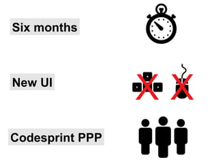
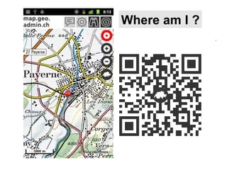
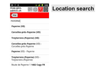
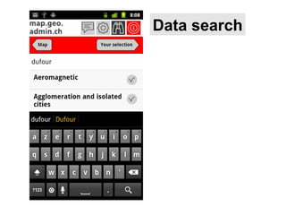
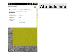
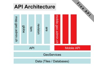
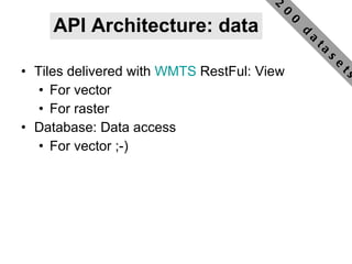
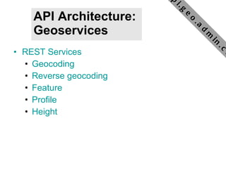
The document summarizes the Swiss Federal Department of Home Affairs' efforts to make Swiss geodata more accessible through mobile applications and APIs. Key points: - FSDI has developed mobile and API access to over 200 Swiss geodatasets to allow access anywhere on mobile devices. - An open source mobile app and website were created in a six month code sprint using HTML5 and open standards. - The mobile app and APIs allow users to search for locations, view data, get attribute info, and have worked well with over 500 daily unique visitors. - The APIs provide tiled and database access to vector and raster data through WMTS and REST services including geocoding, heights and more.


![[Foss4 g2013]the architecture of mobile traffic map service final](https://cdn.slidesharecdn.com/ss_thumbnails/foss4g2013thearchitectureofmobiletrafficmapservicefinal-140325221039-phpapp02-thumbnail.jpg?width=640&height=640&fit=bounds)


