
Downloaded 13 times


![Infrastructure as a Service [Cloud Security and Privacy, by Tim Mather, Subra Kumaraswamy, and Shahed Latif, ISBN 978-0-596-80276-9] Swisstopo‘s choice Traditional (On Premise) Platform as a Service (PaaS) Software as a Service (SaaS) Apps & Services VM Server Storage Network Apps & Services VM Server Storage Network Applications Services Server Storage Network Applications Services Server Storage Network Organization has control and responsibility Organisation shares control and responsibility with Cloud-provider Cloud provider has control and responsibility Infrastructure as a Service (IaaS)](https://image.slidesharecdn.com/eurogigeoadmin20111012-111013023632-phpapp02/75/geo-admin-ch-eurogi-award-presentation-10-2048.jpg)
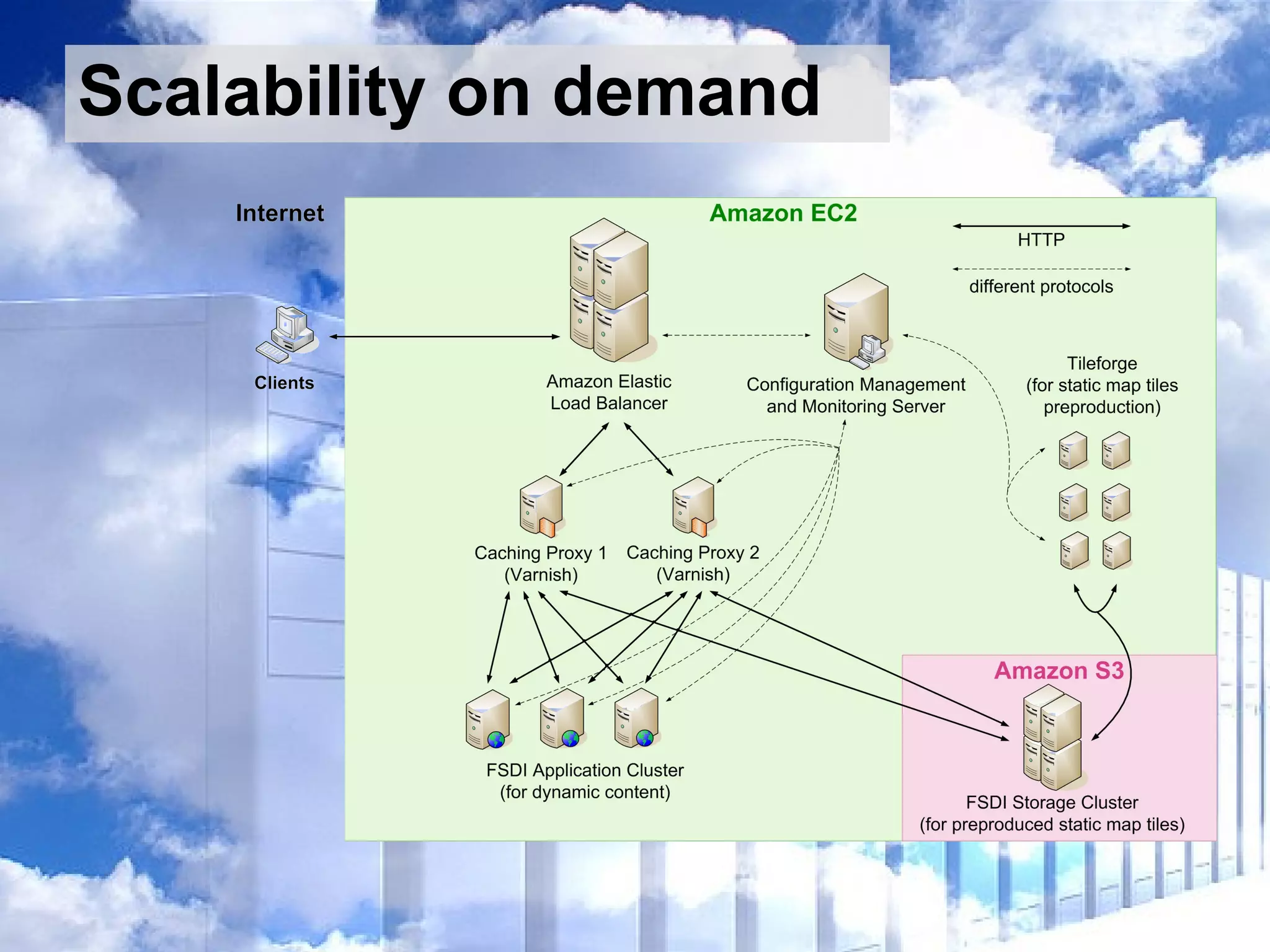
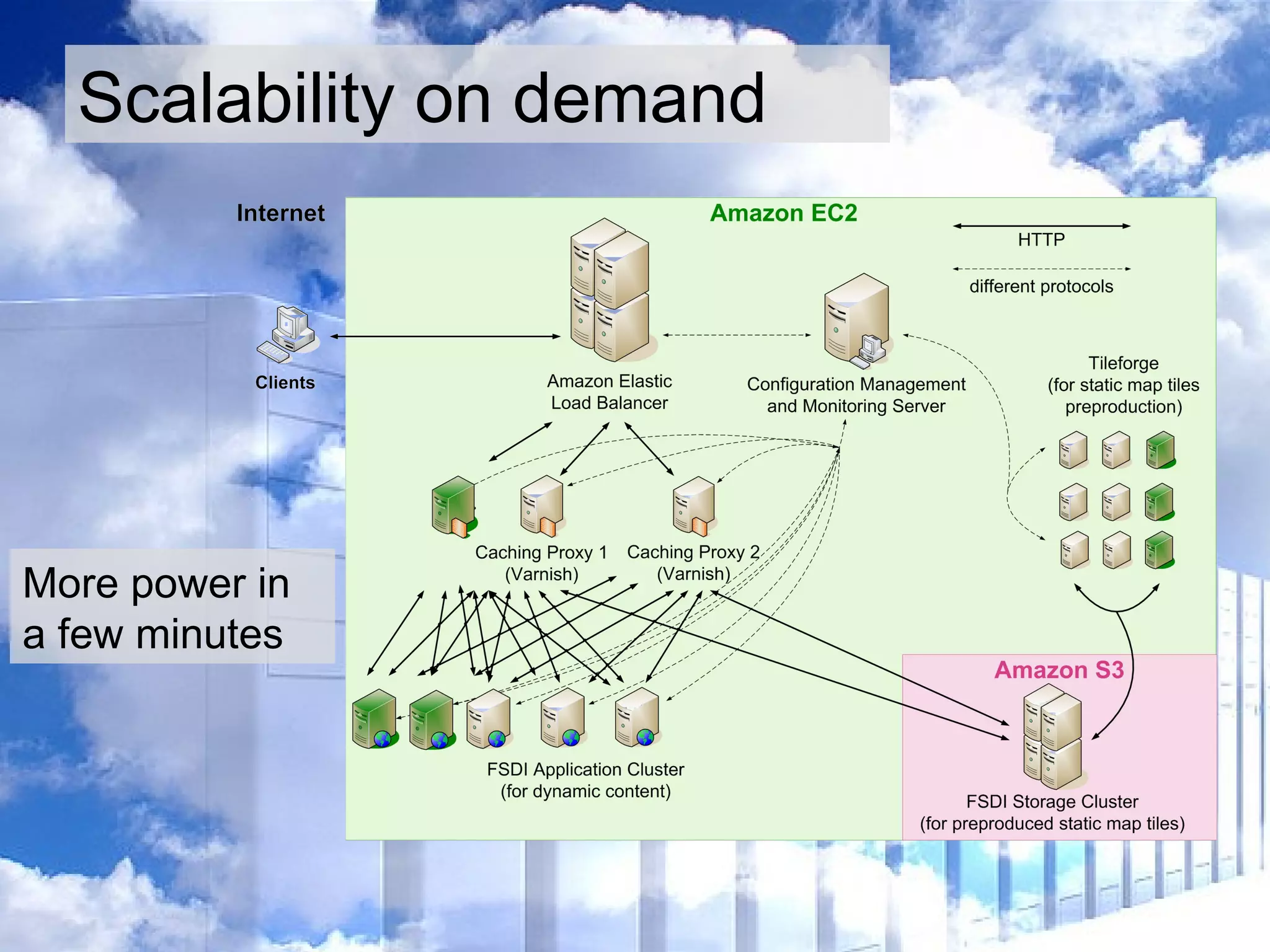
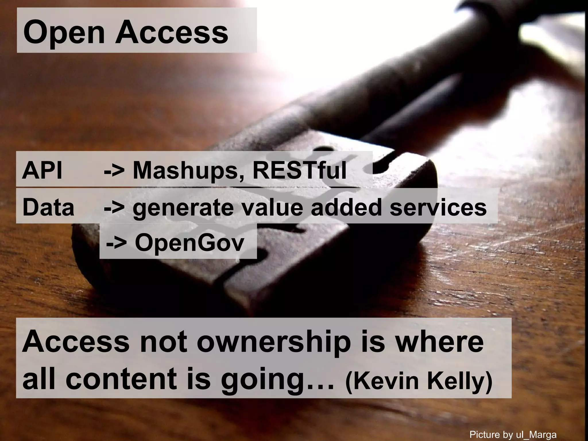
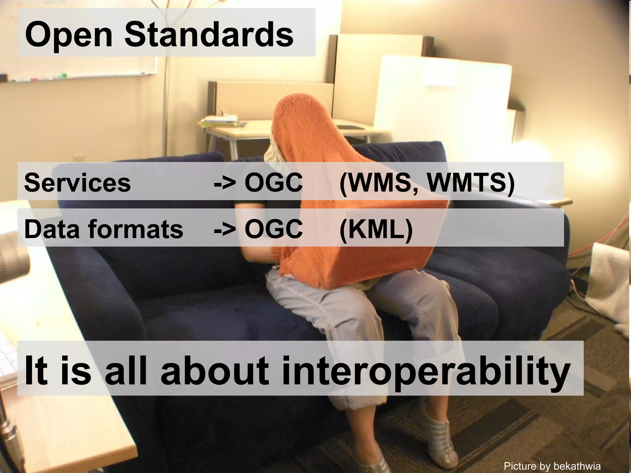
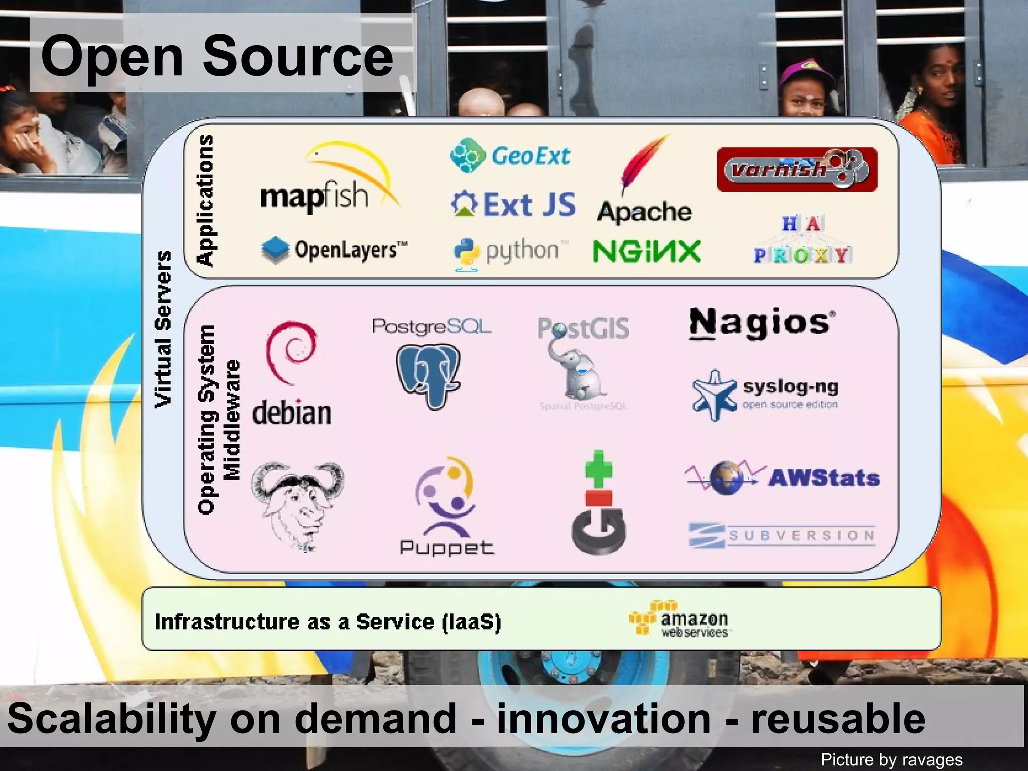

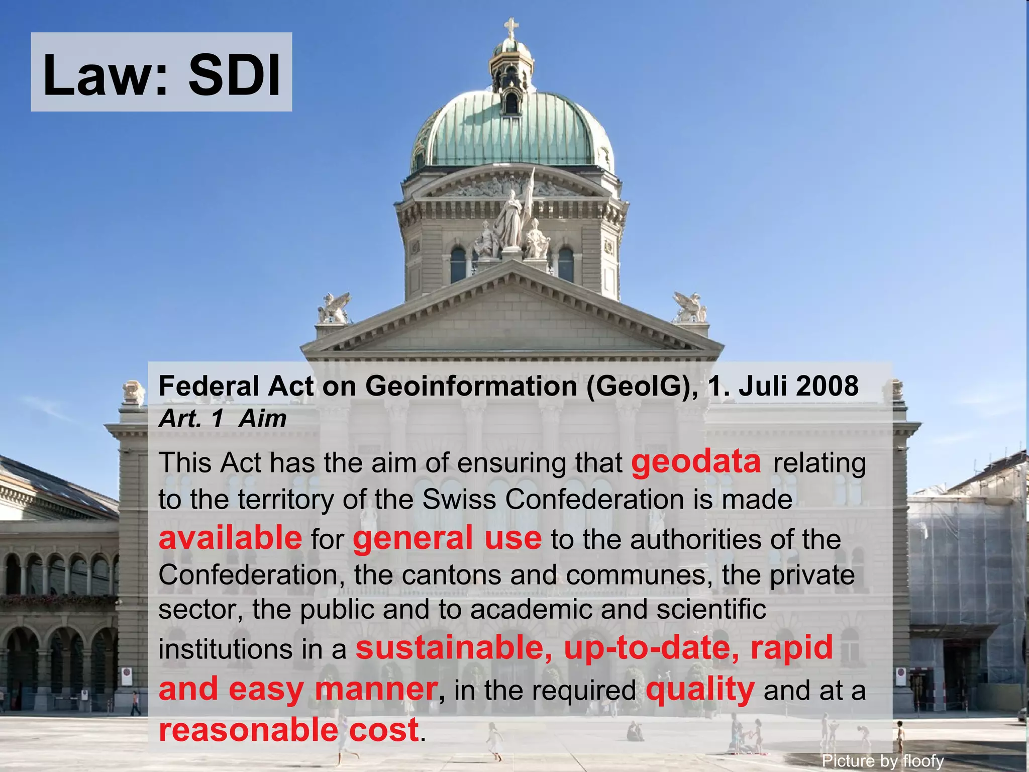
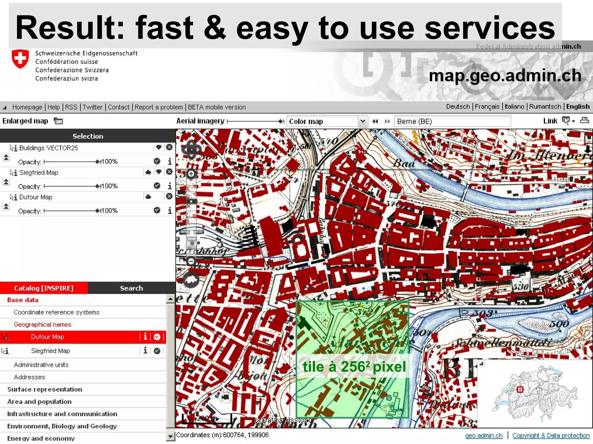
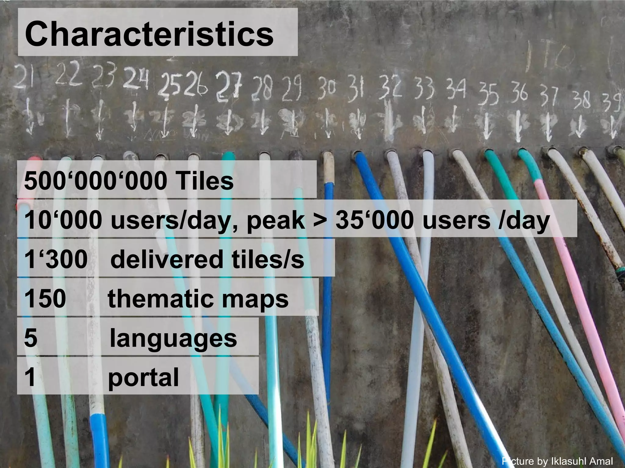
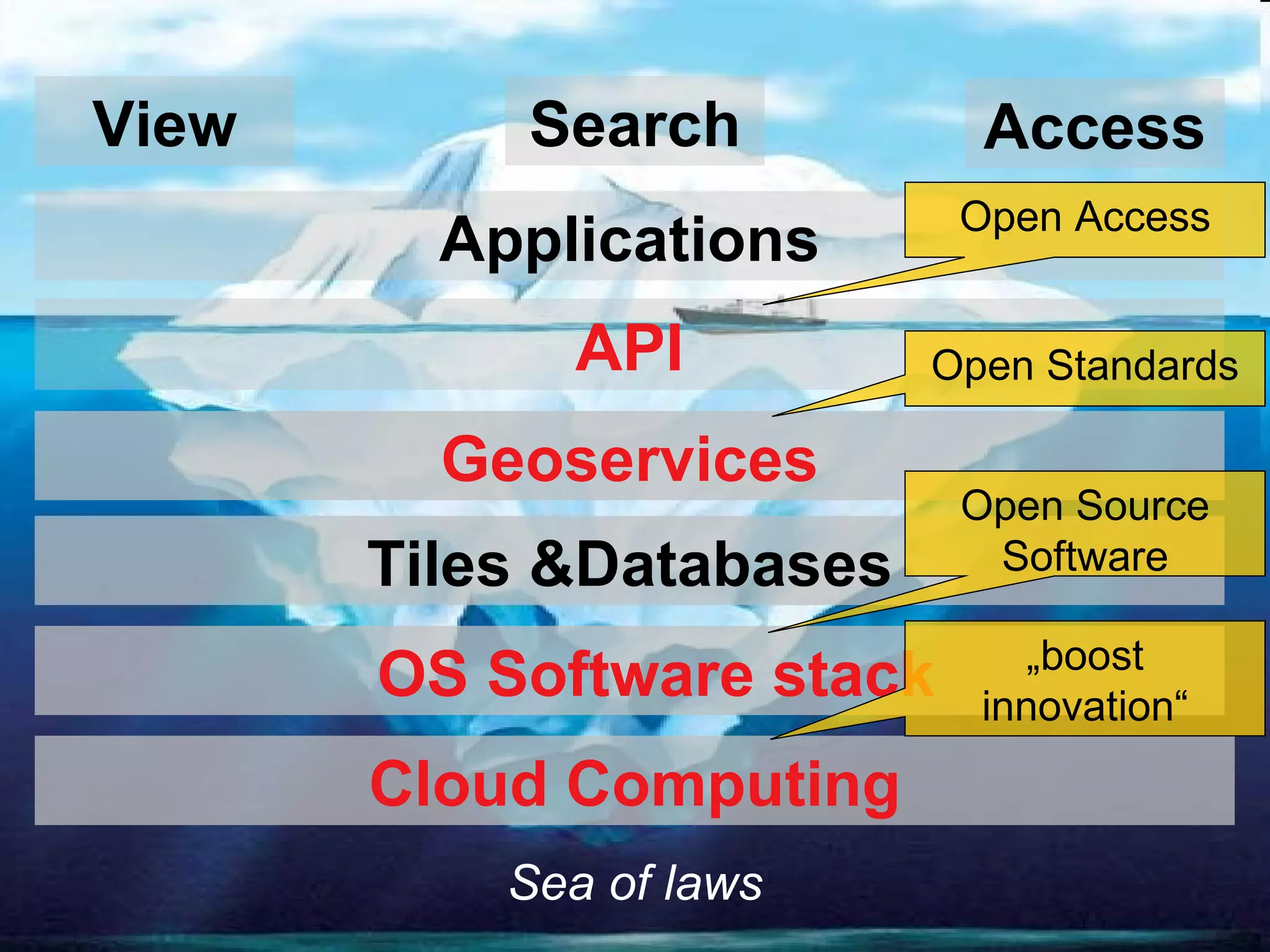
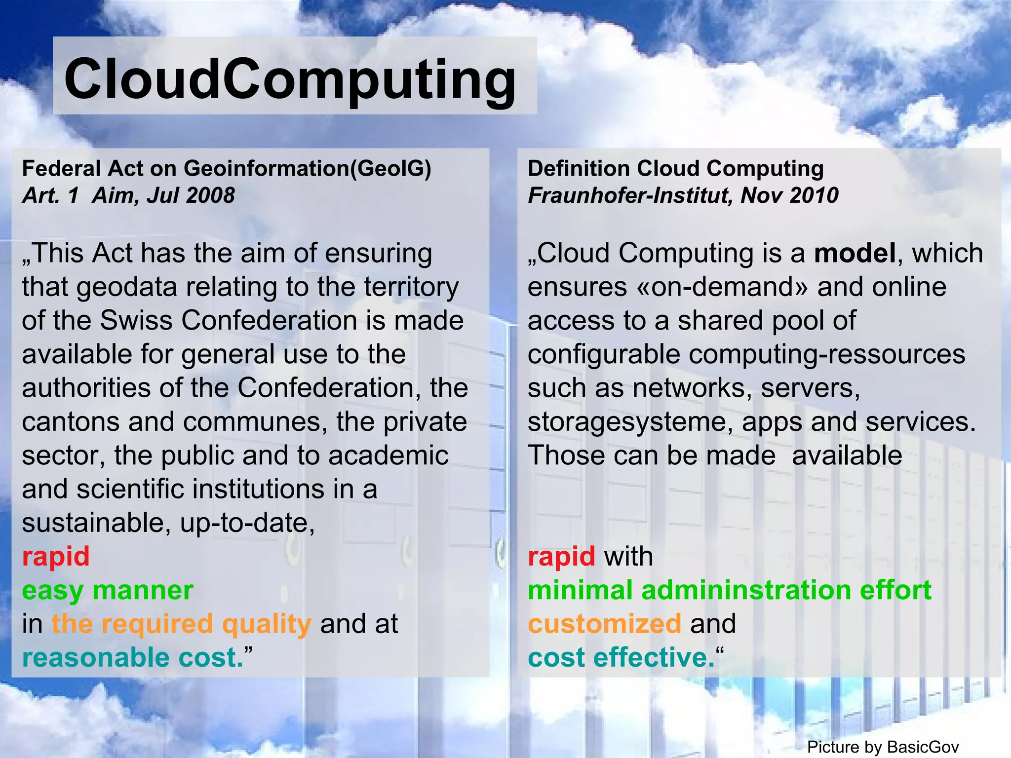
The document summarizes Switzerland's national spatial data infrastructure (SDI) called geo.admin.ch, which is operated by swisstopo, the Federal Office of Topography. Some key points: - Geo.admin.ch provides easy and rapid access to Switzerland's authoritative geodata through web services, maps, and APIs in compliance with the Federal Act on Geoinformation. - It serves over 10,000 daily users and peaks at over 35,000, delivering over 1,300 map tiles per second. - The SDI utilizes cloud computing, open standards, open source software and open APIs to boost innovation and generate value-added services while ensuring scalability and reasonable costs.


![Vibe Coding vs. Spec-Driven Development [Free Meetup]](https://cdn.slidesharecdn.com/ss_thumbnails/vibecodingvsspecdrivendevelopment-251209105622-43f455e7-thumbnail.jpg?width=640&height=640&fit=bounds)


![Coded Agents – with UiPath SDK + LangGraph [Virtual Hands-on Workshop]](https://cdn.slidesharecdn.com/ss_thumbnails/codedagentsdeck-251215155422-5497c599-thumbnail.jpg?width=640&height=640&fit=bounds)


