Download to read offline
![Federal Office of Topography swisstopo
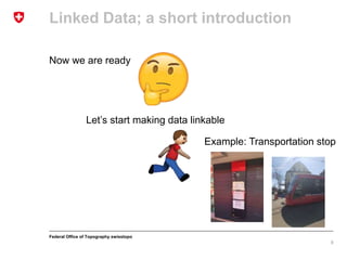
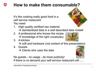
Linked Data; a short introduction
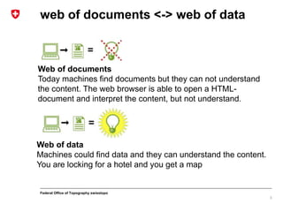
The four rules [Tim Berners-Lee 2006-07-27]
1. Use URIs as names for things
«A resource can be anything that has identity» RFC 2396
URI = scheme ":" hier-part [ "?" query ] [ "#" fragment ] RFC 3986
2. Use HTTP URIs so that people can look up those names.
https://ld.geo.admin.ch/transportation/stop/8571395
3. When someone looks up a URI, provide useful information,
using the standards (RDF*, SPARQL)
RDF Resource
Description Framework
SPARQL Query
language W3C-Standard
4. Include links to other URIs. so that they can discover
additional data.
Connect the data we have, into a web
4](https://image.slidesharecdn.com/20180518eurogeographicslinkeddata-180518070722/85/EuroGeographics-Linked-Data-by-geo-admin-ch-swisstopo-4-320.jpg)
![Federal Office of Topography swisstopo
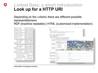
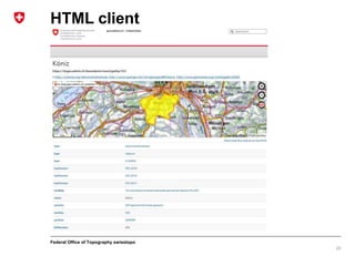
Transportation stops go linkable
Create RDF triples subject–predicate–object (rule 3)
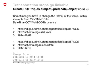
Sometimes you have to calculate the value. In this example
from our local reference system (LV95 EPSG 2056) to WGS84
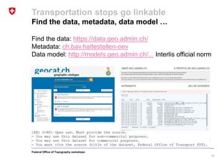
1. https://ld.geo.admin.ch/transportation/stop/8571395
2. https://www.w3.org/2003/01/geo/wgs84_pos#long
3. 7.45264305299276
1. https://ld.geo.admin.ch/transportation/stop/8571395
2. https://www.w3.org/2003/01/geo/wgs84_pos#lat
3. 46.9280273599974
…….
Calculate value
2601067[LV95] to 7.452[WGS84]
119743[LV95] to 46.928[WGS84]
13](https://image.slidesharecdn.com/20180518eurogeographicslinkeddata-180518070722/85/EuroGeographics-Linked-Data-by-geo-admin-ch-swisstopo-13-320.jpg)
![Federal Office of Topography swisstopo
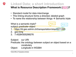
1. https://ld.geo.admin.ch/transportation/stop/8571395
2. http://schema.org/sameAs
3. http://api3.geo.admin.ch/rest/services/api/MapServer/ch.ba
v.haltestellen-oev/8571395?geometryFormat=geojson
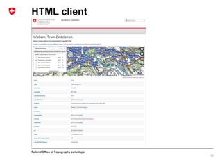
Call REST-API and returns all properties to an
specified stop as geojson
{"feature": {"layerBodId": "ch.bav.haltestellen-oev", "featureId":
8571395, "id": 8571395, "geometry": {"type": "MultiPoint",
"coordinates": [[601066.9624702379, 197436.96865385302]]}, "bbox":
[601066.9624702379, 197436.96865385302, 601066.9624702379,
197436.96865385302], "layerName": "u00f6V-Haltestellen", "type":
"Feature", "properties": {"verkehrsmittel": "Bus_Tram", "name":
"Wabern, Tram-Endstation", "tuabkuerzung": "PAG", "label": "Wabern,
Tram-Endstation", "betriebspunkttyp": "Haltestelle", "abkuerzung":
null}}}
Transportation stops go linkable
Create RDF triples subject–predicate–object (rule 3)
16](https://image.slidesharecdn.com/20180518eurogeographicslinkeddata-180518070722/85/EuroGeographics-Linked-Data-by-geo-admin-ch-swisstopo-16-320.jpg)
1. The document discusses how to make transportation stop data from Switzerland's Federal Office of Topography linkable and accessible on the web. 2. It introduces the concept of linked data and the four rules for publishing linked data, including using URIs to identify things, providing HTTP URIs so that people can look up those names, and including links between data. 3. The document provides steps for publishing transportation stop data as linked data, such as mapping data fields to ontology terms, converting coordinates between reference systems, and linking the data to other datasets to connect it to the larger web of data.