Step-by-Step Guide to Learning GIS in India
•
0 likes•6 views

This guide will aid you in selecting the ideal courses on GIS and remote sensing in India, comprehending the curriculum and planning for the expenses.

Recommended
Recommended
More Related Content
Similar to Step-by-Step Guide to Learning GIS in India
Similar to Step-by-Step Guide to Learning GIS in India (20)
More from SIG Pune
More from SIG Pune (19)
Recently uploaded
Recently uploaded (20)
Step-by-Step Guide to Learning GIS in India
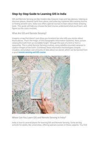
- 1. Step-by-Step Guide to Learning GIS in India GIS and Remote Sensing are like modern-day treasure maps and spy glasses, helping us discover places, observe Earth from above, and solve big mysteries like tracking storms or finding ancient ruins. India now offers special courses to learn about these amazing tools. This guide will help you choose the best course, understand what you'll learn, and figure out the costs involved. What Are GIS and Remote Sensing? Imagine a map that doesn't just show you locations but also tells you stories about those places. That's the magic of GIS (Geographic Information Systems). Now, picture viewing the Earth from an incredible height—through the eyes of a bird or from a spaceship. This is what Remote Sensing involves, using satellite-mounted cameras to capture images of the Earth. Combined, these informatics technologies compile, visualize, and analyze vast amounts of data about our planet, which can be learned from a good remote sensing and GIS course. Where Can You Learn GIS and Remote Sensing in India? India is host to several places for learning GIS and Remote Sensing. Some are big schools for adults, like universities, offering special courses on these subjects. You find
- 2. short GIS courses in India that may last only for a few weeks or long ones that go on for years. One example is the Symbiosis Institute of Geoinformatics (SIG). Spotlight on Symbiosis Institute of Geoinformatics SIG stands out because it's part of Symbiosis, a big group of schools that many people respect. They offer courses that cover everything about GIS and Remote Sensing. In this remote sensing and GIS course, you'll learn how to make maps, use satellite pictures, and even use these tools to solve real-world problems. SIG also connects students with companies and government groups that use GIS and Remote Sensing, which can help you find a job after you finish your course. What Will You Learn In These Courses? GIS courses in India teach you how to make and read maps—right from the basics. Then, you will learn how to use Remote Sensing to get pictures from satellites and what those pictures can tell us about the Earth. Projects you will participate in include making maps and studying satellite images to see, over some time, changes within an area. It's kind of like being a detective but of the Earth! How Much Does Learning Cost? The GIS course fees can vary depending on the area and college. Several courses are cheaper, while some may be very expensive. In essence, it is comparable to buying a bicycle; the price only changes depending on the type and quality of the model. That said, financial help or scholarships from schools are accessible for students who cannot afford their studies. How do you choose the right course? Choosing the right course is like choosing a new game or a book. You should consider what interests you and what you dream of doing. Are you keen on doing something out in the open, or does it thrill you to sit in front of your computer extracting the juice of data? Do you want to conserve the environment or help cities grow smartly? Answers to this will lead you to the right course. You can also look out for well-known schools for their GIS and Remote Sensing programs. Jobs and opportunities after learning Once you learn about GIS and Remote Sensing, so many exciting career opportunities open up for you. It might be development and innovation in terms of better maps, involvement in environmental protection, or planning entirely new spaces in cities. This is a chance that gives you leverage—leverage of your skills to make the world a better place. Conclusion Starting to study a GIS and remote sensing course is not just a road to gaining technical skills but also to opening the door to the entire world of opportunities. It is all about
- 3. understanding our planet in ways that have never been imagined before and making a difference once we do it. If you are eager and love exploring, then an introduction to the GIS and Remote Sensing course in India could be the beginning of a great adventure. The first reminder here is the right course to set on this quite an exciting way.