State of Utah 2010 Air Monitoring Plan
•
1 like•713 views

The Utah Air Monitoring Network Plan describes the state's air quality monitoring network. The network consists of sites that monitor criteria pollutants like ozone and particulate matter to evaluate compliance with National Ambient Air Quality Standards. It also includes sites that collect meteorological data for air quality modeling. The plan discusses each monitoring site, including the monitoring objectives and parameters measured at each location. It provides details on the current network and proposes some modifications for 2010.

Recommended
More Related Content
Similar to State of Utah 2010 Air Monitoring Plan
Similar to State of Utah 2010 Air Monitoring Plan (20)
More from State of Utah, Salt Lake City
More from State of Utah, Salt Lake City (20)
Recently uploaded
Recently uploaded (20)
State of Utah 2010 Air Monitoring Plan
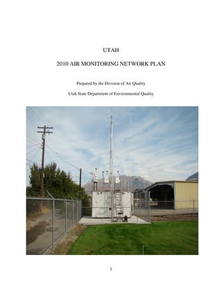
- 1. UTAH 2010 AIR MONITORING NETWORK PLAN Prepared by the Division of Air Quality Utah State Department of Environmental Quality 1
- 2. TABLE OF CONTENTS 1.0 Introduction 1.1 Comments on Utah Air Monitoring Network Plan 1.2 Current Utah Air Monitoring Network 1.3 Metropolitan Statistical Areas (MSA) 1.4 Monitoring Data Quality Assurance 1.5 Monitoring Site Discussion 1.6 Network Modification Process 1.7 Review of Network Modifications in 2009 1.8 Proposed Network Modifications 2.0 Utah Air Monitoring Network 2.1 Sulfur Dioxide 2.2 Nitrogen Dioxide 2.3 Carbon Monoxide 2.4 Ozone 2.5 PM10 2.6 PM2.5 2.7 TSP Lead 2.8 Meteorological Data 2.9 Air Toxics 3.0 Emergency Episode Monitoring 4.0 Network Modification Forms 5.0 Summary and Conclusions A.0 Appendix A – NCore site at Hawthorne Station B.0 Appendix B – Public Comments on Monitoring Plan 2
- 3. MONITORING NETWORK PLAN 1.0 INTRODUCTION This Air Monitoring Network Plan meets the requirements of 40 CFR 58.10(a)(1). The purpose of this plan is to describe the establishment and maintenance of an air quality monitoring network in Utah. This network consists of State and Local Air Monitoring Stations (SLAMS) and Special Purpose Monitoring (SPM) sites. The Utah air monitoring network has been described in network reviews from 1982 through 2009. A complete description of each historical monitoring station is on file at the Air Monitoring Center and is available to review upon request. Monitoring sites that will be retained for 2010 are presented in section 1.5. 1.1 COMMENTS ON UTAH AIR MONITORING NETWORK PLAN This Monitoring Network Plan will be made available for public review for 30 days starting June 17, 2010 to July 19, 2010. Comments can be sent to: Utah Department of Environmental Quality, Division of Air Quality, Attn: Bo Call, PO Box 144820, Salt Lake City, UT 84114-4820 Comments will be reviewed and retained as attachments to the report. 1.2 CURRENT UTAH AIR MONITORING NETWORK The following pages list the SLAMS and SPM sites in Utah's current air monitoring network and identifies the location (address), objective, and spatial scale represented by each site. The location identified is the local street address where each monitoring site is situated. The Aerometric Information Retrieval System (AIRS) # is a unique number that identifies the site by state, county, and location in the EPA AIRS database. Under the listed parameters: • A station may be designated as a State and Local Air Monitoring Station (SLAMS) or as a Special Purpose Monitor (SPM). • The spatial scale represented is described in terms of the physical dimensions of the air parcel surrounding an air monitoring station throughout which pollutant concentrations are reasonably homogeneous. The scales used for Utah's network are: Micro: Several meters to about 100 meters Middle: About 100 to 500 meters 3
- 4. Neighborhood: About 500 meters to 4 kilometers Urban: Overall citywide conditions, usually about 4 to 50 kilometers, requires more than one station to define Regional: Defines a rural area, usually of reasonably homogeneous geography, extending for tens to hundreds of kilometers • The monitoring site should represent; population exposure (Population), source impact (Source), highest expected concentration (High), or background concentration (Background). The following tables provide a technical summary of the current monitoring network including: the type of telemetry used to retrieve the data, the type of analyzer used and frequency of data collection, the source of gases used to calibrate the gaseous monitors, other parameters monitored at each site, and the latitude and longitude of each site. In addition, Utah conducts some “survey” monitoring using state funding to get an initial assessment of some areas of interest. This monitoring is less formal than the SPM monitoring discussed above and focuses on a local project or issue. Based on the results of the survey monitoring, the State may determine that more formal monitoring would be appropriate. 1.3 METROPOLITAN STATISTICAL AREAS (MSA) Population statistics are used to assess various characteristics of populated areas. The primary descriptor used is Metropolitan Statistical Areas (MSA’s). It is convenient to use the MSA designations when discussing air pollution monitoring. Each MSA is composed of a large number of people in similar geographic settings exposed to similar air pollution emissions and similar air pollution concentrations. The MSA for each monitoring site is identified so air pollution concentration for monitoring stations in the same MSA can be compared. There are five MSA’s in Utah. The following populations are based on the Governor’s Planning Office July 1, 2009 population estimates: Salt Lake MSA 1,141,693 Ogden-Clearfield MSA 544,862 Provo-Orem MSA 541,633 Logan MSA 126,952 St. George MSA 145,466 4
- 5. The following graphic shows the counties that make up each MSA. The monitoring stations in each MSA are identified in the discussion of each monitoring location. Figure 1 5
- 6. 1.4 MONITORING DATA QUALITY ASSURANCE A Quality Monitoring Plan (QMP) was prepared by the Utah Department of Environmental Quality and approved by EPA Region 8. The air monitoring network meets the criteria identified in the QMP. A Quality Assurance Project Plan (QAPP) was prepared by the Utah Division of Air Quality and also approved by EPA Region 8. The QAPP identifies in greater detail the monitoring effort and quality assurance procedures the data must meet before it is considered quality assured and acceptable for submittal to the public and EPA. A Standard Operating Procedure (SOP) manual has been prepared by the Utah Division of Air Quality that identifies the steps, procedures, and criteria that must be met in operating the monitoring network and validating the air pollution data. 1.5 MONITORING SITE DISCUSSION The following pages discuss each monitoring site and the objective of the monitoring site. The instruments used at each site are also identified. Monitoring for the criteria pollutants identified by EPA is to be performed using EPA reference or equivalent samplers or analyzers. In all cases the instruments used in the DAQ monitoring network are EPA reference or equivalent instruments. The instruments used to measure the criteria pollutants comply with 40 CFR Part 58, appendix C. 6
- 7. UTAH AIR MONITORING STATION LOCATION SITE CODE STATIONS CITY COUNTY ADDRESS AMC Air Monitoring Center Salt Lake Salt Lake 2861 W Parkway Blv. AI Antelope Island Not in a city Davis Antelope Island BI Badger Island Not in a city Tooele Badger Island B4 Beach #4 Magna Salt Lake 1200 South 12100 West BV Bountiful Bountiful Davis 200 West 1380 North BR Brigham City Brigham City Box Elder 140 West Fishburn CW Cottonwood Holladay Salt Lake 5717 South 1300 East HV Harrisville Harrisville Weber 425 West 2550 North HW Hawthorne Salt Lake Salt Lake 1675 South 600 East HG Highland Highland Utah 10865 North 6000 West LN Lindon Lindon Utah 30 North Main L4 Logan #4 Logan Cache 125 West Center Street MG Magna Magna Salt Lake 2935 South 8560 West NP North Provo Provo Utah 1355 North 200 West N2 North Salt Lake #2 Salt Lake Salt Lake 1795 North Warm Springs Rd nd O2 Ogden #2 Ogden Weber 228 East 32 Street RP Rose Park Salt Lake City Salt Lake 1354 West Goodwin Ave SA Saltaire Salt Lake City Salt Lake 6640 West 1680 North SC Santa Clara Santa Clara Washington 1215 N Lava Flow Dr. SF Spanish Fork Spanish Fork Utah 312 West 2050 North SY Syracuse Syracuse Davis 4700 West 1700 South T3 Tooele #3 Tooele Tooele 434 North 50 West W2 Washington Blvd #2 Ogden Weber 2540 South Washington Blvd WJ West Jordan West Jordan Salt Lake 4540 West 8700 South Table 1 7
- 8. Site: Air Monitoring Center Longitude: 111.9612 Station Type: SPM AQS#: 49-035-3011 Latitude: 40.7118 MSA: Salt Lake City-1,141,693 Address: 2861 West Parkway Blvd. Elevation (M): 1292 City: West Valley County: Salt Lake Site Objective: This site is established to determine mercury in wet deposition and dry deposition. Does the site meet the objective: Yes, all objectives are met. Site Description: The site is located at the Air Monitoring Center, in the city of West Valley, Salt Lake County. Can data from this site be used to evaluate NAAQS ?: No Gas/Particulate parameters: Sampling & Operating Monitoring Spatial Parameter Analysis Method Schedule Objective Scale Dry Dep. Mercury Cold Vapor Atomic Absorption Continuous Population Exposure SPM- Transport Regional Wet Dep. Mercury Manual NADP MDN Integrated 7 day Population Exposure SPM- Transport Regional 8
- 9. Site: Antelope Island Longitude: 112.2313 Station Type: SPM AQS#: 49-011-6001 Latitude: 41.0393 MSA: Salt Lake City-1,141,693 Address: Antelope Island Elevation (M): 1359 City: County: Davis Site Objective: This site is established to collect meteorological information for air quality modeling inputs. Does the site meet the objective: Yes, all objectives are met. Site Description: The site is on Antelope Island state park, near the ranger residences, in Davis County. Can data from this site be used to evaluate NAAQS ?: No Meteorological parameters: Sampling & Operating Tower Spatial Parameter Analysis Method Schedule Height Scale Relative Humidity Elec. Thin Film Continuous 6 meters Urban Ambient Temperature Elec. Resistance Continuous 6 meters Urban Wind Direction Elec. Resistance Level 1 Continuous 6 meters Urban WD Sigma Elec. EPA method Continuous 6 meters Urban Wind Speed Elec. Chopped signal Level 1 Continuous 6 meters Urban 9
- 10. Site: Badger Island Longitude: 112.5620 Station Type: SPM AQS#: 49-045-6001 Latitude: 40.9420 MSA: Salt Lake City-1,141,693 Address: Badger Island Elevation (M): 1282 City: County: Tooele Site Objective: This site is established to collect meteorological information for air quality modeling inputs. Does the site meet the objective: Yes, all objectives are met. Site Description: The site is located on the south end of the Great Salt Lake on the remnants of Badger Island in Tooele County. Can data from this site be used to evaluate NAAQS ?: No Meteorological parameters: Sampling & Analysis Operating Tower Spatial Parameter Method Schedule Height Scale Precipitation Tipping cup Continuous 2 meters Urban Relative Humidity Elec. Thin Film Continuous 10 meters Urban Solar Radiation Elec. LiCor Continuous 2 meters Urban Ambient Temperature Elec. Resistance Continuous 10 meters Urban Wind Direction Elec. Resistance Level 1 Continuous 10 meters Urban WD Sigma Elec. EPA method Continuous 10 meters Urban Wind Speed Elec. Chopped signal Level 1 Continuous 10 meters Urban 10
- 11. Site: Beach #4 Longitude: 112.2103 Station Type: SLAMS AQS#: 49-035-2004 Latitude: 40.7342 MSA: Salt Lake City-1,141,693 Address: 12100 West 1200 South Elevation (M): 1289 City: Magna County: Salt Lake Site Objective: This site is established to determine SO2 concentrations near the Kennecott Copper smelter. Ozone is monitored based on an ozone saturation study and the interaction with the Great Salt Lake. Does the site meet the objective: Yes, all objectives are met. Site Description: The site is located at the Great Salt Lake Marina on the south east end of the Great Salt Lake. Can data from this site be used to evaluate NAAQS ?: Yes Gas/Particulate parameters: Sampling & Operating Monitoring Spatial Parameter Analysis Method Schedule Objective Scale SLAMS-High Sulfur Dioxide Instrumental Pulsed Florescent Continuous Industrial Exposure Neighborhood SLAMS-High Ozone Instrumental Ultra Violet Seasonal Population Exposure Neighborhood Meteorological parameters: Sampling & Operating Tower Spatial Parameter Analysis Method Schedule Height Scale Ambient Temperature Elec. Resistance Continuous 10 meters Urban Wind Direction Elec. Resistance Level 1 Continuous 10 meters Urban WD Sigma Elec. EPA method Continuous 10 meters Urban Wind Speed Elec. Chopped signal Level 1 Continuous 10 meters Urban 11
- 12. Site: Bountiful Viewmont Longitude: 111.8845 Station Type: SLAMS AQS#: 49-011-0004 Latitude: 40.903 MSA: Salt Lake City-1,141,693 Address: 1380 North 200 West Elevation (M): 1316 City: Bountiful County: Davis Site Objective: The Bountiful Viewmont site is established to determine public exposure to air pollution. The site also is to monitor the ambient air near the oil refineries and local sand and gravel operations. Previous monitoring and saturation studies have recorded high ozone concentrations. This site is chosen for intensive speciation of PM2.5 under the EPA Chemical Speciation Network (CSN) and gaseous Volatile Organic Compounds under the EPA National Air Toxics Trends Network (NTTN) including hexavalent chromium and carbonyl compounds. Nitrogen dioxide is monitored in support of the ozone monitoring. Does the site meet the objective: Yes, all objectives are met. Site Description: The site is located near Viewmont High School at the north end of the city of Bountiful, Davis County. Can data from this site be used to evaluate NAAQS ?: Yes Gas/Particulate parameters: Sampling & Operating Monitoring Spatial Parameter Analysis Method Schedule Objective Scale Nitrogen Dioxide Instrumental Chemiluminescence Continuous Population Exposure SLAMS- Population Neighborhood Ozone Instrumental Ultra Violet Seasonal Population Exposure SLAMS-High Neighborhood Sulfur Dioxide Instrumental Pulsed Florescent Continuous Industrial Exposure SLAMS-Impact Neighborhood PM2.5 Manual Gravimetric 1 in 3 days Population Exposure SLAMS- Population Neighborhood PM10 metals Manual Gravimetric 1 in 6 days Population Exposure SLAMS- Population Neighborhood PM10 metals co-located Manual Gravimetric 6 samples/year Population Exposure SLAMS- Population Neighborhood PM2.5 Speciation Manual EPA CSN 1 in 6 days Population Exposure SLAMS- Population Neighborhood VOC Manual EPA NTTN 1 in 6 days Population Exposure SLAMS- Population Neighborhood Semi-volatile Manual EPA NTTN 1 in 6 days Population Exposure SLAMS- Population Neighborhood Carbonyl compounds Manual EPA NTTN 1 in 6 days Population Exposure SLAMS- Population Neighborhood Hexavalent Chromium Manual EPA NTTN 1 in 6 days Population Exposure SLAMS- Population Neighborhood Black Carbon Aethalometer Continuous Population Exposure SLAMS- Population Neighborhood 12
- 13. Meteorological parameters: Sampling & Operating Tower Spatial Parameter Analysis Method Schedule Height Scale Ambient Pressure Barometric Pressure Transducer Continuous 1 meters Urban Relative Humidity Elec. Thin Film Continuous 10 meters Urban Ambient Temperature Elec. Resistance Continuous 10 meters Urban Wind Direction Elec. Resistance Level 1 Continuous 10 meters Urban WD Sigma Elec. EPA method Continuous 10 meters Urban Wind Speed Elec. Chopped signal Level 1 Continuous 10 meters Urban 13
- 14. Site: Brigham City Longitude: 112.0176 Station Type: SLAMS Not in an MSA, but is in the Salt AQS#: 49-003-0003 Latitude: 41.4929 MSA: Lake-Ogden-Clearfield CSA Address: 140 West Fishburn Dr. Elevation (M): 1334 City: Brigham City County: Box Elder Site Objective: This site is established to determine the boundary of ozone concentrations greater than the NAAQS and PM2.5 comparison to Cache County. Does the site meet the objective: Yes, all objectives are met. Site Description: The site is located in a neighborhood area of Brigham City in Box Elder County. Can data from this site be used to evaluate NAAQS ?: Yes Gas/Particulate parameters: Sampling & Operating Monitoring Spatial Parameter Analysis Method Schedule Objective Scale Ozone Instrumental Ultra Violet Seasonal Population Exposure SLAMS- Population Neighborhood PM2.5 Manual Gravimetric 1 in 3 days Population Exposure SLAMS- Population Neighborhood PM2.5 Real time Instrumental TEOM FDMS Continuous Population Exposure SLAMS- Population Neighborhood Meteorological parameters: Sampling & Operating Tower Spatial Parameter Analysis Method Schedule Height Scale Ambient Temperature Elec. Resistance Continuous 10 meters Urban Wind Direction Elec. Resistance Level 1 Continuous 10 meters Urban WD Sigma Elec. EPA method Continuous 10 meters Urban Wind Speed Elec. Chopped signal Level 1 Continuous 10 meters Urban 14
- 15. Site: Cottonwood Longitude: 111.8496 Station Type: SLAMS AQS#: 49-035-0003 Latitude: 40.6446 MSA: Salt Lake City-1,141,693 Address: 5717 South 1300 East Elevation (M): 1338 City: Holladay County: Salt Lake Site Objective: This site is established to determine ozone and ozone precursor compounds. Does the site meet the objective: Yes, all objectives are met. Site Description: The site is located in the southeastern section of Salt Lake County at Cottonwood High School. Can data from this site be used to evaluate NAAQS ?: Yes Gas/Particulate parameters: Sampling & Operating Monitoring Spatial Parameter Analysis Method Schedule Objective Scale Carbon Monoxide Instrumental Gas Phase Correlation Continuous Population Exposure SLAMS- Population Neighborhood Nitrogen Dioxide Instrumental Chemiluminescence Continuous Population Exposure SLAMS-High Neighborhood Ozone Instrumental Ultra Violet Seasonal Population Exposure SLAMS- Population Neighborhood PM2.5 Manual Gravimetric Daily Population Exposure SLAMS- Population Neighborhood PM10 Manual Gravimetric 1 in 3 days Population Exposure SLAMS- Population Neighborhood Meteorological parameters: Sampling & Operating Tower Spatial Parameter Analysis Method Schedule Height Scale Ambient Temperature Elec. Resistance Continuous 10 meters Urban Wind Direction Elec. Resistance Level 1 Continuous 10 meters Urban WD Sigma Elec. EPA method Continuous 10 meters Urban Wind Speed Elec. Chopped signal Level 1 Continuous 10 meters Urban 15
- 16. Site: Harrisville Longitude: 111.9865 Station Type: Slams AQS#: 49-057-1003 Latitude: 41.3028 MSA: Ogden-Clearfield-544,862 Address: 425 West 2550 North Elevation (M): 1322 City: Harrisville County: Weber Site Objective: This site is established in response to an ozone saturation study indicating this as a potential high ozone concentration area. Does the site meet the objective: Yes, all objectives are met. Site Description: The site is located on the grounds of an elementary school in the city of Harrisville, Weber County. Can data from this site be used to evaluate NAAQS ?: Yes Gas/Particulate parameters: Sampling & Operating Monitoring Spatial Parameter Analysis Method Schedule Objective Scale Ozone Instrumental Ultra Violet Seasonal Population Exposure SLAMS- Population Neighborhood PM2.5 Manual Gravimetric 1 in 3 days Population Exposure SLAMS- Background Regional Meteorological parameters: Sampling & Operating Tower Spatial Parameter Analysis Method Schedule Height Scale Ambient Temperature Elec. Resistance Continuous 10 meters Urban Wind Direction Elec. Resistance Level 1 Continuous 10 meters Urban WD Sigma Elec. EPA method Continuous 10 meters Urban Wind Speed Elec. Chopped signal Level 1 Continuous 10 meters Urban 16
- 17. Site: Hawthorne Longitude: 111.8721 Station Type: SLAMS AQS#: 49-035-3006 Latitude: 40.7343 MSA: Salt Lake City-1,141,693 Address: 1675 South 600 East Elevation (M): 1312 City: Salt Lake City County: Salt Lake Site Objective: This site is established to represent the population exposure in the Salt Lake City area. The Hawthorne site is also proposed as the EPA Ncore site for Utah. Does the site meet the objective: Yes, all current objectives are met. Ncore monitoring is required January 2011. Site Description: The site is located at Hawthorne Elementary School in the southeast section of Salt Lake City, Salt Lake County . Can data from this site be used to evaluate NAAQS ?: Yes Gas/Particulate parameters: Sampling & Operating Monitoring Spatial Parameter Analysis Method Schedule Objective Scale Carbon Monoxide, trace Instrumental Gas Phase Correlation Continuous Population Exposure SLAMS-High Neighborhood Nitrogen Dioxide Instrumental Chemiluminescence Continuous Population Exposure SLAMS-High Neighborhood Ozone Instrumental Ultra Violet Continuous Population Exposure SLAMS-High Neighborhood PM2.5 Manual Gravimetric Daily Population Exposure SLAMS- Population Neighborhood PM2.5 Speciation Manual EPA CSN 1 in 3 days Population Exposure SLAMS- Population Neighborhood PM2.5 Real time n-core Instrumental TEOM FDMS Continuous Air Pollution Index SLAMS- Population Neighborhood PM10 Manual Gravimetric Daily Population Exposure SLAMS- Population Neighborhood PM10 Real time n-core Instrumental TEOM FDMS Continuous Air Pollution Index SLAMS- Population Neighborhood PMcoarse Real time n-core Instrumental TEOM FDMS Continuous Population Exposure SLAMS- Population Neighborhood H2O soluble ions Instrumental Ion Chromatography Continuous Population Exposure SLAMS- Population Neighborhood Methane & Non-methane NDIR of converted carbon Continuous Population Exposure SLAMS- Population Neighborhood Organic & Elemental Instrumental Gas Chromatography Continuous Population Exposure SLAMS- Population Neighborhood Carbon 17
- 18. Meteorological Parameters: Sampling & Operating Tower Spatial Parameter Analysis Method Schedule Height Scale Ambient Pressure Barometric Pressure Transducer Continuous 3 meters Urban Relative Humidity Elec. Thin Film Continuous 10 meters Urban Solar Radiation Elec. EPPLY Continuous 4 meters Urban Ambient Temperature Elec. Resistance Continuous 10 meters Urban Wind Direction Elec. Resistance Level 1 Continuous 10 meters Urban WD Sigma Elec. EPA method Continuous 10 meters Urban Wind Speed Elec. Chopped signal Level 1 Continuous 10 meters Urban 18
- 19. Site: Highland Longitude: 111.8039 Station Type: SLAMS AQS#: 49-049-5008 Latitude: 40.4282 MSA: Provo-Orem-541,633 Address: 10865 North 6000 West Elevation (M): 1479 City: Highland County: Utah Site Objective: This site is established in response to an ozone saturation study indicating elevated ozone levels. The site is to evaluate ozone concentrations. Does the site meet the objective: Yes, all objectives are met. Site Description: The site is located at an elementary school in the city of Highland, Utah County. Can data from this site be used to evaluate NAAQS ?: Yes Gas/Particulate parameters: Sampling & Operating Monitoring Spatial Parameter Analysis Method Schedule Objective Scale Ozone Instrumental Ultra Violet Seasonal Population Exposure SLAMS-High Neighborhood PM2.5 Manual Gravimetric 1 in 3 days Population Exposure SLAMS- Population Neighborhood Meteorological parameters: Sampling & Operating Tower Spatial Parameter Analysis Method Schedule Height Scale Ambient Temperature Elec. Resistance Continuous 10 meters Urban Wind Direction Elec. Resistance Level 1 Continuous 10 meters Urban WD Sigma Elec. EPA method Continuous 10 meters Urban Wind Speed Elec. Chopped signal Level 1 Continuous 10 meters Urban 19
- 20. Site: Lindon Longitude: 111.7133 Station Type: SLAMS AQS#: 49-049-4001 Latitude: 40.3396 MSA: Provo-Orem-541,633 Address: 30 North Main Elevation (M): 1442 City: Lindon County: Utah Site Objective: This site is established to determine particulate matter from commercial and industrial sources. Historically this site has reported the highest particulate matter values in Utah County. Does the site meet the objective: Yes, all objectives are met. Site Description: The site is located at the Lindon Elementary School in the City of Lindon, Utah County. Can data from this site be used to evaluate NAAQS ?: Yes Gas/Particulate parameters: Sampling & Operating Monitoring Spatial Parameter Analysis Method Schedule Objective Scale PM2.5 Manual Gravimetric Daily Population Exposure SLAMS- Population Neighborhood PM2.5 Manual Gravimetric co-located 1 in 12 days Precision and accuracy assessment SLAMS- Population Neighborhood PM2.5 Speciation Manual EPA CSN 1 in 6 days Population Exposure SLAMS- Population Neighborhood PM2.5 Real time Instrumental TEOM FDMS Continuous Air Pollution Index SLAMS- Population Neighborhood PM10 Manual Gravimetric Daily Population Exposure SLAMS-Impact Neighborhood PM10 Real time Instrumental TEOM Continuous Air Pollution Index SLAMS-Impact Neighborhood Meteorological parameters: Sampling & Operating Tower Spatial Parameter Analysis Method Schedule Height Scale Relative Humidity Elec. Thin Film Continuous 10 meters Urban Ambient Temperature Elec. Resistance Continuous 10 meters Urban Wind Direction Elec. Resistance Level 1 Continuous 10 meters Urban WD Sigma Elec. EPA method Continuous 10 meters Urban Wind Speed Elec. Chopped signal Level 1 Continuous 10 meters Urban 20
- 21. Site: Logan #4 Longitude: 111.8382 Station Type: SLAMS AQS#: 49-005-0004 Latitude: 41.731 MSA: Logan-126,952 Address: 125 West Center Street Elevation (M): 1384 City: Logan County: Cache Site Objective: This site is established to determine general population exposure based on increased population. Does the site meet the objective: Yes, all objectives are met. Site Description: The site is located downtown in the city of Logan, Cache County. Can data from this site be used to evaluate NAAQS ?: Yes Gas/Particulate parameters: Sampling & Operating Monitoring Spatial Parameter Analysis Method Schedule Objective Scale Nitrogen Dioxide Instrumental Chemiluminescence Continuous Population Exposure SLAMS- Population Neighborhood Ozone Instrumental Ultra Violet Continuous Population Exposure SLAMS- Population Neighborhood PM2.5 Manual Gravimetric Daily Population Exposure SLAMS- Population Neighborhood PM2.5 Manual Gravimetric co-located 1 in 12 days Precision and accuracy assessment SLAMS- Population Neighborhood PM2.5 Real time Instrumental TEOM FDMS Continuous Air Pollution Index SLAMS- Population Neighborhood PM10 Manual Gravimetric 1 in 3 days Population Exposure SLAMS-High Neighborhood Meteorological parameters: Sampling & Operating Tower Spatial Parameter Analysis Method Schedule Height Scale Relative Humidity Elec. Thin Film Continuous 10 meters Urban Solar Radiation Elec. EPPLY Continuous 10 meters Urban Ambient Temperature Elec. Resistance Continuous 10 meters Urban Wind Direction Elec. Resistance Level 1 Continuous 10 meters Urban WD Sigma Elec. EPA method Continuous 10 meters Urban Wind Speed Elec. Chopped signal Level 1 Continuous 10 meters Urban 21
- 22. Site: Magna Longitude: 112.0947 Station Type: SLAMS AQS#: 49-035-1001 Latitude: 40.7068 MSA: Salt Lake City-1,141,693 Address: 2935 South 8560 West Elevation (M): 1308 City: Magna County: Salt Lake Site Objective: This site is established to determine SO2 and particulate matter & lead (Pb) concentrations from Kennecott smelter. Does the site meet the objective: Yes, all objectives are met. Site Description: The site is located on the roof of Brockbank Junior High School in the city of Magna located in western Salt Lake County. Can data from this site be used to evaluate NAAQS ?: Yes Gas/Particulate parameters: Sampling & Operating Monitoring Spatial Parameter Analysis Method Schedule Objective Scale Sulfur Dioxide Instrumental Pulsed Florescent Continuous Industrial Exposure SLAMS-Impact Neighborhood PM2.5 Manual Gravimetric 1 in 3 days Population Exposure SLAMS- Population Neighborhood PM10 Manual Gravimetric 1 in 3 days Population Exposure SLAMS-High Neighborhood Pb Manual Gravimetric 1 in 6 days Population Exposure SLAMS-High Neighborhood Pb co-located Manual Gravimetric 1 in 12 days Population Exposure SLAMS-High Neighborhood Meteorological parameters: Sampling & Operating Tower Spatial Parameter Analysis Method Schedule Height Scale Ambient Temperature Elec. Resistance Continuous 10 meters Urban Wind Direction Elec. Resistance Level 1 Continuous 10 meters Urban WD Sigma Elec. EPA method Continuous 10 meters Urban Wind Speed Elec. Chopped signal Level 1 Continuous 10 meters Urban 22
- 23. Site: North Provo Longitude: 111.6633 Station Type: SLAMS AQS#: 49-049-0002 Latitude: 40.2538 MSA: Provo-Orem-541,633 Address: 1355 North 200 West Elevation (M): 1410 City: Provo County: Utah Site Objective: This site is established to determine general population exposure to air pollutants. Does the site meet the objective: Yes, all objectives are met. Site Description: The site is located at north end of the city of Provo, Utah county. It is located on the grounds of the Dale Rex Army Armory. Can data from this site be used to evaluate NAAQS ?: Yes Gas/Particulate parameters: Sampling & Operating Monitoring Spatial Parameter Analysis Method Schedule Objective Scale Carbon Monoxide Instrumental Gas Phase Correlation Continuous Population Exposure SLAMS- Population Neighborhood Nitrogen Dioxide Instrumental Chemiluminescence Continuous Population Exposure SLAMS-High Neighborhood Ozone Instrumental Ultra Violet Continuous Population Exposure SLAMS- Population Neighborhood PM2.5 Manual Gravimetric Daily Population Exposure SLAMS- Population Neighborhood PM2.5 Real time Instrumental TEOM FDMS Continuous Air Pollution Index SLAMS- Population Neighborhood PM10 Manual Gravimetric 1 in 3 days Population Exposure SLAMS- Population Neighborhood PM10 Manual Gravimetric co-located 1 in 12 days Precision and accuracy assessment SLAMS- Population Neighborhood PM10 Real time Instrumental TEOM FDMS Continuous Air Pollution Index SLAMS- Population Neighborhood Meteorological parameters: Sampling & Operating Tower Spatial Parameter Analysis Method Schedule Height Scale Ambient Temperature Elec. Resistance Continuous 10 meters Urban Wind Direction Elec. Resistance Level 1 Continuous 10 meters Urban WD Sigma Elec. EPA method Continuous 10 meters Urban Wind Speed Elec. Chopped signal Level 1 Continuous 10 meters Urban 23
- 24. Site: North Salt Lake #2 Longitude: 111.921 Station Type: SLAMS AQS#: 49-035-0012 Latitude: 40.8055 MSA: Salt Lake City-1,141,693 1795 North Warm Springs Address: Road Elevation (M): 1283 City: Salt Lake County: Salt Lake Site Objective: This site is established to determine SO2 concentrations at a site near the petroleum refineries. Does the site meet the objective: Yes, all objectives are met. Site Description: The site is located in the city of Salt Lake, in Salt Lake County. Can data from this site be used to evaluate NAAQS ?: Yes Gas/Particulate parameters: Sampling & Operating Monitoring Spatial Parameter Analysis Method Schedule Objective Scale SLAMS-High Middle Sulfur Dioxide Instrumental Pulsed Florescent Continuous Industrial Exposure Neighborhood SLAMS-High Middle PM10 Manual Gravimetric Daily Population Exposure Neighborhood SLAMS-High Middle PM10 Manual Gravimetric 1 in 12 days Precision and accuracy assessment Neighborhood SLAMS-High Middle PM10 Real time Instrumental TEOM FDMS Continuous Air Pollution Index Neighborhood Meteorological parameters: Sampling & Operating Tower Spatial Parameter Analysis Method Schedule Height Scale Ambient Temperature Elec. Resistance Continuous 6 meters Urban Wind Direction Elec. Resistance Level 1 Continuous 6 meters Urban WD Sigma Elec. EPA method Continuous 6 meters Urban Wind Speed Elec. Chopped signal Level 1 Continuous 6 meters Urban 24
- 25. Site: Ogden #2 Longitude: 111.9751 Station Type: SLAMS AQS#: 49-057-0002 Latitude: 41.207 MSA: Ogden-Clearfield-544,862 Address: 228 East 32nd Street Elevation (M): 1318 City: Ogden County: Weber Site Objective: This site is established replace the original Ogden site to determine population exposure based on population. Does the site meet the objective: Yes, all objectives are met. Site Description: The site is located in the city of Ogden in Weber County. Can data from this site be used to evaluate NAAQS ?: Yes Gas/Particulate parameters: Sampling & Operating Monitoring Spatial Parameter Analysis Method Schedule Objective Scale Carbon Monoxide Instrumental Gas Phase Correlation Continuous Population Exposure SLAMS- Population Neighborhood Ozone Instrumental Ultra Violet Continuous Population Exposure SLAMS- Population Neighborhood Nitrogen Dioxide Instrumental Chemiluminescence Continuous Population Exposure SLAMS-High Neighborhood PM2.5 Manual Gravimetric Daily Population Exposure SLAMS-High Neighborhood PM2.5 Real time Instrumental TEOM FDMS Continuous Air Pollution Index SLAMS-High Neighborhood PM10 Manual Gravimetric Daily Population Exposure SLAMS-High Neighborhood PM10 Real time Instrumental TEOM Continuous Air Pollution Index SLAMS-High Neighborhood Meteorological parameters: Sampling & Operating Tower Spatial Parameter Analysis Method Schedule Height Scale Relative Humidity Elec. Thin Film Continuous 10 meters Urban Ambient Temperature Elec. Resistance Continuous 10 meters Urban Wind Direction Elec. Resistance Level 1 Continuous 10 meters Urban WD Sigma Elec. EPA method Continuous 10 meters Urban Wind Speed Elec. Chopped signal Level 1 Continuous 10 meters Urban 25
- 26. Site: Rose Park Longitude: 111.9309 Station Type: SLAMS AQS#: 49-035-3010 Latitude: 40.7955 MSA: Salt Lake City-1,141,693 Address: 1354 West Goodwin Avenue Elevation (M): 1298 City: Salt Lake City County: Salt Lake Site Objective: This site is established to better represent this area of Salt Lake City for PM2.5 exposure. Does the site meet the objective: Yes, all objectives are met. Site Description: The site is located in the community of Rose Park at the north end of Salt Lake City, Salt Lake County. Can data from this site be used to evaluate NAAQS ?: Yes Gas/Particulate parameters: Sampling & Operating Monitoring Spatial Parameter Analysis Method Schedule Objective Scale SLAMS- Population PM2.5 Manual Gravimetric Daily Population Exposure Neighborhood SLAMS- Population PM2.5 Manual Gravimetric co-located 1 in 12 days Precision and accuracy assessment Neighborhood 26
- 27. Site: Saltaire Longitude: 112.0497 Station Type: SPM AQS#: 49-035-3005 Latitude: 40.8061 MSA: Salt Lake City-1,141,693 Address: 6640 West 1680 North Elevation (M): 1282 City: Salt Lake City County: Salt Lake Site Objective: This site is established to collect meteorological information for air quality modeling inputs. Does the site meet the objective: Yes, all objectives are met. Site Description: The site is located west of the Salt Lake Airport in Salt Lake County. Can data from this site be used to evaluate NAAQS ?: No Meteorological parameters: Sampling & Operating Tower Spatial Parameter Analysis Method Schedule Height Scale Relative Humidity Elec. Thin Film Continuous 10 meters Urban Solar Radiation Elec. LiCor Continuous 2 meters Urban Ambient Temperature Elec. Resistance Continuous 10 meters Urban Wind Direction Elec. Resistance Level 1 Continuous 10 meters Urban WD Sigma Elec. EPA method Continuous 10 meters Urban Wind Speed Elec. Chopped signal Level 1 Continuous 10 meters Urban 27
- 28. Site: Santa Clara Longitude: 113.6363 Station Type: SLAMS AQS#: 49-053-0006 Latitude: 37.1291 MSA: St George-145,466 Address: 1215 North Lava Flow Drive Elevation (M): 852 City: Santa Clara County: Washington Site Objective: This site is established to determine population exposure to ozone in Washington County. Does the site meet the objective: Yes, all objectives are met. Site Description: The site is located on the grounds of the Snow Canyon Middle School in the city of Santa Clara in Washington County. Can data from this site be used to evaluate NAAQS ?: Yes Gas/Particulate parameters: Sampling & Operating Monitoring Spatial Parameter Analysis Method Schedule Objective Scale SLAMS- Population Nitrogen Dioxide Instrumental Chemiluminescence Seasonal Population Exposure Neighborhood SLAMS- Population Ozone Instrumental Ultra Violet Seasonal Population Exposure Neighborhood Meteorological parameters: Sampling & Operating Tower Spatial Parameter Analysis Method Schedule Height Scale Relative Humidity Elec. Thin Film Continuous 10 meters Urban Ambient Temperature Elec. Resistance Continuous 10 meters Urban Wind Direction Elec. Resistance Level 1 Continuous 10 meters Urban WD Sigma Elec. EPA method Continuous 10 meters Urban Wind Speed Elec. Chopped signal Level 1 Continuous 10 meters Urban 28
- 29. Site: Spanish Fork Longitude: 111.6603 Station Type: SLAMS AQS#: 49-049-5010 Latitude: 40.1364 MSA: Provo-Orem-541,633 Address: 312 West 2050 North Elevation (M): 1395 City: Spanish Fork County: Utah Site Objective: This site is established to determine the boundary of the high ozone and PM2.5 concentrations in Utah County. Does the site meet the objective: Yes, all objectives are met. Site Description: The site is located at the Spanish Fork airport in the city of Spanish Fork, Utah County. Can data from this site be used to evaluate NAAQS ?: Yes Gas/Particulate parameters: Sampling & Operating Monitoring Spatial Parameter Analysis Method Schedule Objective Scale SLAMS- Population Ozone Instrumental Ultra Violet Seasonal Population Exposure Neighborhood SLAMS- Transport PM2.5 Manual Gravimetric 1 in 3 days Population Exposure Regional Meteorological parameters: Sampling & Operating Tower Spatial Parameter Analysis Method Schedule Height Scale Ambient Temperature Elec. Resistance Continuous 10 meters Urban Wind Direction Elec. Resistance Level 1 Continuous 10 meters Urban WD Sigma Elec. EPA method Continuous 10 meters Urban Wind Speed Elec. Chopped signal Level 1 Continuous 10 meters Urban 29
- 30. Site: Syracuse Longitude: 112.1185 Station Type: SPM AQS#: 49-011-6002 Latitude: 41.0886 MSA: Ogden-Clearfield-544,862 Address: 4700 West 1700 South Elevation (M): 1284 City: Syracuse County: Davis Site Objective: This site is established to collect meteorological information for air quality modeling inputs. Does the site meet the objective: Yes, all objectives are met. Site Description: The site is located in the city of Syracuse near the causeway to Antelope Island State Park, Davis County. Can data from this site be used to evaluate NAAQS ?: No Meteorological parameters: Sampling & Operating Tower Spatial Parameter Analysis Method Schedule Height Scale Relative Humidity Elec. Thin Film Continuous 10 meters Urban Ambient Temperature Elec. Resistance Continuous 10 meters Urban Wind Direction Elec. Resistance Level 1 Continuous 10 meters Urban WD Sigma Elec. EPA method Continuous 10 meters Urban Wind Speed Elec. Chopped signal Level 1 Continuous 10 meters Urban 30
- 31. Site: Tooele #3 Longitude: 112.2997 Station Type: SLAMS AQS#: 49-045-0003 Latitude: 40.5393 MSA: Salt Lake City-1,141,693 Address: 434 North 50 West Elevation (M): 1513 City: Tooele County: Tooele Site Objective: This site is established to determine population exposure to air pollutants. Does the site meet the objective: Yes, all objectives are met. Site Description: The site is located in the city of Tooele, Tooele County. Can data from this site be used to evaluate NAAQS ?: Yes Gas/Particulate parameters: Sampling & Operating Monitoring Spatial Parameter Analysis Method Schedule Objective Scale Ozone Instrumental Ultra Violet Seasonal Population Exposure SLAMS- Population Neighborhood PM2.5 Manual Gravimetric 1 in 3 days Population Exposure SLAMS- Population Neighborhood PM2.5 Real time Instrumental TEOM FDMS Continuous Air Pollution Index SLAMS- Population Neighborhood Meteorological parameters: Sampling & Operating Tower Spatial Parameter Analysis Method Schedule Height Scale Relative Humidity Elec. Thin Film Continuous 3 meters Urban Ambient Temperature Elec. Resistance Continuous 10 meters Urban Wind Direction Elec. Resistance Level 1 Continuous 10 meters Urban WD Sigma Elec. EPA method Continuous 10 meters Urban Wind Speed Elec. Chopped signal Level 1 Continuous 10 meters Urban 31
- 32. Site: Washington Boulevard #2 Longitude: 111.9703 Station Type: SLAMS AQS#: 49-057-0006 Latitude: 41.2201 MSA: Ogden-Clearfield-544,862 Address: 2540 South Washington Blvd Elevation (M): 1338 City: Ogden County: Weber Site Objective: This site is established to monitor ground level, mid-block, mid-sidewalk exposure to carbon monoxide. Does the site meet the objective: Yes, all objectives are met. Site Description: The site is located in downtown city of Ogden in Weber County. Can data from this site be used to evaluate NAAQS ?: Yes Gas/Particulate parameters: Sampling & Operating Monitoring Spatial Parameter Analysis Method Schedule Objective Scale SLAMS- High Carbon Monoxide Instrumental Gas Phase Correlation Continuous Population Exposure Microscale 32
- 33. Site: West Jordan Longitude: 112.001 Station Type: SPM AQS#: 49-035-3004 Latitude: 40.6112 MSA: Salt Lake City-1,141,693 Address: 4540 West 8700 South Elevation (M): 1414 City: West Jordan County: Salt Lake Site Objective: This site is established to collect meteorological information for air quality modeling inputs. Does the site meet the objective: Yes, all objectives are met. Site Description: The site is located in the city of West Jordan, Salt Lake County. Can data from this site be used to evaluate NAAQS ?: No Meteorological parameters: Sampling & Operating Tower Spatial Parameter Analysis Method Schedule Height Scale Relative Humidity Elec. Thin Film Continuous 10 meters Urban Ambient Temperature Elec. Resistance Continuous 10 meters Urban Wind Direction Elec. Resistance Level 1 Continuous 10 meters Urban WD Sigma Elec. EPA method Continuous 10 meters Urban Wind Speed Elec. Chopped signal Level 1 Continuous 10 meters Urban 33
- 34. 1.6 NETWORK MODIFICATION PROCESS Utah’s monitoring network is reviewed annually to verify that the objectives of the network are being met. The most recent emissions inventories for each pollutant are reviewed along with population data and ambient data gathered in the area. When it is available, current computer air pollution dispersion modeling is also reviewed. Based on that information, the State may identify the need for an additional monitoring station or the need to relocate a station to better meet the objectives of the site. The State may also identify sites that are no longer needed to meet the monitoring needs of the State. If a change is needed in the monitoring network, a Network Modification Form is submitted to EPA Region 8 prior to or as part of installing, modifying, or removing a monitor. 1.7 REVIEW OF NETWORK MODIFICATIONS IN 2009 Source oriented, year around lead (Pb) samplers were installed at Magna sampling site to monitor lead ambient concentrations near the Kennecott smelter and high stack to comply with the new federal regulations for Pb monitoring. The high-volume sampler operates on a one-in-six day basis, with a co-located sampler running every twelve days. A methane/non-methane hydrocarbon analyzer was installed at the NCore site at Hawthorne Elementary School. Additionally, an ambient ion analyzer (URG-9000) and a PM2.5 carbon analyzer (Sunset labs) were installed to provide chemical speciation information. 1.8 PROPOSED NETWORK MODIFICATIONS With increasing monitoring needs and fiscal constraints, the State determined that it is critical to verify that the monitoring network is operating as efficiently as possible. To meet that goal each station must be evaluated to determine if the station addresses a critical need without duplicating existing information. To that end, the following criteria have been used to review the Utah air monitoring network. 1. Ensure that the air monitoring network meets the requirements of 40 CFR 58. 2. Identify the monitoring sites that are required to evaluate compliance with the NAAQS and provide public notification of air quality conditions. 3. Provide the technical information needed to support SIP development, including monitoring data for modeling and control strategy selection. 4. Meet the available budget allocations by consolidating monitoring equipment to selected sites and removing monitoring stations that are collecting redundant or immaterial data. As a result of this review, some modifications to the monitoring network may need to occur in the coming year. 34
- 35. DAQ Identified Data Needs The DAQ staff have met to consider how to collect the air monitoring data needed to meet the goals and objectives of DAQ and implement the new EPA monitoring regulations while, at the same time, receiving significantly reducing federal EPA funding for the monitoring program. A number of primary objectives were identified and served as the basis for a major realignment of Utah’s monitoring network. Those objectives are: • Provide timely air quality data to the public to support and enhance DAQ’s public notification process whenever unhealthy air quality conditions are forecast or already exist. This notification allows the public to take the appropriate precautions to protect their health while providing them and local industry the opportunity to reduce their emissions and their impact on air pollution. • Collect air pollution data to evaluate areas against the NAAQS. • Focus on monitoring air pollutants of current concern. Carbon monoxide and SO2 are currently considered “solved problems” because it has been many years since either pollutant violated their respective NAAQS. At the same time, EPA has revised the NAAQS for PM2.5 and ozone to lower levels. CO and SO2 at levels well below the NAAQS may participate in the formation of secondary PM2.5 and ozone. The assessment of the role these pollutants play in the formation of secondary pollutants requires measuring them at very low concentrations. • Collect detailed, continuous, and short-term multi-pollutant data at common sites in each urban area to be used in scientific research, including the support of photochemical computer modeling required for SIP development. PM2.5 and ozone are generally formed from the reaction of other pollutants over time under the right meteorological conditions; therefore, multiple hotspot-type monitors are not necessary. The current network has shown that PM2.5 and ozone concentrations are generally homogeneous in each of the air sheds with only slight variability; therefore, DAQ is proposing concentrating the monitoring efforts into fewer sites. Selection of those sites was based on how well the site represented the air shed, how long of a historic perspective was available for the site, and how well the site met the monitoring siting criteria for all of the pollutants to be monitored as well as meteorological data collection. This objective parallels EPA’s emphasis on NCore monitoring sites. • Increase the capability of the monitoring network to measure non-criteria or toxic air pollutants. • Increase the capability of the monitoring network to provide detailed atmospheric information during short-term intensive measurement campaigns and special studies. • Monitor air quality in areas with significant oil and gas development to determine whether this development is adversely affecting air quality. 35
- 36. • Gather baseline monitoring data in rural Utah to determine if and where air pollution problems may exist. • Define future nonattainment areas for pollutants based on air quality data rather than geo- political boundaries. • Increase the instrumentation at the NCore site at Hawthorne with NOY and trace level SO2. • Extending the ozone monitoring season at all of our ozone sites. • Consider establishing a new Sandy/Draper site. • Look at establishing rural ozone monitoring sites. • Conduct an ozone saturation study. Based on the above changes in DAQ data needs and changes in EPA’s focus and funding, the following changes to the Utah air monitoring network are necessary to meet future needs of the DAQ. Details of these changes will be discussed in the sections discussing individual pollutants. 2.0 UTAH AIR MONITORING NETWORK The following sections discuss the air monitoring network in Utah for the criteria pollutants identified by EPA that have a National Ambient Air Quality Standard (NAAQS). The need for ambient air monitoring for each criteria pollutant is different. The requirements for selecting an appropriate monitoring site are identified by EPA in 40 CFR 58. 2.1 SULFUR DIOXIDE The sulfur dioxide (SO2) monitoring sites were installed at their present locations based on proximity to large SO2 emission sources; the results of early computer modeling; or in response to concerns expressed by the public. Monitoring sites were established at Beach and Magna locations in response to emissions from a nearby copper smelter operation. Changes made in the operations and emissions control by the smelter, have reduced the SO2 emissions by over 99% from those years when violations of the SO2 NAAQS were monitored. Concentrations at the Beach and Magna monitors are now less than 10% of the NAAQS. On-going compliance activities assure the current level of control will be maintained into the future. Since the last violation of the SO2 standard occurred in 1978, the need to measure SO2 around the smelter operation is for support of the State Implementation Plan (SIP). 36
- 37. The Bountiful/Viewmont and North Salt Lake sites are population oriented sites in the area of oil refineries. A violation of the SO2 NAAQS has never been reported since the start of monitoring SO2 at the North Salt Lake site in November 1981. As with the copper smelter, compliance activities will assure continued control of the oil refineries. DAQ plans to continue SO2 monitoring year around at Bountiful and will be able to continue a trend analysis of SO2 concentrations in North Salt Lake. Salt Lake County and a portion of Tooele County are still officially designated nonattainment, pending EPA approval of Utah’s SO2 maintenance plan. The SO2 maintenance plan is based on more than 25 years of continued monitoring, showing attainment of the NAAQS. Once the area is redesignated to attainment, at least one monitor will need to be operated in the maintenance area to ensure that the area continues to maintain the standard. A trace level SO2 monitor will be installed at the Hawthorne consolidated site to ensure that the area continues to maintain the SO2 standard as well as to comply with the NCore site requirements. Data Review from the Existing Monitoring Network The following graph displays the highest and second highest 24-hour values for the monitoring stations. As can be seen, the highest values are much less than the standard. nd Highest & 2 Highest SO2 24-Hour Values 2009 .160 .140 .120 .100 P P .080 M .060 .040 .020 .000 Beach #4 Bountiful Magna North Salt Lake #2 Highest 2nd Highest 24 Hour Standard Figure 2 The following graph shows the history of SO2 concentrations measured in Utah. It shows the last time the standard exceeded was 1981. Since that time, SIP requirements and control measures implemented by industrial operations have resulted in low SO2. 37
- 38. Sulfur Dioxide 2nd Highest 24-hr values Standard (0.14) Beach Bountiful Magna North Salt Lake #2 Salt Lake City 0.6 0.5 0.4 SO2 (ppm) 0.3 0.2 0.1 0 76 78 80 82 84 86 88 90 92 94 96 98 00 02 04 06 08 19 19 19 19 19 19 19 19 19 19 19 19 20 20 20 20 20 Figure 3 New SO2 Standard The U.S. Environmental Protection Agency (EPA) has issued a final new health standard for sulfur dioxide (SO2). The one-hour health standard will protect millions of Americans from short-term exposure to SO2, which is primarily emitted from power plants and other industrial facilities. Exposure to SO2 can aggravate asthma and cause other respiratory difficulties. People with asthma, children, and the elderly are especially vulnerable to the effects of SO2. EPA has set the one-hour SO2 health standard at 75 parts per billion (ppb), a level designed to protect against short-term exposures ranging from five minutes to 24 hours. EPA is revoking the current 24-hour and annual SO2 health standards because the science indicates that short-term exposures are of greatest concern and the existing standards would not provide additional health benefits. EPA has also changed the monitoring requirements for SO2. The new requirements assure that monitors will be placed where SO2 emissions impact populated areas. Any new monitors required by this rule must begin operating no later than Jan. 1, 2013. EPA is expecting to use modeling as well as monitoring to determine compliance with the new standard. An exceedance will be based on the 99% or 4th highest 1-hour value. By using the new 1- hour standard looking at the last three years’ (2007, 2008, and 2009) values, we would still meet the new standard at our four SO2 stations. 38
- 39. The following table shows the values for the last three years. Evaluation of Utah Monitors for New SO2 Primary Standard Year B4 BV MG N2 2007 0.056 0.028 0.033 0.029 2008 0.038 0.014 0.029 0.057 2009 0.069 0.013 0.028 0.038 3 yr Average 0.054 0.018 0.030 0.041 Standard 0.075 0.075 0.075 0.075 Table 2 Changes to the SO2 Monitoring Network The State will continue SO2 monitoring at Beach, Bountiful, Magna, and North Salt Lake stations. This new SO2 standard could possibly have a change to the network by requiring a SO2 instrument in Utah and Weber Counties. Special Studies No special studies are planned. 2.2 NITROGEN DIOXIDE The existing Nitrogen Dioxide (NO2) monitoring stations were installed at their current locations based on a combination of emissions inventories and population centers. EPA’s guidance that monitoring should be performed in areas with a population of 200,000 or greater was considered; but monitoring for the NO2 NAAQS has been a secondary consideration in Utah. The oxides of nitrogen (NOx) are important precursors in the secondary formation of particulate matter and ozone. These pollutants tend to be more regional in nature rather than occurring directly downwind of major sources of NOx. For this reason, NO2 monitoring stations have been co-located with PM2.5 and ozone monitors to better understand and model the formation of these pollutants. All NO2 monitoring sites have consistently measured concentrations well below the NAAQS. Data Review from the Existing Monitoring Network The existing NO2 monitoring stations are: Ogden #2, North Provo, Bountiful, Hawthorne, Logan #4, Cottonwood, and Santa Clara. 39
- 40. The following figure displays the annual average NO2 values for the monitoring stations. As can be seen, the highest values are much less than the standard. Annual Average NO2 Values 2009 Standard is .053 PPM .0600 .0500 .0400 P P .0300 M .0200 .0100 .0000 Bountiful Cottonw ood Haw thorne Logan #4 North Provo Ogden #2 Santa Clara Annual Average Annual Average Standard Figure 4 Over the years, NO2 has not been close to exceeding the standard-as the following graph displays. The concern from NO2 is its involvement in the creation of ozone and fine particulate matter. Because of that concern, NO2 controls have been required on vehicles and industry. As a result of those controls, a close review of the graph shows a slight decreasing trend. Nitrogen Dioxide Annual Averages Standard (.053) Bountiful Cottonw ood Haw thorne Logan #4 North Provo Ogden Salt Lake City Santa Clara .060 .050 .040 NO2 (ppm) .030 .020 .010 .000 93 94 95 96 97 98 99 00 01 02 03 04 05 06 07 08 09 19 19 19 19 19 19 19 20 20 20 20 20 20 20 20 20 20 Figure 5 40
- 41. New NO2 Standard On January 22, 2010, EPA strengthened the health-based National Ambient Air Quality Standard for nitrogen dioxide (NO2). The new standard will protect public health, including the health of sensitive populations – people with asthma, children and the elderly. EPA is setting a new 1-hour NO2 standard at the level of 100 parts per billion (ppb). This level defines the maximum allowable concentration anywhere in an area. In addition to establishing an averaging time and level, EPA also is setting a new “form” for the standard. The form is the air quality statistic used to determine if an area meets the standard. The form for the 1-hour NO2 standard is the 3-year average of the 98th percentile of the annual distribution of daily maximum 1-hour average concentrations. EPA also is retaining, with no change, the current annual average NO2 standard of 53 ppb, which Utah has never exceeded. Below is a table which shows where Utah stands with the new NO2 standard for the last four years (2006-2009). Evaluation of Utah Monitors for New NO2 Primary Standard Year BV CW HW L4 NP O2 SC Yearly 98% 2006 0.059 0.057 0.059 0.055 0.057 0.066 Daily Max. 2007 0.072 0.070 0.069 0.046 0.063 0.065 1-Hr NO2 2008 0.063 0.063 0.064 0.047 0.057 0.067 0.019 Concentrations 2009 0.062 0.059 0.056 0.046 0.056 0.064 0.021 2006- 3 yr Average 2008 0.065 0.063 0.064 0.049 0.059 0.066 0.019 2007- 2009 0.066 0.064 0.063 0.046 0.059 0.065 0.020 Standard 0.100 0.100 0.100 0.100 0.100 0.100 0.100 Table 3 Changes to the NO2 monitoring network: EPA has made revisions to the NO2 NAAQS. Changes to the monitoring network will be assessed when guidance concerning the revision of the monitoring networks and NAAQS are available. Trace level NOy monitoring will be conducted at the Hawthorne NCore site. Special Studies No additional studies are necessary. 2.3 CARBON MONOXIDE Historically, elevated CO concentrations occurred near high traffic areas. Therefore, traffic information was obtained from the Utah Department of Transportation and the two local Municipal Planning Organizations (Wasatch Front Regional Council for Salt Lake, Davis and Weber Counties and Mountainlands Association of Governments for Utah 41