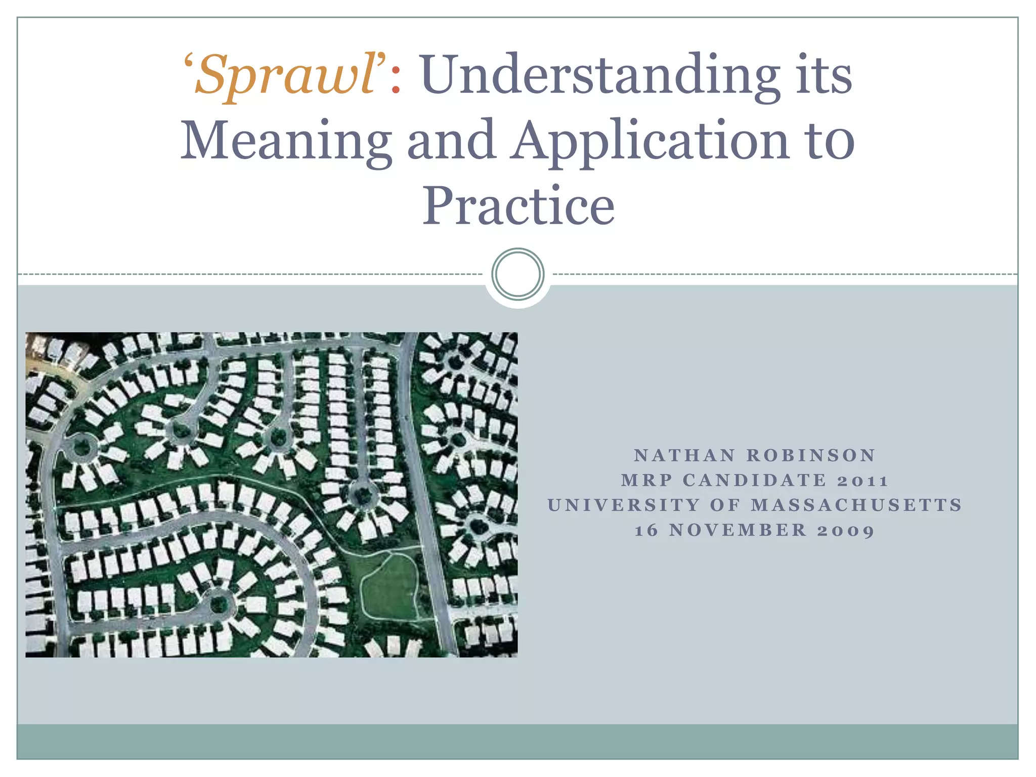
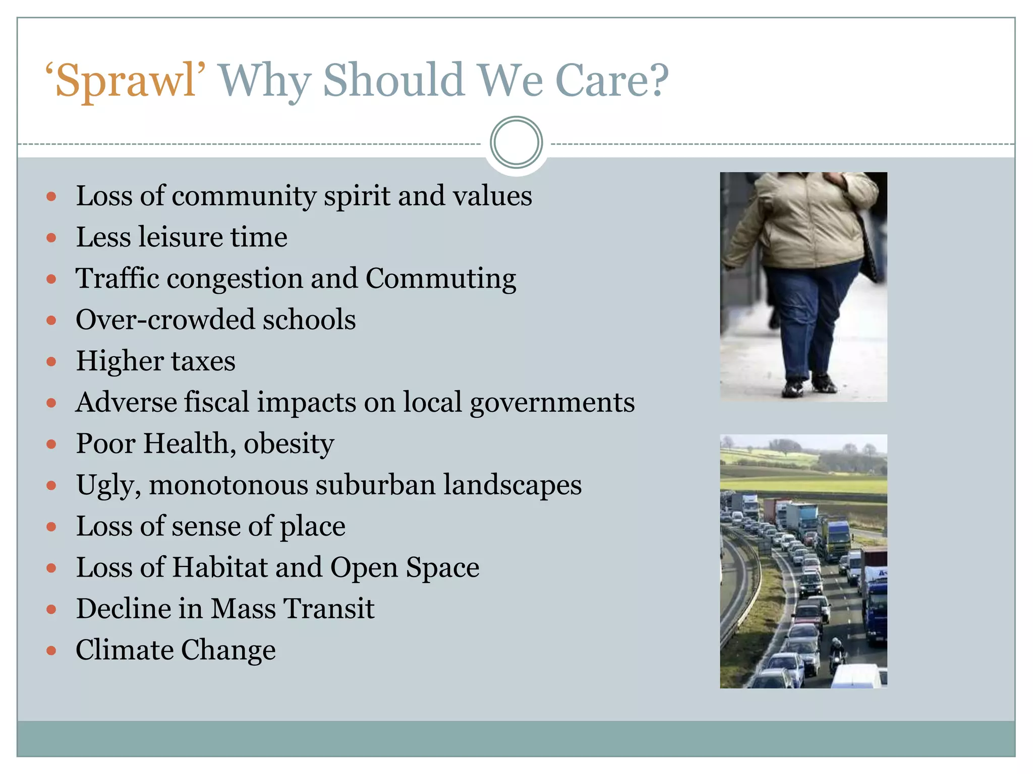
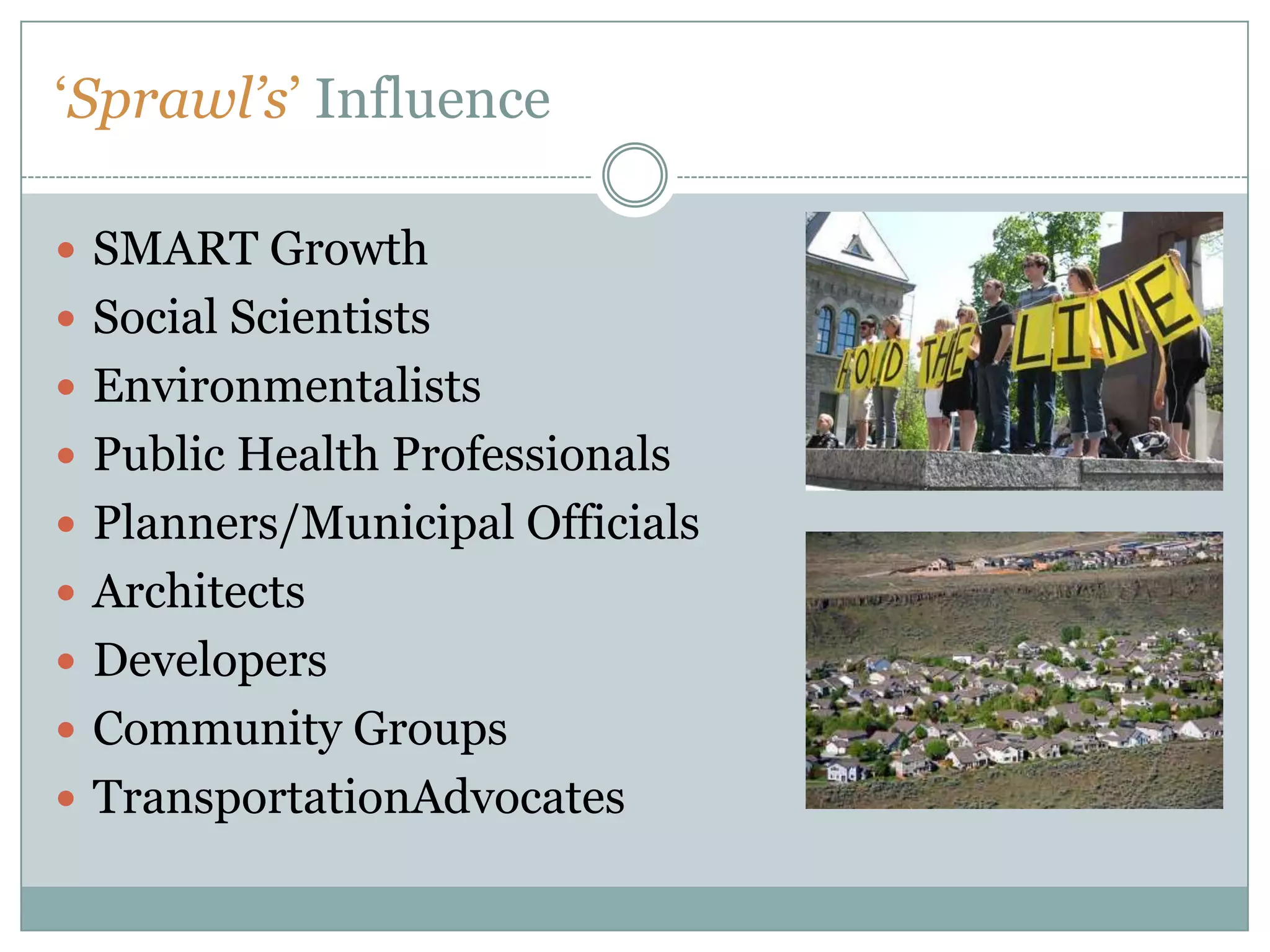
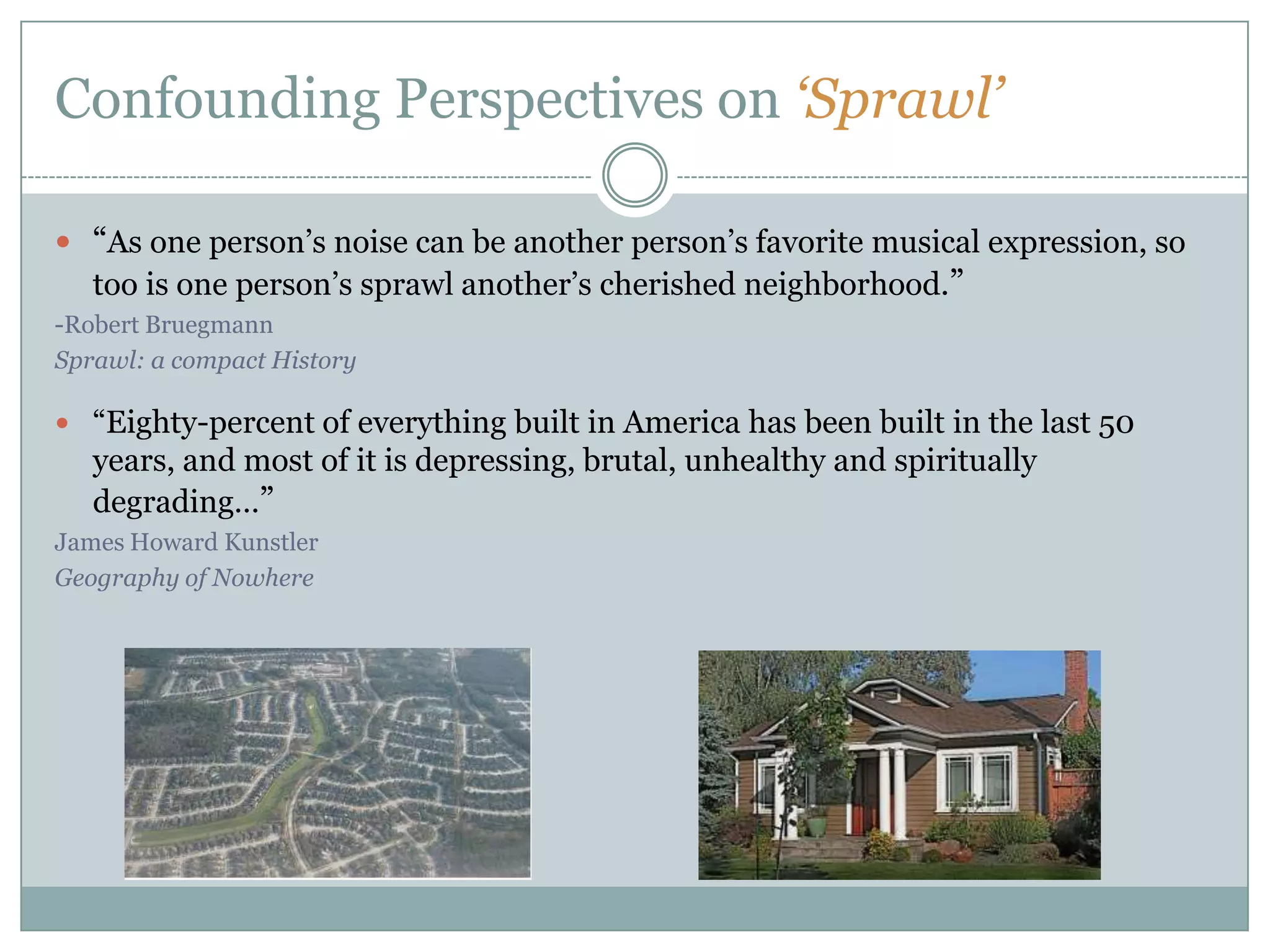
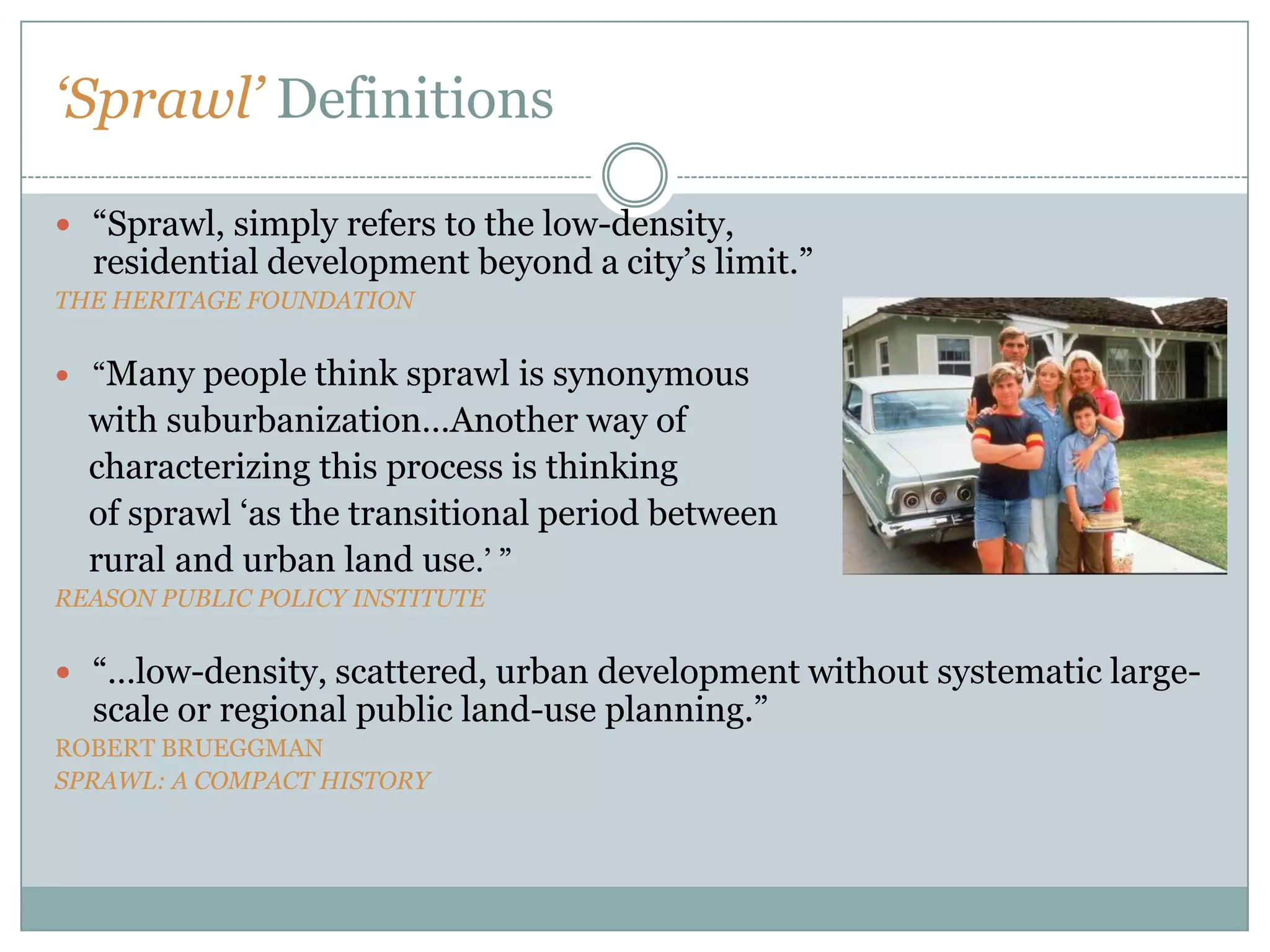
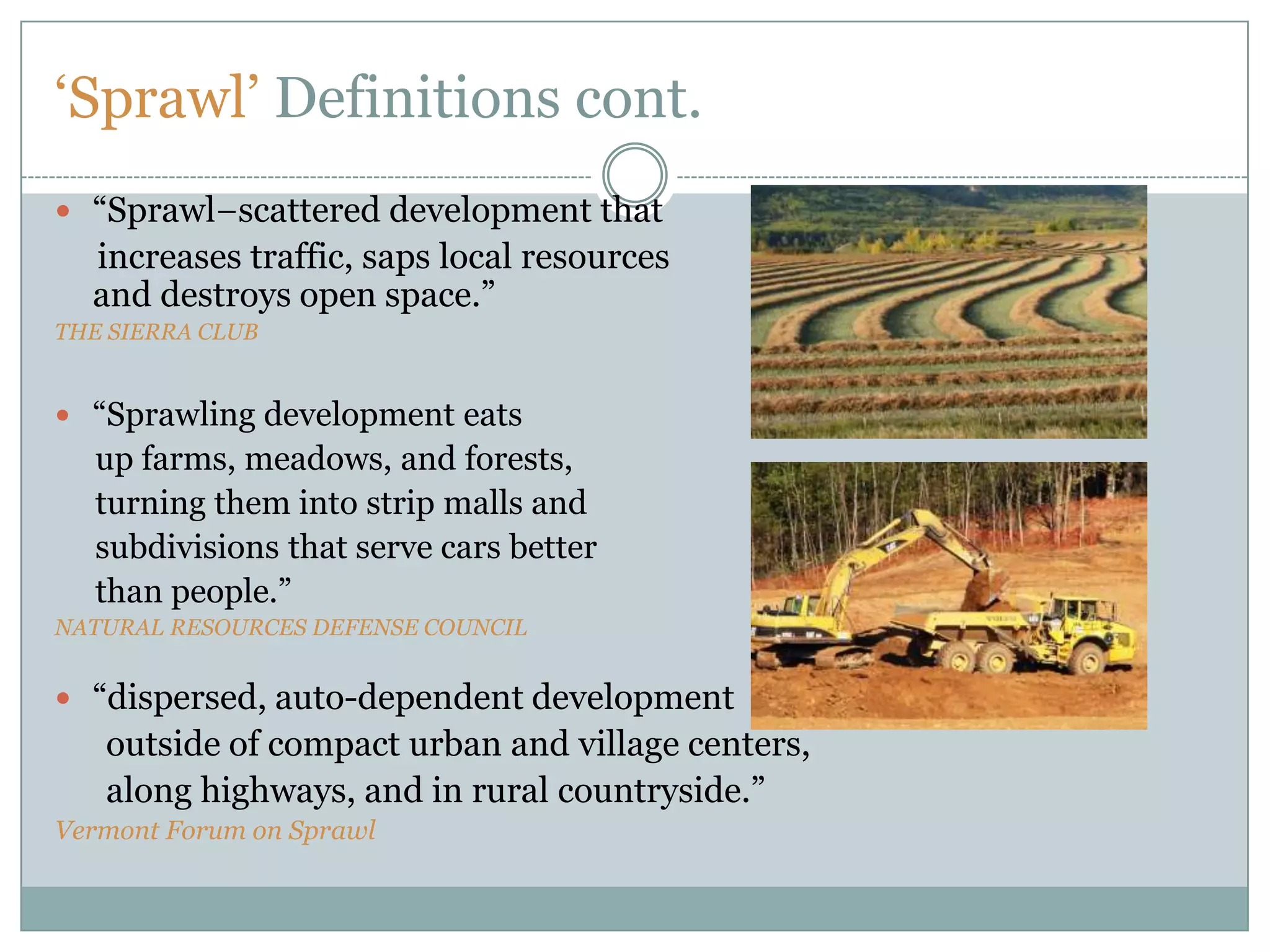
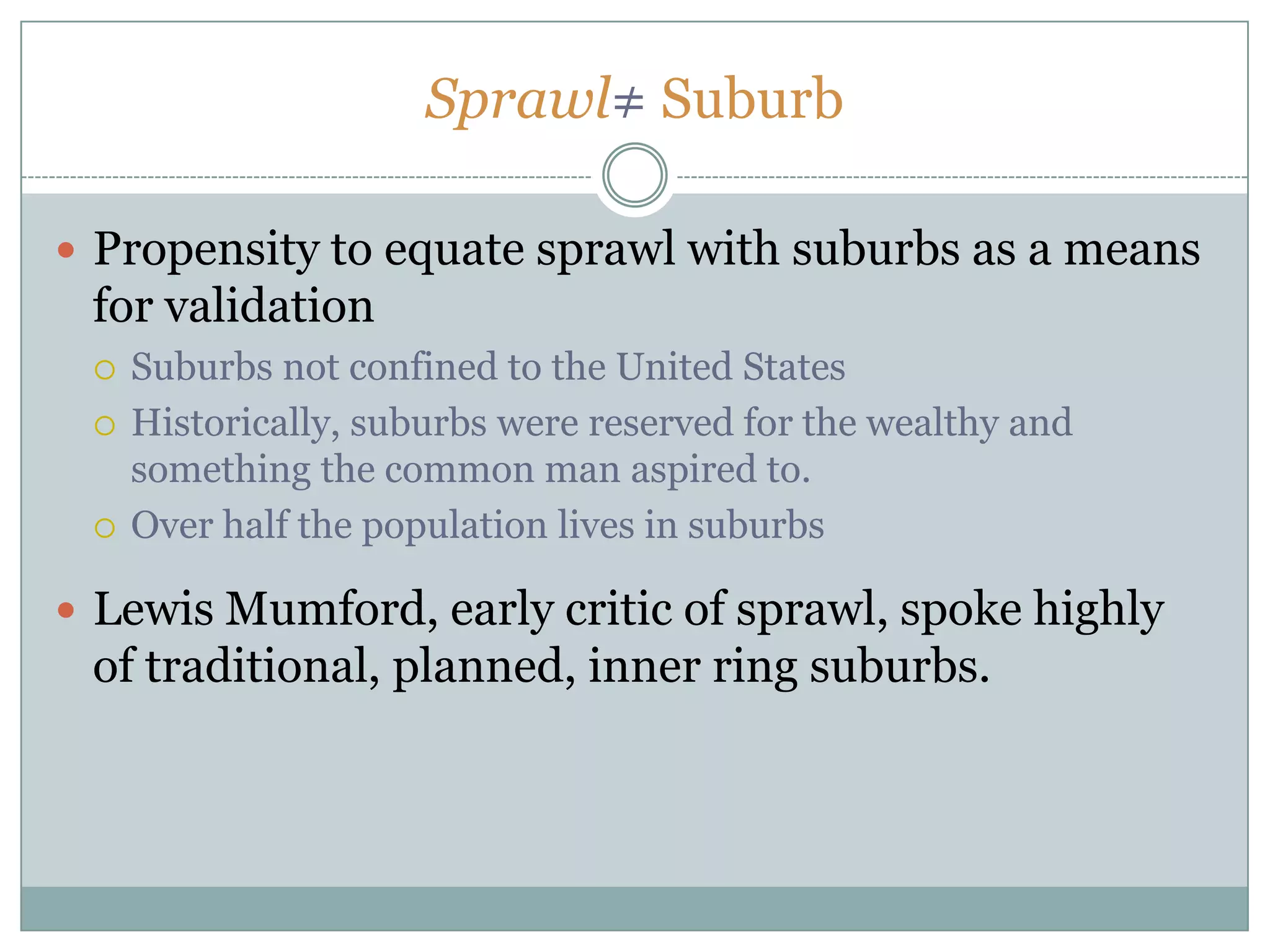
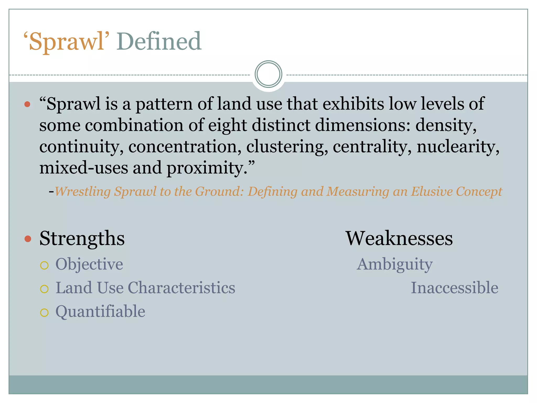
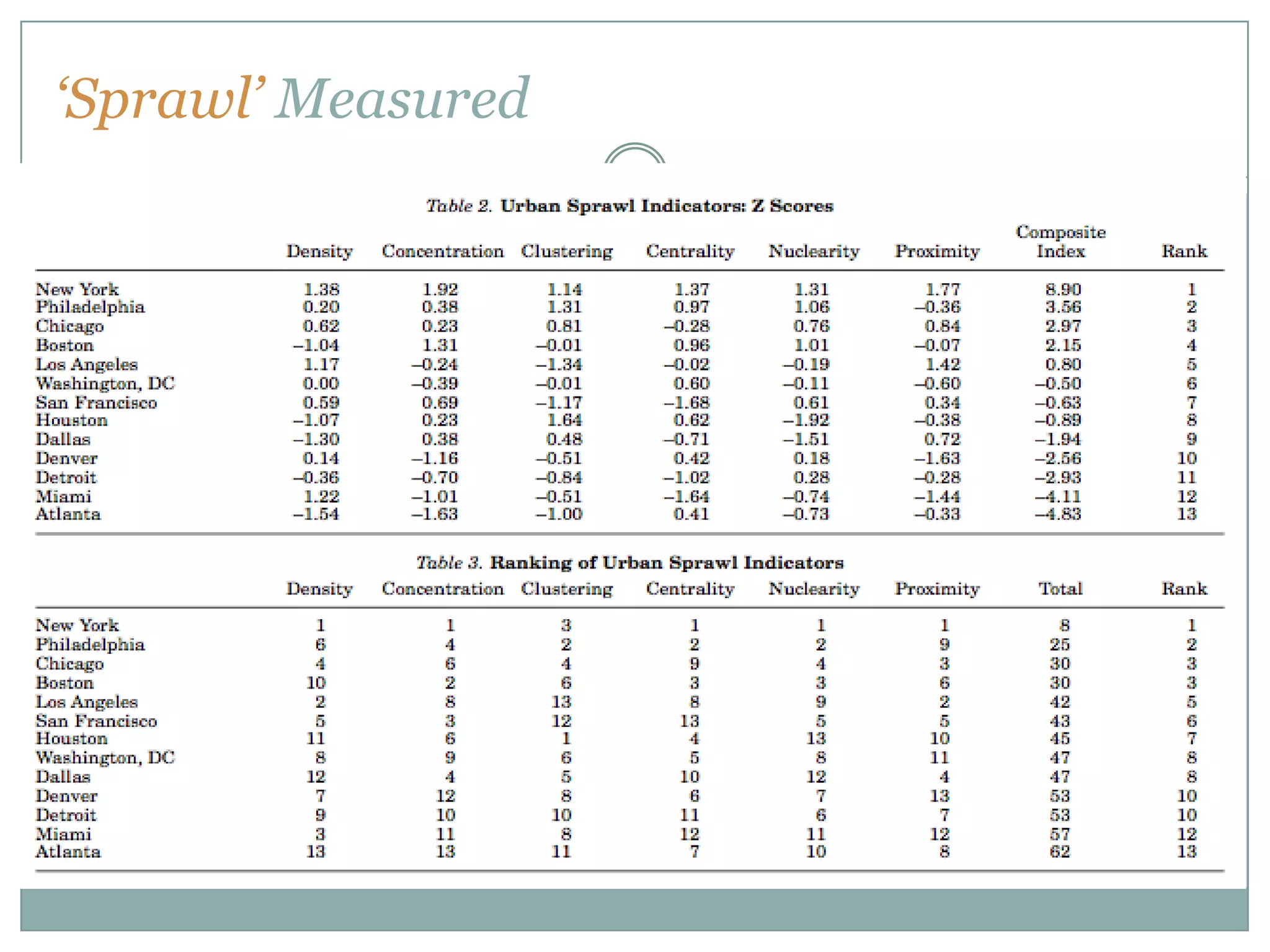
This document discusses the definition and measurement of urban sprawl. It begins with an overview of the origins of the term "sprawl" in the 1930s and its popularization in the 1950s. It then examines conflicting perspectives on sprawl and various definitions from different organizations. The document proposes defining sprawl based on eight dimensions: density, continuity, concentration, clustering, centrality, mixed-uses, and proximity. These dimensions can be quantified to objectively measure sprawl's characteristics in a given geographic area. The document concludes that defining sprawl objectively using land use characteristics can help planners make informed land use decisions.
We are now in the “Century of the City” where urbanization defines our social,economic,and environmental characteristics.
In this era of the Anthropocene, when we are altering the functioning of the global environment, the term “Astycene” accurately describes this “new urban era” where “anthropos” is an “astos,” a dweller of an urban area. The term has been derived from two Greek words:αστυ, i.e., asty= city, town and καιν, i.e., cene= new.
Hence, my topic of presentation is: “Mapping the Astycene”
Placemaking: Building our Cities around placesPriya Vakil
ThinkPhi is on a journey to build cities that are healthy and sustainable. We are doing this by using Placemaking - a design philosophy that explores how spaces in a community can be better utilised.
And this is philosophy, we constantly use when having discussion on helping design sustainable cities.
Maps of the living neighborhoods - a study of Genoa through social mediaMarna Parodi
A proposal for the application to the city of Genoa of “Livehoods”, a urban computing project started in 2012 by Carnegie Mellon University (http://livehoods.org/).
Livehoods analyses data generated on smartphones by Foursquare a location based social network. Foursquare allow users to check-in in a venue, e.g. a shop, a theatre, a swimming pool. Data are aggregated into clusters that display the activity patterns of people dwelling in a certain area. Livehoods maps capture characteristics of the urban habitat that are well perceived by the people, but usually hardly if at all represented by traditional maps. In Genoa, this research could be have as object of study the area of Fiumara and its surroundings, with an analysis of the relation of the institutional borders of the area, with reference to the original urban requalification plan as well, and the dynamic borders traced by Livehoods.
From a land-use perspective, has New Jersey built the kinds of places – and built enough of them – that provide what older adults are likely to be seeking as they age? The short answer is no.
Muhammad Saud Kharal
PhD in Social Science,
Department of Sociology Faculty of Social and Political Sciences, Universitas Airlangga, Surabaya Indonesia
Susan Wachter's presentation from
Comparative Urban Politics Workshop: Rescaling The City
August 30th, 2006
The American Political Science Association, Philadelphia, PA
Presentation made at School of Architecture, RV College of Engineering, Bangalore. The talk focused on military, maritime and administrative embeddings of analog as well as digital mapping techniques; on neogeography, subjectivity and power in maps, and possibilities of counter mapping.
My presentation on Urban Sprawl for Sustainability Information Solutions weekly call.
Urban Sprawl is a situation where large stores, groups of houses, etc. are built in an area around a city that formerly had a few people living in it.
Chapter 2Chapter 2
Suburbs and
Suburban Sprawl
Community Redeveloped 2-1
Suburbs and Suburban Sprawl
Low-density development in a foothills suburb west of Denver,
Colorado. S. Buntin.
There is no more important community design problem than the redesign
and adaptation of the American suburb--the symbol and logos of
American affluence and technology and growth in the past forty years.
-- Sim Van der Ryn1
In the United States, more than one million acres of farmland land area. These are just some of the legacies of suburbanization
are lost annually to development. Between 1969 and 1983, since World War II.2
population in the U.S. grew 16 percent, while vehicle miles traveled Suburban communities demand careful evaluation because
grew 56 percent. Between 1970 and 1990, the Los Angeles many are unsustainable--they use resources without a mechanism for3
metropolitan area grew 45 percent in population, but 300 percent in adequately replenishing them; they are low-density in nature,
4
replacing wilderness with grass lawns, farmland with strip malls; they
give priority to the automobile over the pedestrian; they lack
economic and cultural diversity; and the list goes on. But to say that
many suburbs are unsustainable is not enough. What is unsustainable
about them? How did they get that way? What are the economic,
environmental, and social costs associated with a sprawl existence?
Why Focus on Suburban Communities?
Suburban communities warrant focus not because they are
suburbs per se, but because of their common postwar development
patterns. While central cities are generally high-density and often
based on a grid street pattern, and rural areas are very low density
and preserve--whether intended or not--agricultural and natural open
space, suburbs are often neither city nor country. And they are
Community Redeveloped 2-2
Suburbs and Suburban Sprawl
The Denver Post.
generally not a happy medium somewhere in between. Rather, central city decreases occurred from 1950 to 1990 in Cleveland;
postwar suburbs especially are low-density settlements comprised of Syracuse; Louisville, Kentucky; and Harrisburg, Pennsylvania.
Why are these statistics important? As later sections will
parks, and relatively large-lot residential subdivisions, predominantly
automobile-based.
Perhaps suburban trends would not be so significant if
suburbia wasn’t home to so many people. Today, over half of
America’s population lives in suburban settings. Moreover,5
suburban populations and geographic boundaries in many
metropolitan areas are growing at an alarming rate, especially in the
Western U.S. Here, thirteen states make up the most urbanized
region in America. The Seattle metropolitan area, for example, has6
grown from just over one million people in 1950, to nearly
three million in 1995. In that same time span, the Phoenix7
metropolitan area surged from 350,000 people to 2.5 million. And8 ...
Presentation of thesis research into promoting positive change in existing suburban residential neighborhoods. Allowing infill development such as accessory dwelling units, duplexes, and lot splits can be useful for increasing diversity of housing types, which increases diversity of residents. Modifications to the road network and other neighborhood improvements can also enhance the livability of the community.
Effects of Small Town's Centralization on Spatial Organization of Rural Settl...iosrjce
Centralization in small town is led to functional changes due to increasing Inequality between rural
settlement and cities. On the other hand, mentioned changes are different based on distance with urban center.
Also, these cities effect germ and parasitic role on rural area according to their structure.
The methodology of this study is descriptive –analytic and collecting data is done by documents-library. The
data are generally gathered from scientific centre libraries like universities, organizations, institutes and
research centers such as management and planning organization and internet, official statistics and censuses,
Urban Development Plans By Consulting Engineers, Field Study And So On. Studied Area Is Shandiz &
Torqabeh Cities. Infact, Has Been Studied The Effect Mentioned Cities On Hesar Golestan & Hesar Sorkh
Villages. In Order To , Was Used From Network Analyzed. On The Other Hand, Was Used From Questioner
Tool. Finding Shows, The Relation Between Urban And Rural Area Is Parasitic Theory.
Similar to Sprawl: Understanding its Meaning and Application to Practice (20)
Read| The latest issue of The Challenger is here! We are thrilled to announce that our school paper has qualified for the NATIONAL SCHOOLS PRESS CONFERENCE (NSPC) 2024. Thank you for your unwavering support and trust. Dive into the stories that made us stand out!
We all have good and bad thoughts from time to time and situation to situation. We are bombarded daily with spiraling thoughts(both negative and positive) creating all-consuming feel , making us difficult to manage with associated suffering. Good thoughts are like our Mob Signal (Positive thought) amidst noise(negative thought) in the atmosphere. Negative thoughts like noise outweigh positive thoughts. These thoughts often create unwanted confusion, trouble, stress and frustration in our mind as well as chaos in our physical world. Negative thoughts are also known as “distorted thinking”.
2024.06.01 Introducing a competency framework for languag learning materials ...Sandy Millin
http://sandymillin.wordpress.com/iateflwebinar2024
Published classroom materials form the basis of syllabuses, drive teacher professional development, and have a potentially huge influence on learners, teachers and education systems. All teachers also create their own materials, whether a few sentences on a blackboard, a highly-structured fully-realised online course, or anything in between. Despite this, the knowledge and skills needed to create effective language learning materials are rarely part of teacher training, and are mostly learnt by trial and error.
Knowledge and skills frameworks, generally called competency frameworks, for ELT teachers, trainers and managers have existed for a few years now. However, until I created one for my MA dissertation, there wasn’t one drawing together what we need to know and do to be able to effectively produce language learning materials.
This webinar will introduce you to my framework, highlighting the key competencies I identified from my research. It will also show how anybody involved in language teaching (any language, not just English!), teacher training, managing schools or developing language learning materials can benefit from using the framework.
Instructions for Submissions thorugh G- Classroom.pptxJheel Barad
This presentation provides a briefing on how to upload submissions and documents in Google Classroom. It was prepared as part of an orientation for new Sainik School in-service teacher trainees. As a training officer, my goal is to ensure that you are comfortable and proficient with this essential tool for managing assignments and fostering student engagement.
Welcome to TechSoup New Member Orientation and Q&A (May 2024).pdfTechSoup
In this webinar you will learn how your organization can access TechSoup's wide variety of product discount and donation programs. From hardware to software, we'll give you a tour of the tools available to help your nonprofit with productivity, collaboration, financial management, donor tracking, security, and more.
Unit 8 - Information and Communication Technology (Paper I).pdfThiyagu K
This slides describes the basic concepts of ICT, basics of Email, Emerging Technology and Digital Initiatives in Education. This presentations aligns with the UGC Paper I syllabus.
How to Split Bills in the Odoo 17 POS ModuleCeline George
Bills have a main role in point of sale procedure. It will help to track sales, handling payments and giving receipts to customers. Bill splitting also has an important role in POS. For example, If some friends come together for dinner and if they want to divide the bill then it is possible by POS bill splitting. This slide will show how to split bills in odoo 17 POS.
Palestine last event orientationfvgnh .pptxRaedMohamed3
An EFL lesson about the current events in Palestine. It is intended to be for intermediate students who wish to increase their listening skills through a short lesson in power point.
Sprawl: Understanding its Meaning and Application to Practice
1. Nathan Robinson MRP Candidate 2011 University of Massachusetts 16 November 2009 ‘Sprawl’: Understanding its Meaning and Application t0 Practice
2. Presentation Overview Why Should We Care Origins of ‘Sprawl’ Confounding Perspectives and Definitions ‘Sprawl’ defined Concluding Remarks
3. ‘Sprawl’ Why Should We Care? Loss of community spirit and values Less leisure time Traffic congestion and Commuting Over-crowded schools Higher taxes Adverse fiscal impacts on local governments Poor Health, obesity Ugly, monotonous suburban landscapes Loss of sense of place Loss of Habitat and Open Space Decline in Mass Transit Climate Change
4. ‘Sprawl’s’Origins One of the earliest uses of the word "sprawl" in reference to land use was in a 1937 speech by Earl Draper, planning director of the Tennessee Valley Authority. “Perhaps diffusion is too kind a word…In bursting its bounds, the city actually sprawled and made the country side ugly…uneconomic of services and doubtful of social value.” William Whyte popularized “sprawl” with his essay in the 1958 book, The Exploding Metropolis. “Sprawl is bad aesthetics: sprawl is bad economics.” Much of his analysis continues to frame the debate on “sprawl,” to the present day. Costs of Sprawl, 1974, Real Estate Research Corporation
5. ‘Sprawl’s’ Influence SMART Growth Social Scientists Environmentalists Public Health Professionals Planners/Municipal Officials Architects Developers Community Groups TransportationAdvocates
6. Confounding Perspectives on ‘Sprawl’ “As one person’s noise can be another person’s favorite musical expression, so too is one person’s sprawl another’s cherished neighborhood.” -Robert Bruegmann Sprawl: a compact History “Eighty-percent of everything built in America has been built in the last 50 years, and most of it is depressing, brutal, unhealthy and spiritually degrading…” James Howard Kunstler Geography of Nowhere
7. ‘Sprawl’ Definitions “Sprawl, simply refers to the low-density, residential development beyond a city’s limit.” THE HERITAGE FOUNDATION “Many people think sprawl is synonymous with suburbanization…Another way of characterizing this process is thinking of sprawl ‘as the transitional period between rural and urban land use.’ ” REASON PUBLIC POLICY INSTITUTE “…low-density, scattered, urban development without systematic large-scale or regional public land-use planning.” ROBERT BRUEGGMAN SPRAWL: A COMPACT HISTORY
8. ‘Sprawl’ Definitions cont. “Sprawl−scattered development that increases traffic, saps local resources and destroys open space.” THE SIERRA CLUB “Sprawling development eats up farms, meadows, and forests, turning them into strip malls and subdivisions that serve cars better than people.” NATURAL RESOURCES DEFENSE COUNCIL “dispersed, auto-dependent development outside of compact urban and village centers, along highways, and in rural countryside.” Vermont Forum on Sprawl
9. Sprawl≠ Suburb Propensity to equate sprawl with suburbs as a means for validation Suburbs not confined to the United States Historically, suburbs were reserved for the wealthy and something the common man aspired to. Over half the population lives in suburbs Lewis Mumford, early critic of sprawl, spoke highly of traditional, planned, inner ring suburbs.
10. ‘Sprawl’ Defined “Sprawl is a pattern of land use that exhibits low levels of some combination of eight distinct dimensions: density, continuity, concentration, clustering, centrality, nuclearity, mixed-uses and proximity.” -Wrestling Sprawl to the Ground: Defining and Measuring an Elusive Concept Strengths Weaknesses Objective Ambiguity Land Use Characteristics Inaccessible Quantifiable
11. ‘Sprawl’ Defined Definition dimensions are consistent with the negative externalities associated with sprawl Density- Residential Units/Sq. Mile Continuity- Leapfrog, Fragmented Development Concentration- Open Space Protection, Infrastructure Costs Clustering- Urban Form/Design, Impervious Surfaces Centrality- Relationship to Central Business District Mixed-Uses-Spatial Mismatch, Congestion/Traffic Proximity- Distance Between Uses, Congestion/Traffic
12. ‘Sprawl’ Defined Definition dimensions can be operationalized tomeasure ‘sprawl’ over a defined geographic area. Allows us objectivity in measuring sprawl Identify characteristics that are strengths and weaknesses. i.e. municipal area could have high-density land use, but have a low score with respect to proximity to proximity and mixed-use. Conducive to Master Plan Development Incentive Strategies Flexibility: Different regions have different resource limitations, weighting, and creation of other objective dimensions, allow us to quantify sprawl.
14. Conclusion ‘Sprawl’ is a very controversial word has been influential in shaping the debate on development and growth management. Subjectivity has its benefits and costs ‘Sprawl’ is not all low-density residential development As planners we can use objective definitions to operationalize land use characteristics to help us make rationale and informed land use decisions.
Editor's Notes
William Whyte’s essay, Urban Sprawl, epitomizes the issue, and even in the 1950’s much of his commentary regarding sprawl still rings true today. “The problem is how to achieve an economically high-density in developed areas, and at the same time more amenable surroundings for the people in them.”
The sierra club, natural resource defense council, and the conservation law foundation, preimminent national and regional organizations have all alligned in the fight against sprawl.
Read the two Definitions: One from the Natural Resources Defense Council, the Other From the Reason FoundationSprawl, simply refers to the low-density, residential development beyond a city’s limitMany people think sprawl is synonymous with suburbanization…Another way of characterizing this process is thinking of sprawl as the transitional period between rural and urban land useSprawling Development eats up farms, meadows, and forests, turning them into strip malls and subdivisions that serve cars better than people.” NRDCSprawl-scattered development that increases development, sap local resources and destroys open space. Sierra Club.
I would to this definition that development is characterized by a Temporal element that is characterized by a very quick turn-around time.Objective: The definition does not include value judgments or subjective criteria like aesthetics or “quality of life.”LUC: Deals only land use characteristics, does not include causes of sprawl, (cheap land) or effects of sprawl, “congestion” or loss of open space in the criteriaQuantifiable: As we will see later, the eight distinct dimensions can be operationalized, to be measured. Density: Is a measure of residential housing units/square mile, reflects the built environment, Continuity: Used to measure the “leapfrog effect,” is development being fragmented, which could lead to loss of continuous open space and another negative externality of sprawl such as more driving?Concentration: Refers to how densely development is distrubuted over a measurable area. Areas with high concentration how lower levels of dispersal and thus less sprawl. Clustering: the form of development within a Grid, related to impervious surfaces, water filtration and health, etc. Centrality: Distance from Central business districtNuclearity: Poly nuclear, versus NuclearMixed-Use:
New York, Philadelphia, ChicagoAtlanta, Miami, Detroit had the lowest scores.