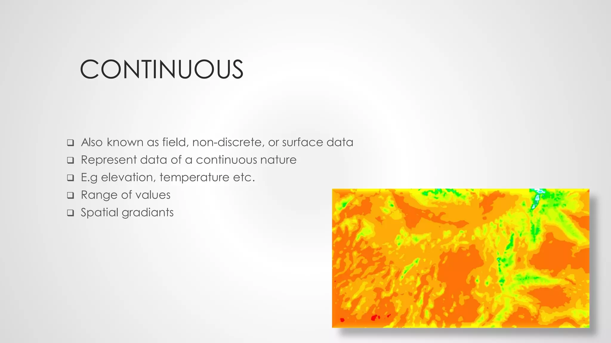
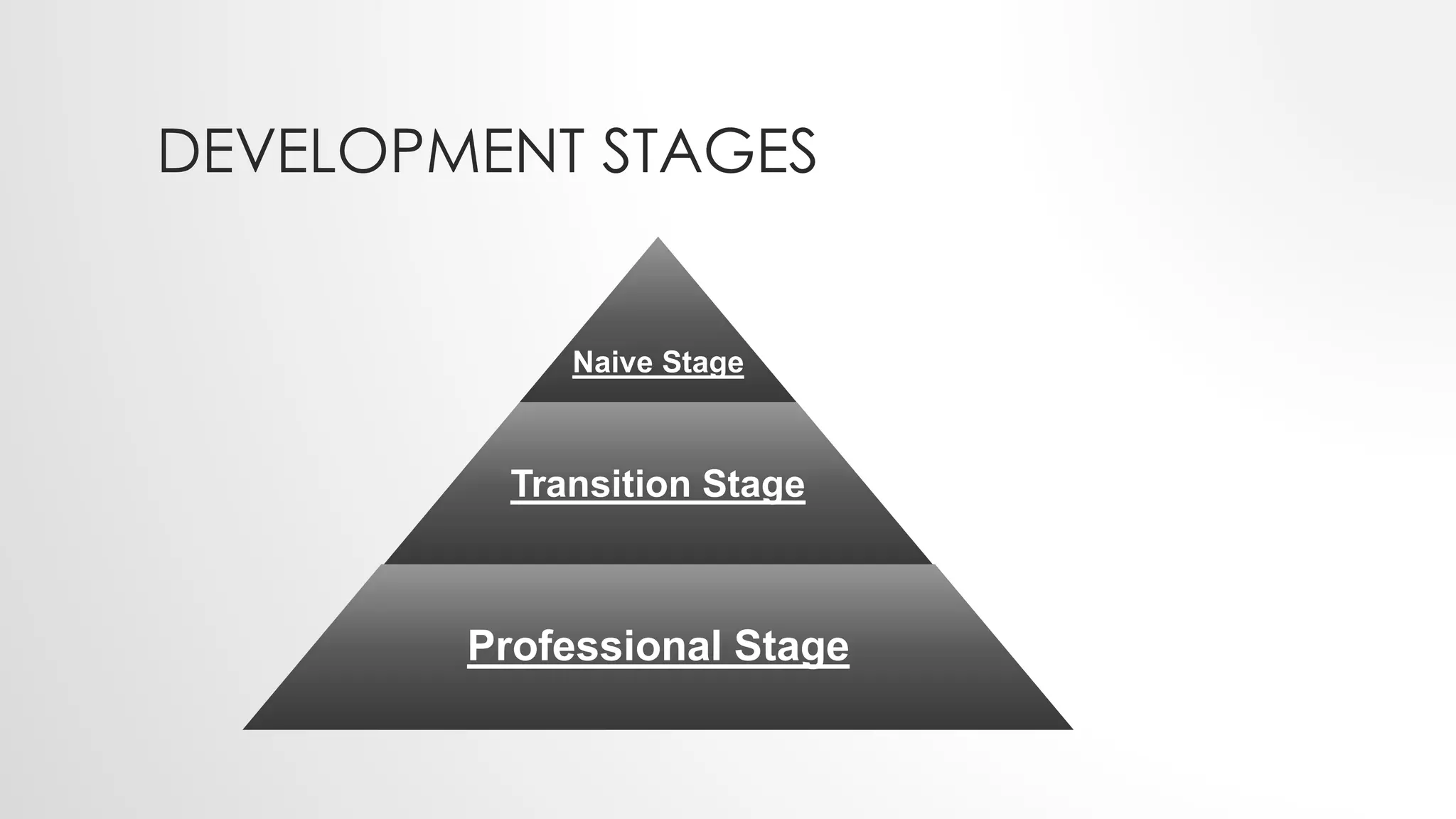
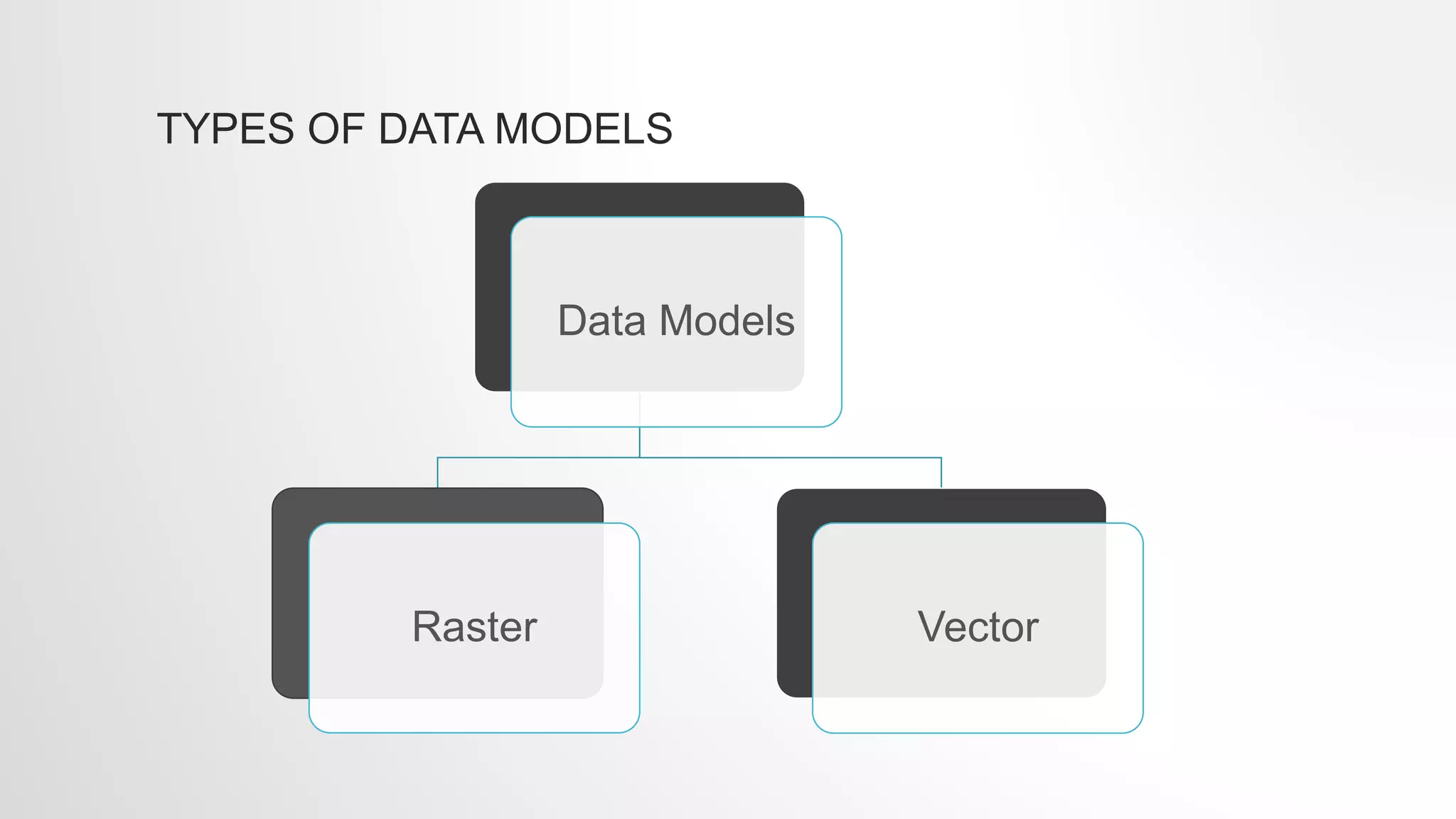
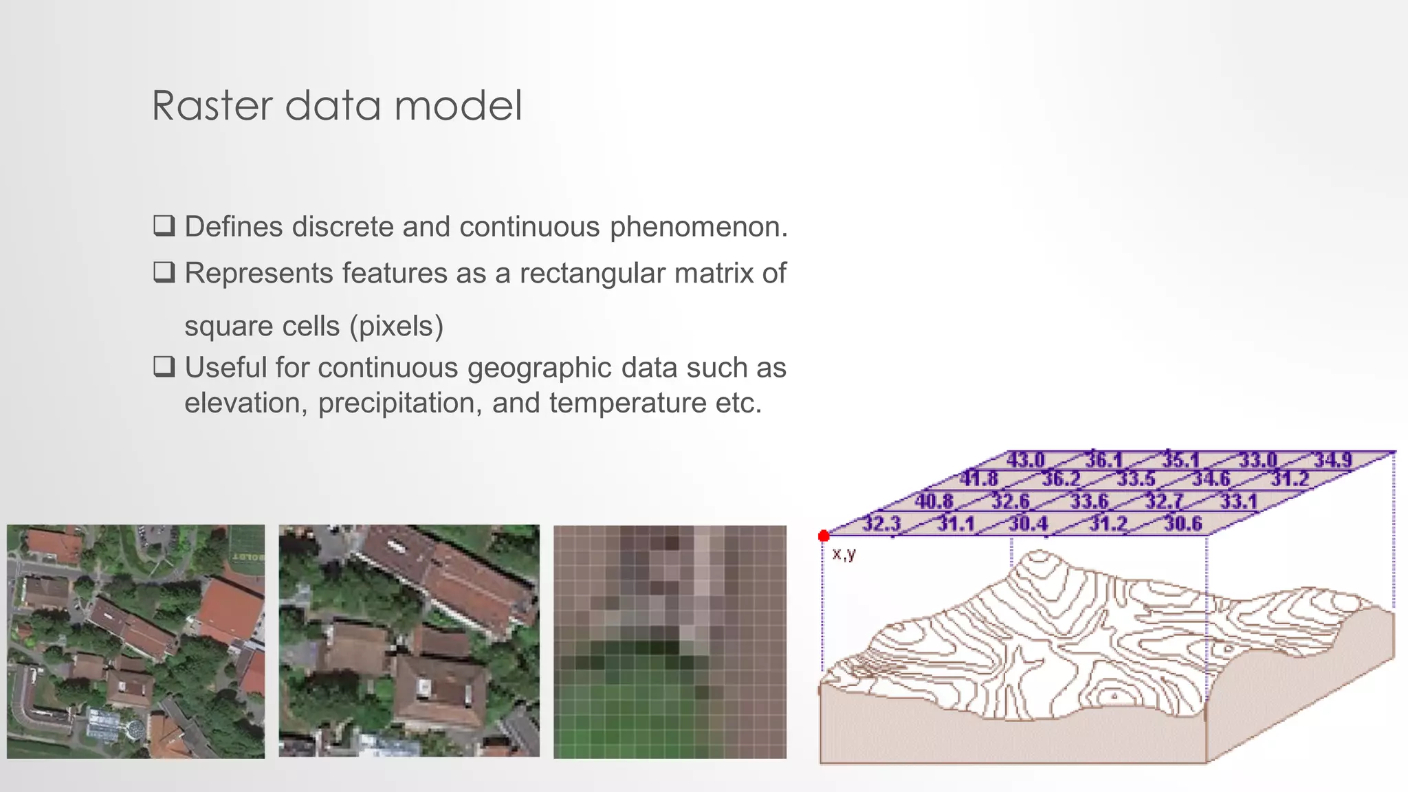
SPATIAL DATA MODELING
Lecture no 3
Presented by:
Sadia Sheikh
• Types of spatial data phenomenon?
• Discrete Vs continuous phenomenon?
• Development Stages?
• Types of data models?
• Raster data structure?
TYPES OF SPATIAL DATA PHENOMENON
Two types of spatial phenomenon
1. Discrete
2. Continuous
DISCRETE
 also known as categorical or discontinuous
data.
 known and definable boundaries.
 Individually distinguishable
 E.g roads, lakes, building parcel etc.
 Independent numbers/ whole numbers
 Abrupt boundaries
 Also known as field, non-discrete, or surface data
 Represent data of a continuous nature
 E.g elevation, temperature etc.
 Range of values
 Spatial gradiants
CONTINUOUS
DEVELOPMENT STAGES
Naive Stage
Transition Stage
Professional Stage
DEVELOPMENT STAGES
1.Naive Stage: Objects to be conceived as point, line and areas to be
represented on a map sheet.
2. Transition Stage: Spatial description of objects was embedded in a
mathematical theory of space and the thematic description was
according to the modern data models of computer science.
3. Professional Stage: The Thematic and spatial description was
reformulated to comply with modern semantic data models of computer
science.
TYPES OF DATA MODELS
Data Models
Raster Vector
Raster data model
 Defines discrete and continuous phenomenon.
 Represents features as a rectangular matrix of
square cells (pixels)
 Useful for continuous geographic data such as
elevation, precipitation, and temperature etc.
VECTOR DATA MODEL
 Defines discrete objects Such as trees, rivers,
lakes, etc.
 Represents features as points, lines, and
polygons.
 Geometrically or mathematically associated.
THNAK YOU!

Spatial Data Modeling (Lecture#3)

  • 1.
    SPATIAL DATA MODELING Lectureno 3 Presented by: Sadia Sheikh
  • 2.
    • Types ofspatial data phenomenon? • Discrete Vs continuous phenomenon? • Development Stages? • Types of data models? • Raster data structure?
  • 3.
    TYPES OF SPATIALDATA PHENOMENON Two types of spatial phenomenon 1. Discrete 2. Continuous
  • 4.
    DISCRETE  also knownas categorical or discontinuous data.  known and definable boundaries.  Individually distinguishable  E.g roads, lakes, building parcel etc.  Independent numbers/ whole numbers  Abrupt boundaries
  • 5.
     Also knownas field, non-discrete, or surface data  Represent data of a continuous nature  E.g elevation, temperature etc.  Range of values  Spatial gradiants CONTINUOUS
  • 6.
  • 7.
    DEVELOPMENT STAGES 1.Naive Stage:Objects to be conceived as point, line and areas to be represented on a map sheet. 2. Transition Stage: Spatial description of objects was embedded in a mathematical theory of space and the thematic description was according to the modern data models of computer science. 3. Professional Stage: The Thematic and spatial description was reformulated to comply with modern semantic data models of computer science.
  • 8.
    TYPES OF DATAMODELS Data Models Raster Vector
  • 9.
    Raster data model Defines discrete and continuous phenomenon.  Represents features as a rectangular matrix of square cells (pixels)  Useful for continuous geographic data such as elevation, precipitation, and temperature etc.
  • 10.
    VECTOR DATA MODEL Defines discrete objects Such as trees, rivers, lakes, etc.  Represents features as points, lines, and polygons.  Geometrically or mathematically associated.
  • 11.