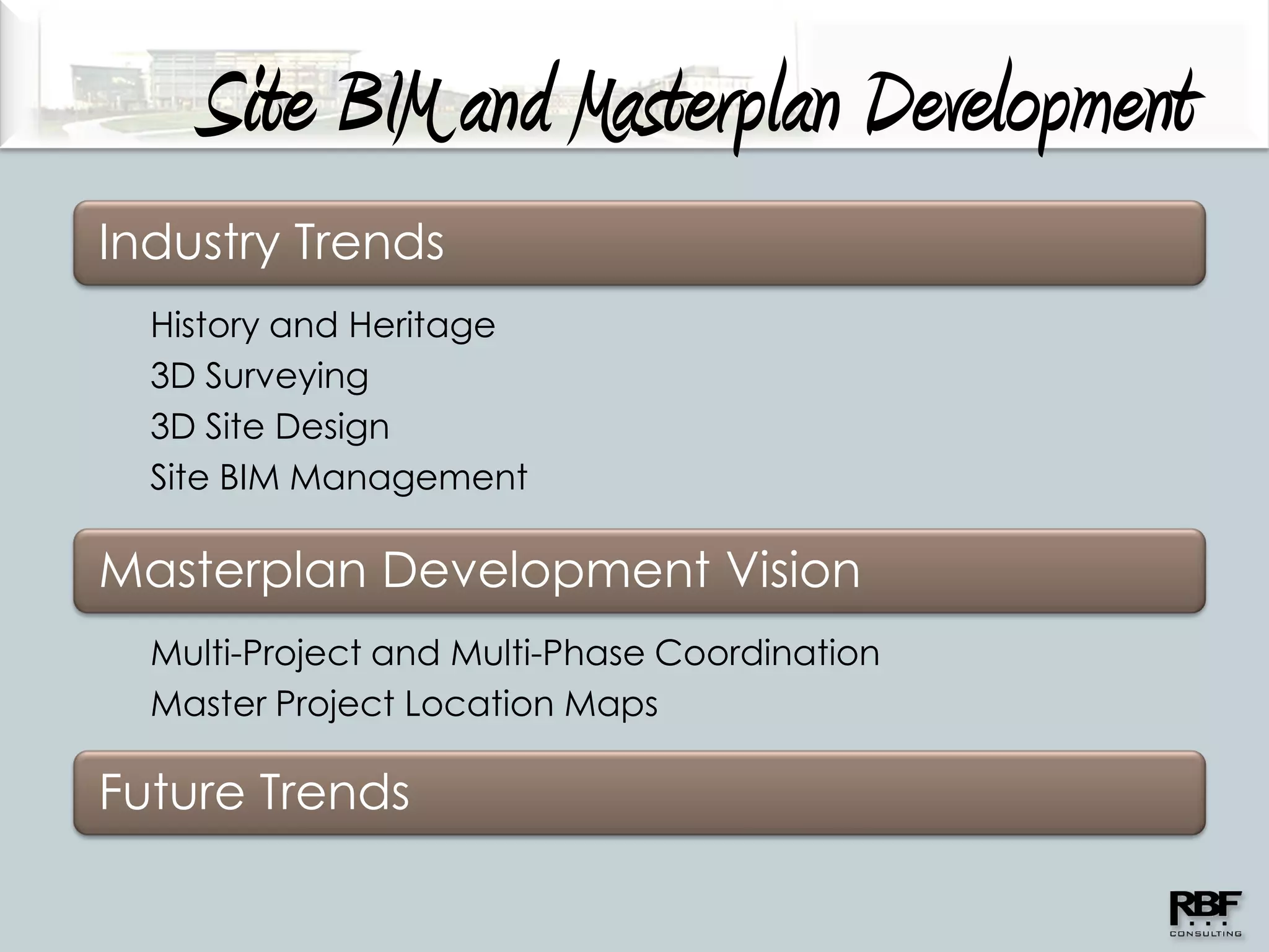
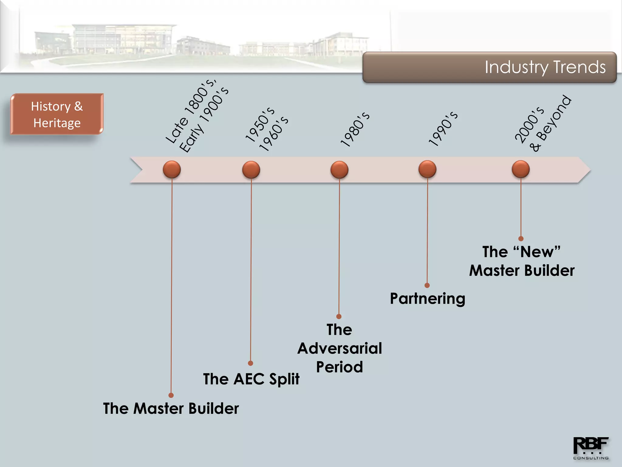
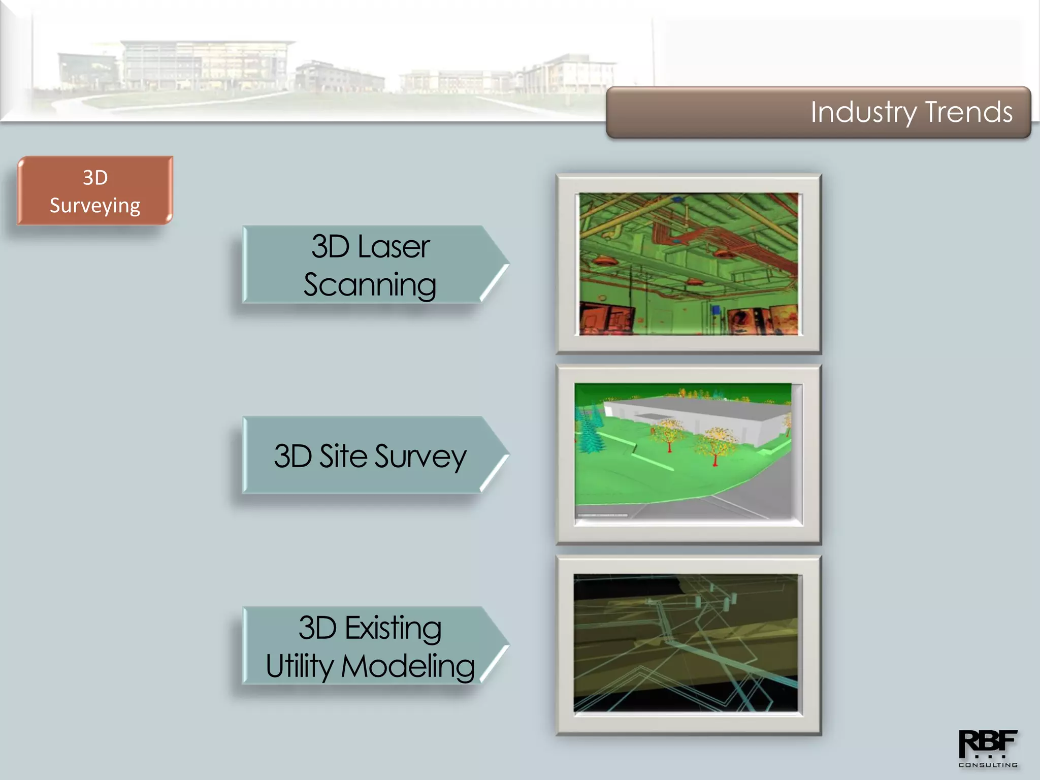
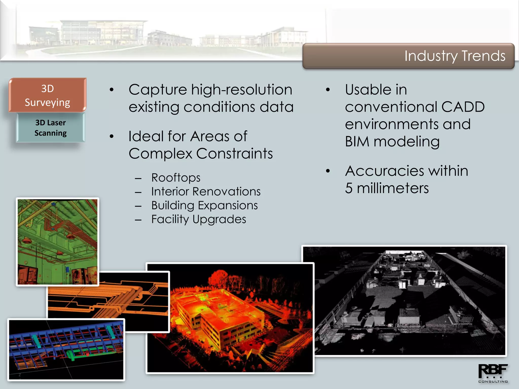
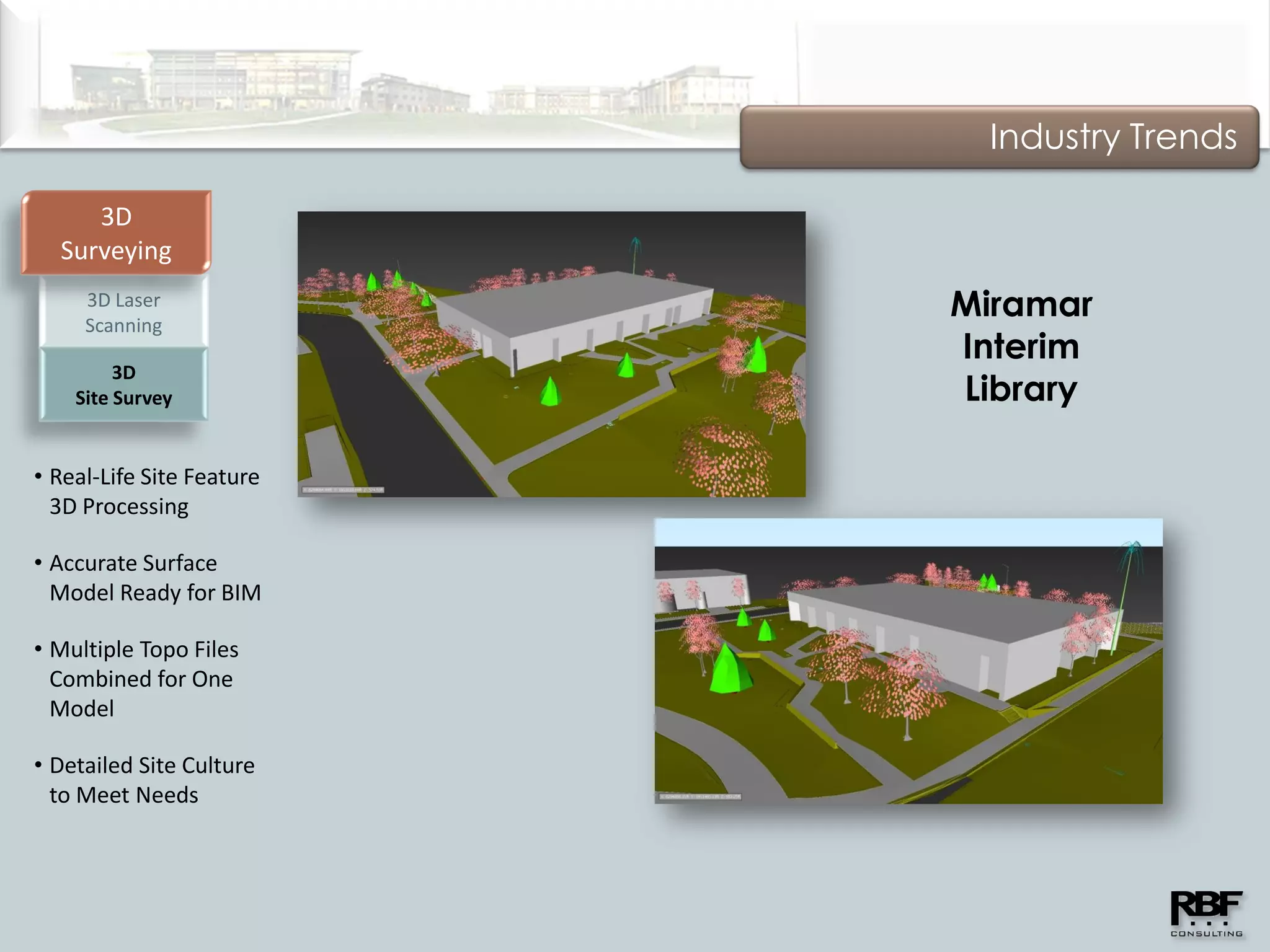
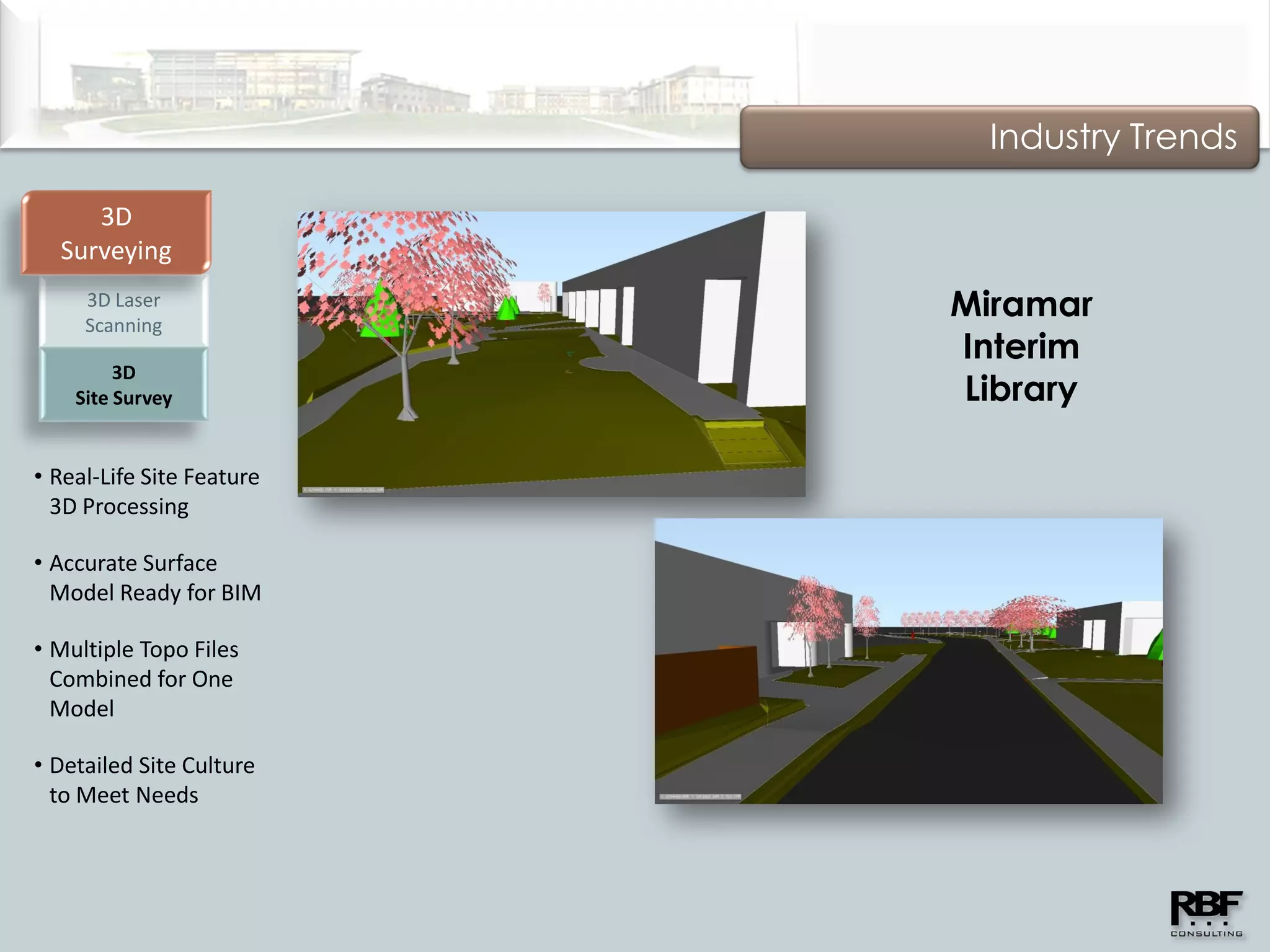
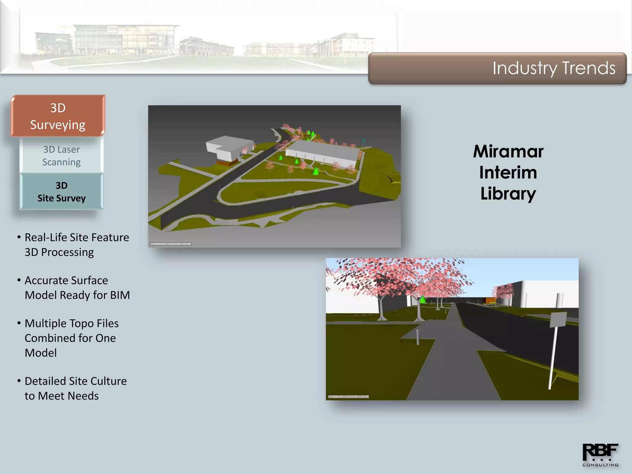
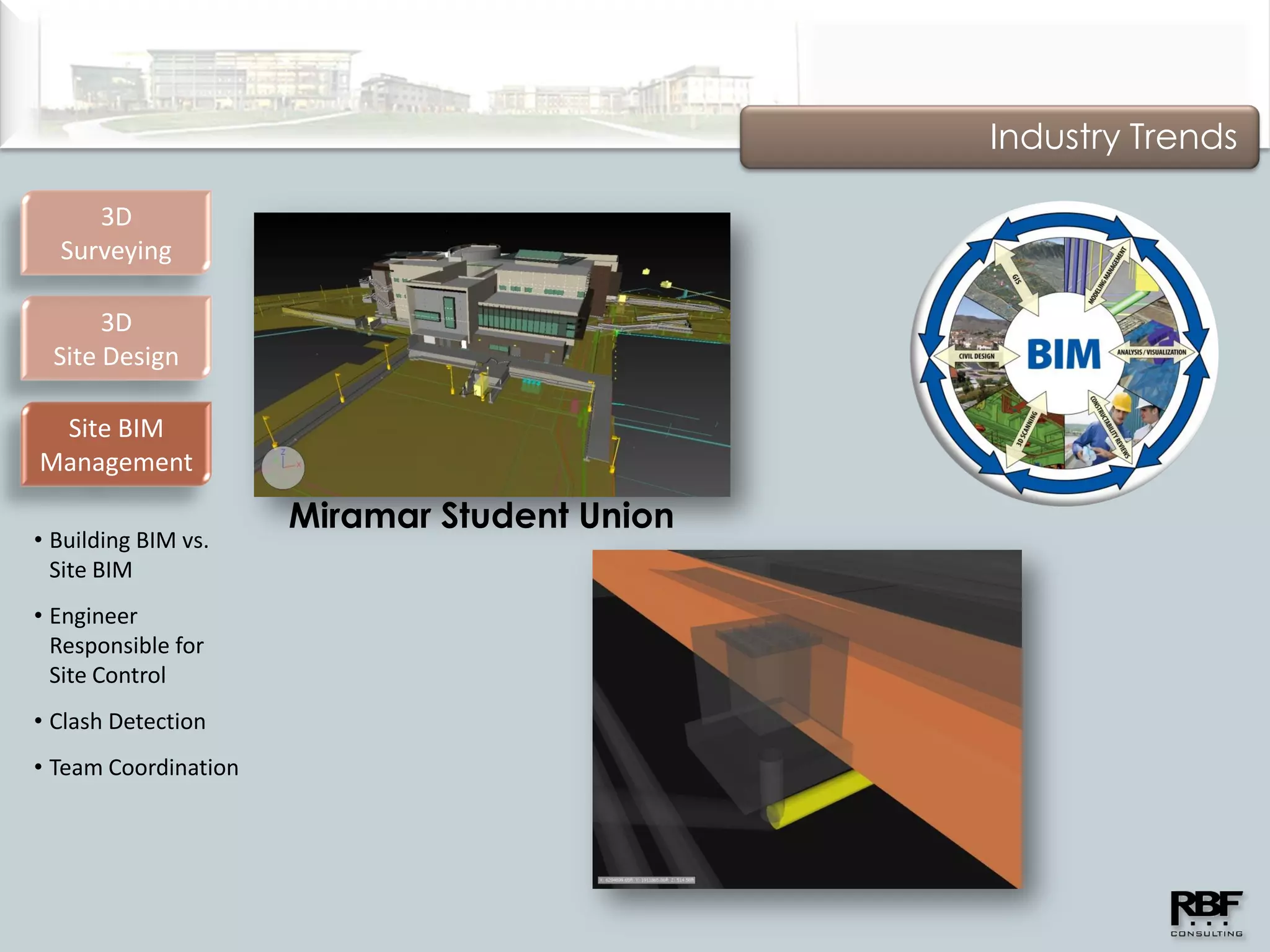
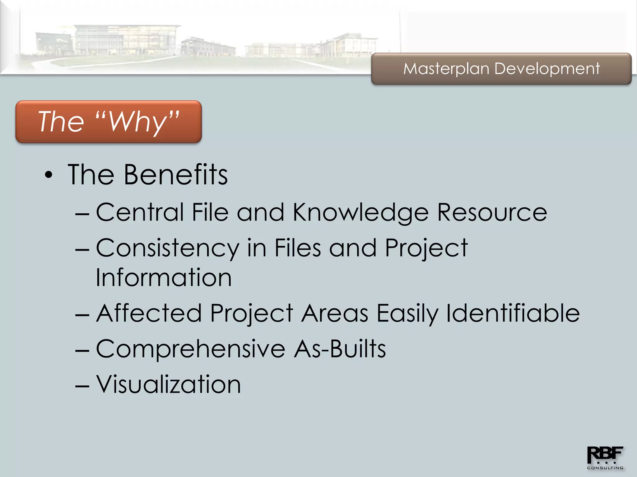
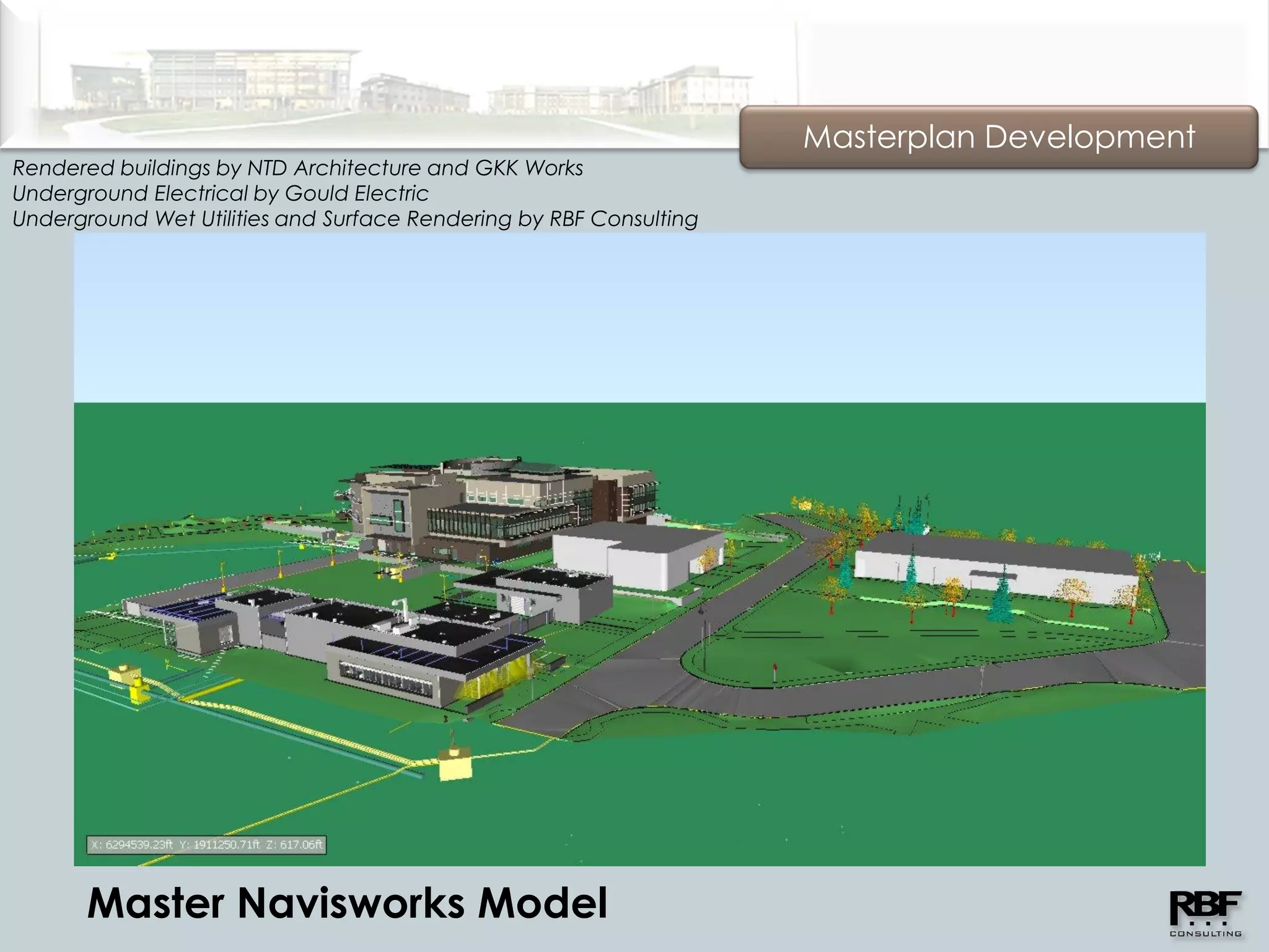
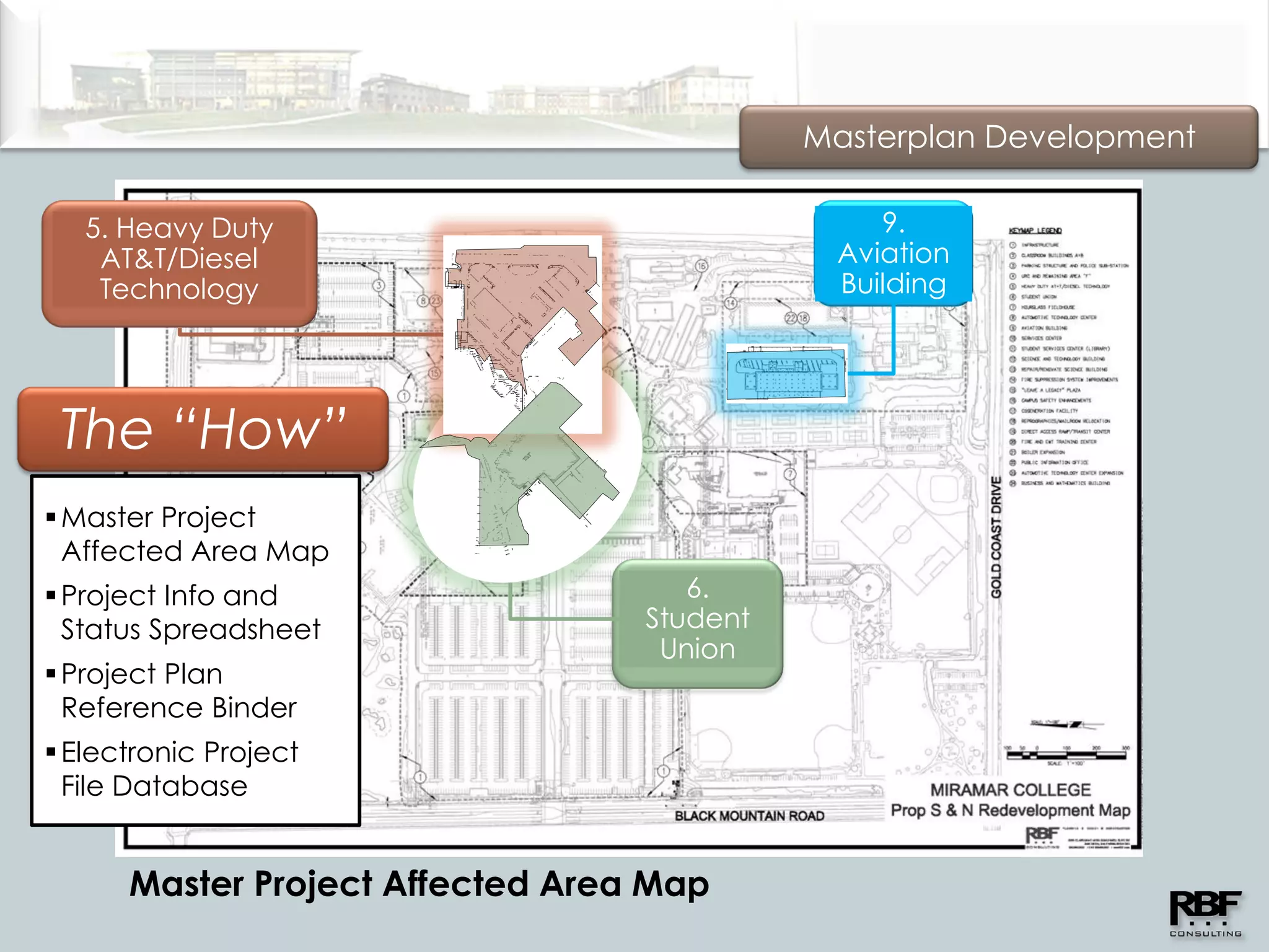
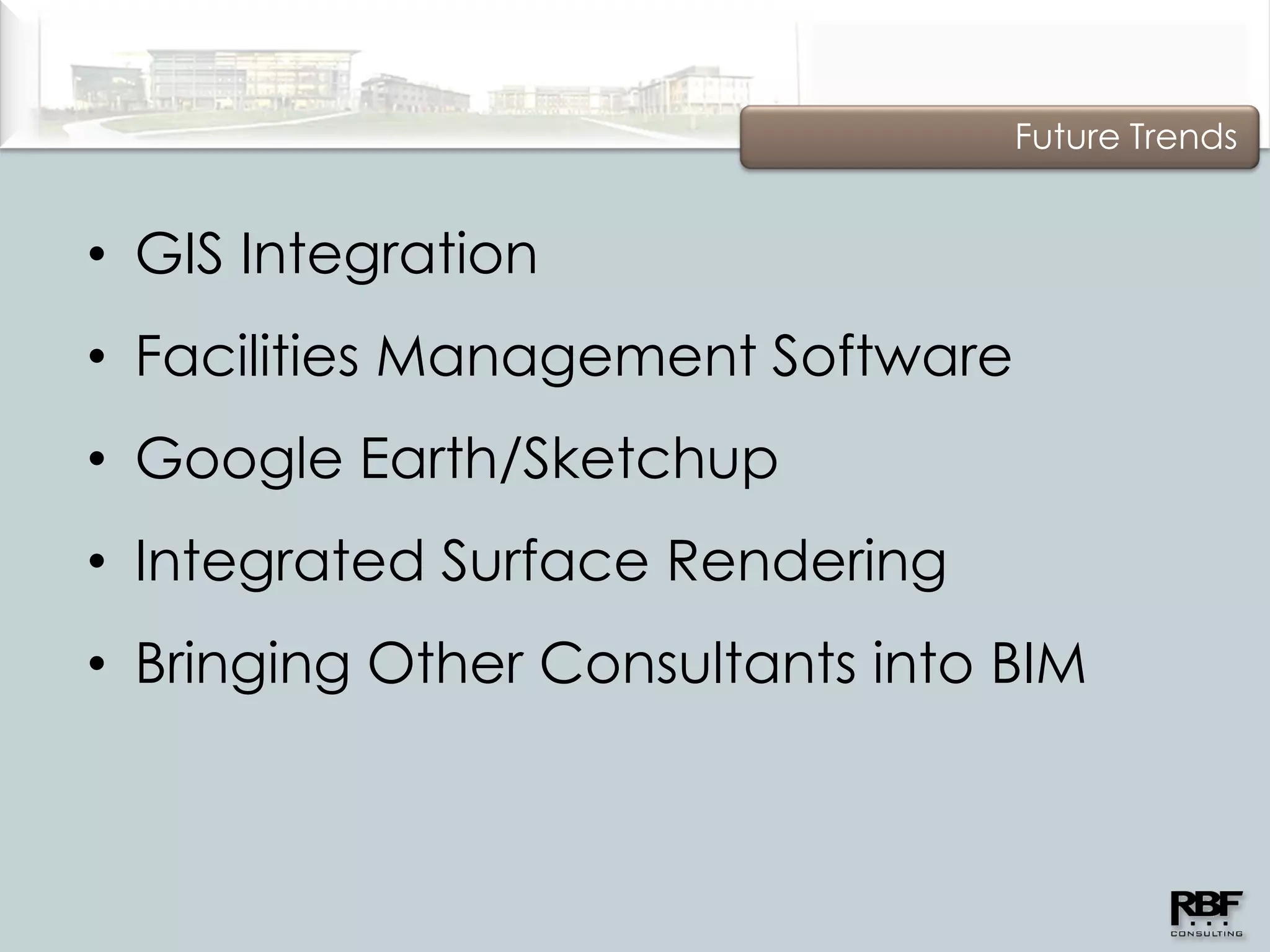
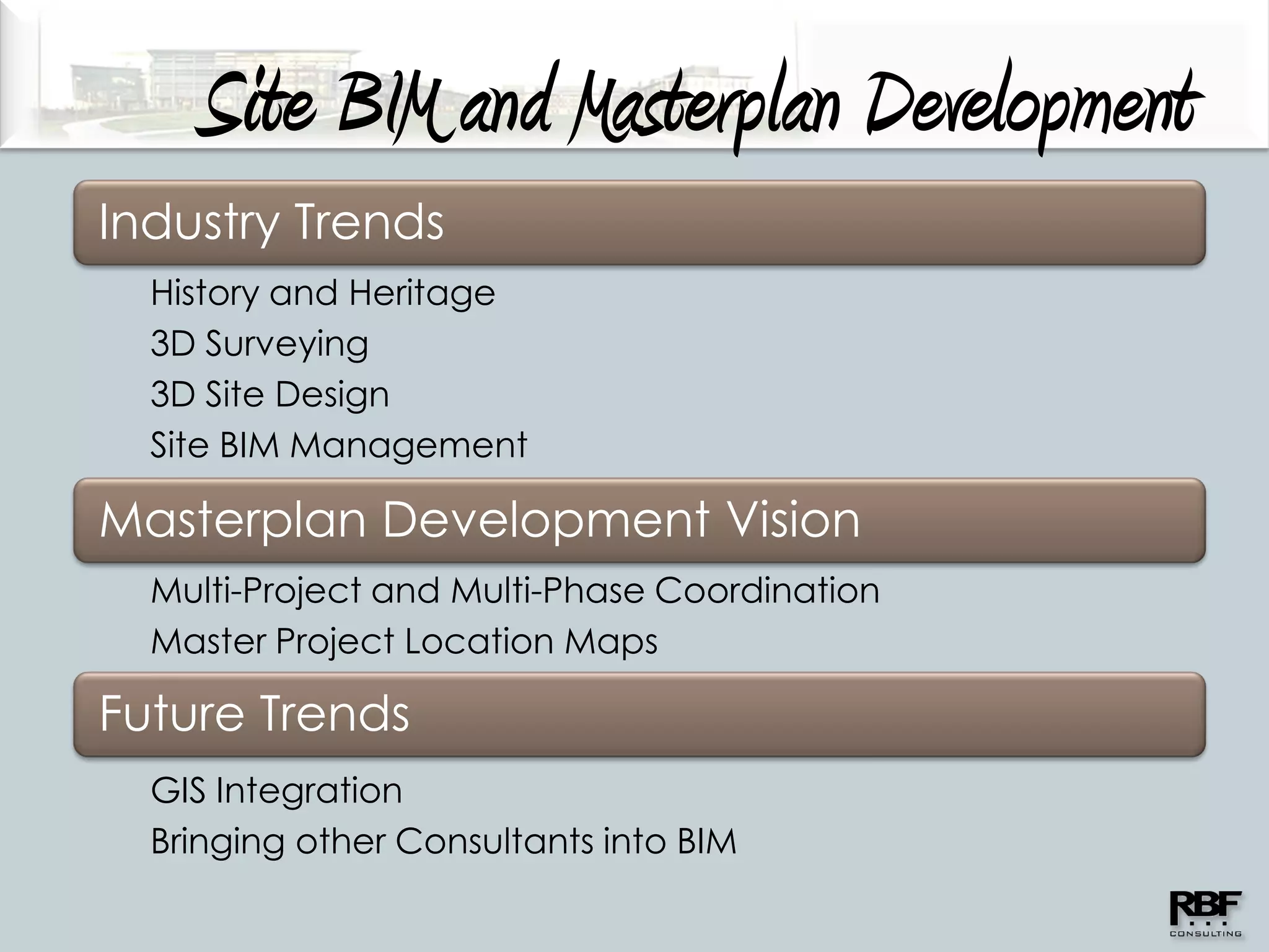
Site BIM and Masterplan Development
             3D Modeling for an Intelligent Design


12/15/2010
Site BIM and Masterplan Development
Industry Trends
  History and Heritage
  3D Surveying
  3D Site Design
  Site BIM Management

Masterplan Development Vision
  Multi-Project and Multi-Phase Coordination
  Master Project Location Maps

Future Trends
Industry Trends

History &
Heritage


                                                                 The “New”
                                                                Master Builder
                                                   Partnering

                                        The
                                     Adversarial
                                       Period
                         The AEC Split
            The Master Builder
Industry Trends

   3D
Surveying
               3D Laser
              Scanning


            3D Site Survey


               3D Existing
            Utility Modeling
Industry Trends

   3D       • Capture high-resolution     • Usable in
Surveying
              existing conditions data      conventional CADD
 3D Laser                                   environments and
 Scanning
            • Ideal for Areas of            BIM modeling
              Complex Constraints
               –   Rooftops
                                          • Accuracies within
               –   Interior Renovations     5 millimeters
               –   Building Expansions
               –   Facility Upgrades
Industry Trends

     3D
  Surveying
     3D Laser
     Scanning
                           Miramar
                           Interim
         3D
    Site Survey            Library

• Real-Life Site Feature
  3D Processing

• Accurate Surface
  Model Ready for BIM

• Multiple Topo Files
  Combined for One
  Model

• Detailed Site Culture
  to Meet Needs
Industry Trends

     3D
  Surveying
     3D Laser
     Scanning

         3D
    Site Survey


• Real-Life Site Feature
  3D Processing

• Accurate Surface
  Model Ready for BIM

• Multiple Topo Files
  Combined for One
  Model

• Detailed Site Culture
  to Meet Needs


                           Miramar Interim Library
3D
Surveying
      3D
                 AutoCAD               Navisworks
Laser Scanning

      3D
 Site Survey


                      One File - Multiple Softwares/Uses
Industry Trends

   3D
Surveying
   3D Laser
   Scanning

       3D
  Site Survey

  3D Existing
Utility Modeling


−Various
 Reference
 Sources

−Ready for BIM

−Embedded
 System
 Information
Industry Trends

     3D
  Surveying

       3D
  Site Design

• Site Utility and
  Surface Design

 −Visual Design

 −Dynamic 3D
  Environment

 −Increased
  Quality

 −Fewer Field
  Revisions
Industry Trends

     3D
  Surveying

       3D
  Site Design

• Site Utility and
  Surface Design

 −Visual Design

 −Dynamic 3D
  Environment

 −Increased
  Quality

 −Fewer Field
  Revisions


                     Miramar Student Union
Industry Trends

     3D
  Surveying

       3D
  Site Design

• Site Utility and
  Surface Design

 −Visual Design
                     Alpine Boulevard
 −Dynamic 3D
  Environment

 −Increased
  Quality

 −Fewer Field
  Revisions


                                        CSUSM Ballfields
Industry Trends

     3D
  Surveying

       3D
  Site Design

• Site Utility and
  Surface Design

 −Visual Design
                     Miramar Student Union
 −Dynamic 3D
  Environment

 −Increased
  Quality

 −Fewer Field
  Revisions


                                             Miramar Student Union
Industry Trends

     3D
  Surveying

       3D
  Site Design

• Site Utility and
  Surface Design

 −Visual Design

 −Dynamic 3D
  Environment

 −Increased
  Quality

 −Fewer Field
  Revisions


                     Miramar Student Union
Industry Trends

     3D
  Surveying

       3D
  Site Design

 Site BIM
Management

                      Miramar Student Union
• Building BIM vs.
  Site BIM
• Engineer
  Responsible for
  Site Control
• Clash Detection
• Team Coordination
Industry Trends

     3D
  Surveying

       3D
  Site Design

 Site BIM
Management

• Building BIM vs.      Web-hosted BIM
  Site BIM            Coordination Meeting
• Engineer
  Responsible for
  Site Control
• Clash Detection
• Team Coordination
Industry Trends

     3D
  Surveying

       3D
  Site Design

 Site BIM
Management

• Building BIM vs.
  Site BIM
• Engineer              Camp
  Responsible for
  Site Control        Pendleton
• Clash Detection        BEQ
• Team Coordination
Site BIM and Masterplan Development
Industry Trends

Masterplan Development Vision
   Multi-Project and Multi-Phase Coordination
   Master Project Location Maps

                   The “What”
                   The “Why”
                   The “How”
Masterplan Development


The “What”
• The Vision
  – Master Utility & Topo Base Files (2D, 3D)
  – Master Navisworks Model
  – Project Tracking
  – Comprehensive As-Built Record
Masterplan Development


The “Why”
• The Benefits
  – Central File and Knowledge Resource
  – Consistency in Files and Project
    Information
  – Affected Project Areas Easily Identifiable
  – Comprehensive As-Builts
  – Visualization
Masterplan Development
Rendered buildings by NTD Architecture and GKK Works
Underground Electrical by Gould Electric
Underground Wet Utilities and Surface Rendering by RBF Consulting


       Master Navisworks Model
Masterplan Development

   5. Heavy Duty                                9.
    AT&T/Diesel                              Aviation
    Technology                               Building


 The “How”
 Master Project
  Affected Area Map
 Project Info and                   6.
  Status Spreadsheet              Student
                                   Union
 Project Plan
  Reference Binder
 Electronic Project
  File Database


      Master Project Affected Area Map
Masterplan Development
CAD & NAVIS Files
                               Design
                             Line Work           XREF
                             Project C
    Design                             Design
  Line Work                          Line Work
  Project B                          Project A
Future Trends


• GIS Integration
• Facilities Management Software
• Google Earth/Sketchup
• Integrated Surface Rendering
• Bringing Other Consultants into BIM
Site BIM and Masterplan Development
Industry Trends
  History and Heritage
  3D Surveying
  3D Site Design
  Site BIM Management

Masterplan Development Vision
  Multi-Project and Multi-Phase Coordination
  Master Project Location Maps

Future Trends
  GIS Integration
  Bringing other Consultants into BIM
Masterplan Development with BIM

Site BIM

  • 1.
    Site BIM andMasterplan Development 3D Modeling for an Intelligent Design 12/15/2010
  • 2.
    Site BIM andMasterplan Development Industry Trends History and Heritage 3D Surveying 3D Site Design Site BIM Management Masterplan Development Vision Multi-Project and Multi-Phase Coordination Master Project Location Maps Future Trends
  • 3.
    Industry Trends History & Heritage The “New” Master Builder Partnering The Adversarial Period The AEC Split The Master Builder
  • 4.
    Industry Trends 3D Surveying 3D Laser Scanning 3D Site Survey 3D Existing Utility Modeling
  • 5.
    Industry Trends 3D • Capture high-resolution • Usable in Surveying existing conditions data conventional CADD 3D Laser environments and Scanning • Ideal for Areas of BIM modeling Complex Constraints – Rooftops • Accuracies within – Interior Renovations 5 millimeters – Building Expansions – Facility Upgrades
  • 6.
    Industry Trends 3D Surveying 3D Laser Scanning Miramar Interim 3D Site Survey Library • Real-Life Site Feature 3D Processing • Accurate Surface Model Ready for BIM • Multiple Topo Files Combined for One Model • Detailed Site Culture to Meet Needs
  • 7.
    Industry Trends 3D Surveying 3D Laser Scanning Miramar Interim 3D Site Survey Library • Real-Life Site Feature 3D Processing • Accurate Surface Model Ready for BIM • Multiple Topo Files Combined for One Model • Detailed Site Culture to Meet Needs
  • 8.
    Industry Trends 3D Surveying 3D Laser Scanning Miramar Interim 3D Site Survey Library • Real-Life Site Feature 3D Processing • Accurate Surface Model Ready for BIM • Multiple Topo Files Combined for One Model • Detailed Site Culture to Meet Needs
  • 9.
    Industry Trends 3D Surveying 3D Laser Scanning 3D Site Survey • Real-Life Site Feature 3D Processing • Accurate Surface Model Ready for BIM • Multiple Topo Files Combined for One Model • Detailed Site Culture to Meet Needs Miramar Interim Library
  • 10.
    3D Surveying 3D AutoCAD Navisworks Laser Scanning 3D Site Survey One File - Multiple Softwares/Uses
  • 11.
    Industry Trends 3D Surveying 3D Laser Scanning 3D Site Survey 3D Existing Utility Modeling −Various Reference Sources −Ready for BIM −Embedded System Information
  • 12.
    Industry Trends 3D Surveying 3D Site Design • Site Utility and Surface Design −Visual Design −Dynamic 3D Environment −Increased Quality −Fewer Field Revisions
  • 13.
    Industry Trends 3D Surveying 3D Site Design • Site Utility and Surface Design −Visual Design −Dynamic 3D Environment −Increased Quality −Fewer Field Revisions Miramar Student Union
  • 14.
    Industry Trends 3D Surveying 3D Site Design • Site Utility and Surface Design −Visual Design Alpine Boulevard −Dynamic 3D Environment −Increased Quality −Fewer Field Revisions CSUSM Ballfields
  • 15.
    Industry Trends 3D Surveying 3D Site Design • Site Utility and Surface Design −Visual Design Miramar Student Union −Dynamic 3D Environment −Increased Quality −Fewer Field Revisions Miramar Student Union
  • 16.
    Industry Trends 3D Surveying 3D Site Design • Site Utility and Surface Design −Visual Design −Dynamic 3D Environment −Increased Quality −Fewer Field Revisions Miramar Student Union
  • 17.
    Industry Trends 3D Surveying 3D Site Design Site BIM Management Miramar Student Union • Building BIM vs. Site BIM • Engineer Responsible for Site Control • Clash Detection • Team Coordination
  • 18.
    Industry Trends 3D Surveying 3D Site Design Site BIM Management • Building BIM vs. Web-hosted BIM Site BIM Coordination Meeting • Engineer Responsible for Site Control • Clash Detection • Team Coordination
  • 19.
    Industry Trends 3D Surveying 3D Site Design Site BIM Management • Building BIM vs. Site BIM • Engineer Camp Responsible for Site Control Pendleton • Clash Detection BEQ • Team Coordination
  • 20.
    Site BIM andMasterplan Development Industry Trends Masterplan Development Vision Multi-Project and Multi-Phase Coordination Master Project Location Maps The “What” The “Why” The “How”
  • 21.
    Masterplan Development The “What” •The Vision – Master Utility & Topo Base Files (2D, 3D) – Master Navisworks Model – Project Tracking – Comprehensive As-Built Record
  • 22.
    Masterplan Development The “Why” •The Benefits – Central File and Knowledge Resource – Consistency in Files and Project Information – Affected Project Areas Easily Identifiable – Comprehensive As-Builts – Visualization
  • 23.
    Masterplan Development Rendered buildingsby NTD Architecture and GKK Works Underground Electrical by Gould Electric Underground Wet Utilities and Surface Rendering by RBF Consulting Master Navisworks Model
  • 24.
    Masterplan Development 5. Heavy Duty 9. AT&T/Diesel Aviation Technology Building The “How”  Master Project Affected Area Map  Project Info and 6. Status Spreadsheet Student Union  Project Plan Reference Binder  Electronic Project File Database Master Project Affected Area Map
  • 25.
    Masterplan Development CAD &NAVIS Files Design Line Work XREF Project C Design Design Line Work Line Work Project B Project A
  • 26.
    Future Trends • GISIntegration • Facilities Management Software • Google Earth/Sketchup • Integrated Surface Rendering • Bringing Other Consultants into BIM
  • 27.
    Site BIM andMasterplan Development Industry Trends History and Heritage 3D Surveying 3D Site Design Site BIM Management Masterplan Development Vision Multi-Project and Multi-Phase Coordination Master Project Location Maps Future Trends GIS Integration Bringing other Consultants into BIM
  • 28.