
Recommended
Recommended
More Related Content
What's hot
What's hot (20)
Similar to Kampung Pulai Temple Site Analysis
Similar to Kampung Pulai Temple Site Analysis (20)
More from chiwunloi
More from chiwunloi (10)
Recently uploaded
Recently uploaded (20)
Kampung Pulai Temple Site Analysis
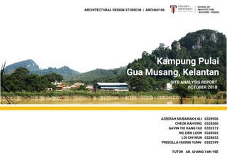
- 1. Kampung Pulai Gua Musang, Kelantan ARCHITECTURAL DESIGN STUDIO III | ARCH60106 SITE ANALYSIS REPORT OCTOBER 2018 AZEERAH MUBARAKH ALI 0328906 CHEOK KAHYING 0328560 GAVIN TIO KANG HUI 0333373 NG ZIEN LOON 0328565 LOI CHI WUN 0328652 PRISCILLA HUONG YUNN 0332599 TUTOR AR. CHANG YAN YEE
- 3. MACRO SITE Gua Musang, Kelantan 01 SITE IN CONTEXT ……….….. 02 HISTORICAL TIMELINE…... 03 ACCESSIBILITY………………… 04 LANDMARK……………………... 05 ZONING…………………………... TEMPLE SITE 01 02 03 04 05
- 4. 01 SITE IN CONTEXT Gua Musang is a town, district and parliamentary constituency deep in the jungles of central Kelantan. It is the largest district in Kelantan and administered by the Gua Musang District Council. Gua Musang as of 2009, has a population of 100,400 people. Within Gua Musang, a Chinese temple called Swee Nyet Temple, which is purportedly 400 years old is situated in Kampung Pulai. It is an early gold mining place, and a historical Chinese village. Kampung Pulai is a traditional village in an area of limestone hills in Malaysia, located about 8 km from Gua Musang in Kelantan. The Pulai Princess Cave is nearby and the village was settled 6 centuries ago by Hakka people from China who came in search of alluvial gold. The gold deposits were exhausted more than 100 years ago and the settlers had to switch to agriculture to survive. 1 KELANTAN GUA MUSANG KAMPUNG PULAI Kelantan is a state of Malaysia with the capital and royal seat of Kota Bharu. Kelantan is positioned in the north-east of Peninsular Malaysia. It is bordered by Narathiwat Province of Thailand to the north, Terengganu to the south-east, Perak to the west and Pahang to the south. To the north-east of Kelantan is the South China Sea.
- 5. 02 HISTORICAL TIMELINE OF SIGNIFICANT EVENTS EXTENSIVE GOLD MINING Pulai is reputed to have been center of an extensive gold mining area covering much of Southern Kelantan. DISPUTE Gold mining in the nineteenth century Kelantan was dangerously likely to fall instead of granting certain wealth. Miners were dependent on outside shipments of food and supplies, at the mercy of local rulers controlling taxes., causing dispute which brought an end to extensive Gold Mining. RECESSION Population reportedly numbered only 200 and many of the miners had already switched to rice farming. Individual Chinese spotted panning for gold in the streams and some groups mining gold on a slightly larger scale. HAKKA SETTLEMENT Travelling on the completed East Coast Railroad to Gua Musang and then walking a remaining nine mile of jungle path to Pulai, a settlement of 800 Hakka- speaking Chinese can be found. The people depended on the cultivation of rice for their livelihood. SWEE NYET TEMPLE Newly rebuilt, the temple houses images of gods and incense pots reputed to date from Ming Dynasty (A.D.1368-1644) 18TH CENTURY 19TH CENTURY 1902 1933 1970 2 Image 1 A gold dredger on Kelantan River Image obtained from internet Image 2 Villagers Protesting Image obtained from reader Image 3 Rice Farming Image obtained from reader Image 4 Hakka Chinese Image obtained from reader Image 5 Swee Nyet Temple Image obtained from reader
- 6. 03 ACCESSIBILITY RIVER The Galas River of Kampung Pulai is located in between the Kelantan River and Nenggiri River. The source of the River starts from Betis River and ends at Nenggiri River. Due to shallow waters, floods easily occur during rainy seasons. Accessibility through river is no longer continued. Villagers have confirmed that there used to be of passing boats on the River which are assumed to span from up to Kota Bharu. ROADS The major road along Kampung Pulai extends into a linking minor road into the Swee Nyet temple square and the village houses in the neighbourhood. The significant archways at the entrance of the minor roads informs the users of the temple site beyond. The accessibility into the site is seen through the roads and roads along river. The archways enhance the user visibility and promotes activity towards the temple site. 3 1. Zi Xia Cave 2. Old Gold Mine Lake 3. Swee Nyet Temple 4. SJKC Kampung Pulai 5. Archway LANDMARKS ACCESSIBILITY 1. Major Road 2. Minor Road 1 2 3 4 1 2 4 Image 6 Archway
- 7. 04 LANDMARK PRINCESS HILL / ZI XIA CAVE Princess Hill can be seen easily from the village. To reach it, visitors have to cross a river through the hanging bridge and walk through a rubber plantation to the other side of the lake. The cave is a major landmark in Kampung Pulai because of its historical significance as it commemorates the Goddess Guan Yin, who is believed to watch over the village. Image 7 Zi Xia Cave SWEE NYET TEMPLE The Swee Nyet temple in the village square is called the Water & Moon Temple and is thought to be one of the oldest in Malaysia although it has had a recent renovations. The temple is a major landmark in Kampung Pulai as well because of its notable physical features as a religious building as well as the archway at the entrance of the road. OLD GOLD MINE LAKE, PULAI The now gold mine lake serves as another major landmark as it used to be the main focus of the village.The Hakka Chinese over 600 years ago came in search of alluvial gold. The gold deposits were exhausted more than 100 years ago and the settlers had to switch to agriculture to survive thus leaving the mine to turn into a lake. SJKC KAMPUNG PULAI The presence of a school in Kampung Pulai becomes a minor landmark for locals as a form of wayfinding and communication. The school impacts the culture and environment by adding a sense of livable community within a rural context. Image 8 Swee Nyet Temple Site Image 9 Old Gold Mine Lake Image 10 SJKC Kg. Pulai Image obtained from internet 4
- 9. 05 ZONING 5 RESIDENCE Detached residence Over 80 families in Kampung Pulai RELIGION Swee Nyet Temple More than hundreds years of historical landmark COMMERCIAL Including traditional coffee shop, restaurants, As grocery store etc. LIGHT INDUSTRIES Agriculture factory RECREATIONAL Purpose-built venue where facilities are provided Including karaoke, standby stage, gathering spot INSTITUTIONAL Clinic, Community Hall UTILITIES Public Access Gazebo, public toilet, basketball court
- 11. MICRO SITE Swee Nyet Temple 01 SITE IN CONTEXT ……………………. 02 CLIMATE & ORIENTATION .….…. 03 SITE CONTOURS ………………….... 04 VEGETATION AND VIEW ……….. 05 NOISE …………………………………….…. 06 ZONING ………………………………….... 07 VEHICULAR CIRCULATION ..…... 08 PEDESTRIAN CIRCULATION …... 09 NEIGHBOURING CONTEXT …….. 10 HUMAN & CULTURAL …………..…. 11 SWOT ANALYSIS …………………..... 12 SITE SYNTHESIS ………………..…... VIC SITE 06 06 07 09 11 12 13 14 15 17 19 20
- 13. Masses are arranged in a way that the plaza is opened up to the panoramic view of the princess hill. The planar quality of the roof of the structures further directs users’ visual towards the view. The plaza is surrounded by the existing structures with softscapes at the outer area. The softscape serves the visual purposes for the site. The existing structures interact through a common open space. 01 SITE IN CONTEXT SOLID SOFTSCAPE VOID 02 CLIMATE | ORIENTATION INTRODUCTION TO SITE The chosen micro site is temple site. It is located adjacent to a three stories building with Swee Nyet Temple across the road. East and west of the site are mostly shaded while its south side is facing the plaza and north side is opening up to the view of a vast vacant land filled with vegetation. From the March graph, we can conclude that the the temperature of the site is inversely proportional to the site. Due to the exposed site, temple site is not well shaded. Thus, natural ventilation should be taken into consideration. Figure 1.1 Sun Shading Diagram at 0900 Figure 1.2 Sun Shading Diagram at 1200 Figure 1.3 Sun Shading Diagram at 1500 MAR 18 APR 18 MAY 18 JUN 18 JUL 18 AUG 18 SEP 18 MAX MIN AVERAGE +15°C +20°C +25°C +30°C +35°C MAR 18 APR 18 MAY 18 JUN 18 JUL 18 AUG 18 SEP 18 MAX MIN AVERAGE +2kmph +3kmph +4kmph +5kmph +6kmph +7kmph MAR 18 APR 18 MAY 18 JUN 18 JUL 18 AUG 18 SEP 18 0mm 200mm 400mm 600mm Graph 1.1 Regional Monthly Temperature Graph Graph 1.2 Regional Monthly Wind Graph Graph 1.3 Regional Monthly Rainfall Graph 6
- 15. 03 SECTIONS 8
- 16. ZONE 1 This zone has the highest density of vegetation. It is relatively more breezy and shady compared to the other zone. The presence of a vast land of vegetation cools down the prevailing wind before entering the site. 04 VEGETATION AND VIEW BAMBOO Act as a screening towards the public from a private space. The bamboo were naturally grown at existing site Gua Musang and being planted into the village. COGAN GRASS Can be found mostly on lower level land, do not provide any shades. Highest density of plant on site,covering the undeveloped land area. MAHOGANY TREE Concentrated at each side of the site, provide the most shades and shelter for sunlight. Therefore the area will be much more breezy compared to the others. I I I I I I Taller trees around the site act as a wind funnel that focuses the prevailing wind into the plaza. In addition, they regulate the amount of morning sun from entering the site. ZONE 2 Vegetation is lacking in this zone, causing it to be hotter. However, in this context, this has make the plaza a gathering spot for the site. ZONE 3 Tall trees is less compared to zone 1 but there are more shrubs and short vegetations in this zone. Absence of tall trees facilitates the movement of prevailing from the south direction into the site. ZONE 1 ZONE 2 ZONE 3 1 2 34 5 6 7 8 9 10 10 9
- 17. 04 VIEWS VIEW FROM THE SITE Clear view with no obstruction and screenings. Excellent view of lake and mountains beyond. View of concentrated tall trees and structures with Chinese architecture presenting the essence of the site. Pleasant view of Swee Nget Temple gives a sense of sacred feeling. Other functional building placed beside of the Temple. Residential areas on the right and Recreational area on the left. Building not well maintained, no well planned arrangements of tents with lacking of great views of natural attributes. 1 3 2 4 Panorama view of cliff restricted by vegetation, buffering the continuous scenic view beyond it. Great view of Zi Xia Cave from the main entrance across the public square. 5 6 VIEW THROUGH SITE 10
- 19. 05 NOISE & VIEWS 7 8 Major view to the site from main entrance across the public square. Viewing towards Zi Xia Cave & mountains. Major view to the site from side entrance, residential area. Viewing across the residential houses towards the Gazebo, indicating the location of Shui Ye Gong. VIEW TO SITE 9 10 11 Noise from the construction site from day up to the evening. Housing dog barking as visitors passing by the residential areas. Noise from Kopitiam. Higher noise level in the afternoon. Neighbourhood socialize with each other. Majority the elderlies. NOISE 11
- 21. 06 ZONING Public structures are located along the perimeter of the plaza. Hence, the plaza is established as a public gathering space. The pathway is the primary entrance to the plaza due to the occurence of semi-private and public buildings (eg. temple, kopitiam) along this path as compared to the path along private residentials. Private residential area barricades circulation from the plaza by establishing visual discontinuity. Scale and proportion of the residential units decrease significantly in relation to the temple and community hall. Image 6.3 View from residential area Image 6.1 Commercial buildings and Swee Nyet Temple Image 6.2 Building structures in relation with plaza SHUI YUE TEMPLE COMMUNITY HALL PLAZA PRIVATE SEMI-PRIVATE PUBLIC VEGETATION INSTITUTIONAL RELIGION UTILITIES RECREATIONAL DETACHED RESIDENCE LIGHT INDUSTRIAL COMMERCIAL COFFEE SHOP LEGENDS 1 1 2 2 12
- 22. Path taken by motorcyclist to cross over to rubber plantation & Princess Cave. Motorcycle users are mostly resident & rubber tappers. May cause safety issue to walking passerbys on bridge/path . Main road circulation for vehicles. Road is taken as shortcut from mainroad to residential area or those living nearby the temple. Locals park car at roadside causes road to be more narrow, minor inconvenience to other vehicles. 07 VEHICULAR CIRCULATION Most motorcyclist and car users are locals. Only minority of car users ar tourist. Path is mostly taken by residents living in the nearby housing area. 1 1 2 3 3 2 13 Image 7.0 Motorcyclist along residentials Image 7.1 Motorcyclist leaving temple site Image 7.2 View of path of main entrance Image 7.3 Bridge crossing to Princess Cave
- 23. Major Circulation Minor Circulation 08 PEDESTRIAN CIRCULATION Path usually used by residents. Residents park at their respective homes and walk to temple/commercial areas. Main path taken by tourist to visit temple or proceed to Princess Cave .Buildings along the road will be the first thing the visitors see . Main route for locals and tourist to cross to rubber plantation/river site . Due to large amount of pedestrian and low maintenance, faulty bridge becomes a hazard to user’s safety . 1 3 1 2 2 3 No proper shading for rainy or sunny day which causes inconvenience to pedestrian. 14Image 8.3 Open Plaza square Image 8.2 Path along residential housing Image 8.1 Bridge that connects to River Site Image 8.0 View upon first entry of pedestrian
- 24. 09 NEIGHBOURING CONTEXT - CONDITION OF EXISTING BUILDINGS MODERATE GOOD Image 9.1 West elevation of coffee shop Image 9.4 Detached residence Condition of each residential unit varies, suggesting that the site is historical and has witnessed the growth of community. Image 9.3 The well-maintained gazebo and temple create contrast to the coffee shop Timber panels of the coffee shop are weathered, showing fine splits and shedding splinters. Shui Yue Temple and gazebos are well-maintained compared to the surrounding existing structures such as coffee shop, residential units, recreational hub, etc. Being sited adjacent to the temple, the coffee shop and residential unit establish a visual emphasis on the temple. Hence, it is suggested the local community prioritises their culture and religion. Image 9.2 Rusted metal roof of residential unit 15
- 25. 09 NEIGHBOURING CONTEXT - ARCHITECTURE PATTERN SWEE NYET TEMPLE It is a historical heritage temple. It is a single-storey structure consisting of a foyer, courtyard and main altar while the latter being the terminating space. The entire structure provides visual impact to the users with its sheer scale, similar to Chinese Architecture. The temple sits on an elevated base plan, establishing a spatial discontinuity without disengaging the physical accessibility. POST AND LINTEL Sitting on a nature site, the simple structure blends well with the landscape. The expression of verticality on site is evident. GAZEBO Having columns as its main structural component, absence of walls allows observation towards the surrounding. Overhang and plants provide shading to the interior. COMMUNITY HALL The structure consists of a gable roof with an open floor plan. It is supported by columns and shaded by a porch which promotes inside and outside relationship. 16
- 26. Most of the residents use temple & coffee shop next to it as a place for gathering & socializing. Residents like stroll around the temple. Main path the the temple. Tourist drop by this area to pray at thee temple before continuing their itinerary. Plaza in front of the temple is used for any community and cultural events (Guan Yin Festival, Moon Cake Festival), It is used as an extension of the community hall for big events to accomodate more people. HUMAN DENSITY During the day, human density circulates around the temple. Temple is the main tourist attraction of the site & villagers like to spend their free time around the temple. At night, villagers stay at home unless there is an cultural event happening at the plaza. Most of the residents are elderly staying at historic houses. Mostly Chinese Hakka & have good relationship with the neighbourhood. Villagers involved in agriculture 10 HUMAN & CULTURAL - HUMAN DENSITY HIGH DENSITY LOW DENSITY 17
- 27. RELIGIOUS ACTIVITY Villagers are highly involved in the events and festivals hosted by the temple. It increase liveliness and human traffic during festivals. SOCIALIZING Villagers spend their time in the afternoon at the coffee shop. Visitors can interact with the villagers to know more about the village and its history. RESTING Gazebo provided at the plaza provide shading to the visitors. SIGHTSEEING Panoramic view of the natural landscape Zi Xia Cave which is another tourist attraction. 10 HUMAN & CULTURAL - HUMAN ACTIVITY 18
- 29. 11 SWOT STRENGTH 1 Good neighbourhood relationship 2 Isolated from busy road 3 Strong historical value of the temple WEAKNESS 1 Polluted river due to development upstream 2 Poor Maintenance of bridge 4 Lack of security due to poor pedestrian path 5 Not shaded walkways 6 Disconnected from urban pace OPPORTUNITY 1 Centre plaza can be used to host festival event, boost economy and society 2 Can be develop into tourist attraction due to the historical value of the village THREAT 1 Faulty Bridge 2 Future generation disconnected from modernization due to laid back living style S1 S2 T1 S3 W1 19 W2 W4 W5 O1 & 02
- 30. 12 SITE SYNTHESIS INTERSECTION OF GAZEBO AND SWEE NYET TEMPLE Structure and building on both axes reflects Chinese Architectural Style. Therefore, VIC shall respond towards the elements. Kampung Pulai prioritize religious activities, VIC should pay respect to the temple and not over power it. FUTURE NODE Potential to become node for outdoor activities such as Bazaar, performance and etc. Act as a public gathering spot. FUTURE NODE Potential to become gathering spot for indoor activities. Strategic location, potential for building VIC , as higher density of user circulate around the area. Therefore, proposal of food venders or cafeteria to replace coffee shop shall be considered due to demolition and replacement of VIC GAZEBO TEMPLE GAZEBO 20