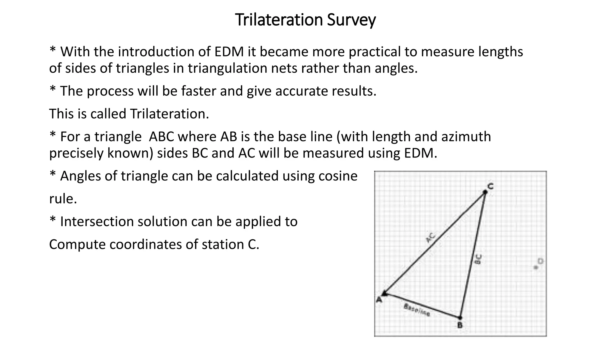
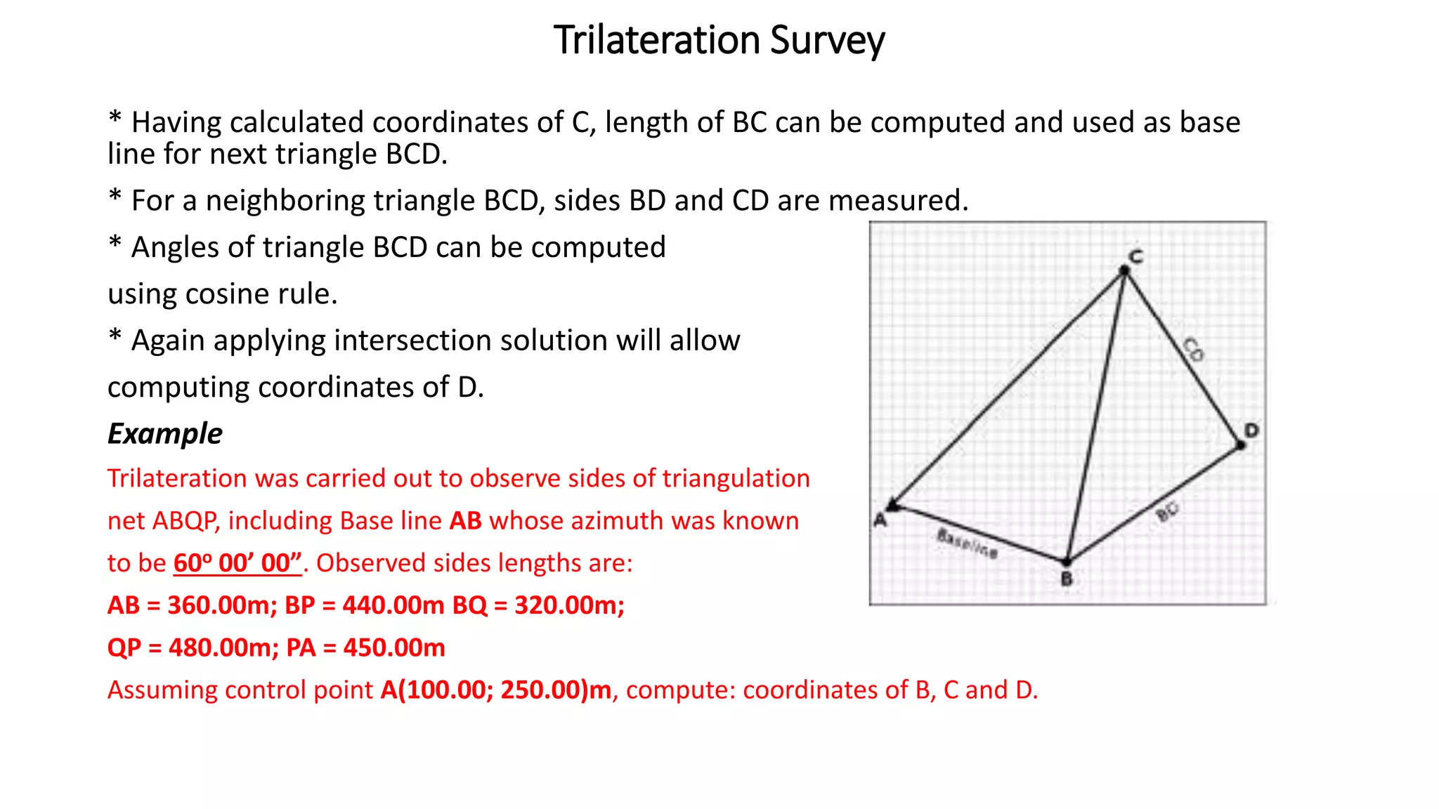
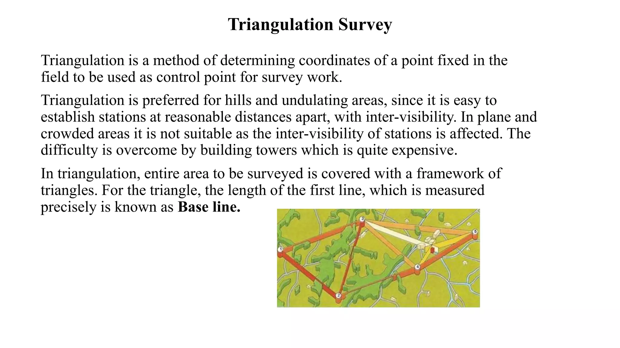
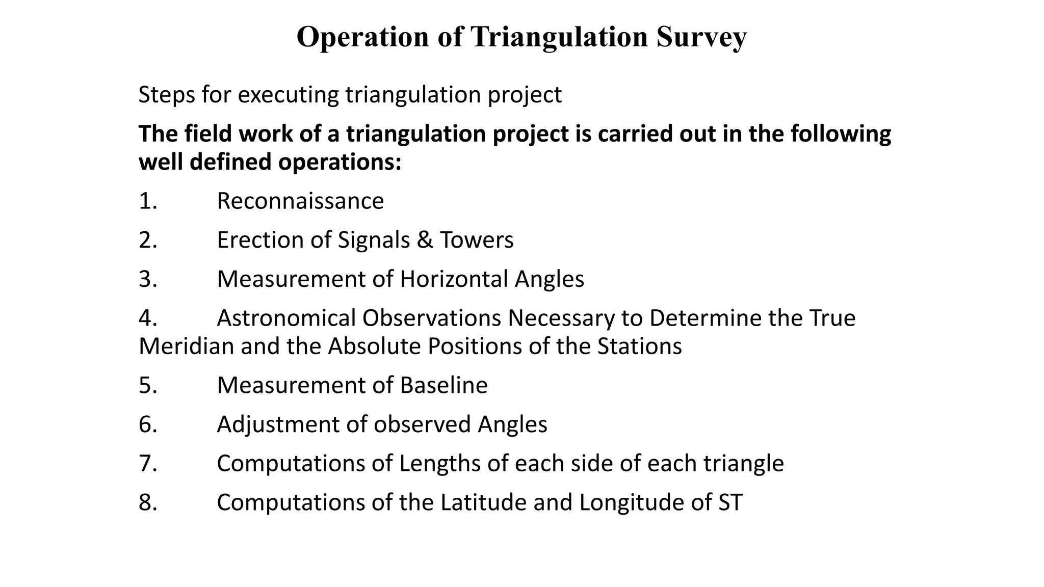
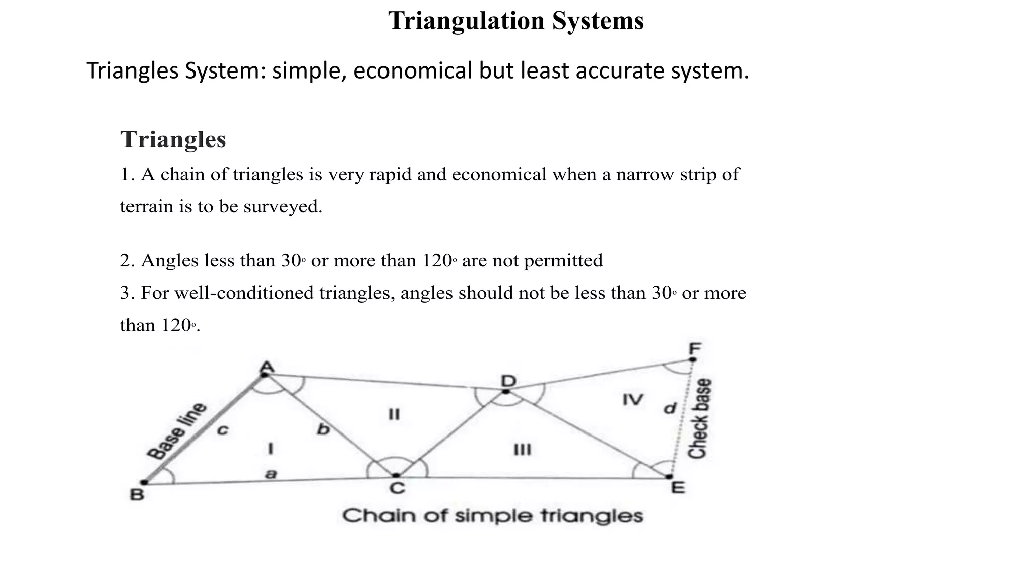
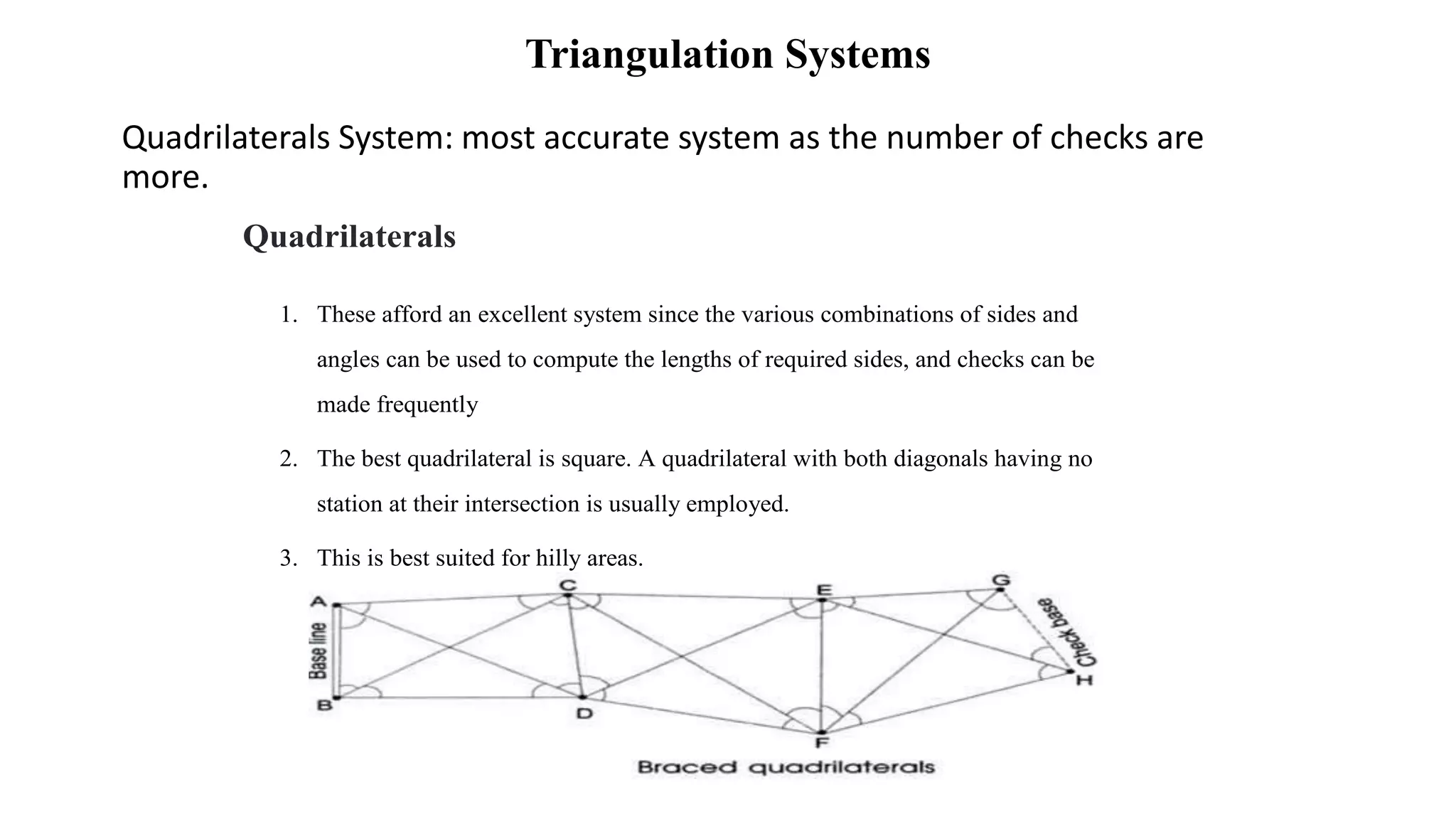
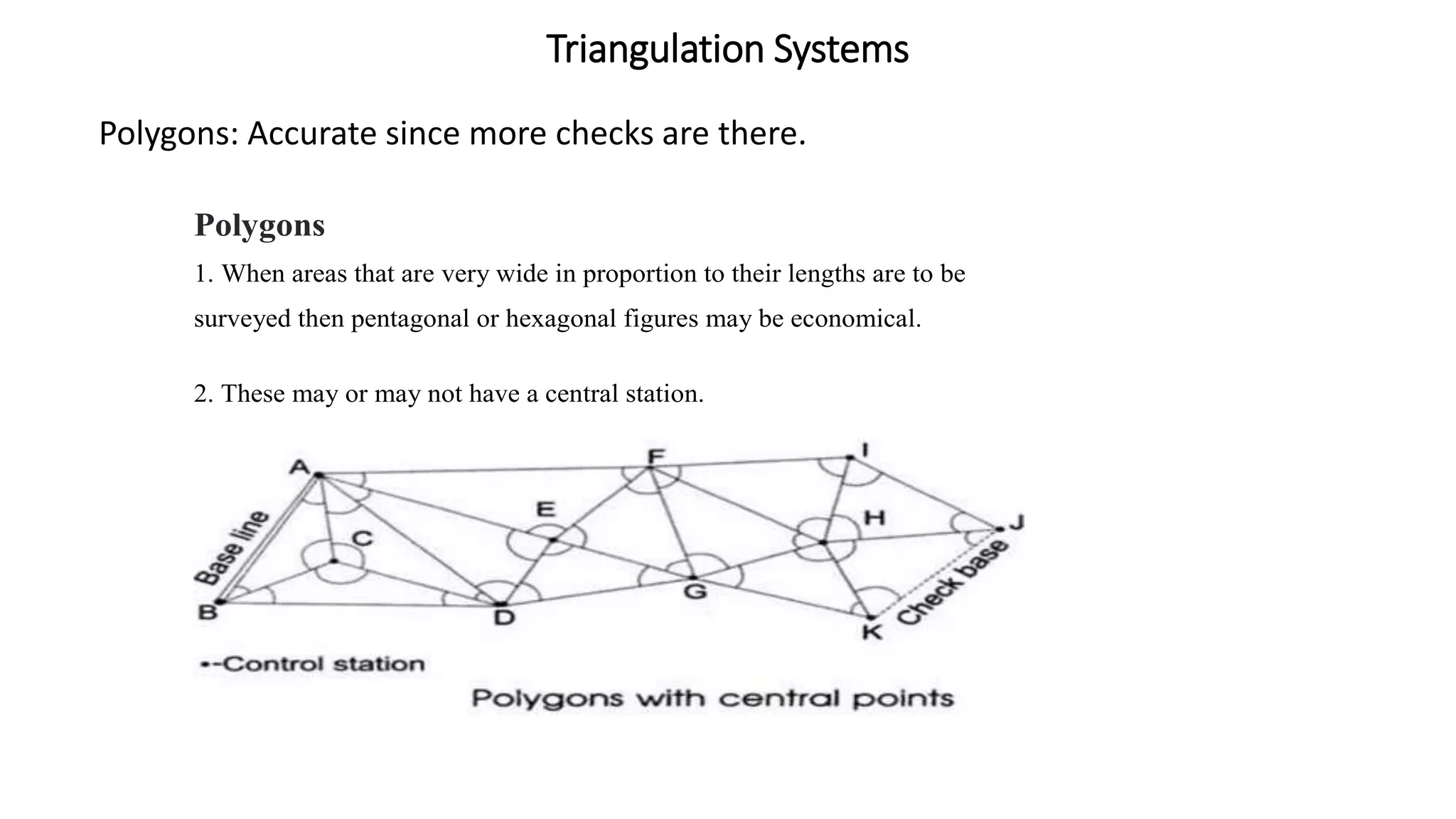
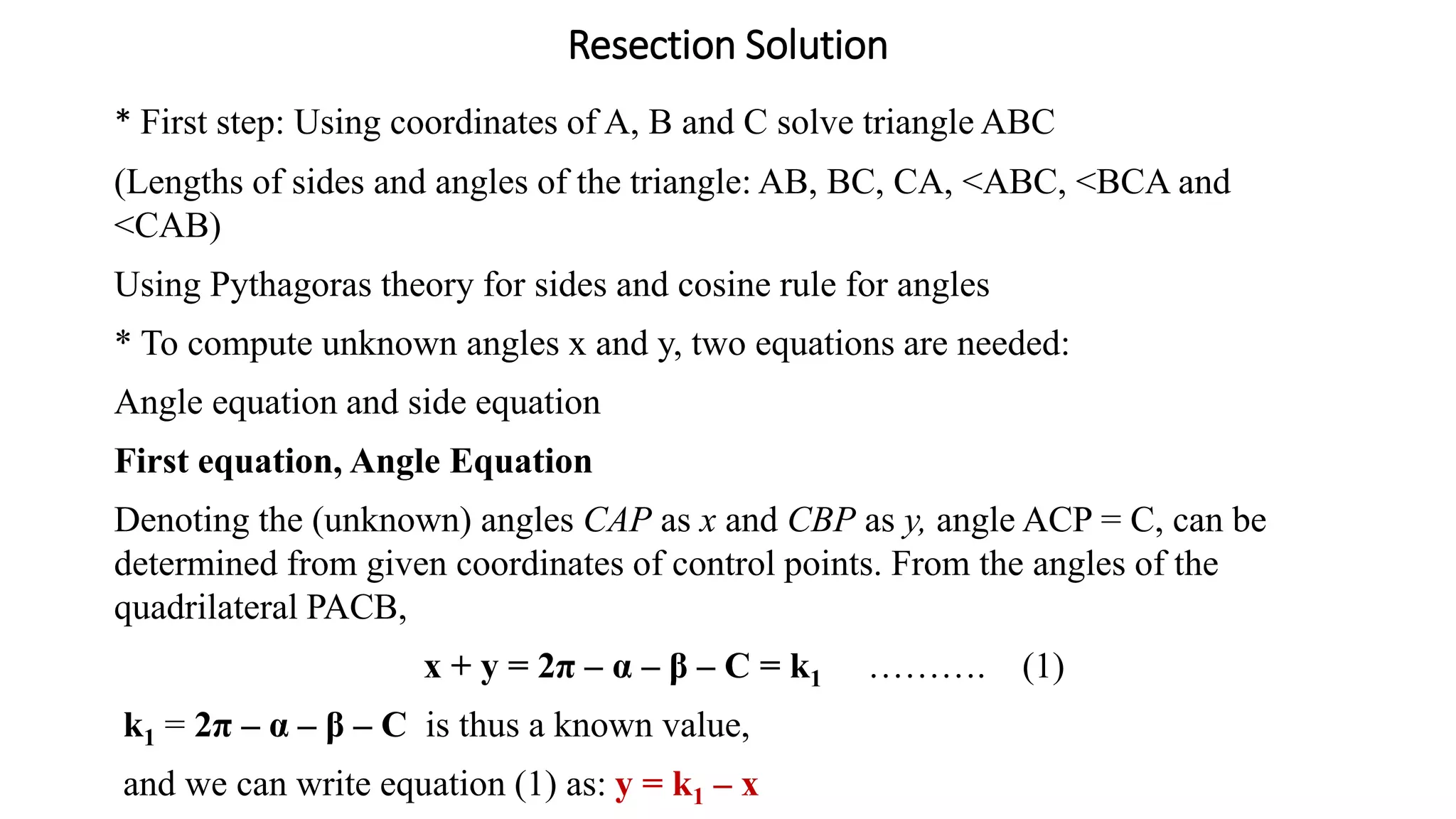
This document discusses triangulation survey methods. Triangulation uses a network of triangles to determine coordinate positions of survey points. It is preferred for hilly areas where stations can be clearly visible from each other. The key steps are:
1) Establishing a baseline between two points with known coordinates
2) Measuring horizontal angles at stations to other points
3) Using trigonometry to calculate lengths of triangle sides and coordinate positions of additional points
4) Adjusting measurements and computations to minimize errors
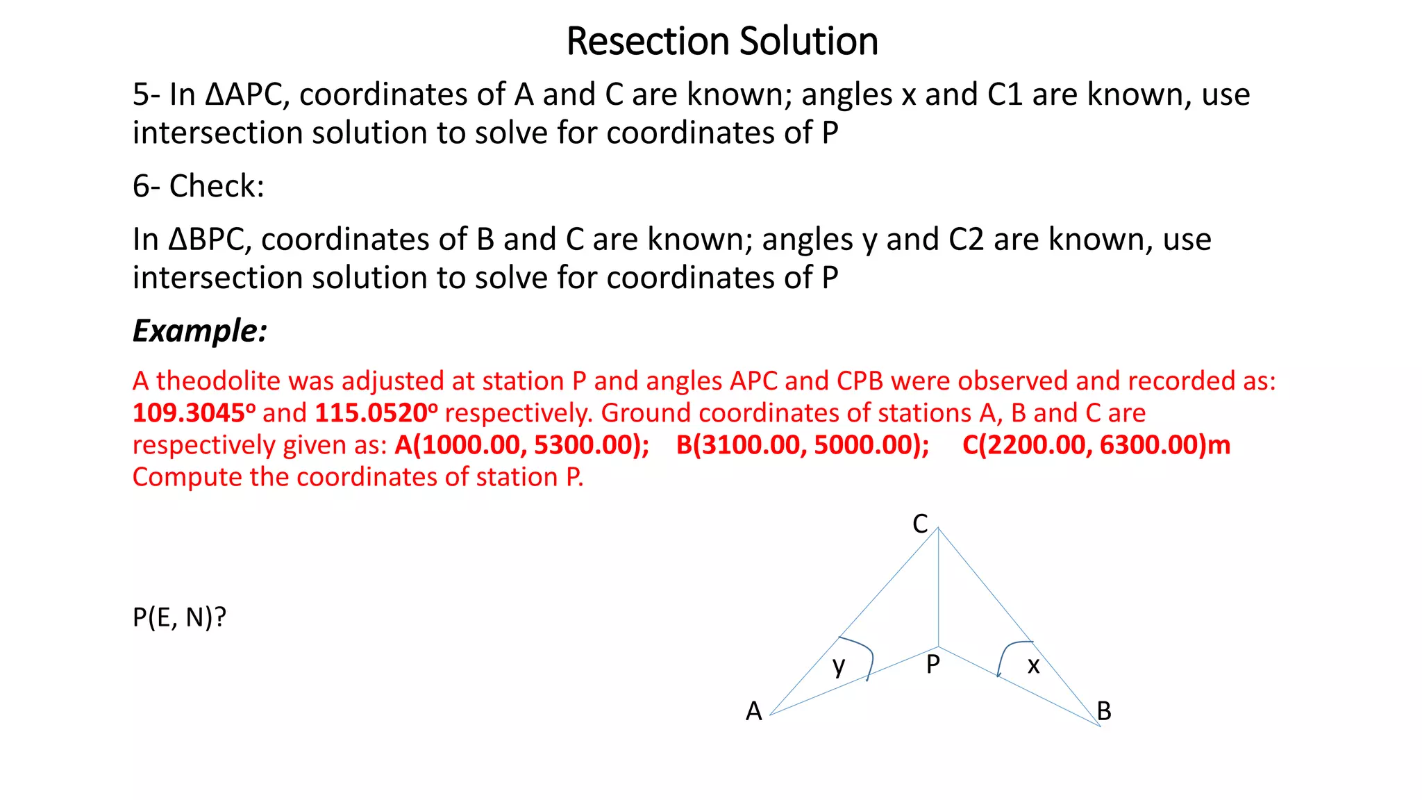
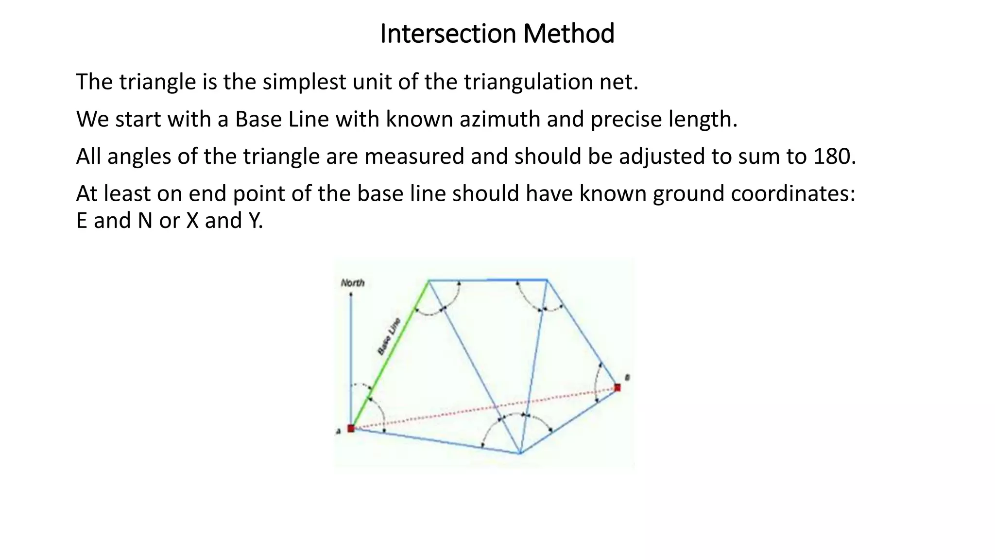
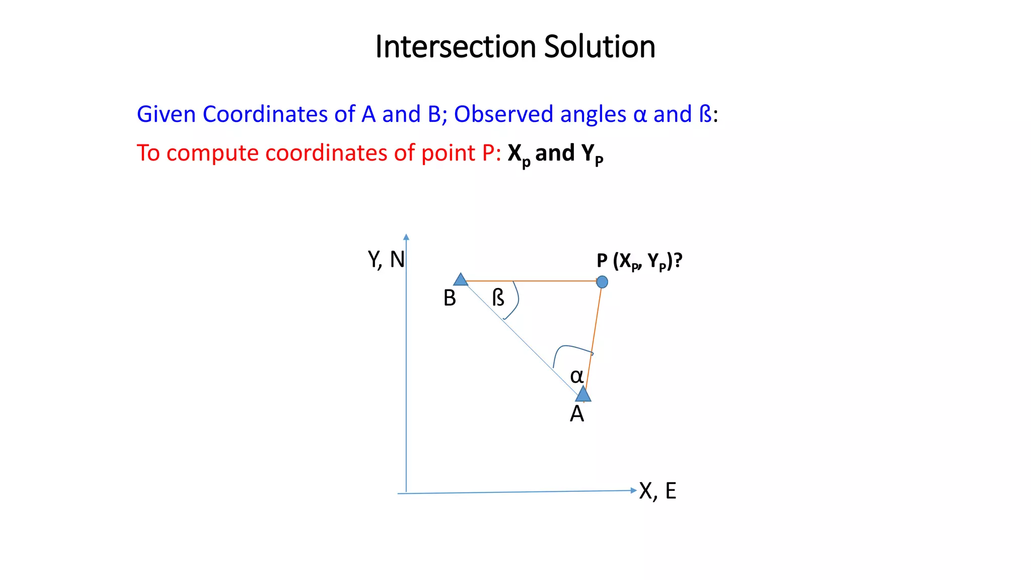
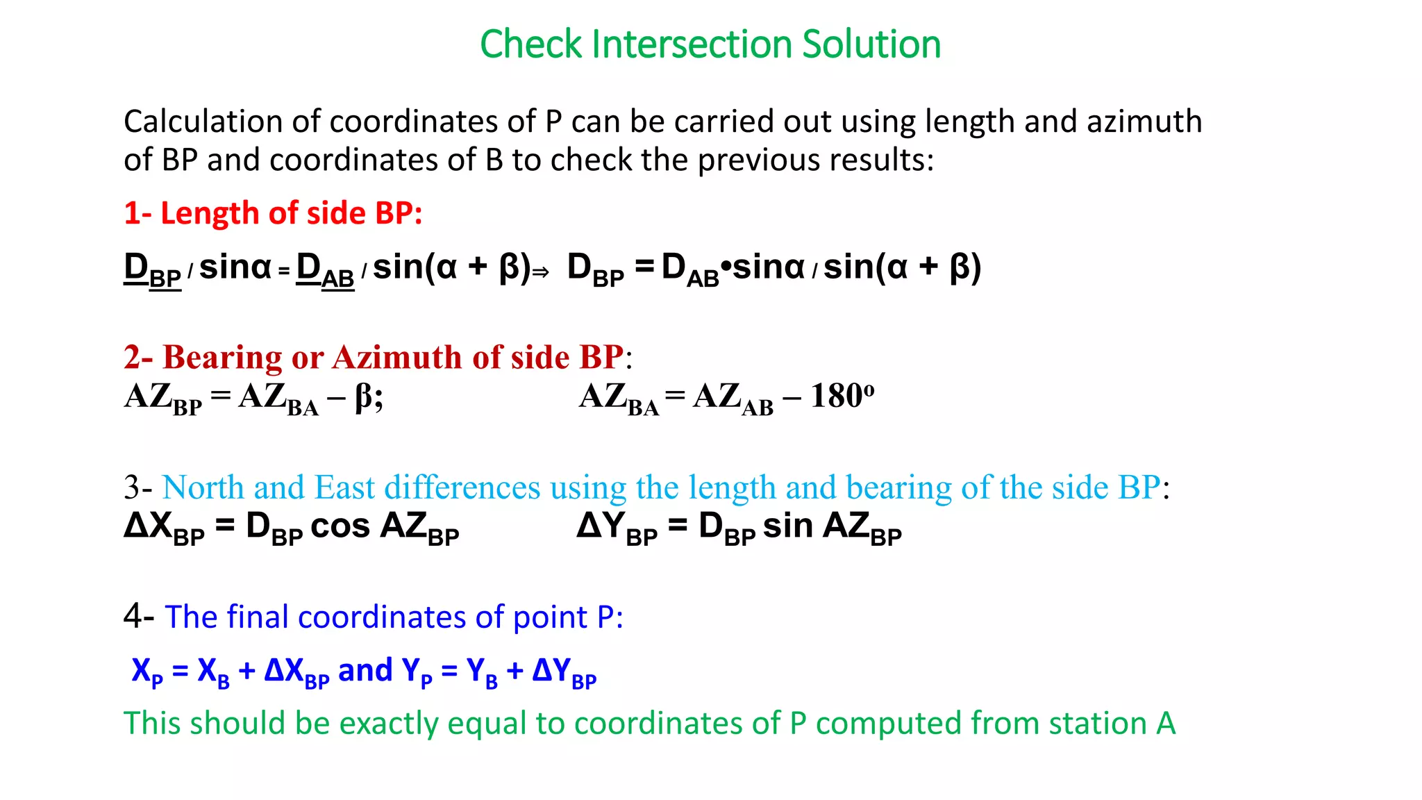
Triangulation provides control points for detailed surveys and is suitable for engineering projects over large areas. Resection and intersection methods are discussed to compute point positions from angle and distance measurements.
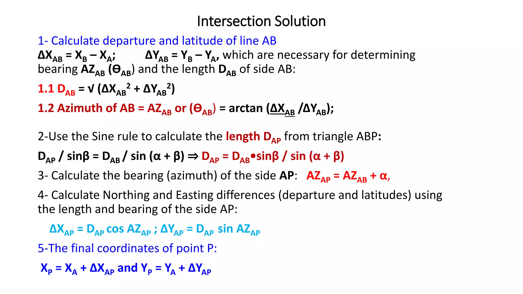
![Intersection Formula
The following formulae are called intersection formula, used to calculate
coordinates of P by directly substituting the given and observed data:
NP = {EA – EB + NA cot β + NB cot α} / [cot α + cot β]
EP = {NB - NA + EA cot β + EB cot α} / [cot α + cot β]
NOTE: Direct substitution should be done when observing A and B from P
should be seen clockwise direction. This means standing at P observing A,
you have to turn clockwise to observe B.
Example:
A and B are ground control points of coordinates: A(200.00, 400.00)m and
B(500.00, 600.00)m. Angles observed at A and B towards station P (almost
east of A) are 65o 00’ 00” and 67o 00’ 00” respectively, compute coordinates
of P.](https://image.slidesharecdn.com/se312ch3-triangulationsurvey-230521151024-986551b0/75/se_312_ch_3_-triangulation_survey-pptx-13-2048.jpg)
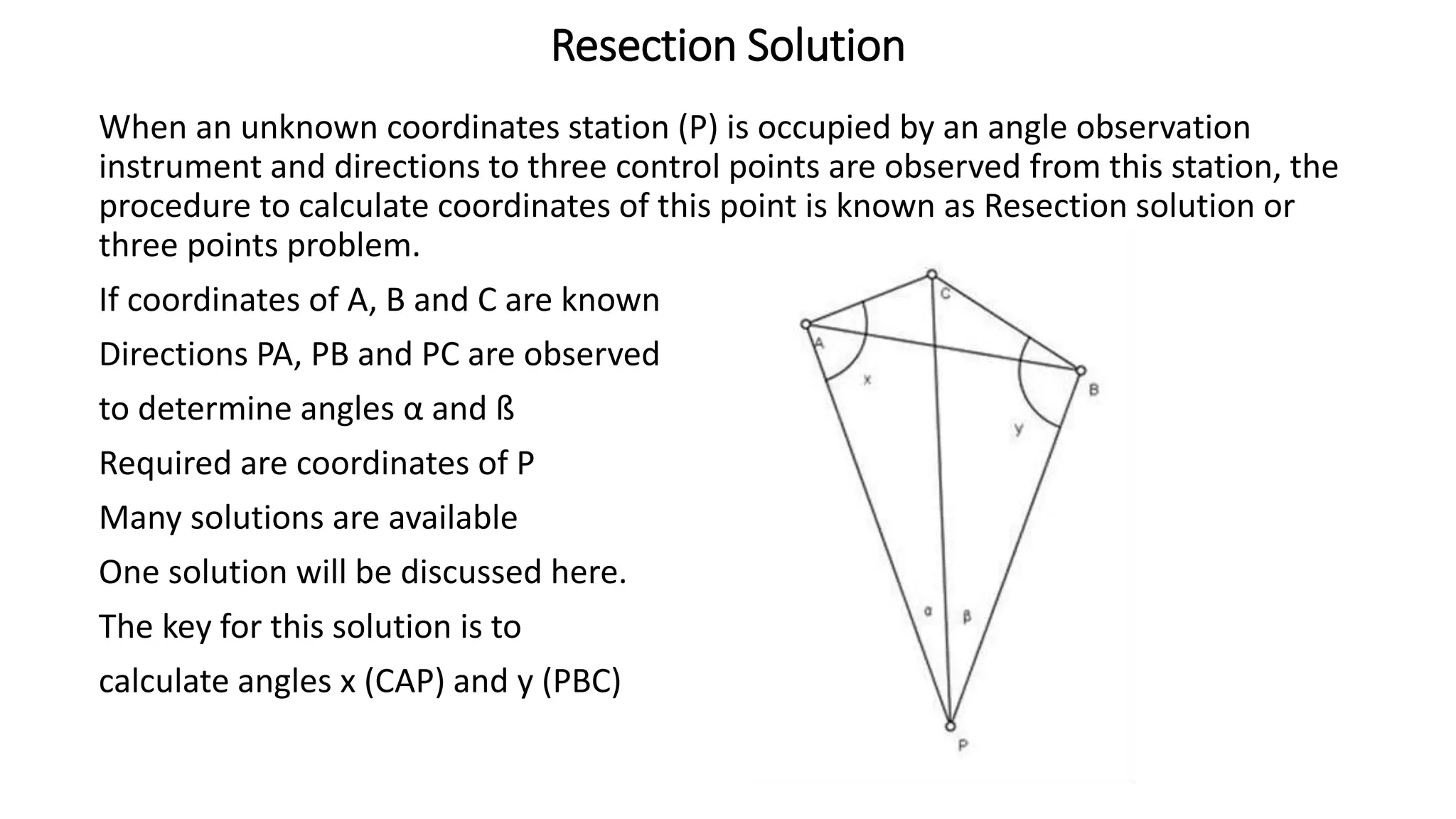
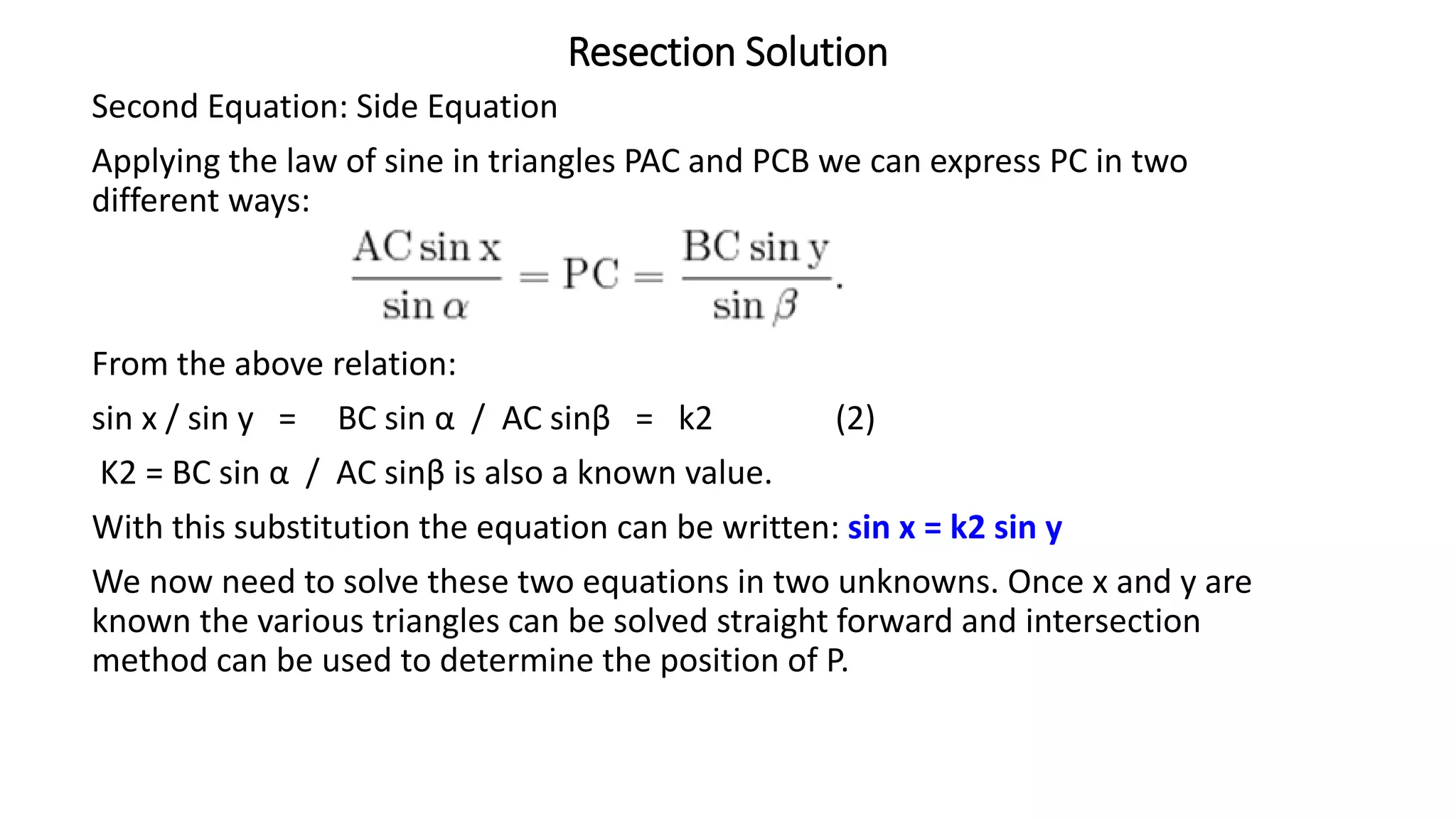
![Resection Solution
Solution of the two equations to give x and y:
1- compute constants k1 and k2
2- Substituting (1) in (2): sin x = k2 sin (k1 – x)
sin x = k2 [ sin k1 cos x - cos k1 sin x ]
Dividing both sides by cos x, tan x = k2 [sin k1 - cos k1 tan x],
hence:
tan x [1 + k2 cos k1] = k2 sin k1
tan x =k2 sin k1/[1 + k2 cos k1];
3- Substitute values of k1 and k2 to calculate x and y:
x = tan-1 {k2 sin k1/[1 + k2 cos k1]}
y = k1 –x
4- Check the solution:
In ∆ ACP, <ACP = C1; In ∆ BCP, <BCP = C2; C1 + C2 = C, already calculated in
∆ABC; also 180 – (α +C1) = x and 180 – (ß + C2](https://image.slidesharecdn.com/se312ch3-triangulationsurvey-230521151024-986551b0/75/se_312_ch_3_-triangulation_survey-pptx-17-2048.jpg)