SlideShare a Scribd company logo
1 of 11
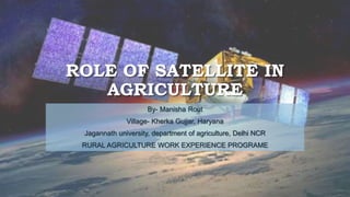
ROLE OF SATELLITE IN
AGRICULTURE
By- Manisha Rout
Village- Kherka Gujjar, Haryana
Jagannath university, department of agriculture, Delhi NCR
RURAL AGRICULTURE WORK EXPERIENCE PROGRAME
REMOTE SENSING SATELLITES OF INDIAN SPACE
RESEARCH ORGANIZATION INVOLVED IN
AGRICULTURE APPLICATIONS.
Satellite Type :-
Multispectral imaging satellite
Objectives :-
Multispectral imaging for crop production forecast, land, water and natural resource inventory and management,
and disaster management support
Satellite -
Resourcesat-2 & Resourcesat-2A
REMOTE SENSING SATELLITES OF INDIAN SPACE
RESEARCH ORGANIZATION INVOLVED IN
AGRICULTURE APPLICATIONS.
Satellite Type :-
Cartography satellite
Objectives :-
High resolution cartographic mapping, digital elevation mapping – drainage and irrigation networks,
topographic mapping and contouring
Satellite –
Cartosat-1
REMOTE SENSING SATELLITES OF INDIAN SPACE
RESEARCH ORGANIZATION INVOLVED IN
AGRICULTURE APPLICATIONS.
Satellite Type :-
Radar imaging
Objectives :-
All weather imaging capability targeted for kharif crop (June to November) during south-west and north-east
monsoon seasons. Flood and natural disaster management.
Satellite –
RISAT-1
REMOTE SENSING SATELLITES OF INDIAN SPACE
RESEARCH ORGANIZATION INVOLVED IN
AGRICULTURE APPLICATIONS.
Satellite Type :-
Meteorological forecasting
Objectives :-
Comprehensive weather status reporting and forecasting.
Satellite -
Kalpana-1
REMOTE SENSING SATELLITES OF INDIAN SPACE
RESEARCH ORGANIZATION INVOLVED IN
AGRICULTURE APPLICATIONS.
Satellite Type :-
Meteorological observation
Objectives :-
improved meteorological observations including vertical – temperature and humidity –
atmosphere weather forecasting and disaster warning.
Satellite -
INSAT-3D & INSAT-3DR
PRECISION AGRICULTURE
• Precision agriculture is a farming management concept based on observing, measuring, and
responding to inter and intra-field variability in crops. Satellite imagery supports precision
agriculture by providing the needed data for more precise use of fertilizers, herbicides,
pesticides, as well as optimizing the use and rotation of pastures, predicting yields and
monitoring loss, to name a few.
• Polish startup SatAgro is an example of an agtech company that has been leveraging satellite
imagery to enhance precision agriculture. According to the company, the variable-rate
prescription maps generated from satellite images (and available within their app) have
enabled farmers to cut the use of nitrogen fertilizer by 12 percent, thereby helping to
maximize the potential of the land while minimizing environmental impact.
PRECISION AGRICULTURE
FOOD SECURITY
• Satellite imagery can be used to generate crop maps over large heterogeneous areas. In
combination with census information, the crop maps can enable regional authorities to
identify priority areas in need of assistance in the event of, for example, drought-related crop
failures. This can inform planning that ultimately has the potential to reduce poverty, famine,
and death.
• NASA Harvest is an example of an initiative that has proven the efficacy of this model. Using
satellite imagery from Sentinel-2, the NASA-USGS Landsat, and Planet’s SkySat, and
subjecting it to machine learning algorithms, NASA Harvest was able to generate a cropland
map within 10 days at the request of the Togolese Government. This map helped authorities
to identify priority areas rapidly and effectively for its relief programs.
THANK YOU
JAI JAWAN, JAI KISAN, JAI VIGYAN

More Related Content

Similar to ROLE OF SATELLITE IN AGRICULTURE.pptx

Implementing E-Agriculture in India from 2010-2020.
Implementing E-Agriculture in India from 2010-2020.Implementing E-Agriculture in India from 2010-2020.
Implementing E-Agriculture in India from 2010-2020.Siddharth Bhattacharya
 
use in remote sensing in agriculture
use in remote sensing in agricultureuse in remote sensing in agriculture
use in remote sensing in agriculturehena parveen
 
Geographical Information System
Geographical Information SystemGeographical Information System
Geographical Information SystemDevegowda S R
 
GIS Applications for Smart Agriculture-Case Studies & Research Prospects.
GIS Applications for Smart Agriculture-Case Studies & Research Prospects.GIS Applications for Smart Agriculture-Case Studies & Research Prospects.
GIS Applications for Smart Agriculture-Case Studies & Research Prospects.AdityaAllamraju1
 
Applications of Remote Sensing
Applications of Remote SensingApplications of Remote Sensing
Applications of Remote SensingAbhiram Kanigolla
 
Remote Sensing and GIS and GPS
Remote Sensing and GIS and GPSRemote Sensing and GIS and GPS
Remote Sensing and GIS and GPSSouvik Roy
 
Cropland extent of South Asia @ 30 m resolution using time series Landsat dat...
Cropland extent of South Asia @ 30 m resolution using time series Landsat dat...Cropland extent of South Asia @ 30 m resolution using time series Landsat dat...
Cropland extent of South Asia @ 30 m resolution using time series Landsat dat...ICRISAT
 
Review Paper: Analysis of Landslide Hazard Zones (Hotspots) & Mitigation in W...
Review Paper: Analysis of Landslide Hazard Zones (Hotspots) & Mitigation in W...Review Paper: Analysis of Landslide Hazard Zones (Hotspots) & Mitigation in W...
Review Paper: Analysis of Landslide Hazard Zones (Hotspots) & Mitigation in W...IRJET Journal
 
Application of remote sensing in precision farming
 Application of remote sensing in precision farming  Application of remote sensing in precision farming
Application of remote sensing in precision farming Suman Dey
 
PRECISE AGRICULTURE USING GPS
PRECISE AGRICULTURE USING GPSPRECISE AGRICULTURE USING GPS
PRECISE AGRICULTURE USING GPSAbhiram Kanigolla
 
Technical Paper ppt.pptx
Technical Paper ppt.pptxTechnical Paper ppt.pptx
Technical Paper ppt.pptxSudeepgowda16
 
Application of Remote Sensing GIS in Agriculture.pdf
Application of Remote Sensing   GIS in Agriculture.pdfApplication of Remote Sensing   GIS in Agriculture.pdf
Application of Remote Sensing GIS in Agriculture.pdfCrystal Sanchez
 
AGRICULTURE INFORMATION SYSTEM USING REMOTE SENSING, GEOGRAPHICAL ANALYSIS ...
AGRICULTURE INFORMATION SYSTEM USING  REMOTE SENSING, GEOGRAPHICAL  ANALYSIS ...AGRICULTURE INFORMATION SYSTEM USING  REMOTE SENSING, GEOGRAPHICAL  ANALYSIS ...
AGRICULTURE INFORMATION SYSTEM USING REMOTE SENSING, GEOGRAPHICAL ANALYSIS ...Alok Singh
 
wasteland mapping
wasteland mappingwasteland mapping
wasteland mappingjosnarajp
 
IRJET- Preparation of Flood Model and Hazard Estimation on Yamuna River (...
IRJET-  	  Preparation of Flood Model and Hazard Estimation on Yamuna River (...IRJET-  	  Preparation of Flood Model and Hazard Estimation on Yamuna River (...
IRJET- Preparation of Flood Model and Hazard Estimation on Yamuna River (...IRJET Journal
 

Similar to ROLE OF SATELLITE IN AGRICULTURE.pptx (20)

Implementing E-Agriculture in India from 2010-2020.
Implementing E-Agriculture in India from 2010-2020.Implementing E-Agriculture in India from 2010-2020.
Implementing E-Agriculture in India from 2010-2020.
 
Mohsin final seminar
Mohsin final seminarMohsin final seminar
Mohsin final seminar
 
use in remote sensing in agriculture
use in remote sensing in agricultureuse in remote sensing in agriculture
use in remote sensing in agriculture
 
Credit seminar
Credit seminarCredit seminar
Credit seminar
 
Geographical Information System
Geographical Information SystemGeographical Information System
Geographical Information System
 
GIS Applications for Smart Agriculture-Case Studies & Research Prospects.
GIS Applications for Smart Agriculture-Case Studies & Research Prospects.GIS Applications for Smart Agriculture-Case Studies & Research Prospects.
GIS Applications for Smart Agriculture-Case Studies & Research Prospects.
 
Applications of Remote Sensing
Applications of Remote SensingApplications of Remote Sensing
Applications of Remote Sensing
 
Remote Sensing and GIS and GPS
Remote Sensing and GIS and GPSRemote Sensing and GIS and GPS
Remote Sensing and GIS and GPS
 
Cropland extent of South Asia @ 30 m resolution using time series Landsat dat...
Cropland extent of South Asia @ 30 m resolution using time series Landsat dat...Cropland extent of South Asia @ 30 m resolution using time series Landsat dat...
Cropland extent of South Asia @ 30 m resolution using time series Landsat dat...
 
Review Paper: Analysis of Landslide Hazard Zones (Hotspots) & Mitigation in W...
Review Paper: Analysis of Landslide Hazard Zones (Hotspots) & Mitigation in W...Review Paper: Analysis of Landslide Hazard Zones (Hotspots) & Mitigation in W...
Review Paper: Analysis of Landslide Hazard Zones (Hotspots) & Mitigation in W...
 
Application of remote sensing in precision farming
 Application of remote sensing in precision farming  Application of remote sensing in precision farming
Application of remote sensing in precision farming
 
PRECISE AGRICULTURE USING GPS
PRECISE AGRICULTURE USING GPSPRECISE AGRICULTURE USING GPS
PRECISE AGRICULTURE USING GPS
 
Technical Paper ppt.pptx
Technical Paper ppt.pptxTechnical Paper ppt.pptx
Technical Paper ppt.pptx
 
Srsac ppt
Srsac  pptSrsac  ppt
Srsac ppt
 
Application of Remote Sensing GIS in Agriculture.pdf
Application of Remote Sensing   GIS in Agriculture.pdfApplication of Remote Sensing   GIS in Agriculture.pdf
Application of Remote Sensing GIS in Agriculture.pdf
 
PPT.Geoinformatics.pdf
PPT.Geoinformatics.pdfPPT.Geoinformatics.pdf
PPT.Geoinformatics.pdf
 
AGRICULTURE INFORMATION SYSTEM USING REMOTE SENSING, GEOGRAPHICAL ANALYSIS ...
AGRICULTURE INFORMATION SYSTEM USING  REMOTE SENSING, GEOGRAPHICAL  ANALYSIS ...AGRICULTURE INFORMATION SYSTEM USING  REMOTE SENSING, GEOGRAPHICAL  ANALYSIS ...
AGRICULTURE INFORMATION SYSTEM USING REMOTE SENSING, GEOGRAPHICAL ANALYSIS ...
 
Q33081091
Q33081091Q33081091
Q33081091
 
wasteland mapping
wasteland mappingwasteland mapping
wasteland mapping
 
IRJET- Preparation of Flood Model and Hazard Estimation on Yamuna River (...
IRJET-  	  Preparation of Flood Model and Hazard Estimation on Yamuna River (...IRJET-  	  Preparation of Flood Model and Hazard Estimation on Yamuna River (...
IRJET- Preparation of Flood Model and Hazard Estimation on Yamuna River (...
 

Recently uploaded

Organic Name Reactions for the students and aspirants of Chemistry12th.pptx
Organic Name Reactions  for the students and aspirants of Chemistry12th.pptxOrganic Name Reactions  for the students and aspirants of Chemistry12th.pptx
Organic Name Reactions for the students and aspirants of Chemistry12th.pptxVS Mahajan Coaching Centre
 
POINT- BIOCHEMISTRY SEM 2 ENZYMES UNIT 5.pptx
POINT- BIOCHEMISTRY SEM 2 ENZYMES UNIT 5.pptxPOINT- BIOCHEMISTRY SEM 2 ENZYMES UNIT 5.pptx
POINT- BIOCHEMISTRY SEM 2 ENZYMES UNIT 5.pptxSayali Powar
 
Software Engineering Methodologies (overview)
Software Engineering Methodologies (overview)Software Engineering Methodologies (overview)
Software Engineering Methodologies (overview)eniolaolutunde
 
BASLIQ CURRENT LOOKBOOK LOOKBOOK(1) (1).pdf
BASLIQ CURRENT LOOKBOOK  LOOKBOOK(1) (1).pdfBASLIQ CURRENT LOOKBOOK  LOOKBOOK(1) (1).pdf
BASLIQ CURRENT LOOKBOOK LOOKBOOK(1) (1).pdfSoniaTolstoy
 
Micromeritics - Fundamental and Derived Properties of Powders
Micromeritics - Fundamental and Derived Properties of PowdersMicromeritics - Fundamental and Derived Properties of Powders
Micromeritics - Fundamental and Derived Properties of PowdersChitralekhaTherkar
 
Contemporary philippine arts from the regions_PPT_Module_12 [Autosaved] (1).pptx
Contemporary philippine arts from the regions_PPT_Module_12 [Autosaved] (1).pptxContemporary philippine arts from the regions_PPT_Module_12 [Autosaved] (1).pptx
Contemporary philippine arts from the regions_PPT_Module_12 [Autosaved] (1).pptxRoyAbrique
 
mini mental status format.docx
mini    mental       status     format.docxmini    mental       status     format.docx
mini mental status format.docxPoojaSen20
 
URLs and Routing in the Odoo 17 Website App
URLs and Routing in the Odoo 17 Website AppURLs and Routing in the Odoo 17 Website App
URLs and Routing in the Odoo 17 Website AppCeline George
 
Crayon Activity Handout For the Crayon A
Crayon Activity Handout For the Crayon ACrayon Activity Handout For the Crayon A
Crayon Activity Handout For the Crayon AUnboundStockton
 
_Math 4-Q4 Week 5.pptx Steps in Collecting Data
_Math 4-Q4 Week 5.pptx Steps in Collecting Data_Math 4-Q4 Week 5.pptx Steps in Collecting Data
_Math 4-Q4 Week 5.pptx Steps in Collecting DataJhengPantaleon
 
Separation of Lanthanides/ Lanthanides and Actinides
Separation of Lanthanides/ Lanthanides and ActinidesSeparation of Lanthanides/ Lanthanides and Actinides
Separation of Lanthanides/ Lanthanides and ActinidesFatimaKhan178732
 
How to Make a Pirate ship Primary Education.pptx
How to Make a Pirate ship Primary Education.pptxHow to Make a Pirate ship Primary Education.pptx
How to Make a Pirate ship Primary Education.pptxmanuelaromero2013
 
Science 7 - LAND and SEA BREEZE and its Characteristics
Science 7 - LAND and SEA BREEZE and its CharacteristicsScience 7 - LAND and SEA BREEZE and its Characteristics
Science 7 - LAND and SEA BREEZE and its CharacteristicsKarinaGenton
 
SOCIAL AND HISTORICAL CONTEXT - LFTVD.pptx
SOCIAL AND HISTORICAL CONTEXT - LFTVD.pptxSOCIAL AND HISTORICAL CONTEXT - LFTVD.pptx
SOCIAL AND HISTORICAL CONTEXT - LFTVD.pptxiammrhaywood
 
Arihant handbook biology for class 11 .pdf
Arihant handbook biology for class 11 .pdfArihant handbook biology for class 11 .pdf
Arihant handbook biology for class 11 .pdfchloefrazer622
 
Mastering the Unannounced Regulatory Inspection
Mastering the Unannounced Regulatory InspectionMastering the Unannounced Regulatory Inspection
Mastering the Unannounced Regulatory InspectionSafetyChain Software
 
Solving Puzzles Benefits Everyone (English).pptx
Solving Puzzles Benefits Everyone (English).pptxSolving Puzzles Benefits Everyone (English).pptx
Solving Puzzles Benefits Everyone (English).pptxOH TEIK BIN
 

Recently uploaded (20)

Organic Name Reactions for the students and aspirants of Chemistry12th.pptx
Organic Name Reactions  for the students and aspirants of Chemistry12th.pptxOrganic Name Reactions  for the students and aspirants of Chemistry12th.pptx
Organic Name Reactions for the students and aspirants of Chemistry12th.pptx
 
Model Call Girl in Bikash Puri Delhi reach out to us at 🔝9953056974🔝
Model Call Girl in Bikash Puri  Delhi reach out to us at 🔝9953056974🔝Model Call Girl in Bikash Puri  Delhi reach out to us at 🔝9953056974🔝
Model Call Girl in Bikash Puri Delhi reach out to us at 🔝9953056974🔝
 
POINT- BIOCHEMISTRY SEM 2 ENZYMES UNIT 5.pptx
POINT- BIOCHEMISTRY SEM 2 ENZYMES UNIT 5.pptxPOINT- BIOCHEMISTRY SEM 2 ENZYMES UNIT 5.pptx
POINT- BIOCHEMISTRY SEM 2 ENZYMES UNIT 5.pptx
 
Software Engineering Methodologies (overview)
Software Engineering Methodologies (overview)Software Engineering Methodologies (overview)
Software Engineering Methodologies (overview)
 
BASLIQ CURRENT LOOKBOOK LOOKBOOK(1) (1).pdf
BASLIQ CURRENT LOOKBOOK  LOOKBOOK(1) (1).pdfBASLIQ CURRENT LOOKBOOK  LOOKBOOK(1) (1).pdf
BASLIQ CURRENT LOOKBOOK LOOKBOOK(1) (1).pdf
 
Micromeritics - Fundamental and Derived Properties of Powders
Micromeritics - Fundamental and Derived Properties of PowdersMicromeritics - Fundamental and Derived Properties of Powders
Micromeritics - Fundamental and Derived Properties of Powders
 
Contemporary philippine arts from the regions_PPT_Module_12 [Autosaved] (1).pptx
Contemporary philippine arts from the regions_PPT_Module_12 [Autosaved] (1).pptxContemporary philippine arts from the regions_PPT_Module_12 [Autosaved] (1).pptx
Contemporary philippine arts from the regions_PPT_Module_12 [Autosaved] (1).pptx
 
mini mental status format.docx
mini    mental       status     format.docxmini    mental       status     format.docx
mini mental status format.docx
 
URLs and Routing in the Odoo 17 Website App
URLs and Routing in the Odoo 17 Website AppURLs and Routing in the Odoo 17 Website App
URLs and Routing in the Odoo 17 Website App
 
Crayon Activity Handout For the Crayon A
Crayon Activity Handout For the Crayon ACrayon Activity Handout For the Crayon A
Crayon Activity Handout For the Crayon A
 
_Math 4-Q4 Week 5.pptx Steps in Collecting Data
_Math 4-Q4 Week 5.pptx Steps in Collecting Data_Math 4-Q4 Week 5.pptx Steps in Collecting Data
_Math 4-Q4 Week 5.pptx Steps in Collecting Data
 
Separation of Lanthanides/ Lanthanides and Actinides
Separation of Lanthanides/ Lanthanides and ActinidesSeparation of Lanthanides/ Lanthanides and Actinides
Separation of Lanthanides/ Lanthanides and Actinides
 
How to Make a Pirate ship Primary Education.pptx
How to Make a Pirate ship Primary Education.pptxHow to Make a Pirate ship Primary Education.pptx
How to Make a Pirate ship Primary Education.pptx
 
Science 7 - LAND and SEA BREEZE and its Characteristics
Science 7 - LAND and SEA BREEZE and its CharacteristicsScience 7 - LAND and SEA BREEZE and its Characteristics
Science 7 - LAND and SEA BREEZE and its Characteristics
 
SOCIAL AND HISTORICAL CONTEXT - LFTVD.pptx
SOCIAL AND HISTORICAL CONTEXT - LFTVD.pptxSOCIAL AND HISTORICAL CONTEXT - LFTVD.pptx
SOCIAL AND HISTORICAL CONTEXT - LFTVD.pptx
 
Arihant handbook biology for class 11 .pdf
Arihant handbook biology for class 11 .pdfArihant handbook biology for class 11 .pdf
Arihant handbook biology for class 11 .pdf
 
Código Creativo y Arte de Software | Unidad 1
Código Creativo y Arte de Software | Unidad 1Código Creativo y Arte de Software | Unidad 1
Código Creativo y Arte de Software | Unidad 1
 
Mastering the Unannounced Regulatory Inspection
Mastering the Unannounced Regulatory InspectionMastering the Unannounced Regulatory Inspection
Mastering the Unannounced Regulatory Inspection
 
Solving Puzzles Benefits Everyone (English).pptx
Solving Puzzles Benefits Everyone (English).pptxSolving Puzzles Benefits Everyone (English).pptx
Solving Puzzles Benefits Everyone (English).pptx
 
TataKelola dan KamSiber Kecerdasan Buatan v022.pdf
TataKelola dan KamSiber Kecerdasan Buatan v022.pdfTataKelola dan KamSiber Kecerdasan Buatan v022.pdf
TataKelola dan KamSiber Kecerdasan Buatan v022.pdf
 

ROLE OF SATELLITE IN AGRICULTURE.pptx

  • 1. ROLE OF SATELLITE IN AGRICULTURE By- Manisha Rout Village- Kherka Gujjar, Haryana Jagannath university, department of agriculture, Delhi NCR RURAL AGRICULTURE WORK EXPERIENCE PROGRAME
  • 2. REMOTE SENSING SATELLITES OF INDIAN SPACE RESEARCH ORGANIZATION INVOLVED IN AGRICULTURE APPLICATIONS. Satellite Type :- Multispectral imaging satellite Objectives :- Multispectral imaging for crop production forecast, land, water and natural resource inventory and management, and disaster management support Satellite - Resourcesat-2 & Resourcesat-2A
  • 3. REMOTE SENSING SATELLITES OF INDIAN SPACE RESEARCH ORGANIZATION INVOLVED IN AGRICULTURE APPLICATIONS. Satellite Type :- Cartography satellite Objectives :- High resolution cartographic mapping, digital elevation mapping – drainage and irrigation networks, topographic mapping and contouring Satellite – Cartosat-1
  • 4. REMOTE SENSING SATELLITES OF INDIAN SPACE RESEARCH ORGANIZATION INVOLVED IN AGRICULTURE APPLICATIONS. Satellite Type :- Radar imaging Objectives :- All weather imaging capability targeted for kharif crop (June to November) during south-west and north-east monsoon seasons. Flood and natural disaster management. Satellite – RISAT-1
  • 5. REMOTE SENSING SATELLITES OF INDIAN SPACE RESEARCH ORGANIZATION INVOLVED IN AGRICULTURE APPLICATIONS. Satellite Type :- Meteorological forecasting Objectives :- Comprehensive weather status reporting and forecasting. Satellite - Kalpana-1
  • 6. REMOTE SENSING SATELLITES OF INDIAN SPACE RESEARCH ORGANIZATION INVOLVED IN AGRICULTURE APPLICATIONS. Satellite Type :- Meteorological observation Objectives :- improved meteorological observations including vertical – temperature and humidity – atmosphere weather forecasting and disaster warning. Satellite - INSAT-3D & INSAT-3DR
  • 7.
  • 8. PRECISION AGRICULTURE • Precision agriculture is a farming management concept based on observing, measuring, and responding to inter and intra-field variability in crops. Satellite imagery supports precision agriculture by providing the needed data for more precise use of fertilizers, herbicides, pesticides, as well as optimizing the use and rotation of pastures, predicting yields and monitoring loss, to name a few. • Polish startup SatAgro is an example of an agtech company that has been leveraging satellite imagery to enhance precision agriculture. According to the company, the variable-rate prescription maps generated from satellite images (and available within their app) have enabled farmers to cut the use of nitrogen fertilizer by 12 percent, thereby helping to maximize the potential of the land while minimizing environmental impact.
  • 10. FOOD SECURITY • Satellite imagery can be used to generate crop maps over large heterogeneous areas. In combination with census information, the crop maps can enable regional authorities to identify priority areas in need of assistance in the event of, for example, drought-related crop failures. This can inform planning that ultimately has the potential to reduce poverty, famine, and death. • NASA Harvest is an example of an initiative that has proven the efficacy of this model. Using satellite imagery from Sentinel-2, the NASA-USGS Landsat, and Planet’s SkySat, and subjecting it to machine learning algorithms, NASA Harvest was able to generate a cropland map within 10 days at the request of the Togolese Government. This map helped authorities to identify priority areas rapidly and effectively for its relief programs.
  • 11. THANK YOU JAI JAWAN, JAI KISAN, JAI VIGYAN