SlideShare a Scribd company logo
"Technical Workshop on Remote Sensing Damage
       Assessment: The Haiti Earthquake Experience“

           The OSM WikiProject Haiti case

Contribution by the Humanitarian OpenStreetMap Team (HOT)
What is openstreetmap?
The openstreetmap “one-liner”

A web project to create a free and open map of
the entire world, built entirely from volunteers
surveying with GPS, digitizing aerial imagery,
and collecting and liberating existing public
sources of geographic data.


                  =
                                        +
free and open voluntary map of the
    world. open contribution. open use.
Voluntary, open contributions, open use (CC-SA)
OSM core – system components.
OSM WikiProject Haiti - snapshot


OSM data in SHP & GPS map extracts (Garmin) available day 1; WFS day 2
OSM GPS map extracts used by Search And Rescue Teams – day 1
OSM = roads core data set (OCHA Core Data sets check-list).
OSM data used as SHP, WFS, WMS in responders mapping production
environment
26 hours to get imagery released and 48 hours to get 1st imagery loaded on
the OSM platform available for tracing
Tracing over Satellite imagery.
   Free, Purchased, Negotiated


Right to access & use raw imagery for deriving data within OSM obtained
though crisis mapping list.
Raw imagery processed into tiles to be made available in OSM editors
(potlatch, merkator & josm)
Thousands traced over base map features, humanitairan features (camps) &
also damages
Cooperation area

* Evaluating OSM tracing against UNOSAT/ WB/ JRC & UNOPS
data

* Methodology
** Follow up with this workshop
** Defining articulation with remote and field OSM work

* Streamlining/ ensuring access to imagery
** Short term: allow imagery for current needs in Haiti, other crisis
(Chile, Uganda, Sahel) or in support to data disaster preparedness
or development work
** Mid term: agreement to make of OSM or OAM an actor to feed
humanitarian actors satellite imagery based geodata products
OSM editors JOSM and Potlach
                          JOSM and Potlach are the two
                          main editors used for creating
                          and modifying OSM data.


                          Potlach is a simple web
                          interface, accessible to users
                          on the OpenStreetMap website.


                          JOSM is a more advanced tool,
                          is a Java application so doesn't
                          require consistent internet
                          access and can run on any
                          operating system.
Database import: Public domain or CC-SA.


Haiti: Base map layers (MINUSTAH/ CNIGS), Health Facility (WHO),
Haiti damage assessment: ITHACA & UNOSAT vectors…
Direct measurements: GPS surveys
Direct measurements: walking papers
                      Combined, GPS and Walking Papers
                      can be used for rapid surveying and
                      ground truthing.

                      Walking Papers allow users to print out
                      small sections of the OSM map. In the
                      field, these paper maps can be used to
                      draw new features, annotate existing
                      data, and take notes that will help with
                      the import of GPS data.

                      Icons in each of the corners and a
                      unique code for each Walking Paper
                      let users scan the paper and upload to
                      OSM so the notes can be viewed in an
                      editing environment.

                      http://walking-papers.org
Direct measurements: Questionnaires.
Based on OSM Humanitarian Data Model (HDM) and
humanitarian data models (Ex UNSDIT)
UNSDI-T v2 Formulaire de collecte de donnees                                                                                                                              Nom de l'ensemble du segment:                                                                                                                                                                                                                                                                                                                                                    Source ID (UNJLC use only):

                                                                                                Routes                                                                                                                                                                                                                                                                                                                                                       Obstacles et Ponts                                                                                                                                                                                                                                                                                              Autres
                                                   Surface                                                            Condition                                            Ouvert pour quels vehicules? (saisir                                                                                                                                                                                                                                                                                                                                                                                                   Passable par quel(s) vehicule(s)?
Du GPS Waypoint        Au GPS Waypoint                                                                                                                                                                                                                                                              GPS Waypoint                                                                                                           Type d'obstacle (saisir une valeur)                                                                                                                                                                                                                                                                            GPS Waypoint                               Description
                                             (saisir une valeur)                                                  (saisir une valeur)                                            les valeurs pertinentes)                                                                                                                                                                                                                                                                                                                                                                                                          (saisir les valeurs pertinentes)
                                                                                                             Mauvaise (<40 kph)

                                                                                                                                  Bonne (>40 kph)


                                                                                                                                                                                                                                                                                                                                                                                                                                                                                                                                          Pont
                                                                                                                                                                                                        Camion Lourd (<20 T)

                                                                                                                                                                                                                               Camion Leger (<10 T)

                                                                                                                                                                                                                                                      4x4D (<3.5 T)


                                                                                                                                                                                                                                                                                                                                                                                                                                                                                                                 Gue


                                                                                                                                                                                                                                                                                                                                                                                                                                                                                                                                                 Culvert


                                                                                                                                                                                                                                                                                                                                                                                                                                                                                                                                                                                                                                              Camion Lourd (<20 T)

                                                                                                                                                                                                                                                                                                                                                                                                                                                                                                                                                                                                                                                                     Camion Leger (<10 T)

                                                                                                                                                                                                                                                                                                                                                                                                                                                                                                                                                                                                                                                                                            4x4D (<3.5 T)
                                                                                                                                                                   Boue


                                                                                                                                                                            Camion + Remorque (>20 T)


                                                                                                                                                                                                                                                                                                                                                                                                                                                                                                                                                                                      Autre (preciser in notes)


                                                                                                                                                                                                                                                                                                                                                                                                                                                                                                                                                                                                                  Camion + Remorque (>20 T)
                                               Route Pave (Asphalt or Bitume)


                                                                                                Dirt/ sand


                                                                                                                                                                                                                                                                      Moto

                                                                                                                                                                                                                                                                             traffic non-motorise


                                                                                                                                                                                                                                                                                                                                                       Road Block/ Barrage routier


                                                                                                                                                                                                                                                                                                                                                                                                                                                                                                                                                                                                                                                                                                                   traffic non-motorise
                                                                                                                                                                                                                                                                                                                                                                                                                Debris/Epaves

                                                                                                                                                                                                                                                                                                                                                                                                                                Lignes Electriques a terre


                                                                                                                                                                                                                                                                                                                                                                                                                                                                                                    Inondation


                                                                                                                                                                                                                                                                                                                                                                                                                                                                                                                                                                                                                                                                                                            Moto
                                                                                                                                                    Neige/ Glace


                                                                                                                                                                                                                                                                                                                                                                                                                                                             Avalanche/Neige

                                                                                                                                                                                                                                                                                                                                                                                                                                                                               Landslide/Mudslide


                                                                                                                                                                                                                                                                                                                                                                                                                                                                                                                       Route endommagee


                                                                                                                                                                                                                                                                                                                                                                                                                                                                                                                                                             Restriction au traffic
                                                                                                                                                                                                                                                                                                                       Mines/ Munitions non exploses
                                                                                Gravel/Murram


                                                                                                                                                                                                                                                                                                                                                               Checkpoint-officiel


                                                                                                                                                                                                                                                                                                                                                                                     Checkpoint-non officiel.
                                                                                                                                                                                                                                                                                                                                                                                                                                                                                                                                                                                                                                                                                                                                            Saisir le
 Saisir le numero du   Saisir le numero du                                                                                                                                                                                                                                                          Saisir le numero                                                                                                                                                                                                                                                                                                                                                                                                                       numero du Utiliser ces champs pour saisir (i) Nom de Rue ou de Route ou autre
 waypoint du GPS.      waypoint du GPS.                                                                                                                                                                                                                                                             du waypoint du                                                                                                                                                                                                                                                                                                                                                                                                                         waypoint du  information textuelle relatives aux segments de route evalues sur le
      Exemple:              Exemple:                                                                                                                                                                                                                                                                GPS. Exemple:                                                                                                                                                                                                                                                                                                                                                                                                                         GPS. Exemple: formulaire Route (formulaire de gauche); (ii) saisir des informations
          001                   017                                                                                                                                                                                                                                                                        017                                                                                                                                                                                                                                                                                                                                                                                                                                 017         ponctuelles importantes (villages, intersections majeures, etc).
Humanitarian Data Model (HDM)


The Humanitarian Data Model seeks to reconcile schemas from many
humanitarian response agencies, all of which are based on field
requirements.


When possible, it matches Humanitarian attributes to existing Map Features
in OSM to make imports to and exports from OSM to response agencies
more straightforward.
Extract-Transform-Load (ETL) tools will smooth this effort


From the HDM the following will be derived::
* Questionnaires to guide data collection
* JOSM Presets to guide editing
* Cartographic symbols to guide rendering
Cooperation area – data modeling
Making the OSM data modeling work over the HDM in Haiti and in SDI
projects (UN, WB) on damage assessment interoperable and articulated to
the efforts towards a standardized data model for damage assessment by
main actors of this field (UNOSAT, JRC, World Bank).
OSM/ HOT Haiti Field Mission – 21-March/ 10-April
Background elements.
 Joint OSM-MapAction Mission funded by ECHO, supported by IOM (logistics,
 workplace) & CNIGS, OCHA (coordination)
 = Goal =
 Support the use of OSM on the ground to make sure it stays relevant and
 useful into the recovery, reconstruction, development of Haiti.
 = Audience =
 * groups of UN and international responders,
 * the Haitian government,
 * Haitian civil society
 = Activities =
 == Training ==
 * Surveying with GPS/Walking Papers
 * Editing
 * Ensuring an efficient use of OSM resources by the responders
 == Surveying ==
 == Community mapping project (slum) - feasibility study ==
 == Ad hoc support work ==
 Humanitarian Data Model and data imports
OSM/ HOT Haiti Field Mission – 21-March/ 10-April
Outcomes

*Training activities
60 persons trained from main UN Agencies & NGOs, Centre National
D’Information Geomatique et Spatiale (CNIGS) – the Haitian National Mapping
Agency, Development projects (WINNER & DAI) and groups form Haitian civil
society (Forum des communautes de Cite Soleil, INURED),

*Surveying activities:
Jacmel, Leogane with IOM & CNIGS staffs seconded to IOM

* Data modeling & data imports
Cooperation areas
* Evaluating OSM tracing against UNOSAT/ WB/ JRC & UNOPS
data
* Data modeling: linking efforts towards a standardized data
model for damage assessment with the OSM HDM work in Haiti
and in SDI projects (UN, WB)
* Methodology
** Follow up with this workshop
** Defining articulation with remote and field OSM work
* Streamlining/ ensuring access to imagery
** Short term: allow imagery for current needs in Haiti, other crisis
(Chile, Uganda, Sahel) or in support to data disaster preparedness or
development work
** Mid term: agreement to make of OSM or OAM an actor to feed
humanitarian actors satellite imagery based geodata products
Humanitarian OpenStreetMap Team (HOT)

Core Mission
- connecting point between humanitarian and open mapping communities
- remote data creation during crisis
- collection and organization of existing data sources
- deployments to the field possible
- distribution point for free data

Advocacy, Training and Outreach
- mapping parties
- speaking, writing, meetings in humanitarian and United Nations technical
communities

Thinking and Design
- promotion of crowd-sourcing and simple web standards for data sharing
- technical improvements to OSM and OSGeo in response to field requirements
(offline support, verification, format adaptors, multi-master sync..)
* WikiProject Haiti
http://wiki.openstreetmap.org/wiki/WikiProject_Haiti

* Strategy & proposal
http://wiki.openstreetmap.org/wiki/Humanitarian_OSM_Team/Haiti
_Strategy_And_Proposal

* Humanitarian OpenStreetMap Team
http://wiki.openstreetmap.org/wiki/Humanitarian_OSM_Team

* Contacts
nicolas.chavent@gmail.com
mikel_maron@yahoo.com

More Related Content

Similar to OpenStreetMap work in humanitarian response to 12-Jan 2010 Haiti Earthquake at UNOSAT, WorldBank & JRC workshop on Damage Assessment (Geneva, 26, 27-April 2010).

Osm Training Ht10 Hot English Version
Osm Training Ht10 Hot English VersionOsm Training Ht10 Hot English Version
Osm Training Ht10 Hot English Version
chavent nicolas
 
Eurosha kenya pres_osm_en_20121031
Eurosha kenya pres_osm_en_20121031Eurosha kenya pres_osm_en_20121031
Eurosha kenya pres_osm_en_20121031Severin Menard
 
OSM HOT SBTF 2013_03_16
OSM HOT SBTF 2013_03_16OSM HOT SBTF 2013_03_16
OSM HOT SBTF 2013_03_16
Frédéric Bonifas
 
Haiti HOT OSM éducation 15/02/2012 (FR)
Haiti HOT OSM éducation 15/02/2012 (FR)Haiti HOT OSM éducation 15/02/2012 (FR)
Haiti HOT OSM éducation 15/02/2012 (FR)Severin Menard
 
Humanitarian OpenStreetMap Team [H.O.T.] Training for SBTF
Humanitarian OpenStreetMap Team [H.O.T.] Training for SBTFHumanitarian OpenStreetMap Team [H.O.T.] Training for SBTF
Humanitarian OpenStreetMap Team [H.O.T.] Training for SBTF
Standby Task Force
 
OpenStreetMap, an introduction
OpenStreetMap, an introductionOpenStreetMap, an introduction
OpenStreetMap, an introduction
Frédéric Rodrigo
 
Openstreetmap presentation of Mapping Party at FSMK camp
Openstreetmap presentation of Mapping Party at FSMK campOpenstreetmap presentation of Mapping Party at FSMK camp
Openstreetmap presentation of Mapping Party at FSMK camp
Yogesh Ks
 
Build with live location data
Build with live location dataBuild with live location data
Build with live location data
Zahra Sdg
 
The GRASS GIS software (with QGIS) - GIS Seminar
The GRASS GIS software (with QGIS) - GIS SeminarThe GRASS GIS software (with QGIS) - GIS Seminar
The GRASS GIS software (with QGIS) - GIS Seminar
Markus Neteler
 
OpenStreetMap louis liu
OpenStreetMap   louis liuOpenStreetMap   louis liu
OpenStreetMap louis liuAidIQ
 

Similar to OpenStreetMap work in humanitarian response to 12-Jan 2010 Haiti Earthquake at UNOSAT, WorldBank & JRC workshop on Damage Assessment (Geneva, 26, 27-April 2010). (11)

Osm Training Ht10 Hot English Version
Osm Training Ht10 Hot English VersionOsm Training Ht10 Hot English Version
Osm Training Ht10 Hot English Version
 
Eurosha kenya pres_osm_en_20121031
Eurosha kenya pres_osm_en_20121031Eurosha kenya pres_osm_en_20121031
Eurosha kenya pres_osm_en_20121031
 
OSM HOT SBTF 2013_03_16
OSM HOT SBTF 2013_03_16OSM HOT SBTF 2013_03_16
OSM HOT SBTF 2013_03_16
 
Haiti HOT OSM éducation 15/02/2012 (FR)
Haiti HOT OSM éducation 15/02/2012 (FR)Haiti HOT OSM éducation 15/02/2012 (FR)
Haiti HOT OSM éducation 15/02/2012 (FR)
 
Humanitarian OpenStreetMap Team [H.O.T.] Training for SBTF
Humanitarian OpenStreetMap Team [H.O.T.] Training for SBTFHumanitarian OpenStreetMap Team [H.O.T.] Training for SBTF
Humanitarian OpenStreetMap Team [H.O.T.] Training for SBTF
 
OpenStreetMap, an introduction
OpenStreetMap, an introductionOpenStreetMap, an introduction
OpenStreetMap, an introduction
 
Openstreetmap presentation of Mapping Party at FSMK camp
Openstreetmap presentation of Mapping Party at FSMK campOpenstreetmap presentation of Mapping Party at FSMK camp
Openstreetmap presentation of Mapping Party at FSMK camp
 
Build with live location data
Build with live location dataBuild with live location data
Build with live location data
 
The GRASS GIS software (with QGIS) - GIS Seminar
The GRASS GIS software (with QGIS) - GIS SeminarThe GRASS GIS software (with QGIS) - GIS Seminar
The GRASS GIS software (with QGIS) - GIS Seminar
 
ITB Tutorial
ITB TutorialITB Tutorial
ITB Tutorial
 
OpenStreetMap louis liu
OpenStreetMap   louis liuOpenStreetMap   louis liu
OpenStreetMap louis liu
 

More from chavent nicolas

#HackFrancophonie @Etalab @CFImedias - Projet Espace OSM Francophone #ProjetE...
#HackFrancophonie @Etalab @CFImedias - Projet Espace OSM Francophone #ProjetE...#HackFrancophonie @Etalab @CFImedias - Projet Espace OSM Francophone #ProjetE...
#HackFrancophonie @Etalab @CFImedias - Projet Espace OSM Francophone #ProjetE...
chavent nicolas
 
#HackFrancophonie @Etalab @CFImedias - Projet Espace OSM Francophone #ProjetE...
#HackFrancophonie @Etalab @CFImedias - Projet Espace OSM Francophone #ProjetE...#HackFrancophonie @Etalab @CFImedias - Projet Espace OSM Francophone #ProjetE...
#HackFrancophonie @Etalab @CFImedias - Projet Espace OSM Francophone #ProjetE...
chavent nicolas
 
#CNH2016 - Projet Espace OSM Francophone #ProjetEOF : Gestion d'Information #...
#CNH2016 - Projet Espace OSM Francophone #ProjetEOF : Gestion d'Information #...#CNH2016 - Projet Espace OSM Francophone #ProjetEOF : Gestion d'Information #...
#CNH2016 - Projet Espace OSM Francophone #ProjetEOF : Gestion d'Information #...
chavent nicolas
 
Réalisations du projet de cartographie numérique libre OpenStreetMap pour l'a...
Réalisations du projet de cartographie numérique libre OpenStreetMap pour l'a...Réalisations du projet de cartographie numérique libre OpenStreetMap pour l'a...
Réalisations du projet de cartographie numérique libre OpenStreetMap pour l'a...
chavent nicolas
 
Pré
PréPré
Projet Espace OSM Francophone (ProjetEOF) au launch parisien du projet TheMis...
Projet Espace OSM Francophone (ProjetEOF) au launch parisien du projet TheMis...Projet Espace OSM Francophone (ProjetEOF) au launch parisien du projet TheMis...
Projet Espace OSM Francophone (ProjetEOF) au launch parisien du projet TheMis...
chavent nicolas
 
Projet Espace OpenStreetMap Francophone (ProjetEOF) à ETALAB 5-Dec 2014
Projet Espace OpenStreetMap Francophone (ProjetEOF) à ETALAB 5-Dec 2014Projet Espace OpenStreetMap Francophone (ProjetEOF) à ETALAB 5-Dec 2014
Projet Espace OpenStreetMap Francophone (ProjetEOF) à ETALAB 5-Dec 2014
chavent nicolas
 
Projet Espace OpenStreetMap Francophone (ProjetEOF) à l'Institut de Géographi...
Projet Espace OpenStreetMap Francophone (ProjetEOF) à l'Institut de Géographi...Projet Espace OpenStreetMap Francophone (ProjetEOF) à l'Institut de Géographi...
Projet Espace OpenStreetMap Francophone (ProjetEOF) à l'Institut de Géographi...
chavent nicolas
 
Usages cartographiques d'OpenStreetMap en contextes humanitaire/développement...
Usages cartographiques d'OpenStreetMap en contextes humanitaire/développement...Usages cartographiques d'OpenStreetMap en contextes humanitaire/développement...
Usages cartographiques d'OpenStreetMap en contextes humanitaire/développement...
chavent nicolas
 
Comité Technique GéoBretagne : le projet OpenStreetMap dans les champs Humani...
Comité Technique GéoBretagne : le projet OpenStreetMap dans les champs Humani...Comité Technique GéoBretagne : le projet OpenStreetMap dans les champs Humani...
Comité Technique GéoBretagne : le projet OpenStreetMap dans les champs Humani...
chavent nicolas
 
Espace OSM Francophone 2013 : OpenStreetMap dans le continuum humanitaire-dév...
Espace OSM Francophone 2013 : OpenStreetMap dans le continuum humanitaire-dév...Espace OSM Francophone 2013 : OpenStreetMap dans le continuum humanitaire-dév...
Espace OSM Francophone 2013 : OpenStreetMap dans le continuum humanitaire-dév...
chavent nicolas
 
Work of the Humanitarian OpenStreetMap Team (HOT) in Haiti March-June 2010
Work of the Humanitarian OpenStreetMap Team (HOT) in Haiti March-June 2010Work of the Humanitarian OpenStreetMap Team (HOT) in Haiti March-June 2010
Work of the Humanitarian OpenStreetMap Team (HOT) in Haiti March-June 2010
chavent nicolas
 
Osm Training Ht10 Hot French Version
Osm Training Ht10 Hot French VersionOsm Training Ht10 Hot French Version
Osm Training Ht10 Hot French Version
chavent nicolas
 
Field Mission Ht10 Hot French Short Version
Field Mission Ht10 Hot French Short VersionField Mission Ht10 Hot French Short Version
Field Mission Ht10 Hot French Short Version
chavent nicolas
 

More from chavent nicolas (16)

#HackFrancophonie @Etalab @CFImedias - Projet Espace OSM Francophone #ProjetE...
#HackFrancophonie @Etalab @CFImedias - Projet Espace OSM Francophone #ProjetE...#HackFrancophonie @Etalab @CFImedias - Projet Espace OSM Francophone #ProjetE...
#HackFrancophonie @Etalab @CFImedias - Projet Espace OSM Francophone #ProjetE...
 
#HackFrancophonie @Etalab @CFImedias - Projet Espace OSM Francophone #ProjetE...
#HackFrancophonie @Etalab @CFImedias - Projet Espace OSM Francophone #ProjetE...#HackFrancophonie @Etalab @CFImedias - Projet Espace OSM Francophone #ProjetE...
#HackFrancophonie @Etalab @CFImedias - Projet Espace OSM Francophone #ProjetE...
 
#CNH2016 - Projet Espace OSM Francophone #ProjetEOF : Gestion d'Information #...
#CNH2016 - Projet Espace OSM Francophone #ProjetEOF : Gestion d'Information #...#CNH2016 - Projet Espace OSM Francophone #ProjetEOF : Gestion d'Information #...
#CNH2016 - Projet Espace OSM Francophone #ProjetEOF : Gestion d'Information #...
 
Réalisations du projet de cartographie numérique libre OpenStreetMap pour l'a...
Réalisations du projet de cartographie numérique libre OpenStreetMap pour l'a...Réalisations du projet de cartographie numérique libre OpenStreetMap pour l'a...
Réalisations du projet de cartographie numérique libre OpenStreetMap pour l'a...
 
Pré
PréPré
Pré
 
Projet Espace OSM Francophone (ProjetEOF) au launch parisien du projet TheMis...
Projet Espace OSM Francophone (ProjetEOF) au launch parisien du projet TheMis...Projet Espace OSM Francophone (ProjetEOF) au launch parisien du projet TheMis...
Projet Espace OSM Francophone (ProjetEOF) au launch parisien du projet TheMis...
 
Projet Espace OpenStreetMap Francophone (ProjetEOF) à ETALAB 5-Dec 2014
Projet Espace OpenStreetMap Francophone (ProjetEOF) à ETALAB 5-Dec 2014Projet Espace OpenStreetMap Francophone (ProjetEOF) à ETALAB 5-Dec 2014
Projet Espace OpenStreetMap Francophone (ProjetEOF) à ETALAB 5-Dec 2014
 
Projet Espace OpenStreetMap Francophone (ProjetEOF) à l'Institut de Géographi...
Projet Espace OpenStreetMap Francophone (ProjetEOF) à l'Institut de Géographi...Projet Espace OpenStreetMap Francophone (ProjetEOF) à l'Institut de Géographi...
Projet Espace OpenStreetMap Francophone (ProjetEOF) à l'Institut de Géographi...
 
Usages cartographiques d'OpenStreetMap en contextes humanitaire/développement...
Usages cartographiques d'OpenStreetMap en contextes humanitaire/développement...Usages cartographiques d'OpenStreetMap en contextes humanitaire/développement...
Usages cartographiques d'OpenStreetMap en contextes humanitaire/développement...
 
Usages cartographiques d'OpenStreetMap en contextes humanitaire/développement...
Usages cartographiques d'OpenStreetMap en contextes humanitaire/développement...Usages cartographiques d'OpenStreetMap en contextes humanitaire/développement...
Usages cartographiques d'OpenStreetMap en contextes humanitaire/développement...
 
Comité Technique GéoBretagne : le projet OpenStreetMap dans les champs Humani...
Comité Technique GéoBretagne : le projet OpenStreetMap dans les champs Humani...Comité Technique GéoBretagne : le projet OpenStreetMap dans les champs Humani...
Comité Technique GéoBretagne : le projet OpenStreetMap dans les champs Humani...
 
Espace OSM Francophone 2013 : OpenStreetMap dans le continuum humanitaire-dév...
Espace OSM Francophone 2013 : OpenStreetMap dans le continuum humanitaire-dév...Espace OSM Francophone 2013 : OpenStreetMap dans le continuum humanitaire-dév...
Espace OSM Francophone 2013 : OpenStreetMap dans le continuum humanitaire-dév...
 
Work of the Humanitarian OpenStreetMap Team (HOT) in Haiti March-June 2010
Work of the Humanitarian OpenStreetMap Team (HOT) in Haiti March-June 2010Work of the Humanitarian OpenStreetMap Team (HOT) in Haiti March-June 2010
Work of the Humanitarian OpenStreetMap Team (HOT) in Haiti March-June 2010
 
Osm Training Ht10 Hot French Version
Osm Training Ht10 Hot French VersionOsm Training Ht10 Hot French Version
Osm Training Ht10 Hot French Version
 
Field Mission Ht10 Hot French Short Version
Field Mission Ht10 Hot French Short VersionField Mission Ht10 Hot French Short Version
Field Mission Ht10 Hot French Short Version
 

Recently uploaded

Essentials of Automations: Optimizing FME Workflows with Parameters
Essentials of Automations: Optimizing FME Workflows with ParametersEssentials of Automations: Optimizing FME Workflows with Parameters
Essentials of Automations: Optimizing FME Workflows with Parameters
Safe Software
 
The Art of the Pitch: WordPress Relationships and Sales
The Art of the Pitch: WordPress Relationships and SalesThe Art of the Pitch: WordPress Relationships and Sales
The Art of the Pitch: WordPress Relationships and Sales
Laura Byrne
 
Unsubscribed: Combat Subscription Fatigue With a Membership Mentality by Head...
Unsubscribed: Combat Subscription Fatigue With a Membership Mentality by Head...Unsubscribed: Combat Subscription Fatigue With a Membership Mentality by Head...
Unsubscribed: Combat Subscription Fatigue With a Membership Mentality by Head...
Product School
 
Monitoring Java Application Security with JDK Tools and JFR Events
Monitoring Java Application Security with JDK Tools and JFR EventsMonitoring Java Application Security with JDK Tools and JFR Events
Monitoring Java Application Security with JDK Tools and JFR Events
Ana-Maria Mihalceanu
 
GraphRAG is All You need? LLM & Knowledge Graph
GraphRAG is All You need? LLM & Knowledge GraphGraphRAG is All You need? LLM & Knowledge Graph
GraphRAG is All You need? LLM & Knowledge Graph
Guy Korland
 
Securing your Kubernetes cluster_ a step-by-step guide to success !
Securing your Kubernetes cluster_ a step-by-step guide to success !Securing your Kubernetes cluster_ a step-by-step guide to success !
Securing your Kubernetes cluster_ a step-by-step guide to success !
KatiaHIMEUR1
 
Assuring Contact Center Experiences for Your Customers With ThousandEyes
Assuring Contact Center Experiences for Your Customers With ThousandEyesAssuring Contact Center Experiences for Your Customers With ThousandEyes
Assuring Contact Center Experiences for Your Customers With ThousandEyes
ThousandEyes
 
AI for Every Business: Unlocking Your Product's Universal Potential by VP of ...
AI for Every Business: Unlocking Your Product's Universal Potential by VP of ...AI for Every Business: Unlocking Your Product's Universal Potential by VP of ...
AI for Every Business: Unlocking Your Product's Universal Potential by VP of ...
Product School
 
How world-class product teams are winning in the AI era by CEO and Founder, P...
How world-class product teams are winning in the AI era by CEO and Founder, P...How world-class product teams are winning in the AI era by CEO and Founder, P...
How world-class product teams are winning in the AI era by CEO and Founder, P...
Product School
 
JMeter webinar - integration with InfluxDB and Grafana
JMeter webinar - integration with InfluxDB and GrafanaJMeter webinar - integration with InfluxDB and Grafana
JMeter webinar - integration with InfluxDB and Grafana
RTTS
 
From Daily Decisions to Bottom Line: Connecting Product Work to Revenue by VP...
From Daily Decisions to Bottom Line: Connecting Product Work to Revenue by VP...From Daily Decisions to Bottom Line: Connecting Product Work to Revenue by VP...
From Daily Decisions to Bottom Line: Connecting Product Work to Revenue by VP...
Product School
 
Builder.ai Founder Sachin Dev Duggal's Strategic Approach to Create an Innova...
Builder.ai Founder Sachin Dev Duggal's Strategic Approach to Create an Innova...Builder.ai Founder Sachin Dev Duggal's Strategic Approach to Create an Innova...
Builder.ai Founder Sachin Dev Duggal's Strategic Approach to Create an Innova...
Ramesh Iyer
 
De-mystifying Zero to One: Design Informed Techniques for Greenfield Innovati...
De-mystifying Zero to One: Design Informed Techniques for Greenfield Innovati...De-mystifying Zero to One: Design Informed Techniques for Greenfield Innovati...
De-mystifying Zero to One: Design Informed Techniques for Greenfield Innovati...
Product School
 
Key Trends Shaping the Future of Infrastructure.pdf
Key Trends Shaping the Future of Infrastructure.pdfKey Trends Shaping the Future of Infrastructure.pdf
Key Trends Shaping the Future of Infrastructure.pdf
Cheryl Hung
 
GenAISummit 2024 May 28 Sri Ambati Keynote: AGI Belongs to The Community in O...
GenAISummit 2024 May 28 Sri Ambati Keynote: AGI Belongs to The Community in O...GenAISummit 2024 May 28 Sri Ambati Keynote: AGI Belongs to The Community in O...
GenAISummit 2024 May 28 Sri Ambati Keynote: AGI Belongs to The Community in O...
Sri Ambati
 
GDG Cloud Southlake #33: Boule & Rebala: Effective AppSec in SDLC using Deplo...
GDG Cloud Southlake #33: Boule & Rebala: Effective AppSec in SDLC using Deplo...GDG Cloud Southlake #33: Boule & Rebala: Effective AppSec in SDLC using Deplo...
GDG Cloud Southlake #33: Boule & Rebala: Effective AppSec in SDLC using Deplo...
James Anderson
 
Connector Corner: Automate dynamic content and events by pushing a button
Connector Corner: Automate dynamic content and events by pushing a buttonConnector Corner: Automate dynamic content and events by pushing a button
Connector Corner: Automate dynamic content and events by pushing a button
DianaGray10
 
FIDO Alliance Osaka Seminar: The WebAuthn API and Discoverable Credentials.pdf
FIDO Alliance Osaka Seminar: The WebAuthn API and Discoverable Credentials.pdfFIDO Alliance Osaka Seminar: The WebAuthn API and Discoverable Credentials.pdf
FIDO Alliance Osaka Seminar: The WebAuthn API and Discoverable Credentials.pdf
FIDO Alliance
 
Kubernetes & AI - Beauty and the Beast !?! @KCD Istanbul 2024
Kubernetes & AI - Beauty and the Beast !?! @KCD Istanbul 2024Kubernetes & AI - Beauty and the Beast !?! @KCD Istanbul 2024
Kubernetes & AI - Beauty and the Beast !?! @KCD Istanbul 2024
Tobias Schneck
 
Slack (or Teams) Automation for Bonterra Impact Management (fka Social Soluti...
Slack (or Teams) Automation for Bonterra Impact Management (fka Social Soluti...Slack (or Teams) Automation for Bonterra Impact Management (fka Social Soluti...
Slack (or Teams) Automation for Bonterra Impact Management (fka Social Soluti...
Jeffrey Haguewood
 

Recently uploaded (20)

Essentials of Automations: Optimizing FME Workflows with Parameters
Essentials of Automations: Optimizing FME Workflows with ParametersEssentials of Automations: Optimizing FME Workflows with Parameters
Essentials of Automations: Optimizing FME Workflows with Parameters
 
The Art of the Pitch: WordPress Relationships and Sales
The Art of the Pitch: WordPress Relationships and SalesThe Art of the Pitch: WordPress Relationships and Sales
The Art of the Pitch: WordPress Relationships and Sales
 
Unsubscribed: Combat Subscription Fatigue With a Membership Mentality by Head...
Unsubscribed: Combat Subscription Fatigue With a Membership Mentality by Head...Unsubscribed: Combat Subscription Fatigue With a Membership Mentality by Head...
Unsubscribed: Combat Subscription Fatigue With a Membership Mentality by Head...
 
Monitoring Java Application Security with JDK Tools and JFR Events
Monitoring Java Application Security with JDK Tools and JFR EventsMonitoring Java Application Security with JDK Tools and JFR Events
Monitoring Java Application Security with JDK Tools and JFR Events
 
GraphRAG is All You need? LLM & Knowledge Graph
GraphRAG is All You need? LLM & Knowledge GraphGraphRAG is All You need? LLM & Knowledge Graph
GraphRAG is All You need? LLM & Knowledge Graph
 
Securing your Kubernetes cluster_ a step-by-step guide to success !
Securing your Kubernetes cluster_ a step-by-step guide to success !Securing your Kubernetes cluster_ a step-by-step guide to success !
Securing your Kubernetes cluster_ a step-by-step guide to success !
 
Assuring Contact Center Experiences for Your Customers With ThousandEyes
Assuring Contact Center Experiences for Your Customers With ThousandEyesAssuring Contact Center Experiences for Your Customers With ThousandEyes
Assuring Contact Center Experiences for Your Customers With ThousandEyes
 
AI for Every Business: Unlocking Your Product's Universal Potential by VP of ...
AI for Every Business: Unlocking Your Product's Universal Potential by VP of ...AI for Every Business: Unlocking Your Product's Universal Potential by VP of ...
AI for Every Business: Unlocking Your Product's Universal Potential by VP of ...
 
How world-class product teams are winning in the AI era by CEO and Founder, P...
How world-class product teams are winning in the AI era by CEO and Founder, P...How world-class product teams are winning in the AI era by CEO and Founder, P...
How world-class product teams are winning in the AI era by CEO and Founder, P...
 
JMeter webinar - integration with InfluxDB and Grafana
JMeter webinar - integration with InfluxDB and GrafanaJMeter webinar - integration with InfluxDB and Grafana
JMeter webinar - integration with InfluxDB and Grafana
 
From Daily Decisions to Bottom Line: Connecting Product Work to Revenue by VP...
From Daily Decisions to Bottom Line: Connecting Product Work to Revenue by VP...From Daily Decisions to Bottom Line: Connecting Product Work to Revenue by VP...
From Daily Decisions to Bottom Line: Connecting Product Work to Revenue by VP...
 
Builder.ai Founder Sachin Dev Duggal's Strategic Approach to Create an Innova...
Builder.ai Founder Sachin Dev Duggal's Strategic Approach to Create an Innova...Builder.ai Founder Sachin Dev Duggal's Strategic Approach to Create an Innova...
Builder.ai Founder Sachin Dev Duggal's Strategic Approach to Create an Innova...
 
De-mystifying Zero to One: Design Informed Techniques for Greenfield Innovati...
De-mystifying Zero to One: Design Informed Techniques for Greenfield Innovati...De-mystifying Zero to One: Design Informed Techniques for Greenfield Innovati...
De-mystifying Zero to One: Design Informed Techniques for Greenfield Innovati...
 
Key Trends Shaping the Future of Infrastructure.pdf
Key Trends Shaping the Future of Infrastructure.pdfKey Trends Shaping the Future of Infrastructure.pdf
Key Trends Shaping the Future of Infrastructure.pdf
 
GenAISummit 2024 May 28 Sri Ambati Keynote: AGI Belongs to The Community in O...
GenAISummit 2024 May 28 Sri Ambati Keynote: AGI Belongs to The Community in O...GenAISummit 2024 May 28 Sri Ambati Keynote: AGI Belongs to The Community in O...
GenAISummit 2024 May 28 Sri Ambati Keynote: AGI Belongs to The Community in O...
 
GDG Cloud Southlake #33: Boule & Rebala: Effective AppSec in SDLC using Deplo...
GDG Cloud Southlake #33: Boule & Rebala: Effective AppSec in SDLC using Deplo...GDG Cloud Southlake #33: Boule & Rebala: Effective AppSec in SDLC using Deplo...
GDG Cloud Southlake #33: Boule & Rebala: Effective AppSec in SDLC using Deplo...
 
Connector Corner: Automate dynamic content and events by pushing a button
Connector Corner: Automate dynamic content and events by pushing a buttonConnector Corner: Automate dynamic content and events by pushing a button
Connector Corner: Automate dynamic content and events by pushing a button
 
FIDO Alliance Osaka Seminar: The WebAuthn API and Discoverable Credentials.pdf
FIDO Alliance Osaka Seminar: The WebAuthn API and Discoverable Credentials.pdfFIDO Alliance Osaka Seminar: The WebAuthn API and Discoverable Credentials.pdf
FIDO Alliance Osaka Seminar: The WebAuthn API and Discoverable Credentials.pdf
 
Kubernetes & AI - Beauty and the Beast !?! @KCD Istanbul 2024
Kubernetes & AI - Beauty and the Beast !?! @KCD Istanbul 2024Kubernetes & AI - Beauty and the Beast !?! @KCD Istanbul 2024
Kubernetes & AI - Beauty and the Beast !?! @KCD Istanbul 2024
 
Slack (or Teams) Automation for Bonterra Impact Management (fka Social Soluti...
Slack (or Teams) Automation for Bonterra Impact Management (fka Social Soluti...Slack (or Teams) Automation for Bonterra Impact Management (fka Social Soluti...
Slack (or Teams) Automation for Bonterra Impact Management (fka Social Soluti...
 

OpenStreetMap work in humanitarian response to 12-Jan 2010 Haiti Earthquake at UNOSAT, WorldBank & JRC workshop on Damage Assessment (Geneva, 26, 27-April 2010).

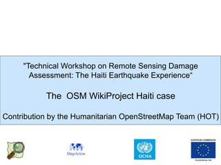
  • 1. "Technical Workshop on Remote Sensing Damage Assessment: The Haiti Earthquake Experience“ The OSM WikiProject Haiti case Contribution by the Humanitarian OpenStreetMap Team (HOT)
  • 2. What is openstreetmap? The openstreetmap “one-liner” A web project to create a free and open map of the entire world, built entirely from volunteers surveying with GPS, digitizing aerial imagery, and collecting and liberating existing public sources of geographic data. = +
  • 3. free and open voluntary map of the world. open contribution. open use. Voluntary, open contributions, open use (CC-SA)
  • 4. OSM core – system components.
  • 5. OSM WikiProject Haiti - snapshot OSM data in SHP & GPS map extracts (Garmin) available day 1; WFS day 2 OSM GPS map extracts used by Search And Rescue Teams – day 1 OSM = roads core data set (OCHA Core Data sets check-list). OSM data used as SHP, WFS, WMS in responders mapping production environment 26 hours to get imagery released and 48 hours to get 1st imagery loaded on the OSM platform available for tracing
  • 6. Tracing over Satellite imagery. Free, Purchased, Negotiated Right to access & use raw imagery for deriving data within OSM obtained though crisis mapping list. Raw imagery processed into tiles to be made available in OSM editors (potlatch, merkator & josm) Thousands traced over base map features, humanitairan features (camps) & also damages
  • 7. Cooperation area * Evaluating OSM tracing against UNOSAT/ WB/ JRC & UNOPS data * Methodology ** Follow up with this workshop ** Defining articulation with remote and field OSM work * Streamlining/ ensuring access to imagery ** Short term: allow imagery for current needs in Haiti, other crisis (Chile, Uganda, Sahel) or in support to data disaster preparedness or development work ** Mid term: agreement to make of OSM or OAM an actor to feed humanitarian actors satellite imagery based geodata products
  • 8. OSM editors JOSM and Potlach JOSM and Potlach are the two main editors used for creating and modifying OSM data. Potlach is a simple web interface, accessible to users on the OpenStreetMap website. JOSM is a more advanced tool, is a Java application so doesn't require consistent internet access and can run on any operating system.
  • 9. Database import: Public domain or CC-SA. Haiti: Base map layers (MINUSTAH/ CNIGS), Health Facility (WHO), Haiti damage assessment: ITHACA & UNOSAT vectors…
  • 11. Direct measurements: walking papers Combined, GPS and Walking Papers can be used for rapid surveying and ground truthing. Walking Papers allow users to print out small sections of the OSM map. In the field, these paper maps can be used to draw new features, annotate existing data, and take notes that will help with the import of GPS data. Icons in each of the corners and a unique code for each Walking Paper let users scan the paper and upload to OSM so the notes can be viewed in an editing environment. http://walking-papers.org
  • 12. Direct measurements: Questionnaires. Based on OSM Humanitarian Data Model (HDM) and humanitarian data models (Ex UNSDIT) UNSDI-T v2 Formulaire de collecte de donnees Nom de l'ensemble du segment: Source ID (UNJLC use only): Routes Obstacles et Ponts Autres Surface Condition Ouvert pour quels vehicules? (saisir Passable par quel(s) vehicule(s)? Du GPS Waypoint Au GPS Waypoint GPS Waypoint Type d'obstacle (saisir une valeur) GPS Waypoint Description (saisir une valeur) (saisir une valeur) les valeurs pertinentes) (saisir les valeurs pertinentes) Mauvaise (<40 kph) Bonne (>40 kph) Pont Camion Lourd (<20 T) Camion Leger (<10 T) 4x4D (<3.5 T) Gue Culvert Camion Lourd (<20 T) Camion Leger (<10 T) 4x4D (<3.5 T) Boue Camion + Remorque (>20 T) Autre (preciser in notes) Camion + Remorque (>20 T) Route Pave (Asphalt or Bitume) Dirt/ sand Moto traffic non-motorise Road Block/ Barrage routier traffic non-motorise Debris/Epaves Lignes Electriques a terre Inondation Moto Neige/ Glace Avalanche/Neige Landslide/Mudslide Route endommagee Restriction au traffic Mines/ Munitions non exploses Gravel/Murram Checkpoint-officiel Checkpoint-non officiel. Saisir le Saisir le numero du Saisir le numero du Saisir le numero numero du Utiliser ces champs pour saisir (i) Nom de Rue ou de Route ou autre waypoint du GPS. waypoint du GPS. du waypoint du waypoint du information textuelle relatives aux segments de route evalues sur le Exemple: Exemple: GPS. Exemple: GPS. Exemple: formulaire Route (formulaire de gauche); (ii) saisir des informations 001 017 017 017 ponctuelles importantes (villages, intersections majeures, etc).
  • 13. Humanitarian Data Model (HDM) The Humanitarian Data Model seeks to reconcile schemas from many humanitarian response agencies, all of which are based on field requirements. When possible, it matches Humanitarian attributes to existing Map Features in OSM to make imports to and exports from OSM to response agencies more straightforward. Extract-Transform-Load (ETL) tools will smooth this effort From the HDM the following will be derived:: * Questionnaires to guide data collection * JOSM Presets to guide editing * Cartographic symbols to guide rendering
  • 14. Cooperation area – data modeling Making the OSM data modeling work over the HDM in Haiti and in SDI projects (UN, WB) on damage assessment interoperable and articulated to the efforts towards a standardized data model for damage assessment by main actors of this field (UNOSAT, JRC, World Bank).
  • 15. OSM/ HOT Haiti Field Mission – 21-March/ 10-April Background elements. Joint OSM-MapAction Mission funded by ECHO, supported by IOM (logistics, workplace) & CNIGS, OCHA (coordination) = Goal = Support the use of OSM on the ground to make sure it stays relevant and useful into the recovery, reconstruction, development of Haiti. = Audience = * groups of UN and international responders, * the Haitian government, * Haitian civil society = Activities = == Training == * Surveying with GPS/Walking Papers * Editing * Ensuring an efficient use of OSM resources by the responders == Surveying == == Community mapping project (slum) - feasibility study == == Ad hoc support work == Humanitarian Data Model and data imports
  • 16. OSM/ HOT Haiti Field Mission – 21-March/ 10-April Outcomes *Training activities 60 persons trained from main UN Agencies & NGOs, Centre National D’Information Geomatique et Spatiale (CNIGS) – the Haitian National Mapping Agency, Development projects (WINNER & DAI) and groups form Haitian civil society (Forum des communautes de Cite Soleil, INURED), *Surveying activities: Jacmel, Leogane with IOM & CNIGS staffs seconded to IOM * Data modeling & data imports
  • 17. Cooperation areas * Evaluating OSM tracing against UNOSAT/ WB/ JRC & UNOPS data * Data modeling: linking efforts towards a standardized data model for damage assessment with the OSM HDM work in Haiti and in SDI projects (UN, WB) * Methodology ** Follow up with this workshop ** Defining articulation with remote and field OSM work * Streamlining/ ensuring access to imagery ** Short term: allow imagery for current needs in Haiti, other crisis (Chile, Uganda, Sahel) or in support to data disaster preparedness or development work ** Mid term: agreement to make of OSM or OAM an actor to feed humanitarian actors satellite imagery based geodata products
  • 18. Humanitarian OpenStreetMap Team (HOT) Core Mission - connecting point between humanitarian and open mapping communities - remote data creation during crisis - collection and organization of existing data sources - deployments to the field possible - distribution point for free data Advocacy, Training and Outreach - mapping parties - speaking, writing, meetings in humanitarian and United Nations technical communities Thinking and Design - promotion of crowd-sourcing and simple web standards for data sharing - technical improvements to OSM and OSGeo in response to field requirements (offline support, verification, format adaptors, multi-master sync..)
  • 19. * WikiProject Haiti http://wiki.openstreetmap.org/wiki/WikiProject_Haiti * Strategy & proposal http://wiki.openstreetmap.org/wiki/Humanitarian_OSM_Team/Haiti _Strategy_And_Proposal * Humanitarian OpenStreetMap Team http://wiki.openstreetmap.org/wiki/Humanitarian_OSM_Team * Contacts nicolas.chavent@gmail.com mikel_maron@yahoo.com