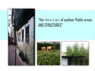
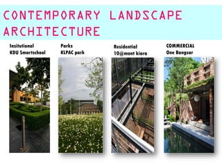
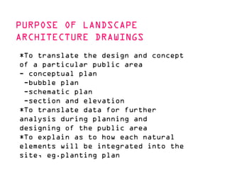
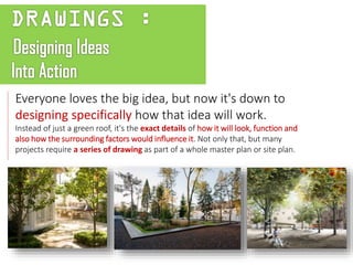
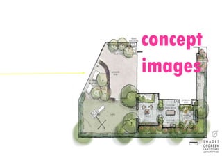
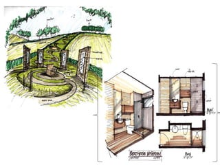
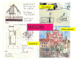
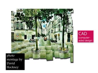
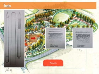
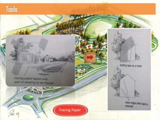
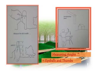
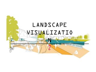
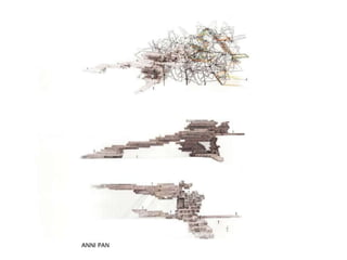
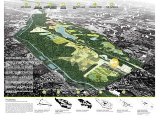
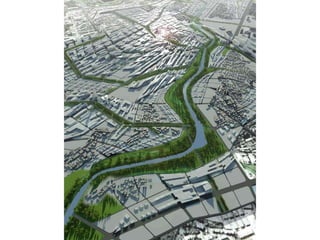
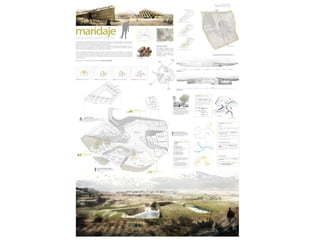
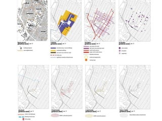
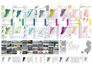
Talking about
Landscape
Architecture
Drawings
TYPES OF
LANDSCAPE
DRAWINGS
history +
evolvement
PURPOSE +
PEOPLE
SITE+
CONTEXT
DEVELOP
MENT
INTEGRATION+
APPLICATION
CONTENTS
1# Understanding landscape
architecture
“the design of outdoor Public areas
AND STRUCTURES”
23 to achieve
environmental
social-behavioral
+ aesthetic outcomes
HISTORY
ANCIE egypt ENGLI
NG SEK SAN
ESTABLISHED
MALAYSIAN
LANDSCAPE
ARCHITECT
CONTEMPORARY LANDSCAPE
ARCHITECTURE
Residential
10@mont kiara
Parks
KLPAC park
Insitutional
KDU Smartschool
COMMERCIAL
One Bangsar
2# PURPOSE + PEOPLE
Purpose of
drawings
Drawing,
is quintessential for the work of
landscape
architects. It is the ultimate tool to
communicate the concepts and designs
behind it.
PURPOSE OF LANDSCAPE
ARCHITECTURE DRAWINGS
*To translate the design and concept
of a particular public area
- conceptual plan
-bubble plan
-schematic plan
-section and elevation
*To translate data for further
analysis during planning and
designing of the public area
*To explain as to how each natural
elements will be integrated into the
site, eg.planting plan
Everyone loves the big idea, but now it's down to
designing specifically how that idea will work.
Instead of just a green roof, it's the exact details of how it will look, function and
also how the surrounding factors would influence it. Not only that, but many
projects require a series of drawing as part of a whole master plan or site plan.
PEOPLE BEHIND THE DRAWINGS
WHOCREATESIT?
LANDSCAPE
ARCHITECTS
WHOUSESIT?
Project
manager +
Site
supervisor
QUANTITY
SURVEYOR +
LAND
SURVEYOR
ARCHITECTS
+
LANDSCAPE
ARCHITECTS
construction+planning+analysing+maintanence
TYPES OF
LANDSCAPE
DRAWINGS
PROCESS OF LANDSCAPE
DRAWINGS
SITE
ANALYSIS
BUBBLE PLAN PLOT PLAN PERSPECTIVES
PLANTING PLAN
LOCA
TION
ORIENTAT
ION
Temperature &
Sun Path
wind direction
SOIL
TYPE +
CONDITI
ON
topogra
phy
vegetation
and natural
features
Precipitation
&
Hydrology
Infrastru
cture &
Facilitie
s
land uses and
buildings
VIS
UAL
LIN
KAG
ES
locally
availabl
e
resourc
es
SITE
ANALYSIS
bubble plan
plot plan
concept
images
P
l
a
n
t
i
n
g
P
l
a
n
of
Landscape
Plans
+
Drawings
Chia
Sue
Hwa
General Maister
Memorial Park, Slovenia
Ocean View, Rodanthe,
North Carolina
a. SIte &
context
b. development
of drawings
What
is
SITE+CONTEXT?
“The city, the suburbs, and the countryside
must be viewed as a single, evolving system
with nature, as must every individual park
and building within that largerwhole. “
– AnneWhiston Spirn
SITE
*inventory and analysis
*recording
*mapping
CLIMATE
Seasons
Regions
Microclimate
Climate change
LAND
Rail bridge over
the Garden
River (Canada),
showing local
spirit through
graffiti.
Land + Law
Stone &
Soil
Land use
WATER
Water systems
Management
Gro-Wall vertical
garden systems
are on display at
the Landscape
Australia Expo in
Sydney
PLANTS
“I saw that animals were important. I saw that
plants were even more important. I was also
to learn that compared to many of the other
species, we weren't important at all except for
the damage we do. We do not rule the natural
world, despite our conspicuous position in it.
On the contrary, it is our lifeline, and we do
well to try to understand its rules.”
― Elizabeth Marshall Thomas
Cultivat
ion
Cracked Concrete Garden proves
that many plants have a way of
surviving even with minimal
resources. The project took a site
that was previously paved with
concrete and transformed the land
into a true piece of urban wild.
TOPOGRAPHY
Contours
Site survey
< wilderness + nature
built environment
>
Landscape
Character
How
do
landscape drawings
develop?
analytical
observational
conceptual
SKETCHES
“I sometimes think
there is
nothing so delightful as
drawing.”
-Vincent van Gogh
(1853 - 1890)
ORTHO
PROJECTION
scale // plan
// section //
section
elevation
PERSPECTIVE
< hand – drawn
computer-rendered >
3D IMAGES
axonometric
isometric
*sketchmodels
*presentationmodels
Models --------------------------------
CAD
(computer-
aided design)
photo
montage by
David
Hockney
e.g. photo montage /
3D imaging
the world at
your
fingertips
Tools
&
Technique
Tracing Paper
Kneaded erasers
Erasing Shield
Plastic Erasers
tortillion
Stump
Sharpeners
Bridges
Transfer Paper
Mahlstick
Perspective
Jaws
Mirror
Pencil
Extender
ViewFinder
Brush
Lines & Strokes
Lines & Strokes
Hatching and Crosshatching, Stippling, Scribbles, Pressure and Edges
Measuring
<< Eyeballs and Thumbs
Measuring Angles ^
Gridding
Plumblines
Perspectives
One-point perspective and
two-points perspective
Graphic
of
Landscape Drawings
6#REPRESENTING LANDSCAPES:
INTEGRATION AND APPLICATION OF LANDSCAPE
ARCHITECTURE DRAWINGS
How do we graphically
represent the
enviromentally dynamic,
ever changing social,
cultural and political
landscape?
LANDSCAPE
VISUALIZATIO
N
2
2 Landscape architecture has
undergone numerous shifts of
representation over the past
several decades. This was a period
where current technological context
allows the collobaration of various
choice of medium and drawing
typology to reflect the intended
nature of the site.
6 To convey a sense of atmosphere and
seasonality and to communicate design
proposals through a range of
drawings. It is important to consider
how the drawings operate as
representations of space.
RHODE ISLAND SCHOOL OF DESIGN
Landscape is not a concrete definition, but a strong
foundation that is a flexible idea encouraging you to
explore and define through your own unique pursuits.
The studio focuses on the process of critical making and
exploring the dynamic, spatial, and environmental elements
specific to the medium of landscape architecture.
Powerpoint Presentation - Landscape Drawings

Powerpoint Presentation - Landscape Drawings