
Recommended
More Related Content
What's hot
What's hot (20)
Viewers also liked
Viewers also liked (20)
Similar to PhotoVoice Final 7-29-11
Similar to PhotoVoice Final 7-29-11 (20)
PhotoVoice Final 7-29-11
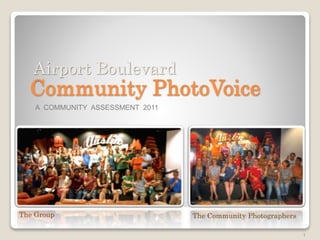
- 1. 1 Community PhotoVoice The Group The Community Photographers A COMMUNITY ASSESSMENT 2011 Airport Boulevard
- 2. 2 What is PhotoVoice? Your neighbors and local business owners came together and took photos of what they consider to be the good, the bad, and the ugly about Airport Boulevard. They wrote brief descriptions for why the photos matter to them and collectively decided which photos and words might create the most compelling presentation of the community’s interest in Airport Boulevard redevelopment. This presentation is intended to help you continue the conversation about Airport Boulevard with your neighbors, church groups, employees, and anyone else you may know. Location of All Photos
- 3. The Purpose of PhotoVoice Promote discussion about what you think is important for Airport Boulevard Prepare you for the Vision and Design discussions Assessment (Spring and Summer 2011) Mapping current conditions - Stakeholder and other meetings Vision (Summer and Fall 2011) Define goals and opportunities - Public workshop and outreach Design (Fall and Winter 2011) Design charrette - Illustrative master plan - Transportation Corridor Study Code (Spring and Summer 2012) Form-base code – Regulation plan – Development standards Action (Fall 2012 and Beyond) Implementation plans – Public Investment – Private development 3 You are here
- 4. Discussion ThemesThe group discussed themes to help them create ompelling slides. A presenter could integrate these themes into their presentation. Airport Boulevard: Feels like a wasteland, disjointed and unsafe Strongest asset is its unique local businesses Has natural assets that need to be improved and maintained Needs to become accessible to all users and connected to its neighboring communities Needs a unifying public or civic vision of its unique character 4
- 5. Airport Boulevard assets, things we celebrate and want to keep. Community PhotoVoice: THE GOOD 5
- 6. Community-oriented redevelopment is important for the health of Airport Boulevard • Local business • Within mixed-use buildings 6 Photographer: Tiff Ting
- 7. Who doesn't love Lammes Candies? • A landmark • Local business There should be better connectivity from businesses to the surrounding neighborhoods Photographer: Kim Johnson 7
- 8. Photographers: Cindy Black, Al Breitenbach 8 The New Airport Boulevard should make provisions for Quality Seafood • Thriving local business • Fun for Family
- 9. Photographers: Cindy Black, Jill Csekitz 9 Unique local businesses should be promoted along the new Airport Boulevard • Seedy-chic, funky, unique to Austin • Established, thriving • Need improved infrastructure/connectivity
- 10. House Pizzeria represents everything desirable about a local business Photographer: Charlotte Harris 10 • Successful repurposing of a building • Attractive design including shady outdoor spaces, rear parking, etc. • It's local, environmentally conscientious, and good food
- 11. • Obsolete buildings and use of land • Design should resolve parking, impervious cover and connectivity for this type of location Photographers: Tony Velasco, Al Breitenbach, Melissa Martinez Unique, landmark local businesses that are important to keep, but . . . 11
- 12. • Good “pocket” businesses are opportunistically filling small spaces • There can also be competing demands for public rights-of-way and land uses Photographers: Tony Velasco, Jenny McWilliams, Vanessa Gelvin, Kim Bernson Airport Boulevard is a complex place 12
- 13. Airport Boulevard should welcome art and invite play Photographers: Sandra Calderon, Kim Davis, Jessica Galloway 13 • Support creative use of existing opportunities • Create new opportunities for community spaces for play, art & civic activities
- 14. 14 Photographers: Al Breitenbach, Jill Csekitz, Kim Johnson, Jenny McWilliams • Support purple martin and bat populations • Enhance and maintain the greenway as green space • Create and maintain a trail on the entire greenway Airport Boulevard has natural assets to protect and enhance 14
- 15. Photographer: John Schwoeble Could the entire greenway have these? 15 • Good covered seating areas and a shade trellis • Manicured drainage channel • Colorful pedestrian walkway • Planted vegetation • Buried utilities
- 16. Airport Boulevard does have some pleasant walkways • The area is well maintained • The sidewalk is wide and not right on the street • Trees can provide shade Photographers: Kim Johnson, Vanessa Gelvin 16
- 17. The bike lane and sidewalk separated from the road • Feels safe • Invites use Photographer: Kim Johnson 17
- 18. 18 Airport Boulevard is not a shady place Photographer: Charlotte Harris • These trees were planted as a community effort to provide much needed shade • Trees can also hide the ugly wires and poles
- 19. 19 Things that we want to improve: safety, connectivity, shade, better use of land. Community PhotoVoice: THE BAD
- 20. Most of Airport Boulevard is hostile for pedestrians • Road design and a lack of coordinated signalization increases frustration and potential for conflicts Photographer: Tony Velasco 20
- 21. Photographer: Lisa Wright, Sebastian Wren 21 Many places along Airport Boulevard are not pedestrian friendly, accessible • No sidewalk/ curb cuts without sidewalks • Still enough people use them to create a desire line • Need to complete the sidewalks • Need shade
- 22. Complex Intersections: Does this really feel safe and inviting? Photographer: Melissa Anderson 22 • Incomplete crosswalks, poor sidewalk connectivity, a train crossing, and a second street/intersection with 50 feet of each other. • Yet drivers, pedestrians, bicyclists, elementary school children have to negotiate this intersection.
- 23. Photographer: Jill Csekitz 23 • Too many lanes of traffic, too wide, cross walk lights are too short • Confusing intersection even for motorists The Lamar / Airport intersection is difficult for everyone
- 24. • The redesign MUST keep Koenig from being a barrier to people • Connectivity across Airport to neighborhoods is a critical issue Photographer: Sebastian Wren 24 Koenig Bridge is an intersection designed for cars only
- 25. Photographer: Kim Bernson • Great new bus pad • BUT: No sidewalk • No crossing Connectivity is Important 25
- 26. It’s a sidewalk, really? • Redevelopment should address new design and needed improvements • It should also address maintenance Photographer: Bryan Dore 26
- 27. Can we solve several problems at once? • Need to create safe/attractive pedestrian facilities • Need to address storm water management • Maybe one solution can integrate both solutions Photographer: Vanessa Gelvin 27
- 28. Is not well-kept, uninviting, and potentially unsafe • Need a workable maintenance program Photographer: Melinda Bilich 28
- 29. Need connectivity from neighborhoods to Airport Boulevard, includes crossing the train tracks especially for pedestrians and bicyclists Photographer: Sebastian Wren 29 We can’t get there from here
- 30. Airport Boulevard redevelopment should create jobs • Redevelopment should create opportunities to work for all types of workers • Add to the health of the local economy Photographer: Tony Velasco 30
- 31. • Need good lighting throughout corridor for all users • Particularly need lighting around businesses expecting people to walk Photographer: Elizabeth Quintanilla 31 Airport Boulevard is dark, inhospitable and unsafe at night
- 32. • It's sad that these oaks are some of the oldest trees along Airport Boulevard • Need to preserve the trees that are already established and add more Photographer: Jenny McWilliams 32 Airport Boulevard needs more trees, more shade!
- 33. 33 Things to improve, that also have an aesthetic role in Airport Boulevard. Community PhotoVoice: THE UGLY
- 34. The Sea of Asphalt Photographer: Damon Howze 34 • Need more aggregate/shared parking • Need better use of land • Design for less impervious cover • Design for more green, more shade
- 35. Photographer: Sarah Talkington 35 Small things will matter • Exposed dumpsters junk up the place • When the truck comes to pick it up, the small pieces of trash (not in bags) placed in the dumpster by pedestrians are dispersed by the wind along the boulevard
- 36. Businesses need to be good neighbors Photographer: Cindy Black 36 • This used car/tire yard pays no attention to its right of way • Barbed Wire: Appears that they are more interested in keeping people on foot out than inviting people in
- 37. Several ghost "towns" haunt Airport Boulevard Photographers: Tiff Ting, Charlotte Harris, Bryan Dore 37 • "For lease" signs and empty storefronts should not be the norm for the sake of the local economy and neighborhood morale • Redesign land use and “seas of asphalt” into places that can thrive
- 38. Crass commercial dominates the public interest Airport Redevelopment should balance: • Rampant impervious cover • Cars stacked on top of each other • The lack of a designated sidewalk • The signage • The lack of vegetation or shade • The overhead power lines • The misuse of public property Photographers: John Schwoeble, Jessica Galloway, Lisa Wright 38
- 39. Do we really want a place where art is overpowered by clutter? Photographer: Jenny McWilliams 39 Need to work with public utilities to see if power lines can be hidden below ground
- 40. So much is wrong in this picture • Ugly, overpowering billboards • Unattractive, single purpose use of land • Poor pedestrian connectivity Photographer: Sarah Talkington 40
- 41. This slide says it all Photographer: John Schwoeble 41 • There is a lack of a cohesive public use between Airport Boulevard and the rail road tracks • Less than attractive implementation of power lines, intersection, billboard signs • Need a commitment to maintenance
- 42. 42 Where to go from here? • Get ready for the Vision Workshop in September • Does Airport Boulevard have portions (zones) that share common characteristics? • How should the roadway function and how do car lanes, bike lanes, sidewalks, trees, etc fit together in the rights of way? • Where are the best opportunities for redevelopment? • What are the priority public infrastructure investments? • What else is important to you? • To give or share this presentation with your neighbor, employee, or church group you can get the PowerPoint at Airportboulvard.com • If you want help or to let us know what your learned, email us at AirportBoulevard@ci.austin.tx.us
- 43. 43 Join the conversation www.AirportBoulevard.com If you LIVE WORK SHOP PLAY STUDY INVEST DRIVE WALK RIDE or belong on Airport Boulevard You can help make it better.
Editor's Notes
- "Tamale House hasn't changed one bit over the last decade since I've been coming here. That's what makes it so great!" The food is tasty and affordable.
- Want: family friendly, good neighbors, successful businesses Want: Safe access for all users. Want: design to resolve parking issues while reducing requirements for a lot of land use as parking.
- This should be a model for small pockets along the greenway Maybe allow food vendors and adjacent local businesses co-located at these transit stops, pocket parks, etc.
- A row of trees on both sides of the sidewalk provides even better shade Need to strengthen connectivity between walkways and stores/businesses.
- Need these all along the corridor Need to strengthen connectivity between walkways and stores/businesses.
- Intersections are a problem Long distance between protected crossings No crossing at transit stops. Poor operations and traffic flow, e.g., no synchronized signals. Wide road, with fast moving traffic. Poor crossing connectivity. Auto-only design and operations.
- Directly across from Tamale House, a successful local business with parking problems.
- Create safe pedestrian/bicycle access under the bridge and along both sides of the Koenig bridge
- Also . . . No shade!
- People are tell us where they need to walk, desire lines indicate use.
- We should also like at opportunities to remove/reduce billboards, Improve lighting and safety. Increase shade and remove overhead lines
- When we design for parking as if everyday is Christmas, this is what we get. There is actually a creek under this parking lot.
- Is that really a sidewalk?
- Participant absent
- Who saw the bus stop before the Billboard sign? Land use: warehouse building and cars, lots of cars