Download as PDF, PPTX

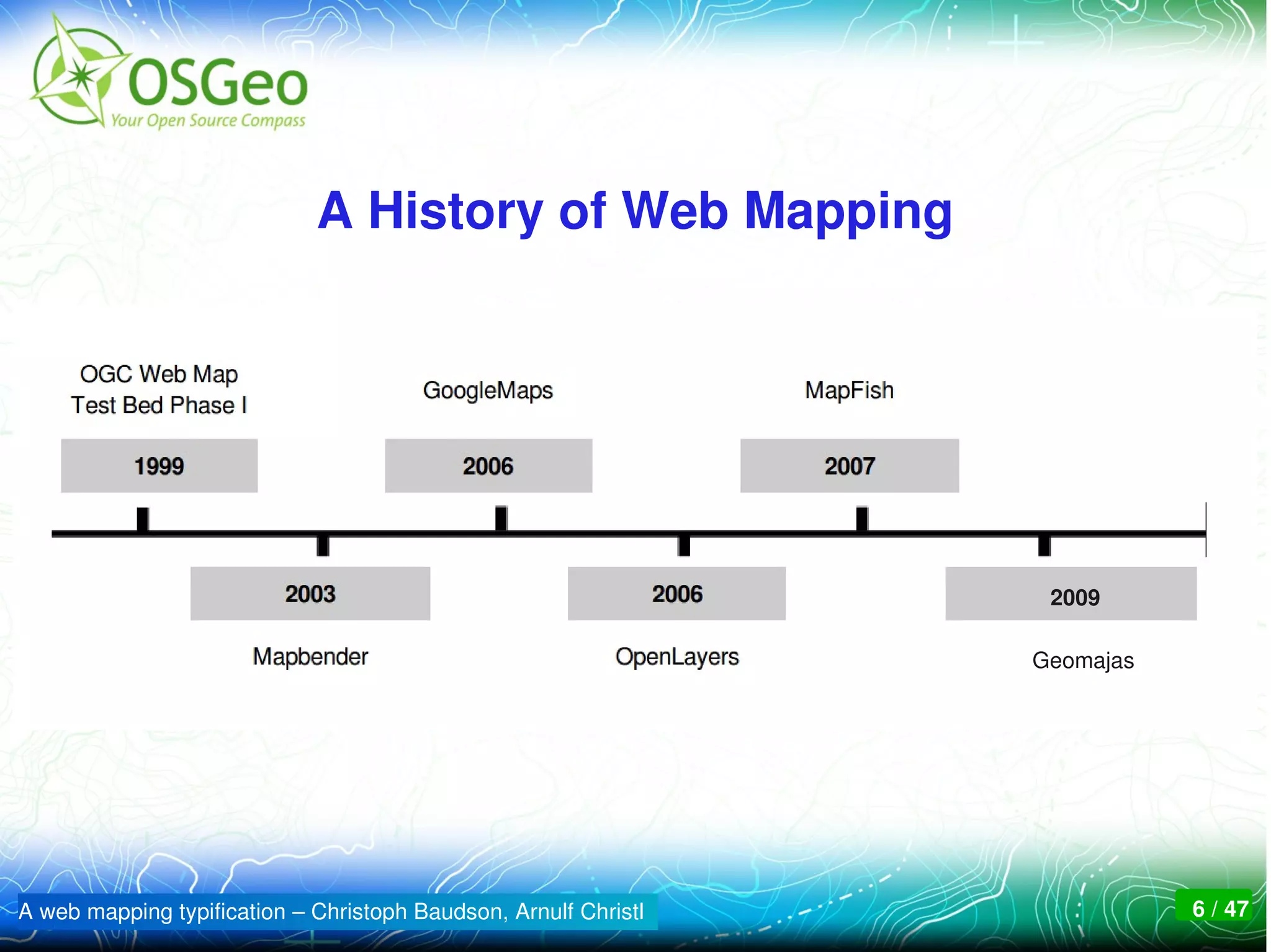
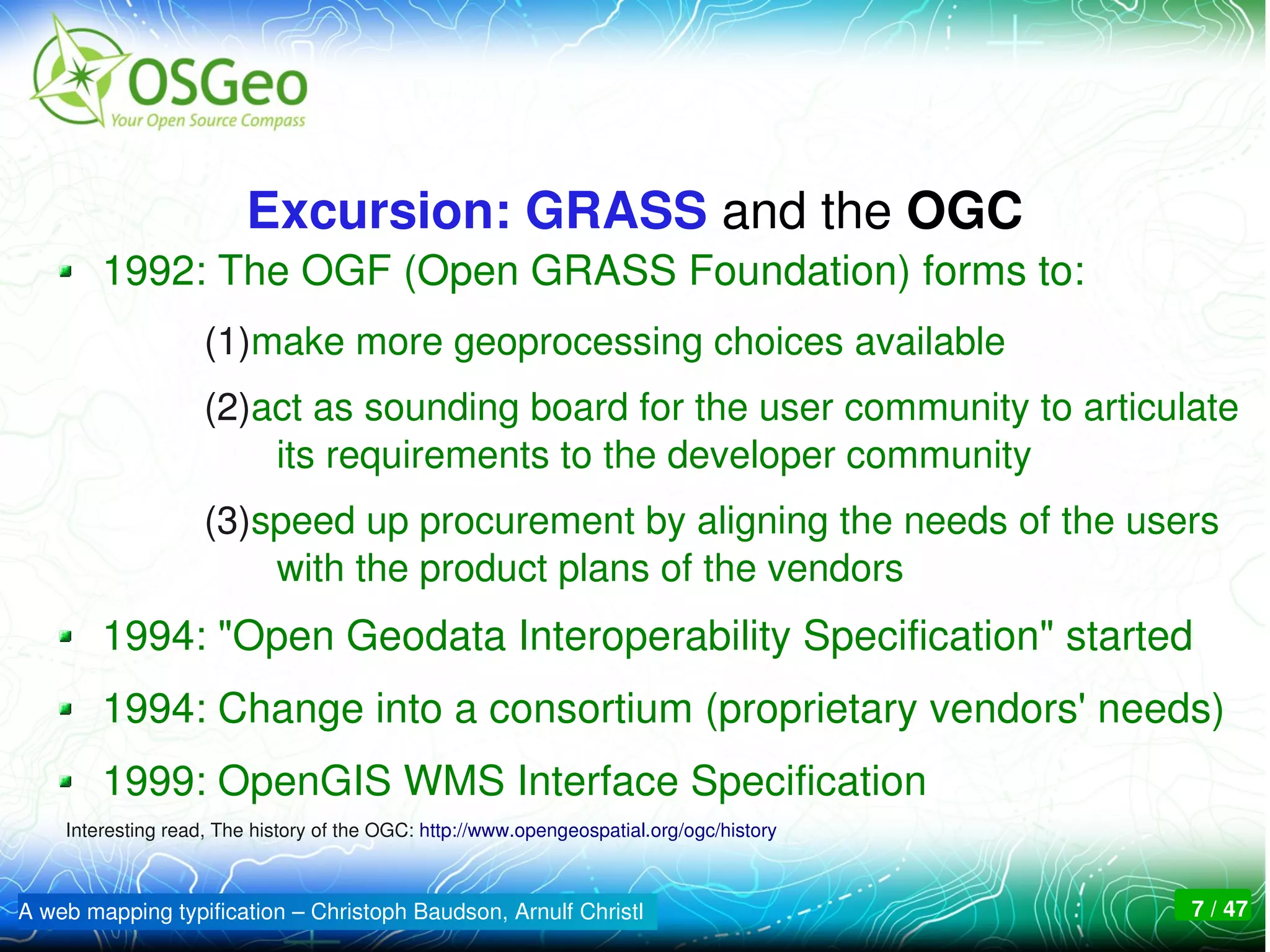
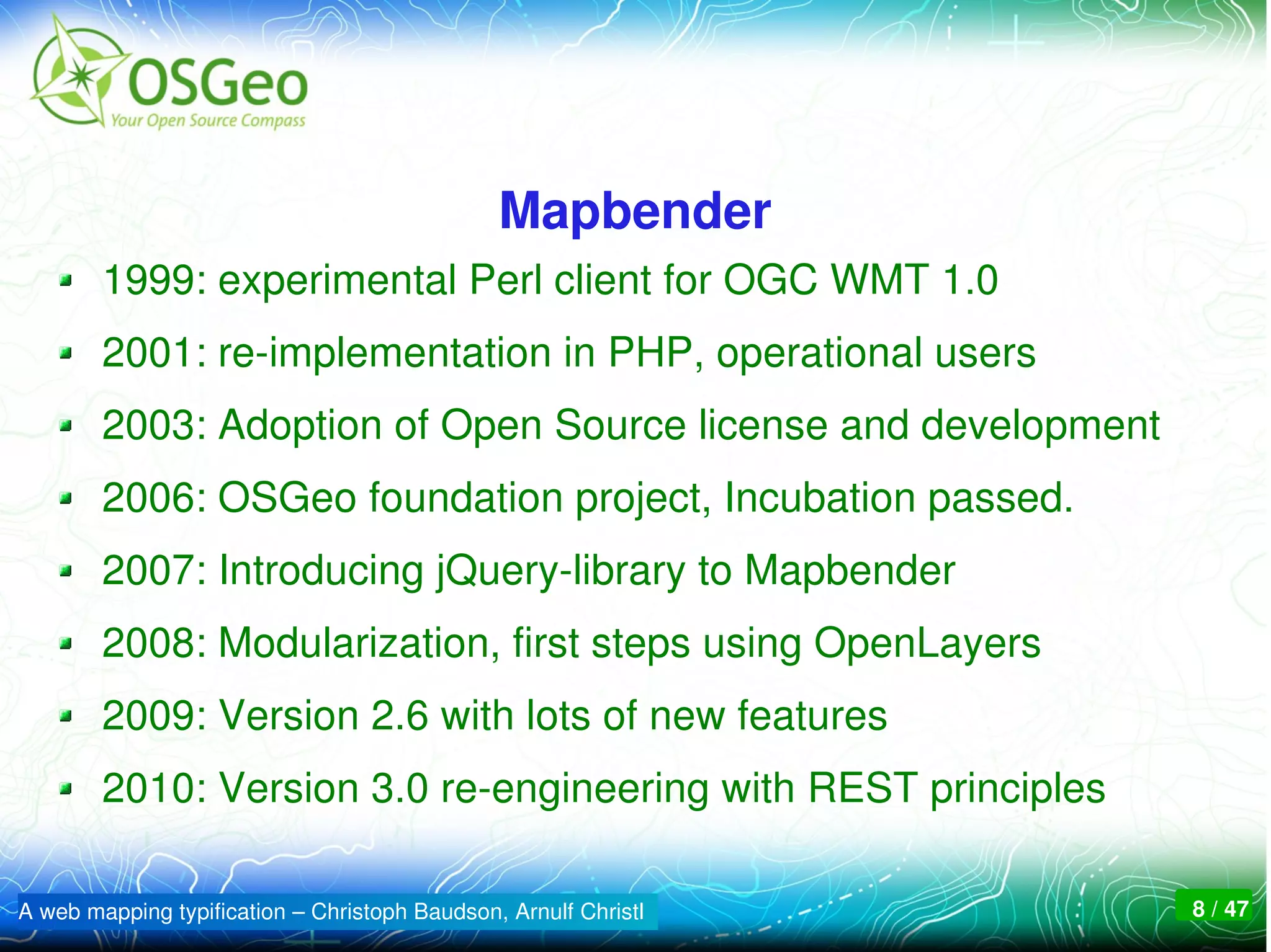
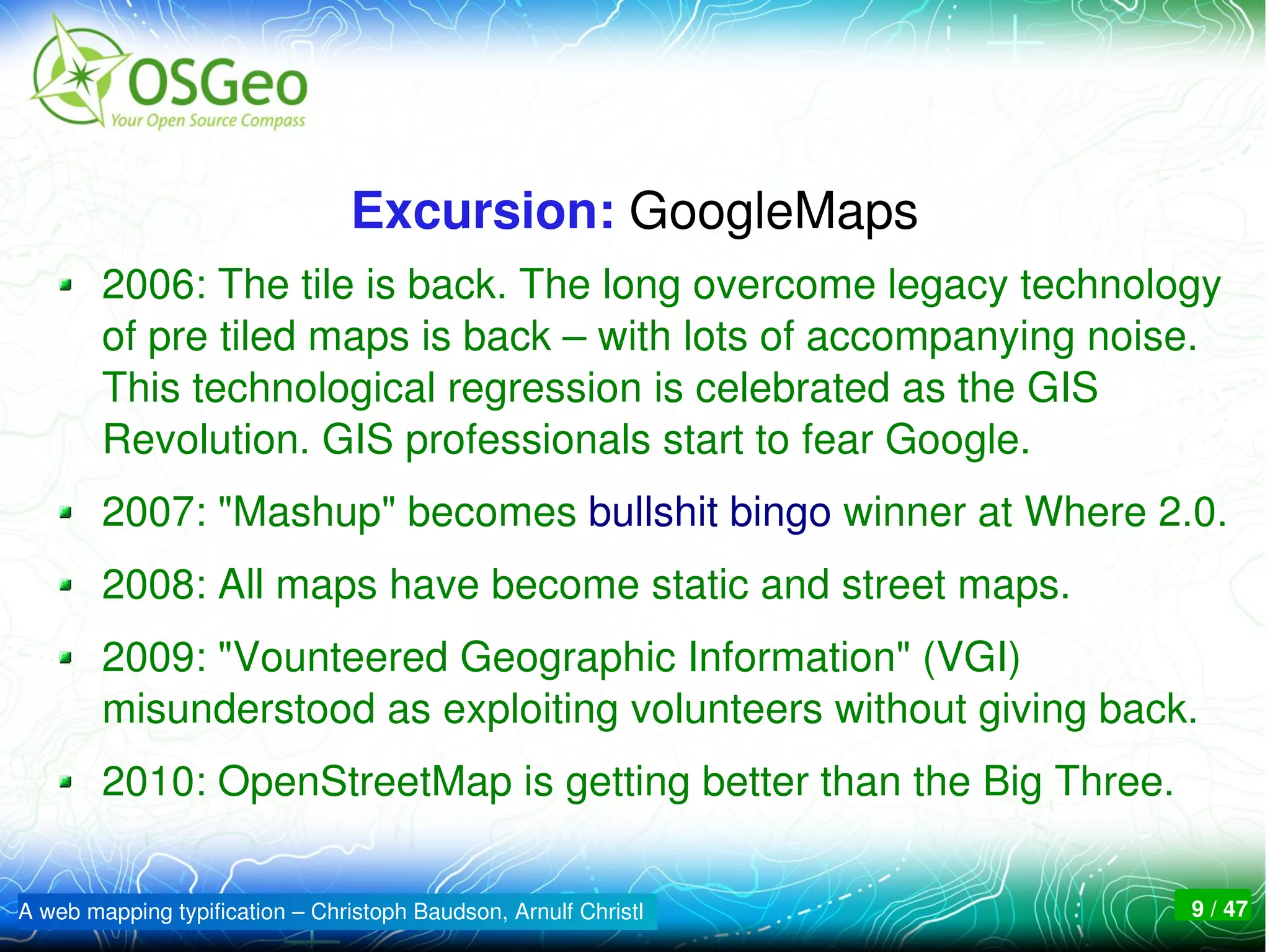


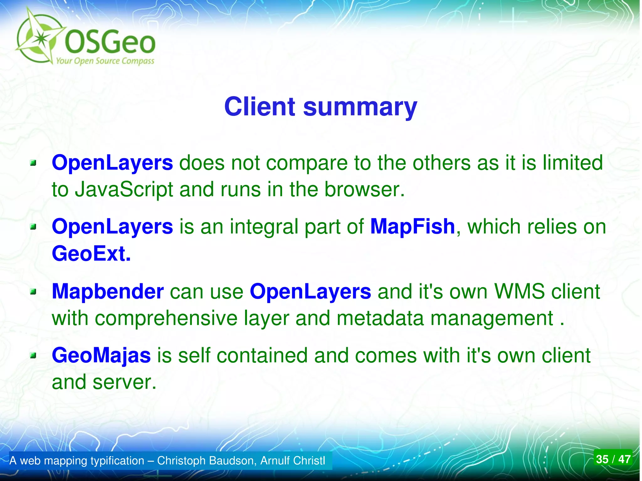
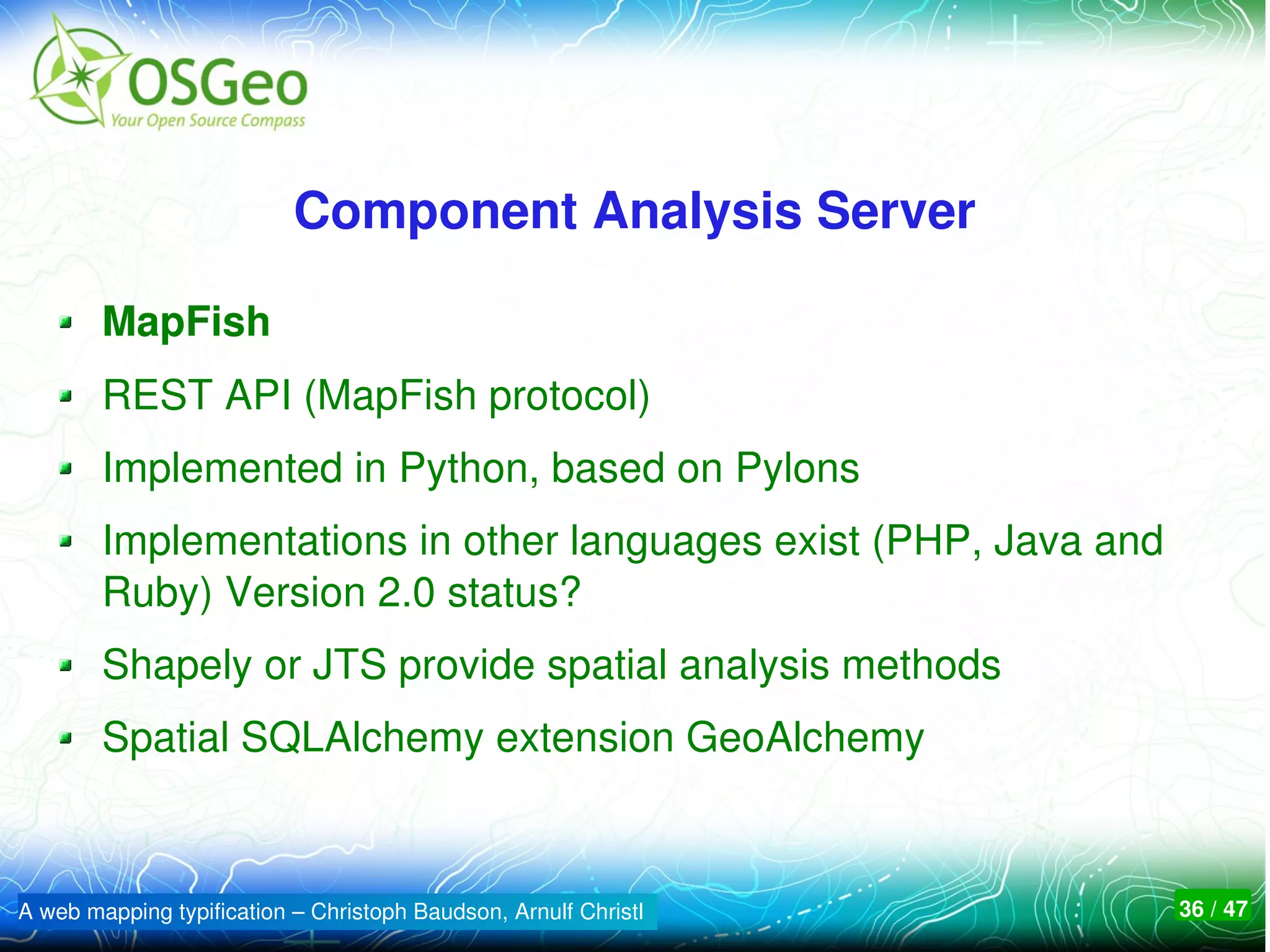
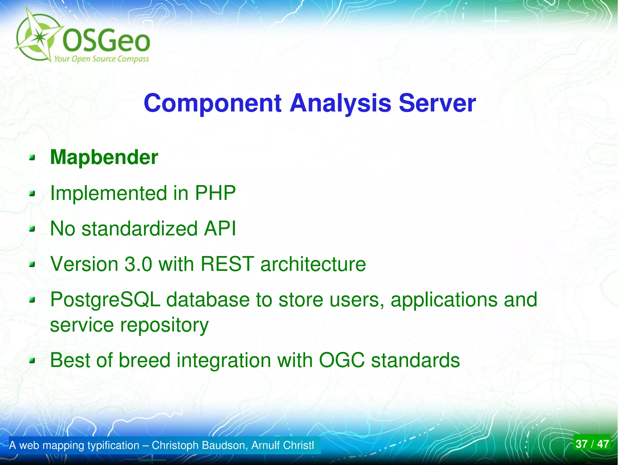
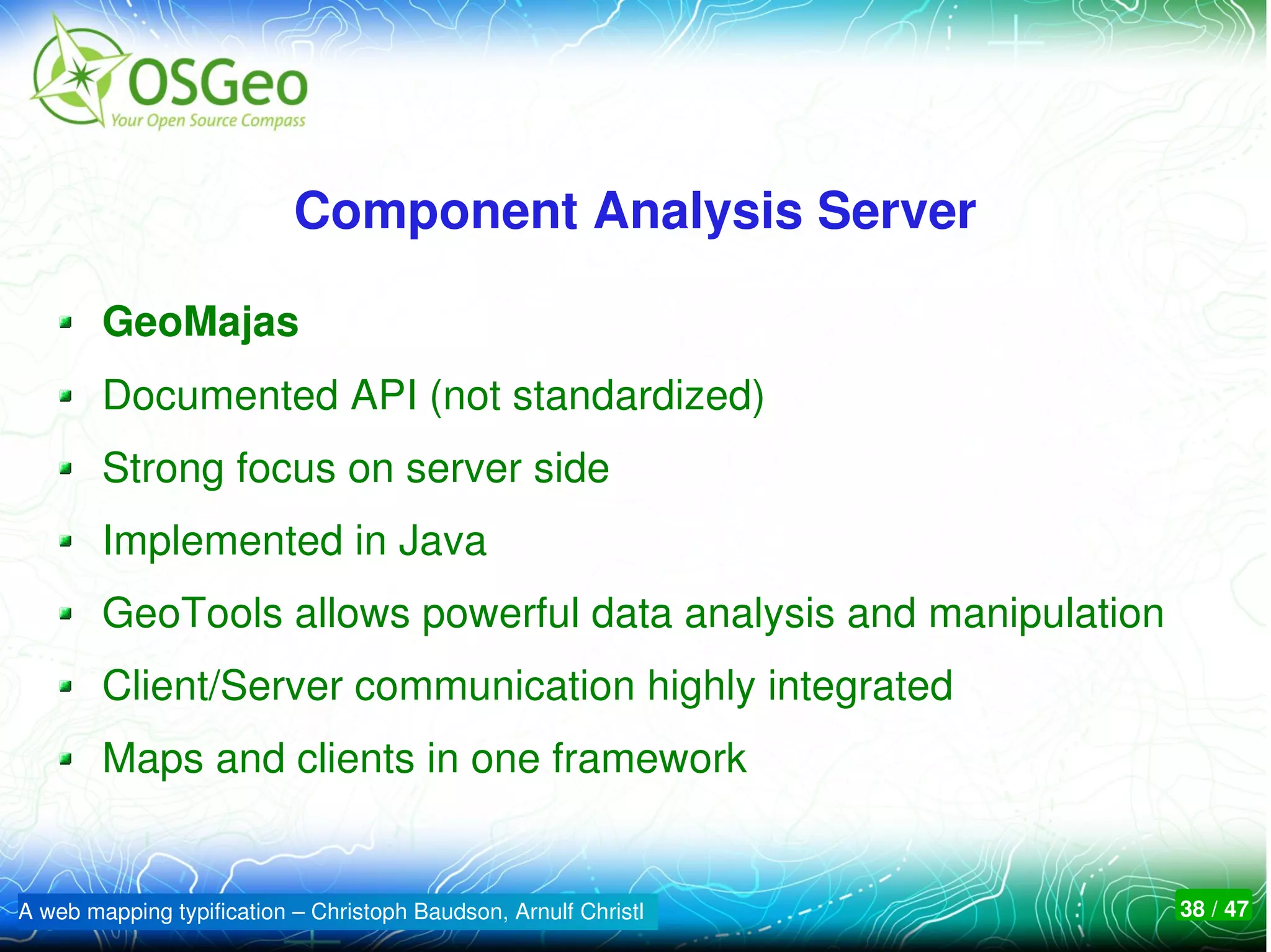

The document presents an overview of four prominent OSGeo web mapping projects: Geomajas, OpenLayers, Mapbender, and MapFish, highlighting their functionalities and roles in web GIS. It emphasizes the importance of diversity and competition within the open-source community while providing historical context and development milestones for each framework. Ultimately, it aims to guide users in selecting the best option suited to their needs for spatial data infrastructures.


