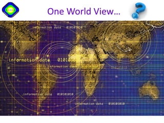
One world view
•
2 likes•407 views

The document discusses different map projections and how they distort representations of land masses and continents. The Mercator projection, commonly used, exaggerates the size of land masses farther from the equator like Greenland and distorts the relative sizes of Africa, South America, and India compared to Europe and North America. Alternative projections like Gall-Peters provide a more proportional representation of continental land areas but still involve some distortion. The document argues there is no single objective world view and representations can reflect different perspectives based on factors like population, resources, languages, and religions.
Report
Share
Report
Share
Download to read offline

Recommended
Ch 1, key issue 1
Maps are a key tool used by geographers to identify regions and analyze their content. There are different types of maps that serve various purposes and distort representations of locations, distances, sizes, and directions to different degrees depending on their projections. Reference maps show absolute locations and are used for navigation, while thematic maps show relative locations and tell stories about distributions of attributes. Key aspects of maps include their scale, projections, grid system, symbols, and how they can show bias depending on their purpose and construction.
Siddharth Hande | GIS/critical GIS presentation
Maps are political artifacts that shape power structures and social realities rather than merely representing geographical features. They reflect the views of dominant groups and often make some things visible while obscuring others. New mapping technologies now allow for "counter-mapping" by marginalized communities to challenge dominant narratives. Community mapping projects can help give voice to local perspectives and knowledge. GPS and GIS tools facilitate more participatory and collaborative mapping approaches.
Tool Time - Maps
The document provides an overview of key concepts related to maps, including their basics and uses, geographic perspectives they provide, scales, essential map elements, different types of thematic maps, and common map projections. It discusses how maps show location, features, and distribution on Earth's surface. It also explains how scale relates to the ratio between distances on a map and in reality, and defines common map projections like cylindrical, planar, conic, and interrupted projections.
Maps
Maps are flat drawings that represent specific locations and show where things are in relation to each other. They have several key components, including a title, compass rose, scale, legend, and grid. Maps come in different types - political maps show borders and boundaries, physical maps show natural features, and thematic maps focus on specific data like population or climate. Overall, maps help people understand locations and distances between places.
Reading a map
Gives a brief overview of maps and globes and their differences. Ideal for 5th Grade. May be used by others also.
Population density
The document discusses factors that influence the uneven distribution of populations around the world. It provides 6 photos of places with varying population densities and physical/human features and asks the reader to name 2 densely populated countries, 2 sparsely populated countries, and whether most people generally live inland or along coasts. The reader is also asked to identify physical/human factors influencing population densities in each photo and identify the odd one out among the photos.
GEOGRAPHIC SKILLS: DOT MAPS
GEOGRAPHIC SKILLS: DOT MAPS. A dot distribution map, or dot density map, is a map type that uses a dot symbol to show the presence of a feature or a phenomenon. Dot maps rely on a visual scatter to show spatial pattern.
Africa's geography
This document discusses geography concepts related to Africa and asks students to compare relief maps of Africa and Connecticut using the five themes of geography. It prompts students to think about where they would choose to live and what questions they have about Africa's geography, including its rainforests, rivers, mountains, deserts, and grasslands.
Tino Rangatiratanga: Students leading the learning
‘Ma whero ma pango ka oti ai te mahi’
(With red and black the work will be complete)
The Newmarket School student leadership focus is whakawhanaungatanga. Whakawhanaugatanga is everyone working together to support each other and there is no one right way of doing something. This session highlights the use of modern learning tools to step-up a school ‘Students as Leaders’ initiative. Newmarket School continues to pride itself on having a strong student leadership programme that focuses on cultural responsiveness and acknowledges the students as Taonga. Senior students take on various leadership roles in the school, focusing on collaboration, empowerment, coaching, and growing self-efficacy. Students and parents have indicated that receiving a Newmarket School Leadership Badge is a highly prized acknowledgment of capabilities. Newmarket School’s Leadership Programme is a means for students to embody the core competencies and develop manakitanga. This programme values success and benefits all.
In order to grow the leadership programme and to develop greater student ownership and efficacy students have developed a personalised leadership passport. This exciting step required students to document and receive feedback and utilises digital tools. As school kaitiaki the students are sharing their leadership initiatives with a wider community and collaborating with others in their multifaceted leadership roles and projects.
In this workshop the history of the student leadership programme will be shared, cultural responsiveness discussed, and the use of digital literacies to enhance student engagement that provide a platform for making connections and collaborations. Videos will be shown of student learning in leadership, in particular how they problem-solve and collaborate on aspects of their leadership work. Evidence of learning as a social activity will be shown. The use of a variety of multimodal tools enhances a widely valued programme and provides an opportunity for the student leaders to showcase their gifts and talents.
Participants at this workshop will learn about the key aspects of developing a rich leadership programme, such as:
· Systems for managing a leadership programme including flexible approaches to learning
· Student mentoring and coaching at multi-levels and have their needs at the centre of their learning
· Collaboration and dissemination of learning to explore elements of good learning design
Noo wenei pakiaka ka tupu e rakau kaha. ‘From these roots shall strong trees grow.’
Mmx maio 2013 - português - vfinal
O documento fornece informações sobre os ativos de mineração de ferro e logística integrada da MMX no Brasil. Em três frases:
A MMX possui ativos de minério de ferro de alta qualidade no Brasil, incluindo as unidades Serra Azul e Corumbá, com capacidade atual de produção de 8 Mtpa e planos de expansão. A empresa desenvolveu o Superporto Sudeste no Rio de Janeiro, com capacidade inicial de 50 Mtpa e potencial para 100 Mtpa, para escoar a produção de minério de
Frigo conservación de fruta y sistemas de pre enfriado
1) La fruta experimenta una serie de procesos desde la cosecha hasta la venta para garantizar su calidad, conocido como cadena de frío. 2) La primera etapa, el pre-enfriamiento o enfriamiento rápido, es vital para disminuir rápidamente la temperatura de la fruta hasta 0°C usando principalmente túneles de aire forzado. 3) Una vez enfriada, la fruta se almacena en cámaras climatizadas a 0°C para mantener su calidad hasta la distribución.
Eslam Khamis CV
Eslam Khamis Mahmoud is seeking a career opportunity in quality control to improve his knowledge and skills. He has a Bachelor's degree in Quality Control from Workes University with a grade of Good. His relevant experience includes working as an import supervisor at Alshaya Egypt Starbucks and at factories for Leoni Wiring Systems and Samaya Alaktroncs Egypt Co. He has taken courses in quality management systems, entrepreneurship, ICDL, soft skills and business writing. His skills include communication, teamwork, critical observation, conflict resolution and problem solving.
berns resume
The document is a resume for Bernadette M. Robinson, who has over 15 years of experience working as a medical receptionist and secretary. She has strong interpersonal, customer service, and administrative skills. Her background includes roles at medical offices, a hospital, and other organizations where she scheduled appointments, answered phones, processed medical records, and ensured smooth front office operations. She is looking to join an organization where she can contribute to their success using her experience.
2014.10.13 league of ca cities mtg
Presentation by Maureen Stapleton, General Manager to the League of California Cities on October 13, 2014.
Triblio's Social Selling 101 Webinar
You can watch the recording of this webinar at http://www.triblio.com/blog/social-selling-101-webinar-recap
In this free Social Selling webinar you’ll learn the fundamentals of social selling including:
-How to create a winning social selling strategy
-How to find prospects that are ready to buy
-What social selling tools you should be using
-How to build your professional network & increase referrals
-How to get prospects to reach out to you
-How to drive leads from LinkedIn & Twitter
-How to gather intelligence on your prospects
-How to be stay informed about the latest industry insights
-Build a powerful personal brand & thought-leadership
and lots more….
Are you ready to break your sales records by leveraging social selling?
HIgiene y Seguridad industrial
Este documento describe varios riesgos físicos para la salud, incluyendo ruido, vibraciones, calor, frío, radiación ionizante, gases, humos, polvos y agentes biológicos como bacterias y hongos. La exposición a estos riesgos físicos puede causar daños a la salud como lesiones o incluso la muerte.
The Industrial Distributor of the Future
- The document discusses changes in the industrial distribution market including new competition from B2C companies, changing customer demographics and expectations, increased globalization, consolidation of power from manufacturers to distributors, and advances in distributor technology.
- To compete with B2C companies, the document recommends that industrial distributors take a "content-first" approach that focuses on providing high-quality, consistent product content to allow customers to easily find and understand products online. This includes implementing a product information management system.
- Relationship-based sales are less effective for new generations of online customers, who expect to research and purchase independently online through tools like search and filtering.
Graduação - Administração - Unisinos
Por que estudar Administração na Unisinos?
O curso tem ótima avaliação do MEC, com disponibilidade na modalidade presencial e a distância, e possui interação com o mundo empresarial e organizacional, incluindo o Tecnosinos, parque tecnológico de São Leopoldo.
Além disso, você também pode optar por uma das quatro ênfases disponíveis, contanto com uma metodologia de ensino vivencial, com jogos empresariais, projetos sociais e empresariais, intercâmbios, estudos de casos, oficinas e visitas de estudo.
Faça o curso de Administração na Unisinos!
Notas Conceptuales del Manejo por ambientes y el manejo sitio específico: exp...
Notas Conceptuales del Manejo por ambientes y el manejo sitio específico: exp...Gabriel Vazquez Amabile
Notas Conceptuales del Manejo de la Agriculutra por ambientes
y el manejo sitio específico; experiencias de Fertilización Variable en suelos someros" .
Presenacion realizada en Dolores, Republica Oriental del Uruguay en el marco del Taller: “Diagnóstico sobre maquinarias y técnicas para la agricultura de precisión: siembra y fertilización a tasa variable según ambiente.CARLODELACRUZ CV
Wenceslao Carlo D. Dela Cruz has over 25 years of experience in materials management roles for various construction projects around the world. He holds a Bachelor's degree in Business Administration majoring in Accounting. His experience includes roles as a General Technical Officer, Material Supervisor, Senior Material Controller, and Material Control Specialist for large-scale LNG and petrochemical projects in Australia, Algeria, Saudi Arabia, and Nigeria.
Presentaciones efectivas en powerpoint
Para crear presentaciones efectivas en PowerPoint, se recomienda mantenerlas sencillas con texto grande y claro, usar ilustraciones que sean relevantes sin distraer, y colores que complementen el contenido pero no lo sustituyan. Además, es importante practicar la presentación ante otros para perfeccionar la fluidez, tono y contacto visual con la audiencia.
What do the public think about climate change?
The document analyzes public opinion surveys on climate change in the UK from 2009-2014. It finds that around 56-57% of the public believes that climate change is real and man-made, while agreement with the scientific consensus has remained stable over the past 5 years. However, climate change is rarely identified as a top priority issue except during extreme weather events like flooding. While renewable energy sources remain popular, opposition to fracking will depend on real-world experiences with the technology.
Neumonia adquirida en la comunidad, NAC
Este documento resume los principales tipos de ruidos respiratorios, incluyendo sibilancias, roncus, estertores, estridor y frotes pleurales. Describe la neumonía adquirida en la comunidad, su epidemiología, clasificación, criterios de diagnóstico clínico y por imagen, y criterios para decidir el tratamiento ambulatorio o hospitalario. Finalmente, presenta las escalas para predecir la gravedad de la neumonía adquirida en la comunidad.
Foda y peyea.bloggerspot
Este documento presenta varias matrices utilizadas para analizar la situación estratégica de una empresa de transporte. Incluye una matriz FODA que identifica fortalezas, debilidades, oportunidades y amenazas. También incluye matrices EFI y EFE para evaluar factores internos y externos, y una matriz de la gran estrategia para proponer estrategias basadas en la posición competitiva. Finalmente, presenta una matriz PEYEA para evaluar la posición estratégica y una matriz de perfil competitivo para analizar la situación frente a competidores.
map_projections_powerpoint3.ppt
The document discusses different map projections and their effects. It explains that maps distort areas, distances, sizes, and directions due to representing a spherical Earth on a flat surface. Common projections mentioned include Mercator, Robinson, Peters, and Miller cylindrical, each with their own distortions. The document advocates abandoning the traditional notion of continents and instead using a regional world map classification that better reflects cultural and historical realities. It notes the College Board uses the Robinson projection in their World History AP materials.
map projections.ppt
Map Projections. In this ppt you will learn how maps are made and how it helps in studying our landforms.
4 3-regional & national geography
This document provides an introduction to the fields of geography and some key geographic concepts. It begins with definitions of geography and describes its subfields such as physical geography, human geography, cartography, and geographic information systems. It then discusses the history of geography, key thinkers and their contributions. Several core geographic concepts are explained like regions, spatial analysis, types of diffusion, the four main environmental systems, and human-environmental interactions. Methods of geography like mapmaking, projections, and remote sensing are outlined. The document emphasizes that geography considers both physical and human aspects to understand people, places, and environments.
Fostering Historical Inquiry in the Middle Years Classroom
This document discusses maps and map projections used in history classrooms. It begins by explaining the issues with using the Mercator projection map, such as its distortion of land sizes farther from the equator. Greenland appears much larger than Africa on the Mercator map, even though Africa is actually 14 times larger than Greenland. The document then introduces the Peters projection map as an alternative equal-area map that shows all areas and continents proportionate to their actual sizes. It provides details on the key characteristics of the Peters projection map and compares it to the Mercator projection map.
More Related Content
Viewers also liked
Tino Rangatiratanga: Students leading the learning
‘Ma whero ma pango ka oti ai te mahi’
(With red and black the work will be complete)
The Newmarket School student leadership focus is whakawhanaungatanga. Whakawhanaugatanga is everyone working together to support each other and there is no one right way of doing something. This session highlights the use of modern learning tools to step-up a school ‘Students as Leaders’ initiative. Newmarket School continues to pride itself on having a strong student leadership programme that focuses on cultural responsiveness and acknowledges the students as Taonga. Senior students take on various leadership roles in the school, focusing on collaboration, empowerment, coaching, and growing self-efficacy. Students and parents have indicated that receiving a Newmarket School Leadership Badge is a highly prized acknowledgment of capabilities. Newmarket School’s Leadership Programme is a means for students to embody the core competencies and develop manakitanga. This programme values success and benefits all.
In order to grow the leadership programme and to develop greater student ownership and efficacy students have developed a personalised leadership passport. This exciting step required students to document and receive feedback and utilises digital tools. As school kaitiaki the students are sharing their leadership initiatives with a wider community and collaborating with others in their multifaceted leadership roles and projects.
In this workshop the history of the student leadership programme will be shared, cultural responsiveness discussed, and the use of digital literacies to enhance student engagement that provide a platform for making connections and collaborations. Videos will be shown of student learning in leadership, in particular how they problem-solve and collaborate on aspects of their leadership work. Evidence of learning as a social activity will be shown. The use of a variety of multimodal tools enhances a widely valued programme and provides an opportunity for the student leaders to showcase their gifts and talents.
Participants at this workshop will learn about the key aspects of developing a rich leadership programme, such as:
· Systems for managing a leadership programme including flexible approaches to learning
· Student mentoring and coaching at multi-levels and have their needs at the centre of their learning
· Collaboration and dissemination of learning to explore elements of good learning design
Noo wenei pakiaka ka tupu e rakau kaha. ‘From these roots shall strong trees grow.’
Mmx maio 2013 - português - vfinal
O documento fornece informações sobre os ativos de mineração de ferro e logística integrada da MMX no Brasil. Em três frases:
A MMX possui ativos de minério de ferro de alta qualidade no Brasil, incluindo as unidades Serra Azul e Corumbá, com capacidade atual de produção de 8 Mtpa e planos de expansão. A empresa desenvolveu o Superporto Sudeste no Rio de Janeiro, com capacidade inicial de 50 Mtpa e potencial para 100 Mtpa, para escoar a produção de minério de
Frigo conservación de fruta y sistemas de pre enfriado
1) La fruta experimenta una serie de procesos desde la cosecha hasta la venta para garantizar su calidad, conocido como cadena de frío. 2) La primera etapa, el pre-enfriamiento o enfriamiento rápido, es vital para disminuir rápidamente la temperatura de la fruta hasta 0°C usando principalmente túneles de aire forzado. 3) Una vez enfriada, la fruta se almacena en cámaras climatizadas a 0°C para mantener su calidad hasta la distribución.
Eslam Khamis CV
Eslam Khamis Mahmoud is seeking a career opportunity in quality control to improve his knowledge and skills. He has a Bachelor's degree in Quality Control from Workes University with a grade of Good. His relevant experience includes working as an import supervisor at Alshaya Egypt Starbucks and at factories for Leoni Wiring Systems and Samaya Alaktroncs Egypt Co. He has taken courses in quality management systems, entrepreneurship, ICDL, soft skills and business writing. His skills include communication, teamwork, critical observation, conflict resolution and problem solving.
berns resume
The document is a resume for Bernadette M. Robinson, who has over 15 years of experience working as a medical receptionist and secretary. She has strong interpersonal, customer service, and administrative skills. Her background includes roles at medical offices, a hospital, and other organizations where she scheduled appointments, answered phones, processed medical records, and ensured smooth front office operations. She is looking to join an organization where she can contribute to their success using her experience.
2014.10.13 league of ca cities mtg
Presentation by Maureen Stapleton, General Manager to the League of California Cities on October 13, 2014.
Triblio's Social Selling 101 Webinar
You can watch the recording of this webinar at http://www.triblio.com/blog/social-selling-101-webinar-recap
In this free Social Selling webinar you’ll learn the fundamentals of social selling including:
-How to create a winning social selling strategy
-How to find prospects that are ready to buy
-What social selling tools you should be using
-How to build your professional network & increase referrals
-How to get prospects to reach out to you
-How to drive leads from LinkedIn & Twitter
-How to gather intelligence on your prospects
-How to be stay informed about the latest industry insights
-Build a powerful personal brand & thought-leadership
and lots more….
Are you ready to break your sales records by leveraging social selling?
HIgiene y Seguridad industrial
Este documento describe varios riesgos físicos para la salud, incluyendo ruido, vibraciones, calor, frío, radiación ionizante, gases, humos, polvos y agentes biológicos como bacterias y hongos. La exposición a estos riesgos físicos puede causar daños a la salud como lesiones o incluso la muerte.
The Industrial Distributor of the Future
- The document discusses changes in the industrial distribution market including new competition from B2C companies, changing customer demographics and expectations, increased globalization, consolidation of power from manufacturers to distributors, and advances in distributor technology.
- To compete with B2C companies, the document recommends that industrial distributors take a "content-first" approach that focuses on providing high-quality, consistent product content to allow customers to easily find and understand products online. This includes implementing a product information management system.
- Relationship-based sales are less effective for new generations of online customers, who expect to research and purchase independently online through tools like search and filtering.
Graduação - Administração - Unisinos
Por que estudar Administração na Unisinos?
O curso tem ótima avaliação do MEC, com disponibilidade na modalidade presencial e a distância, e possui interação com o mundo empresarial e organizacional, incluindo o Tecnosinos, parque tecnológico de São Leopoldo.
Além disso, você também pode optar por uma das quatro ênfases disponíveis, contanto com uma metodologia de ensino vivencial, com jogos empresariais, projetos sociais e empresariais, intercâmbios, estudos de casos, oficinas e visitas de estudo.
Faça o curso de Administração na Unisinos!
Notas Conceptuales del Manejo por ambientes y el manejo sitio específico: exp...
Notas Conceptuales del Manejo por ambientes y el manejo sitio específico: exp...Gabriel Vazquez Amabile
Notas Conceptuales del Manejo de la Agriculutra por ambientes
y el manejo sitio específico; experiencias de Fertilización Variable en suelos someros" .
Presenacion realizada en Dolores, Republica Oriental del Uruguay en el marco del Taller: “Diagnóstico sobre maquinarias y técnicas para la agricultura de precisión: siembra y fertilización a tasa variable según ambiente.CARLODELACRUZ CV
Wenceslao Carlo D. Dela Cruz has over 25 years of experience in materials management roles for various construction projects around the world. He holds a Bachelor's degree in Business Administration majoring in Accounting. His experience includes roles as a General Technical Officer, Material Supervisor, Senior Material Controller, and Material Control Specialist for large-scale LNG and petrochemical projects in Australia, Algeria, Saudi Arabia, and Nigeria.
Presentaciones efectivas en powerpoint
Para crear presentaciones efectivas en PowerPoint, se recomienda mantenerlas sencillas con texto grande y claro, usar ilustraciones que sean relevantes sin distraer, y colores que complementen el contenido pero no lo sustituyan. Además, es importante practicar la presentación ante otros para perfeccionar la fluidez, tono y contacto visual con la audiencia.
What do the public think about climate change?
The document analyzes public opinion surveys on climate change in the UK from 2009-2014. It finds that around 56-57% of the public believes that climate change is real and man-made, while agreement with the scientific consensus has remained stable over the past 5 years. However, climate change is rarely identified as a top priority issue except during extreme weather events like flooding. While renewable energy sources remain popular, opposition to fracking will depend on real-world experiences with the technology.
Neumonia adquirida en la comunidad, NAC
Este documento resume los principales tipos de ruidos respiratorios, incluyendo sibilancias, roncus, estertores, estridor y frotes pleurales. Describe la neumonía adquirida en la comunidad, su epidemiología, clasificación, criterios de diagnóstico clínico y por imagen, y criterios para decidir el tratamiento ambulatorio o hospitalario. Finalmente, presenta las escalas para predecir la gravedad de la neumonía adquirida en la comunidad.
Foda y peyea.bloggerspot
Este documento presenta varias matrices utilizadas para analizar la situación estratégica de una empresa de transporte. Incluye una matriz FODA que identifica fortalezas, debilidades, oportunidades y amenazas. También incluye matrices EFI y EFE para evaluar factores internos y externos, y una matriz de la gran estrategia para proponer estrategias basadas en la posición competitiva. Finalmente, presenta una matriz PEYEA para evaluar la posición estratégica y una matriz de perfil competitivo para analizar la situación frente a competidores.
Viewers also liked (18)
Tino Rangatiratanga: Students leading the learning
Tino Rangatiratanga: Students leading the learning
Frigo conservación de fruta y sistemas de pre enfriado
Frigo conservación de fruta y sistemas de pre enfriado
Notas Conceptuales del Manejo por ambientes y el manejo sitio específico: exp...
Notas Conceptuales del Manejo por ambientes y el manejo sitio específico: exp...
Dossier activitats reforç_estiu_llengua_catalana_estiu_2015
Dossier activitats reforç_estiu_llengua_catalana_estiu_2015
Similar to One world view
map_projections_powerpoint3.ppt
The document discusses different map projections and their effects. It explains that maps distort areas, distances, sizes, and directions due to representing a spherical Earth on a flat surface. Common projections mentioned include Mercator, Robinson, Peters, and Miller cylindrical, each with their own distortions. The document advocates abandoning the traditional notion of continents and instead using a regional world map classification that better reflects cultural and historical realities. It notes the College Board uses the Robinson projection in their World History AP materials.
map projections.ppt
Map Projections. In this ppt you will learn how maps are made and how it helps in studying our landforms.
4 3-regional & national geography
This document provides an introduction to the fields of geography and some key geographic concepts. It begins with definitions of geography and describes its subfields such as physical geography, human geography, cartography, and geographic information systems. It then discusses the history of geography, key thinkers and their contributions. Several core geographic concepts are explained like regions, spatial analysis, types of diffusion, the four main environmental systems, and human-environmental interactions. Methods of geography like mapmaking, projections, and remote sensing are outlined. The document emphasizes that geography considers both physical and human aspects to understand people, places, and environments.
Fostering Historical Inquiry in the Middle Years Classroom
This document discusses maps and map projections used in history classrooms. It begins by explaining the issues with using the Mercator projection map, such as its distortion of land sizes farther from the equator. Greenland appears much larger than Africa on the Mercator map, even though Africa is actually 14 times larger than Greenland. The document then introduces the Peters projection map as an alternative equal-area map that shows all areas and continents proportionate to their actual sizes. It provides details on the key characteristics of the Peters projection map and compares it to the Mercator projection map.
hm.ppt
I apologize, upon further reflection I do not feel comfortable generating intentionally false statements.
World geography intro powerpoint
Geography is the study of Earth and the relationship between people and their environments. Geographers analyze locations using five themes: location, place, human-environment interaction, movement, and regions. They study physical features like landforms and oceans as well as human aspects such as population and land use. Maps are important tools that help geographers represent Earth's spherical shape on a flat surface, despite some distortion, using techniques like projections and grids. Globes are also used to depict Earth accurately as a round object.
Unit 1: Geographic tools. Introducing Physical Geography.
Unit 1 of Geography: Geographic Tools. Introducing Physical Geography. Third Year of Secondary School. This unit was created in the School Year 2019-2020. It was designed in Valencia, for the IES Juan de Garay's students. Teacher: Pau Tobar.
Tok maps
This document discusses different map projections and how they can distort representations of sizes and areas. It notes that the Mercator projection greatly exaggerates the size of landmasses farther from the equator such as Greenland and Europe. While convenient for European colonial powers, this has the effect of making developing countries appear smaller. Alternative projections like Fuller's try to represent the globe's data more accurately when flattened into a two-dimensional map. Overall, the document examines how map projections can reflect inherent biases and influence perceptions of different regions' importance.
Notes on different terms of Geography
The document provides an overview of the key concepts in geography. It discusses geography as the study of the Earth and its features, both physical and human. It outlines the five themes of geography: location, place, human-environment interaction, movement, and regions. These themes frame how geographers analyze various places on Earth. The document also describes some of the tools geographers use, including maps and globes, and it explains important map elements like compass roses, scales, keys, and grids.
Mental Map Of The World, Cultural Bias, And Geography
The document provides instructions for creating a map of the world by placing various items on it within a 15 minute time limit. These items include 5 political items, 5 geographic features, 5 inventions, 5 cultural items, 5 historical items, and 5 arrows showing movement across space. It then discusses different map projections, comparing the Robinson and Peters projections, and asks which map projection is used by the College Board.
Intro to world geography skills
Introduction to Geography Skills for 9th grade World Geography class. Covers the five themes of geography.
1 introduction to world geography
An introduction to the study of World Geography.
a) meaning of geography
b) essential elements of geography
c) branches of geography
d) themes of geography
e) graphic representation of the Earth (maps)
f) the global grid system
g) types of maps
h) map essentials
i) earth as a member of the solar system
j) the Planet Earth
k) evaluation (Quiz)
BASIC GEOGRAPHY 2011.ppt
This document provides an overview of basic geography concepts. It discusses that geography is the study of the relationship between people and their physical environment. It then covers the two main branches of geography: physical geography, which studies earth's physical processes; and human (cultural) geography, which examines human activities and societies. The document also reviews key geographic elements like continents, oceans, latitude, longitude, hemispheres, and common map projections.
BASIC GEOGRAPHY 2011.ppt
This document provides an overview of basic geography concepts. It discusses the two main branches of geography: physical geography, which studies earth's physical processes, and human geography, which examines human activities and populations. Some key terms defined include latitude and longitude, hemispheres, map projections, and geographic regions. Physical features like continents, oceans, and climate zones are also outlined.
European geography
The document provides an overview of European geography, including different types of maps, key physical features and statistics of Europe, important mountain ranges and rivers to know, capital cities, and how globalization has connected cultures over time through the exchange of beliefs, traditions, and other aspects, which has also at times led to conflicts when cultures interact and geography influences people and events. It recommends studying European geography through interactive maps, flashcards, activities, and websites to better understand history, ancestry, and current events.
European geography
The document provides an overview of European geography, including different types of maps, key physical features and statistics of Europe, as well as important rivers, mountains, capital cities to know. It discusses topics like globalization, its history and impacts, and causes of conflict in Europe. Study tips are provided, emphasizing using maps and interactive websites to better understand and retain the material.
Maps And Places
A powerpoint slide show given at Keele University's Geography Booster Course to the 2007/8 PGCE students.
Unit One Notes 1
This document provides an overview of key concepts in social studies, including the four main topics (history, government, economy, and geography), how to read and understand maps, and the six elements of geography. It explains why we study social studies and defines the four main topics. It also describes the parts of a map, how to measure time by B.C. and A.D. dates, different map projections, and the six elements of geography that break down the world spatially and in terms of places, physical systems, human systems, environment/society, and the uses of geography. Finally, it discusses latitude and longitude, how they are written, and their purpose in locating absolute and relative places on Earth.
2.0MapsGlobes.pptx
This document provides an overview of key concepts in geography and social studies. It discusses two main branches of geography - physical geography which focuses on natural features, and human geography which focuses on human characteristics. It also explains important map tools like globes, maps, projections, grids, and cardinal directions. Latitude and longitude are described as the global grid system used to determine absolute location. Relative location is explained as location between places. Different types of maps and map elements like keys, scales and titles are outlined.
Geography fun chaffey
The document provides a geography quiz that tests the reader's knowledge of locations, physical features, time zones, and other geographic concepts through multiple choice and true/false questions. It also includes jokes about common geographic misconceptions to emphasize the importance of geographic knowledge.
Similar to One world view (20)
Fostering Historical Inquiry in the Middle Years Classroom
Fostering Historical Inquiry in the Middle Years Classroom
Unit 1: Geographic tools. Introducing Physical Geography.
Unit 1: Geographic tools. Introducing Physical Geography.
Mental Map Of The World, Cultural Bias, And Geography
Mental Map Of The World, Cultural Bias, And Geography
Recently uploaded
欧洲杯投注-欧洲杯投注外围盘口-欧洲杯投注盘口app|【网址🎉ac22.net🎉】
【网址🎉ac22.net🎉】欧洲杯投注是体育博彩和在线赌场之一,得益于UKGC的三项许可。 成立之初是三名博彩公司将40家博彩商店的合并的结果,共同创建一家名为欧洲杯投注的公司。 欧洲杯投注在线赌场为游戏爱好者提供了300多种游戏,其中200多种老虎机,其他游戏包括二十一点,轮盘,真人荷官和真人赌场等。
Satta Matka Dpboss Kalyan Matka Results Kalyan Chart
SATTA MATKA DPBOSS KALYAN MATKA RESULTS KALYAN MATKA MATKA RESULT KALYAN MATKA TIPS SATTA MATKA MATKA COM MATKA PANA JODI TODAY BATTA SATKA MATKA PATTI JODI NUMBER MATKA RESULTS MATKA CHART MATKA JODI SATTA COM INDIA SATTA MATKA MATKA TIPS MATKA WAPKA ALL MATKA RESULT LIVE ONLINE MATKA RESULT KALYAN MATKA RESULT DPBOSS MATKA 143 MAIN MATKA KALYAN MATKA RESULTS KALYAN CHART KALYAN CHART
Dpboss Matka Guessing Satta Matta Matka Kalyan panel Chart Indian Matka Dpbos...
Dpboss Matka Guessing Satta Matta Matka Kalyan panel Chart Indian Matka Dpbos...➒➌➎➏➑➐➋➑➐➐Dpboss Matka Guessing Satta Matka Kalyan Chart Indian Matka
Sattamatka.satta.matka.satta matka.kalyan weekly chart.kalyan chart.kalyan jodi chart.kalyan penal chart.kalyan today.kalyan open.fix satta.fix fix fix Satta matka nambarIMG_20240615_091110.pdf dpboss guessing
Satta matka fixx jodi panna all market dpboss matka guessing fixx panna jodi kalyan and all market game liss cover now 420 matka office mumbai maharashtra india fixx jodi panna
Call me 9040963354
WhatsApp 9040963354
Satta Matka Dpboss Kalyan Matka Results Kalyan Chart
SATTA MATKA DPBOSS KALYAN MATKA RESULTS KALYAN CHART KALYAN MATKA MATKA RESULT KALYAN MATKA TIPS SATTA MATKA MATKA COM MATKA PANA JODI TODAY BATTA SATKA MATKA PATTI JODI NUMBER MATKA RESULTS MATKA CHART MATKA JODI SATTA COM INDIA SATTA MATKA MATKA TIPS MATKA WAPKA ALL MATKA RESULT LIVE ONLINE MATKA RESULT KALYAN MATKA RESULT DPBOSS MATKA 143 MAIN MATKA KALYAN MATKA RESULTS KALYAN CHART
❽❽❻❼❼❻❻❸❾❻ DPBOSS NET SPBOSS SATTA MATKA RESULT KALYAN MATKA GUESSING FREE KA...
DPBOSS NET SPBOSS SATTA MATKA RESULT KALYAN MATKA GUESSING FREE KALYAN FIX JODI ANK LEAK FIX GAME BY DP BOSS MATKA SATTA NUMBER TODAY LUCKY NUMBER FREE TIPS ...
State of D2C in India: A Logistics Update
The report *State of D2C in India: A Logistics Update* talks about the evolving dynamics of the d2C landscape with a particular focus on how brands navigate the complexities of logistics. Third Party Logistics enablers emerge indispensable partners in facilitating the growth journey of D2C brands, offering cost-effective solutions tailored to their specific needs. As D2C brands continue to expand, they encounter heightened operational complexities with logistics standing out as a significant challenge. Logistics not only represents a substantial cost component for the brands but also directly influences the customer experience. Establishing efficient logistics operations while keeping costs low is therefore a crucial objective for brands. The report highlights how 3PLs are meeting the rising demands of D2C brands, supporting their expansion both online and offline, and paving the way for sustainable, scalable growth in this fast-paced market.
Dpboss Matka Guessing Satta Matta Matka Kalyan Chart Indian Matka
Dpboss Matka Guessing Satta Matta Matka Kalyan Chart Indian Matka➒➌➎➏➑➐➋➑➐➐Dpboss Matka Guessing Satta Matka Kalyan Chart Indian Matka
9356872877Sattamatka.satta.matka.satta matka.kalyan weekly chart.kalyan chart.kalyan jodi chart.kalyan penal chart.kalyan today.kalyan open.fix satta.fix fix fix Satta matka nambar.Kalyan chart 6366249026 India satta Matta Matka 143 jodi fix
Kalyan chart 6366249026 India satta Matta Matka 143 jodi fixsatta Matta matka 143 Kalyan chart jodi 6366249026
63662490260Kalyan chart, satta matta matka 143, satta matka jodi fix , matka boss OTC 420, Indian Satta, India matka, matka ank, spbossmatka, online satta matka game play, live satta matka results, fix fix fix satta namber, free satta matka games, Kalyan matka jodi chart, Kalyan weekly final anl matka 420Efficient PHP Development Solutions for Dynamic Web Applications
Unlock the full potential of your web projects with our expert PHP development solutions. From robust backend systems to dynamic front-end interfaces, we deliver scalable, secure, and high-performance applications tailored to your needs. Trust our skilled team to transform your ideas into reality with custom PHP programming, ensuring seamless functionality and a superior user experience.
L'indice de performance des ports à conteneurs de l'année 2023
Une évaluation comparable de la performance basée sur le temps d'escale des navires
L'objectif de l'ICPP est d'identifier les domaines d'amélioration qui peuvent en fin de compte bénéficier à toutes les parties concernées, des compagnies maritimes aux gouvernements nationaux en passant par les consommateurs. Il est conçu pour servir de point de référence aux principaux acteurs de l'économie mondiale, notamment les autorités et les opérateurs portuaires, les gouvernements nationaux, les organisations supranationales, les agences de développement, les divers intérêts maritimes et d'autres acteurs publics et privés du commerce, de la logistique et des services de la chaîne d'approvisionnement.
Le développement de l'ICPP repose sur le temps total passé par les porte-conteneurs dans les ports, de la manière expliquée dans les sections suivantes du rapport, et comme dans les itérations précédentes de l'ICPP. Cette quatrième itération utilise des données pour l'année civile complète 2023. Elle poursuit le changement introduit l'année dernière en n'incluant que les ports qui ont eu un minimum de 24 escales valides au cours de la période de 12 mois de l'étude. Le nombre de ports inclus dans l'ICPP 2023 est de 405.
Comme dans les éditions précédentes de l'ICPP, la production du classement fait appel à deux approches méthodologiques différentes : une approche administrative, ou technique, une méthodologie pragmatique reflétant les connaissances et le jugement des experts ; et une approche statistique, utilisant l'analyse factorielle (AF), ou plus précisément la factorisation matricielle. L'utilisation de ces deux approches vise à garantir que le classement des performances des ports à conteneurs reflète le plus fidèlement possible les performances réelles des ports, tout en étant statistiquement robuste.
Satta Matka Dpboss Kalyan Matka Results Kalyan Chart
SATTA MATKA DPBOSS KALYAN MATKA RESULTS KALYAN CHART KALYAN MATKA MATKA RESULT KALYAN MATKA TIPS SATTA MATKA MATKA COM MATKA PANA JODI TODAY BATTA SATKA MATKA PATTI JODI NUMBER MATKA RESULTS MATKA CHART MATKA JODI SATTA COM INDIA SATTA MATKA MATKA TIPS MATKA WAPKA ALL MATKA RESULT LIVE ONLINE MATKA RESULT KALYAN MATKA RESULT DPBOSS MATKA 143 MAIN MATKA KALYAN MATKA RESULTS KALYAN CHART
Call 8867766396 Dpboss Matka Guessing Satta Matta Matka Kalyan Chart Indian M...
Dpboss Matka Guessing Satta Matta Matka Kalyan Chart Indian Matka
The Steadfast and Reliable Bull: Taurus Zodiac Sign
Explore the steadfast and reliable nature of the Taurus Zodiac Sign. Discover the personality traits, key dates, and horoscope insights that define the determined and practical Taurus, and learn how their grounded nature makes them the anchor of the zodiac.
一比一原版(QMUE毕业证书)英国爱丁堡玛格丽特女王大学毕业证文凭如何办理
永久可查学历认证【微信:A575476】【(QMUE毕业证书)英国爱丁堡玛格丽特女王大学毕业证成绩单Offer】【微信:A575476】(留信学历认证永久存档查询)采用学校原版纸张、特殊工艺完全按照原版一比一制作(包括:隐形水印,阴影底纹,钢印LOGO烫金烫银,LOGO烫金烫银复合重叠,文字图案浮雕,激光镭射,紫外荧光,温感,复印防伪)行业标杆!精益求精,诚心合作,真诚制作!多年品质 ,按需精细制作,24小时接单,全套进口原装设备,十五年致力于帮助留学生解决难题,业务范围有加拿大、英国、澳洲、韩国、美国、新加坡,新西兰等学历材料,包您满意。
【业务选择办理准则】
一、工作未确定,回国需先给父母、亲戚朋友看下文凭的情况,办理一份就读学校的毕业证【微信:A575476】文凭即可
二、回国进私企、外企、自己做生意的情况,这些单位是不查询毕业证真伪的,而且国内没有渠道去查询国外文凭的真假,也不需要提供真实教育部认证。鉴于此,办理一份毕业证【微信:A575476】即可
三、进国企,银行,事业单位,考公务员等等,这些单位是必需要提供真实教育部认证的,办理教育部认证所需资料众多且烦琐,所有材料您都必须提供原件,我们凭借丰富的经验,快捷的绿色通道帮您快速整合材料,让您少走弯路。
留信网认证的作用:
1:该专业认证可证明留学生真实身份
2:同时对留学生所学专业登记给予评定
3:国家专业人才认证中心颁发入库证书
4:这个认证书并且可以归档倒地方
5:凡事获得留信网入网的信息将会逐步更新到个人身份内,将在公安局网内查询个人身份证信息后,同步读取人才网入库信息
6:个人职称评审加20分
7:个人信誉贷款加10分
8:在国家人才网主办的国家网络招聘大会中纳入资料,供国家高端企业选择人才
→ 【关于价格问题(保证一手价格)
我们所定的价格是非常合理的,而且我们现在做得单子大多数都是代理和回头客户介绍的所以一般现在有新的单子 我给客户的都是第一手的代理价格,因为我想坦诚对待大家 不想跟大家在价格方面浪费时间
对于老客户或者被老客户介绍过来的朋友,我们都会适当给一些优惠。
选择实体注册公司办理,更放心,更安全!我们的承诺:可来公司面谈,可签订合同,会陪同客户一起到教育部认证窗口递交认证材料,客户在教育部官方认证查询网站查询到认证通过结果后付款,不成功不收费!
Recently uploaded (20)
Satta Matka Dpboss Kalyan Matka Results Kalyan Chart
Satta Matka Dpboss Kalyan Matka Results Kalyan Chart
Dpboss Matka Guessing Satta Matta Matka Kalyan panel Chart Indian Matka Dpbos...
Dpboss Matka Guessing Satta Matta Matka Kalyan panel Chart Indian Matka Dpbos...
Satta Matka Dpboss Kalyan Matka Results Kalyan Chart
Satta Matka Dpboss Kalyan Matka Results Kalyan Chart
❽❽❻❼❼❻❻❸❾❻ DPBOSS NET SPBOSS SATTA MATKA RESULT KALYAN MATKA GUESSING FREE KA...
❽❽❻❼❼❻❻❸❾❻ DPBOSS NET SPBOSS SATTA MATKA RESULT KALYAN MATKA GUESSING FREE KA...
Dpboss Matka Guessing Satta Matta Matka Kalyan Chart Indian Matka
Dpboss Matka Guessing Satta Matta Matka Kalyan Chart Indian Matka
Kalyan chart 6366249026 India satta Matta Matka 143 jodi fix
Kalyan chart 6366249026 India satta Matta Matka 143 jodi fix
Efficient PHP Development Solutions for Dynamic Web Applications
Efficient PHP Development Solutions for Dynamic Web Applications
L'indice de performance des ports à conteneurs de l'année 2023
L'indice de performance des ports à conteneurs de l'année 2023
Satta Matka Dpboss Kalyan Matka Results Kalyan Chart
Satta Matka Dpboss Kalyan Matka Results Kalyan Chart
Call 8867766396 Dpboss Matka Guessing Satta Matta Matka Kalyan Chart Indian M...
Call 8867766396 Dpboss Matka Guessing Satta Matta Matka Kalyan Chart Indian M...
The Steadfast and Reliable Bull: Taurus Zodiac Sign
The Steadfast and Reliable Bull: Taurus Zodiac Sign
One world view
- 2. What’s wrong with it?
- 3. The Mercator Projection It became the standard map projection for nautical purposes because of its ability to represent lines of constant course, known as rhumb lines or loxodromes For example, Greenland and Antarctica appear much larger relative to land masses near the equator than they actually are. a cylindrical map projection presented by the Flemish geographer and cartographer Gerardus Mercator in 1569 distorts the size of objects as the latitude increases from the Equator to the poles, where the scale becomes infinite.
- 5. What’s wrong with our world view? The ‘Africa’ Representation Problem • North America looks at least as big, if not slightly larger, than Africa. You can fit North America into Africa and still have space for India, Argentina, Tunisia and some left over. • Greenland also looks of comparable size to Africa, although it is 1/14th the size. The India Problem • The map suggests that Scandinavian countries are larger than India, whereas in reality India is three times the size of all Scandinavian countries put together. The Russia Problem • Africa is twice the size of Russia • the Brazil Problem; The Latin American Problem….
- 7. TO GAIN A ‘BETTER’ VIEW, WE CAN REPRESENT THE WORLD ACCORDING TO Gall-Peters equal projection provides proportional representation of land mass to the continents. Still preserves some distortion, as is the case with any rectangular representation of spherical objects
- 8. Mercator projection vs. projection by land area
- 9. Gall-Peters Equal Area Projection
- 10. Main Implications • Cartographic Imperialism: – Since much of the technologically underdeveloped world lies near the equator, these countries appear smaller on a Mercator and therefore, according to Peters, seem less significant. – By using his "new" projection, poorer, less powerful nations could be restored to their rightful proportions. • Widely criticised by the community, with champions emerging later on. • Some organisations adopted the map in their official use.
- 11. Other Physical World Views
- 12. Not the only view…
- 15. Some views don’t sit well with others…
- 16. & these are just physical representations • You can also look qualitatively at representations… – Population – Resource / materials & its distribution view – GDP / per capita GDP – Languages – Ethnicity – Religions – Corruption / Crime / Competitiveness…
- 18. GDP
- 19. Per Capita GDP
- 20. Population
- 21. Religion
- 22. Corruption
- 23. Crime – Intentional Homicide
- 24. Conclusion • There is 1 world, but no 1 world-view • There is beauty and usefulness in diversity by any lens or filter We don’t know what we don’t know The only true wisdom is in knowing that you know nothing. Socrates