
Recommended
Recommended
More Related Content
What's hot
What's hot (19)
Viewers also liked
Viewers also liked (20)
Similar to Nottingham hack soc
Similar to Nottingham hack soc (19)
More from SK53
More from SK53 (10)
Recently uploaded
Recently uploaded (20)
Nottingham hack soc
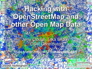
- 1. Hacking with OpenStreetMap and other Open Map Data Jerry Clough, (aka SK53) OSM Contributor Maps Matter: http://sk53-osm.blogspot.com/
- 2. Outline ● Intro to OpenStreetMap – Mapping – Humanitarian Uses – Example, Haiti Earthquake 2010 – Challenges ● A simple (geo)Open Data hack ● Addresses & POI Matching – Critical to improving OSM data everywhere – Improve efficiency during Humanitarian crises ● OSM Tool Hacks ● Fun Hacks
- 3. OpenStreeMap in Haiti, January 2010 Case Study of Mapping for Humanitarian Purposes A personal experience
- 4. Call for action First message at 05:28, 13 Jan 2010 from Mikel Maron. You have likely heard about the massive quake that has hit Haiti OpenStreetMap can contribute map data to help the response .. http://wiki.openstreetmap.org/wiki/WikiProject_Haiti#2010_Earthq uake_Response Thanks Mikel – My first edit at 17:17 13 Jan 2010 http://www.openstreetmap.org/browse/changeset/3611391
- 5. Initial edits around Port-au-Prince Adequate aerial imagery ex. Yahoo Existing major roads imported ex. Haiti mapping service – – Part of earlier initiative for Hurricane Gustav Mostly experienced OSM contributors Some names from DMA topo maps
- 7. GeoEye imagery 14th January (Christoph Schmidt, telascience) Damage assessment Infill mapping Resolve ambiguity
- 9. Displaced People Camps Example of development of ad hoc tagging Camp site already rendered on main OSM render (mapnik) – – Tile refresh in order of minutes IDP could be shown quickly tourism=campsite, refugee=yes – Don't get too involved with conventional meaning of tags
- 10. Damage assessment • Buildings – building=collapsed – building=yes earthquake:damage=collapsed • Roads – impassable=yes – barrier=*
- 11. Geofabrik Downloads Standard service for community – – Many extracts for most of Europe – Larger area extracts outwith Europe – Daily frequency North America not then covered A specific Haiti extract added – – Special landing page – 5 minute refresh frequency Later extended to cover whole island of Hispaniola OSM extracts SHP files Garmin IMG files
- 13. Bridges NEMA asked if we had bridge information (14:00 Jan 14) Checked they had geofabrik shapefiles (16:50 ) Asked Geofabrik if they could add bridges Mapped 60+ bridges Bridges added to shape files Confirmatory message to NEMA (20:52)
- 17. Garmin download ● Multiple Garmin downloads (mainly created using mkgmap) ● Geofabrik ● All-in-One map ● ● Multiple overlays & base map Contours from SRTM data (cpgsmapper /GroundTruth) ● NC distribution not integrated with OSM Maps ● Separate transparent overlay layer
- 19. Street Names Names were available from 1994 DMA map 266 2010-01-27 224 121 80 2010-01-30 Ushahidi & SAR 2010-01-26 2010-01-29 About 1200 in total 387 2010-01-28 Not as psychologically rewarding to map 569 2010-01-25 Slow workflow No. Unchecked/unmapped 2010-01-24 Awkward to find Date 72 Critical information 2010-01-31 35 Rectified DMA maps 2010-02-01 57 Gap reports 2010-02-02 38 Click through listings 2010-02-03 22 Nominatim on wiki,
- 20. Maps for Dogs ● Nottingham Open Streetlight data contains streetnames and location
- 21. Maps for Dogs ● Nottingham Open Streetlight data contains streetnames and location
- 22. Addresses : the real challenge ● Food Hygiene Data – 400k premises – Whole UK – 15% of all postcodes – – Bars, schools, hospitals, restaurants Geolocated (only to postcode) ● Land Registry Prices Paid – 18 million house prices since 1995 – England and Wales only – Address data only
- 25. Matching Data
- 27. OSMLY