
Download as PDF, PPTX

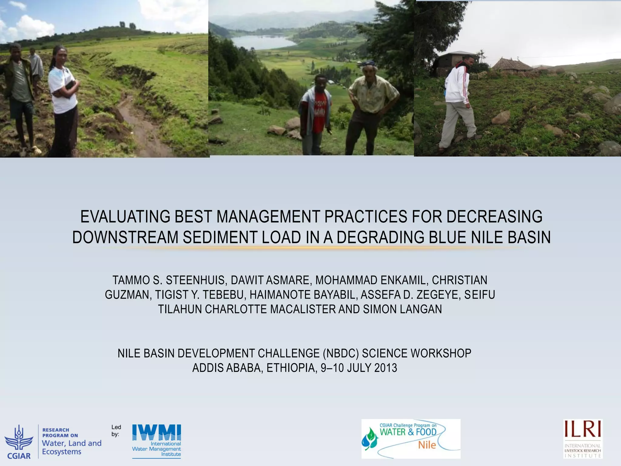

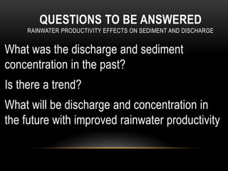
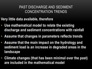
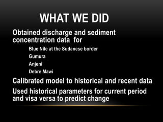

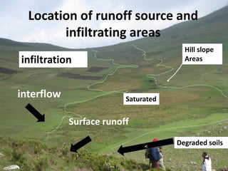
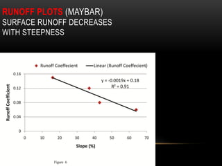
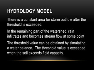
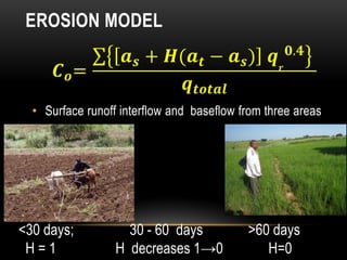
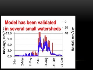
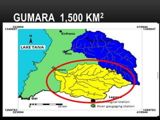
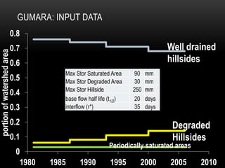
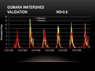
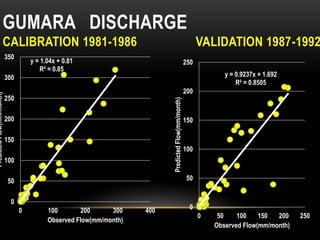
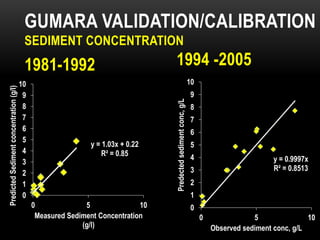
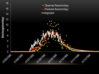
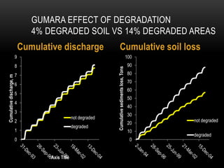

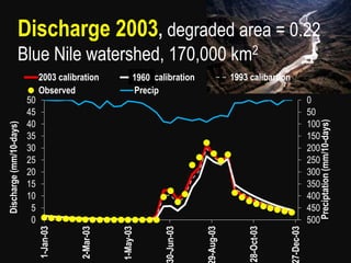
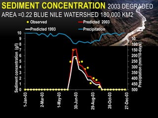
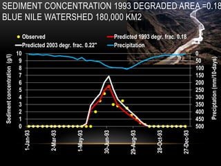
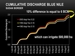
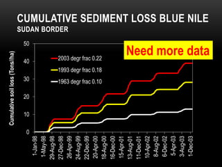

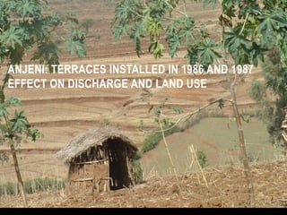
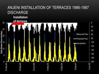
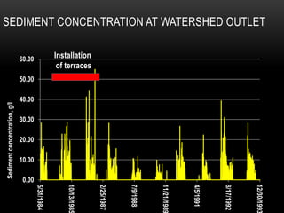


The document evaluates best management practices for reducing sediment load in the Blue Nile basin, analyzing the effects of improved rainwater productivity on downstream discharge and sediment concentration. It discusses the use of mathematical models to relate historical data with current predictions, highlighting the significant impact of land degradation on hydrology. The findings indicate that while erosion-control measures like terrace installation can reduce sediment, their overall effect on discharge is minimal, emphasizing the need for comprehensive land improvement strategies.


