
Recommended
Recommended
More Related Content
What's hot
What's hot (19)
Similar to Navigator pro
Similar to Navigator pro (20)
Recently uploaded
Recently uploaded (20)
Navigator pro
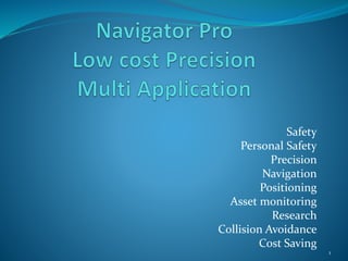
- 1. Safety Personal Safety Precision Navigation Positioning Asset monitoring Research Collision Avoidance Cost Saving 1
- 3. Gps Performance Navigator Pro utilizes moving base technology enables the achievement of sub meter accuracies. The moving baseline (MB) mode differs from standard RTK operation in that the base is no longer stationary at a pre-determined location. Both the base and rover receivers are allowed to move while computing an accurate vector between the receiver's antennae. This mode enables the calculation of heading on dynamic or static platforms, plus provides a centimetre level accurate 3D vector for use in dynamic positioning for example, e.g. UAV ”Storing Event Markers on Rinex Files” feature. Precise navigation and automation is becoming a topic that is discussed more often than not Using the moving baseline functionality with fixed base and rover antenna positions on a platform gives the means to estimate the baseline angle with respect to the local datum via the relative position information. This derived angular error will then be proportional to the baseline length. Figure 3 (UBlox) below provides the trend for baseline lengths up to 1 m for a typical (1 sigma) relative position error of 0.8 cm. This is applicable to the use of a closed loop GPS instead of an open loop GPS 3
- 4. Gps Performance Figure 3 courtesy of UBlox 4
- 5. Navigator Pro Performance Navigator Pro is a uniquely designed GPS that without any external correction sources achieves sub meter accuracies. With the addition of a fixed base and a communications network Navigator Pro achieves sub decimetre accuracies. Normally the following would be applicable when powering up a GPS TTFF (Time to first fix) from a cold start is achieved in 26 seconds when observing GPS and GLONASS. Hot and aided starts fixes in approximately 2 to 3 seconds. The unique design of Navigator Pro keeps the receivers alive resulting in a RTK fix from a loss of lock in under a second from re-establishing a lock. A RTK fix from a “cold start” in under a minute. 5
- 6. Navigator Pro Performance The example below indicates a single solution position with a baseline of 4.664 M (the base line was 4.5 M) within a few seconds from startup 6
- 7. Navigator Pro Performance Navigator Pro achieves a Float solution a few sends later with the base line 5.017 M as the GPS calculates the 3D vector. Once the vector has been calculated a Fix solution is achieved and now has a base line of 4.511 M 7
- 8. Navigator Pro Performance Navigator Pro has the ability to resolve short base lines, calculate Yaw (Dead Reckoning) and Pitch. With the addition of another receiver Roll can also be calculated and displayed. The display would be displayed in a graphical format and can be used to guide machines in order to grade access ramps accurately without having to exit the cab to check grade boxes. Saving Surveyors time to construct the grade boxes. With the ability to give direction, accurate position and height, Navigator Pro can direct a drill operator along a previously calculated “flight Plan”, uploaded from the Rock Engineer/Mine Planners office directly to the required drill rig. The drill operator will be guided to the drilling position in a similar fashion as a stake out function on a survey GPS. 8
- 9. Navigator Pro Performance Actual deployment of GPS Node with restricted sky veiw 9
- 12. Calculation of Pitch Pitch: Base Line b = 820, Antenna height difference c = 30mm Angle A = 2.095° 12
- 13. Navigator Pro Performance As can be seen from the previous 2 slides the GPS node accurately calculates Pitch and Yaw and displays such very accurately and is stable. Acquisition time from start-up to resolving the short base line and pitch angle is normally under a minute and once established remains accurate even when moving, if lock is lost due for instance passing under a structure such as a bridge lock is re-established within about 7 seconds from clearing the obstacle. 13
- 14. Navigator Pro Performance Base Performance u-center_v8.25u-Center.exe 14
- 15. Navigator Pro Performance Rover Performanceu-center_v8.25u-Center.exe 15
- 16. Gps Performance Base Rinex Data 16
- 17. Gps Performance Rover Rinex Data 17
- 18. Gps Performance Post Processed Datarudolfrover2.pos 18
- 19. Navigator Pro Safety Navigator Pro provides accurate positioning in real time and all data is recorded for future analysis such as incident reconstruction in conjunction with laser scans etc. An envelope is created around each node depending on the installation of such node. If the node is used for High wall monitoring no envelope is created. If the node is installed in a vehicle or worn on a person, an envelope using predetermined values to create a safety envelope around the machine/person equipped with the node. The node carried on a person or mounted to a vehicle allows for the “visibility” of personnel or vehicles in the vicinity of moving earthmoving machines by displaying their position and presence on the screen in the cab warning the operator and the person/s or drivers about the danger/s present. By adding low cost accelerometers (IMU’s ,3 axis Gyro) to predominately moving nodes, additional real time data is provided in terms of acceleration , deceleration, vehicle tilt etc. A person carrying a node equipped with an accelerometer will raise an alarm if the person falls off a machine. 19
- 20. Navigator Pro Safety Predetermined values for minimum and maximum values for vehicle roll and pitch can be programed into the node that will raise alarm when such hazards are encountered All impact alarms will be a “Red” alarm and all other alarms will be in 3 levels of severity. “Yellow” entering a hazardous area , “Orange” in a hazardous area “Red” should an impact alarm be detected. Impact alarms include collisions, sudden acceleration or deceleration of moving nodes. Predominantly moving nodes can also be Geofenced excluding access certain areas for unauthorised people, vehicle etc. Precision Navigator Pro is an Autonomous GPS with sub meter accuracy without external RTCM correction messages and sub decimetre accuracy with external RTCM messages. 20
- 21. Navigator Pro Navigation Navigator Pro provides precise navigation by means of a tablet that display maps of old underground works and dangerous terrain with precise position indicated on the screen allowing the operator to remain in predetermined safe areas Positioning Navigator Pro with external RTCM correction messages achieves decimetre accuracy in X, Y and Z allowing for the precise positioning of mining machinery such as Drills. Hole depth can also be verified using Navigator Pro. Asset monitoring Assets equipped with Navigator Pro can be Geo-fenced. If the asset then crosses the predetermined Geo fence alarm is raised. Research Real time data, precision positioning and a variety of attachable sensor renders Navigator Pro the ideal research tools for the industry. 21
- 22. Navigator Pro Applications Monitoring. Navigator pro is a low cost accurate L1 GPS, due to the low cost and factors such as low power consumption and networkability makes it ideal for monitoring of structures such as High walls and other critical structures in conjunction with Radar and laser scanners. Precise and real time monitoring of all moving equipment inclusive of position, speed, payload and any other functions deemed required for monitoring. Navigator Pro allows for the connection and real time monitoring of numerous sensors such as air quality, seismic, vibration and other sensors allowing real time monitoring of for instance air quality inside and outside of the machine cab. 22
- 23. Navigator Pro Applications Real time data, Navigator Pro provides real time data to whoever requires such, the production office will know the position, speed and payload of all production vehicles, bottle necks therefor can be cleared by redirecting trucks. Grade slopes, Navigator Pro has the ability to display various graphical aids such as angles etc. to the operator. Data such as drill hole locations and grade slope data can be uploaded to specific machines over the air without the need to access the machine 23
- 24. There are a plethora of applications of such a system . With the initial system built from old RF receivers accuracies of 10 and 20 centimetres were achieved testing in underground parking areas. With the University of Johannesburg and Wits also getting involved in precise underground research and having shared this with them I am sure that such a system that is centimetre accurate will be available in the very near future making mining that much safer and easier to mine. The amount of real time data collected would therefor be invaluable for research and with modern day electronics again any number of low cost sensors or where required more precise sensors can be connected to the system and monitored. I do not think such a system has ever been available to the mining of for that matter any industry where precision in positioning is required. Navigator Pro Applications 24
- 25. With several nodes deployed on the surface of an underground mine to known positions such as Main and Vent shafts and allowing the network of GPS node to synchronise as close to zero Nano seconds as possible and taking the node position underground by means of single mode fibre optic cable and connecting it to a RF network of nodes in an open loop configuration will once the network is complete and the nodes have line of sight in a zigzag patter along a tunnel propagate corrections to each other using the above ground positions as reference and the RF nodes mounted to previously surveyed underground points to correct themselves in relation to and synchronise with the above ground network Any corrections to the known point with increased accuracy with be propagated via the network to all other nodes allowing them to apply such corrections to themselves eventually after applying all corrections and with a synchronised system any roving node “seeing” 3 or more static nodes will after initialization be centimetre accurate. From a safety and automation aspect this system can save lives by being able to send a machine into a hazardous area instead of a person. This will in turn lead to the development of autonomous and remote control (possibly from the surface) mining machinery Navigator Pro Applications 25
- 26. Navigator Pro Operation Navigator Pro is a unique designed low cost sub meter autonomous GPS. It provides a continuous real time GPS and RTCM data streams as well as Sensor data. The data is transmitted by means of a low cost mesh network, RTCM corrections are propagated by a stationery base as well as between units allowing for sub decimetre accuracy. Navigator Pro in a monitoring installation such as High Wall and structural monitoring besides transmitting real time data samples data is post processes at given time intervals to verify positions. With the small packets of data and Mesh infrastructure the system has a complete redundancy and fails safe back backbone whereas the radios also synchronise and by means of RSSI (Received Signal Strength Indicator) and TOF (Time Of Flight) calculates a vector between itself and any other radios that it is connected to. 26
- 27. Navigator Pro Operation The vector is compared with the GPS receiver’s position and in time the radio position will be the same as the GPS receiver’s position with the only differences being the distances between the radio antenna and the Rover antenna centre. The system constantly does “health” checks on all nodes within the network any node failures are reported via the network to the responsible person for action to be taken. Replacement of a unit is as simple as disconnecting the faulty node and connecting a new node and powering it up. The node is intelligent enough to connect itself to the mesh, select the strongest and most relevant nodes to itself initiate communications with them, receive any updates since it was last powered up, do the maths and precisely position itself. 27
- 28. Navigator Pro Operation Navigator Pro is besides modular and easy to deploy. The units will upon power up establish it’s position and also survey the mesh network and automatically select the strongest signals. Once radio communication is established the new node will start receiving RTCM corrections and also broadcast its own generated RTCM messages allowing the GPS Node correct itself in relation to the base and the balance of the GPS Nodes Once the network has fully propagated the mean of deviations are calculated for X,Y and Z. The correction values for X, Y and Z are transmitted over the air to all GPS Nodes that will apply the corrections to X,Y and Z for local Datum's 28
- 29. Navigator Pro The following slides from a random observation with Navigator Pro node in full QD mode. All slides with thanks to Tomoji Takasu 29
- 30. 30 Acceleration Plot in QD Mode
- 31. 31 Dilution of Precision Plot in QD Mode
- 32. 32 Scatterplot in QD Mode
- 33. 33 Sky Plot in QD Mode
- 35. 35 Position Plot in QD Mode
- 37. 37 Sky Plot
- 38. 38 SNR / Multipath Plot in QD Mode
- 39. 39 SNR / Multipath / Elevation Plot
- 40. 40 Velocity Plot in QD Mode
- 41. Navigator Pro 41 As can be seen from the previous slides Navigator Pro “Flat Lines” in QD Mode. RTKLIB employs EKF (extended Kalman filter) in order to obtain the final solutions in DGPS/DGNSS, Static, Kinematic and Moving‐baseline modes in conjunction with the GNSS signal measurement models in the troposphere and ionosphere models. But more importantly it also negates the effect of multipath on receivers without specialised and expensive choke ring antennas under certain conditions. The conditions are microprocessor and mathematically dependant and not receiver dependant. Open Loop systems allow for this the instance more than 2 nodes are able to establish communication. Each and every node added strengthens the network and every other Node. Besides applications for mining simple units can be designed for example a small 5 / 10 or whatever number of portable units could be deployed anywhere where research or where ever precise positioning is required. The radios are capable of transceiving to a distance of 48 Km Line of sight (LOS) once all 5 units are connected any roving node will accurate to at least a decimetre.
Editor's Notes
- Figure 3 courtesy of UBlox