Le 20 mars 2019, chez Léonard (https://leonard.vinci.com) à Paris.
Après une période d'euphorie médiatique et à la suite de plusieurs accidents, le sujet des véhicules autonomes est maintenant tombé dans la zone de désillusion*. En fautes, certains challenges techniques difficiles à surmonter. Par exemple, la précision centimétrique et la fiabilité à chaque instant de la géolocalisation des véhicules est essentielle pour permettre le fonctionnement de ces véhicules en parfaite sécurité. En ce sens, le rythme et le montant des investissements en R&D ne cessent de grimper et de réelles avancées commencent à émerger, en laboratoire comme en entreprise.
Leonard /https://leonard.vinci.com/ est le laboratoire du futur des villes et des infrastructures, créé par VINCI. Son équipe nous invite à organiser notre 18ème Meetup dans leur sublimes locaux dans le 12ème arrondissement à Paris. L'occasion de venir approfondir le sujet des technologies liées à la géolocalisation des véhicules autonomes à travers deux experts du sujet:
⚬ Marie-Anne Mittet, Localization Expert for ADAS and Autonomous Driving chez Renault-Nissan-Mitsubishi /www.renault.com/
⚬ Romain Legros de Géoflex /www.geoflex.fr/
⚬ Rémi Villain, Product Manager chez TomTom /https://www.tomtom.com/
En conclusion, un apéro networking sera généreusement offert par l'équipe de Leonard, groupe Vinci.
L'entrée, strictement réservée aux professionnels, est gratuite sur inscription avec prénom, nom, email, fonction/entreprise.
Les Meetups Voiture Connectée et Autonome vous sont proposés par Laurent Dunys, https://www.linkedin.com/in/laurentdunys, depuis 2016.
----------------------------------------------------------------------------
Hashtag #MeetupConnect
Comptes Twitter: @MeetupConnect @WeAreLeonard @Mobileye @Groupe_Renault @LDunys
*https://www.gartner.com/smarterwithgartner/top-trends-in-the-gartner-hype-cycle-for-emerging-technologies-2017/
Marathi Call Girls Santacruz WhatsApp +91-9930687706, Best Service
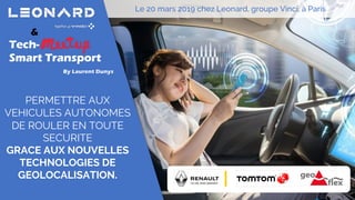
Meetup Voiture Connectée et Autonome #18 avec Vinci, Renault, TomTom, Geoflex
1. &
Tech-
Smart Transport
PERMETTRE AUX
VEHICULES AUTONOMES
DE ROULER EN TOUTE
SECURITE
GRACE AUX NOUVELLES
TECHNOLOGIES DE
GEOLOCALISATION.
By Laurent Dunys
Le 20 mars 2019 chez Leonard, groupe Vinci, à Paris
2. Meetup Voiture Connectée et Autonome #18
Marie-Anne Mittet, @Groupe_Renault
Romain Legros, Géoflex
Rémi Villain, @TomTom
20 Mars 2019www.meetup.com/fr-FR/MeetupVoitureConnecteeAutonome Laurent Dunys, xMotion.io
PERMETTRE AUX VEHICULES AUTONOMES DE
ROULER EN TOUTE SECURITE
GRACE AUX NOUVELLES TECHNOLOGIES DE
GEOLOCALISATION.
3. Hashtag Twitter: #MeetupConnect
Comptes Twitter:
@MeetupConnect
@WeAreLeonard
@Groupe_Renault
@TomTom
PERMETTRE AUX VEHICULES AUTONOMES DE
ROULER EN TOUTE SECURITE
GRACE AUX NOUVELLES TECHNOLOGIES DE
GEOLOCALISATION.
20 Mars 2019www.meetup.com/fr-FR/MeetupVoitureConnecteeAutonome Laurent Dunys, xMotion.io
Meetup Voiture Connectée et Autonome #18
4. Nos prochains Meetups
Tech-Meetup Smart Transport #05
le 11 avril 2019 chez Octo Technology
Meetup Voiture Connectée et Autonome #19
Mi mai 2019 chez RCI Bank & Services
20 Mars 2019www.meetup.com/fr-FR/MeetupVoitureConnecteeAutonome Laurent Dunys, xMotion.io
Meetup Voiture Connectée et Autonome #18
7. Confidential C
C’EST QUOI ? POURQUOI ?
La localisation précise dans le véhicule autonome
Percevoir Décider Agir
Ø Le véhicule doit percevoir le monde qui l’entoure afin de décider de ses actions
8. Confidential C
C’EST QUOI ? POURQUOI ?
La localisation précise dans le véhicule autonome
Percevoir
Perception de l’environnement – Situation actuelle
L’environnement est reconstruit autour du véhicule grâce aux capteurs de perception
(caméra, radar, lidar…) qui permettent de détecter:
- Lignes au sol
- Panneaux
- Objets (véhicules, piétons…)
9. Confidential C
C’EST QUOI ? POURQUOI ?
La localisation précise dans le véhicule autonome
Problèmes:
Le champ de vue est très limité
• Manque d’anticipation total
• On ne tire pas partie de toute la perfo des capteurs
Le véhicule ne détecte l’infrastructure que via les lignes et
les panneaux proches
• Impossibilité de comprendre globalement la scène
• Gros problème de contrôle si les capteurs/l’infrastructure
sont défaillants27%* des reprises en main sont dues aux pertes de lignes
(Projet interne)
*Etude réalisée sur un échantillon représentatif de 3 semaines de roulages en 2017
10. Confidential C
C’EST QUOI ? POURQUOI ?
La localisation précise dans le véhicule autonome
Solution:
Utiliser les informations d’une HDMap
En se localisant sur cette HDMap, on peut extraire un horizon électronique autour du
véhicule, contenant des informations comme les lignes, les panneaux etc.
11. Confidential C
C’EST QUOI ? POURQUOI ?
La localisation précise dans le véhicule autonome
Percevoir
Perception
« classique »
(Capteurs)
Horizon Electronique
issu d’une HDMap
Lignes, panneaux,
objets perçus par le
véhicule
Lignes, panneaux, et
autres informations
issues de la carte
EmmergencyLane
12. Confidential C
C’EST QUOI ? POURQUOI ?
La localisation précise dans le véhicule autonome
Pour être utile, l’horizon électronique extrait doit être précis par rapport à ego
EmmergencyLane
Þ Pour cela, nous devons nous localiser précisément dans
la carte
13. Confidential C
COMMENT ÇA MARCHE ?
La localisation précise dans le véhicule autonome
Fusion
AbsolutePositionning
(onmap)Relativepositionning
GNSS
Camera-
based loc
Lidar-
based loc
Radar-
based loc
Camera-based
odometry
Lidar-based
odometry
Radar-based
odometry
IMU/Veh odometry
Map pose
Map pose
Map pose
Absolute pose
Speed, dx, dy…
Speed, dx, dy…
Speed, dx, dy…
Speed, dx, dy…
HDMap
Camera
Radar
Lidar
14. Confidential C
COMMENT ÇA MARCHE ?
La localisation précise dans le véhicule autonome – La localisation
Fusion
AbsolutePositionning
(onmap)Relativepositionning
GNSS
Absolute pose
GNSS: Donne la position absolue sur la terre. Sert avant tout
à l’initialisation, et à donner une première idée grossière de
la zone dans laquelle on est dans la carte.
15. Confidential C
COMMENT ÇA MARCHE ?
La localisation précise dans le véhicule autonome – La localisation
Fusion
AbsolutePositionning
(onmap)Relativepositionning
Camera-
based loc
Lidar-
based loc
Radar-
based loc
Map pose
Map pose
Map pose
HDMap
Camera
Radar
Lidar
16. Confidential C
COMMENT ÇA MARCHE ?
La localisation précise dans le véhicule autonome – La localisation
Sensor based localisation:
Principe général: Mettre en correspondance les informations vues par un capteur avec les
informations de la carte, afin d’en déduire notre position
La carte
Ce qui est vu par le capteur
17. Confidential C
COMMENT ÇA MARCHE ?
La localisation précise dans le véhicule autonome – La localisation
Fusion
Relativepositionning
Camera-based
odometry
Lidar-based
odometry
Radar-based
odometry
IMU/Veh odometry
Speed, dx, dy…
Speed, dx, dy…
Speed, dx, dy…
Speed, dx, dy…
Camera
Radar
Lidar
Solutions de relative positionning: Permettent
de calculer un déplacement
18. Confidential C
COMMENT ÇA MARCHE ?
La localisation précise dans le véhicule autonome – La localisation
Sensor based odometry
Calcul de notre déplacement à partir du déplacement d’objets fixes entre deux images
19. Confidential C
• Horizon Electronique
− Issu d’une HDMap et de la localisation du véhicule dans cette HDMap
ON RESUME !
La localisation précise dans le véhicule autonome
Extraction de
l’e-Horizon
Localisation
précise sur la
carte HD
HDMap
Capteurs de
perception
GNSS,
Odométrie
véhicule
Horizon Electronique
issu d’une HDMap
Position précise sur la
carte
20. Confidential C
• Pour améliorer la perception de nos véhicules, on
veut pouvoir extraire des informations d’une
carte, afin de construire un horizon électronique
autour de ces véhicules
• Pour être utile cet horizon doit être précis
• Pour extraire un horizon précis, le véhicule doit
être localisé précisément une carte
22. Operator of new services to augment
Global Navigation Satellite Systems
23. 2
Positioning: Up to 4 cm (2D-95%), in real
time, everywhere (worldwide, on lands,
across seas, and in the air), all the time
Time stamping: Few nanoseconds
romain.legros@geoflex.fr / mobile: +33 7 83 30 96 86
GEOFLEX is operator of new GNSS augmentation services to augment
GNSS accuracy, integrity and continuity
GEOFLEX provides disruptive GNSS solutions
GEOFLEX sold:
Corrections data stream in an open format
under subscriptions
Optionally accompanied by HDK, SDK &
Reference implementations
To provide simple, affordable, and state of the
art solutions adapted to applicative integrators
for:
25. 4 romain.legros@geoflex.fr / mobile: +33 7 83 30 96 86
General principles of GNSS
User Equivalent Range Error:
Satellites errors
Orbits errors
Clocks errors
Antenna phase center and
electronic biases
Atmospheric errors
Ionospheric refraction
Tropospheric refraction
Multipaths
Receiver errors
Clocks errors
Antenna phase center and
electronic biases
Errors affecting GNSS measurements
26. 5 romain.legros@geoflex.fr / mobile: +33 7 83 30 96 86
Errors affecting GNSS measurements
Without GNSS augmentation, lack of precision (few meters), lack of continuity
(at least 4 satellites in visibility), and no integrity
27. 6 romain.legros@geoflex.fr / mobile: +33 7 83 30 96 86
Precise Point Positioning (PPP): Model / estimate each error
affecting GNSS measurements in a real “Zero difference” approach
GEOFLEX provides disruptive GNSS solutions
To obtain for each
satellite its precise
coordinate and the
precise distance to the
receiver:
To perform an hybrid
multilateration with
LIDAR and/or camera
To constrain the drift
of an IMU system
… from only 1 satellite in
downtown
28. 7 romain.legros@geoflex.fr / mobile: +33 7 83 30 96 86
Precise Point Positioning (PPP): Model / estimate each error
affecting GNSS measurements in a real “Zero difference” approach
Our Technology
30 minutes of convergence to reach an accuracy of 4 cm (2D-95%) =
More than 68% of surveying points matching a 2 euros coin year after
year (absolute precision) = PPP-IAR
29. 8 romain.legros@geoflex.fr / mobile: +33 7 83 30 96 86
Precise Point Positioning (PPP): Model / estimate each error
affecting GNSS measurements in a real “Zero difference” approach
Our Technology
1 - 5 minutes of convergence using atmospheric refractions from a
local “atmospheric base station” serving an area of interest with a
radius up to 100 km ! = Local PPP-RTK (50 CORS for France)
30. 9 romain.legros@geoflex.fr / mobile: +33 7 83 30 96 86
Precise Point Positioning (PPP): Model / estimate each error
affecting GNSS measurements in a real “Zero difference” approach
Our Technology
With a such « semi-dense » network, we can significantly
augment the performance of “L1 only” low-cost receivers
32. 11 romain.legros@geoflex.fr / mobile: +33 7 83 30 96 86
Precise Point Positioning (PPP): Model / estimate each error
affecting GNSS measurements in a real “Zero difference” approach
Our Technology
Instantaneous precision of few centimeters with quadri-
frequencies observations E1/E5a/E5b/E5/E6 since March 2018 =
Ultra-fast Global PPP-RTK
Constellation
Number of operational
satellites on December 2018
Number of
frequencies
GPS 12 Block IIF 3
BEIDOU 18 MEO 3S 5
GALILEO 20 FOC and 2 IOV 5
33. 12 romain.legros@geoflex.fr / mobile: +33 7 83 30 96 86
Precise Point Positioning (PPP): Model / estimate each error
affecting GNSS measurements in a real “Zero difference” approach
Our Technology
Instantaneous precision of few centimeters with quadri-
frequencies observations E1/E5a/E5b/E5/E6 since March 2018 =
Ultra-fast Global PPP-RTK
34. 13 romain.legros@geoflex.fr / mobile: +33 7 83 30 96 86
Radically different of others solutions
Others solutions as RTK/NRTK exists but:
They are not scalable to worldwide operations with at least 200 reference
stations for a country as France
They doesn’t allow the tight hybridization between GNSS and others
sensors to ensure continuity and integrity
35. 14 romain.legros@geoflex.fr / mobile: +33 7 83 30 96 86
Radically different of others solutions
Others solutions as RTK/NRTK exists but:
They doesn’t allow the tight hybridization between GNSS and others
sensors to ensure continuity and integrity
37. 16 romain.legros@geoflex.fr / mobile: +33 7 83 30 96 86
Geospatial, Construction, Agriculture and Transports in link with
dronification of activities
Location Based Services
Diversified and very important markets
38. 17 romain.legros@geoflex.fr / mobile: +33 7 83 30 96 86
Core GNSS market of more than 60 billions of Euros in 2020
GNSS augmentation market of about 3 billions of Euros in 2020 with
a compound annual growth of 6.36% between 2015 and 2020
In 2030, GNSS will impact 30% of the European GDP (6% in 2015)
Diversified and very important markets
39. 18 romain.legros@geoflex.fr / mobile: +33 7 83 30 96 86
AUTOMOTIVE: 4D/4.5D GIS as support for field activities
automatization
Diversified and very important markets
Road navigation
ADAS (Advanced Driver Assistance
Systems
Connected Vehicles
Autonomous Vehicles
40. 19 romain.legros@geoflex.fr / mobile: +33 7 83 30 96 86
LOCATION-BASED SERVICES (LBS): New mobility of people
Diversified and very important markets
GÉOFLEX 100% compatible
with Android N (Google)
Navigation on smartphone and
tablet
Transport multimodality
Collaborative mapping
Security and emergency services
Geomarketing
Sports and hobbies
Augmented reality
41. 20 romain.legros@geoflex.fr / mobile: +33 7 83 30 96 86
LOCATION-BASED SERVICES (LBS): New mobility of people
Diversified and very important markets
42. 21 romain.legros@geoflex.fr / mobile: +33 7 83 30 96 86
LOCATION-BASED SERVICES (LBS): New mobility of people
Diversified and very important markets
43. 22 romain.legros@geoflex.fr / mobile: +33 7 83 30 96 86
ASSETS TRACKING (IoT): New mobility of goods and new
interactions with humans
Diversified and very important markets
45. 24 romain.legros@geoflex.fr / mobile: +33 7 83 30 96 86
Precise Point Positioning (PPP): Model / estimate each error
affecting GNSS measurements
Our Solutions
46. 25 romain.legros@geoflex.fr / mobile: +33 7 83 30 96 86
The THD box for « True High Definition »:
Our Solutions
From L1 GPS/GLO/GAL to
L1/L2/L5 GPS/GLO/GAL/BEI
dual-antennas
WAAS / EGNOS
DGNSS / N-DGNSS
RTK / N-RTK
PPP / PPP-AR / PPP-RTK
PPS
MARKER EVENT
47. 26 romain.legros@geoflex.fr / mobile: +33 7 83 30 96 86
The THD box for « True High Definition »:
UHF Radio 430-450 MHz
External and Internal
GPRS-UMTS
Two internal modems
Multilink NTRIP Client
Satcom
External INMARSAT–IRIDIUM etc.
Internal IRIDIUM to follow
9/36V
2 SERIAL, 1 USB, 1 BLUETOOTH
1 ETHERNET, 1 WIFI
Our Solutions
48. 27 romain.legros@geoflex.fr / mobile: +33 7 83 30 96 86
The THD box for « True High Definition »:
Our Solutions
Perfect Integration of the quadri-frequency GPS/GLO/GAL/BEI with
the Inertial Measurement Unit from iXblue (URSA3 / ATLANS /
PHINS) and SBG (ELLIPSE, EKINOX, APOGEE)
49. 28 romain.legros@geoflex.fr / mobile: +33 7 83 30 96 86
The THD box packaged in a GNSS CORS (Continuously Operating
Reference Station): Full secured installation to meet industrial
requirements
Our Solutions
50. 29 romain.legros@geoflex.fr / mobile: +33 7 83 30 96 86
The THD box packaged in an Auto-georeferenced RTK or Atmo Base
Station:
Our Solutions
Automatic georeferencing of a Base station anywhere in the world, in
a global or local geodetic system
Sending RTK corrections or PPP iono/tropo by UHF and/or GPRS
51. To serve applicative integrators with available and open GNSS augmentation,
To endows the others sensors of a global localization system with the power of
our solutions,
To use GNSS in mass market applications
Romain LEGROS
Chief Executive Officier
romain.legros@geoflex.fr
+33 7 83 30 96 86
Find us on www.geoflex.fr
52. To serve applicative integrators with available and open GNSS augmentation,
To endows the others sensors of a global localization system with the power of
our solutions,
To use GNSS in mass market applications
Romain LEGROS
Chief Executive Officier
romain.legros@geoflex.fr
+33 7 83 30 96 86
Find us on www.geoflex.fr
53. To serve applicative integrators with absolute and available positioning
and timing solutions
Romain LEGROS, Chief Executive Officier
romain.legros@geoflex.fr
+33 7 83 30 96 86
Find us on www.geoflex.fr
54. HD MAP AND LOCALIZATION
Rémi Villain, Product Manager
Paris Meetup, March 20th
60. HD map as a service
Map Production: Transactional map making engine
Map Maintenance:
Crowdsourcing and Targeted surveys
Map Delivery:
Map tiles streaming on demand