
Recommended
Recommended
More Related Content
Similar to melwebinaragrometeorologicalindicators20190529.pptx
Similar to melwebinaragrometeorologicalindicators20190529.pptx (20)
More from constantino34
More from constantino34 (11)
Recently uploaded
Recently uploaded (20)
melwebinaragrometeorologicalindicators20190529.pptx
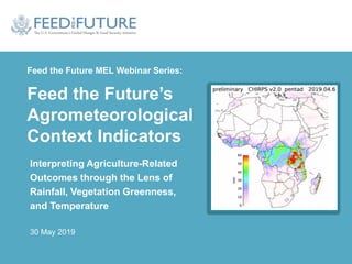
- 1. Feed the Future MEL Webinar Series: Feed the Future’s Agrometeorological Context Indicators Interpreting Agriculture-Related Outcomes through the Lens of Rainfall, Vegetation Greenness, and Temperature 30 May 2019
- 2. 2018-19 Feed the Future MEL Webinar Series • Introduction to the MEL System (link) • Standard Indicator Overview (link) • New Indicators: Application of improved practices & technologies (link) • New Indicators: Sales, finance & investment (link) • Annual FTFMS user’s webinar (link) • Nutrition, sanitation & hygiene indicators (link) • New Indicators: Gender (link) • Reporting on policy change (link) • New Indicators: Yield Revealed! (link) • New Indicators: Agrometeorological context indicators 2
- 3. Presenters 3
- 4. Webinar objective #1 • Introduce new agrometeorological context indicators that will allow us to interpret agriculture-related outcomes through the lens of: Rainfall Greenness Temperature 4
- 5. Webinar objective #2 and #3 • Discuss how the new indicators will be calculated • Discuss how these indicators can be used to interpret agricultural measures – yield – other measures (e.g., levels of input use) 5
- 6. New Context Indicators Rainfall: FTF Context-12: Average Standard Precipitation Index score during the main growing seasons (p203-4 of the Feed the Future Indicator Handbook) Greenness: FTF Context-13: Average deviation from 10-year average NDVI during the main growing season (p205-7 of the Feed the Future Indicator Handbook) Temperature: FTF Context-14: Total number of heat stress days above 30°C during the main growing season (p208-09 of the Feed the Future Indicator Handbook) 6
- 7. Rationale for adding these indicators • In places where rainfed agriculture is predominant, the weather is a key factor in determining yields (as well as some practices, like how much area to plant) • Without having a sense of weather-related variables from year to year, it is not possible to interpret trends and performance in yields – Did el Niño negatively impact farmers’ production in the Zone of Influence this year? Or were our programs slow to get started? – Was there a bumper crop for everyone this year because of perfect weather, or were our programs especially effective in the ZOI? 7
- 8. What each indicator tells us individually… 8 Near Normal Moderately Wet Very Wet Extremely Wet Moderately Dry Severely Dry Extremely Dry Data Source: Climate Hazards Group InfraRed Precipitation with Station (CHIRPS) datasets. CHIRPS is a 30+ year quasi-global rainfall dataset spanning 50°S-50°N (and all longitudes), starting in 1981 to near-present. Rainfall: Maize from the Upper West region of Ghana
- 9. What each indicator tells us individually… 9 Normal Above Normal Bellow Normal Data Source: NASA MODIS Greenness: Maize from the Upper West region of Ghana
- 10. What each indicator tells us individually… 10 Data Source: Modern-Era Retrospective analysis for Research and Applications version 2 (MERRA-2), NASA’s atmospheric reanalysis for the satellite era using the Goddard Earth Observing System Model, Version 5 (GEOS-5) with its Atmospheric Data Assimilation System (ADAS), version 5.12.4 Temperature: Maize from the Upper West region of Ghana
- 11. …and taken together. 11 Maize • A wet start to the season followed by a moderately dry period during the main vegetative period. • Above average NDVI values during the season showing healthy crops. • Average number of heat stress days during the season. • Despite the reduced rainfall during the main vegetative period, extremely wet to moderately wet conditions earlier in the season combined with normal temperatures allowed for soil moisture to carry a healthy crop until harvest. • Overall the season was above average with final yields of the season above the 10-yr average.
- 12. How these indicators will be calculated • USAID/BFS and Feed the Future are building the capacity to use the remotely-sensed data that inform these indicators. • We are currently being supported in these efforts by the NASA Harvest Consortium as well as FFP/FEWS NET colleagues. • Implementing partners will not need to calculate these context indicators. • All of us need to learn how to interpret our performance indicators in the context of these indicators. 12
- 13. How to interpret trends in production in light of rainfall, greenness & temperature: Ghana 13 Above Average Year Below Average Year Average Year Maize
- 14. How to interpret trends in production in light of rainfall, greenness & temperature: Ghana 14 On the ground example of below average conditions: Below Average Year
- 15. How to interpret trends in production in light of rainfall, greenness & temperature: Ghana 15 Average Year On the ground example of average conditions:
- 16. How to interpret trends in production in light of rainfall, greenness & temperature: Ghana 16 On the ground example of above average conditions: Above Average Year
- 17. How to interpret trends in production in light of rainfall, greenness & temperature: Senegal 17 Average Year Above Average Year Below Average Year Rice
- 18. How to interpret trends in production in light of rainfall, greenness & temperature: Senegal 18 On the ground example of below average conditions: Below Average Year
- 19. How to interpret trends in production in light of rainfall, greenness & temperature: Senegal 19 On the ground example of average conditions: Average Year
- 20. How to interpret trends in production in light of rainfall, greenness & temperature: Senegal 20 On the ground example of above average conditions: Above Average Year
- 21. An examination over time 21 Maize in northern Ghana: Maize • A comparison of the indicators over time along with the final yields from implementing partners. 3.00 3.25 3.50 3.75 4.00 2015 2016 2017 Yield (MT/Ha) Year Average Final Yields
- 22. What other trends might we better understand in light of rain, temp & NDVI? • If there is no rain, – farmers might not purchase seeds, fertilizer – planted area might be reduced • Currently in the process of assessing whether data are available that allow us to look at this – implementing partners may be able to assess their own data on input use and area under cultivation through the lens of rainfall, temperature and NDVI – if available data allow, we may organize a future webinar to go into more depth on this topic 22
- 23. 23
Editor's Notes
- Rainfall is one of the primary factors affecting crop productivity, especially for rainfed agriculture. This is especially true during the main growing season in semiarid conditions, where most of the GFSS countries are located. Lower or less than optimum crop yields are usually associated with lower than normal (or higher than normal) rainfall conditions. The indicator will help in analyzing conditions that led to observed crop yields. It will also help to understand the rainfall context that best suits a given crop (for example, it could provide insights leading to recommendations to shift planting times or select a crop type that fits the rainfall context better). Earth observation data, and the NDVI measure derived therefrom, are spatially explicit, broad in extent, uniform for the entire area covered, repeatable over time, and capable of appraising entire landscapes. Satellite-derived estimates of net primary production in plants – which are correlated with yield – are calculated using vegetation indices like NDVI. NDVI is correlated with plant biomass, crop yield, plant nitrogen, plant chlorophyll, water stress, plant disease, and pest damage. Air temperature influences plant growth through photosynthesis and respiration, affects soil temperature, and impacts the amount of available water in the soil. When temperatures exceed 30°C, especially during certain growth phases (e.g. flowering and seed development), crop yields can be negatively impacted. Assessing the number of days on which temperatures exceed 30°C during the main growing season in conjunction with precipitation data can help determine if temperature was a factor affecting crop yield.
- Rainfall is one of the primary factors affecting crop productivity, especially for rainfed agriculture. This is especially true during the main growing season in semiarid conditions, where most of the GFSS countries are located. Lower or less than optimum crop yields are usually associated with lower than normal (or higher than normal) rainfall conditions. The indicator will help in analyzing conditions that led to observed crop yields. It will also help to understand the rainfall context that best suits a given crop (for example, it could provide insights leading to recommendations to shift planting times or select a crop type that fits the rainfall context better). Earth observation data, and the NDVI measure derived therefrom, are spatially explicit, broad in extent, uniform for the entire area covered, repeatable over time, and capable of appraising entire landscapes. Satellite-derived estimates of net primary production in plants – which are correlated with yield – are calculated using vegetation indices like NDVI. NDVI is correlated with plant biomass, crop yield, plant nitrogen, plant chlorophyll, water stress, plant disease, and pest damage. Air temperature influences plant growth through photosynthesis and respiration, affects soil temperature, and impacts the amount of available water in the soil. When temperatures exceed 30°C, especially during certain growth phases (e.g. flowering and seed development), crop yields can be negatively impacted. Assessing the number of days on which temperatures exceed 30°C during the main growing season in conjunction with precipitation data can help determine if temperature was a factor affecting crop yield.
- Rainfall is one of the primary factors affecting crop productivity, especially for rainfed agriculture. This is especially true during the main growing season in semiarid conditions, where most of the GFSS countries are located. Lower or less than optimum crop yields are usually associated with lower than normal (or higher than normal) rainfall conditions. The indicator will help in analyzing conditions that led to observed crop yields. It will also help to understand the rainfall context that best suits a given crop (for example, it could provide insights leading to recommendations to shift planting times or select a crop type that fits the rainfall context better). Earth observation data, and the NDVI measure derived therefrom, are spatially explicit, broad in extent, uniform for the entire area covered, repeatable over time, and capable of appraising entire landscapes. Satellite-derived estimates of net primary production in plants – which are correlated with yield – are calculated using vegetation indices like NDVI. NDVI is correlated with plant biomass, crop yield, plant nitrogen, plant chlorophyll, water stress, plant disease, and pest damage. Air temperature influences plant growth through photosynthesis and respiration, affects soil temperature, and impacts the amount of available water in the soil. When temperatures exceed 30°C, especially during certain growth phases (e.g. flowering and seed development), crop yields can be negatively impacted. Assessing the number of days on which temperatures exceed 30°C during the main growing season in conjunction with precipitation data can help determine if temperature was a factor affecting crop yield.
- When analyzing combined temperature and precipitation data with Normalized Difference Vegetation Index (NDVI) data, the degree of impact on crop productivity and yield that Feed the Future interventions have contributed to can be more clearly understood. Agricultural yield is critical to achieving the Feed the Future goal to Sustainably Reduce Global Poverty and Hunger. This indicator is linked to IR.4: Increased sustainable productivity, particularly through climate-smart approaches in the GFSS Results Framework.
- USAID/BFS and Feed the Future are in the process of building the capacity to access and use the remotely-sensed data that inform these indicators. We are currently being supported in these efforts by the NASA Harvest Consortium, a NASA-funded program that has partner capacity building as a core mission. Implementing partners will not need to calculate these indicators. All of us need to learn how to interpret our performance indicators in the context of these context indicators
- Rainfall is one of the primary factors affecting crop productivity, especially for rainfed agriculture. This is especially true during the main growing season in semiarid conditions, where most of the GFSS countries are located. Lower or less than optimum crop yields are usually associated with lower than normal (or higher than normal) rainfall conditions. The indicator will help in analyzing conditions that led to observed crop yields. It will also help to understand the rainfall context that best suits a given crop (for example, it could provide insights leading to recommendations to shift planting times or select a crop type that fits the rainfall context better). Earth observation data, and the NDVI measure derived therefrom, are spatially explicit, broad in extent, uniform for the entire area covered, repeatable over time, and capable of appraising entire landscapes. Satellite-derived estimates of net primary production in plants – which are correlated with yield – are calculated using vegetation indices like NDVI. NDVI is correlated with plant biomass, crop yield, plant nitrogen, plant chlorophyll, water stress, plant disease, and pest damage. Air temperature influences plant growth through photosynthesis and respiration, affects soil temperature, and impacts the amount of available water in the soil. When temperatures exceed 30°C, especially during certain growth phases (e.g. flowering and seed development), crop yields can be negatively impacted. Assessing the number of days on which temperatures exceed 30°C during the main growing season in conjunction with precipitation data can help determine if temperature was a factor affecting crop yield.