
Recommended
More Related Content
What's hot
What's hot (20)
Viewers also liked
Viewers also liked (13)
Similar to Mapping the Cultural Landscape of San Antonio
Similar to Mapping the Cultural Landscape of San Antonio (18)
Recently uploaded
Recently uploaded (20)
Mapping the Cultural Landscape of San Antonio
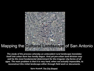
- 1. Mapping the Cultural Landscape of San Antonio The study of the process whereby an antecedent rural landscape translates itself into urban form has hardly begun. And yet pre-urban land division may well be the most fundamental determinant for the irregular city-forms of all ages. The main problem is that it is very hard, when not actually impossible, to reconstruct this initial landscape either through field work or documents. Spiro Kostoff, The City Shaped
- 2. Cultural Landscape What is it, and why should it be considered? A cultural landscape is the result of the human imprint on the natural realm, the natural landscape fashioned by the hand of man. The term originates from anthropological studies to more fully understand and explain the contextual relationships in social studies.
- 3. How is the cultural landscape useful for architects? Lewis Mumford The Culture of Cities, Contrapuntal Order Edmund Bacon The City as an Act of Will, Simultaneity of Movement, Form, and Space Kevin Lynch Normative Theory, Human Values and Settlement Form Relationships Christopher Alexander Pattern Language, Incremental Timelessness Spiro Kostoff Form as Receptacle of Meaning, The Urban Process Rowe and Koetter The City as Collage, Bricolage, the Architect as Bricoleur
- 4. GENERAL RELATIONAL ATTRIBUTES OF A CULTURAL LANDSCAPE NATURAL REALM Geomorphology Climate Water Soils Flora/Fauna HUMAN IMPRINT Land Tenure Infrastructure Architecture Landscape Equipment VANTAGE Time Scale Movement Position Involvement
- 5. TEXAS CITIES URBAN FORM Radial/Concentric Regional Scale San Antonio Houston Dallas/Fort Worth
- 6. THE IRREGULAR CITY FORM The study of the process whereby an antecedent rural landscape translates itself into urban form has hardly begun. And yet pre- urban land division may well be the most fundamental determinant for the irregular city-forms of all ages. The main problem is that it is very hard, when not actually impossible, to reconstruct this initial landscape either through field work or documents. Spiro Kostoff, The City Shaped
- 7. METHODOLOGY ARCHIVAL RESEARCH Historic Maps Deed Records Historic Narratives Contemporary Maps FIELD INVESTIGATION Ground Investigation Aerial Reconnaissance RECONSTRUCTION Comparable Scale Graphic Consistency Measure is intrinsic to the design, habitation, and representation of land. It underlies the variety of ways land is traversed and negotiated; it enables the spacing, marking, delineation, and occupation of a given terrain; and it reflects the values and judgments of the society that lives upon the land…Measure, then, is as much a conceptual apparatus as it is a mode of representation, facilitating events while constructing a particular world. James Corner, Taking Measures Across the American Landscape
- 8. 1722 Presidio and Mision San Antonio Aguayo Expedition
- 9. 1730 Royal Plan for San Fernando Villasenior
- 10. 1767 Map of San Antonio de Bexar Urrutia
- 11. 1873Bird’s Eye View of San Antonio, Augustus Koch
- 12. 1911 Map of Congested District San Antonio Sanborn Insurance Map
- 13. 1965 Quadrangle Map 7.5 Minute Series USGS
- 14. 1725Rio San Antonio Arroyo San Pedro Presidio de Bexar Mision San Antonio de Valero Caminos Reales Acequia Madre Acequia Principal Presidio de Bexar Mision San Antonio de Valero
- 15. Rio San Antonio Arroyo San Pedro Presidio de Bexar Mision San Antonio de Valero Caminos Reales Acequia Madre Acequia Principal 1725 Presidio de Bexar Mision San Antonio de Valero
- 16. Rio San Antonio Arroyo San Pedro Presidio de Bexar Mision San Antonio de Valero Caminos Reales Acequia Madre Acequia Principal 1725 Presidio de Bexar Mision San Antonio de Valero
- 17. Rio San Antonio Arroyo San Pedro Presidio de Bexar Mision San Antonio de Valero Caminos Reales Acequia Madre Acequia Principal 1725 Presidio de Bexar Mision San Antonio de Valero
- 18. Rio San Antonio Arroyo San Pedro Presidio de Bexar Mision San Antonio de Valero Caminos Reales Acequia Madre Acequia Principal 1725 Presidio de Bexar Mision San Antonio de Valero
- 19. Rio San Antonio Arroyo San Pedro Presidio de Bexar Mision San Antonio de Valero Caminos Reales Acequia Madre Acequia Principal 1725 Presidio de Bexar Mision San Antonio de Valero
- 20. Rio San Antonio Arroyo San Pedro Presidio de Bexar Mision San Antonio de Valero Caminos Reales Acequia Madre Acequia Principal 1725 Presidio de Bexar Mision San Antonio de Valero
- 21. Rio San Antonio Arroyo San Pedro Presidio de Bexar Mision San Antonio de Valero Caminos Reales Acequia Madre Acequia Principal 1725 Presidio de Bexar Mision San Antonio de Valero
- 26. The Laws of the Indies regulated social, political and economic life in the American and Philippine Spanish Colonies and provided the planning precepts for the formation of settlements and towns.. The laws were compiled several times, most notably in 1680 under Charles II in the Recopilación de las Leyes de los Reynos de Indias (Compilation of the Laws of the Kingdoms of the Indies). The laws emphasized respect for native populations. LAWS OF THE INDIES 1573 King Philip II Spanish Ordinances for New Towns
- 28. “…choose the province, county, and place which will be settled taking into consideration the health of the area which will be known from the abundance of old men or of young men of good complexion, natural fitness and colour, and without illness; and in the abundance of healthy animals of sufficient size, and of healthy fruits and fields where no toxic or noxious things are grown, but that it be of good climate, the sky clear and benign, the air pure and soft, without impediment or alterations and of good temperature, without excessive heat or cold…and they should be in fertile areas with an abundance of fruits and fields, of good land to plant and harvest, of grasslands to grow livestock, of mountains and forests for wood and building materials for homes and edifices, and of good and plentiful water supply for drinking and irrigation.” LAWS OF THE INDIES 1573 King Philip II Spanish Ordinances for New Towns
- 29. • the health of the area [as evidenced by healthy inhabitants]… • abundance of healthy animals… • healthy fruits and fields where no toxic or noxious things are grown.. • good climate, • the sky clear and benign, • the air pure and soft…and of good temperature, without excessive heat or cold… • fertile areas with an abundance of fruits and fields… • good land to plant and harvest… • grasslands to grow livestock… • mountains and forests for wood and building materials… • good and plentiful water supply for drinking and irrigation.” LAWS OF THE INDIES 1573 King Philip II Spanish Ordinances for New Towns
- 30. CLEAN AIR CLEAN WATER SITE LOCATION/CLIMATE (ENVIRONMENTAL COMFORT) DIVERSE RESOURCES (SUSTAINABILITY) FERTILE SOIL (HEALTHY FOODS) LAWS OF THE INDIES 1573 King Philip II Spanish Ordinances for New Towns
- 31. LAWS OF THE INDIES 1573 King Philip II Spanish Ordinances for New Towns Grid Town Plan PLAZA Minimum Size 200’x300’ Optimum Size 400’x600’ Maximum Size 300’x800’ Ideal Proportion 2:3 width/length Arcades on all sides Primary buildings STREETS Basis for town grid 45 degrees to the cardinal points 12 streets converge on Plaza 4 main center streets 4 pairs each corner Arcades at main streets MEASURE Vara 32.89 inches League (linear) feet, 2.7 miles League (area) 1,728 acres, 7.29 square miles Gun Blast 200-300 yards
- 33. 1750Villa San Fernando Potrero Propios Caminos Reales Acequia Madre expansions Acequia Principal expansions Acequia Pajalache Villa San Fernando
- 34. Villa San Fernando Potrero Propios Caminos Reales Acequia Madre expansions Acequia Principal expansions Acequia Pajalache 1750 Villa San Fernando
- 35. Villa San Fernando Potrero Propios Caminos Reales Acequia Madre expansions Acequia Principal expansions Acequia Pajalache 1750 Villa San Fernando
- 36. Villa San Fernando Potrero Propios Caminos Reales Acequia Madre expansions Acequia Principal expansions Acequia Pajalache 1750 Villa San Fernando
- 37. Villa San Fernando Potrero Propios Caminos Reales Acequia Madre expansions Acequia Principal expansions Acequia Pajalache 1750 Villa San Fernando
- 38. Villa San Fernando Potrero Propios Caminos Reales Acequia Madre expansions Acequia Principal expansions Acequia Pajalache 1750 Villa San Fernando
- 39. Villa San Fernando Potrero Propios Caminos Reales Acequia Madre expansions Acequia Principal expansions Acequia Pajalache 1750 Villa San Fernando
- 40. Villa San Fernando Potrero Propios Caminos Reales Acequia Madre expansions Acequia Principal expansions Acequia Pajalache 1750 Villa San Fernando
- 41. Villa San Fernando Potrero Propios Caminos Reales Acequia Madre expansions Acequia Principal expansions Acequia Pajalache 1750 Villa San Fernando
- 42. Villa San Fernando Potrero Propios Caminos Reales Acequia Madre expansions Acequia Principal expansions Acequia Pajalache 1750 Villa San Fernando
- 43. Villa San Fernando Potrero Propios Caminos Reales Acequia Madre expansions Acequia Principal expansions Acequia Pajalache 1750 Villa San Fernando
- 45. SAN ANTONIO de BEJAR Villa de San Antonio Pueblo del Alamo Mision Concepcion Mision San Jose Mision San Juan Mision Espada 1800
- 46. Villa de San Antonio Pueblo del Alamo Mision Concepcion Mision San Jose Mision San Juan Mision Espada SAN ANTONIO de BEJAR 1800
- 47. Villa de San Antonio Pueblo del Alamo Mision Concepcion Mision San Jose Mision San Juan Mision Espada SAN ANTONIO de BEJAR 1800
- 48. Villa de San Antonio Pueblo del Alamo Mision Concepcion Mision San Jose Mision San Juan Mision Espada SAN ANTONIO de BEJAR 1800
- 49. Villa de San Antonio Pueblo del Alamo Mision Concepcion Mision San Jose Mision San Juan Mision Espada SAN ANTONIO de BEJAR 1800
- 50. Villa de San Antonio Pueblo del Alamo Mision Concepcion Mision San Jose Mision San Juan Mision Espada SAN ANTONIO de BEJAR 1800
- 51. Villa de San Antonio Pueblo del Alamo Mision Concepcion Mision San Jose Mision San Juan Mision Espada SAN ANTONIO de BEJAR 1800
- 52. Acequia Principal Acequia Madre Acequia Pajalache Acequia San Jose Acequia San Juan Acequia Espada SAN ANTONIO de BEJAR 1800
- 53. Acequia Principal Acequia Madre Acequia Pajalache Acequia San Jose Acequia San Juan Acequia Espada SAN ANTONIO de BEJAR 1800
- 54. Acequia Principal Acequia Madre Acequia Pajalache Acequia San Jose Acequia San Juan Acequia Espada SAN ANTONIO de BEJAR 1800
- 55. Acequia Principal Acequia Madre Acequia Pajalache Acequia San Jose Acequia San Juan Acequia Espada SAN ANTONIO de BEJAR 1800
- 56. Acequia Principal Acequia Madre Acequia Pajalache Acequia San Jose Acequia San Juan Acequia Espada SAN ANTONIO de BEJAR 1800
- 57. Acequia Principal Acequia Madre Acequia Pajalache Acequia San Jose Acequia San Juan Acequia Espada SAN ANTONIO de BEJAR 1800
- 58. Acequia Principal Acequia Madre Acequia Pajalache Acequia San Jose Acequia San Juan Acequia Espada SAN ANTONIO de BEJAR 1800
- 59. 8 League Grant Hilltops Fords Caminos Reales SAN ANTONIO de BEJAR 1800
- 60. 8 League Grant Hilltops Fords Caminos Reales SAN ANTONIO de BEJAR 1800
- 61. 8 League Grant Hilltops Fords Caminos Reales SAN ANTONIO de BEJAR 1800
- 62. 8 League Grant Hilltops Fords Caminos Reales SAN ANTONIO de BEJAR 1800
- 63. 8 League Grant Hilltops Fords Caminos Reales SAN ANTONIO de BEJAR 1800
- 64. Barrio del Norte Potrero Pueblo del Alamo Barrio del Sur Laredito Camino Reales Acequia Labor Arriba Acequia Madre expansion 1800 Villa de San Antonio
- 65. 1800 Villa de San Antonio Barrio del Norte Potrero Pueblo del Alamo Barrio del Sur Laredito Camino Reales Acequia Labor Arriba Acequia Madre expansion
- 66. 1800 Villa de San Antonio Barrio del Norte Potrero Pueblo del Alamo Barrio del Sur Laredito Camino Reales Acequia Labor Arriba Acequia Madre expansion
- 67. 1800 Villa de San Antonio Barrio del Norte Potrero Pueblo del Alamo Barrio del Sur Laredito Camino Reales Acequia Labor Arriba Acequia Madre expansion
- 68. 1800 Villa de San Antonio Barrio del Norte Potrero Pueblo del Alamo Barrio del Sur Laredito Camino Reales Acequia Labor Arriba Acequia Madre expansion
- 69. 1800 Villa de San Antonio Barrio del Norte Potrero Pueblo del Alamo Barrio del Sur Laredito Camino Reales Acequia Labor Arriba Acequia Madre expansion
- 70. 1800 Villa de San Antonio Barrio del Norte Potrero Pueblo del Alamo Barrio del Sur Laredito Camino Reales Acequia Labor Arriba Acequia Madre expansion
- 71. 1800 Villa de San Antonio Barrio del Norte Potrero Pueblo del Alamo Barrio del Sur Laredito Camino Reales Acequia Labor Arriba Acequia Madre expansion
- 72. 1800 Villa de San Antonio Barrio del Norte Potrero Pueblo del Alamo Barrio del Sur Laredito Camino Reales Acequia Labor Arriba Acequia Madre expansion
- 73. 1800 Villa de San Antonio Barrio del Norte Potrero Pueblo del Alamo Barrio del Sur Laredito Camino Reales Acequia Labor Arriba Acequia Madre expansion
- 81. Barrio del Norte Potrero Pueblo del Alamo Barrio del Sur Laredito Camino Reales Acequia Labor Arriba Acequia Madre expansion Alameda 1800 Villa de San Antonio
- 83. Plat of the City Tract of San Antonio de Bexar Francois Giraud, Surveyor Theodore Gentilz, Draughtsman 1852
- 85. Disposition of Public Lands Land Ordinance of 1785 Required land be surveyed and recorded on the plat before settlement. 1852
- 86. Railroads Public Space City of San Antonio 1875
- 87. Railroads Public Space City of San Antonio 1875
- 88. Railroads Public Space City of San Antonio 1875
- 89. Streetcar Transit River Channelization Bridges City of San Antonio 1925
- 90. 1925 City of San Antonio Streetcar Transit River Channelization Bridges
- 91. 1925 City of San Antonio Streetcar Transit River Channelization Bridges
- 92. 1925 City of San Antonio Streetcar Transit River Channelization Bridges
- 93. Expressway System Street Closures City of San Antonio 2000
- 96. City of San Antonio 2000Expressway System Street Closures
- 97. City of San Antonio 2000Expressway System Street Closures
- 100. Street Pattern Types Caminos Reales Laws of the Indies Acequia Mission Land Grant Spanish Land Grant Ranch Grant Cardinal Grid West Side Grid Railroad Radial Drainage Hillside Expressway San Antonio’s urban fabric is a mosaic of geomorphic, radial and gridiron street patterns that overlay the natural divide between hill country and prairie, resulting in an episodic and polymorphic city form. Polymorphic City Form SAN ANTONIO CULTURAL LANDSCAPE
- 101. Laws of the Indies Classical/Geomorphic Grid 17th century planning precepts for Spanish Colonial towns promoted a uniform street grid with a central plaza. This ideal form is well adapted to the course alignment of the San Antonio River and San Pedro Creek. Spanish Land Grant Metes & Bounds - Geomorphi Boundaries establishing the 1733 Land Grant also connected strategic point of defense and access: hilltops along the northern boundaries and water crossings along the southern boundaries. Aransas, Ogden, Jackson Keller, Hillcrest, Acme and Nogalitos mark the limits of Villa San Fernando. Terrain Topography/Drainage Open gravity flow irrigation channels for agricultural and domestic water were in use for more than half of San Antonio’s history. Their courses became geometric determinants in subsequent urbanization. SAN ANTONIO CULTURAL LANDSCAPE Acequia Geomorphic – Linear/Orthogonal The geomorphographic character is determined by the geology, soils, flora, climate, and resultant land form.
- 102. Secularization of missions Concepcion, San Jose, San Juan and Espada resulted in land grants with narrow frontage on the San Antonio River and extremely long side boundaries oriented east/west. Payments of land by the Republic of Texas for military service encouraged settlement north of the 1733 Spanish Land Grant. The parcel configuration is aligned with the NE and NW boundaries of the 1733 grant. Mission Land Grant Linear/Orthogonal Ranch Grant Gridiron Cardinal Grid Township Streets that follow the 1852 subdivision of the propios for public auction. The majority of the streets are oriented true north; the west side grid streets are slightly east of north due to initial alignment with San Pedro Creek. Many Spanish Colonial regional roads followed the preexisting indigenous trail network between strategic destinations. The convergence of these roads emerged as radials imbedded in the expanding city.SAN ANTONIO CULTURAL LANDSCAPE Caminos Reales Radial
- 103. Drainage Geomorphic Stream Bed Hillside Geomorphic Closely related to Riparian Streets, Hillside Streets are associated more with steeper grades remote from significant streambeds. Primary streets are parallel with contours to provide terracing and secondary streets orthogonally traverse the slope. Railroad Radial Pattern Rail lines generally follow the earlier Caminos Reales and so approach the center in radial pattern until squaring up with the cardinal alignment of downtown streets. Drainage pattern streets are physiographically similar to acequia pattern streets as they are designed to convey water, but drainage streets are for the confluence of runoff rather than distribution of irrigation, and a low-cost stormwater solution for 20th century subdivisions. Expressway Radial/Concentric Pattern The primary State and US Interstate highways are larger scale successors to the Caminos Reales and so are radial in pattern at the regional scale. Similar to most other cities San Antonio has circumferential loops for moving and distributing large volumes of traffic. SAN ANTONIO CULTURAL LANDSCAPE
- 104. San Antonio Psychrometrics- Year 28.4%
- 106. Walkable Cities Psychrometrics- Year New York San Francisco Boston Philadelphia Cairo Nice 18.1% 8.7% 13.3% 19.6% 25.8% 24.5%
- 107. “Any great work has within it seminal forces capable of influencing subsequent development around it, and often in ways unconceived of by its creator.” Edmund N. Bacon, The Design of Cities