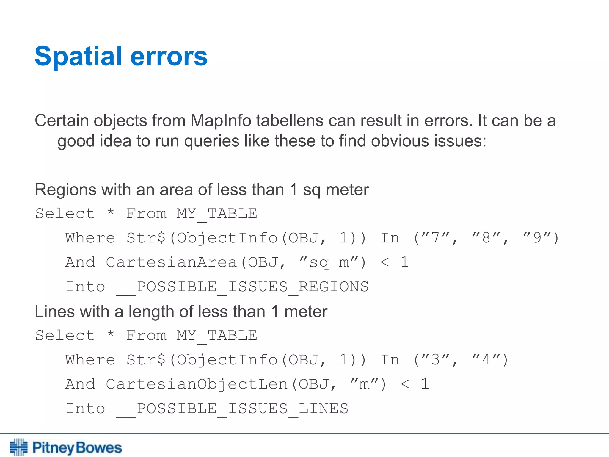
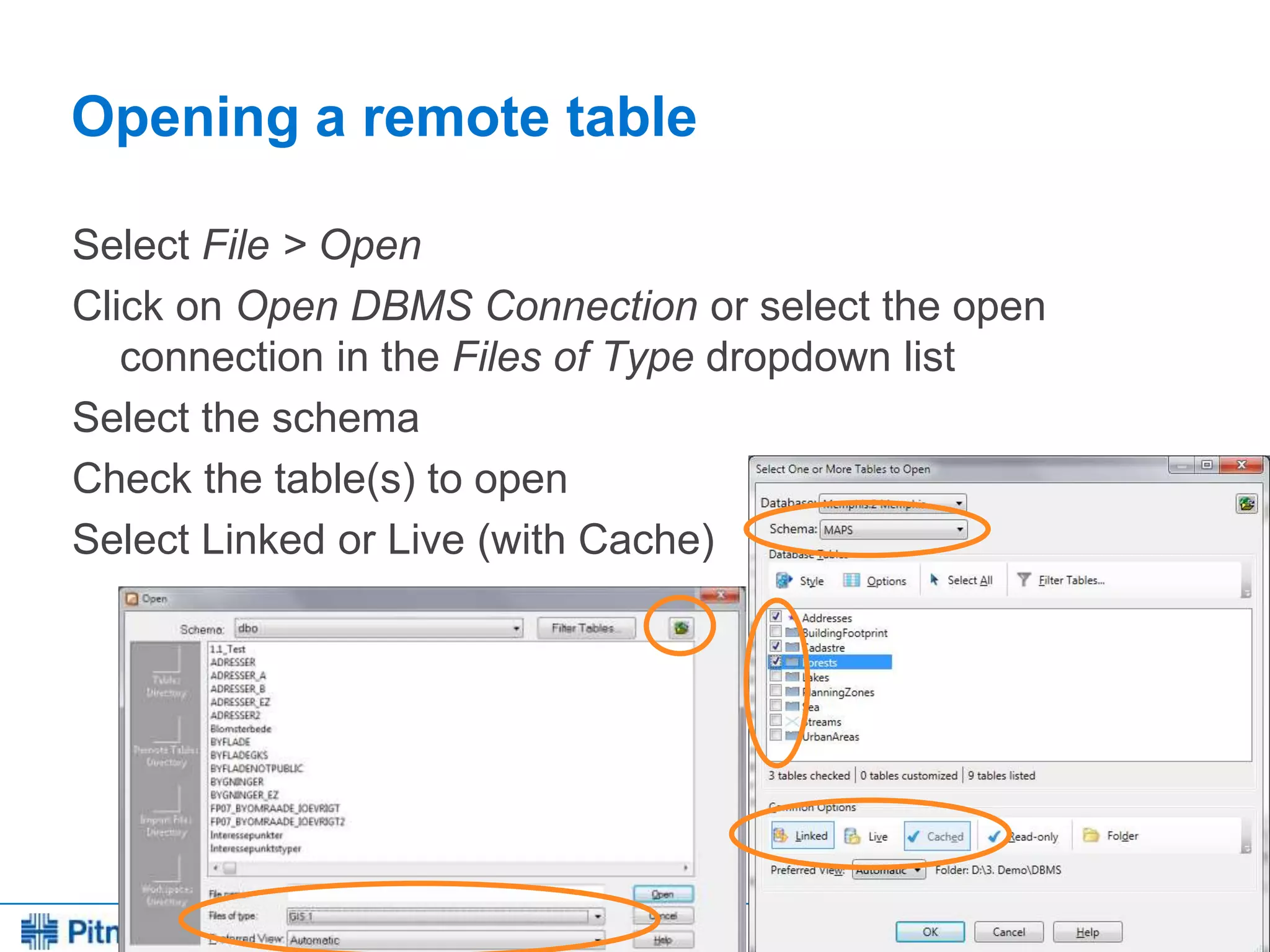
Downloaded 344 times


![Every connection is a new opportunity™
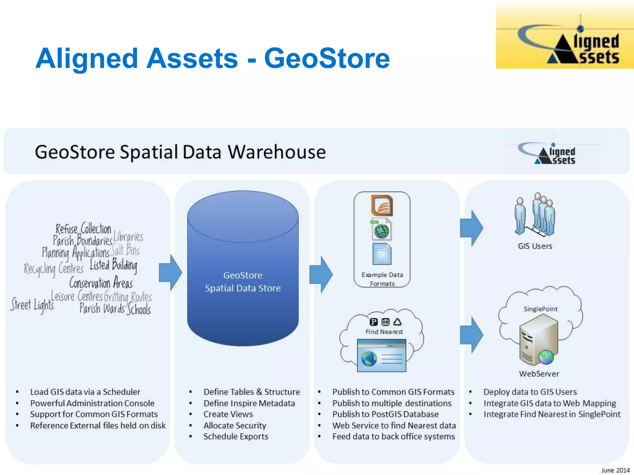
Trigger statement
CREATE TRIGGER [schema_name.] trigger_name
ON { table | view }
[ WITH <dml_trigger_option> [ ,...n ] ]
{ FOR | AFTER | INSTEAD OF } { [INSERT] [,] [UPDATE] [,] [DELETE]}
[ NOT FOR REPLICATION ]
AS { sql_statement [ ; ]
[ ,...n ]
| EXTERNAL NAME <method specifier [ ; ] > }](https://image.slidesharecdn.com/mugukisessiononmipro12andsqlserver2008-140701090415-phpapp02/75/MapInfo-Professional-12-0-and-SQL-Server-2008-103-2048.jpg)
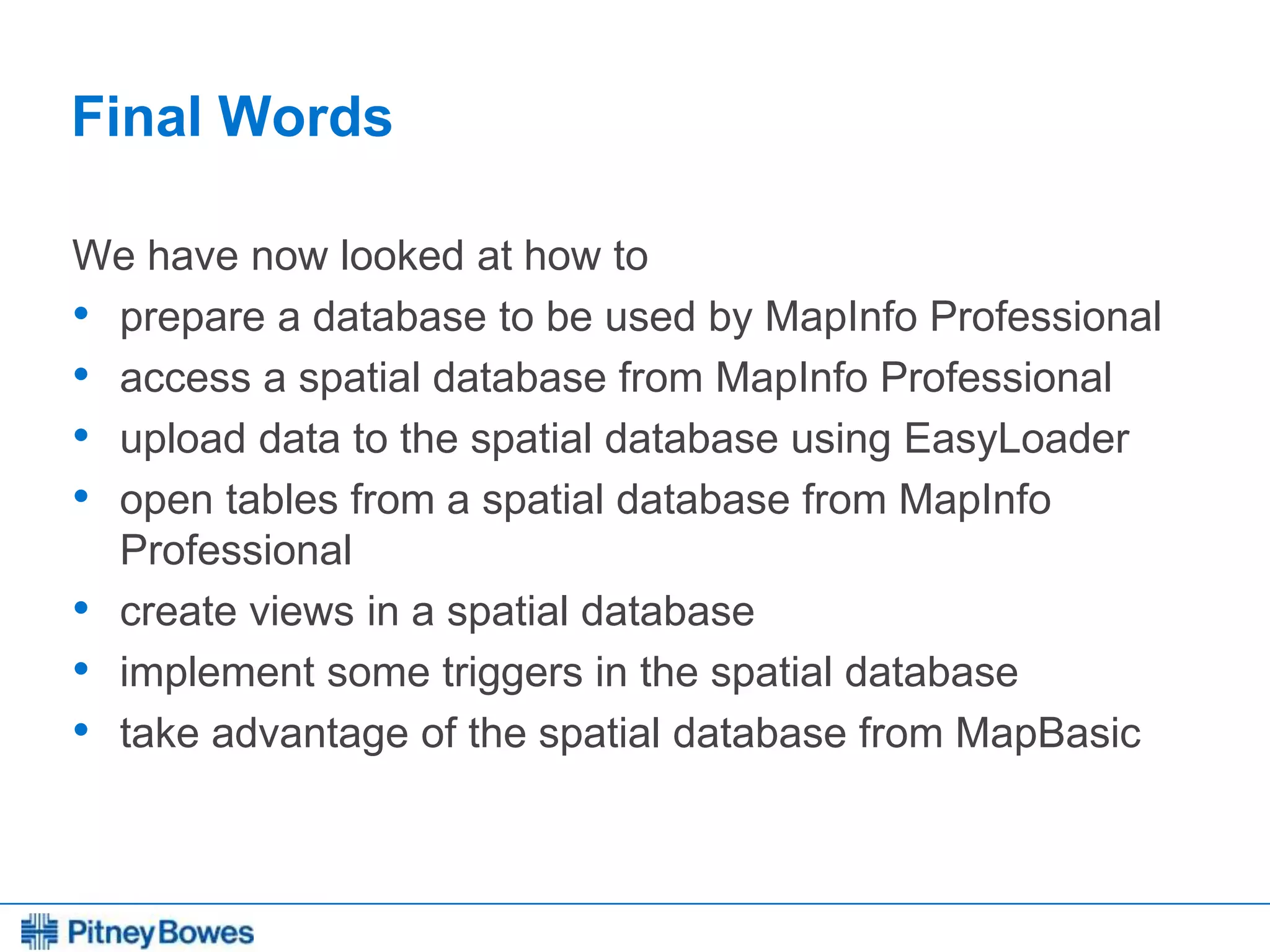
![Every connection is a new opportunity™
Trigger updating X and Y columns
Create TRIGGER [dbo].[trg_MYTABLE_AfterUpdate]
ON [dbo].[MYTABLE]
AFTER INSERT, UPDATE
AS
BEGIN
UPDATE DBO.MYTABLE
SET X = SP_GEOMETRY.STX,
Y = SP_GEOMETRY.STY
WHERE MI_PRINX IN (SELECT MI_PRINX FROM inserted)
END](https://image.slidesharecdn.com/mugukisessiononmipro12andsqlserver2008-140701090415-phpapp02/75/MapInfo-Professional-12-0-and-SQL-Server-2008-107-2048.jpg)


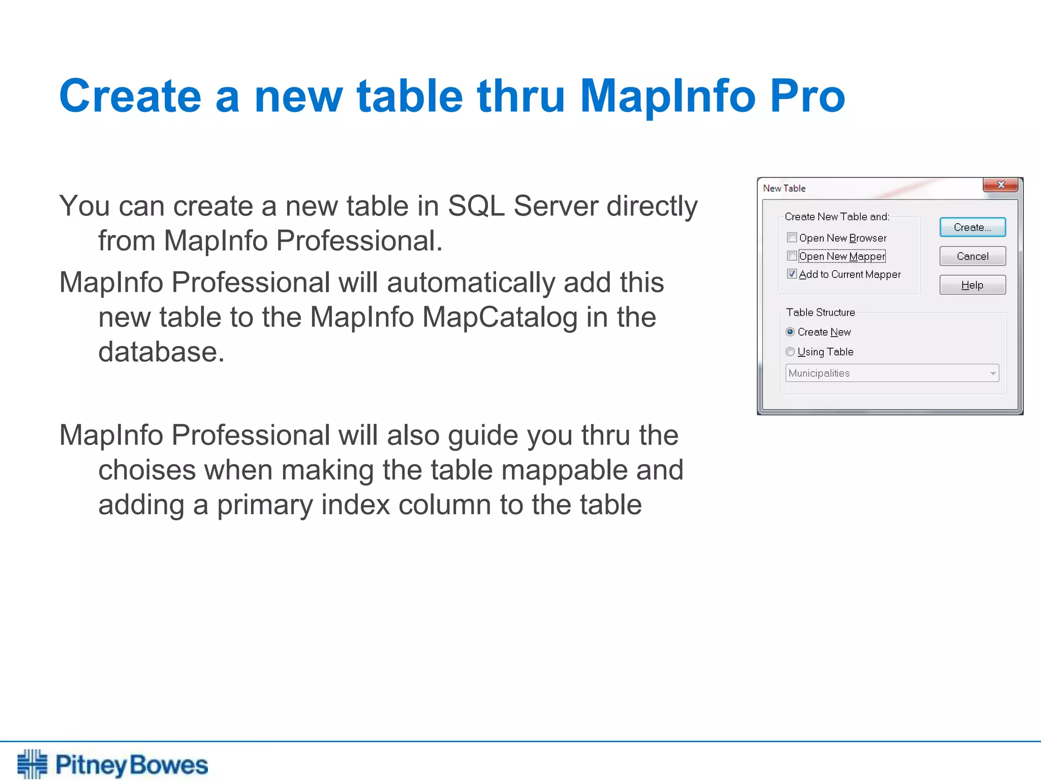
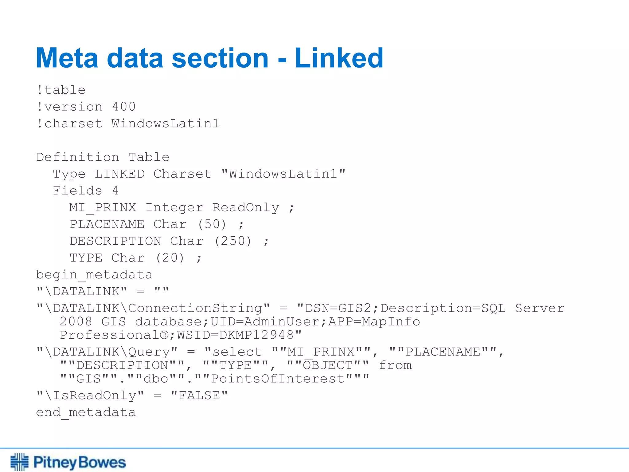
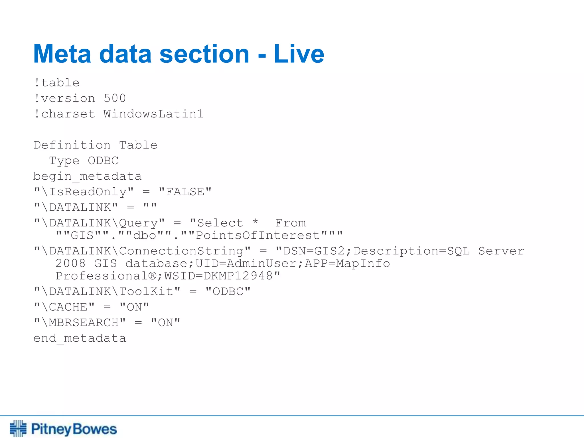
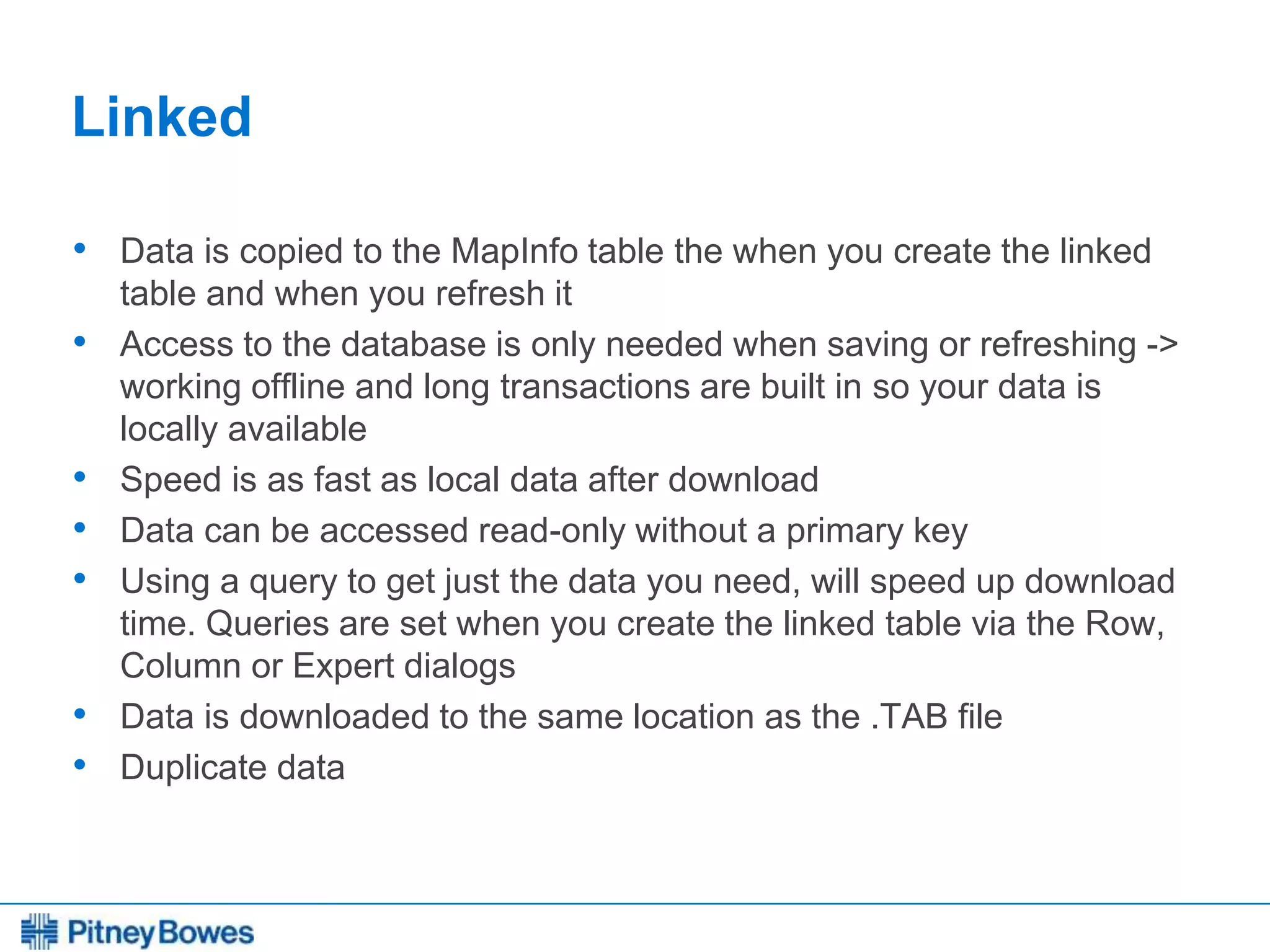
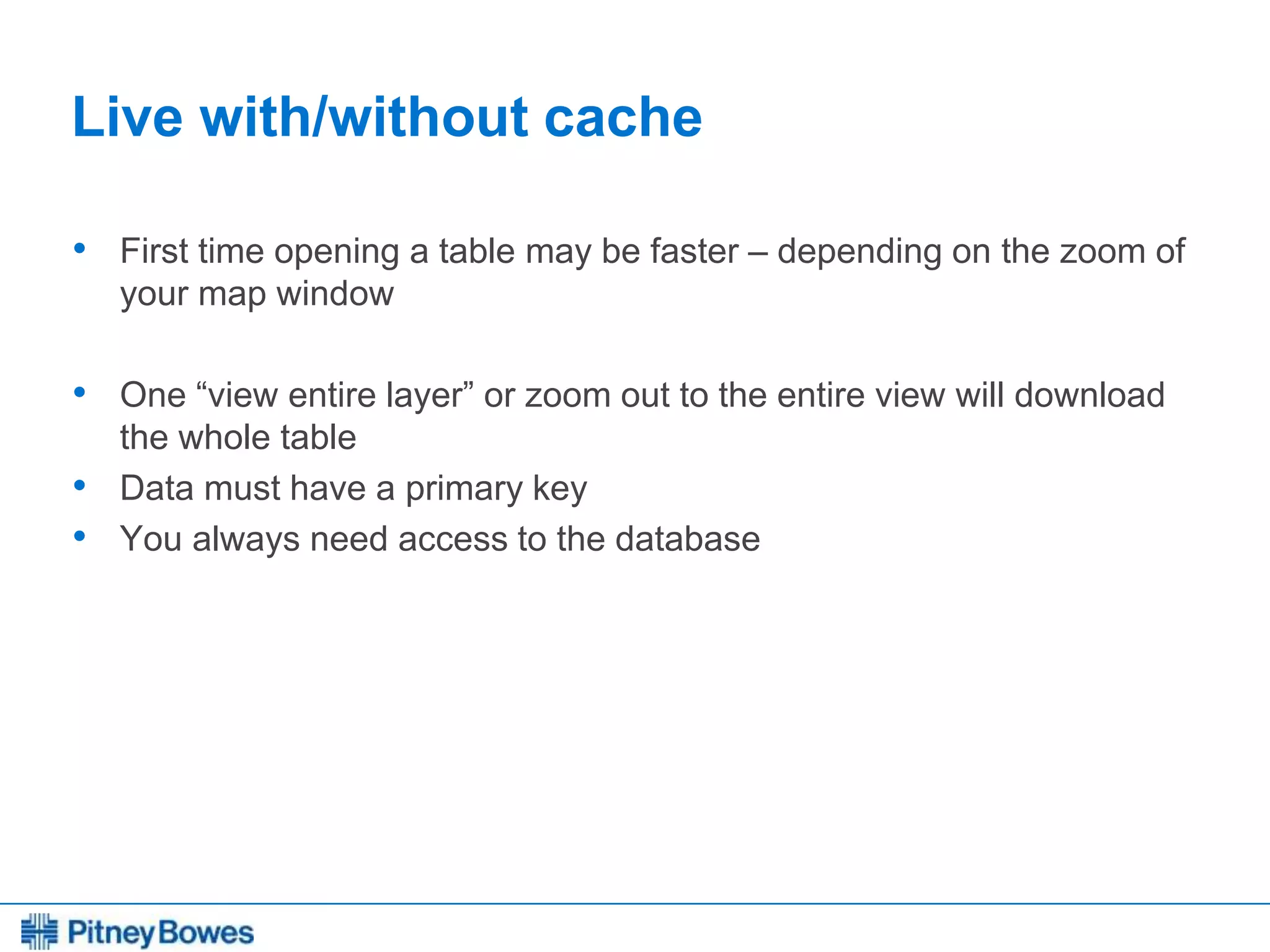
The document provides a comprehensive guide on setting up and working with spatial databases using MapInfo Professional, focusing on SQL Server and other related tools. It covers topics such as creating databases, managing users and schemas, data types, and employing EasyLoader for uploading tables. Additionally, it discusses the differences between linked and live table connections, offering best practices for various data management scenarios.