Download as PDF, PPTX


![#import "STSViewController.h"
@interface STSViewController ()
{
IBOutlet MKMapView *_mapView;
}
@end
@implementation STSViewController
- (void)viewDidLoad {
[super viewDidLoad];
[_mapView setMapType:3];
}
- (BOOL)shouldAutorotateToInterfaceOrientation:(UIInterfaceOrientation)interfaceOrientation {
return YES;
}
@end](https://image.slidesharecdn.com/mapkitlight-130121060048-phpapp01/85/Map-kit-light-30-320.jpg)


![Simulateur
#if TARGET_IPHONE_SIMULATOR
[_mapView setMapType:MKMapTypeHybrid];
#else
[_mapView setMapType:3];
#endif
Appareil](https://image.slidesharecdn.com/mapkitlight-130121060048-phpapp01/85/Map-kit-light-34-320.jpg)


![- (BOOL)shouldAutorotateToInterfaceOrientation:(UIInterfaceOrientation)interfaceOrientation
{…}
#pragma mark -
- (void)delayedSaveVisibleMapRect {
MKMapRect tVisibleMapRect=_mapView.visibleMapRect;
NSString *tString=[NSString stringWithFormat:@"%g|%g|%g|%g",tVisibleMapRect.origin.x,
tVisibleMapRect.origin.y,
tVisibleMapRect.size.width,
tVisibleMapRect.size.height];
[[NSUserDefaults standardUserDefaults] setObject:tString forKey:STSLastVisibleMapRect];
}
#pragma mark - MKMapView delegate
- (void)mapView:(MKMapView *)mapView regionDidChangeAnimated:(BOOL)animated {
[NSObject cancelPreviousPerformRequestsWithTarget:self
selector:@selector(delayedSaveVisibleMapRect)
object:nil];
[self performSelector:@selector(delayedSaveVisibleMapRect)
withObject:nil
afterDelay:1.0];
}
@end](https://image.slidesharecdn.com/mapkitlight-130121060048-phpapp01/85/Map-kit-light-38-320.jpg)


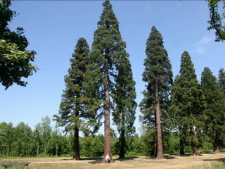
![#import "STSTreeAnnotation.h"
@interface STSTreeAnnotation ()
{
! CLLocationCoordinate2D _coordinate;
! STSTreeKind _treeKind;
! BOOL _logged;
}
@end
@implementation STSTreeAnnotation
@synthesize coordinate=_coordinate,treeKind=_treeKind,logged=_logged;
+ (id) treeAnnotationWithCoordinate:(CLLocationCoordinate2D)inCoordinate treeKind:
(STSTreeKind)inKind logged:(BOOL)inLogged {
! return [[[STSTreeAnnotation alloc] initWithCoordinate:inCoordinate
treeKind:inKind logged:inLogged] autorelease];
}
- (id) initWithCoordinate:(CLLocationCoordinate2D)inCoordinate treeKind:(STSTreeKind)inKind
logged:(BOOL)inLogged {
! self=[super init];
!
! if (self!=nil) {
! ! _coordinate=inCoordinate;
! ! _treeKind=inKind;
! ! _logged=inLogged;](https://image.slidesharecdn.com/mapkitlight-130121060048-phpapp01/85/Map-kit-light-44-320.jpg)
![#import "STSViewController.h"
#import "STSTreeAnnotation.h"
#import <CoreLocation/CoreLocation.h>
@interface STSViewController ()
{
IBOutlet MKMapView *_mapView;
}
- (void)delayedSaveVisibleMapRect;
@end
NSString * const STSLastVisibleMapRect=@"LastVisibleMapRect";
@implementation STSViewController
- (void)viewDidLoad {
[super viewDidLoad];
/* Set Map Type to Terrain */
[_mapView setMapType:3];
/* Restore (approximately) the visible map rect */
NSString *tString=[[NSUserDefaults standardUserDefaults]](https://image.slidesharecdn.com/mapkitlight-130121060048-phpapp01/85/Map-kit-light-45-320.jpg)


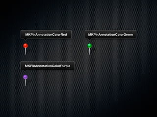


![- (id)initWithAnnotation:(STSTreeAnnotation *)inTreeAnnotation reuseIdentifier:(NSString
*)reuseIdentifier {
self=[super initWithAnnotation:inTreeAnnotation reuseIdentifier:reuseIdentifier];
if (self!=nil) {
if ([inTreeAnnotation isTreeLogged]==YES) {
self.pinColor=MKPinAnnotationColorRed;
}
else {
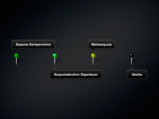
switch([inTreeAnnotation treeKind]) {
case STSTreeKindSequoiadendronGiganteum:
self.pinColor=MKPinAnnotationColorGreen;
break;
case STSTreeKindSequoiaSempervirens:
self.pinColor=MKPinAnnotationColorPurple;
break;
case STSTreeKindMetasequoia:
self.pinColor=MKPinAnnotationColorGreen;
break;
}
}
[super setImage:[self image]];
}
return self;
}](https://image.slidesharecdn.com/mapkitlight-130121060048-phpapp01/85/Map-kit-light-57-320.jpg)


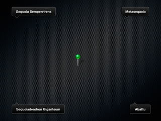
![}
+ (UIImage *)imageForTreeKind:(STSTreeKind)treeKind logged:(BOOL)logged {
UIImage *tImage=nil;
if (logged==YES) {
tImage=[UIImage imageNamed:@"loggedPin"];
}
else {
MKPinAnnotationColorRed
switch(treeKind) {
case STSTreeKindSequoiadendronGiganteum:
tImage=[UIImage imageNamed:@"sequoiadendronPin"];
break;
case STSTreeKindSequoiaSempervirens:
tImage=[UIImage imageNamed:@"sempervirensPin"];
break;
MKPinAnnotationColorPurple
case STSTreeKindMetasequoia:
tImage=[UIImage imageNamed:@"metasequoiaPin"];
break;
}
}
return tImage;
}
#pragma mark -
- (id)initWithAnnotation:(STSTreeAnnotation *)annotation reuseIdentifier:(NSString
*)reuseIdentifier {](https://image.slidesharecdn.com/mapkitlight-130121060048-phpapp01/85/Map-kit-light-62-320.jpg)


![<?xml version="1.0" encoding="UTF-8"?>
<kml xmlns="http://earth.google.com/kml/2.2">
<Document>
<name><![CDATA[Val-d'Oise (95)]]></name>
<Style id="gitesdegaule.fr">
<LineStyle>
<color>cc2d3939</color>
<width>3</width>
</LineStyle>
<PolyStyle>
<color>804d4def</color>
</PolyStyle>
</Style>
<Placemark id="val-doise">
<name><![CDATA[Val-d'Oise (95)]]></name>
<styleUrl>#gitesdegaule.fr</styleUrl>
<Polygon>
<outerBoundaryIs>
<LinearRing>
<tessellate>1</tessellate>
<coordinates>
2.20056187,48.90881128,250
</coordinates>
</LinearRing>
</outerBoundaryIs>
</Polygon>
</Placemark>
</Document>
</kml>](https://image.slidesharecdn.com/mapkitlight-130121060048-phpapp01/85/Map-kit-light-74-320.jpg)


![#import "STSPolygonWrapper.h"
@interface STSPolygonWrapper ()
{
! MKPolygon * _polygon;
}
@end
@implementation STSPolygonWrapper
@synthesize polygon=_polygon;
+ (STSPolygonWrapper *)polygonWrapperWithContentsOfURL:(NSURL *)inURL {
! STSPolygonWrapper *tPolygonWrapper=nil;
!
! if (inURL!=nil)
tPolygonWrapper=[[STSPolygonWrapper alloc] initWithContentsOfURL:inURL];
!
! return [tPolygonWrapper autorelease];
}
- (id)initWithContentsOfURL:(NSURL *)inURL {
! self=[super init];
!
! if (self!=nil) {
! ! NSString *tRawCoordinates;
! !](https://image.slidesharecdn.com/mapkitlight-130121060048-phpapp01/85/Map-kit-light-79-320.jpg)
![#import "STSViewController.h"
#import "STSTreeAnnotation.h"
#import "STSTreeAnnotationView.h"
#import "STSPolygonWrapper.h"
#import <CoreLocation/CoreLocation.h>
@interface STSViewController ()
{…}
- (void)delayedSaveVisibleMapRect;
@end
NSString * const STSLastVisibleMapRect=@"LastVisibleMapRect";
NSString * const STSTreeAnnotationViewIdentifier=@"TreeAnnotationViewIdentifier";
@implementation STSViewController
- (void)viewDidLoad {
[super viewDidLoad];
/* Set Map Type to Terrain */
[_mapView setMapType:3];
/* Restore (approximately) the visible map rect */](https://image.slidesharecdn.com/mapkitlight-130121060048-phpapp01/85/Map-kit-light-80-320.jpg)


![#import "STSMapView.h"
@implementation STSMapView
@synthesize trackingMode=_trackingMode;
- (void) dealloc {
! [_cachedOriginalRecognizers release];
!
! [super dealloc];
}
#pragma mark -
- (void) setTrackingMode:(NSInteger)inMode {
! if (_trackingMode!=inMode) {
! ! if (inMode==STSMAPVIEW_TRACKING_MODE_NORMAL) {
! ! !
self.zoomEnabled=YES;
self.scrollEnabled=YES;
if (_cachedOriginalRecognizers!=nil) {
! ! ! ! self.gestureRecognizers=_cachedOriginalRecognizers;
! ! ! !
! ! ! ! [_cachedOriginalRecognizers release];
! ! ! !
! ! ! ! _cachedOriginalRecognizers=nil;
! ! ! }
! ! }
! ! else {](https://image.slidesharecdn.com/mapkitlight-130121060048-phpapp01/85/Map-kit-light-90-320.jpg)

![#import "STSPolygonWrapper.h"
@interface STSPolygonWrapper ()
{
! MKPolygon * _polygon;
! CGMutablePathRef _pathRef;
! BOOL _contours;
NSString * _label;
}
@end
@implementation STSPolygonWrapper
@synthesize polygon=_polygon,contours=_contours,label=_label;
+ (STSPolygonWrapper *)polygonWrapperWithContentsOfURL:(NSURL *)inURL label:(NSString
*)inLabel {
! STSPolygonWrapper * tPolygonWrapper=nil;
!
! if (inURL!=nil)
tPolygonWrapper=[[STSPolygonWrapper alloc] initWithContentsOfURL:inURL
label:inLabel];
!
! return [tPolygonWrapper autorelease];
}
- (id)initWithContentsOfURL:(NSURL *)inURL label:(NSString *)inLabel {
! self=[super init];](https://image.slidesharecdn.com/mapkitlight-130121060048-phpapp01/85/Map-kit-light-92-320.jpg)

![#import "STSViewController.h"
#import "STSPolygonWrapper.h"
#import <CoreLocation/CoreLocation.h>
@interface STSViewController ()
{
IBOutlet STSMapView *_mapView;
NSMutableArray *_overlays;
STSPolygonWrapper *_overlay;
}
- (void)delayedSaveVisibleMapRect;
@end
NSString * const STSLastVisibleMapRect=@"LastVisibleMapRect";
@implementation STSViewController
- (void)viewDidLoad {
[super viewDidLoad];
/* Set Map Type to Terrain */
[_mapView setMapType:3];](https://image.slidesharecdn.com/mapkitlight-130121060048-phpapp01/85/Map-kit-light-94-320.jpg)


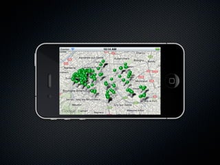
This document provides information about using MapKit and displaying map data in iOS applications. It discusses displaying maps, adding annotations and overlays like polygons and circles, handling gestures, and loading KML data. It includes code snippets in Objective-C for creating map views, annotations, overlays from KML, handling gestures, and displaying annotation views with custom images.