1. I.S.F.D LENGUAS VIVAS BARILOCHE –
PRÁCTICA DOCENTE III
ENTREGA DE PLANIFICACIÓN
ALUMNO PRACTICANTE: María Silvia Maestromey
Año y sección: 4to nivel
Nivel lingüístico del curso: mixto pre-intermediate to advanced
Cantidad de alumnos: 18
Tipo de Planificación: clase
Unidad Temática: Continents
Clase Nº: 1
Duración de la clase: 80 minutos
Fecha de la clase: 6/06/19
Fecha de entrega de la planificación: 01/06/19
Learning Aims
During this lesson, learners will be able to:
- write down notes from a video.
- summarize an article about a country in Africa.
- extract the main ideas in a text.
- work collaboratively.
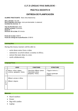
Language Focus
LEXIS FUNCTIONS STRUCTURE
R
E
V
Nature, culture, religion,
currency, geography, history
-Describing different places
-Describing culture,
geography, history
- “Egypt is home to…”
-“Egypt’s landscape
contains…”
N
E
W
Different animals in Africa
Different religions
Materials
Board markers
Eraser
Bag with candies
Laptop
2. Projector
Loud speakers
Sets of photocopies
Procedures
ROUTINE (5 minutes)
WARM- UP (10 minutes)
I give each student a piece of candy; “I want to invite you something sweet so as to start this
lesson”. Students will pick it without choosing. “Now that you all have a piece I want you to get
together with your classmates who got the same candy as you. Sit together so you can work in
groups for the following activities”. Depending on the colour they got, they will get in groups,
that is, all students who got a red piece of candy will work together. As they get together, I will
ask them to tell me something about themselves as they unwrap the piece of candy “Please put
all the pieces of paper in this bag, so we do not leave them all over the classroom” I will give
one of the students the bag so they put all the wrappers inside.
PRESENT ATI ON (10 minutes)
After finishing the presentation activity, I will tell students that we will be working with one
continent in this class: Africa. I will ask them to tell me anything they know about this
continent. In case they cannot come up with anything, I will tell them to think about countries,
animals, languages, weather. Then I will show them the following video about Africa and I will
ask them to take down notes about the most important facts.
https://www.youtube.com/watch?v=PSYHMWmyVfo&t=12s
DEVELOP M ENT (PRACTI CE and PRODUCTI ON)
Activity 1 (5 minutes)
Once the video finishes, I will ask students to share what they wrote down about the video. I
will write down their notes on the board so they can copy what they did not get the first time.
Activity 2 (15 minutes)
Then I will hand out texts about different countries in Africa. Each group will have a different
country. “Now you are going to read about different touristic countries in Africa. Each group
will read about a different one.” The texts will be taken from the website
www.kids.nationalgeographic.com and they will be about Tanzania, Nigeria, South Africa,
Kenya and Egypt.
Tanzania: https://kids.nationalgeographic.com/explore/countries/tanzania/#tanzania-masai.jpg
Nigeria: https://kids.nationalgeographic.com/explore/countries/nigeria/#nigeria-river.jpg
South Africa: https://kids.nationalgeographic.com/explore/countries/south-africa/#south-africa-
johannesburg.jpg
Kenya: https://kids.nationalgeographic.com/explore/countries/kenya/#kenya-reserve.jpg
Egypt: https://kids.nationalgeographic.com/explore/countries/egypt/#egypt-pyramids.jpg
3. I will hand out 2 copies per group. I will walk around monitoring them in case they need help
with some specific vocabulary or in case there is something they do not understand. They will
also be able to use dictionaries, if necessary.
Activity 3 (15 minutes)
“Once you are done reading the text, and get the main ideas of each paragraph and make a
summary. Decide if there is anything you consider you can leave behind and if there is
anything you want to add.”
Activity 4 (10 minutes)
In order to look for more information, I will tell students to search for it online on their
cellphones. “You can look for more information about your country on your cellphone. Think
of any important information that is not on the text and you want to include”.
CLOSURE (5 minutes)
“Please remember to bring the material I gave you next class so we can continue working with
it. You should also bring markers and colours in order to use them for one of next class
activities in which you are going to give a presentation about the country you were given”. I
will ask them to put away and I will say “Thank you for your attention, see you next class.
Goodbye”.
4. APPENDIX
EGYPT
FAST FACTS
OFFICIAL NAME: Arab Republic of Egypt
FORM OF GOVERNMENT: Republic
CAPITAL: Cairo
POPULATION: 88,487,396
OFFICIAL LANGUAGE: Arabic
MONEY: Egyptian pound
AREA: 386,662 square miles (1,001,449
square kilometers)
MAJOR MOUNTAIN RANGES: Eastern
Highlands
MAJOR RIVER: Nile
Egyptian Flag
5. Map of Egypt
GEOGRAPHY
Without the Nile River, all of Egypt would be desert. Only about an inch (2.5 centimeters) of rain
falls throughout Egypt each year. But each summer, the river rises because of rains at its source
far to the south in Ethiopia. Floods cover the river's valleys, leaving sediments needed for trees,
plants, and crops to grow.
Egypt is often divided into two sections: Upper Egypt in the south and Lower Egypt in the north.
The sections are named this way because the Nile flows from south to north. The river empties
into the Mediterranean Sea.
Southern Egypt's landscape contains low mountains and desert. Northern Egypt has wide valleys
near the Nile and desert to the east and west. North of Cairo, the capital, is the sprawling,
triangular Nile River Delta. This fertile land is completely covered with farms.
PEOPLE & CULTURE
About 90 percent of Egyptians are Muslim, which means they are followers of the Islamic religion.
About 10 percent of Egyptians are Copts, one of the oldest branches of the Christian religion.
Egypt's population is growing rapidly. This puts strains on Egypt's resources, since most people
live in a narrow strip of land along the Nile River. Having so many people in such a small area can
cause overcrowding, from schools to apartment buildings to hospitals.
Children are highly valued in Egypt, especially in rural areas where they help on family farms.
Children are also expected to look after their parents in their old age.
6. NATURE
Egypt is home to a wide variety of animals and plants, including jackals, gazelles, crocodiles, and
cobras. The best places to see Egypt's wildlife are in its more than 20 protected regions, which
include oases, deserts, mountains, coastal areas, river islands, and wetlands.
Egyptians have always been close to the natural world. The ancient Egyptians left paintings and
carvings of large animals like elephants, hippos, leopards, and cheetahs. These animals were
once common in Egypt, but they are now rare or extinct because of hunting and habitat loss.
Egyptian Pound - Photograph by Roy Pedersen, Dreamstime
GOVERNMENT & ECONOMY
Egypt's geography, population, history, and military strength have made it highly influential in the
region. Egypt is a democratic republic, although some critics claim that it is not truly democratic.
Until 2005, there was never more than one presidential candidate to vote for.
Along with oil and gas exports, Egypt's tourism industry remains a key part of its economy. Visitors
flock to the country to see ancient monuments like the Great Pyramids and the Sphinx.
HISTORY
The first people to live on the banks of the Nile were hunters and fishermen, who settled there
over 8,000 years ago. They learned to grow crops and raise animals, and they began to build
villages and towns. They traded with their neighbors and learned to sail boats. By 3000 B.C., a
civilization was established.
7. Around 3100 B.C., the kingdoms of Upper and Lower Egypt were unified under a powerful king,
later called a pharaoh. These kings built huge pyramids, temples, and other monuments. They
also conquered other lands.
By 1000 B.C., Egypt had split into smaller parts and the kingdom was in decline. Strong neighbors
attacked and took over Egyptian territory. In 31 B.C., Egypt fell under Roman control. In A.D. 640,
Muslim warriors took over Egypt and founded the modern capital, Cairo. They ruled for several
centuries. In the 16th century, Egypt became part of the Ottoman Turkish Empire.
European powers played an increasing role in Egypt starting in the late 18th century. In 1882, the
British invaded and occupied Egypt. The British wanted control of the Suez Canal, which linked
the Mediterranean Sea with the Red Sea and greatly shortened the sailing trip from Asia to
Europe. Egypt gained full independence from Great Britain in 1952 and took control of the Suez
Canal in 1956.
Egypt and other neighboring Arab countries fought a series of wars with the Jewish state of Israel
into the 1970s. In 1979 Egypt and Israel signed a peace agreement.
In 2011, a popular uprising toppled Egypt's long-time president, Hosni Mubarek. The country has
held several democratic elections since 2011, but the role of the military in government remains
strong.
Egypt pyramids
10. Map of Kenya
GEOGRAPHY
Even if you've never been to Kenya, chances are you know what it looks like. Kenya's savanna is
familiar from movies, TV shows, books, and commercials. It's the landscape many people imagine
when they think of Africa.
Kenya is located in East Africa. Its terrain rises from a low coastal plain on the Indian Ocean to
mountains and plateaus at its center. Most Kenyans live in the highlands, where Nairobi, the
capital, sits at an altitude of 5,500 feet (1,700 meters).
West of Nairobi the land descends to the Great Rift Valley, a 4,000-mile (6,400-kilometer) tear in
the Earth's crust. Within this valley in the deserts of northern Kenya are the jade-green waters of
famous Lake Turkana.
PEOPLE & CULTURE
In Kenya, more than 60 languages are spoken and there are more than 40 ethnic groups. Almost
everyone there speaks more than one African language.
School is free in Kenya, but many children are too busy to go to classes. They help their families
by working the land, tending cattle, cooking, or fetching water.
Music and storytelling are important parts of Kenyan culture. For centuries, tribes throughout the
country have used songs, stories, and poems to pass on their beliefs, history, and customs.
11. NATURE
Millions of people visit Kenya each year to see its endless savanna and the animals that inhabit
it: elephants, lions, cheetahs, giraffes, zebras, hippos, rhinos, and more. The Kenyan government
has set up more than 50 reserves and parks to protect these animals.
People seeking African wildlife usually focus on Kenya's lowland savannas. But Kenya's
ecosystems also include deserts, swamps, mountain, and forests. Each region has its own mix of
plants and animals that are suited to the area's particular conditions. Kenya's highland forests are
home to many animals found nowhere else in the world.
Kenyan Shilling, Photograph by Michael Smith, Dreamstime
GOVERNMENT
Kenya was a colony of the United Kingdom from 1920 until 1963. Since its independence, it has
been a republic, with a president, a national assembly, called the Bunge, and a judiciary.
HISTORY
Kenya's location between the Indian Ocean and Lake Victoria means that people from all over
Africa and the Middle East have traveled and traded across it for centuries. This has created a
diverse culture with many ethnic groups and languages.
Scientists think Northern Kenya and Tanzania may have been the original birthplace of humans.
The bones of one of the earliest human ancestors ever found were discovered in Kenya's Turkana
Basin.
Slavery is a big part of Kenya's history. During the 1600s and 1700s, many Kenyans were
kidnapped and taken as slaves by Arabs, Europeans, and Americans. By the mid-19th century,
slavery was outlawed by most countries, but by then, thousands of Kenyans and other East
Africans had been taken to countries throughout the world.
13. Tribal people in Kenya
Lake Victoria
Source: https://kids.nationalgeographic.com/explore/countries/kenya/#kenya-reserve.jpg
14. NIGERIA
FAST FACTS
OFFICIAL NAME: Federal Republic of
Nigeria
FORM OF GOVERNMENT: Federal republic
CAPITAL: Abuja
POPULATION: 177,155,754
OFFICIAL LANGUAGES: English
MONEY: Naira
AREA: 356,667 square miles (923,768
square kilometers)
MAJOR MOUNTAIN RANGE: Cameroonian
Highlands
MAJOR RIVERS: Niger, Benue
Nigerian Flag
15. Map of Nigeria
GEOGRAPHY
Nigeria is often called the "Giant of Africa." This name comes from the vastness of its land, the
diversity of its peoples and languages, its huge population (the largest in Africa), and its oil and
other natural resources.
Nigeria is a patchwork of distinctive regions, including deserts, plains, swamps, mountains, and
steamy jungles. It has one of the largest river systems in the world, including the Niger Delta, the
third largest delta on Earth.
Much of Nigeria is covered with plains and savannas. These tropical grasslands spread out as far
as the eye can see and are interrupted here and there by trees and shrubs. The southwestern
plains are home to the Yoruba people, who have lived there for thousands of years.
PEOPLE & CULTURE
There are at least 250 languages spoken in Nigeria and possibly more than 400. Music and art
spring from strong tribal roots and are prevalent throughout society.
At least 60 percent of Nigerians live below the poverty line, existing on less than a dollar a day.
Unfair distribution of the country's oil wealth, as well as political, ethnic, and religious conflicts have
put a strain on Nigerian society.
NATURE
High on Nigeria's southern mountains, the slopes are covered by thick rain forest. Green plants
grow everywhere, broken by flashes of color from flowers, fruits, birds, and butterflies. This is the
home of rare western lowland gorillas, once thought to be extinct in Nigeria.
16. Nigeria's diverse landscape makes it ideal for a broad range of plants and animals. Many species
live nowhere else on Earth. Unfortunately there aren't very many national parks in Nigeria and
competition for space with humans has left many species on the endangered list.
Many years ago Nigeria's savannas teemed with giraffes, elephants, lions, cheetahs, and large
herds of antelope. Today, most of these animals have been killed by hunters or their habitats have
been destroyed.
Naira, Photograph by Johnny Greig, iStockphoto
GOVERNMENT AND ECONOMY
Since Nigeria won independence from Britain in 1960, it has suffered through corrupt leaders and
occasional military rule. In 1999 the country adopted a new constitution and the first democratic
elections in 20 years were held.
Nigeria is the most important country politically and economically in West Africa. It is richer than all
other West African nations and holds considerable power.
Nigeria's most important export is oil, more than half of which is shipped to the United States.
Rubber and cacao (for chocolate and cocoa) are also important export products.
HISTORY
Although the country of Nigeria is fairly new, the area's history stretches back for thousands of
years. The town of Nok in central Nigeria was once the home of a culture that existed more than
2,000 years ago. Archaeologists have found many of their clay carvings.
Hundreds of thousands of years before the Nok culture, ancient people in Nigeria began making
stone tools and eventually learned to farm and keep animals.
17. In the 1600s, many Africans became victims of the European slave trade. Millions of people lost
their freedom. In the 1800s, the British defeated many of Nigeria's tribal kingdoms and created the
colony of Nigeria. They ruled the country until 1960.
Nigeria festival
Abuja National Mosque (national mosque of Nigeria)
18. Niger river
Source: https://kids.nationalgeographic.com/explore/countries/nigeria/#nigeria-festival.jpg
SOUTH AFRICA
FAST FACTS
OFFICIAL NAME: Republic of South Africa
FORM OF GOVERNMENT: Republic
CAPITALS: Pretoria (administrative), Cape
Town (legislative), Bloemfontein (judicial)
POPULATION: 48,375,645
OFFICIAL LANGUAGES: Afrikans, English,
IsiNdebele, IsiXhosa, IsiZulu, Northern Sotho,
Sesotho, Setswana, SiSwati, Tshivenda,
Xitsonga
MONEY: Rand
AREA: 470,693 square miles (1,219,089
square kilometers)
MAJOR MOUNTAIN RANGES: Drakensberg
MAJOR RIVERS: Limpopo, Orange
South African Flag
19. Map of South Africa
GEOGRAPHY
Most of South Africa's landscape is made up of high, flat areas called plateaus. These lands are
covered with rolling grasslands, called highveld, and tree-dotted plains called bushveld.
To the east, south, and west of the plateau lands is a mountainous region called the Great
Escarpment. The eastern range, called the Drakensberg, or Dragon's Mountain, is filled with
jagged peaks, some more than 11,400 feet (3,475 meters) high.
Interestingly, South Africa has another country within its borders. Nestled in the Drakensberg is
the mountainous kingdom of Lesotho. Much of South Africa's water comes from the snowcapped
peaks of this tiny, landlocked nation.
PEOPLE & CULTURE
Many different peoples make up South Africa, each with their own language and history. The
country has 11 official languages and many more unofficial ones. This colorful mix of cultures
gives South Africa its nickname "rainbow nation."
South Africans are passionate about music, often using song and dance to express social and
political ideas. They're also known worldwide for their skill in sports, including rugby, cricket, golf,
and soccer. In 2010, South Africa became the first African nation to host the World Cup.
NATURE
20. From aardvarks to zebras, South Africa is full of wildlife. The country takes up only about one
percent of Earth's land surface, but is home to almost 10 percent of the world's known bird, fish,
and plant species and about 6 percent of its mammal and reptile species.
The seas around South Africa are also crowded with wildlife. About 2,000 marine species visit
South African waters at some point during the year. There's also a world-famous sardine run off
the east coast each June that draws thousands of hungry sharks, dolphins, and birds.
South Africa works to preserve its wildlife with dozens of protected land and marine areas,
including the famous Kruger National Park in the north, as well as nearly 9,000 privately-owned
game reserves throughout the country.
Nevertheless, many of South Africa's animals are hurt by illegal hunting and loss of habitat, and
dozens of species are in danger of extinction, including the black rhinoceros, the cheetah, and the
African wild dog.
South African Rand, Photograph by Asafta, Dreamstime
GOVERNMENT & ECONOMY
South Africa has been a democratic republic since holding its first truly open election on April 27,
1994. Natural resources, agriculture, tourism, and manufacturing have made South Africa the
largest economy on the continent. But problems with unemployment, poverty, and AIDS present
huge challenges for the government.
HISTORY
In northern South Africa near Johannesburg, there is a cave formation called the Sterkfontein.
Within these caves, archaeologists have uncovered some of the earliest human fossils ever found.
Some are more than two million years old. The find earned the region the nickname "Cradle of
Humankind."
About 24,000 years ago, tribes of hunter-gatherers known as the San, or Bushmen, began moving
into South Africa. Many San still live, much as their ancestors did, around the Kalahari Desert in
the northwest.
21. In the 1400s, European ships heading to the Far East began stopping on the South African coast
for supplies. In 1652, the Netherlands established the southern city of Cape Town, and Dutch
farmers, called Boers, began settling in the areas around the city.
In 1806, wars in Europe left the British in control of the Cape Town colony. In 1910, the British
united four colonies in the region and created South Africa. They established laws that separated
whites from black South Africans, a practice of segregation called apartheid, which led to decades
of conflict.
In 1963, Nelson Mandela, head of the anti-apartheid African National Congress, was given a life
sentence in jail for "terrorist" activities. In 1990, after 27 years behind bars, he was freed by
President F.W. de Klerk. In 1994, Mandela was elected president of South Africa.
Johannesburg
22. Bushman (san people)
African Penguins
Source: https://kids.nationalgeographic.com/explore/countries/south-africa/#south-africa-
johannesburg.jpg
TANZANIA
FAST FACTS
OFFICIAL NAME: United Republic of
Tanzania
FORM OF GOVERNMENT: Republic
CAPITAL: Dar es Salaam
AREA: 365,755 square miles (947,300
square kilometers)
POPULATION: 49,639,138
OFFICIAL LANGUAGE: Kiswahili or Swahili,
English
MONEY: Tanzanian shilling
Tanzanian Flag
23. Map of Tanzania
GEOGRAPHY
Tanzania is the largest country in East Africa and includes the islands of Zanzibar, Pemba, and
Mafia. About twice the size of California, this African country is bordered by the Indian Ocean and
eight countries: Kenya, Uganda, Rwanda, Burundi, Democratic Republic of Congo, Zambia,
Malawi, and Mozambique.
Mount Kilimanjaro, once an active volcano, is the highest point in Africa and is bordered by three
of the largest lakes on the continent: Lake Victoria (the world's second-largest freshwater lake) in
the north, Lake Tanganyika in the west, and Lake Nyasa in the southwest.
PEOPLE & CULTURE
About 90 percent of Tanzanians live in rural areas and live off what they can grow on the land.
Tanzania’s early people were hunters and gatherers. Traders moved to the country in about A.D.
800. The native people married the newcomers from India, Arabia, and the Shirazis from Persia.
Their language, Kiswahili, spread to other East African areas.
There are about 120 African tribal groups in Tanzania. Arranged marriage is still customary for
many Tanzanian families and parents start planning for their daughter’s future when she is young.
Parts of the country are infested with the tsetse fly. This blood sucking insect carries sleeping
sickness, which affects humans and livestock. While the government has tried to eliminate the
flies, many areas are not safe for humans or their animals. Malaria is always a threat in the
country. Soccer is the favorite sport in Tanzania.
24. NATURE
Most of the land was once savanna and bush, but today is semidesert. There is an abundance of
wildlife in Tanzania. The largest remaining elephant populations in the world are in Tanzania’s
Selous Game Reserve, but they are still being killed for their ivory tusks.
Some of the most well-known African mammal species are native to Tanzania:
wildebeest, zebra, giraffe, elephant, rhino, lion, and leopard. They are endangered due to
poaching. Crocodiles and hippopotamuses can be found along riverbanks and lakeshores, and
giant turtles live off the coast.
The Gombe Stream National Park is a well-known chimpanzee sanctuary where Jane Goodall did
research on chimps in their natural habitat. Serengeti National Park is Tanzania’s oldest and most
popular park for tourists. It is linked to the Masai Mara Game Reserve in Kenya and is home to
over 1.7 million wildebeest, and about a million other animals.
Tanzanian Shilling - Photograph by Wiktor
Wojtas, Dreamstime
25. GOVERNMENT
The president is the head of the country and chief of the armed services. General
elections are held once every five years. Zanzibar also has its own president,
assembly, ministry, and makes its own laws. Zanzibar is wealthier than the rest of
the country.
Dar es Salaam is the administrative capital, but Dodoma will be the future capital
and is home to Tanzania's legislature.
HISTORY
After Tanganyika and Zanzibar became independent countries, they merged in
1964 to form the nation of Tanzania. Tanzania is the world’s largest producer of
cloves.
Olduvai Gorge in northern Tanzania is the location of the oldest human settlements
found by Louis and Mary Leakey. This area is often called “The Cradle of
Civilization.”
27. Source: https://kids.nationalgeographic.com/explore/countries/tanzania/#tanzania-
masai.jpg
Each activity must be described in terms of the following components:
Timing
Activity description and instructions as they will be said to
students (include direct speech)
Scaffolding strategies
Transition comment to link each stage of the lesson with the next one
To be completed by your tutor:
Lesson plan
component
Excellent
5
Very Good
4
Good
3
Acceptable
2
Needs
improvement
1
Visual
organization
X
Coherence
and
sequencing
X
Variety of
resources
X
Stages and
activities
X
Scaffolding
strategies
X
Language
accuracy
x
Observations
Nice lesson!