Jica global map_small
•Download as KEY, PDF•
1 like•639 views

JICA Global Map Lecture at the Geospatial Information Authority of Japan (GSI) http://t.co/pHRoUI7

More Related Content
Viewers also liked
Viewers also liked (19)
Similar to Jica global map_small
Similar to Jica global map_small (20)
More from Taichi Furuhashi
More from Taichi Furuhashi (20)
Recently uploaded
Recently uploaded (20)
Jica global map_small
- 2. Today, I bring a new device for demonstration 2
- 3. That name is “GigaPan” 3
- 4. 4
- 5. I will explain about this device in my presentation. 5
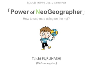
- 6. How to use map on the net? 6
- 7. How to use map on the net? 7
- 8. the net? 8
- 9. digital 9
- 10. You are expert of GIS in each countries. 10
- 11. You have provider orientation thinking. 11
- 12. I want to explain about user orientation thinking. 12
- 15. I’m a TreeClimber b y Ta i c h i F U R U H A S H I 15
- 16. Of course, I have two licenses b y Ta i c h i F U R U H A S H I 16
- 17. Because, b y Ta i c h i F U R U H A S H I
- 18. I (we) have a TreeHouse in Japan. (made by ourself) b y Ta i c h i F U R U H A S H I 18
- 19. That’s my hobby, but... b y Ta i c h i F U R U H A S H I
- 20. It’s related with the Digital Map(GIS) tech. b y Ta i c h i F U R U H A S H I
- 21. It means... b y Ta i c h i F U R U H A S H I
- 22. GIS can use a lot of GeoSpatial Data as MODEL. We called Feature. b y Ta i c h i F U R U H A S H I
- 23. You know, “MODEL” is not “real”. ≒ Similar but different From Wikipedia, the free encyclopedia From Wikipedia, the free encyclopedia b y Ta i c h i F U R U H A S H I
- 24. Every time we have to compare between both information using by training data. b y Ta i c h i F U R U H A S H I
- 25. Field work is very important for GIS tech. b y Ta i c h i F U R U H A S H I
- 26. Agenda 1: Project Haiti/sinsai.info 2: Old/Neo Geographer 3: Digital Earth 4: GIS forecast(UAV/Gigapan/GeoHex) b y Ta i c h i F U R U H A S H I
- 28. 12 Jan 2010 b y Ta i c h i F U R U H A S H I
- 29. b y Ta i c h i F U R U H A S H I
- 30. We made high quality map in Haiti for a few days. b y Ta i c h i F U R U H A S H I
- 31. How? b y Ta i c h i F U R U H A S H I
- 32. b y Ta i c h i F U R U H A S H I
- 33. Like the wikipedia method! b y Ta i c h i F U R U H A S H I
- 34. GPS logging by handyGPS b y Ta i c h i F U R U H A S H I
- 35. Draw map by paper. And scan. b y Ta i c h i F U R U H A S H I
- 36. Digitizing on Satellite images b y Ta i c h i F U R U H A S H I
- 37. "The OpenStreetMap community can help the response by tracing Yahoo imagery and other data sources,....." (13Jan2010) b y Ta i c h i F U R U H A S H I
- 38. OSM v.s. GoogleMaps v.s. YahooMap v.s. bing Map There is no good map in Haiti. b y Ta i c h i F U R U H A S H I
- 39. Start to making map! on OSM community. b y Ta i c h i F U R U H A S H I
- 40. Before b y Ta i c h i F U R U H A S H I
- 41. After b y Ta i c h i F U R U H A S H I
- 42. We plotted many camp sites. b y Ta i c h i F U R U H A S H I
- 43. How about Google Maps ? b y Ta i c h i F U R U H A S H I
- 44. Google Maps b y Ta i c h i F U R U H A S H I
- 45. Low Quality. b y Ta i c h i F U R U H A S H I
- 46. And also, we compare to b y Ta i c h i F U R U H A S H I
- 47. Google MapMaker b y Ta i c h i F U R U H A S H I
- 48. OpenStreetMap b y Ta i c h i F U R U H A S H I
- 49. ZOOM in!! b y Ta i c h i F U R U H A S H I
- 50. Google Maps b y Ta i c h i F U R U H A S H I
- 51. Google MapMaker b y Ta i c h i F U R U H A S H I
- 52. OpenStreetMap b y Ta i c h i F U R U H A S H I
- 53. Data quality and quantity are different. b y Ta i c h i F U R U H A S H I
- 54. Why, we could? b y Ta i c h i F U R U H A S H I
- 55. Some satellite image companies provide to us, very quickly. b y Ta i c h i F U R U H A S H I
- 59. Of course, b y Ta i c h i F U R U H A S H I
- 61. Those images are provided with Georeference meta data b y Ta i c h i F U R U H A S H I
- 62. Collaborated with JAXA and NIED b y Ta i c h i F U R U H A S H I
- 63. JAXA: Japanese Space Org < Data Provider > b y Ta i c h i F U R U H A S H I
- 64. NIED: National research Institute for Earth science and Disaster Prevention < Web GIS Server Hosting > b y Ta i c h i F U R U H A S H I
- 65. That’s great corroboration in Japan b y Ta i c h i F U R U H A S H I
- 66. JAXA → NIED → OSM by mapconcierge
- 67. Key Point is... b y Ta i c h i F U R U H A S H I
- 68. WMS protocol b y Ta i c h i F U R U H A S H I
- 69. Others ( OSM ) Potlatch JOSM (OSM editor on WebBrowser) ( OSM ) by mapconcierge
- 70. We could mashup to many services b y Ta i c h i F U R U H A S H I
- 71. Especially, OSM can access to Road lines as vector. b y Ta i c h i F U R U H A S H I
- 72. As a Result... b y Ta i c h i F U R U H A S H I
- 73. Support portal site used OSM data. b y Ta i c h i F U R U H A S H I
- 74. Quick release as iPhone application b y Ta i c h i F U R U H A S H I
- 75. Good point is, OpenStreetMap has many experts for editing map b y Ta i c h i F U R U H A S H I
- 76. Over 100 people includes japanese guys... Mikel Claudius Henrichs Axel von Matern Harry Wood pascal_n MaWD Tim Waters zvenzzon David FawceW Simone Gadenz Dane Springmeyer tors_ko MaQa Giovannini Gianfra Phono Nicolas Chavent Dave Smith / DruidSmith Dankarran tomoki PB Randal Hale Andrew Turner Phil Shipley Sam Larsen Christopher Parker EdLoach Robert ScoW davespod Seehundeführer Esperanza Adam Schreiber Mapconcierge osmapb1 Imapi Flacus ikiya Bikeman2000 Cohan Komяpa Morten Jagd Christensen ‐ XBear Holly Glaser acdsig Temporalista Divebalu HB9DTX Sergio Sevillano StellanL Andrew Allison Jeffrey Johnson AssetBurned Jus_n Houk Jaakko Helleranta Ceyockey Luc Castera Andrzej Zaborowski Ævar Arnjörð Bjarmason Michael Lane FredB Ivansanchez Mike Hogan harrierco ALE! David Runneals ‐ neuhausr Fabianos Jarno Peschier ‐ PaulY Kevin helmed, Osbornec Julian Boudewijn Ka_e Filbert olvagor Fil Thea Clay Gubaer Estela Llorente Micha Ruh UbuntuAcer Kam SK53 RatZillaS Marc Schneider Jonas Krückel (John07) Jean‐Guilhem Cailton Rafa Gu_errez Colin Marquardt clara Samusz Floris Looijesteijn steve8 Sean BenneW AndyGates Gert Gremmen (cetest) JarraWp Jean‐Marc Lio_er Lübeck Xapitoun sxpert Pierre Beland http://wiki.openstreetmap.org/wiki/WikiProject_Haiti/Who_is_helping b y Ta i c h i F U R U H A S H I
- 77. Over 100 people includes japanese guys... Mikel Claudius Henrichs Axel von Matern Harry Wood pascal_n MaWD Tim Waters zvenzzon David FawceW Simone Gadenz Dane Springmeyer tors_ko MaQa Giovannini Gianfra Phono Nicolas Chavent Dave Smith / DruidSmith Dankarran tomoki PB Randal Hale Andrew Turner Phil Shipley Sam Larsen Christopher Parker EdLoach Robert ScoW davespod Seehundeführer Esperanza Adam Schreiber Mapconcierge osmapb1 Imapi Flacus ikiya Bikeman2000 Cohan Komяpa Morten Jagd Christensen ‐ XBear Holly Glaser acdsig Temporalista Divebalu HB9DTX Sergio Sevillano StellanL Andrew Allison Jeffrey Johnson AssetBurned Jus_n Houk Jaakko Helleranta Ceyockey Luc Castera Andrzej Zaborowski Ævar Arnjörð Bjarmason Michael Lane FredB Ivansanchez Mike Hogan harrierco ALE! David Runneals ‐ neuhausr Fabianos Jarno Peschier ‐ PaulY Kevin helmed, Osbornec Julian Boudewijn Ka_e Filbert olvagor Fil Thea Clay Gubaer Estela Llorente Micha Ruh UbuntuAcer Kam SK53 RatZillaS Marc Schneider Jonas Krückel (John07) Jean‐Guilhem Cailton Rafa Gu_errez Colin Marquardt clara Samusz Floris Looijesteijn steve8 Sean BenneW AndyGates Gert Gremmen (cetest) JarraWp Jean‐Marc Lio_er Lübeck Xapitoun sxpert Pierre Beland http://wiki.openstreetmap.org/wiki/WikiProject_Haiti/Who_is_helping b y Ta i c h i F U R U H A S H I
- 78. Actually, over 300 or 400 users joined. Maybe... b y Ta i c h i F U R U H A S H I
- 81. b y Ta i c h i F U R U H A S H I
- 84. ’ b y Ta i c h i F U R U H A S H I
- 86. Tim. J Berners-Lee talked at b y Ta i c h i F U R U H A S H I
- 87. b y Ta i c h i F U R U H A S H I
- 88. Raw Data Now! OpenData will change the world b y Ta i c h i F U R U H A S H I
- 91. Crisis Mapping Map Crowd source UGC/CGM by mapconcierge
- 92. Google Maps/Earth Release in 2005 by mapconcierge
- 93. Finding Dr. Jim Gray in 2007 by mapconcierge
- 94. Google MyMap since 2007 by mapconcierge
- 95. by mapconcierge
- 96. 2008 Kenya by mapconcierge
- 97. Mexico hWp://www.cuidemoselvoto.org/ by mapconcierge
- 98. hWp://www.cuidemoselvoto.org/ by mapconcierge
- 99. Washington hWp://snowmageddoncleanup.com/ by mapconcierge
- 100. 2010 haiti by mapconcierge
- 101. 2010 Chile by mapconcierge
- 102. by mapconcierge
- 103. 2011 / NZ by mapconcierge
- 104. 2011 / Libya hWp://libyacrisismap.net/ by mapconcierge
- 105. 2 0 1 1 3/11 by mapconcierge
- 106. by mapconcierge
- 107. sinsai.info Staff Open Street Map Foundation Japan (NPO) over 15 (Amazon,Yahoo, NTT, NTT Data, etc..) by mapconcierge
- 108. by mapconcierge
- 109. sample report by mapconcierge
- 110. We add on map by mapconcierge
- 111. sinsai.info work flow by mapconcierge
- 112. sinsai.info Result • 10,000+ •1,000,000+ PV / •650,000+ •500,000+ • by mapconcierge
- 113. sinsai.info joint to others by mapconcierge
- 114. Report Report Report Report API Crisis Mapping Map Trace Map Dona_on GPS UAV Gigapan A lot of Satellite images by mapconcierge
- 115. Old / Neo Geographer Next Generation of GIS engineer
- 116. NEOGeographer OLDGeographer b y Ta i c h i F U R U H A S H I
- 117. What’s different? b y Ta i c h i F U R U H A S H I
- 118. OLDGeographer 6 years ago. b y Ta i c h i F U R U H A S H I
- 119. OLD NEO Geographer Geographer b y Ta i c h i F U R U H A S H I
- 120. In 2005 Threshold b y Ta i c h i F U R U H A S H I
- 121. b y Ta i c h i F U R U H A S H I 121
- 122. OLD NEO Geographer Geographer Before Google-Geo After Google-Geo Year 2004 2005 2006 2007 b y Ta i c h i F U R U H A S H I
- 123. OLD NEO Geographer Geographer SHP, MIF, GeoTIFF XML, DB, API Year 2004 2005 2006 2007 b y Ta i c h i F U R U H A S H I
- 124. Change to NEOGeographer ! b y Ta i c h i F U R U H A S H I
- 125. OLD NEO Geographer Geographer Result SHP SHP as Table SHP Process KML SQL GIS Clients GeoTIFF GeoTIFF WKT DB WKTraster Process File orientation API/DB orientation b y Ta i c h i F U R U H A S H I
- 126. b y Ta i c h i F U R U H A S H I 126
- 127. b y Ta i c h i F U R U H A S H I 127
- 128. “Digital Earth Browser” means View/Share software by virtual globe. Those software delivers an easy-to-use way to view and share information geographically.
- 129. “Digital Earth” Keyword appeared since 2004. Google Earth v3 World Wind, Google Earth v4 Keyhole By hWp://www.google.com/trends (2007/11/30)
- 130. “Digital Earth” What is this?
- 132. Digital Earth
- 134. “Digital Earth Browser” is not “web browser”. By Michael T. Jones(Google)
- 135. Digital Earth Browser and Web Browser Digital Earth Browser Web Browser Google (c) 2007 Google (c) 2007 KML HTML Digital Earth Browser can access many spatial information(KML) in all over the world. Like the Web Browser with HTML.
- 136. Major Digital Earth Browsers Google Earth World Wind ArcGIS Explorer (Google, since2005) (NASA, since 2004) (ESRI, since 2006) Google (c) 2007 NASA (c) 2007 ESRI (c) 2007 hWp://earth.google.com/ hWp://worldwind.arc.nasa.gov hWp://www.esri.com/sorware/arcgis/explorer/ All applications are provided as Free. And, Those software can mapping a lot of satellite / airphoto images all over the world as Free too.
- 137. Characteristic of KML Keyhole Markup Language
- 138. Characteristic of KML Keyhole Markup Language • Open format on the net.
- 139. Characteristic of KML Keyhole Markup Language • Open format on the net. • XML
- 140. Characteristic of KML Keyhole Markup Language • Open format on the net. • XML • Zip Compression available
- 141. Characteristic of KML Keyhole Markup Language • Open format on the net. • XML • Zip Compression available • Network Connectivity
- 142. Characteristic of KML Keyhole Markup Language • Open format on the net. • XML • Zip Compression available • Network Connectivity • Multiply Data Type
- 143. Characteristic of KML Keyhole Markup Language • Open format on the net. • XML • Zip Compression available • Network Connectivity • Multiply Data Type • Time Stamp / Time Span
- 144. KML Sample <?xml version="1.0" encoding="UTF‐8"?> <kml xmlns="hWp://earth.google.com/kml/2.1"> <Folder> <name>cafe</name> <descrip_on><![CDATA[Created with <a href="hWp://sketchup.google.com/">Google SketchUp 6.0.312</a>]]></ descrip_on> <LookAt> <longitude>139.9366077796045</longitude> <la_tude>35.90168740874968</la_tude> <al_tude>17.41304574400348</al_tude> <range>104.3070304725559</range> <_lt>80.4794</_lt> <heading>141.932</heading> </LookAt> <Folder> <name>Tour</name> <Placemark> <name>Camera</name> <LookAt> <longitude>139.9366077796045</longitude> <la_tude>35.90168740874968</la_tude>
- 145. Data Type in KML
- 146. Data Type in KML • Point
- 147. Data Type in KML • Point • Line
- 148. Data Type in KML • Point • Line • Polygon (include Donuts Polygon)
- 149. Data Type in KML • Point • Line • Polygon (include Donuts Polygon) • Image (Ground/Screen/Photo)
- 150. Data Type in KML • Point • Line • Polygon (include Donuts Polygon) • Image (Ground/Screen/Photo) • 3D Object (with Texture, COLLADA)
- 151. Line Polygon Point
- 152. 3D Object Line
- 153. Image (Screen) Image (Ground)
- 155. 3D Object with Texture
- 156. Polygon with attributes and TimeScale Image (Screen)
- 157. Digital Earth Browser
- 158. Digital Earth Browser • Low cost (almost free)
- 159. Digital Earth Browser • Low cost (almost free) • No border (using by Lat/Lon coordinates)
- 160. Digital Earth Browser • Low cost (almost free) • No border (using by Lat/Lon coordinates) • Free reference data set (Satellite/ Airphoto)
- 161. Digital Earth Browser • Low cost (almost free) • No border (using by Lat/Lon coordinates) • Free reference data set (Satellite/ Airphoto) • Multi data type (with Texture, COLLADA)
- 162. Digital Earth Browser • Low cost (almost free) • No border (using by Lat/Lon coordinates) • Free reference data set (Satellite/ Airphoto) • Multi data type (with Texture, COLLADA) • Key data format is ”KML”
- 163. b y Ta i c h i F U R U H A S H I
- 164. b y Ta i c h i F U R U H A S H I
- 165. uDig GeoServer PostGIS Spatialite GRASS QGIS Desktop OpenLayers MappingServer Geo Data Base Desktop MappingServer Library OpenGeoSuite FOSS4G Tools OGR Statistics FDO R Project Foundation GEOS Catalog PROJ4 OpenStandard GPS TC211 Google Chrome OS GML Google Earth Android
- 166. Licenses b y Ta i c h i F U R U H A S H I
- 167. b y Ta i c h i F U R U H A S H I
- 168. There are many type of licenses. b y Ta i c h i F U R U H A S H I
- 169. License Copy Right FREE CC-by-NC-ND CC-by-ND CC-by-NC-SA CC-by-SA CC-by-NC CC-by All Rights Public Reserved Domain b y Ta i c h i F U R U H A S H I 153
- 170. License Copy Right FREE CC-by-NC-ND CC-by-ND CC-by-NC-SA CC-by-SA CC-by-NC CC-by All Rights Public Reserved Domain mytext b y Ta i c h i F U R U H A S H I 154
- 172. b y Ta i c h i F U R U H A S H I
- 173. “GIS Tech.” like a “Bridge” between the ITworld and the Realworld. b y Ta i c h i F U R U H A S H I
- 174. “GeoSpatial data” made by “real data”. ≒ From Wikipedia, the free encyclopedia From Wikipedia, the free encyclopedia b y Ta i c h i F U R U H A S H I
- 177. http:// goo.gl/Y8aH b y Ta i c h i F U R U H A S H I
- 179. Open Data Commons b y Ta i c h i F U R U H A S H I
- 180. b y Ta i c h i F U R U H A S H I
- 181. b y Ta i c h i F U R U H A S H I
- 182. ’ b y Ta i c h i F U R U H A S H I
- 185. b y Ta i c h i F U R U H A S H I
- 186. b y Ta i c h i F U R U H A S H I
- 190. ’ b y Ta i c h i F U R U H A S H I
- 193. ’ b y Ta i c h i F U R U H A S H I
- 194. b y Ta i c h i F U R U H A S H I
- 208. b y Ta i c h i F U R U H A S H I
- 212. b y Ta i c h i F U R U H A S H I
- 215. ’ b y Ta i c h i F U R U H A S H I
- 216. b y Ta i c h i F U R U H A S H I
- 218. NEOGeographer Activity b y Ta i c h i F U R U H A S H I
- 219. I love OpenSource GIS (FOSS4G) b y Ta i c h i F U R U H A S H I
- 220. b y Ta i c h i F U R U H A S H I 204
- 221. ESRI v.s FOSS4G? b y Ta i c h i F U R U H A S H I
- 222. ESRI v.s FOSS4G? b y Ta i c h i F U R U H A S H I
- 223. InteDevelopment Strategy Functions 201x 2010 2009 Proprietary Projects FOSS4GProjects 207
- 224. one more thing... b y Ta i c h i F U R U H A S H I
- 225. GSI(GeoSpatial Information Authority of Japan) FOSS4 cyberjapan MappingSystem cyberjapan MappingSystem b y Ta i c h i F U R U H A S H I
- 226. GSI(GeoSpatial Information Authority of Japan) FOSS4 cyberjapan MappingSystem cyberjapan MappingSystem b y Ta i c h i F U R U H A S H I
- 227. OpenGov b y Ta i c h i F U R U H A S H I
- 228. GIS forecast
- 229. iPhone/Android with GIS (hWp://www.apple.com) Apple (c) 2007
- 231. for Geo tools on Google by Alos4Amazon Project
- 245. Simulation Story How to use Android for your field work. Deforestation Polygon: Made by PALSAR Viewer by manipulation as KML-Polygon. ALOS-image: Made by PALSAR Viewer from ALOS-PALSAR as KML-GroundOverlay. BackGround: Made by WMS from InteliGeo/Siscom as Cache. Before field PalserViewer KML/WMS Viewer Polygon GroundOverlay WMC GPS Tracker InteliGeo/Siscom KM L, G PX, and SHP/GPX mo My Tracks re.. Spatial DB Photo X, Y, Z, D SHP irection +Exif Spatialite Camera with GeoTAG(Exif) SQL Field Office After field by Alos4Amazon Project
- 246. One Laptop per Child The mission of the OLPC Project is to develop a low-cost laptop(about $100) to revolutionize how to educate the world's children. Goal is to provide children around the world with new opportunities to explore, experiment, and express themselves. Why do children in developing nations need laptops? Laptops are a window and a tool: a window into the world and a tool with which to think. They are a wonderful way for all children to learn learning through independent interaction and exploration. OLPC espouses five core principles: (1) child ownership; (2) low ages; (3) saturation; (4) connection; and (5) free and open source. If all laptop has include the GIS application, they will become to good geo-spatial contents providers. OLPC (c) 2007 hWp://www.laptop.org/
- 247. MAP of OLPC OLPC (c) 2007 those countries we plan to pilot those countries we plan to include in the post-launch phase those countries who have expressed interest at the Ministry-of-Education level or higher those countries who are currently seeking government support
- 248. The Green WiFi Mission hWp://www.green‐wifi.org/ Green WiFi is commiWed to providing solar powered access to global informa_on and educa_onal resources for developing regions and K‐12 school children striving for knowledge in a digitally divided world. There are approximately 3 billion people under the age of 15 living in developing na_ons. 42 percent of the developing world's popula_on is below the age of 15. Green WiFi was founded on the principle that the welfare of our world is dependent, in large part, on providing these children with free and open access to the world's informa_on. Green WiFi (c) 2007
- 249. GNSS Global Navigation Satellite System Now, some GNSS services provided by U.S. , Russia, EU and China. And Japan will lunch the Quasi‐Zenith Satellites for GPS System. We will be able to use a more highly accurate loca_on informa_on.
- 251. by mapconcierge
- 252. (c) www.physorg.com by mapconcierge
- 253. hWp://www.youtube.com/watch?v=Fw8CqIwVa44 by mapconcierge
- 254. by mapconcierge
- 255. by mapconcierge
- 256. by mapconcierge 用
- 257. 1st May, 2011 Akahama area in Ohtsuchi, IWATE CC-by-SA by mapconcierge CC-by-SA by mapconcierge by mapconcierge
- 258. UAV at Akahama area in Ohtsuchi, IWATE. 1st May, 2011 CC-by-SA by mapconcierge by mapconcierge
- 259. Tsunami destroyed Akahama area. CC-by-SA by Univ.of Tokyo/ISTS/Bizworks/MAPconcierge by mapconcierge
- 260. The university of Tokyo, Interna_onal ocean research center. CC-by-SA by Univ.of Tokyo/ISTS/Bizworks/MAPconcierge by mapconcierge
- 261. A ship on the house. CC-by-SA by Univ.of Tokyo / ISTS / Bizworks / MAPconcierge by mapconcierge
- 262. CC-by-SA by Univ.of Tokyo/ISTS/Bizworks/MAPconcierge OrthoRectified Mosaic data by mapconcierge
- 265. G pixels = 1,000,000,000 = General DigitalCamera x 100
- 272. Midtown in Ohtsuchi, IWATE CC-by-SA by Kaoru Saito by mapconcierge
- 273. View on Google Earth using by KML PhotoOverlay data CC-by-SA by mapconcierge by mapconcierge
- 274. Office of volunteer center in Tohno, IWATE(magokoronet) CC-by-SA by Taichi by mapconcierge
- 275. GigaPan can take CC-by-SA by Taichi by mapconcierge
- 276. by mapconcierge
- 277. Informa_on Crawler by mapconcierge 261
- 278. Informa_on Scooter by mapconcierge 262
- 279. by mapconcierge 263
- 280. NEOGeographer b y Ta i c h i F U R U H A S H I
- 281. w w w. s l i d e s h a r e . n e t / mapconcierge @mapconcie by mapconcierge
- 282. To g e t h e r f o r t h e E a r t h ! ! @mapconcie by mapconcierge
Editor's Notes
- Hi, My Name is Taichi FURUHASHI.\n\n\n&#x201C;Taichi&#x201D; means &#x201C;the Ground&#x201D; in Japanese.\nAnd &#x201C;FURUHASHI&#x201D; means &#x201C;Old Bridge&#x201D;.\n\n&#x201C;Taichi FURUHASHI&#x201D; means &#x201C;Old Bridge on the earth&#x201D;\n\n\nI've working at the University of Tokyo, in Japan.\n\nMy work is the GIS education for students and general people. \nSo, my GIS course is opened every month, and a lot of people attends my lecture. \nAnd today, I have to lecture about many GIS techniques for yours.\n\nAnyway, Please show my document of today.\nA little character are standing on the title page.\nHis name is &#x201C;EARTH-KUN&#x201D;.\nIt&#x2019;s my character for GIS-MAGAZINE.\n\nSo, I have written many magazine papers about Google Earth/Maps.\n&#x201C;Earth-KUN&#x201D; appear in those documents.\n\n\n\n\n\nOur tools is the ArcGIS, ERDAS IMAGINE,\nand other commercial application.\n\nOn the other hand, Recently\nWe use many free software.\n
- \n
- \n
- \n
- \n
- \n
- \n
- \n
- \n
- \n
- \n
- \n
- \n
- \n
- \n
- \n
- \n
- \n
- \n
- \n
- \n
- \n
- \n
- \n
- \n
- \n
- OK, Let&#x2019;s start\n
- \n
- \n
- \n
- \n
- \n
- \n
- \n
- \n
- \n
- \n
- \n
- \n
- \n
- \n
- \n
- \n
- \n
- \n
- \n
- \n
- \n
- \n
- \n
- \n
- \n
- \n
- \n
- \n
- \n
- \n
- \n
- \n
- \n
- \n
- \n
- \n
- \n
- \n
- \n
- \n
- \n
- \n
- \n
- \n
- \n
- \n
- \n
- \n
- \n
- \n
- \n
- \n
- \n
- \n
- \n
- \n
- \n
- \n
- \n
- \n
- \n
- \n
- \n
- \n
- \n
- \n
- \n
- \n
- \n
- \n
- \n
- \n
- \n
- \n
- \n
- \n
- \n
- \n
- \n
- \n
- \n
- \n
- \n
- \n
- \n
- \n
- \n
- \n
- \n
- \n
- \n
- \n
- \n
- \n
- \n
- \n
- \n
- \n
- \n
- \n
- \n
- \n
- \n
- \n
- \n
- \n
- \n
- \n
- \n
- OK, The last module theme is GIS forecast, in the future of ten years.\nI said NEXT &#x201C;S&#x201D; of GIS will means &#x201D;the Society&#x201C;.\n\nNow GIServices provided many organization.\nAnd those services will wrapping by e-government and some web mapping services, like WPS.\n\nI think, Standalone software will decrease.\n\nThe advancement of the Internet technology is very early. \nI pickup some interest technology.\n\nLet&#x2019;s show\n\nNEXT, Slide No. is &#xFF41;\n
- This slide is hardware and Browser forecast.\n\nIn 2007, Apple released the iPhone/iPod touch.\nIt can be use very useful touch interface.\nAnd you can use the google maps and some WEB-GIS.\n\nToday, I have a iPod touch.\n\nLike this, we can zoom and wide by pinch action.\n\nNo mouse, No keyboad.\nI think the Google Earth and other some software&#x3000;will run on this device.\n\nBecause, Apple started&#x3000;to provide the SDK tool Kit for iPhone and iPod touch.\n\n\n\n\nNEXT, Slide No. is &#xFF43;\n
- \n
- \n
- \n
- \n
- \n
- \n
- \n
- \n
- \n
- \n
- \n
- \n
- \n
- \n
- \n
- \n
- This Slide is new Hardware and browser.\n\nName is &#x201C;OLPC&#x201D;.\nOLPC means &#x201C;One Laptop per Child&#x201D; project.\n\nThe mission of the OLPC Project is to develop a low-cost laptop to revolutionize how to educate the world's children.\nTarget cost is $100!\n\nGoal is to provide children around the world with new opportunities to explore, experiment, and express themselves. \n\nEspecially my interest is electric power generator by human power.\nCenter figure is that. Like the Yo-Yo.\nChildren can pull the thin rope.\nThis Yo-Yo will generate power for OLPC. \n\nWhy do children in developing nations need laptops?\nLaptops are a window and a tool: a window into the world and a tool with which to think.\nThey are a wonderful way for all children to learn learning through independent interaction and exploration.\n \nOLPC espouses five core principles:\n(1) child ownership; (2) low ages; (3) saturation; (4) connection; and (5) free and open source.\n\nIf all OLPC has include the GIS application, they will become to good geo-spatial contents providers. \n\nLast year, I tested some OLPC machine&#xFF53;.\nThe First generation is very slow for web browsing.\nIt could use the Google Maps, but complex API site don&#x2019;t run on this machine.\n\nI think, next generation of OLPC will become to fast.\n\n\n\n\n&#x300C;(2008&#x5E74;&#x9803;&#x306B;&#x306F;)100&#x30C9;&#x30EB;&#x30CE;&#x30FC;&#x30C8;PC&#x300D;&#x3053;&#x3068;OLPC &#x201C;XO&#x201D;&#x306B;&#x624B;&#x56DE;&#x3057;&#x30AF;&#x30E9;&#x30F3;&#x30AF;&#x306B;&#x66FF;&#x308F;&#x308B;&#x5145;&#x96FB;&#x624B;&#x6BB5;&#x3068;&#x3057;&#x3066;&#x63A1;&#x7528;&#x3055;&#x308C;&#x3001;&#x3042;&#x308B;&#x610F;&#x5473;XO&#x672C;&#x4F53;&#x3088;&#x308A;&#x3082;&#x6CE8;&#x76EE;&#x3055;&#x308C;&#x3066;&#x3044;&#x308B;&#x30E8;&#x30FC;&#x30E8;&#x30FC;&#x578B;&#x767A;&#x96FB;&#x6A5F;&#x304C;&#x4E00;&#x822C;&#x767A;&#x58F2;&#x3082;&#x8996;&#x91CE;&#x306B;&#x5165;&#x308C;&#x305F;&#x5546;&#x7528;&#x5316;&#x3092;&#x76EE;&#x6307;&#x3059;&#x3053;&#x3068;&#x304C;&#x767A;&#x8868;&#x3055;&#x308C;&#x307E;&#x3057;&#x305F;&#x3002;&#x958B;&#x767A;&#x3057;&#x305F;Squid Labs&#x3067;&#x306F;&#x30DD;&#x30FC;&#x30BF;&#x30D6;&#x30EB;&#x767A;&#x96FB;&#x6A5F;(&#x540D;&#x524D;&#x306F;&#x307E;&#x3060;&#x306A;&#x3044;&#x3089;&#x3057;&#x3044;)&#x306E;&#x5546;&#x7528;&#x5316;&#x306E;&#x305F;&#x3081;&#x65B0;&#x4F1A;&#x793E;Potenco&#x3092;&#x8A2D;&#x7ACB;&#x3001;&#x6C11;&#x751F;&#x7528;&#x30E2;&#x30D0;&#x30A4;&#x30EB;&#x6A5F;&#x5668;&#x306E;&#x5145;&#x96FB;&#x3084;&#x707D;&#x5BB3;&#x5730;&#x30FB;&#x958B;&#x767A;&#x9014;&#x4E0A;&#x5730;&#x57DF;&#x3067;&#x306E;&#x7167;&#x660E;&#x3084;&#x901A;&#x4FE1;&#x3001;&#x307E;&#x305F;&#x8ECD;&#x7528;&#x3068;&#x3044;&#x3063;&#x305F;&#x3055;&#x307E;&#x3056;&#x307E;&#x306A;&#x5206;&#x91CE;&#x3067;&#x306E;&#x63A1;&#x7528;&#x3092;&#x76EE;&#x6307;&#x3057;&#x305F;&#x6D3B;&#x52D5;&#x3092;&#x958B;&#x59CB;&#x3057;&#x3066;&#x3044;&#x307E;&#x3059;&#x3002;100 &#x30C9;&#x30EB;PC&#x306E;&#x30B7;&#x30F3;&#x30DC;&#x30EB;&#x7684;&#x5B58;&#x5728;&#x3060;&#x3063;&#x305F;&#x624B;&#x56DE;&#x3057;&#x3057;&#x5F0F;&#x306B;&#x4EE3;&#x308F;&#x3063;&#x3066;&#x767B;&#x5834;&#x3057;&#x305F;&#x3053;&#x306E;&#x767A;&#x96FB;&#x6A5F;&#x306F;&#x30DB;&#x30C3;&#x30B1;&#x30FC;&#x306E;&#x30D1;&#x30C3;&#x30AF;&#x3092;&#x4E8C;&#x3064;&#x91CD;&#x306D;&#x305F;&#x3088;&#x3046;&#x306A;&#x5927;&#x304D;&#x3055;&#x3067;&#x3001;&#x30C1;&#x30A7;&#x30FC;&#x30F3;&#x30BD;&#x30FC;&#x3084;&#x30DC;&#x30FC;&#x30C8;&#x306E;&#x30A8;&#x30F3;&#x30B8;&#x30F3; &#x59CB;&#x52D5;&#x6642;&#x306E;&#x3088;&#x3046;&#x306B;&#x3072;&#x3082;&#x3092;&#x5F15;&#x3044;&#x3066;&#x767A;&#x96FB;&#x3059;&#x308B;&#x3082;&#x306E;&#x3002;&#x7247;&#x624B;&#x306B;&#x672C;&#x4F53;&#x3092;&#x6301;&#x3063;&#x3066;&#x3082;&#x3046;&#x7247;&#x65B9;&#x306E;&#x624B;&#x3067;&#x5F15;&#x3044;&#x305F;&#x308A;&#x3001;&#x672C;&#x4F53;&#x3092;&#x673A;&#x306B;&#x56FA;&#x5B9A;&#x3057;&#x3066;&#x8DB3;&#x3067;&#x8E0F;&#x3093;&#x3060;&#x308A;&#x3057;&#x3066;&#x4F7F;&#x3044;&#x307E;&#x3059;&#x3002;&#x958B;&#x767A;&#x8005;&#x306B;&#x3088;&#x308C;&#x3070;&#x30CF;&#x30F3; &#x30C9;&#x30AF;&#x30E9;&#x30F3;&#x30AF;&#x3088;&#x308A;&#x69CB;&#x9020;&#x304C;&#x5358;&#x7D14;&#x3067;&#x58CA;&#x308C;&#x306B;&#x304F;&#x304F;&#x30E1;&#x30F3;&#x30C6;&#x30CA;&#x30F3;&#x30B9;&#x304C;&#x5BB9;&#x6613;&#x3001;&#x8155;&#x3067;&#x30CF;&#x30F3;&#x30C9;&#x30EB;&#x3092;&#x56DE;&#x8EE2;&#x3055;&#x305B;&#x308B;&#x52D5;&#x304D;&#x3088;&#x308A;&#x4EBA;&#x4F53;&#x69CB;&#x9020;&#x7684;&#x306B;&#x81EA;&#x7136;&#x306A;&#x811A;&#x306E;&#x529B;&#x3092;&#x4F7F;&#x3048;&#x308B;&#x305F;&#x3081;&#x3088;&#x308A;&#x52B9;&#x7387;&#x7684;&#x3002;&#x809D;&#x5FC3;&#x306E;&#x767A;&#x96FB;&#x80FD;&#x529B;&#x306B;&#x3064;&#x3044;&#x3066;&#x6B63;&#x78BA;&#x306A;&#x6570;&#x5B57;&#x306F;&#x6319;&#x3052;&#x3089;&#x308C;&#x3066;&#x306A;&#x3044;&#x3082;&#x306E;&#x306E;&#x3001;Potenco&#x306E;&#x30B5;&#x30A4;&#x30C8;&#x306B;&#x3088;&#x308C;&#x3070;&#x4E00;&#x5206;&#x9593;&#x306E;&#x767A;&#x96FB;&#x3067;&#x300C;&#x643A;&#x5E2F;&#x96FB;&#x8A71;&#x306A;&#x3089;25&#x5206;&#x901A;&#x8A71;&#x300D;&#x3002;&#x5225;&#x306E;&#x30A4;&#x30F3;&#x30BF;&#x30D3;&#x30E5;&#x30FC;&#x8A18;&#x4E8B;&#x3067;&#x306F;&#x3001;&#x304A;&#x306A;&#x3058;&#x304F;&#x4E00;&#x5206;&#x9593;&#x3067;&#x300C;iPod shuffle&#x306A;&#x3089;230&#x5206;&#x3001;&#x30CB;&#x30F3;&#x30C6;&#x30F3;&#x30C9;&#x30FC;DS&#x3092;45&#x5206;&#x9593;&#x300D;&#x3002;OLPC XO&#x3067;&#x306F;&#x300C;&#x4E00;&#x5206;&#x9593;&#x3067;10&#x5206;&#x4F7F;&#x7528;&#x300D;&#x304C;&#x76EE;&#x6A19;&#x3068;&#x3055;&#x308C;&#x3066;&#x304D;&#x307E;&#x3057;&#x305F;&#x3002;&#x4E00;&#x822C;&#x767A;&#x58F2;&#x3055;&#x308C;&#x308B;&#x3068;&#x3057;&#x3066;&#x3069;&#x306E;&#x3088;&#x3046;&#x306A;&#x5F62;&#x614B;&#x306B;&#x306A;&#x308B;&#x306E;&#x304B;&#x306F;&#x307E;&#x3060;&#x4E0D;&#x660E;&#x306A;&#x304C;&#x3089;(&#x767A;&#x96FB;&#x6A5F;&#x5074;&#x306B;&#x5145;&#x96FB;&#x6C60;&#x3092;&#x5185;&#x8535;&#x3059;&#x308B;&#x306E;&#x304B;etc)&#x3001;&#x96FB;&#x6C60;&#x304C;&#x5207;&#x308C;&#x308B;&#x3068;&#x6B7B;&#x3093;&#x3067;&#x3057;&#x307E;&#x3046;&#x4EBA;&#x7A2E;&#x306B;&#x3068;&#x3063;&#x3066;&#x306F;&#x975E;&#x5E38;&#x306B;&#x671F;&#x5F85;&#x3067;&#x304D;&#x308B;&#x88FD;&#x54C1;&#x3067;&#x3059;&#x3002;\n\n\n\nNEXT, Slide No. is &#xFF44;\n
- OLPC is already provides many countries.\nGREEN countries are pilot area.\n\nIn Keniya They plan to include in the post-launch phase.\n\nIn the feature, \nThe children all over the world will use own laptop PC. \n\n\n\nNEXT, Slide No. is e\n
- This Slide is new Hardware and browser.\n\nThe OLPC can put the many laptop PCs.\nAnd Those machine can connect the network by each machines.\nBut They must increase many WiFi Stations for children.\n\nOLPC has some spin out projects.\nExample the Green Wifi Mission.\n\nGreen WiFi is committed to providing solar powered access to global information and educational resources for developing regions and K-12 school children striving for knowledge in a digitally divided world.\nThere are approximately 3 billion people under the age of 15 living in developing nations.\n42 percent of the developing world's population is below the age of 15.\n\nGreen WiFi was founded on the principle that the welfare of our world is dependent, in large part, on providing these children with free and open access to the world's information.\n\n\n\nNEXT, Slide No. is &#xFF46;\n
- This Slide is new Hardware.\n\nYou know, GPS is using all over the world now.\nEspecially, The GPS car navigation is becoming the major driving assist device. \n\nNow, some GNSS services provided by U.S. , Russia, EU and China. And Japan will lunch the Quasi-Zenith Satellites for GPS System.\n\nU.S. GPS System has about 30 satellites.\nRecently, Single positioning accuracy is about 5m by handy-GPS.\n\nIf all GNSS satellites are totaled, it becomes 100 satellites.\n\nWe will be able to use a more highly accurate location information. \n\n\n\n\nNEXT, Slide No. is &#xFF44;\n
- This Slide is new Software.\n\n\nSo, I explained about the WPS.\nWeb Processing Service (WPS) defines a standardized interface that facilitates the publishing of geospatial processes,\nand the discovery of and binding to those processes by clients. \n\nEspecially, The GRASS Server technology become to major of WPS.\nYou know the GRASS has many good functions.\nBut , those interface are poor.\n\nStandalone GIS users changed to QGIS from GRASS.\nBecause, QGIS is adding some grass function modules.\n\nSo GRASS function has high performance.\nWPS with GRASS Server is good components. I think.\n\nStandalone GIS software will change into the WPS server system in the future. \n\n\n\nNEXT, Slide No. is &#xFF44;\n
- \n
- \n
- \n
- \n
- \n
- \n
- \n
- \n
- \n
- \n
- \n
- \n
- \n
- \n
- \n
- \n
- \n
- \n
- \n