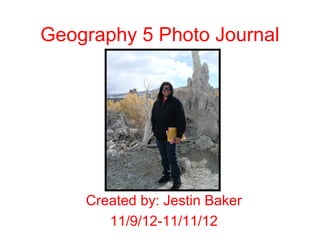
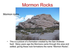
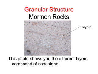
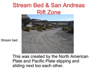
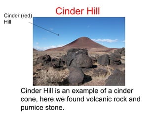
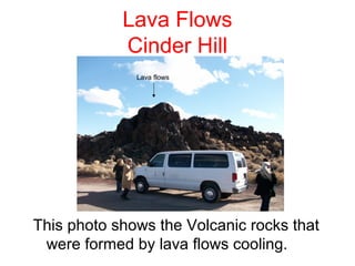
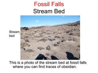
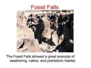
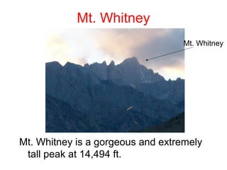
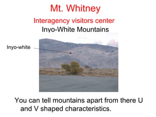
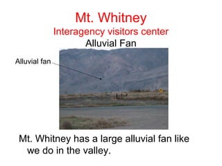
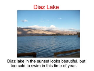
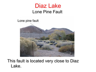
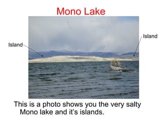
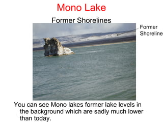
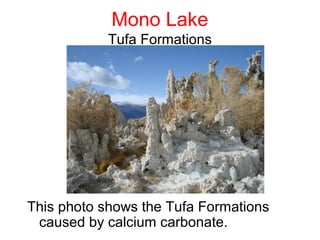
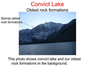
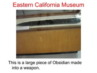
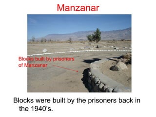
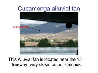
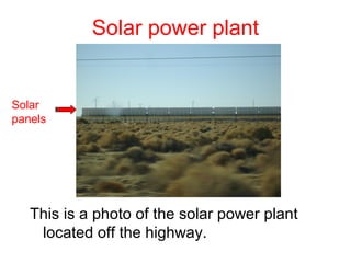
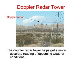
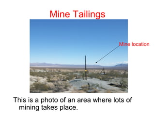
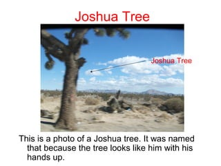
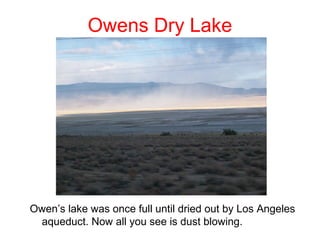
Geography 5 Photo Journal


    Created by: Jestin Baker
       11/9/12-11/11/12
Mormon Rocks
Mormon rocks


  •   This is a picture of a formation created by the San Andreas
      fault. Many years ago the Mormons came through this area and
      settled, giving these rock formations the name “Mormon Rocks”.
Granular Structure
         Mormon Rocks
                                      layers


This photo shows you the different layers
 composed of sandstone.
Stream Bed & San Andreas
               Rift Zone


Stream bed


      This was created by the North American
      Plate and Pacific Plate slipping and
      sliding next too each other.
Cinder (red)
                 Cinder Hill
Hill


       Cinder Hill is an example of a cinder
       cone, here we found volcanic rock and
       pumice stone.
Lava Flows
            Cinder Hill
              Lava flows


This photo shows the Volcanic rocks that
 were formed by lava flows cooling.
Fossil Falls
               Stream Bed


Stream
bed


This is a photo of the stream bed at fossil falls
  where you can find traces of obsidian.
Fossil Falls


The Fossil Falls showed a great example of
  weathering, native, and prehistoric habitat.
Fossil Falls
            Metate Holes
Metate
holes


The Native Americans used the Metate Holes
  for different purposes, mainly food.
Fossil Falls
                 Obsidian
obsidian


 The Obsidian was easy to find at fossil falls
   because it was a precious material for the
   Native Americans.
Fossil Falls
            Petroglyph
                                    petroglyph


The Petroglyphs often tell a story of the
 Native Americans.
Fossil Falls
             House Rings
                                      House rings


The Native Americans used to reside here and
  the House Rings is an example of the
  foundation for their homes.
Mt. Whitney
                                   Mt. Whitney


Mt. Whitney is a gorgeous and extremely
 tall peak at 14,494 ft.
Mt. Whitney
             Interagency visitors center
                Inyo-White Mountains

Inyo-white


   You can tell mountains apart from there U
    and V shaped characteristics.
Mt. Whitney
               Interagency visitors center
                      Alluvial Fan
Alluvial fan


 Mt. Whitney has a large alluvial fan like
  we do in the valley.
Diaz Lake


Diaz lake in the sunset looks beautiful, but
  too cold to swim in this time of year.
Diaz Lake
               Lone Pine Fault

     Lone pine fault


This fault is located very close to Diaz
 Lake.
Mono Lake

                                             Island
Island


  This is a photo shows you the very salty
   Mono lake and it’s islands.
Mono Lake
            Former Shorelines
                                          Former
                                          Shoreline


You can see Mono lakes former lake levels in
  the background which are sadly much lower
  than today.
Mono Lake
            Tufa Formations


This photo shows the Tufa Formations
 caused by calcium carbonate.
June Lake Loop
                 Grant Lake


                                           Grant
                                           Lake


Excellent photo of Grant Lake, which Is man-
  made.
June Lake Loop
                Moraines


          Moraines


This photo is a great representation of
 Grant lake and its lateral moraines.
June Lake Loop
                Waterfall
                                      waterfall


The waterfall as indicated is a part of
 silver lake, but is frozen at the moment.
June Lake Loop
                  Silver Lake


Silver Lake is part of the June lake loop and has
All of it’s perks.
Convict Lake


This photo shows convict lake at
 somerset.
Convict Lake
                  Oldest rock formations
Sierras oldest
rock formations


    This photo shows convict lake and our oldest
      rock formations in the background.
Eastern California Museum


This is a large piece of Obsidian made
 into a weapon.
Manzanar


Manzanar guard
shack


This is a photo of a guards post at
 Manzanar Prison camp.
Manzanar


 Blocks built by prisoners
 of Manzanar


Blocks were built by the prisoners back in
  the 1940’s.
Cucamonga alluvial fan

  Alluvial fan


This Alluvial fan is located near the 15
 freeway, very close too our campus.
Solar power plant


Solar
panels


   This is a photo of the solar power plant
    located off the highway.
Doppler Radar Tower
Doppler radar


The doppler radar tower helps get a more
  accurate reading of upcoming weather
  conditions.
Mine Tailings


                                   Mine location


This is a photo of an area where lots of
 mining takes place.
Joshua Tree


                                   Joshua Tree


This is a photo of a Joshua tree. It was named
  that because the tree looks like him with his
  hands up.
Owens Dry Lake


Owen’s lake was once full until dried out by Los Angeles
 aqueduct. Now all you see is dust blowing.

Jb photo journal

  • 1.
    Geography 5 PhotoJournal Created by: Jestin Baker 11/9/12-11/11/12
  • 2.
    Mormon Rocks Mormon rocks • This is a picture of a formation created by the San Andreas fault. Many years ago the Mormons came through this area and settled, giving these rock formations the name “Mormon Rocks”.
  • 3.
    Granular Structure Mormon Rocks layers This photo shows you the different layers composed of sandstone.
  • 4.
    Stream Bed &San Andreas Rift Zone Stream bed This was created by the North American Plate and Pacific Plate slipping and sliding next too each other.
  • 5.
    Cinder (red) Cinder Hill Hill Cinder Hill is an example of a cinder cone, here we found volcanic rock and pumice stone.
  • 6.
    Lava Flows Cinder Hill Lava flows This photo shows the Volcanic rocks that were formed by lava flows cooling.
  • 7.
    Fossil Falls Stream Bed Stream bed This is a photo of the stream bed at fossil falls where you can find traces of obsidian.
  • 8.
    Fossil Falls The FossilFalls showed a great example of weathering, native, and prehistoric habitat.
  • 9.
    Fossil Falls Metate Holes Metate holes The Native Americans used the Metate Holes for different purposes, mainly food.
  • 10.
    Fossil Falls Obsidian obsidian The Obsidian was easy to find at fossil falls because it was a precious material for the Native Americans.
  • 11.
    Fossil Falls Petroglyph petroglyph The Petroglyphs often tell a story of the Native Americans.
  • 12.
    Fossil Falls House Rings House rings The Native Americans used to reside here and the House Rings is an example of the foundation for their homes.
  • 13.
    Mt. Whitney Mt. Whitney Mt. Whitney is a gorgeous and extremely tall peak at 14,494 ft.
  • 14.
    Mt. Whitney Interagency visitors center Inyo-White Mountains Inyo-white You can tell mountains apart from there U and V shaped characteristics.
  • 15.
    Mt. Whitney Interagency visitors center Alluvial Fan Alluvial fan Mt. Whitney has a large alluvial fan like we do in the valley.
  • 16.
    Diaz Lake Diaz lakein the sunset looks beautiful, but too cold to swim in this time of year.
  • 17.
    Diaz Lake Lone Pine Fault Lone pine fault This fault is located very close to Diaz Lake.
  • 18.
    Mono Lake Island Island This is a photo shows you the very salty Mono lake and it’s islands.
  • 19.
    Mono Lake Former Shorelines Former Shoreline You can see Mono lakes former lake levels in the background which are sadly much lower than today.
  • 20.
    Mono Lake Tufa Formations This photo shows the Tufa Formations caused by calcium carbonate.
  • 21.
    June Lake Loop Grant Lake Grant Lake Excellent photo of Grant Lake, which Is man- made.
  • 22.
    June Lake Loop Moraines Moraines This photo is a great representation of Grant lake and its lateral moraines.
  • 23.
    June Lake Loop Waterfall waterfall The waterfall as indicated is a part of silver lake, but is frozen at the moment.
  • 24.
    June Lake Loop Silver Lake Silver Lake is part of the June lake loop and has All of it’s perks.
  • 25.
    Convict Lake This photoshows convict lake at somerset.
  • 26.
    Convict Lake Oldest rock formations Sierras oldest rock formations This photo shows convict lake and our oldest rock formations in the background.
  • 27.
    Eastern California Museum Thisis a large piece of Obsidian made into a weapon.
  • 28.
    Manzanar Manzanar guard shack This isa photo of a guards post at Manzanar Prison camp.
  • 29.
    Manzanar Blocks builtby prisoners of Manzanar Blocks were built by the prisoners back in the 1940’s.
  • 30.
    Cucamonga alluvial fan Alluvial fan This Alluvial fan is located near the 15 freeway, very close too our campus.
  • 31.
    Solar power plant Solar panels This is a photo of the solar power plant located off the highway.
  • 32.
    Doppler Radar Tower Dopplerradar The doppler radar tower helps get a more accurate reading of upcoming weather conditions.
  • 33.
    Mine Tailings Mine location This is a photo of an area where lots of mining takes place.
  • 34.
    Joshua Tree Joshua Tree This is a photo of a Joshua tree. It was named that because the tree looks like him with his hands up.
  • 35.
    Owens Dry Lake Owen’slake was once full until dried out by Los Angeles aqueduct. Now all you see is dust blowing.