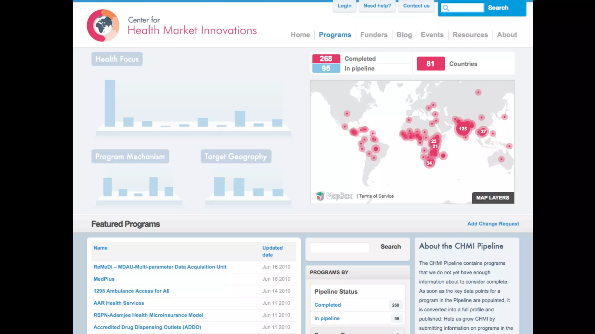
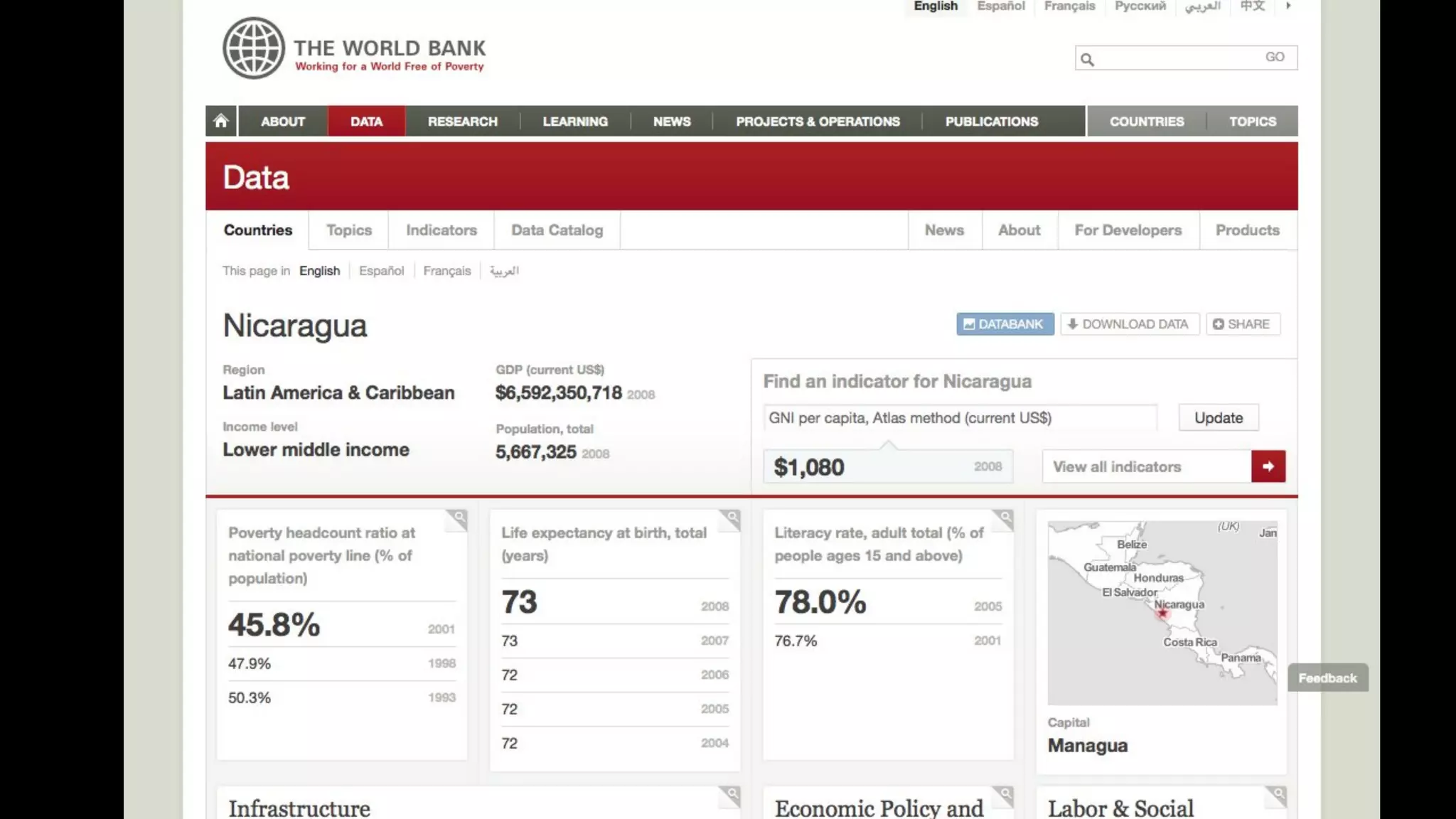
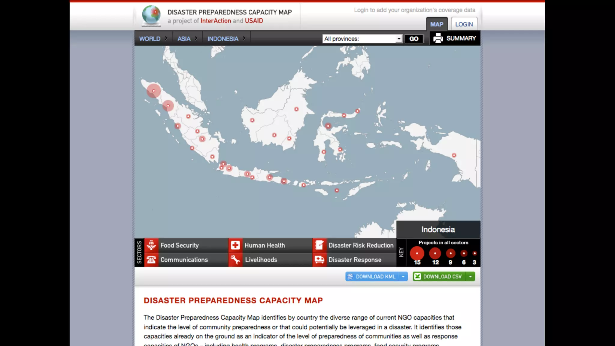
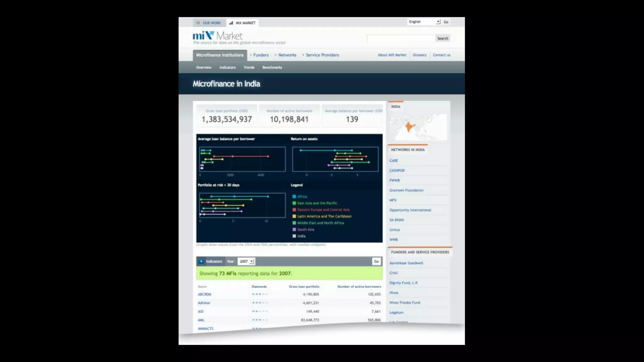
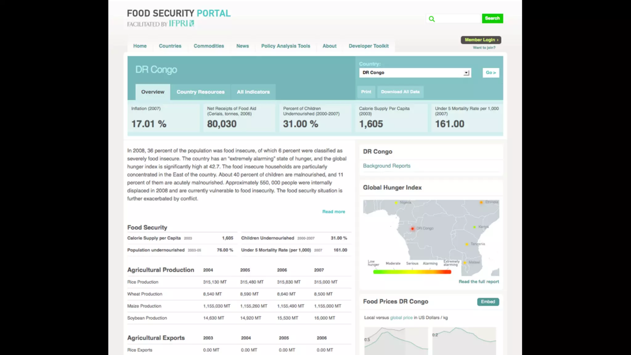
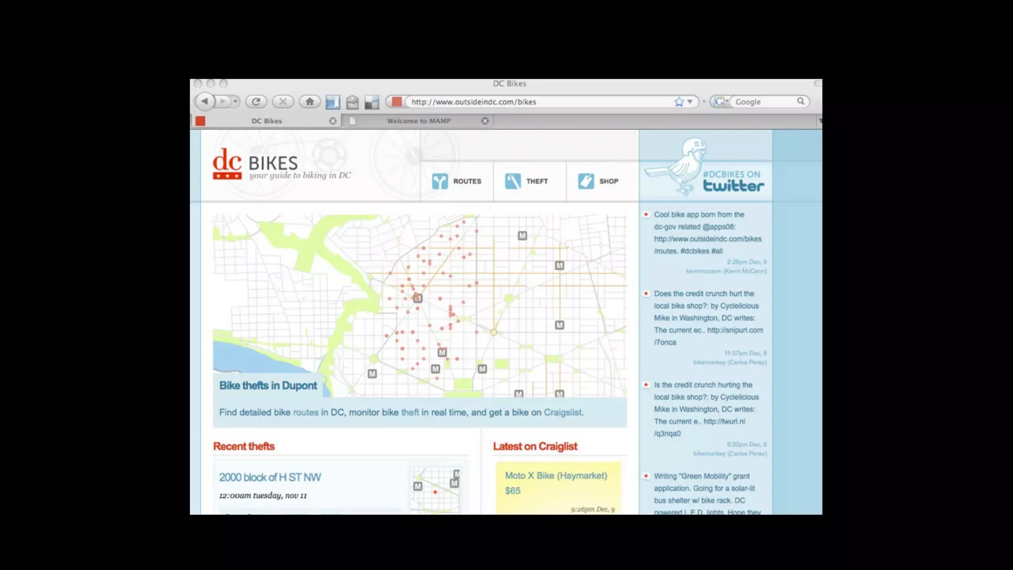
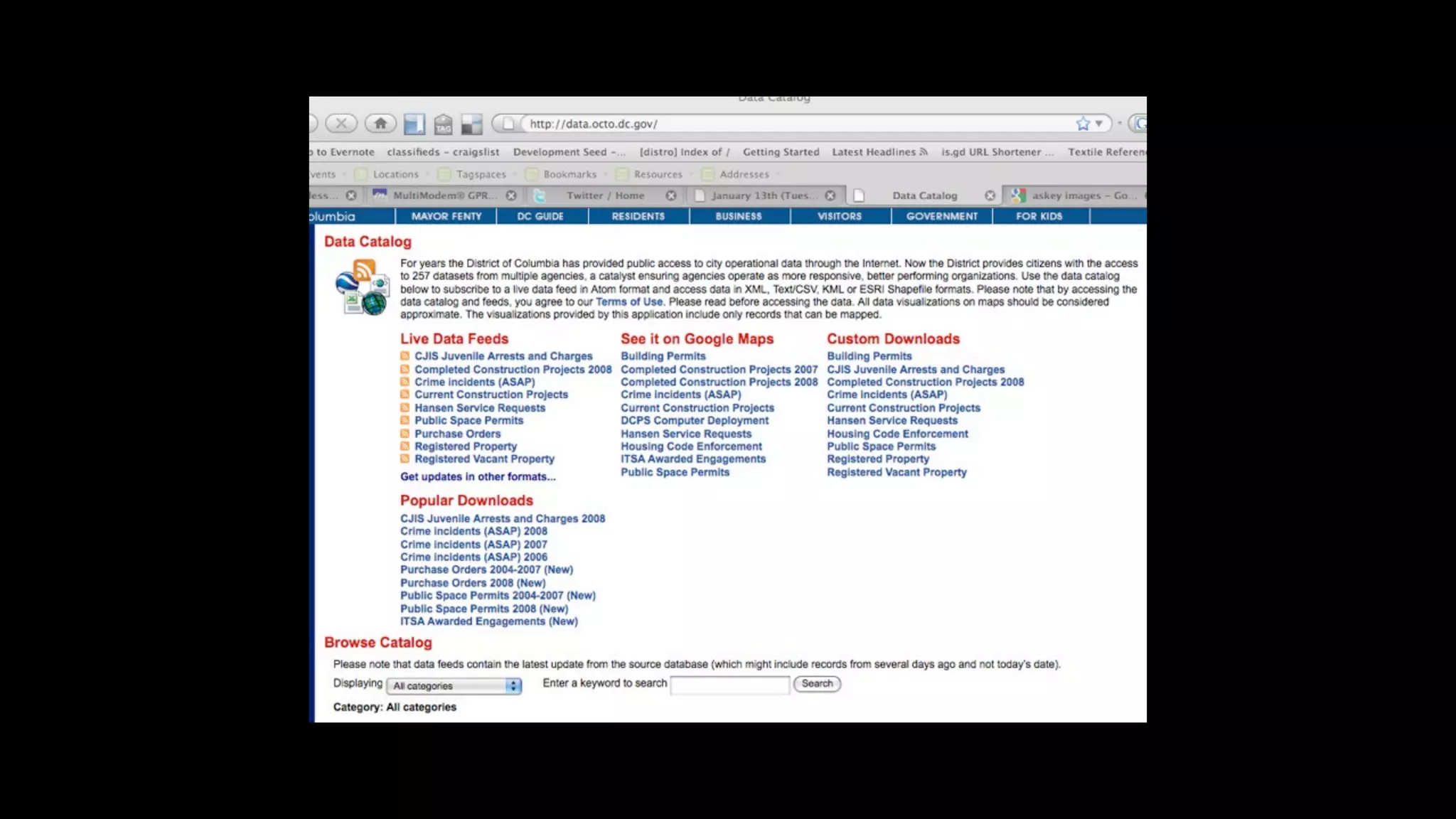
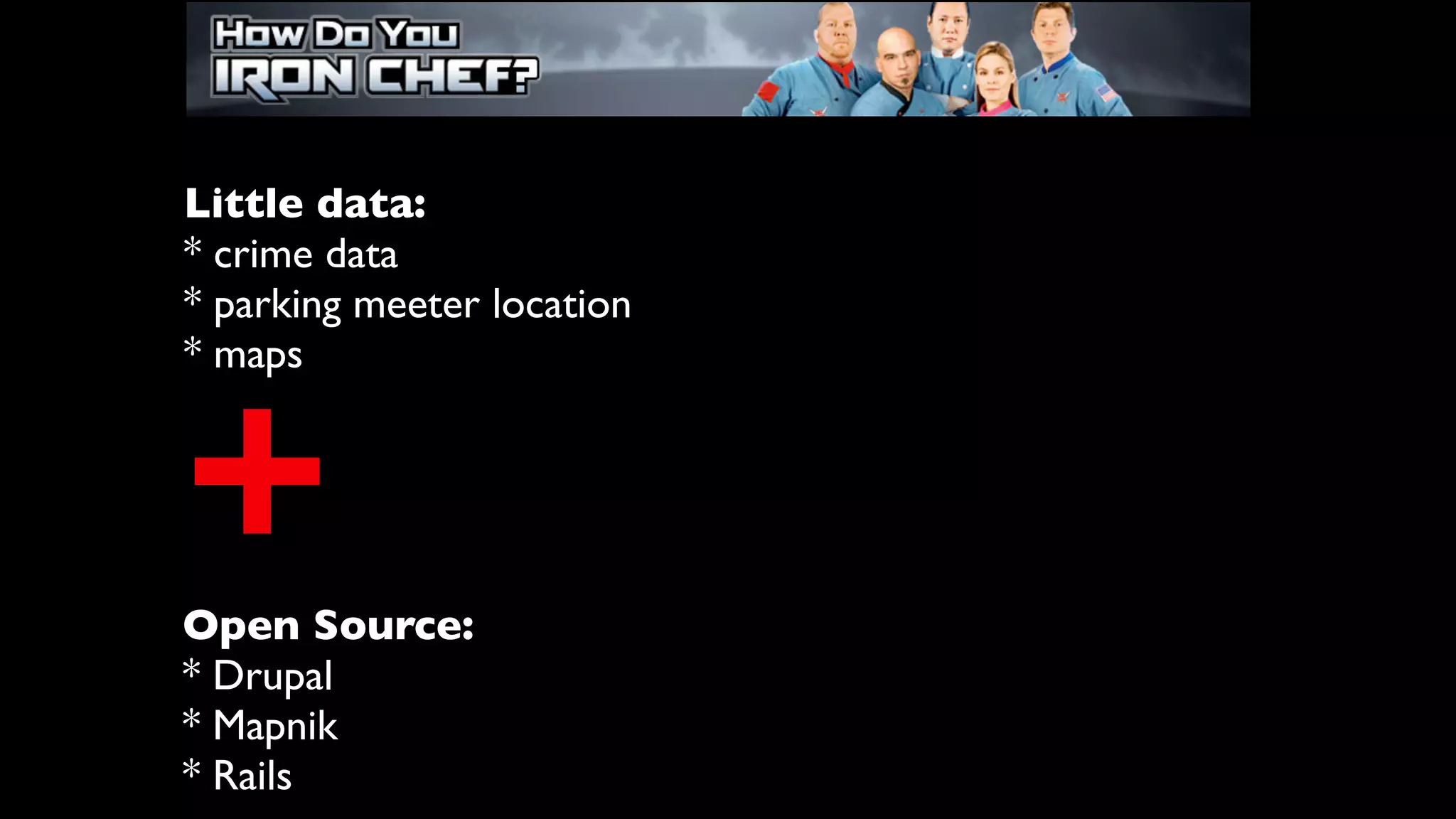
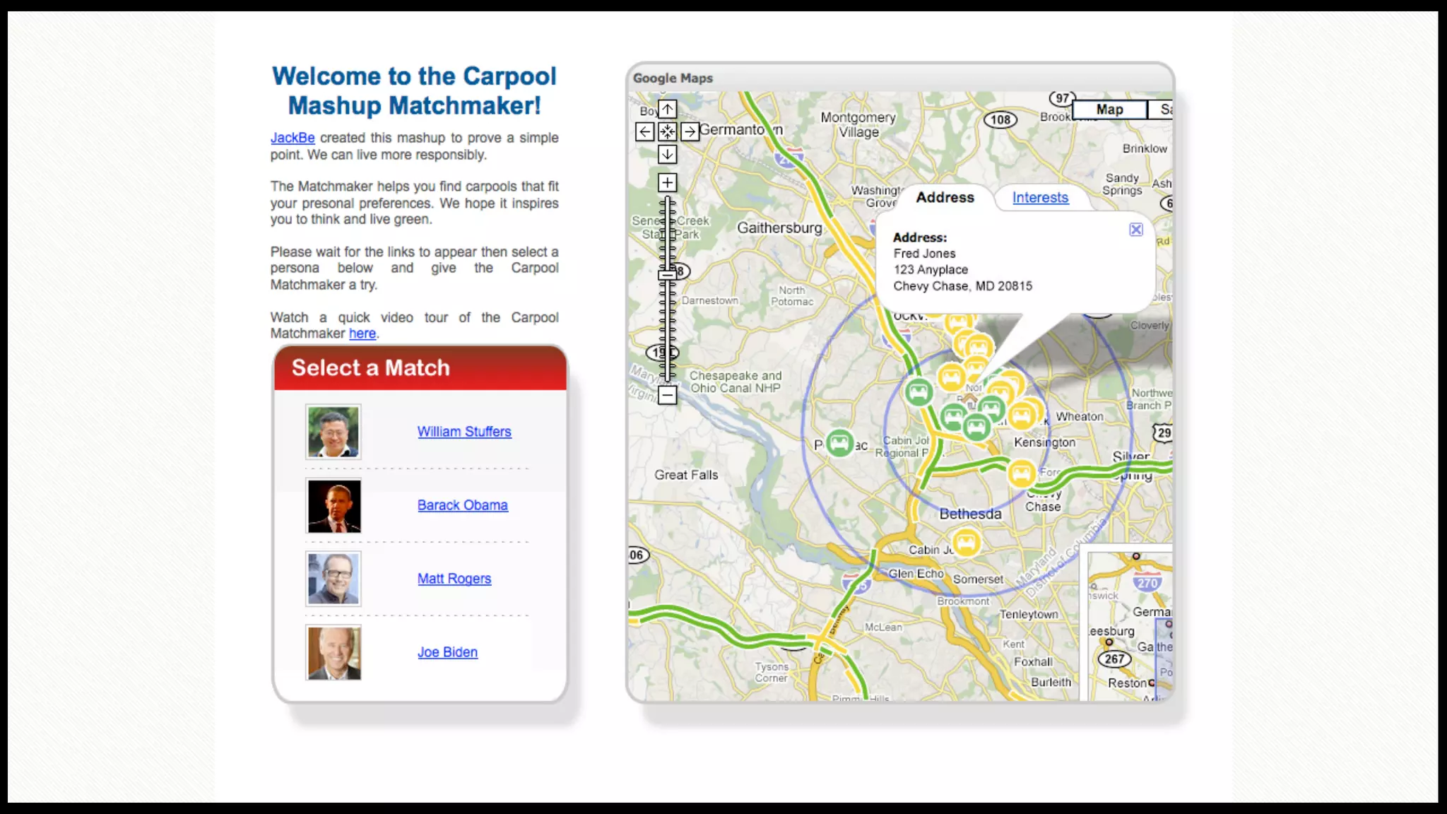
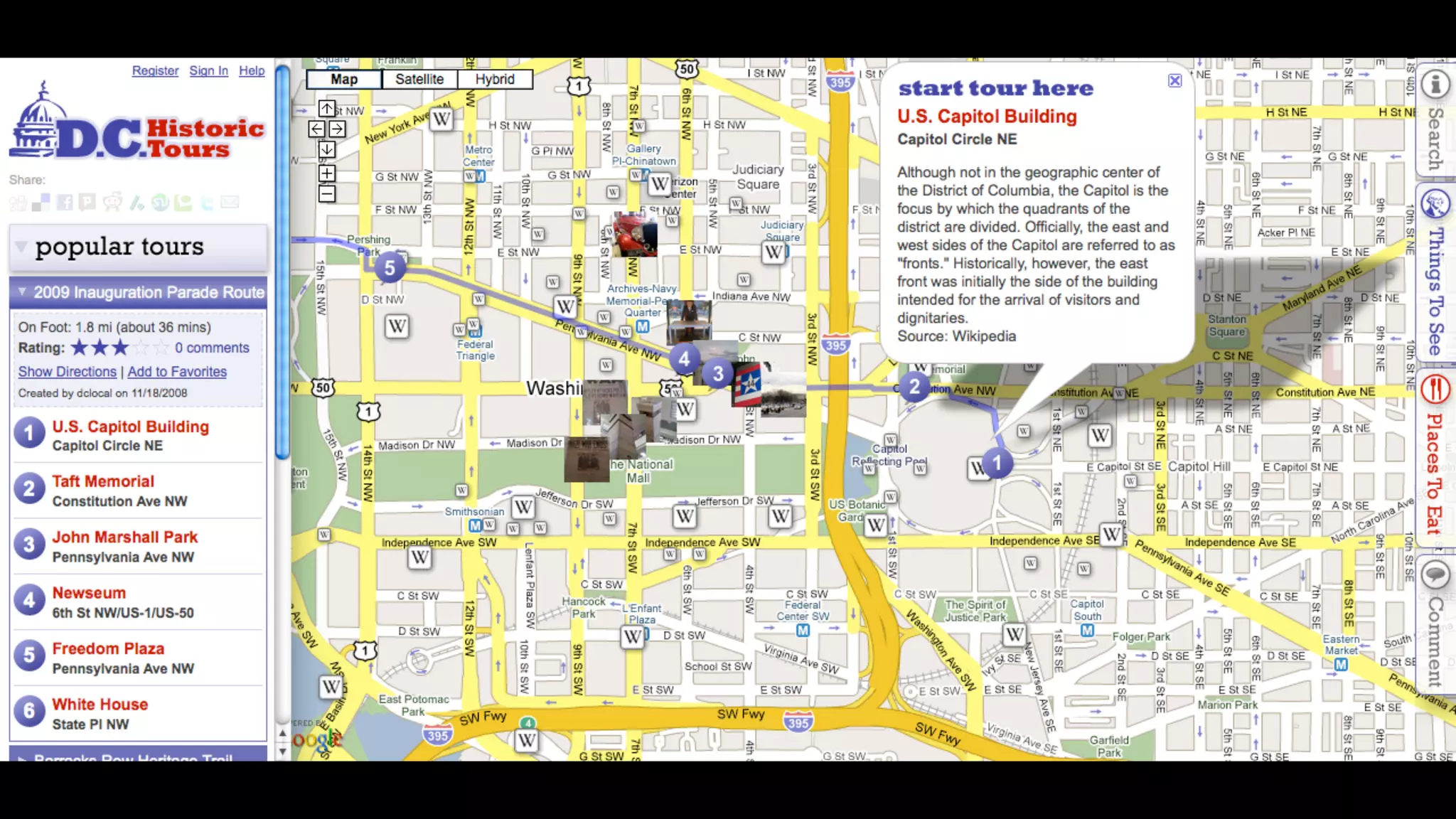
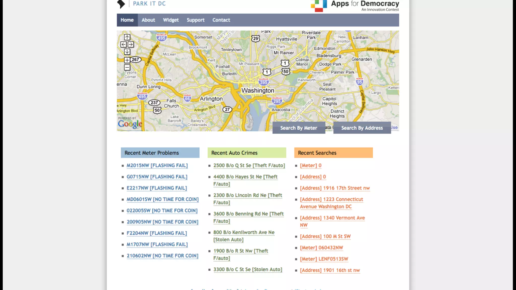
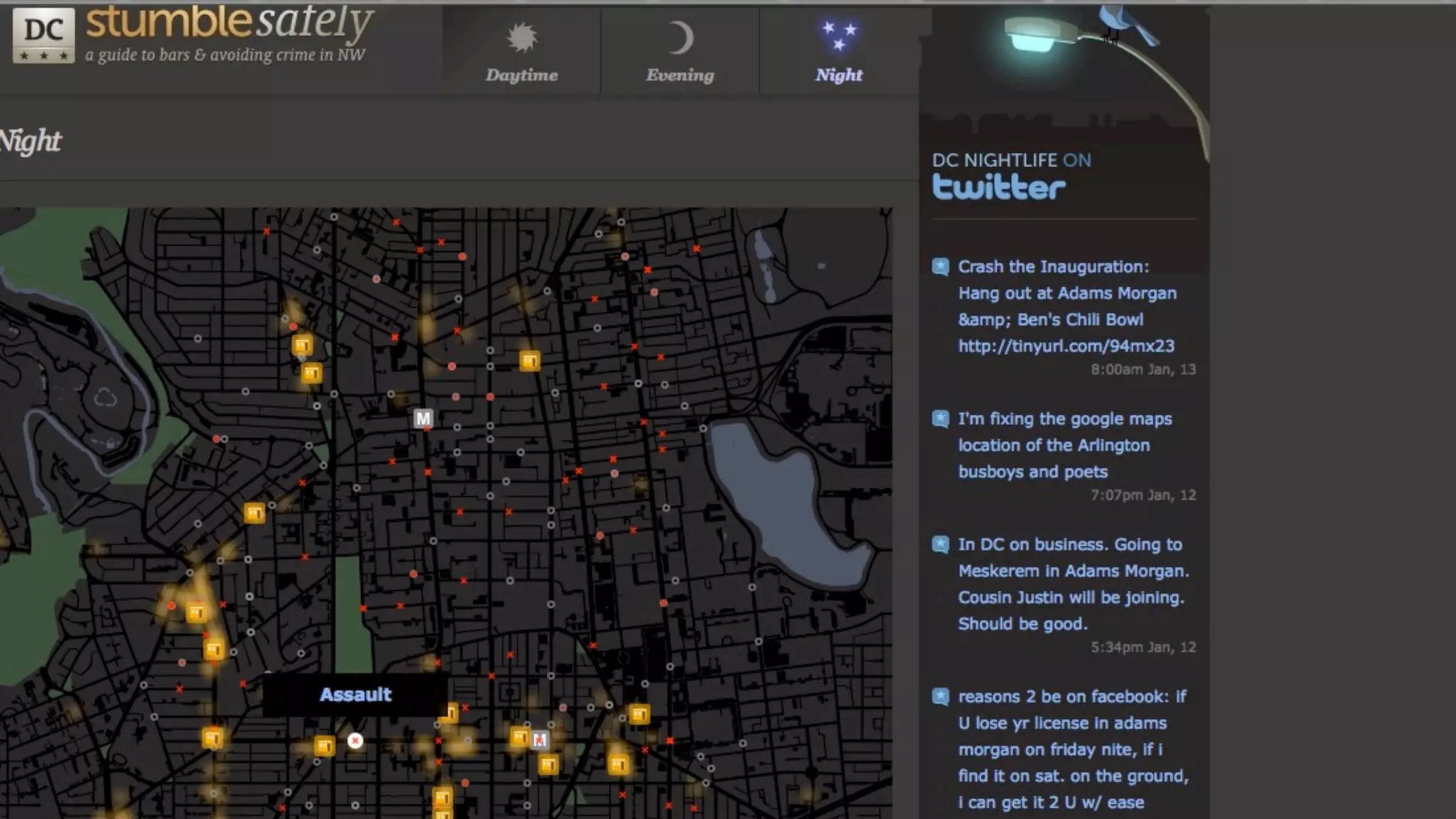
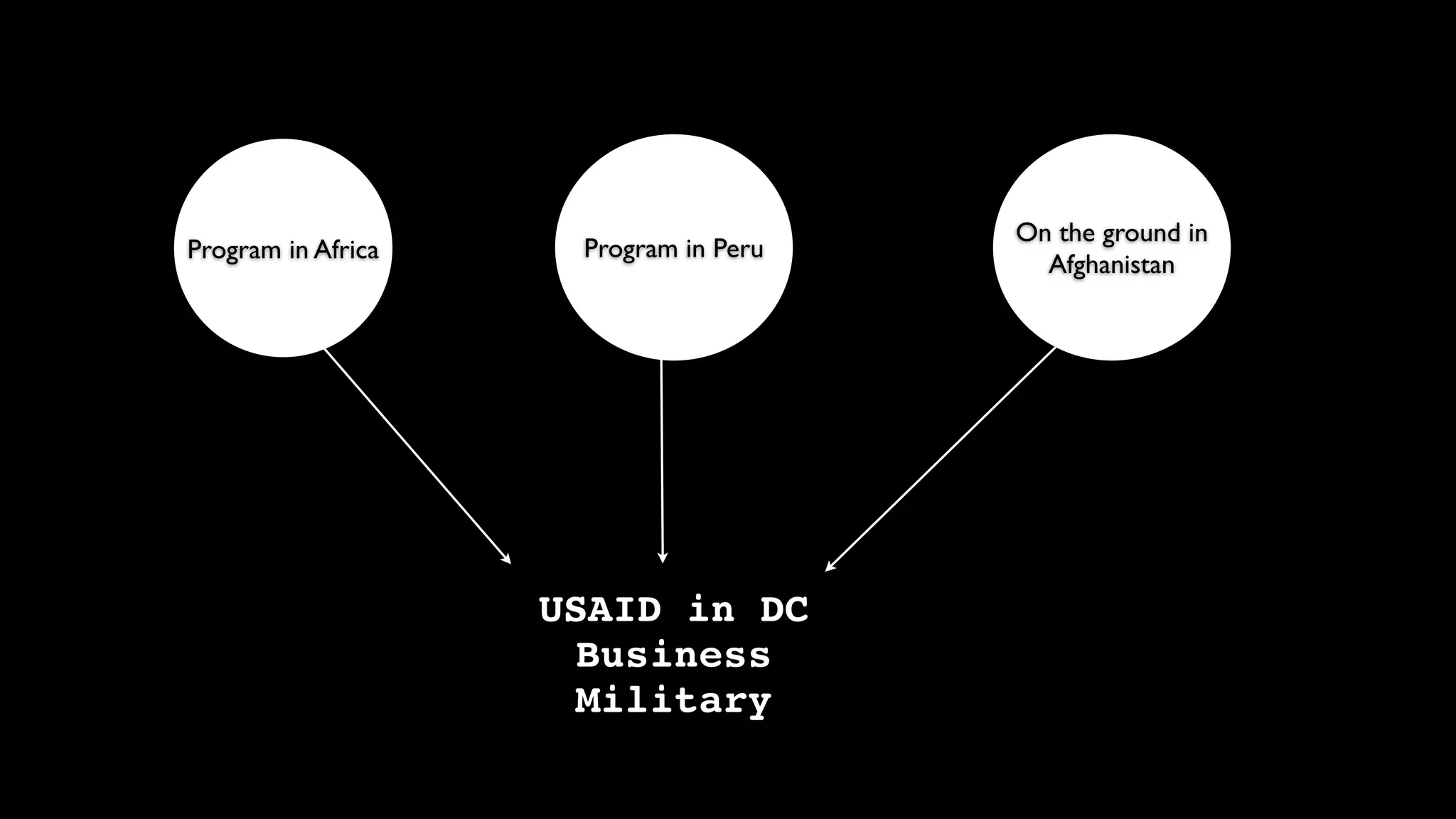
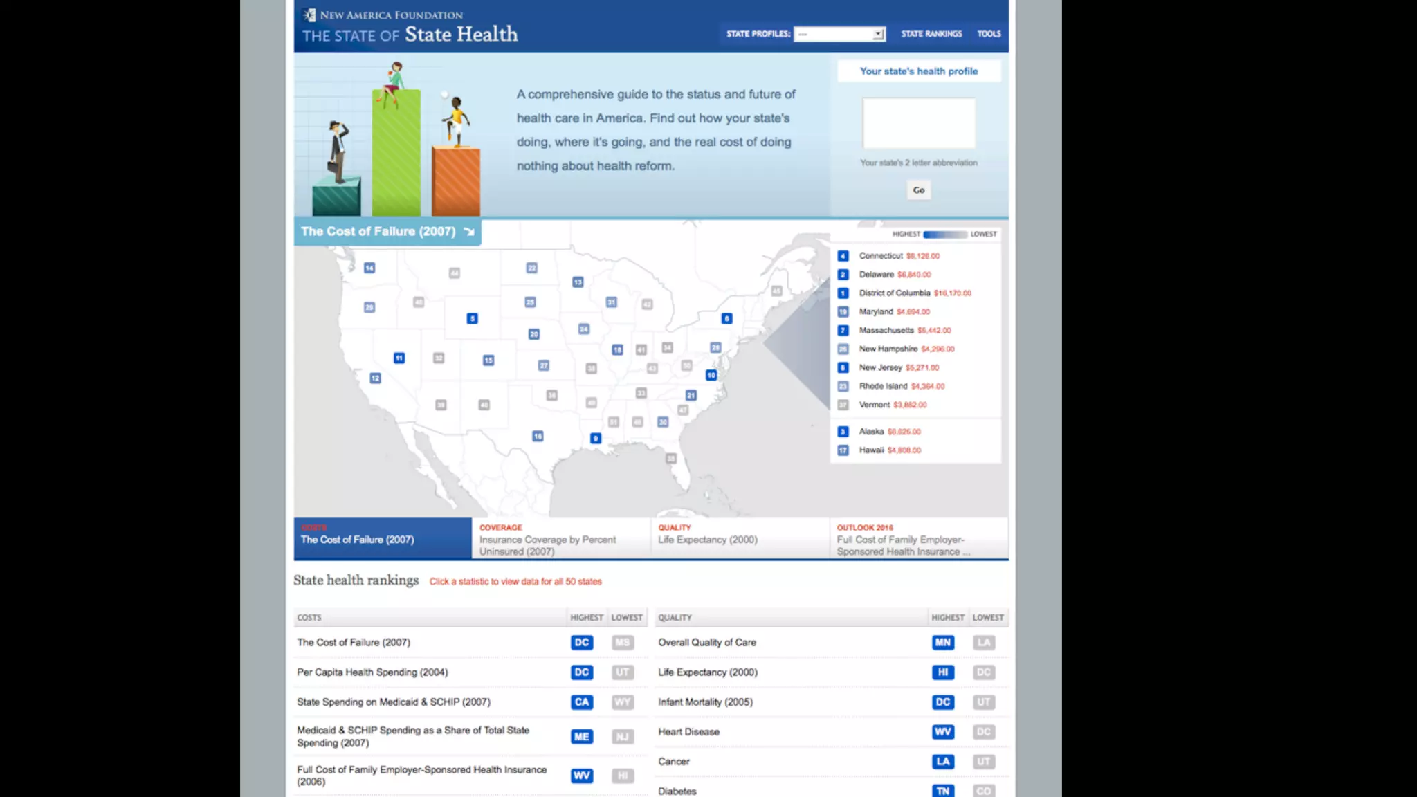
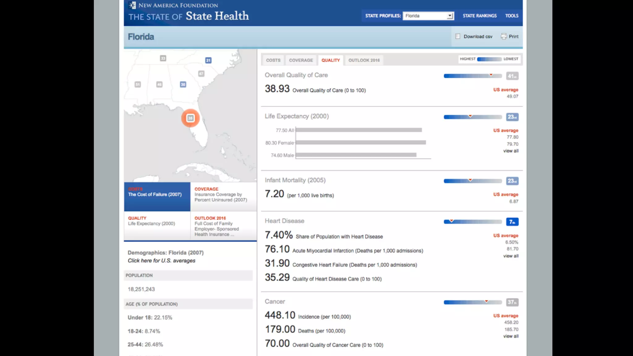
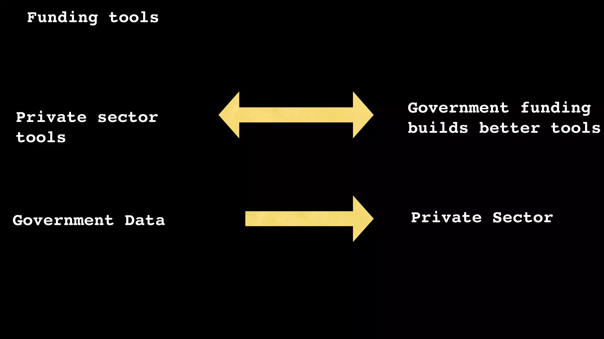
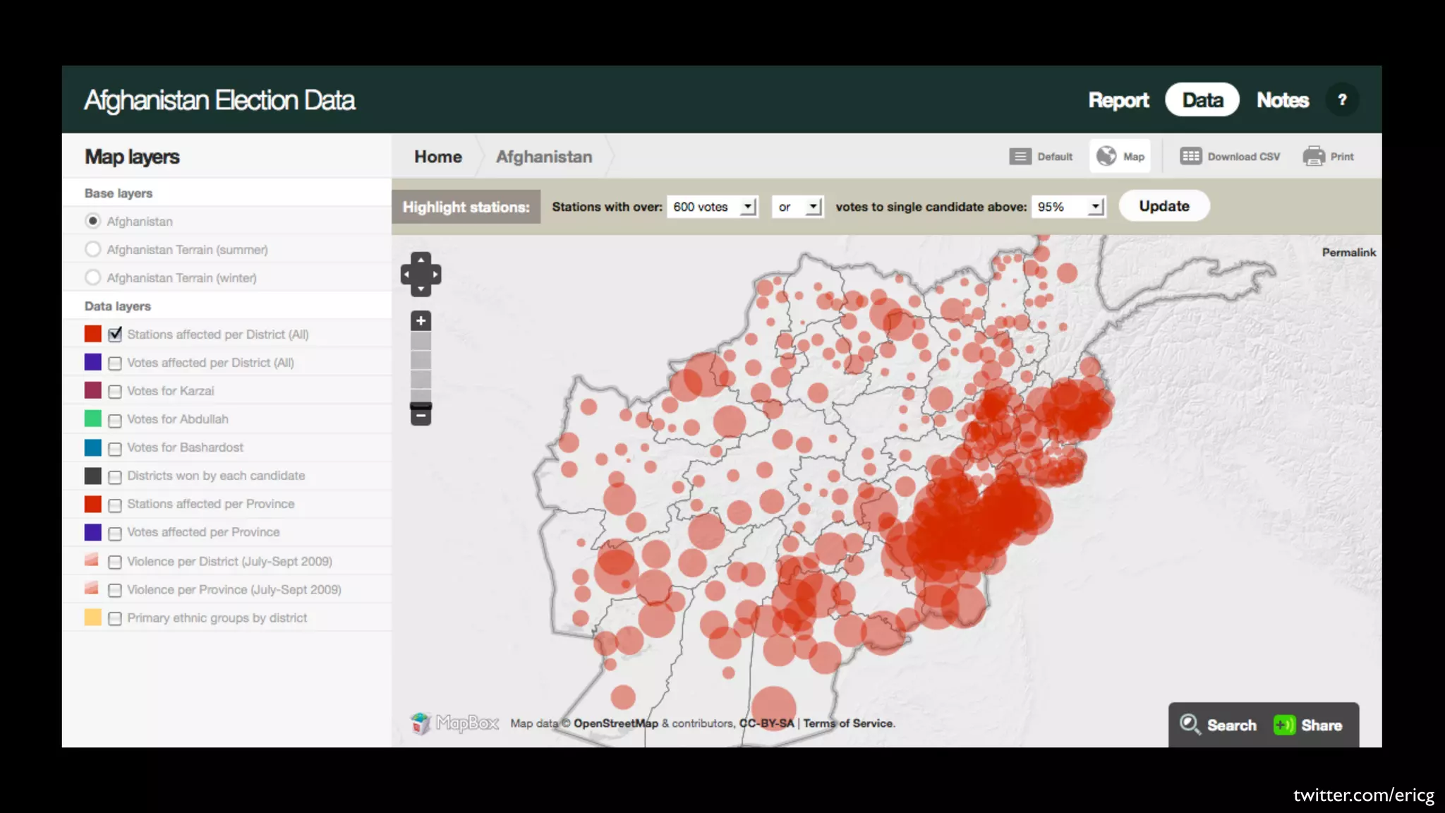
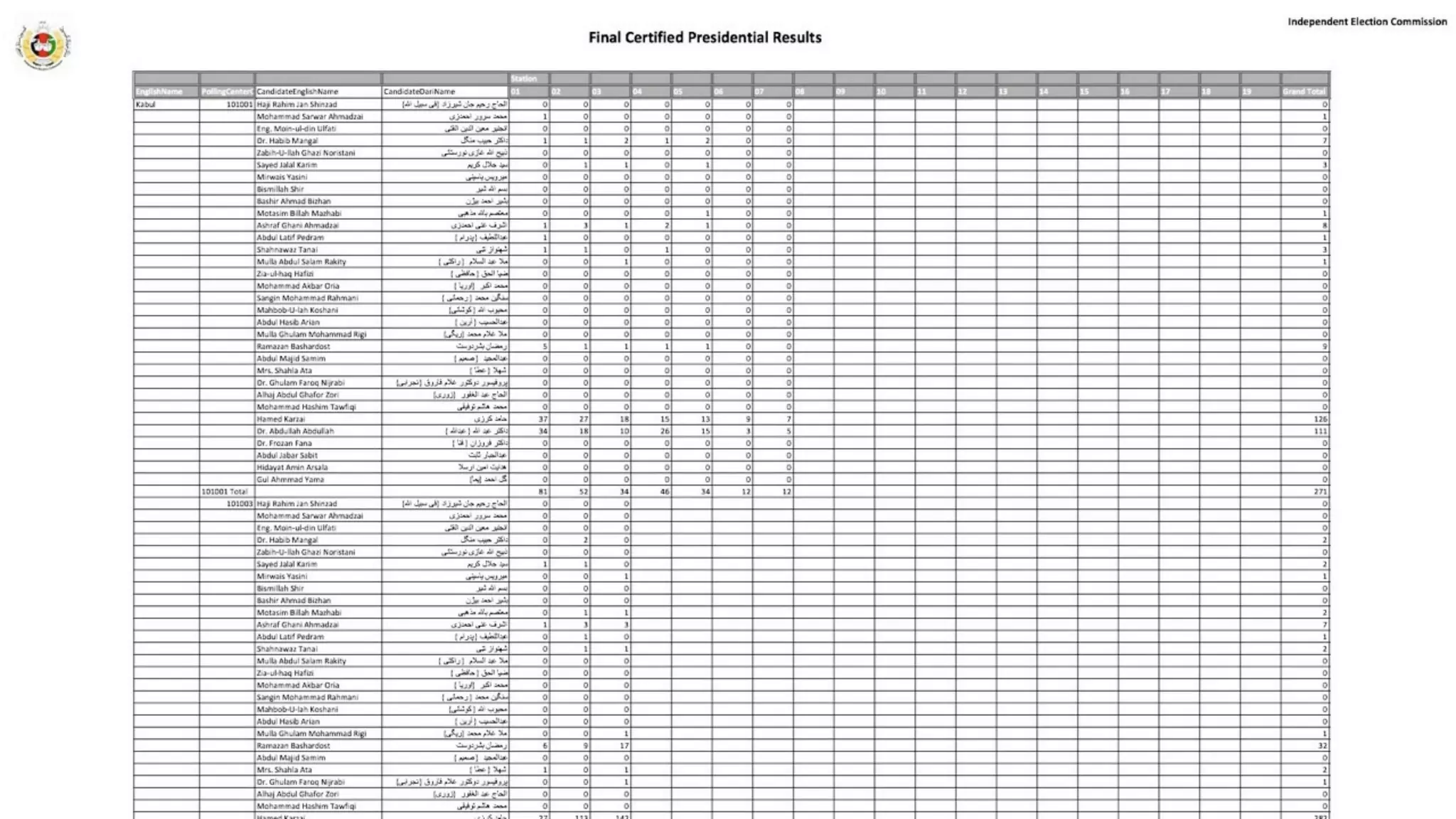
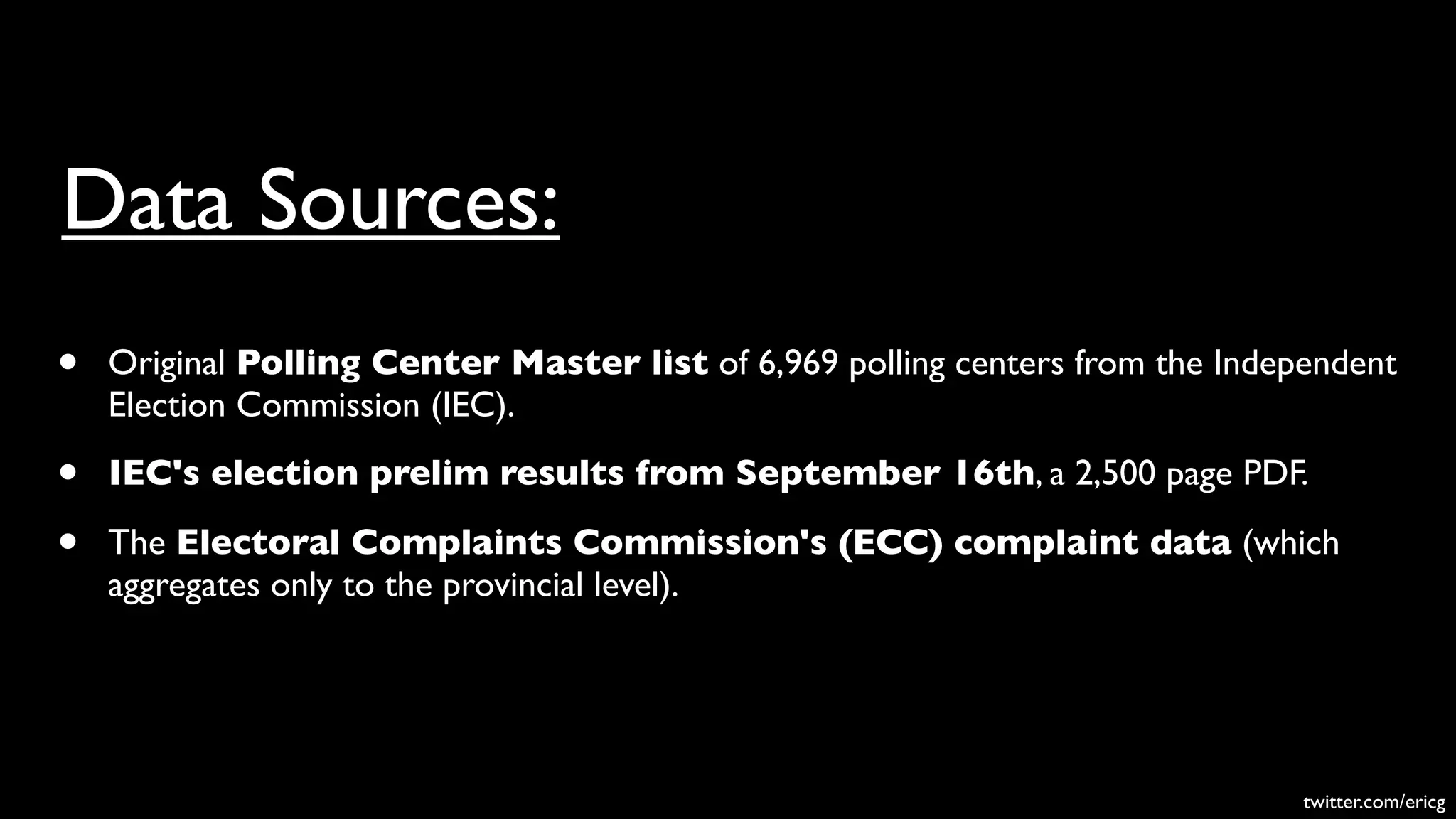
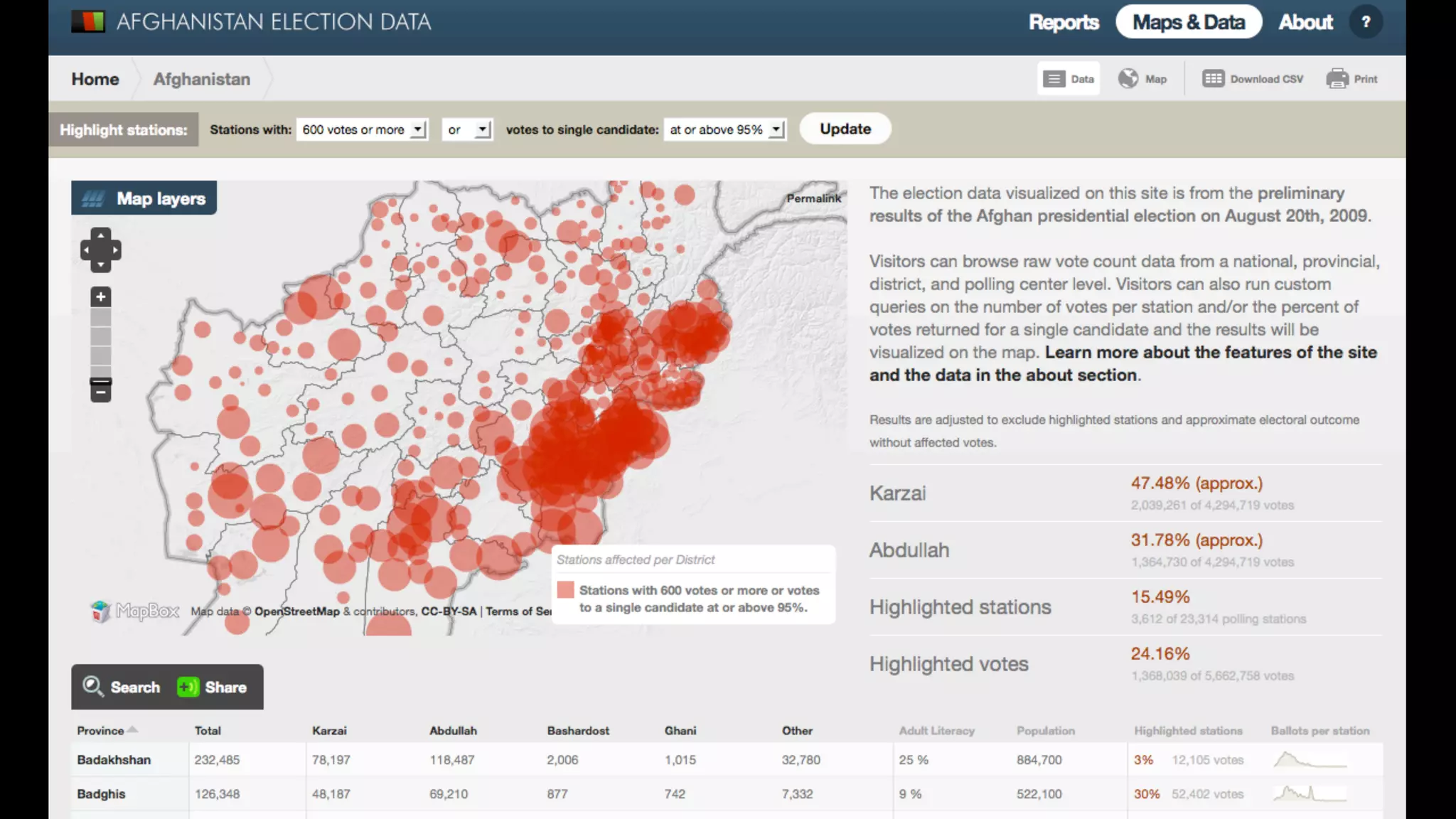
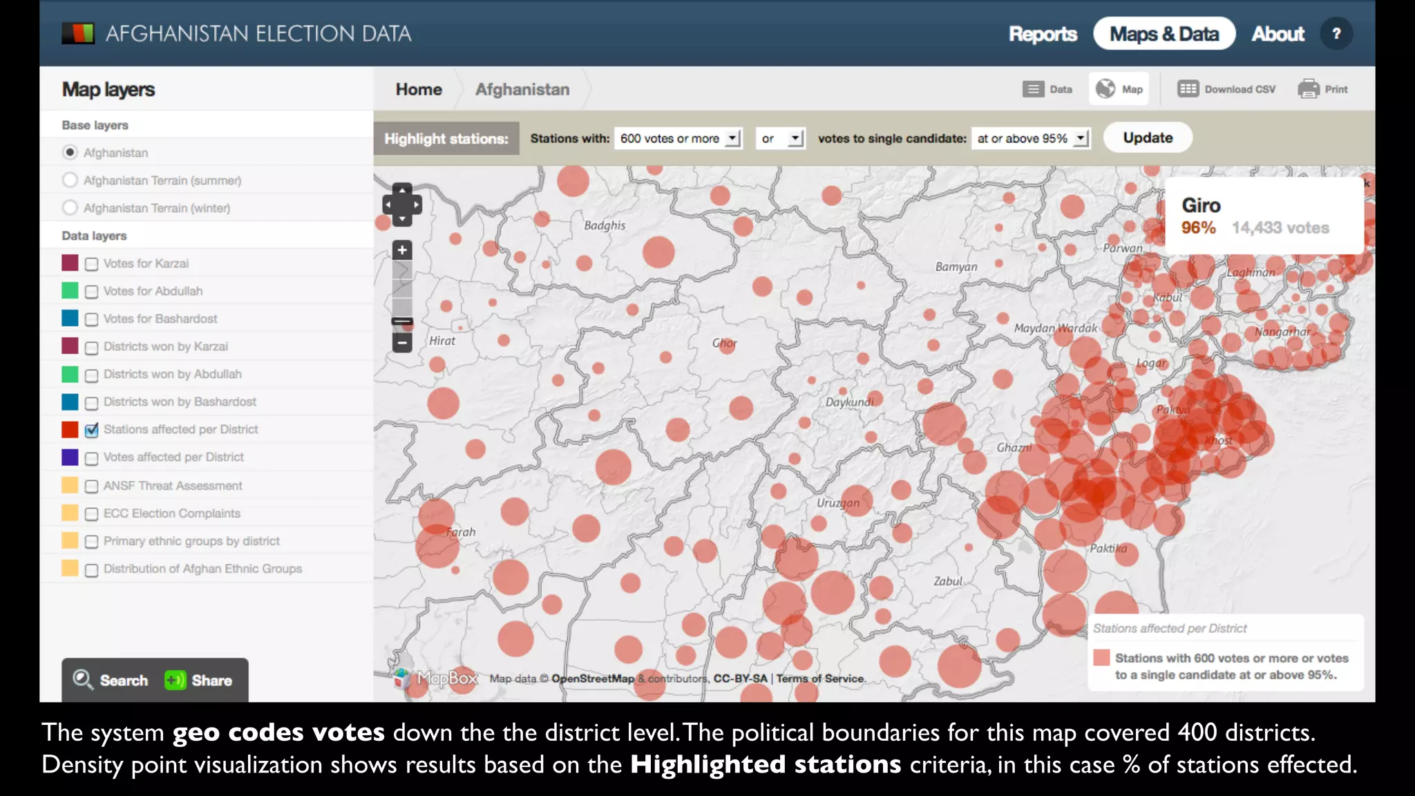
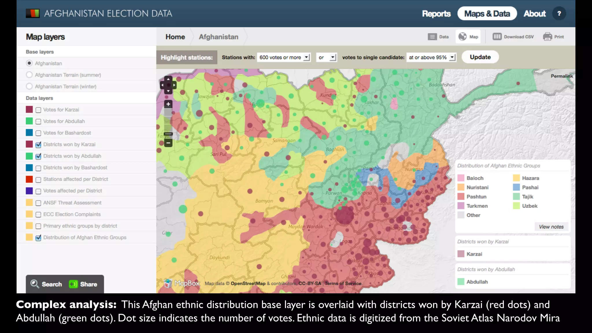
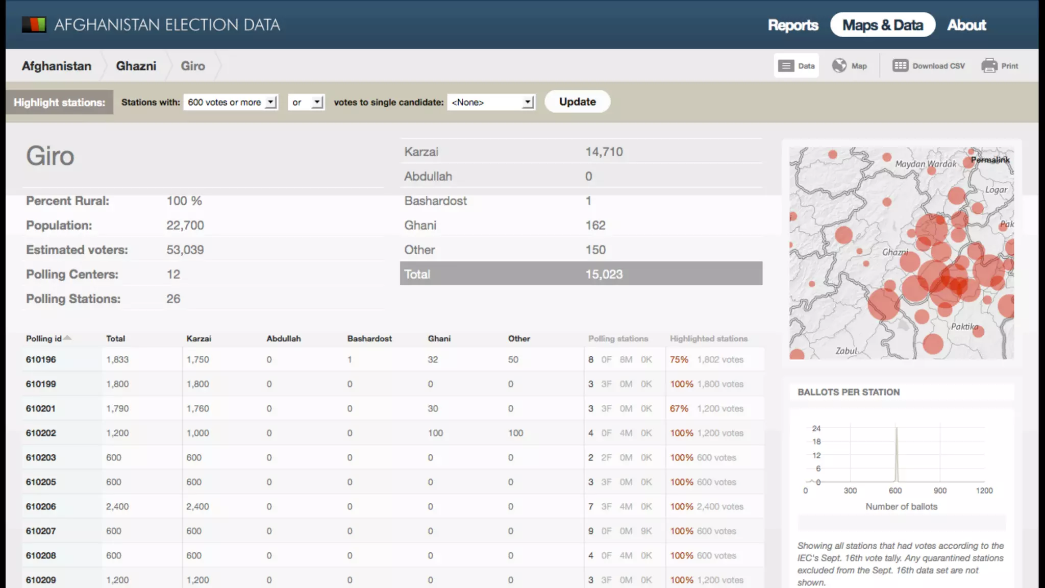
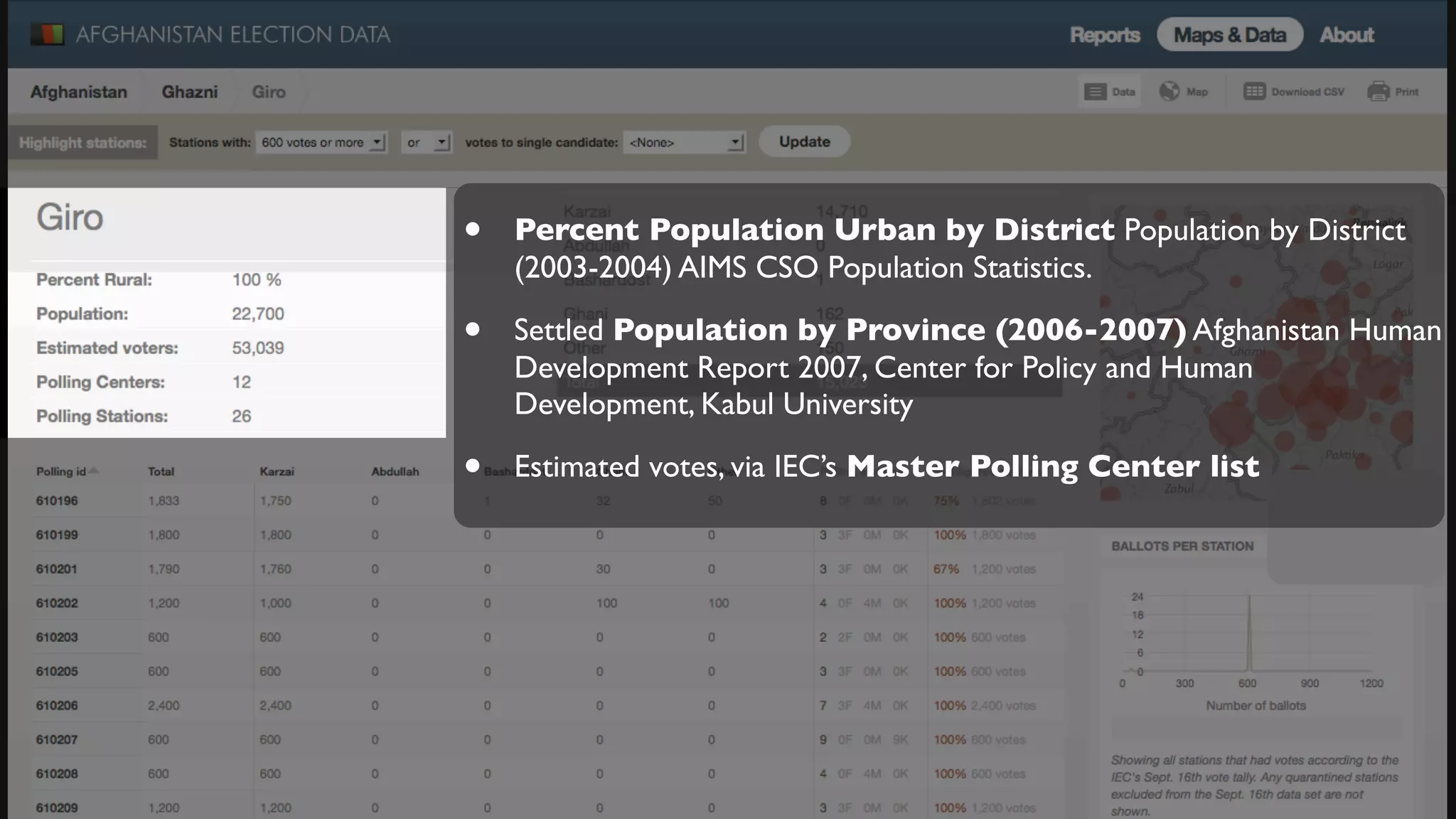
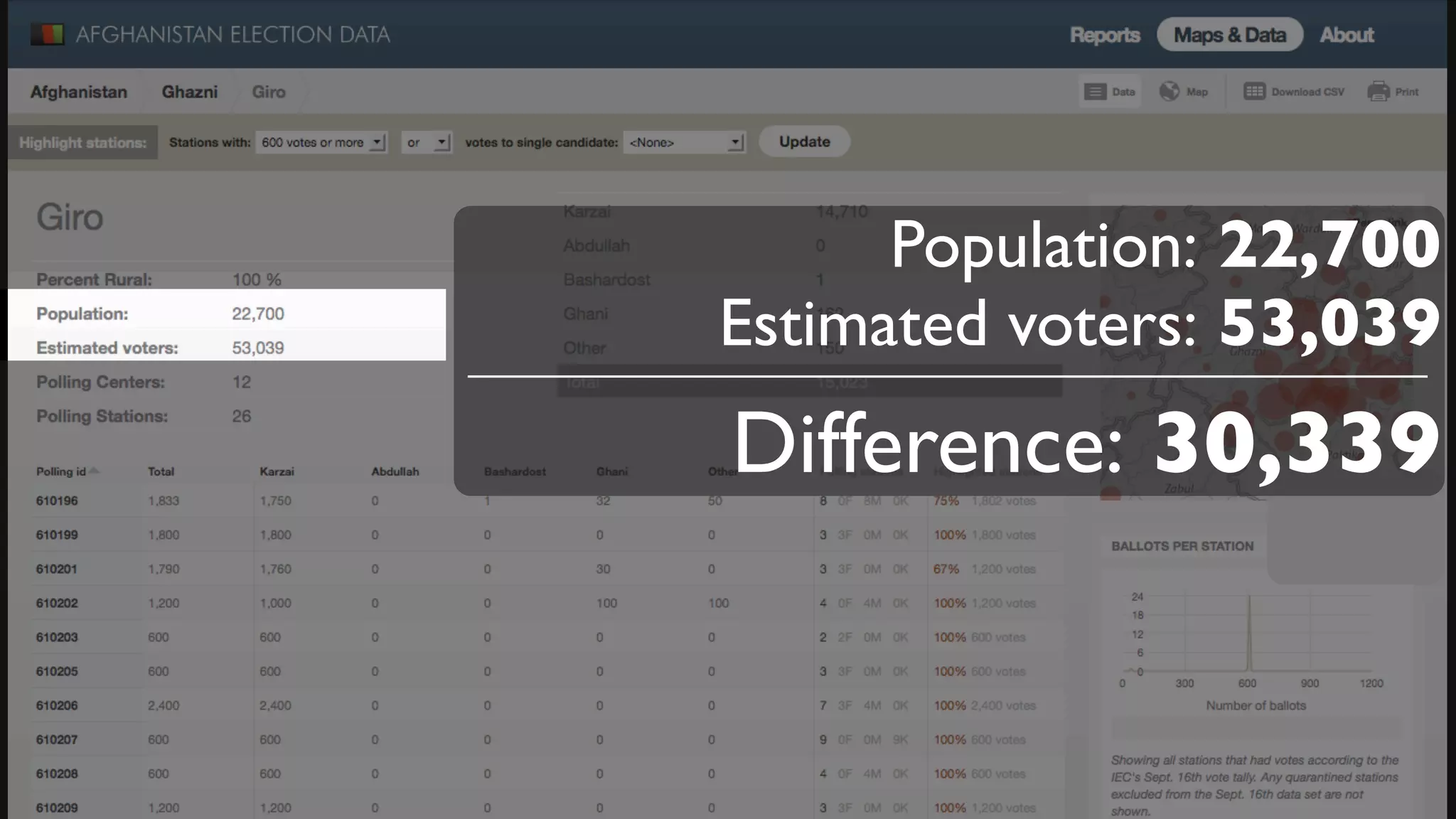
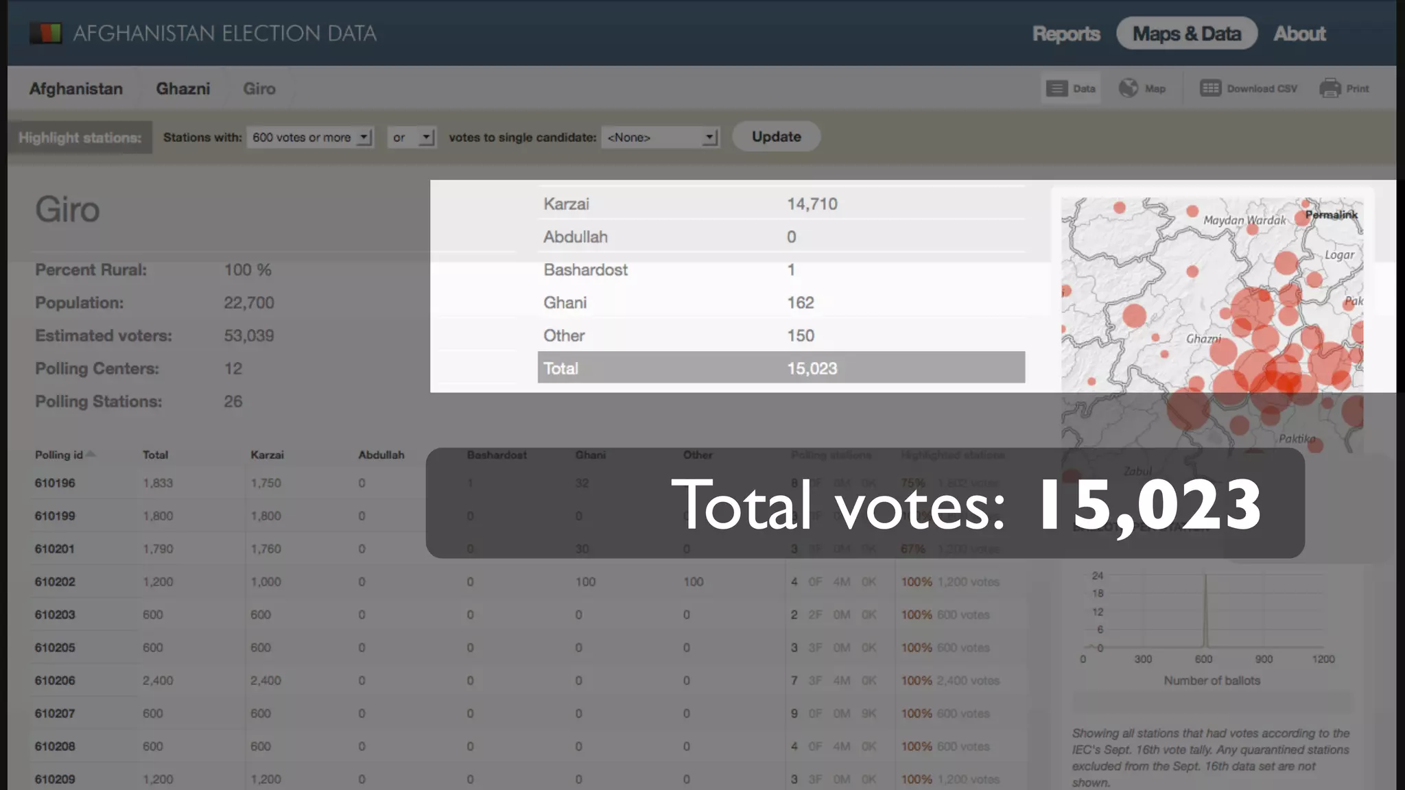
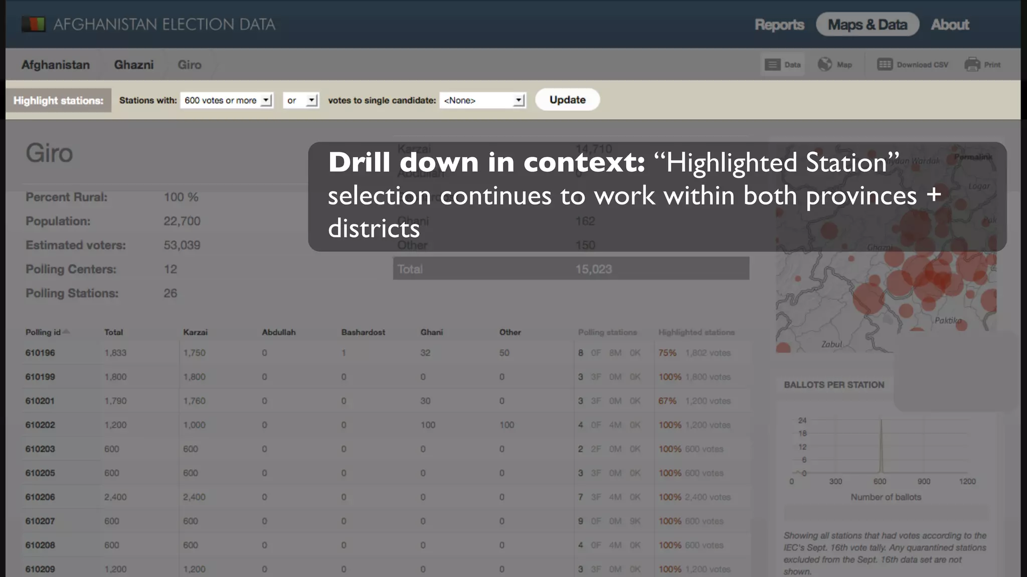
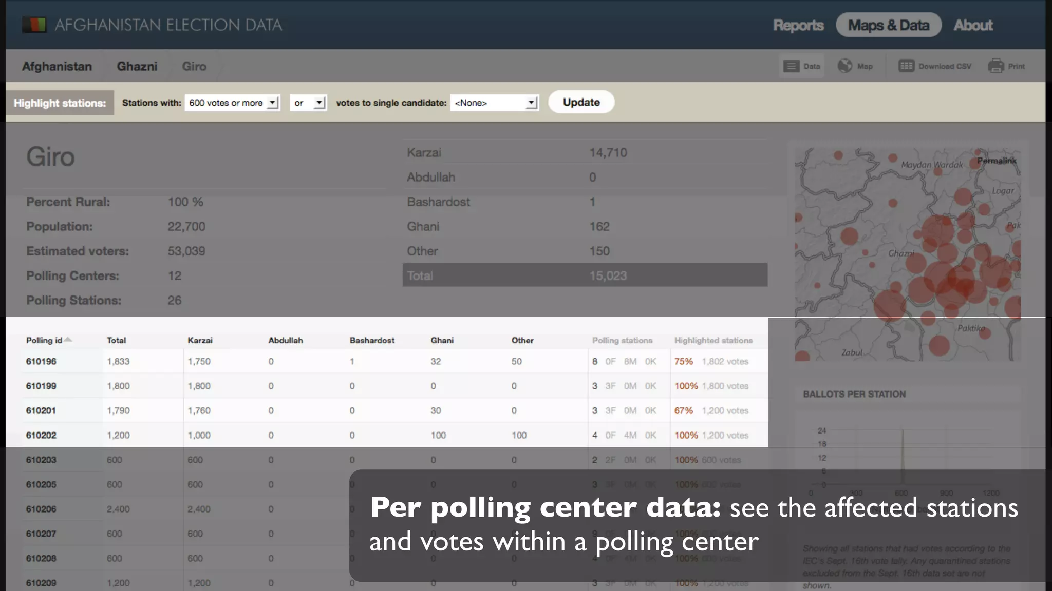
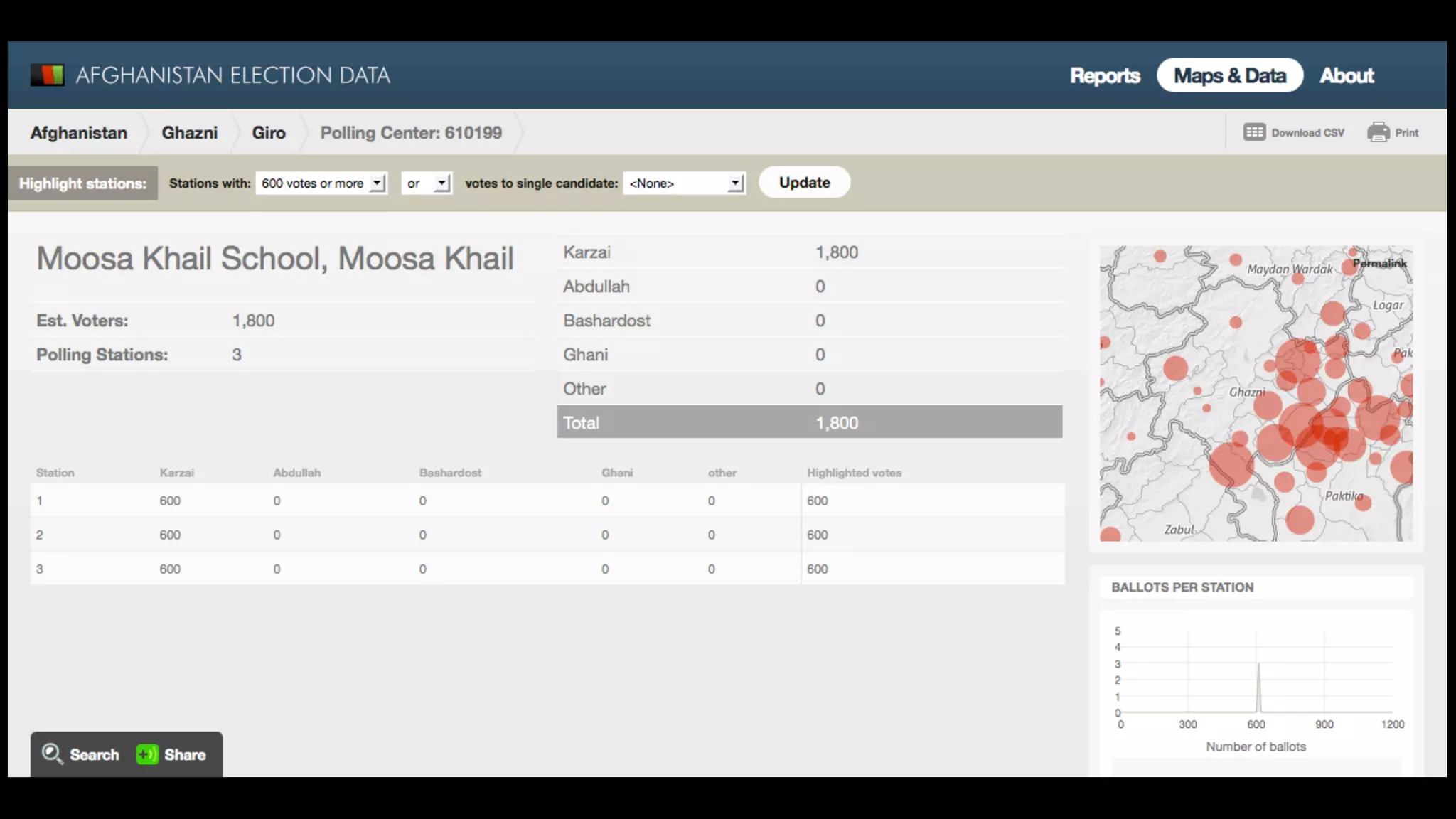
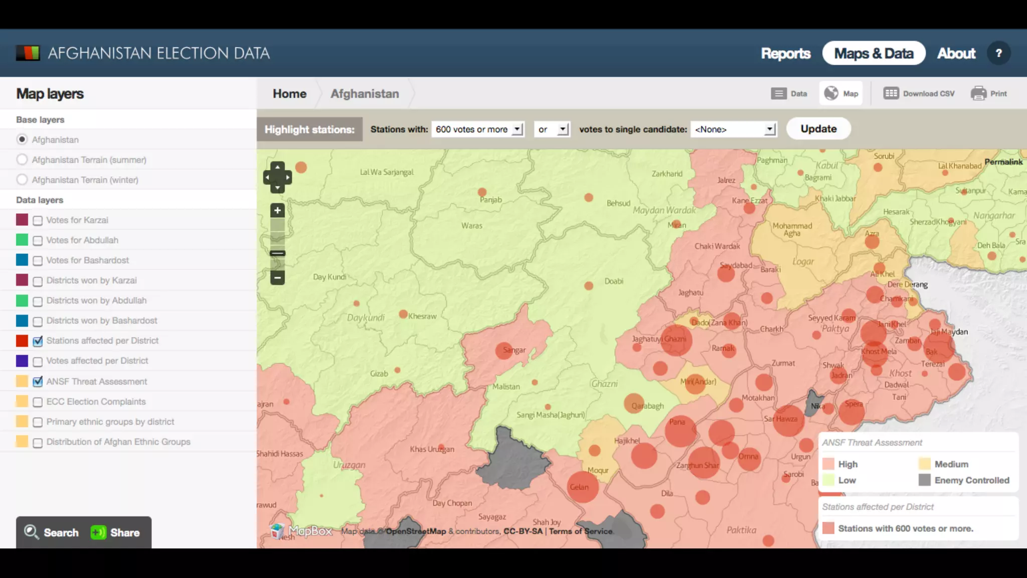
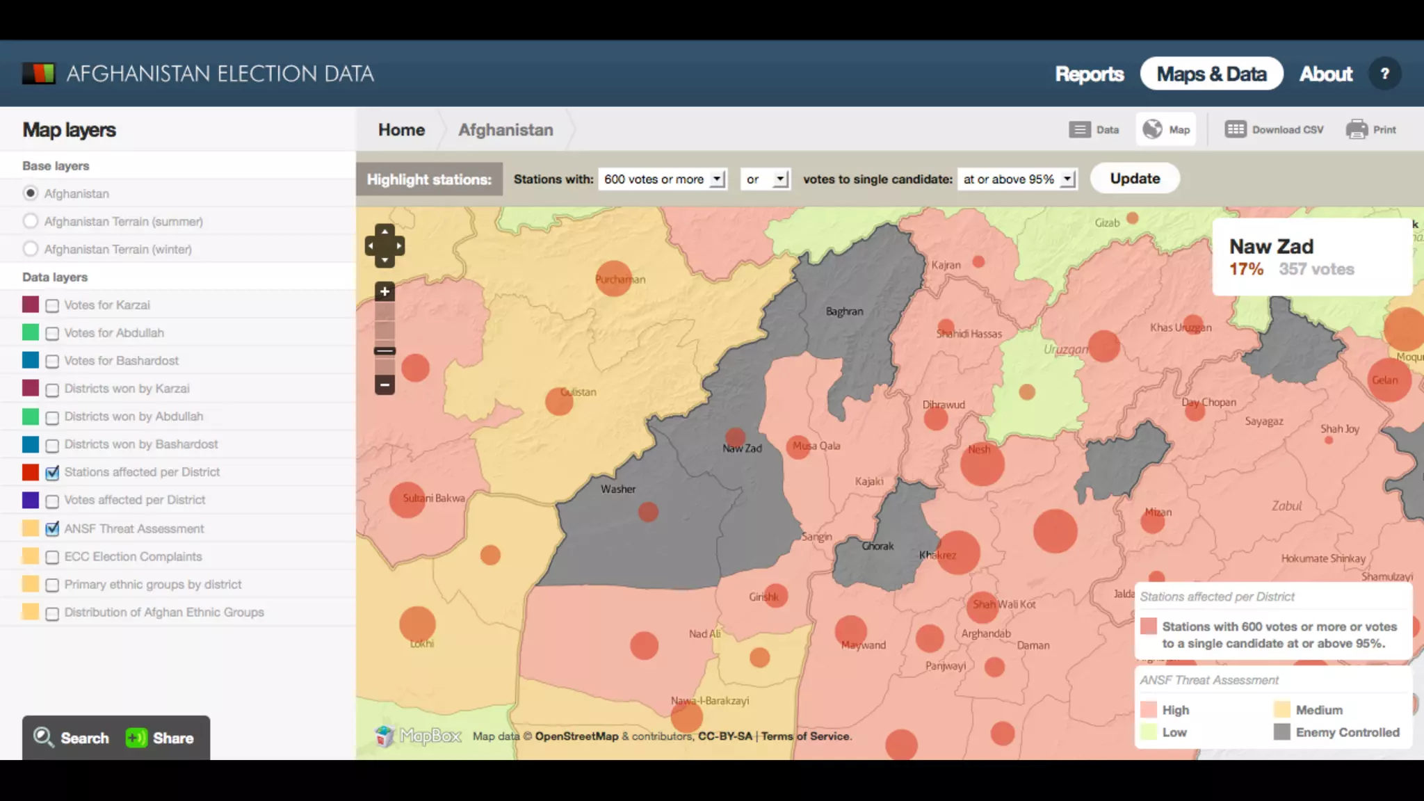
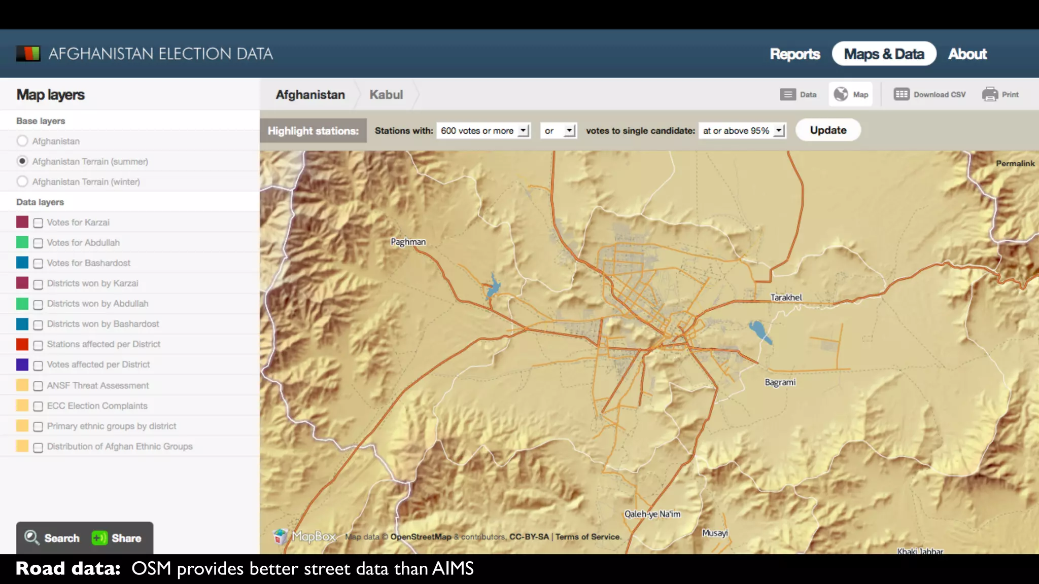
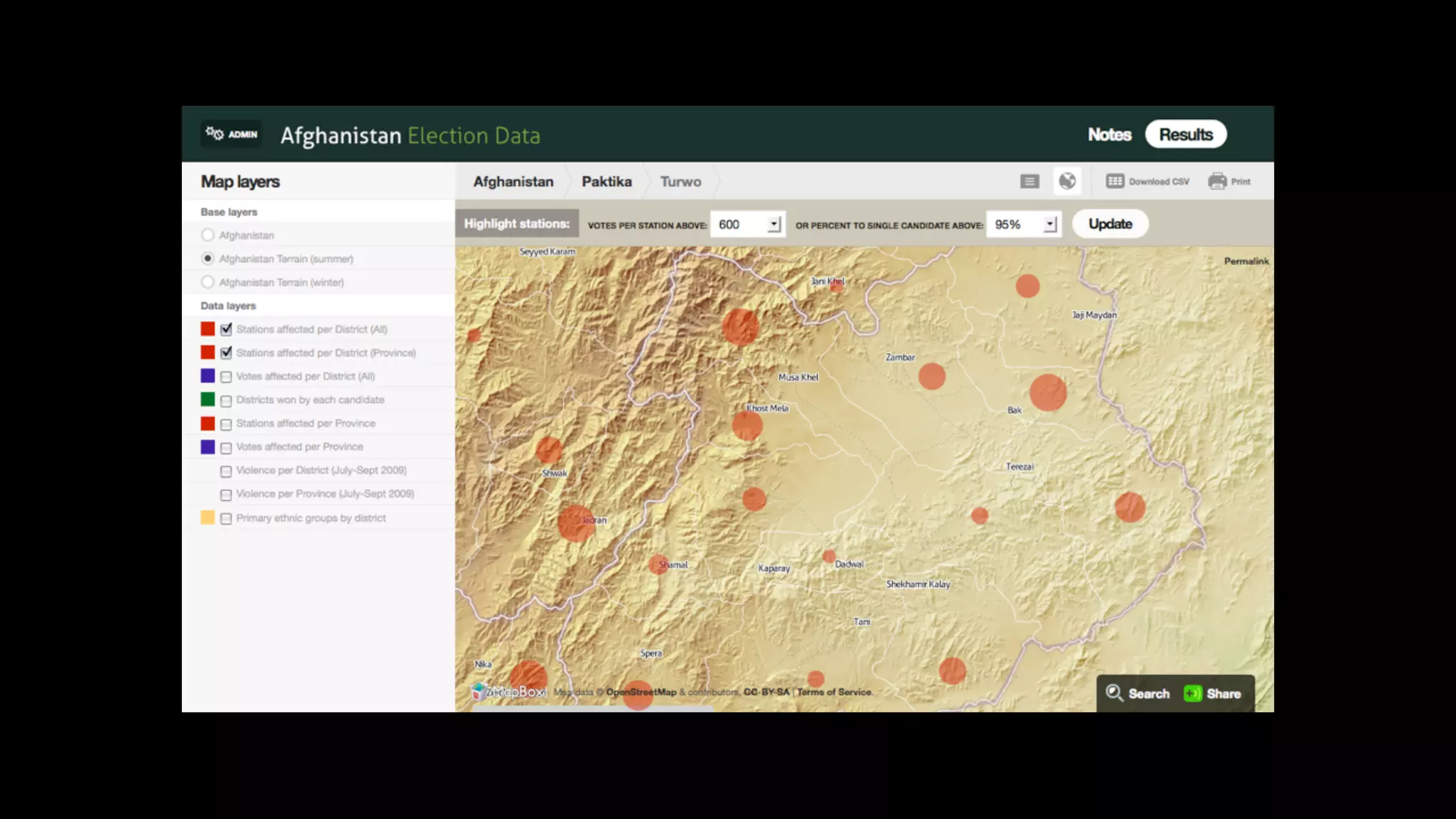
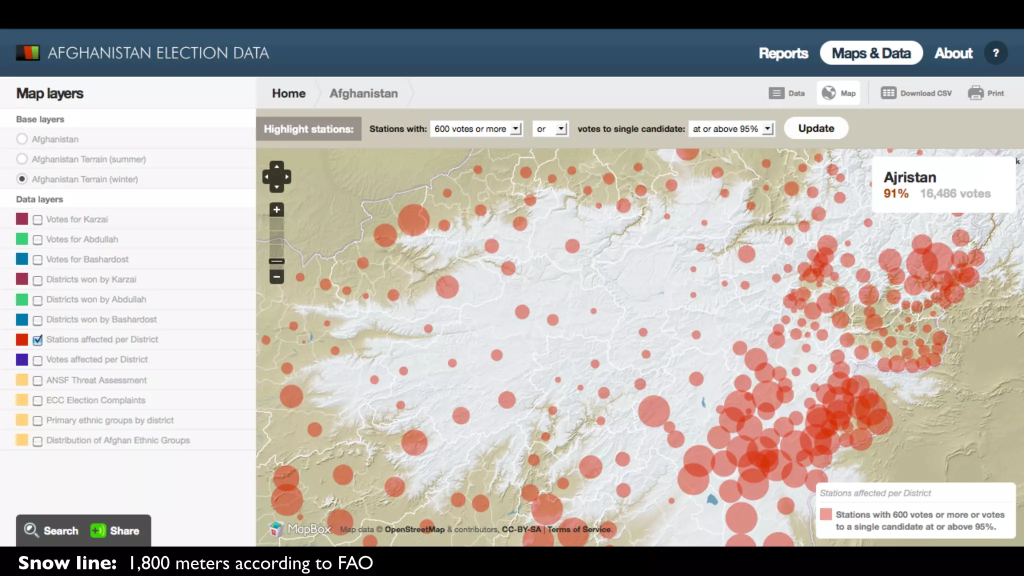
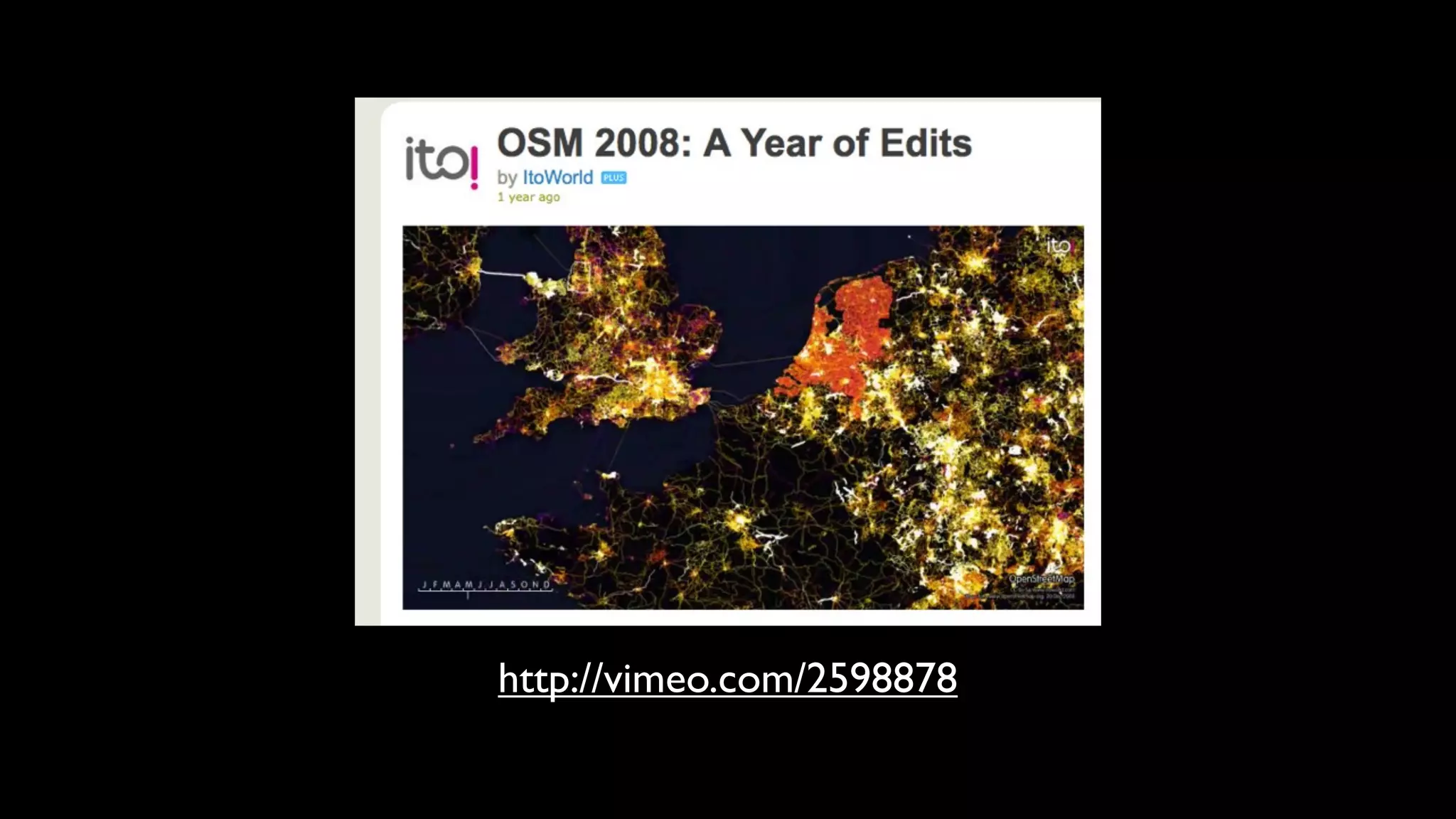
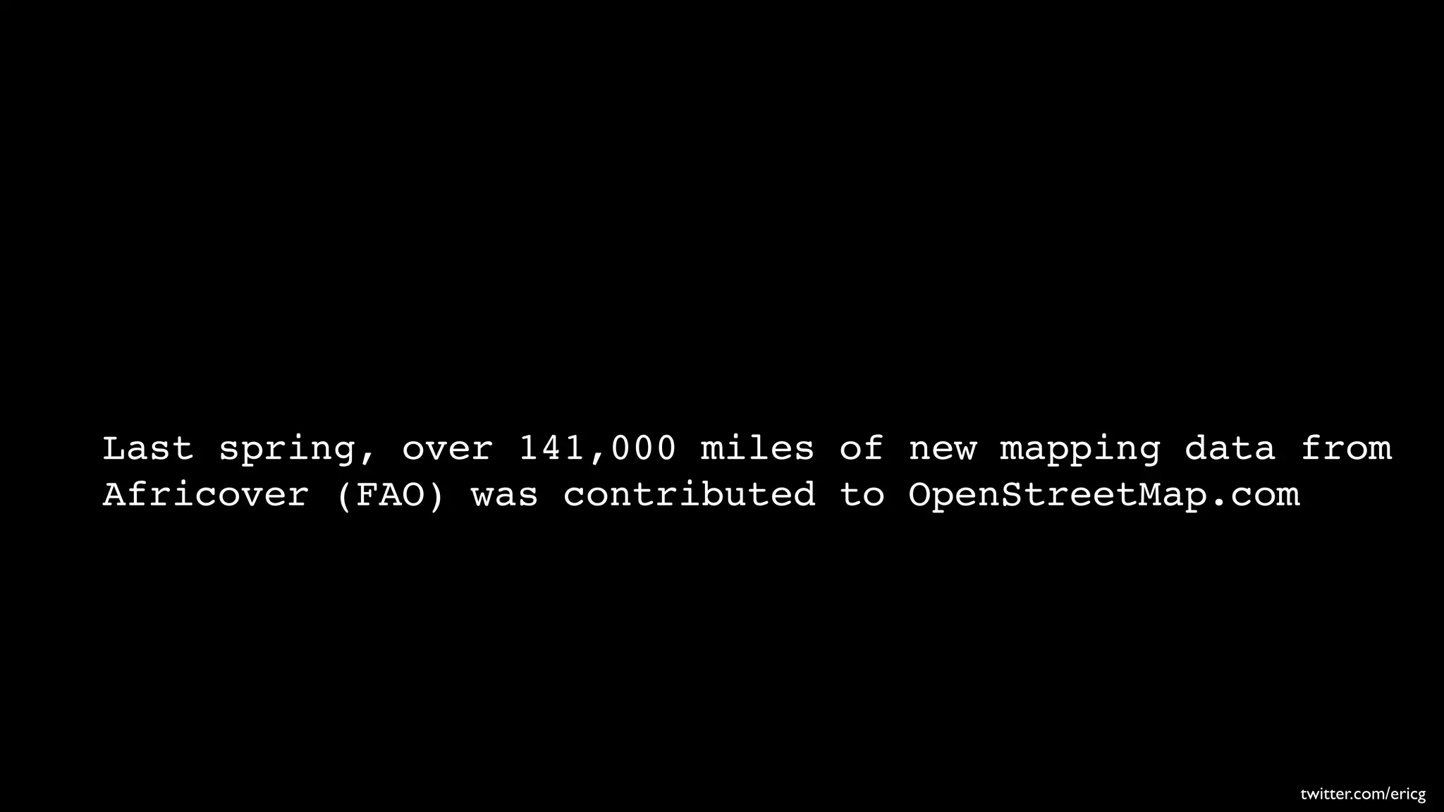
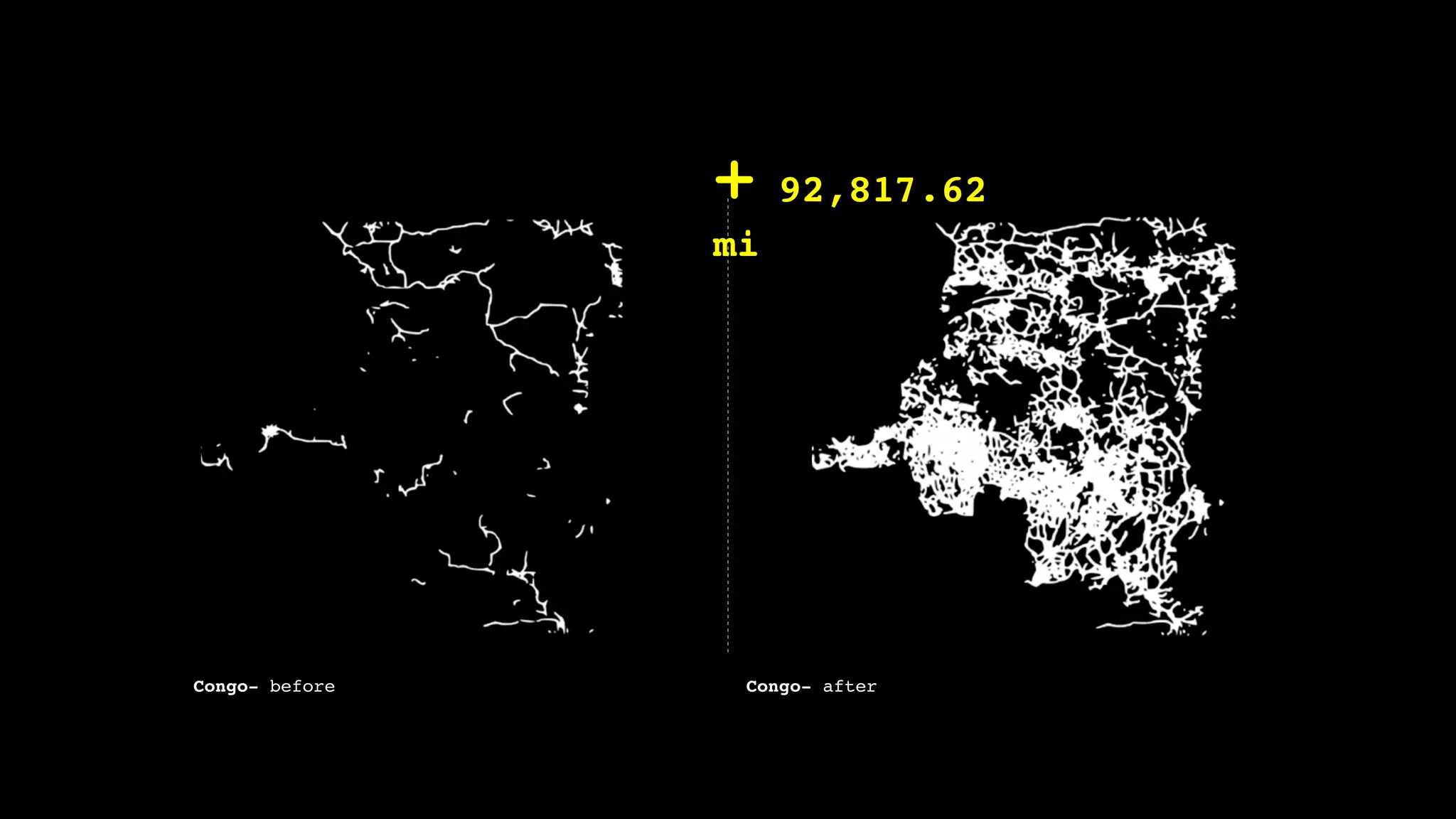
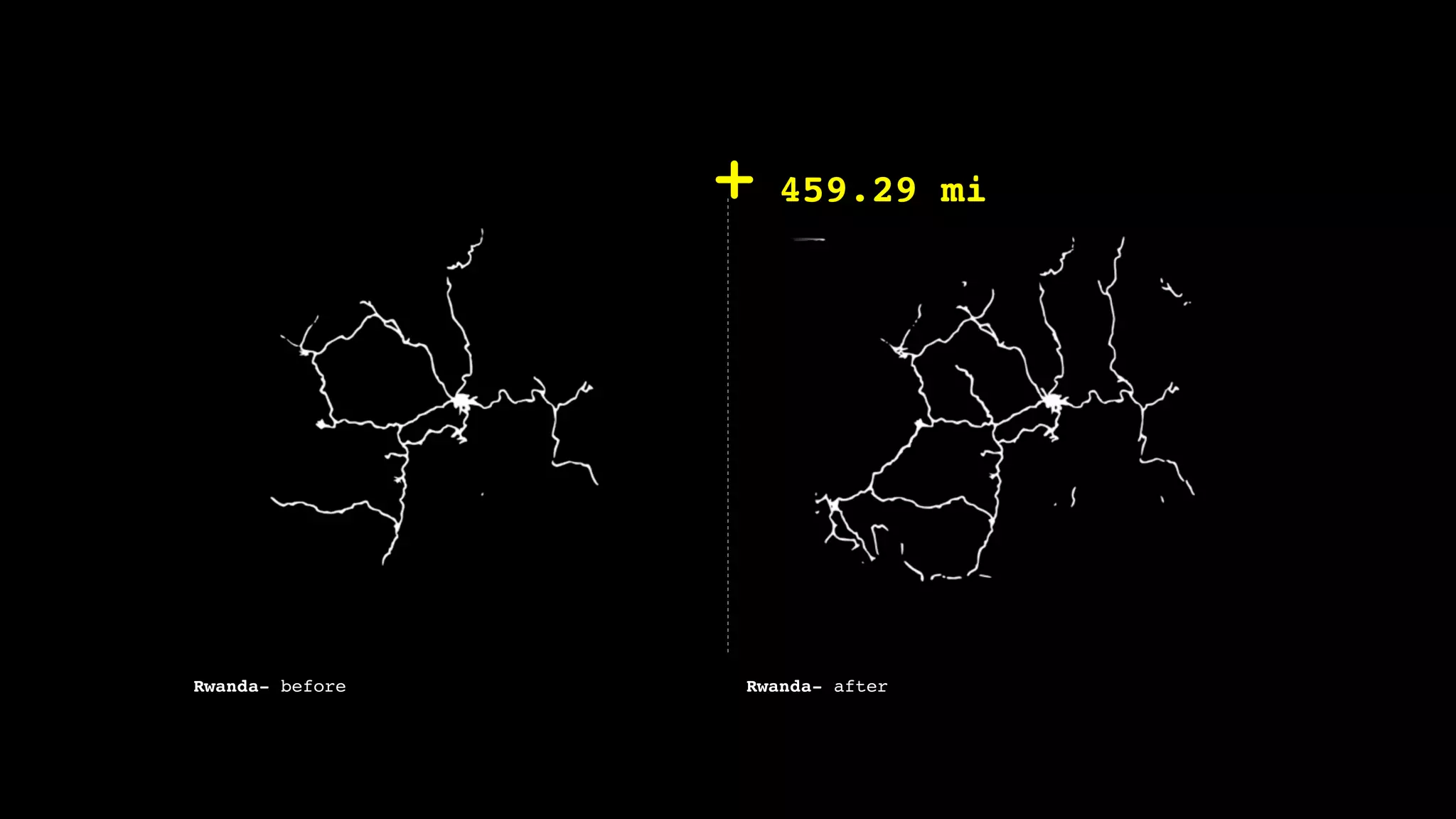
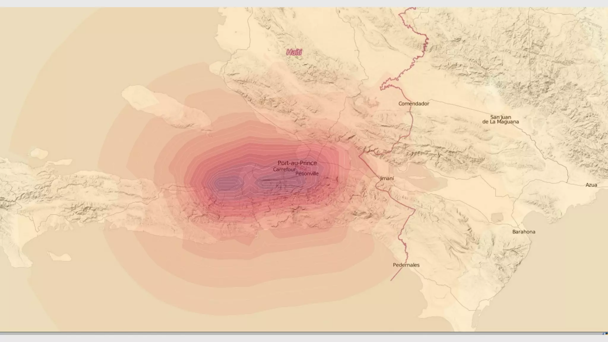
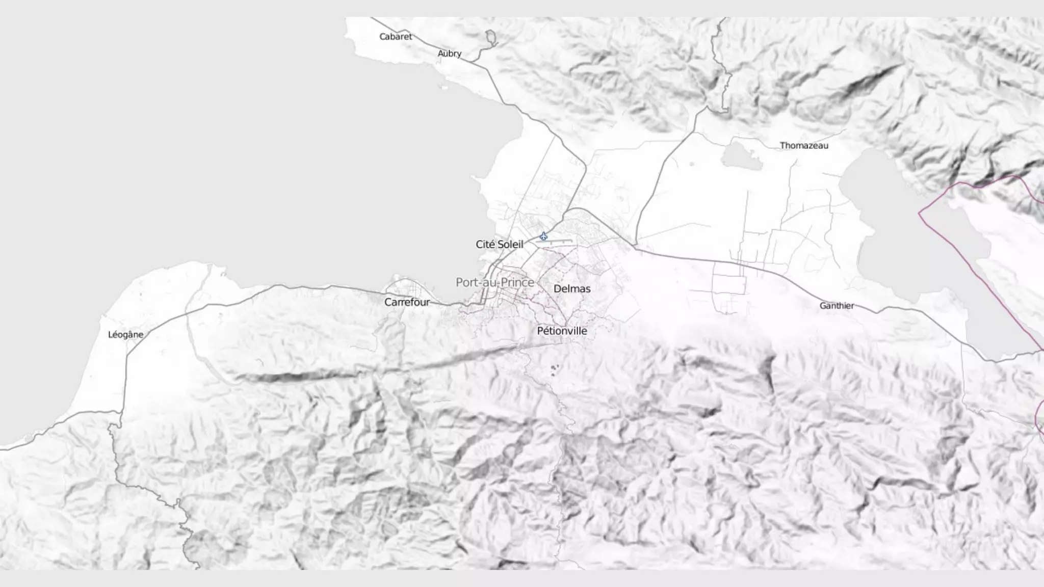
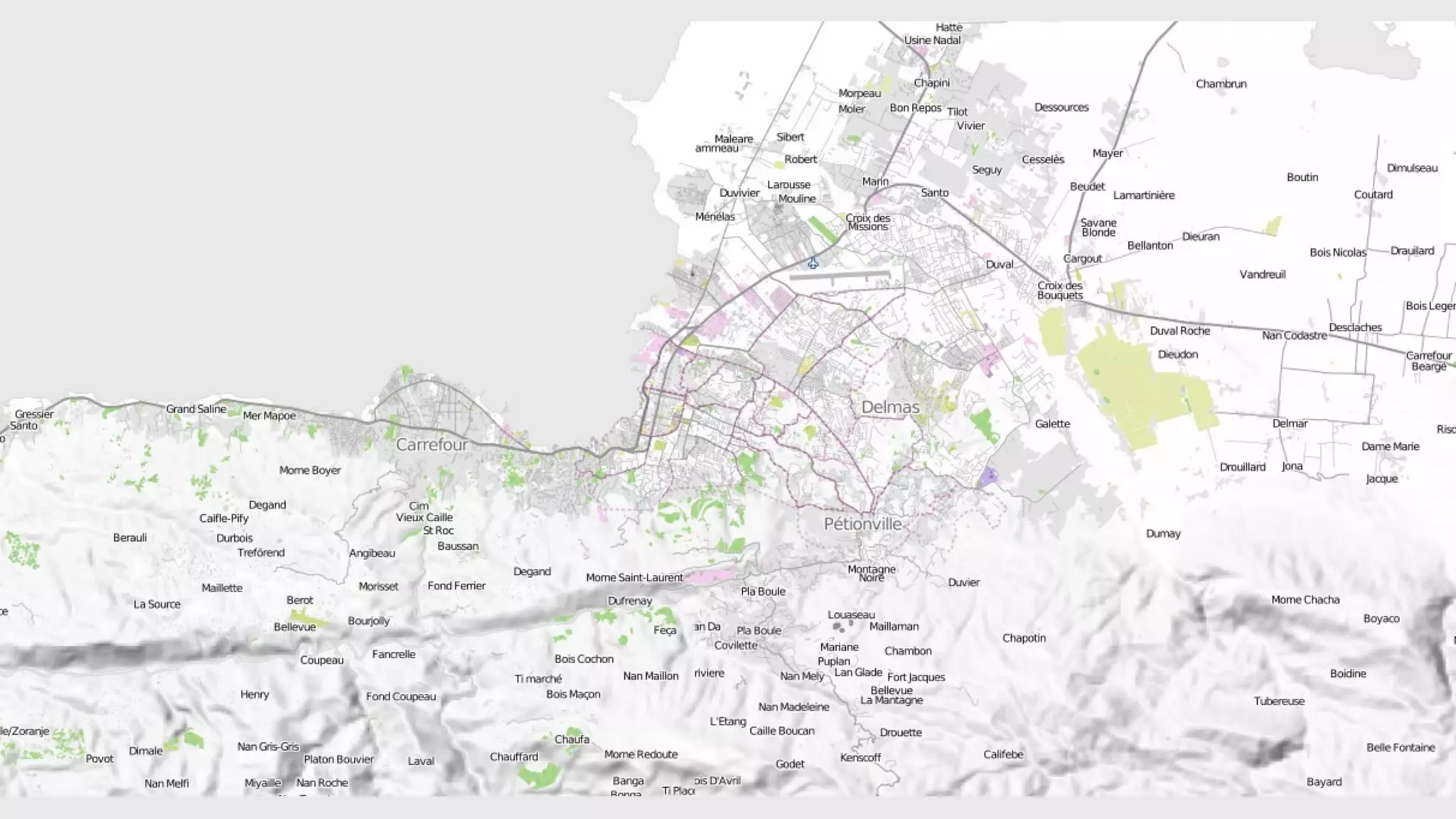
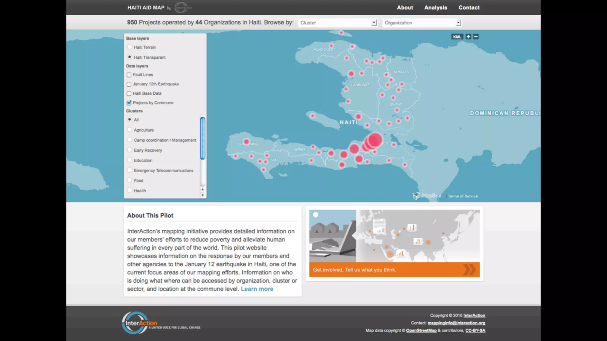
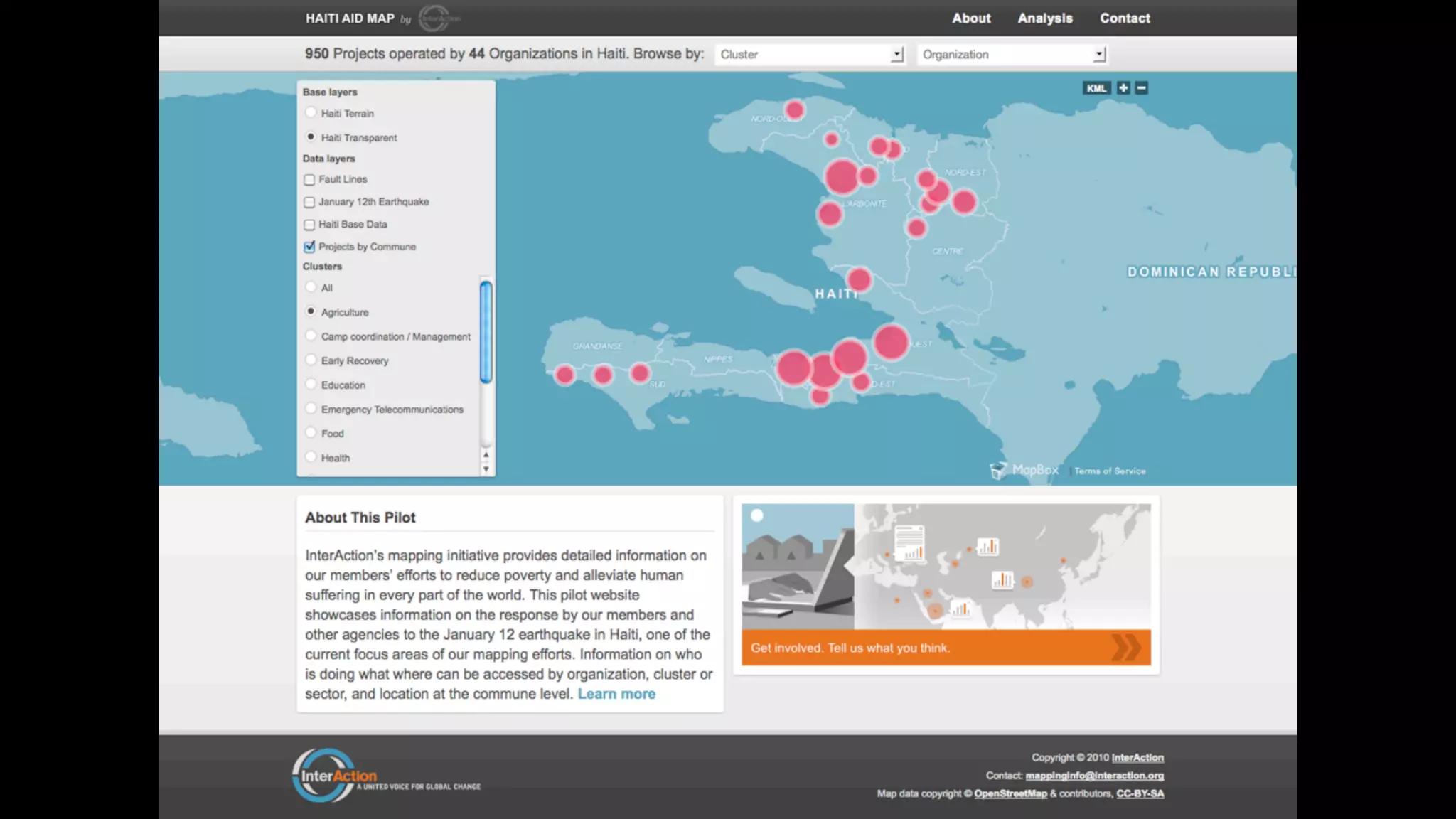
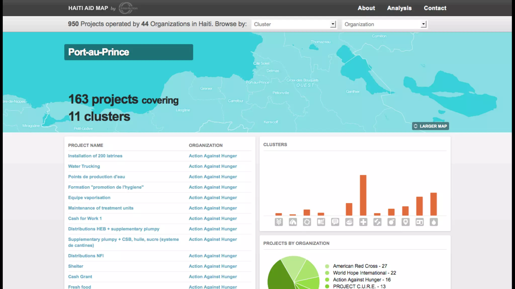
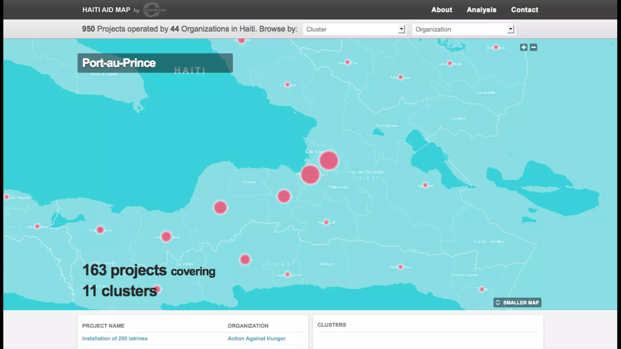
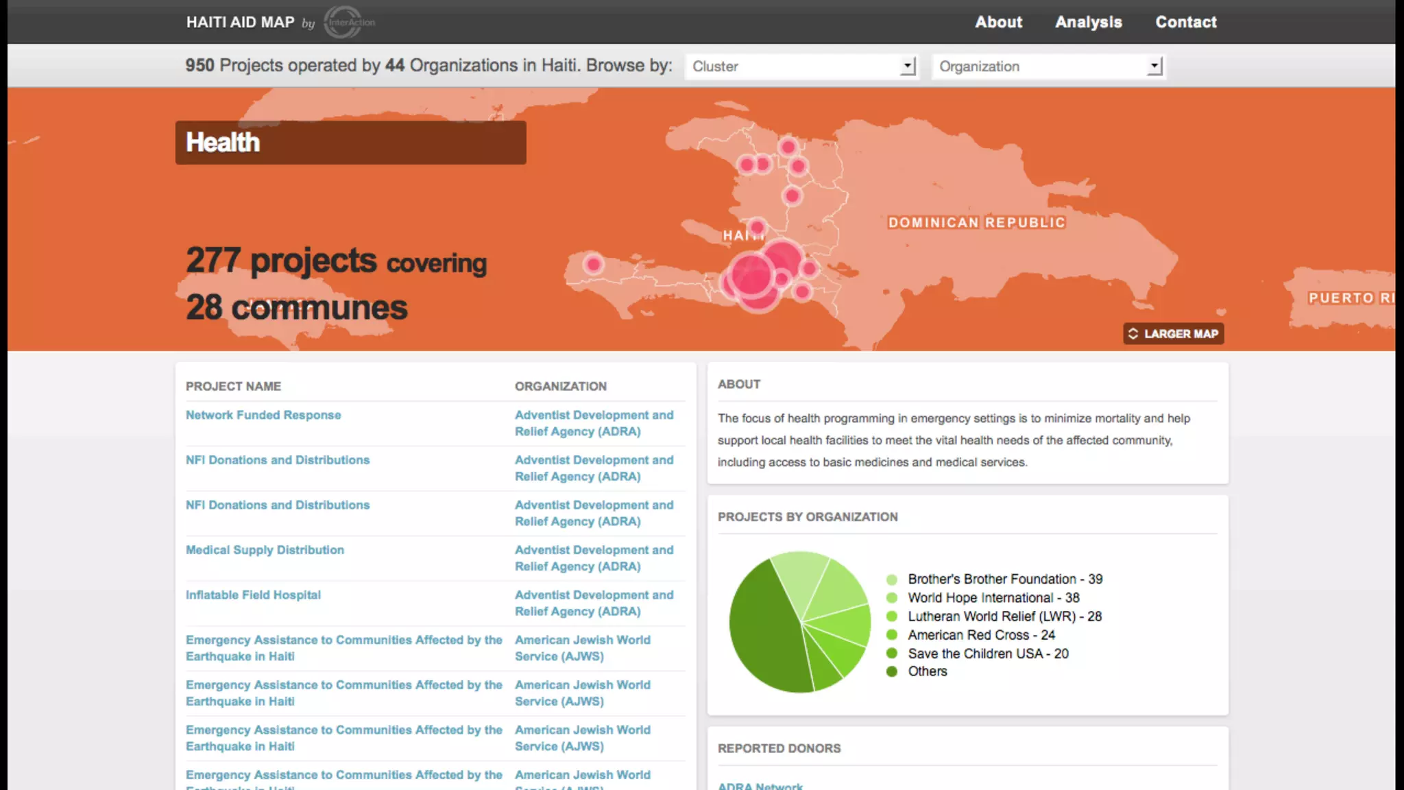
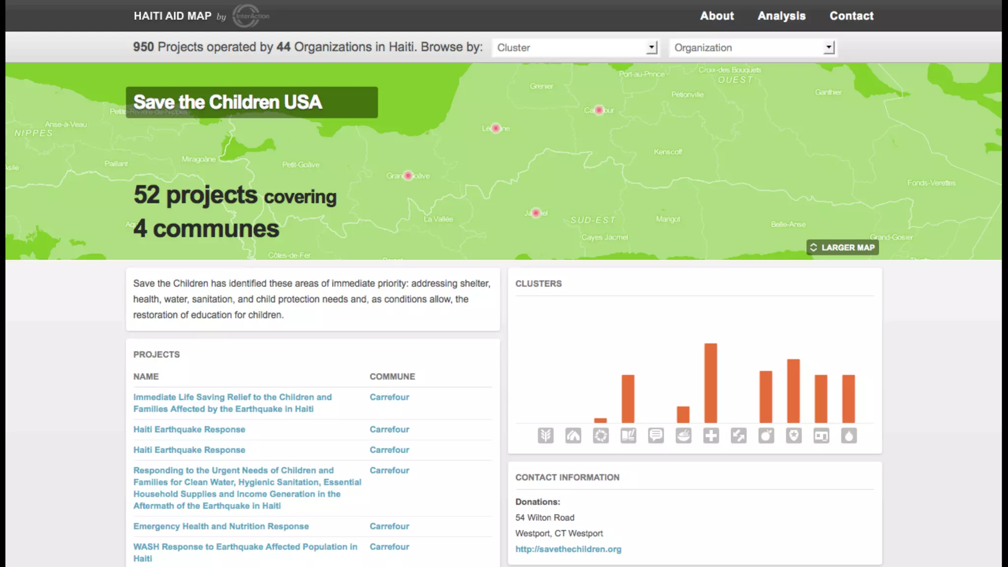
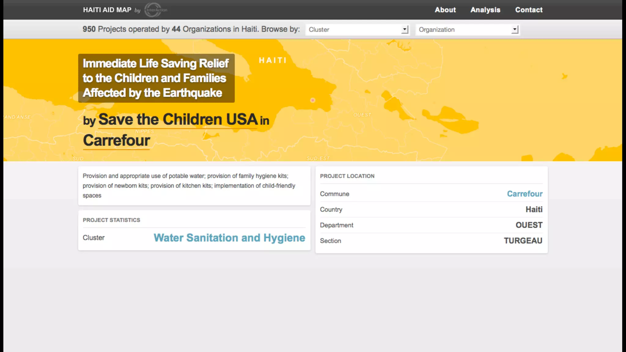
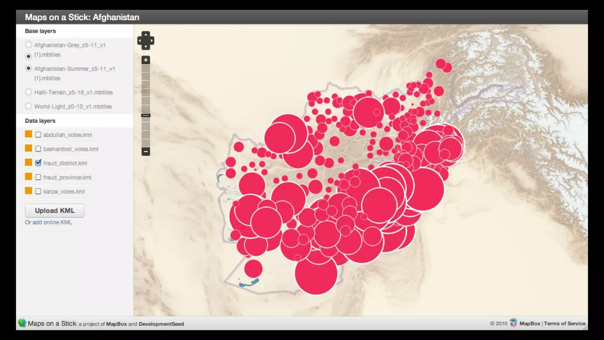
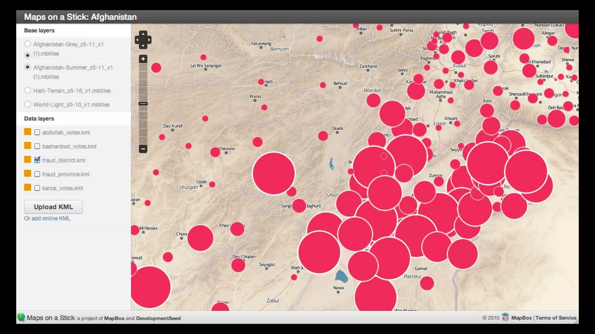
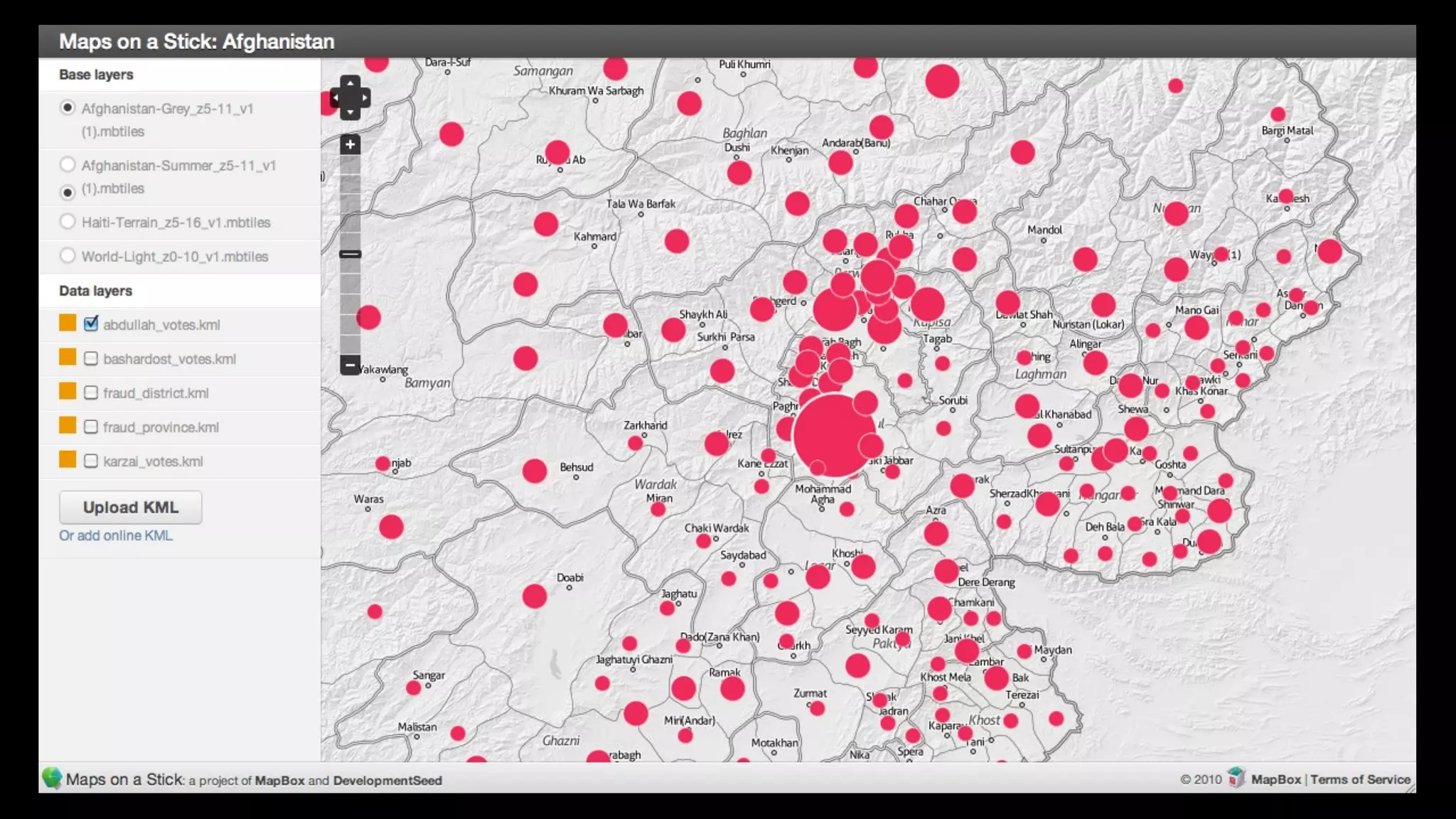
Tools + strategies for data collection + visualization
ISDT 2010
tools to help teams communicate
July 4, 1966
via wikipedia
early 1990s
2009
Open Gov. Data
Little data:
* crime data
* parking meeter location
* maps


+
Open Source:
* Drupal
* Mapnik
* Rails
data.octo.dc.gov
www.outsideindc.com
www.stumblesafely.com
Data Visualization Matters
What do you call this?
a positive externality
More effective government
On the ground in
Program in Africa    Program in Peru
                                         Afghanistan


                    USAID in DC
                     Business
                     Military
So who paid for these great tool?
Funding tools


                  Government funding
Private sector
                  builds better tools
tools


Government Data   Private Sector
Reinventing Government
November 19th, 2009
twitter.com/ericg
          via cnn
"Afghanistan is committed to end the culture of impunity and
violation of law and bring to justice those involved in spreading
corruption and abuse of public property"
                                              - President Hamid Karzai
                                                            3 hours ago
twitter.com/ericg
twitter.com/ericg
twitter.com/ericg
Data Sources:
•   Original Polling Center Master list of 6,969 polling centers from the Independent
    Election Commission (IEC).

•   IEC's election prelim results from September 16th, a 2,500 page PDF.

•   The Electoral Complaints Commission's (ECC) complaint data (which
    aggregates only to the provincial level).


                                                                               twitter.com/ericg
we needed a data browser
www.AfghanistanElectionData.org
The system geo codes votes down the the district level. The political boundaries for this map covered 400 districts.
Density point visualization shows results based on the Highlighted stations criteria, in this case % of stations effected.
Complex analysis: This Afghan ethnic distribution base layer is overlaid with districts won by Karzai (red dots) and
Abdullah (green dots). Dot size indicates the number of votes. Ethnic data is digitized from the Soviet Atlas Narodov Mira
Interacting with the data: you can quickly drill down to any region, as the map zooms.
•   Percent Population Urban by District Population by District
    (2003-2004) AIMS CSO Population Statistics.

•   Settled Population by Province (2006-2007) Afghanistan Human
    Development Report 2007, Center for Policy and Human
    Development, Kabul University

•   Estimated votes, via IEC’s Master Polling Center list
Population: 22,700
Estimated voters: 53,039
Difference: 30,339
Total votes: 15,023
Drill down in context: “Highlighted Station”
selection continues to work within both provinces +
districts
Per polling center data: see the affected stations
and votes within a polling center
security matters
                   photo credit boston.com
geography matters
                    via flickr: by www.pictobank.com
Road data: OSM provides better street data than AIMS
twitter.com/ericg
via wikimedia.org
Snow line: 1,800 meters according to FAO
Map Data Sources:
•   Elevation information is from the SRTM (Shuttle Radar Topography Mission)

•   Road information from OpenStreetMap

•   Provincial and district data are from AIMS (Afghanistan Information Management
    Services)
Opening Data with Open Street Maps
Mogadishu-   Kinshasa
The OSM Community is Huge and Growing
http://vimeo.com/2598878
Last spring, over 141,000 miles of new mapping data from
Africover (FAO) was contributed to OpenStreetMap.com


                                                    twitter.com/ericg
+    92,817.62
                mi


Congo- before    Congo- after
+    17,212.75
                   mi


Tanzania- before    Tanzania- after
+   459.29 mi


Rwanda- before   Rwanda- after
+   17,212 mi


Kenya- before   Kenya- after    twitter.com/
                                    ericg
+    11,609.51
                mi


Sudan- before    Sudan- after    twitter.com/
                                     ericg
+   1,796 mi


Burundi- before   Burundi- after   twitter.com/
                                       ericg
Total
+ 141,107.17 mi


             twitter.com/ericg
Making Beautiful Maps From Open Data
Flexible Data Workflow
Offline Mapping
The Future of Data Browsers
Isdt 2010

Isdt 2010