1) The document describes life for the Iqaluktuurmiut people at Iqaluktuuq in the Kitikmeot region of Nunavut. Iqaluktuuq was an important place for fishing Arctic char which provided a key food source.
2) Traditional activities like fishing for char in the spring and fall are described, as well as caribou hunting. Archaeological evidence and oral histories help paint a picture of life at Iqaluktuuq over thousands of years.
3) The area continues to be important culturally as the Kitikmeot Heritage Society works with elders to document and preserve knowledge of the history and archaeology of Iq
What WAS the fishing like in Doubtless Bay, New Zealand. A marine conservat...Mary Ralph
"What WAS the fishing like" in Doubtless Bay, New Zealand is the title of a year long research project. Data was obtained from historical records as well as oral interviews of old people who remembered what it was like in the past.
Fishing is an ancient practice dating back over 40,000 years involving catching fish from the wild using techniques like netting, angling, and trapping. According to FAO statistics, 38 million people are employed in fisheries and aquaculture, providing food and jobs for over 500 million people. Technological advances like improved boats, navigation devices, synthetic net materials, and fish processing equipment have increased fishing efficiency and catch sizes over time.
The document discusses the history of the uninhabited Inishkea islands off the coast of Mayo, Ireland. It describes how the islands were previously inhabited until 1934, with the islanders making their living from fishing and kelp harvesting. Life was difficult without electricity or easy access to supplies from the mainland. The document outlines aspects of the island communities like rivalries between the islands, the school and burial sites. It also discusses the whaling station that operated briefly in the early 1900s, employing some islanders until it closed down. Natural wildlife seen around the islands is also mentioned.
This document provides an overview of the Kodiak National Wildlife Refuge in Alaska. It discusses the refuge's establishment in 1941 by President Roosevelt to protect brown bears and other wildlife on Kodiak and Uganik Islands. It highlights some of the refuge's current research projects studying rare seabirds, brown bears, and mountain goats. It also promotes the refuge's visitor center and educational programs as a way for the public to learn about conservation.
The largest offshore island in Pakistan. This island is a part of Pasni sub-district in Gawadar, Balochistan. It is Pakistan's first marine protected area. Due to isolation there are many endemic species in Astola island. It is also known as 'Jazira Haft Talar' which means island of seven hills. The endangered green turtle can be found here.
The document summarizes various naval activities that took place in early April 2013, including the commissioning of the USS Arlington, a wreath laying ceremony for victims of the USS Thresher submarine disaster, and an aircraft carrier qualifying exercises. Engineering projects were conducted by Seabees in the Philippines and Djibouti, while medical outreach was provided by Navy and Air Force personnel in Cameroon.
The 2008 Lake Kamestastin expedition in Labrador had the goals of observing the caribou migration, establishing relationships with the Tshikapisk Foundation, and exploring the area. The expedition successfully met the caribou and gained valuable experience at the lake. Future plans include further scientific study and connecting Innu youth to their cultural heritage through canoe expeditions.
The Great Barrier Reef is one of the seven natural wonders of the world located off the coast of Queensland, Australia. It is the largest structure made by living organisms and is visible from space, stretching over 2,600 kilometers. The reef has a vast biodiversity of life and warm, clear waters that make it a popular destination for divers visiting from cities like Cairns and Townsville. Both its biological and geological diversity have led UNESCO to declare it a World Heritage Site in 1981 in order to protect this natural wonder.
This document outlines an 11-day cruise to Antarctica that includes:
- International airfare and transportation between Ushuaia, Argentina and various sites in Antarctica via a cruise ship.
- 9 nights aboard the cruise ship with meals included, and cabins ranging from quad to suites.
- Activities including Zodiac excursions led by expedition teams, lectures, and opportunities to see wildlife like penguins, whales and seals.
- Stops planned for the Antarctic Peninsula and South Shetland Islands depending on weather and ice conditions, with a goal of 2 excursions per day.
The Inuit people lived in Nunavut, the Northwest Territories, and northern Quebec. They built igloos in the winter out of blocks of ice, which they could construct in 30 minutes. In the summer, they lived in tents made of animal skins stretched over poles. The Inuit made their clothing like parkas and pants from caribou hides to protect them from the cold. They used tools like harpoons and goggles to hunt seals, whales, and fish for food. When hunting and gathering, the Inuit relied on caribou, arctic char, berries, and preserved foods like bannock and pemmican.
Captain James Cook was a British explorer, navigator and cartographer who made three voyages to the Pacific Ocean in the late 18th century. He rose through the ranks of the British Royal Navy, gaining experience charting Newfoundland and serving in North America during the Seven Years' War. Cook commanded HMS Endeavour on his first voyage where he discovered Australia and Hawaii. His second and third voyages further explored and mapped the Pacific, though he was killed in Hawaii during his third voyage. Cook made major contributions to cartography and helped pioneer methods to prevent scurvy on long sea voyages.
The 2010 Norfolk Island Whale Survey found that the humpback whale population migrating past Norfolk Island had not recovered to pre-whaling levels, despite whaling ending in the region in 1962. Over multiple years of research, the Survey has documented several whale species in the area but observed recovery rates for humpback whales passing Norfolk Island have been much lower than along the east coast of Australia. The Survey will continue monitoring whale migration in the region to understand why recovery has been slower than in other areas.
The document summarizes various Navy activities that took place on December 7, 2012. It describes Pearl Harbor survivors attending a commemoration ceremony in Hawaii. It also mentions funeral honors being provided to a Pearl Harbor survivor in Washington, and the interment of another Pearl Harbor veteran at the USS Arizona Memorial. Additionally, it outlines Navy operations around the world, including counterdrug operations in the Pacific, underwater searches in Papua New Guinea, and support for African maritime security in Senegal.
The Inuit lived in Nunavut, Northwest Territories, and northern Quebec. In winter, they lived in igloos made of stacked ice blocks in a dome shape. In summer, they lived in tents made of poles or whale bones covered with animal skins. Their clothing, like parkas, pants, mittens, and boots, was made from caribou and sealskin to protect them from the freezing conditions. The Inuit's main foods were caribou, Arctic char fish, nuts, berries, bannock bread, and pemmican made from meat, fat, and berries. They used tools like harpoons, sleds, kayaks, and boats to hunt seals, whales, and
The document summarizes aspects of traditional Inuit culture, including their clothing made from caribou hides and sealskin, their igloo homes in winter and tents in summer, their diet centered around caribou and fish, and their tools like harpoons for hunting seals and whales. The Inuit lived in Nunavut, Northwest Territories, and Northern Quebec and adapted well to the harsh Arctic climate.
The document summarizes aspects of traditional Inuit life, including that they lived in Nunavut, Northwest Territories, and northern Quebec; made parkas and pants from caribou hides for protection from ice, snow, and wind; used tools like harpoons and goggles for hunting seals and whales; hunted caribou and fish as well as gathering nuts and berries since vegetables did not grow in the Arctic; built igloos in winter by stacking ice blocks and tents in summer made of poles and skins; and prepared foods like bannock, dried meat and berries.
The Inuit lived in the Arctic regions of Canada. In winter, they lived in igloos made of stacked ice blocks in the shape of a dome. In summer, they lived in tents made of poles and animal skins. The Inuit made their clothing from caribou hides to protect them from the cold weather. Their main food sources were caribou, fish, and berries since vegetables do not grow in the Arctic. They used tools like harpoons, sleds, and boats for hunting, fishing, and transportation.
The document summarizes aspects of traditional Inuit life, including their homes, clothing, food sources, and tools. It describes how the Inuit built igloos in winter and tents in summer out of local materials. It details the caribou skin and seal skin clothing and footwear worn by Inuits to survive the harsh Arctic climate. The document lists some of the Inuit's main food sources as caribou, fish, berries and nuts, bannock bread, and pemmican. It provides examples of tools used by Inuits for hunting, fishing, travel and transport, such as harpoons, sleds, kayaks and umiaks.
About the Pacific Grove Museum of Natural History's Youth Summer CampsNader Agha
The document discusses the Pacific Grove Museum of Natural History's youth summer camps. The museum, founded in 1883, features exhibits on sea life, birds, butterflies, geology and more. It also runs educational programs including various summer camps for pre-K through 5th grade students focused on topics like water, weather, dinosaurs, oceans, insects and wildlife. The camps last five days in June or July and run from 8:45am to 1 or 3pm. More details can be found at their website.
The Battle of Okinawa took place from April to June 1945 as Allied forces sought to take the island of Okinawa to use as a base for the planned invasion of Japan. Over 60,000 Allied soldiers landed on Okinawa's beaches on April 1st meeting little resistance at first. However, the Japanese mounted increasingly fierce defenses over the following months. The battle resulted in over 12,000 American deaths, 36,000 wounded, and over 100,000 civilian casualties as the Japanese military encouraged mass suicides rather than surrender. It was one of the bloodiest battles of the Pacific War, but securing Okinawa allowed the Allies to begin preparations for the planned invasion of Japan.
The Inuit people lived in the Arctic regions of Canada, subsisting on a diet of caribou, Arctic char, berries, and pemmican. They built igloos from blocks of ice in the winter and tents made from whale bones in the summer. For clothing, the Inuit wore caribou skin parkas with pouches for babies, pants, mittens made from sealskin, and boots called kamiks made from caribou or sealskin. Hunting tools included harpoons, goggles with slits, sleds pulled by dogs, and kayaks and umiaks for transportation.
The Inuit lived in Nunavut, the Northwest Territories, and northern Quebec. In the winter, they lived in igloos made of stacked ice blocks, and in the summer they lived in tents made of poles and animal skins. Their clothing, like parkas and pants, were made from caribou hides to protect them from the freezing conditions. Their main foods were caribou, Arctic char fish, nuts, and berries. As they had no vegetables in the Arctic. They used tools like harpoons, sleds, and boats for hunting, fishing, and transportation.
The Battle of Okinawa in 1945 was a major battle in the Pacific Theater of World War II. [1] It was important for the Allies to take the island of Okinawa to cut off Japanese supply lines and have a place to refuel and repair ships before invading Japan. [2] The battle resulted in heavy casualties on both sides, especially among Japanese troops and Okinawan civilians, with estimates of over 75,000 civilian deaths. [3] Ultimately, the Allied victory at Okinawa paved the way for the planned invasion of Japan's mainland, though the bombings of Hiroshima and Nagasaki ended the war before an invasion was necessary.
The Inuit lived in Nunavut, Quebec, and the Northwest Territories of Canada. In the winter, they lived in igloos made of stacked ice blocks, and in the summer they lived in tents made of animal skins stretched over wooden poles. Their clothing, like parkas and pants, were made of caribou hides to protect them from the freezing temperatures. Their main foods included caribou, arctic char fish, berries, and bannock bread or pemmican made from meat and berries. To hunt and travel, the Inuit used tools like harpoons, sleds pulled by dogs, and kayaks.
The Battle of Okinawa was the largest amphibious assault in the Pacific War between the Allies and Japan from April 1st to June 22nd 1945. Over 300,000 troops fought in the 82-day long battle on the Ryukyu Islands of Okinawa, resulting in over 150,000 casualties between Allied and Japanese forces as well as around 100,000 civilian deaths. The Japanese forces utilized overwhelming kamikaze attacks involving over 1,500 airplanes. Although the Allies were gaining victory, the Japanese refusal to surrender ultimately led to the use of atomic bombs on Hiroshima and Nagasaki to end the war.
Matthew Flinders was a British navigator and cartographer who explored and mapped much of the Australian coastline. He made three voyages to Australia between 1791-1810, commanding HMS Investigator from 1801-1803 where he circumnavigated and charted the coast. Flinders was the first to circumnavigate Australia and recognized it as a continent, separate from New Guinea and New Zealand. He proposed the name "Australia" for the territory. Flinders was imprisoned on Mauritius for almost 8 years due to the Napoleonic Wars before returning to England, where he worked to publish his voyages and charts before his early death at age 40.
The document summarizes the history of Okinawa Island and the Battle of Okinawa that took place from April to June 1945. Okinawa was originally a prosperous trading island but was later invaded by Japanese samurai in 1609. In 1945, the United States led an invasion of Okinawa with support from other Allied countries against Japan. The battle resulted in over 79,000 Japanese deaths as well as over 14,000 civilian deaths and heavy casualties on both sides. The battle marked one of the bloodiest of World War 2 and the largest amphibious assault in the Pacific Theater of Operations.
This document summarizes information about the Madivala Vegetable Market in Bangalore. [1] It is the largest market for leafy vegetables in Bangalore, with around 700-750 shops. [2] Leafy vegetables make up 58% of the goods procured at the market each year. [3] While the market provides lower prices than supermarkets, it faces challenges like price fluctuations, high commission fees for agents, increasing rents, and declining customer base as more people shop at vegetable supermarkets.
Ryan Ward is producing a magazine that will feature photos taken between December 2nd and 7th at a recording studio and other locations. From December 7th to 16th, he will create and edit the magazine. On the 16th, the magazine will be finished and proofread. He will use various models like Lewis Fennell, Will Tollerfield, Emily-jane Mason, and Liam Saxton and take photos of them holding instruments, playing instruments, using studio equipment, and going about their everyday lives as musicians.
This short document promotes creating presentations using Haiku Deck, a tool for making slideshows. It encourages the reader to get started making their own Haiku Deck presentation and sharing it on SlideShare. In just one sentence, it pitches the idea of using Haiku Deck to easily create engaging slideshows.
This document summarizes the characterization and optimization of a thermal lensing compensated Ti:Sapphire femtosecond laser system operating at 1-kHz repetition rate using frequency resolved optical gating (FROG). The laser system is optimized to produce 4.0 mJ pulses at 30 fs duration. Thermal lensing in the amplifier crystals is compensated using convex mirrors and Peltier cooling. Single-shot SHG-FROG is used to characterize the pulses in both the frequency and time domains. Optimization of the grating compressor is performed to minimize pulse duration, achieving 30 fs pulses at zero grating detuning.
The present continuous tense is formed using the auxiliary verb "to be" and the gerund (infinitive + "-ing") of the main verb. It is constructed by placing the subject before the appropriate form of "to be" (am, is, are) followed by the gerund form of the main verb. This tense is used to describe actions that are happening or ongoing at the present time.
The limbic system is a group of brain structures located on the medial side of the brain involved in emotion, motivation and memory. It contains cortical structures like the orbitofrontal cortex, cingulate cortex and parahippocampal gyrus as well as subcortical structures like the hippocampus, amygdala, accumbens nucleus and septal nuclei. The hippocampus plays a key role in memory formation and retrieval, while the amygdala is important for emotional processing and memory consolidation involves the basal and septal nuclei.
This document provides treatment recommendations for Hodgkin's lymphoma based on stage. For early stage disease, recommended treatment is chemotherapy (ABVD) followed by involved field radiation therapy (IFRT). For advanced stages III and IV, the recommended treatment is ABVD chemotherapy followed by IFRT to bulky or residual sites. Relapse is treated with chemotherapy followed by IFRT to previously untreated sites. The document also discusses definitions of radiation therapy fields and doses for different involved sites.
The description of the recruitment process is not just about the flowchart of the recruitment process. It is about the roles and responsibilities in the recruitment process as the managers fully understand the details of the process when they apply to fill the job vacancy.
This document discusses the stage-wise treatment of urinary bladder cancer. It begins by outlining the aims of managing superficial, muscle-invasive, and metastatic bladder cancers. For superficial cancers, it describes risk stratification, treatment options including transurethral resection and intravesical therapies like BCG, and their toxicities. For muscle-invasive cancers, it discusses modalities like radical cystectomy, lymphadenectomy, and bladder preservation approaches including radiotherapy and chemoradiotherapy. It provides details on radiotherapy techniques, dose fractionation schedules, and ideal candidates for definitive radiotherapy versus cystectomy.
This document describes several common nail abnormalities and their potential causes. Clubbing is the loss of the nail bed angle and may be seen in lung cancer, chronic lung disease, and other conditions. Beau's lines are transverse non-pigmented grooves associated with arrested nail growth following fever or illness. Koilonychia causes spoon-shaped nails often due to iron deficiency. Half and half nails have a distal red/brown band and proximal white/pink area, linked to chronic kidney or liver disease. Psoriasis can cause pitting with multiple indentations and onycholysis or nail separation from the nail bed.
This document provides guidance on performing venepuncture for first year medical students. It details the necessary steps including checking the request form and order of draw, gathering equipment, choosing a vein, performing the puncture safely, and obtaining and handling samples. Complications are outlined as well as alternative venepuncture systems beyond the standard Sarstedt system. The overall process is broken down into clear individual steps to help students properly conduct their first venepunctures.
This document discusses the presentation, imaging findings, and treatment of renal cell carcinoma. Key points include:
- Renal cell carcinoma originates from the proximal convoluted tubules and presents as a loin mass, hematuria, or incidental finding. Metastasis commonly occurs in the bone, brain, lung and liver.
- On CT, renal cell carcinoma appears as an isodense or hypodense soft tissue mass that enhances with contrast. It can contain areas of necrosis and calcifications. MRI shows high signal on T1 and T2 weighted imaging.
- Treatment involves nephrectomy. For localized disease, nephron-sparing surgery may be performed. Advanced disease with tumor
Non-receptor tyrosine kinases (nRTKs) are cytoplasmic enzymes that catalyze the transfer of phosphate groups from ATP to tyrosine residues in proteins. Unlike receptor tyrosine kinases, nRTKs lack extracellular and transmembrane domains. nRTKs contain two domains - a catalytic domain consisting of two lobes that facilitate ATP transfer, and a protein-protein interaction domain containing SH2 and SH3 subdomains. There are several families of nRTKs including Src, Abl, Syk, Jak, and Zap70 that perform critical functions in immune cell signaling through T cell and B cell receptors. Inhibitors of overactive nRTKs show promise for cancer treatment by blocking intracellular tumor processes.
Support Vector Machines can be used for regression by finding the tube that best fits the data while minimizing complexity. This is done by minimizing errors outside an epsilon-insensitive tube while allowing errors within epsilon. Non-linear regression is handled by mapping data into a higher dimensional feature space and using kernels to calculate inner products without explicitly performing the mapping. Kernels allow support vector regression to find a linear function in this feature space, resulting in a non-linear function in the original space.
The discovery of wooden artifacts on a beach in Quinhagak, Alaska that were in good condition despite being very old led to an archaeological partnership between a local company and the University of Aberdeen in Scotland. Excavations since 2009 at the site called Nunalleq have uncovered over 8,000 artifacts dating from 1350 to 1670, prior to European contact, that have provided unprecedented insights into pre-contact Yup'ik life due to the artifacts' excellent preservation in permafrost. The dig is attempting to learn how the local population was affected by a period of lower temperatures known as the Little Ice Age by examining objects from before and after the climate change. However, the site is rapidly eroding from the
1
http://ngm.nationalgeographic.com/2008/03/people-pacific/smith-text
Smith, Roff
2008 Beyond the Blue Horizon: How Ancient Voyagers Settled the Far Flung Islands
of the Pacific. National Geographic March 2008.
Beyond the Blue Horizon: How Ancient Voyagers Settled
the Far Flung Island of the Pacific
By: Roff Smith
Much of the thrill of venturing to the far side of the world rests on the romance of difference. So
one feels a certain sympathy for Captain James Cook on the day in 1778 that he "discovered" Hawaii.
Then on his third expedition to the Pacific, the British navigator had explored scores of islands across the
breadth of the sea, from lush New Zealand to the lonely wastes of Easter Island. This latest voyage had
taken him thousands of miles north from the Society Islands to an archipelago so remote that even the
old Polynesians back on Tahiti knew nothing about it. Imagine Cook's surprise, then, when the natives of
Hawaii came paddling out in their canoes and greeted him in a familiar tongue, one he had heard on
virtually every mote of inhabited land he had visited. Marveling at the ubiquity of this Pacific language
and culture, he later wondered in his journal: "How shall we account for this Nation spreading it self so
far over this Vast ocean?"
That question, and others that flow from it, has tantalized inquiring minds for centuries: Who
were these amazing seafarers? Where did they come from, starting more than 3,000 years ago? And
how could a Neolithic people with simple canoes and no navigation gear manage to find, let alone
colonize, hundreds of far-flung island specks scattered across an ocean that spans nearly a third of the
globe?
Answers have been slow in coming. But now a startling archaeological find on the island of
Éfaté, in the Pacific nation of Vanuatu, has revealed an ancient seafaring people, the distant ancestors of
today's Polynesians, taking their first steps into the unknown. The discoveries there have also opened a
window into the shadowy world of those early voyagers.
At the same time, other pieces of this human puzzle are turning up in unlikely places. Climate data
gleaned from slow-growing corals around the Pacific and from sediments in alpine lakes in South
America may help explain how, more than a thousand years later, a second wave of seafarers beat their
way across the entire Pacific.
On a lonely sun-drenched knoll on Éfaté, about half an hour's drive east of Port-Vila, the old
colonial capital of Vanuatu, Matthew Spriggs is sitting on an upturned bucket, gently brushing away
crumbs of dirt from a richly decorated piece of pottery unearthed only a few minutes earlier. "I've never
seen anything like this," he says, admiring the intricate design. "Nobody has. This is unique."
That description fits much of what is coming out of the ground here. "What we have is a first- or second-
generation site containing the graves of some of the Pacific's first ...
The document provides an overview of Antarctica, including its geological history and formation over time. Key events summarized are the hypothetical concept of "Terra Australis" on early world maps, explorers first sighting and landing in Antarctica in the early 19th century, and Roald Amundsen becoming the first person to reach the South Pole in 1911. The document also briefly outlines some Antarctic wildlife, such as penguins, seals and fish that have adapted to the freezing temperatures.
People go on voyages for reasons like lack of food and land, earning more money, or seeking a better life elsewhere. Captain Cook made early European contact with New Zealand in 1769, discovering the east coast and naming locations. Sea creatures also make voyages, sometimes to avoid areas being used or polluted by humans or to migrate between warm and cold waters. Grey whales migrate over 20,000 km between feeding grounds in the Arctic and breeding grounds in Mexico.
The excavation site in Quinhagak, Alaska has uncovered over 8,000 centuries-old wooden artifacts from the Yup'ik Eskimo culture, due to the area's permafrost preserving the items. After Warren Jones sent photos of mysterious wooden artifacts washing ashore to Professor Rick Knecht, their discussion led to cooperation between Jones' company and Knecht's university to conduct test digs. The digs have expanded over the years, uncovering tools, clothing, weapons and more in excellent condition. The site is being rapidly eroded by the shifting Arolik River, so the excavations are urgently working to uncover the items before they are lost to the landscape changes.
The Sea Shepherd Conservation Society (SSCS) is an international non-profit organization that uses direct action tactics to investigate, document, and intervene in illegal activities that threaten marine wildlife and habitats. SSCS was founded in 1977 by Paul Watson after disagreements with Greenpeace, and its primary mission is to end whaling through direct confrontation with whaling vessels. Notable SSCS campaigns include ramming whaling ships, disabling vessels, and disrupting whaling operations to prevent the killing of thousands of whales. Through television shows and online presence, SSCS aims to educate the public about threats to ocean wildlife and gain support for its controversial anti-poaching methods.
It’s in Our Treaty the Right to Whale1 By Jovana .docxAASTHA76
It’s in Our Treaty: the Right to Whale1
By
Jovana J. Brown,2 The Evergreen State College
Abstract: The Makah people have lived on the northwest part of the Olympic Peninsula
for thousands of years and utilized the bounty of the seas. Their historical tradition of
whaling can be traced back at least 1,500 years. When they signed the Treaty of Neah
Bay in 1855 the Makah reserved the right to hunt whales. The Makah Nation resumed
this whaling tradition in 1999 by harvesting a gray whale. Since this successful hunt the
Tribe has had to continue to confront and overcome many involved legal and political
obstacles to continue hunting whales. This case details the Makah’s continuing efforts to
resume whaling.
A Tradition of Whaling
The northwest Olympic Peninsula, in what is now Washington State, has been the home
of the Makah people for well over 2,000 years. With a homeland adjoining the Straits of
San Juan De Fuca which connects the Puget Sound with the Pacific Ocean, they have
always lived from the wealth of the sea. The marine riches of the area provided for the
Makahs’ spiritual and physical needs (Collins, p. 180). Whaling was central to the Tribe’s
way of life. The Makah people hunted gray, humpback, finback and right whales
(Renker, 2007, p. 11). Whaling was not only an essential subsistence and commercial
activity for the Makah, but it also “formed one of the most important organizing aspects
of Makah culture” (Firestone and Lilley, p. 10766).
Both archeological and written evidence of the Makah’s history of whaling exists in
abundance. When the historical Makah village of Ozette was excavated in the early
1970’s evidence of their tradition as a whaling people was uncovered. Archeological
evidence shows that the Makah practiced whale hunting for subsistence purposes for at
least 1,500 years. Renker states: “Documented use of whale products for subsistence
purposes extends another 750 years before this date, since Makahs used drift and stranded
whales long before hunting technology developed”(Renker, 2007, p. 4).3 Europeans
coming to the Pacific Northwest coast in the early 1800’s left written commentaries about
Makah whale hunting (Renker, 2007, p.13). James Swan served as a school teacher on
the Makah Reservation in the early 1860’s. In his Indians of Cape Flattery he states:
“The principle subsistence of the Makahs is drawn from the ocean, and is formed of
nearly all its products, the most important of which are the whale and halibut” (p. 19).
T.T. Waterman also describes Makah whaling in detail in his 1920 The Whaling
1 Copyright held by The Evergreen State College. Please use appropriate attribution when using and
quoting this case. Cases are available at the Native Cases website at www.evergreen.edu/tribal/cases.
Thanks to Dr. Ann Renker for her careful review and comments, and to Debbie Ross-Pre.
1. Ingólfr Arnarson, recognized as the first permanent Norse settler of Iceland, arrived in 874 and built his homestead in Reykjavik.
2. Whaling has a long history in Iceland, with the Basques being the first to engage in organized whaling in Icelandic waters in the 12th century. Norwegians established shore whaling stations in Iceland in the late 1800s.
3. Commercial whaling grew in the early 20th century but whale populations declined sharply, leading Iceland to enact the first whaling ban in 1915. Whaling continued under regulations until the international ban of 1986.
The Status of Archeology in the PhilippinesMary Reyes
The Archaeology Division conducts research on human prehistory through artifacts, ecofacts, and structures found in the Philippines and Southeast Asia. It focuses on two main areas: terrestrial archaeology of land sites, and underwater archaeology of shipwrecks. The division oversees collections, records, and exhibitions including two permanent displays at the National Museum showcasing Philippine prehistory and archaeological treasures.
This document summarizes an undergraduate thesis about a Yup'ik caribou teeth belt. The thesis traces the object's biography through archival research and interviews. It also analyzes the teeth to study long-term caribou herd health. The student conducted a literature review on traditional Yup'ik culture and lifestyle in Alaska, including gender roles, subsistence strategies, and relationships with animals. Missionary activity in the late 19th century introduced trade goods and diseases and shifted economies, but Yup'ik continued many cultural practices. Analysis of the belt's teeth provides insights into both past Yup'ik life and long-term ecological conditions.
In 1997, two scientists discovered an archeologically significant cave during an environmental assessment near Mossel Bay, South Africa. Extensive excavations of the Pinnacle Point caves since 2000 have uncovered evidence of human occupation dating back over 160,000 years, challenging previous beliefs that modern human behavior emerged much more recently in Europe. The caves contain thick layers of shells, bones, stone tools, and charcoal remains that have provided insights into how early humans lived in the area and harvested resources sustainably from the shoreline.
The document provides information about Kakadu National Park in Australia. It is a UNESCO World Heritage listed site that has been home to Aboriginal people for over 50,000 years, making it the oldest living culture. The park protects extraordinary biodiversity with diverse landscapes and habitats for many endemic plants and animals. Conservation efforts focus on preventing wildfires, managing crocodiles, and protecting natural habitats and Aboriginal culture.
TREATY OF WAITANGI - 1840 SETTING THE SCENE: WHALERS, SEALERS, LOGGERSGeorge Dumitrache
The document summarizes New Zealand's early commercial industries of whaling, sealing, and logging in the late 18th and early 19th centuries. Whalers and sealers established temporary camps in New Zealand waters and some married local Māori women. The industries declined by the early 1800s as whale and seal populations decreased and fashion changed. Logging of kauri and other native trees then grew as an important export industry through the 1800s, with "bushmen" living in forest camps to cut timber. Settlement increased further after the 1840 Treaty of Waitangi as more Europeans arrived and cleared forest for farms and towns.
The Inuit lived in Alaska, Canada, Greenland, and the northern United States. They used resources from the Arctic environment to survive harsh winters and short summers. In winter, they fished through holes cut in sea ice and hunted ocean animals. In summer, they hunted migrating caribou for meat and skins for clothing and shelter. They built shelters from animal skins and snow blocks, and used kayaks, dog sleds, walrus tusks, seal skins, and other materials to obtain food, travel, and keep warm in the Arctic.
The document provides background information on the Inuit people. It discusses that the Inuit are indigenous peoples inhabiting Arctic regions of Alaska, Canada, and Greenland. They are descended from the Thule culture and displaced the related Dorset culture. The Inuit speak Inuktitut and rely on hunting marine mammals like seals and walrus for food and materials. They use dogsleds, kayaks, and umiaks for transportation and make clothing from animal skins for protection from the harsh Arctic climate. Marriage customs among Inuit were not strictly monogamous and divorce was sometimes arranged by community elders.
Port Lockroy is a natural harbor on the Antarctic Peninsula that was originally used for whaling and as a British military base during World War 2. It now operates as a museum and receives many tourists each year. The buildings have been restored and a gift shop provides income to maintain the site. It is protected as a historic site under the Antarctic Treaty and gives visitors a view of what life was like for researchers in Antarctica during the 1940s and 50s.
The Outback is a remote, sparsely populated region of Australia that extends across northern, central, and southern areas of the country. It has a low population density and largely intact natural environment characterized by climatic zones ranging from tropical to temperate. Aboriginal peoples have lived in the Outback for over 50,000 years. The main industries in the Outback are pastoralism, mining, and tourism, with cattle grazing being the largest land use. The Outback has significant mineral resources and is a popular tourist destination known for its natural beauty and Indigenous culture.
The document provides information about the geography, demographics, languages, and industries of Western Visayas, which consists of 6 provinces: Aklan, Antique, Capiz, Guimaras, Iloilo, and Negros Occidental. It notes that the region has a tropical climate with two pronounced seasons. It also lists the major languages spoken in each province and the primary economic activities, which include agriculture, fishing, and tourism.
The document discusses the history and impacts of whaling. It notes that while whaling was once an important industry, unregulated commercial whaling drove many whale species to endangerment or extinction due to overhunting. Today, some countries like Japan, Norway, and Iceland still engage in limited whaling despite an international ban, and whale populations remain threatened. Protecting whales is important for maintaining ocean biodiversity and ecosystem balance.
Norway has a long history of aquaculture dating back to the 1850s. Today, salmon and rainbow trout farming have developed into major industries along Norway's coast utilizing ocean cage systems. Atlantic salmon and rainbow trout account for the majority of production. Other species being farmed include cod, halibut, spotted wolffish, Arctic charr, oysters, mussels, and sea urchins. Farming practices involve breeding programs, hatcheries, ongrowing in ocean cages, and processing facilities. Aquaculture has grown significantly and brought economic benefits, though employment levels have decreased as operations have become more efficient.
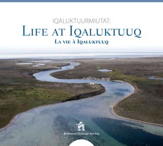
2. Iqaluktuurmiutat
Uqalimaaliuqtiik Darren Keith, Qaujihaqti, Kitikmeot Ingilrangnittaliriyiit
Katimayiit, amma Max Friesen, Ittarnitaliriji, Torontop Iliniarvigyuaq.
Qaanganiittuq Piksa: Iqaluktuuq, takunnartuq uataagut Iqaluktuurmit.
Tahiryuaq, taunaniittuq, qurluaqpakhuni Iqaluktuup Kuugaanut-Amihuuyut
ittarnittalgit kuukkap hinaani (Max Friesen).
Iqaluktuurmiutat: Life at Iqaluktuuq
Written by Darren Keith, Senior Researcher,
Kitikmeot Heritage Society and
Professor Max Friesen, Department of Anthropology,
University of Toronto
This project has been made possible in part through contributions
from the Museums Assistance Program, Department of Canadian Heritage,
and the Nunavut Department of Culture, Language, Elders and Youth and
Artisan Press Ltd.
Cover photograph by Max Friesen
Booklet design & printing by Artisan Press Ltd., Yellowknife, NT
Iqaluktuuq, looking west toward Wellington Bay.
Ferguson Lake, at bottom, drains into the Ekalluk River –
both banks of the river contain many archaeological sites.
Les Iqaluktuurmiutut : la vie à Iqaluktuuq
Redigé par Darren Keith, Researcheur Senior de Kitikmeot Heritage
Society and Professeur Max Friesen, Departement d’Anthropologie,
Université de Toronto.
Ce projet a ete rendu possible en partie grace les contributions du
Programme d’aide aux musees du ministere du Partimoine canadien,
et le Departement de Culture, de la Langue, des Aînés et de la Jeunesse
de la Territoire de Nunavut.
Photo en couverture : Iqaluktuuq, face à l’ouest vers la baie Wellington.
Le lac Ferguson, au bas, alimente la rivière Ekalluk – les deux rives de la rivière
regorgent de sites archéologiques. (Max Friesen)
3. English
Iqaluktuuq – A Place of Many Fish
Iqaluktuuq (Ekalluk River) is the Inuinnaqtun name for a short section of river
that drains Tahiryuaq (Ferguson Lake) (see map facing). The group of Inuit families
whose homeland was centred on Iqaluktuuq are called the Iqaluktuurmiut or
“people of Iqaluktuuq”. This short river was very important to the Iqaluktuurmiut
because of the rich runs of char that occur here annually in the spring and in the
fall. It was also very important because the area formed a natural funnel for caribou
migrating south between the enormous lake Tahiryuaq to the East and the ocean
to the West. In good years the Iqaluktuuq area provided ample opportunity to
accumulate enough fish, caribou and caribou skins to enable Iqaluktuurmiut to
be well fed and clothed while hunting seals through the long winter season.
Iqaluktuuq formed such a strategic location for subsistence life in the region,
that there is archaeological evidence for the area being continuously occupied
for four thousand years.
“A long time ago I remember living in Iqaluktuuq as a
young boy. There were people here a long time ago as
there are some old campsites…Right now the campsites
are overgrown with grass and the rocks and paths are also
covered. At these campsites people used to go spearing
fish starting early in the morning as I remember it. They did not even have
anything to drink or eat. They would go to the fishing spots while the fish were
running in order to stock up for the winter by spearing fish. They did not have
nets. They buried fish in the rocks and dried them also. While the men were
fishing the women would bring them dried fish and fish heads to eat. They
would fish until it got dark and then they would go home” (Frank Analok at
Iqaluktuuq, July 5th, 2000).
5 Frank Analok at Iqaluktuuq, 2000 (Kim Crockatt).
4. Iqaluktuuq Area Place Names
Tikiraaryuk - “little point” Qikiqhiitaat – “the first islands you reach”
Nuqharnaq - unknown Kuugaryuaq - “big river”
Ayapqaut - “a place to steady your qayaq” Umingmangnak - unknown – it has many
ivitaaruq (land-locked char)
Iqaluktuuq - “place of many fish” Hingigyuaq - “big peninsula”
Kinngait - “hills” Qiggut- unknown – it has many flat rocks
Nalvaaq - “found lake” Kuviuhivik - “where water trickles down”
5. 6
English
A Place to Remember
The Kitikmeot Heritage Society has been working in
partnership with Dr. Max Friesen of the Anthropology
Department of the University of Toronto since the year 2000
to undertake Archaeological and Oral History research at
Iqaluktuuq. The Elders have joined the archaeologist camp
several times to tell stories of the history of the area, and to
assist the archaeologists in interpreting artifacts and features.
Together, the Elders and archaeologists have developed a
detailed picture of historic and prehistoric life at Iqaluktuuq.
Elders Mackie Kaosoni and Mabel Ekvana Angulalik at an old
stone fox trap (Max Friesen).
6. 4
8
Traditional Life at Iqaluktuuq
Historically, Iqaluktuurmiut spent their winters on the sea
ice hunting seals. They first started moving towards the land
in the spring. Iqaluktuurmiut moved to fishing lakes to catch
iqalukpiit (arctic char) and ihuuraryuit (lake trout) through
the ice. One of those important spring fishing lakes was
Tahiryuaq (Ferguson Lake) which is drained by Iqaluktuuq.
Fishing at the ocean’s edge or on the lake ice in the spring
was done with an aulajjut (jigger) and qaryuqaq (fishing
hook); or alternatively with an aulajjut and iqaluuyaq (fish
shaped lure without a hook), and a kakivak (fish spear) or
leister. The iqaluuyaq was used to lure in the fish close
enough that it could be speared with the kakivak.
As the edge of the lakes melted, char and lake trout began
to move along the ice edge. Iqaluktuurmiut used specialized
fish spears at this time of year, and they wore a type of
5 Inuit elders, students, and archaeologists share songs and
history during a drum dance at the Iqaluktuuq elders’
traditional knowledge camp (Max Friesen).
waterproof boot called an ipirauhiq to guard against the cold
water. One of the spears was a one or two pronged fishing
harpoon called a naulaqtuut. The naulaqtuut had a wooden
handle and antler foreshaft with an antler harpoon head
tied tightly to it. It doesn’t appear that any early explorers
or ethnographers collected an example of this spear and so
no photographs are available. However, some Elders still
remember the design and use of the naulaqtuut. The other
type of fishing spear was the nuiyaaqpait (nuiyaaqpak) or
trident – a fishing spear with three barbed prongs made of
caribou antler (see Kapuutit section on page 7).
During the months of May and June Iqaluktuurmiut hunted
the returning caribou and made mipku (dried meat). In June
the char began to run downstream out of Tahiryuaq through
Iqaluktuuq to the ocean. Iqaluktuurmiut fished intensively
at this time using the kakivak, and with the warm weather of
summer, they had to dry the fish to preserve it so it would be
available for consumption in the winter.
In late August the char began to run up Iqaluktuuq from
the ocean to Tahiryuaq. This was another time of intensive
fishing with the kakivak. As the weather was significantly
cooler at this time of year, Iqaluktuurmiut were able to cache
whole fish in a rectangular shaped cache called a qinngniq
without fear that the fish would rot. The floor of a qinngniq
was made of flat rocks, or of a wooden lattice. This kept the
cached fish off the moist ground.
Ikpakuak Fishing in Lake Ekallugak, Northwest Territories,
May 15, 1915 (Diamond Jenness/CMC/36971).
Fishing Rod, line and hook collected by Joseph F. Bernard
(CMC /IV-D-1637).
48 Fishing Lure made from polar bear tooth (CMC/IV-D-431).
8. The success of the char runs at Iqaluktuuq was very
important to the yearly survival of Iqaluktuurmiut.
For this reason there were rules about proper behaviour
while camping next to the river. If any of these rules were
broken Iqaluktuurmiut believed that this could spell disaster
for the group, as the fish may be offended and the run
could collapse.
When fish were caught along the river one of the rules was
that the fish had to be laid on the bank with its head facing
the direction it was migrating. Once it had been split and
laid on the fish drying rack the dorsal fin of the fish had to
be facing the direction of its migration. Another important
rule was that equipment could not be made or repaired
beside the river or around the tents. There was a specific
working place or hannavik established a distance back
from the river where the people could work on their things
without offending the fish.
5 One of many Inuit fish caches, (qinngniit) spread along both
banks of Iqaluktuuq (Max Friesen).
5 Mannigyorina about to go fishing near
Bernard Harbour, Northwest Territories.
She is wearing ipirauhiit, June 29, 1916
(Diamond Jenness/CMC/37076).
5 Inuinnait fish drying racks and tents near Bernard Harbour, July 3, 1915
(Rudolph Martin Anderson/CMC/39360).
9. 5 Nikhigaut or fish rake collected by
Canadian Arctic Expedition
(CMC/IV-D-431).
5
Canadian Arctic Expedition
(CMC/IV-D-117).
5 Nuiyaaqpait or trident collected by
Canadian Arctic Expedition
(CMC/IV-D-121).
Kapuutit
English
6 Copper Inuk man hammering out copper
arrowheads at the hannavik, Coppermine River
June 1, 1916 (John Ruggles Cox/CMC/39673).
7
10. Immediately after the fall fish run Iqaluktuurmiut hunted
the caribou that were now starting to migrate south. The
geography of Iqaluktuuq – narrow corridor of land between
the ocean and the enormous lake Tahiryuaq – made it a
natural funnel for migrating caribou. Evidence for large
organized caribou hunts at Iqaluktuuq can be found in the
archaeological sites and place names of the area.
The remains of a caribou drive system, including a long line
of inuksuit and shooting blinds have been found on the north
side of the river. These rows of inuksuit stretch for over three
kilometres, all the way from Tahiryuaq to the ocean. Some
sections are deeply buried and covered with lichen, and must
have been built in ancient times, while other sections were
probably built as recently as the 1920s. The caribou were
driven by people, often women, into the funnel created by
the inuksuit. The shooting blinds were located at the narrow
end of the funnel so that the caribou would have to pass
close to the hidden archers. Animals that made it past the
shooting blinds and entered the water were pursued by men
in kayaks, and killed with lances. Ayapqaut is the name of a
place located just upstream of the caribou drive on the north
shore (see map on page 2). It means “a place to steady your
kayak”. The name preserves the memory of Inuit hunting
caribou in kayaks at Iqaluktuuq, and the close association of
this place with the caribou drive suggests that it may have
been used at the same time.
After the fall fishing and caribou hunting, Iqaluktuurmiut
would ideally have a winter’s supply of dry fish, whole
fish, dried caribou meat, frozen caribou meat and skins
for clothing. They left the Iqaluktuuq area to gather at
innagharviit (“places of preparation”) where they would finish
preparing their winter clothing and equipment before moving
out on to the sea ice to spend the winter in seal hunting
villages of iglus. 5 Tommy Kilaodluk at one of the oldest sections of the caribou
drive lanes at Iqaluktuuq (Max Friesen).
11. TODAY
1250 AD
1500 AD
ModernInuitLateDorset
EarlyandMiddleDorsetThuleInuit
800 AD
An Ancient Homeland
Traditional knowledge and archaeology have revealed that
Iqaluktuuq is one of the most important archaeological
areas in Nunavut. Iqaluktuuq has been important to Inuit
for centuries, but its importance as a place to fish and hunt
caribou is even more ancient.
5 After excavation, a very finely made stone floor is revealed in
the Thule Inuit house (Max Friesen).
6 A soapstone cooking pot fragment, found in the kitchen area of
the Thule Inuit house (Max Friesen).
The cultural history of Iqaluktuuq is divided into several
periods. For the past 750 years, Iqaluktuuq was inhabited
by Inuit, including their early ancestors who are known as
“Thule Inuit”. Before Inuit, the land was occupied by very
different people whom Inuit knew as “Tuniit”, who first
arrived in the region over 4000 years ago. Archaeologists
call Tuniit by several names, with later Tuniit called Dorset,
and the most ancient Tuniit known as Pre-Dorset. In the
following pages, the lives of these ancient people will be
described, starting with most recent period, and working
back through time to the most ancient.
Thule Inuit - 0 AD to 00 AD
About 750 years ago, early Thule Inuit arrived at Iqaluktuuq,
after migrating from Alaska in the west. They built large
stone houses at a place archaeologists have named the
Bell site. These houses have deep entrance tunnels and
separate kitchen rooms. The deep deposits of animal
bones and artifacts at this site show us that Thule Inuit
led a comfortable, settled life here, depending on stored
caribou and char to last them through the winter. During
the summer, they lived in skin tents, and may have travelled
inland or along the coast to hunt or trade with their
neighbours. Thule Inuit brought with them from Alaska
complex and very effective tools including several kinds of
fish spears, bows and arrows, sleds, kayaks, and sophisticated
sewing equipment. Modern Elders recognize almost all
tool types from Thule sites, and have a deep understanding
of how they were used. This has helped archaeologists
reconstruct early Thule life.
English
500 BC
1800 BC
Pre-Dorset
12. TODAY
LateDorset
EarlyandMiddleDorset
1250 AD
800 AD
500 BC
Pre-Dorset
1800 BC
ModernInuit
ThuleInuit
1500 AD
Late Dorset - 00 AD to 0 AD
When Thule Inuit first arrived at Iqaluktuuq, they probably
met Late Dorset people, who Inuit call Tuniit. Tuniit were
very different from Inuit, and shortly after the two societies
met, Tuniit disappeared from the area. However, they left
several large sites, including the largest gathering site in all
of Nunavut. There, they built four longhouses out of large
boulders, as well as hundreds of other stone structures. The
largest longhouse is 43 metres (140 feet) long and probably
held about 100 people who met during the summer to trade,
share information, and hunt together. During the cold season,
Late Dorset people lived in houses which were not as large
or solidly constructed as Thule houses, but which were
dug into the surrounding earth to add warmth. Late Dorset
people are famous for their artwork, and several examples of
small animal carvings have been recovered from this period
at Iqaluktuuq.
5 Dorset carving of an arctic char (Max Friesen).
Early and Middle Dorset - 00 BC to 00 AD
Early Dorset people came to Iqaluktuuq around 500 BC,
probably arriving from the east.
They are the first people to build deep cold-season houses,
and to take advantage of the arctic char at Iqaluktuuq. At
a site near Cambridge Bay, a particularly fine example of
an Early Dorset house was excavated, with a central “mid
passage” structure which would have been used for storage
and cooking (see photo on page 12). One of the biggest
sites at Iqaluktuuq, the Buchanan Site, was a warm-season
occupation where Middle Dorset people successfully hunted
caribou and fished for char. We have collected many tools
from this period, including harpoon heads, sewing needles,
and very small stone cutting tools known as microblades.
3 Inuit and southern students measure a huge longhouse built by
Late Dorset people (Max Friesen).
0
13. TODAY
1250 AD
LateDorset
EarlyandMiddleDorsetT
800 AD
500 BC
1800 BC
Pre-Dorset
11
1500 AD
ModernInuit
huleInuit
5 ArchaeologistsatworkontheearliestsiteatIqaluktuuq–the
WellingtonBaysite–occupiedbyPre-Dorsetpeoplealmost
4000yearsago(Max Friesen).
English
5 Threetinystonemicroblades,fromtheMiddleDorsetperiod,
onlyabout4cm(1½inches)long(onright),whichwere
removedfromthestonecoreonleft (Max Friesen).
Pre-Dorset — 1800 to 500 BC
TheearliestsettlementofIqaluktuuqwasbyPre-Dorset
peoplearound1800BC(almost4000yearsago).Atthis
time,Iqaluktuuqwasnotyetariver–sealevelsweremuch
higher,andPre-Dorsetpeoplesettledonaseriesofislands
wheretheyhuntedsealsandcaribou.ThePre-Dorsetway
oflifewasverydifferentfromtheTuniitandInuitwho
followedthem.Theymovedaroundoften,andlivedinvery
smallgroupsofonlyoneortwofamiliesformostoftheyear.
Pre-DorsetsitesatIqaluktuuqcontainthousandsofstone
flakesleftbehindaswasteaftertheymadefinelycrafted
arrowheads,spearpoints,andcuttingtools.Wehavenot
foundanyPre-Dorsetlivingstructures,althoughtheymust
havelivedinskintentsformuchoftheyear.
8 Pre-Dorsetpeopleprobablyusedthistinybrokenbarbedpoint
forfishing(Max Friesen).
14. TODAY
LateDorset
EarlyandMiddleDorset
800 AD
Pre-Dorset
500 BC
1800 BC
ModernInuit
ThuleInuit
1500 AD
1250 AD
5 Dorset house at the Ekvana site after excavation.
Note the two rows of upright slabs running down the centre
of the house, and the carefully constructed flagstone floors on
each side (Max Friesen).