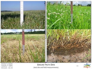
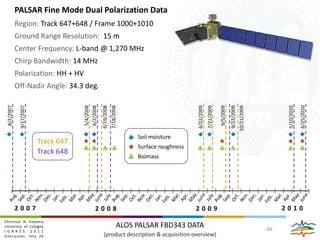
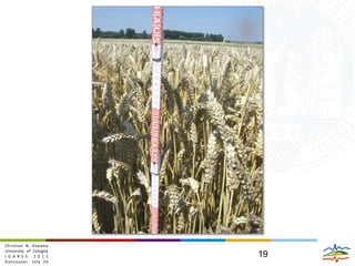
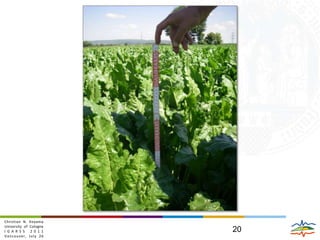
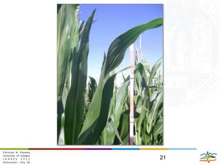
The document presents a study on retrieving soil moisture under vegetation using dual polarized ALOS PALSAR data. Field measurements were taken at a test site to measure soil properties and vegetation characteristics. PALSAR data from multiple dates was processed to generate HH, HV backscatter and alpha, entropy, and span images. A grassland soil moisture retrieval model was developed that accounts for effects of the grass canopy and thatch layer on the radar signal. The model was able to estimate high resolution surface soil moisture patterns and distributions without using prior vegetation information.
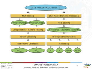

![ALOS PALSAR FBD343 Level 1.1Multi-looking[C2] Matrix Elements ProcessingHH Power Imageσ0HHHV Power Imageσ0HVMulti-LookingCovariance [C2] Matrix ElementsCoregistration + Generic FilteringHAalphaspanTerrain GeocodingH/A/Alpha DecompositionRadiometric CalibrationGeocodingSimplified Processing Chain(basicprocessingand polarimetric decompositionof FBD343)- 05 -](https://image.slidesharecdn.com/igarss2011-koyama-schneider2-110726130216-phpapp01/85/IGARSS2011_Koyama_Schneider-pptx-9-320.jpg)
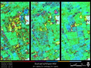
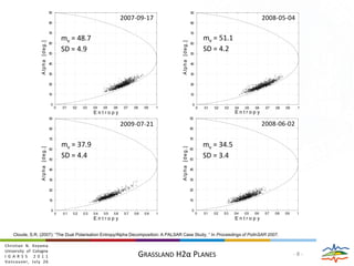
![2009-07-212008-05-042007-09-172008-06-02mv = 51.1 SD = 4.2mv = 34.5 SD = 3.4mv = 48.7 SD = 4.9mv = 37.9 SD = 4.4Alpha [deg.]Alpha [deg.]Alpha [deg.]Alpha [deg.]EntropyEntropyEntropyEntropyCloude, S.R. (2007): “The Dual Polarisation Entropy/Alpha Decomposition: A PALSAR Case Study, “ In Proceedings of PolInSAR 2007.Grassland H2αPlanes- 8 -](https://image.slidesharecdn.com/igarss2011-koyama-schneider2-110726130216-phpapp01/85/IGARSS2011_Koyama_Schneider-pptx-12-320.jpg)
![2007-08-022007-09-17Christian N. KoyamaUniversity of CologneIGARSS 2011Vancouver, July 262575Surface Soil Moisture Distributionmv [Vol.-%]](https://image.slidesharecdn.com/igarss2011-koyama-schneider2-110726130216-phpapp01/85/IGARSS2011_Koyama_Schneider-pptx-15-320.jpg)
![2008-05-042008-06-022008-06-19Christian N. KoyamaUniversity of CologneIGARSS 2011Vancouver, July 262575Surface Soil Moisture Distributionmv [Vol.-%]](https://image.slidesharecdn.com/igarss2011-koyama-schneider2-110726130216-phpapp01/85/IGARSS2011_Koyama_Schneider-pptx-22-320.jpg)