Downloaded 414 times
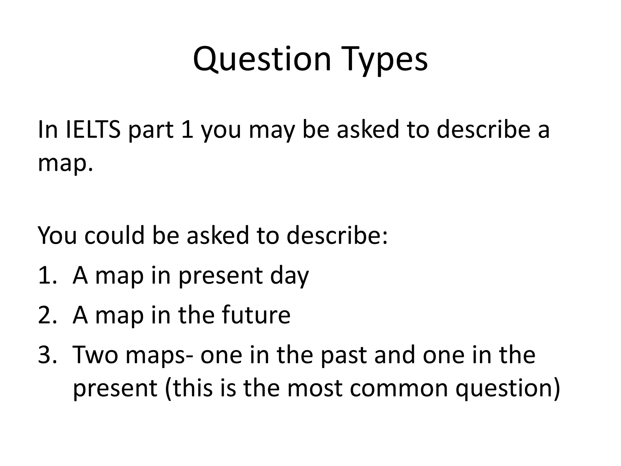
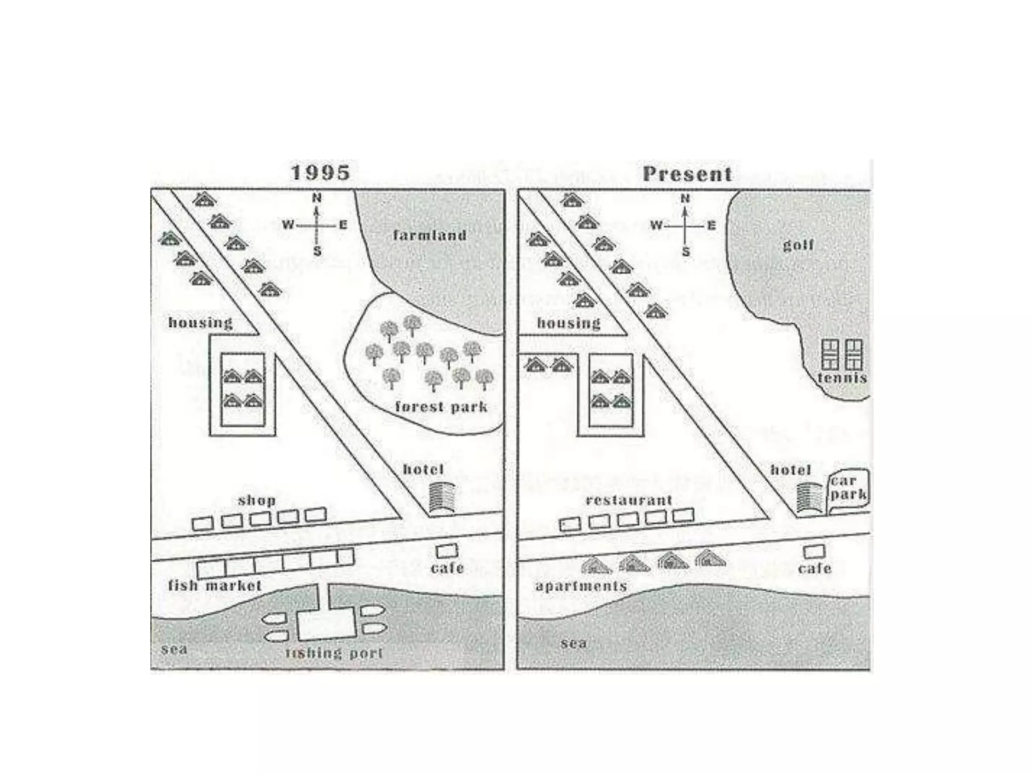
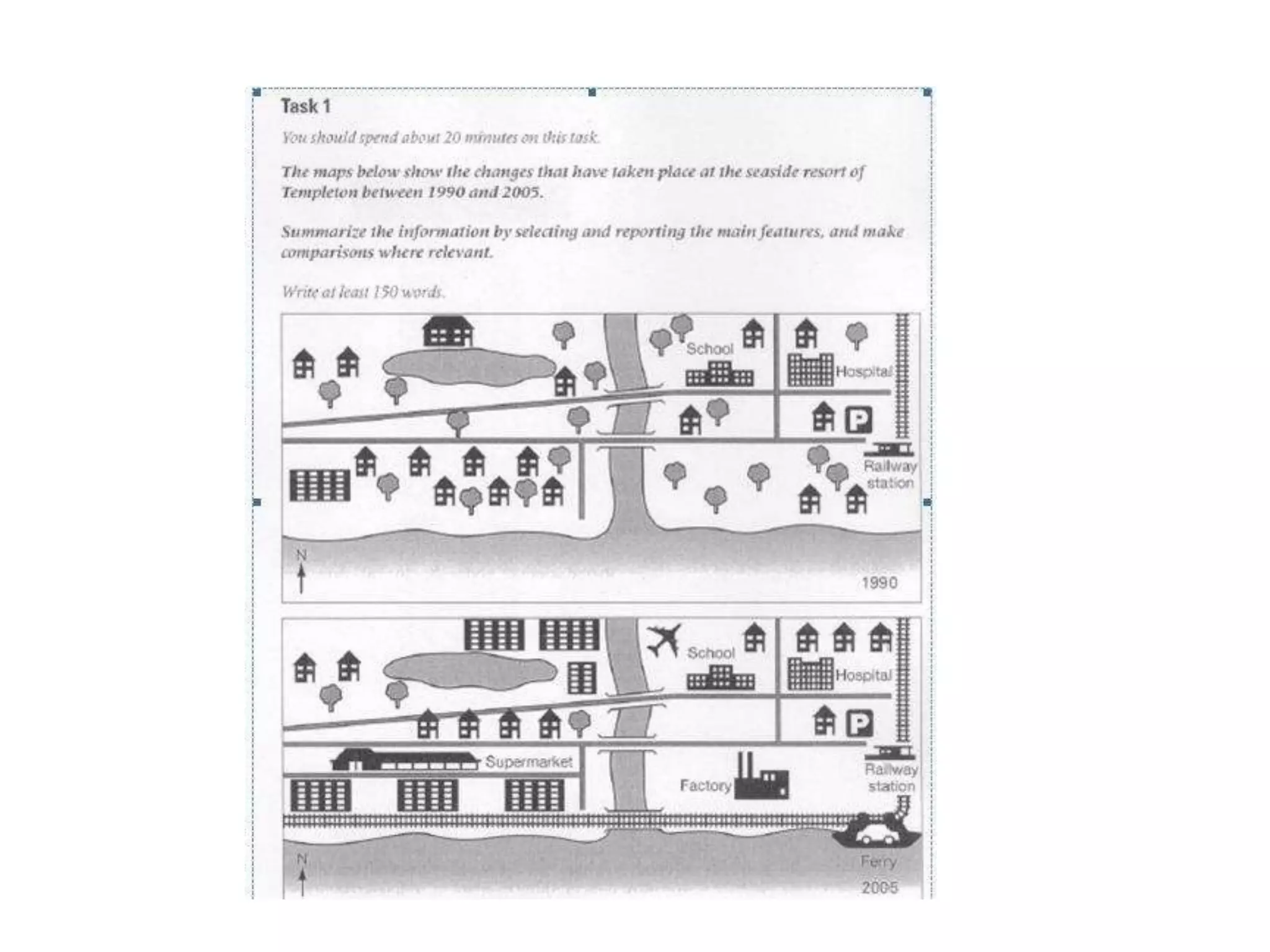
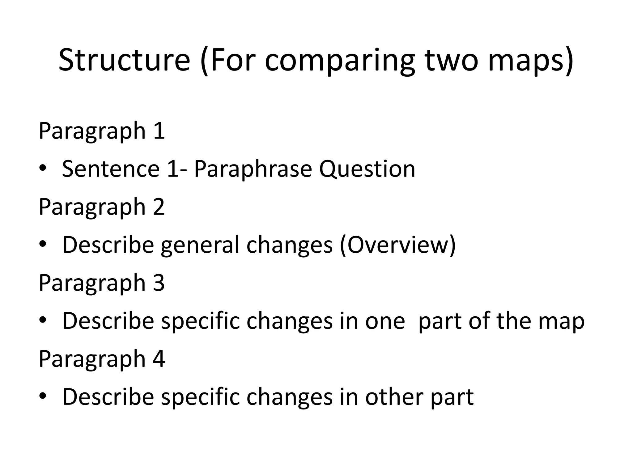
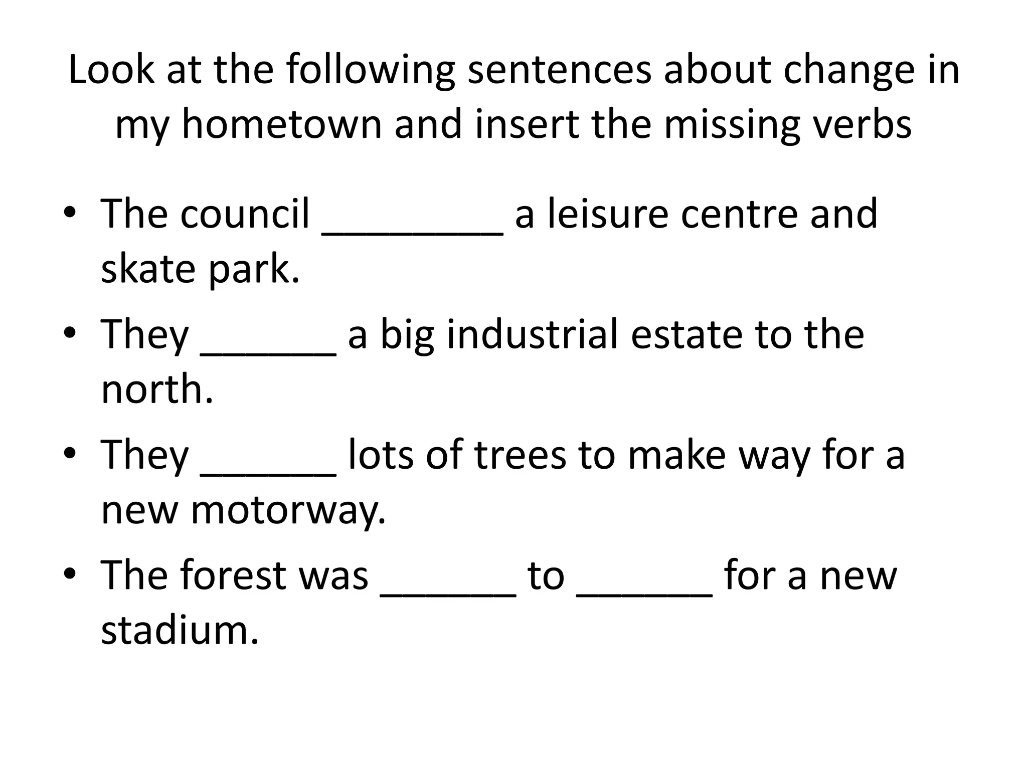
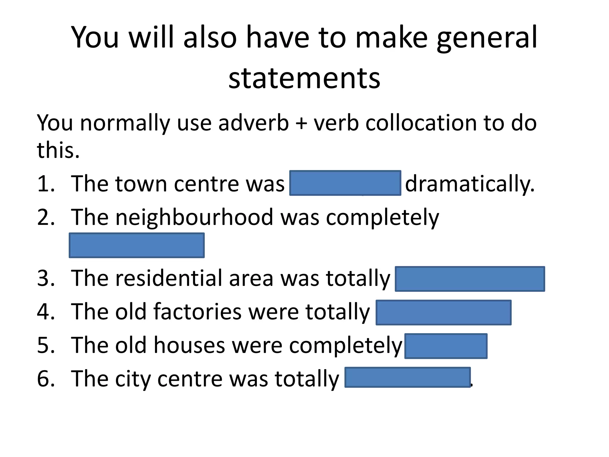

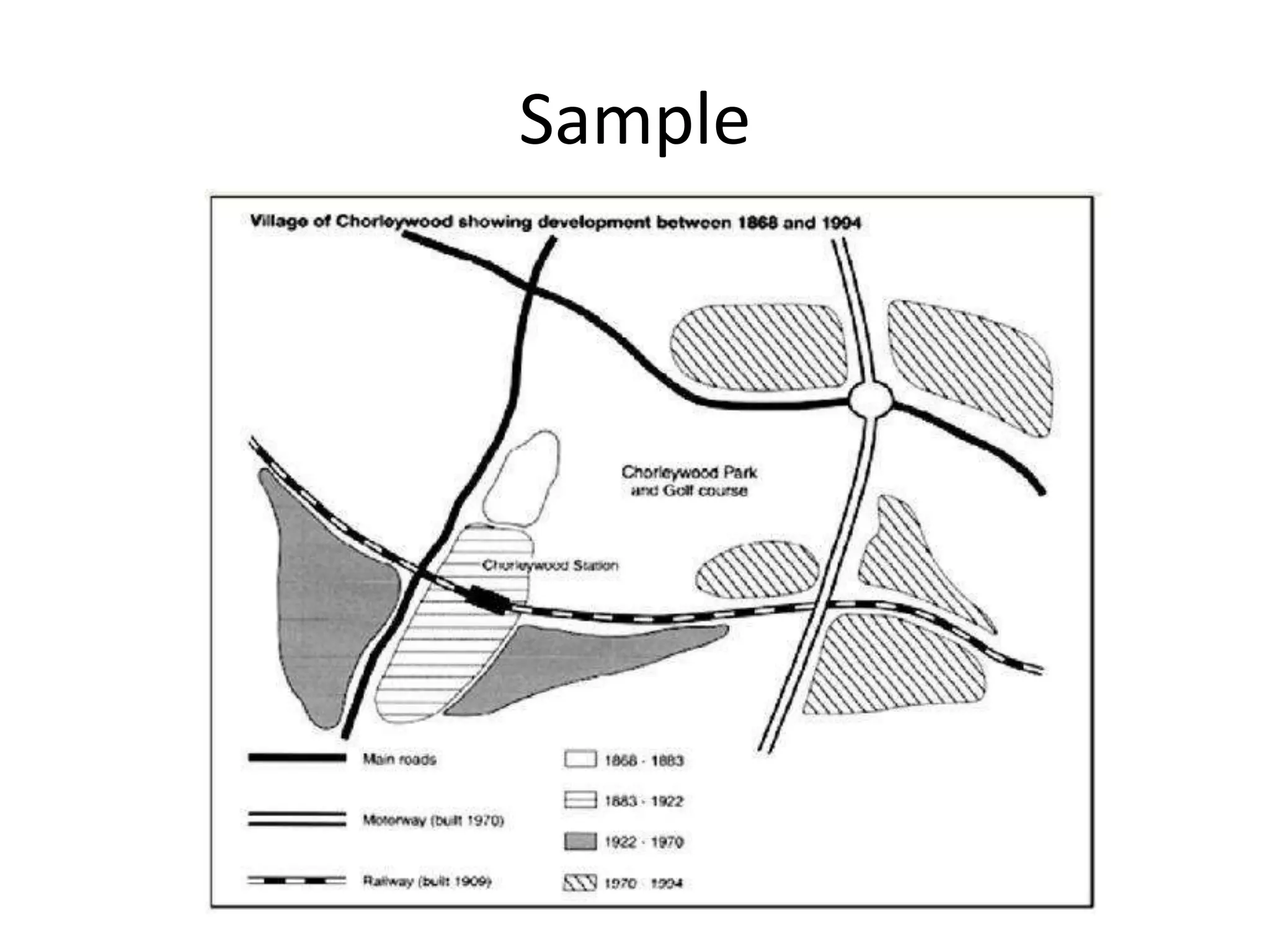
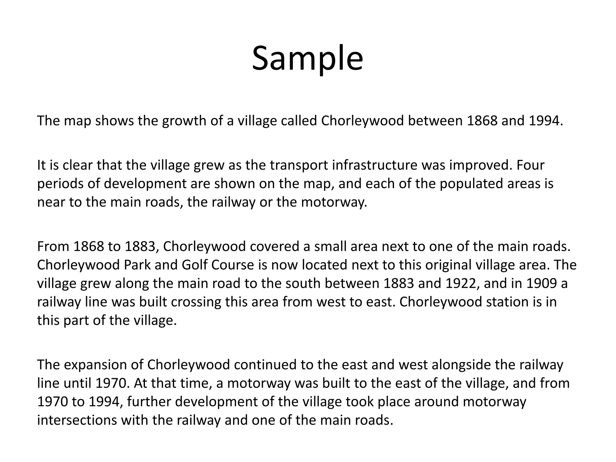

This document provides guidance on describing maps for the IELTS Writing Task 1. It discusses the different types of map questions, outlines a structure for comparing two maps, and provides examples of language for describing specific changes. The key points are: map questions may require describing a single present-day map, a future map, or comparing a past and present map; a four paragraph structure is suggested, with paragraphs 2-4 describing general and specific changes; and adverb + verb collocations should be used to make general statements about changes over time. An example is also given comparing the growth of a village between 1868 and 1994 shown on two maps.


![[IELTS] Academic Writing, Task 1 - Describing Maps - Lesson Slides.pptx](https://cdn.slidesharecdn.com/ss_thumbnails/ieltsacademicwritingtask1-describingmaps-lessonslides-250619212529-235f16b9-thumbnail.jpg?width=640&height=640&fit=bounds)


![IELTS Revision - Task 1 Writing (1) [Autosaved] v2.pptx](https://cdn.slidesharecdn.com/ss_thumbnails/ieltsrevision-task1writing1autosavedv2-230814121437-d82ee472-thumbnail.jpg?width=640&height=640&fit=bounds)


