How does the geology of California impact the effectiveness of Ground Penetrating Radar
•
0 likes•2 views

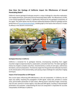
California's diverse geological landscape presents a unique challenge for subsurface exploration and imaging techniques, particularly Ground Penetrating Radar (GPR). The effectiveness of GPR, a non-invasive geophysical method, is significantly influenced by the geological composition of the region.

Recommended
Recommended
More Related Content
Similar to How does the geology of California impact the effectiveness of Ground Penetrating Radar
Similar to How does the geology of California impact the effectiveness of Ground Penetrating Radar (20)
More from Tec
More from Tec (20)
Recently uploaded
Recently uploaded (20)
How does the geology of California impact the effectiveness of Ground Penetrating Radar
- 1. How Does the Geology of California Impact the Effectiveness of Ground Penetrating Radar? California's diverse geological landscape presents a unique challenge for subsurface exploration and imaging techniques, particularly Ground Penetrating Radar (GPR). The effectiveness of GPR, a non-invasive geophysical method, is significantly influenced by the geological composition of the region. This article delves into the intricate relationship between California's geology and the performance of Ground Penetrating Radar, shedding light on the factors that enhance or hinder its efficacy in this dynamic environment. Geological Diversity in California California is renowned for its geological diversity, encompassing everything from rugged mountain ranges to expansive deserts, coastal plains, and active fault lines. The state's geological history has shaped a complex subsurface, characterized by a variety of rock types, sedimentary formations, and soil compositions. The diversity ranges from the granitic Sierra Nevada mountains to the alluvial plains of the Central Valley, each posing unique challenges for subsurface imaging techniques. Impact of Soil Composition on GPR Signals One crucial aspect influencing GPR effectiveness is the soil composition. In California, the soil types vary widely, impacting the propagation of GPR signals. Sandy soils, prevalent in coastal areas, permit better penetration of radar waves, offering clearer subsurface images. Conversely, clay-rich soils, common in certain regions, may attenuate GPR signals, resulting in reduced depth penetration and resolution. Understanding the local soil composition is imperative for accurate interpretation of GPR data in California.
- 2. Effect of Geological Structures on GPR California's geological structures, such as faults, folds, and stratigraphic variations, introduce additional challenges for GPR applications. The presence of fault zones, such as the infamous San Andreas Fault, can disrupt GPR signals and complicate subsurface imaging. The reflectivity of radar waves may be altered as they encounter changes in geological structures, making it essential for practitioners to adapt their interpretation methods based on the geological context. Influence of Rock Types on GPR Performance Different rock types in California contribute to the heterogeneity of the subsurface and influence GPR performance. Granite, prevalent in mountainous regions, tends to have higher radar wave velocities, affecting the travel time and reflection patterns in GPR data. Conversely, sedimentary rocks like shale or sandstone may exhibit varied GPR responses, depending on factors such as porosity and moisture content. Understanding the geological context is crucial for accurate interpretation of GPR data when dealing with diverse rock types. Water Content and GPR Resolution The presence of water in the subsurface is a critical factor affecting GPR performance. California experiences a range of hydrological conditions, from arid deserts to coastal regions with high precipitation. The water content in soils and rocks significantly influences GPR resolution, as radar waves interact differently with wet and dry materials. In areas with high water content, GPR signals may attenuate more quickly, limiting depth penetration and resolution. Challenges Posed by Urban Environments California's urban areas present a unique set of challenges for GPR applications. Urban environments often feature complex subsurface structures, including infrastructure, utilities, and buildings. The presence of man-made materials and variations in construction materials can impact GPR signals, leading to reflections and interference that complicate data interpretation. Accurate subsurface imaging in urban settings requires careful consideration of both natural geological features and anthropogenic influences. Advancements in GPR Technology to Address Challenges Recognizing the challenges posed by California's geological complexity, ongoing advancements in GPR technology aim to improve its effectiveness in diverse environments. Enhanced antenna designs, signal processing algorithms, and multi-frequency systems are among the innovations that contribute to overcoming geological obstacles. These advancements empower GPR practitioners to obtain clearer and more accurate subsurface images, even in regions with complex geological characteristics.
- 3. Conclusion The geology of California plays a pivotal role in shaping the effectiveness of Ground Penetrating Radar. The state's diverse geological features, including soil types, rock formations, fault lines, and water content, pose both challenges and opportunities for GPR applications. A comprehensive understanding of the local geological context, coupled with advancements in GPR technology, is essential for optimizing the performance of this geophysical method in California's dynamic environment. As technology continues to evolve, the synergy between geological knowledge and cutting-edge GPR applications promises to unlock new possibilities for subsurface exploration and imaging in the Golden State.