Ground Penetrating Radar Scanning an Overview of Technology.pdf
•
0 likes•2 views

Ground Penetrating Radar Scanning an Overview of Technology

Recommended
Recommended
More Related Content
Similar to Ground Penetrating Radar Scanning an Overview of Technology.pdf
Similar to Ground Penetrating Radar Scanning an Overview of Technology.pdf (20)
More from Tec
More from Tec (20)
Recently uploaded
Recently uploaded (20)
Ground Penetrating Radar Scanning an Overview of Technology.pdf
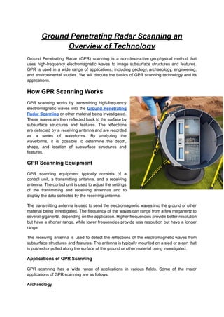
- 1. Ground Penetrating Radar Scanning an Overview of Technology Ground Penetrating Radar (GPR) scanning is a non-destructive geophysical method that uses high-frequency electromagnetic waves to image subsurface structures and features. GPR is used in a wide range of applications, including geology, archaeology, engineering, and environmental studies. We will discuss the basics of GPR scanning technology and its applications. How GPR Scanning Works GPR scanning works by transmitting high-frequency electromagnetic waves into the Ground Penetrating Radar Scanning or other material being investigated. These waves are then reflected back to the surface by subsurface structures and features. The reflections are detected by a receiving antenna and are recorded as a series of waveforms. By analyzing the waveforms, it is possible to determine the depth, shape, and location of subsurface structures and features. GPR Scanning Equipment GPR scanning equipment typically consists of a control unit, a transmitting antenna, and a receiving antenna. The control unit is used to adjust the settings of the transmitting and receiving antennas and to display the data collected by the receiving antenna. The transmitting antenna is used to send the electromagnetic waves into the ground or other material being investigated. The frequency of the waves can range from a few megahertz to several gigahertz, depending on the application. Higher frequencies provide better resolution but have a shorter range, while lower frequencies provide less resolution but have a longer range. The receiving antenna is used to detect the reflections of the electromagnetic waves from subsurface structures and features. The antenna is typically mounted on a sled or a cart that is pushed or pulled along the surface of the ground or other material being investigated. Applications of GPR Scanning GPR scanning has a wide range of applications in various fields. Some of the major applications of GPR scanning are as follows: Archaeology
- 2. GPR scanning is used in archaeology to map buried structures, graves, and artifacts. The technology is particularly useful for investigating sites that are difficult or impossible to excavate, such as areas with sensitive cultural or environmental conditions. GPR scanning can be used to determine the depth and shape of buried structures, such as walls, floors, and foundations. It can also be used to detect anomalies in the soil that may indicate the presence of buried artifacts or other features. Geology GPR scanning is used in geology to study the structure and properties of the subsurface. The technology can be used to map geological formations, identify faults, and locate groundwater. GPR scanning is particularly useful for studying the properties of permafrost and glaciers. The technology can be used to determine the thickness and structure of these formations, as well as to detect changes in the subsurface due to climate change. Environmental Studies GPR scanning is used in environmental studies to investigate the subsurface properties of contaminated sites. The technology can be used to locate buried contaminants and to map the distribution of subsurface contaminants. GPR scanning is also used to study the properties of soils and sediments. The technology can be used to determine the porosity, permeability, and moisture content of soils and sediments, which is important for understanding how these materials interact with contaminants and for developing remediation strategies. Engineering GPR scanning is used in engineering to investigate the subsurface properties of construction sites and to locate buried utilities. The technology can be used to determine the thickness and properties of pavements, as well as to detect voids, cracks, and other defects. GPR scanning is also used in the construction of tunnels and other underground structures. The technology can be used to map the subsurface and to identify potential hazards, such as water-bearing zones or weak rock formations. Advantages and Limitations of GPR GPR scanning has several advantages over other geophysical methods. Some of the major advantages are as follows: Non-Destructive GPR scanning is a non-destructive method, which means that it does not require drilling, coring, or other invasive techniques. This makes it a useful tool for investigating sensitive or inaccessible areas, such as archaeological sites, historical buildings, or environmentally sensitive locations.
- 3. High Resolution GPR scanning provides high-resolution images of the subsurface, which can reveal detailed information about buried structures and features. The technology can detect objects as small as a few centimeters, depending on the frequency used and the properties of the material being investigated. Rapid Data Collection GPR scanning can rapidly collect large amounts of data, which can be processed and analyzed in real-time. This makes it a useful tool for mapping large areas or for investigating sites with complex subsurface structures. However, GPR scanning also has some limitations that need to be considered. Some of the major limitations are as follows: Limited Penetration Depth The penetration depth of GPR scanning depends on the frequency of the electromagnetic waves and the properties of the material being investigated. Higher frequencies provide better resolution but have a shorter range, while lower frequencies provide less resolution but have a longer range. In general, GPR scanning is most effective at depths of up to 20 meters, although deeper penetration may be possible under certain conditions. Limited Accuracy The accuracy of GPR scanning depends on several factors, including the properties of the material being investigated, the frequency of the electromagnetic waves, and the calibration of the equipment. Errors in the data can arise from variations in the soil properties, changes in the antenna height or orientation, or interference from nearby objects. Interference from Conductive Materials: GPR scanning can be affected by the presence of conductive materials, such as metals, water, or clay. These materials can absorb or reflect electromagnetic waves, which can cause distortion or attenuation of the data. Special techniques, such as frequency filtering or signal processing, may be needed to correct for these effects. Conclusion: Ground Penetrating Radar scanning is a powerful geophysical method that can provide detailed information about subsurface structures and features. The technology is used in a wide range of applications, including archaeology, geology, environmental studies, and engineering. GPR scanning has several advantages, such as non-destructive data collection, high resolution, and rapid data processing. However, the technology also has some limitations, such as limited penetration depth, limited accuracy, and interference from conductive materials.