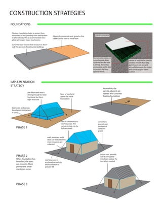
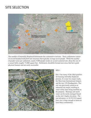
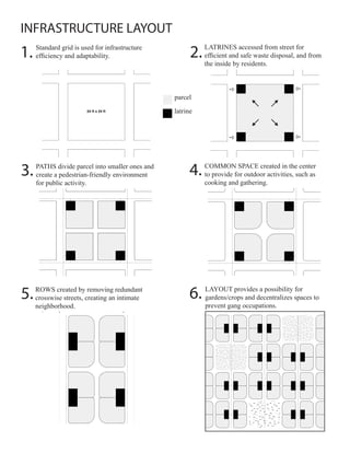
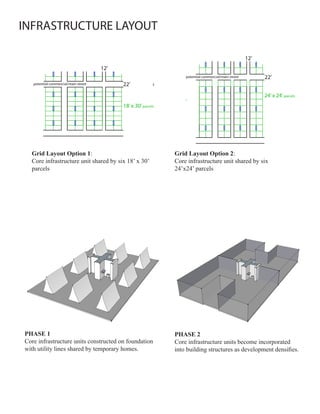
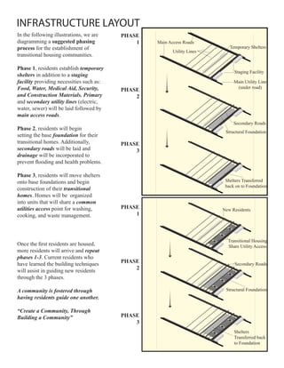
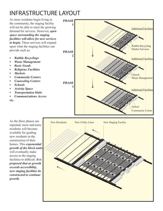
The document proposes strategies for transitioning Haitian refugees from camps to permanent communities. It recommends selecting a large site near roads and services that has suitable physical characteristics. An infrastructure layout is suggested using a grid for efficiency with shared utilities. Construction strategies focus on using local materials and a phased approach, starting with temporary shelters that can later be incorporated into permanent homes. The goal is to house refugees safely and quickly while establishing self-sustaining communities.

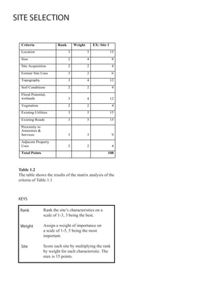
![CONSTRUCTION STRATEGIES
ROOF SYSTEMS
to minimize lift from
strong winds, roof slope
should be pitched on all
sides or approaches a
dome
to minimize lift from
strong winds, roof
slope should be about
30 - 50 degrees
WALL SYSTEMS
reinforced C or S-Shaped walls can
Concrete steel bars resist lateral forces
while acting as
Masonry Units stronger bearing walls
[CMUs]
They are also acting
CMU like columns
wood-frame
sand bags canvas or plastic tube
to hold the content
together
soil or sand can
provide cement like
strength
barb wire to keep the
tubes in place while
providing tensile
strength
Super Adobe Wall
Gabion units can be made
from wire mesh and filled
with crushed rubbles that
are widely available on site.](https://image.slidesharecdn.com/haitichallenge-100214123351-phpapp01/85/Haiti-Challenge-11-320.jpg)