Download to read offline

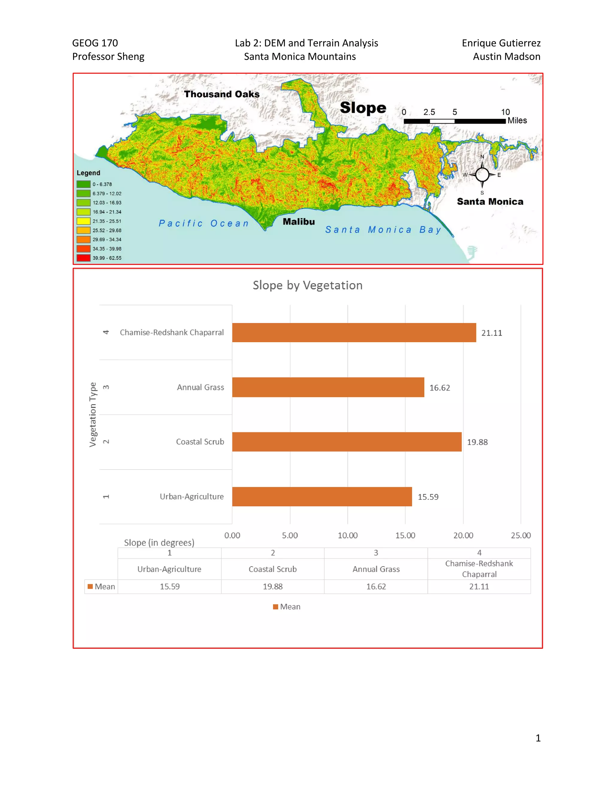
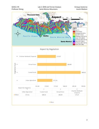
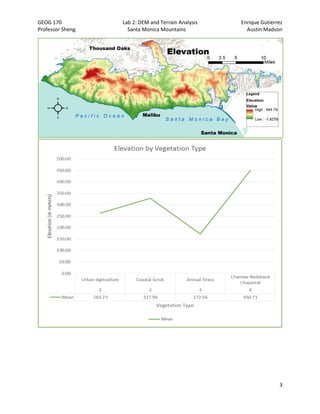
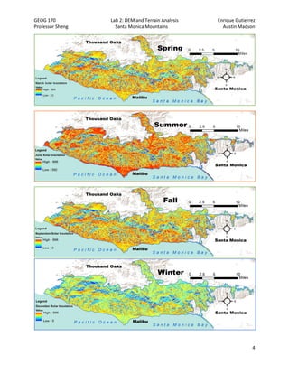


This document describes procedures for analyzing terrain and solar insolation for different vegetation types in the Santa Monica Mountains using GIS tools. The key findings are that chaparral exists at the highest elevations and steepest slopes, receiving the lowest solar insolation, while urban agriculture exists at the lowest elevations and receives the highest insolation. Annual grass has a relatively high slope given its low mean elevation. The analysis finds patterns between vegetation types and terrain/solar factors as expected.


