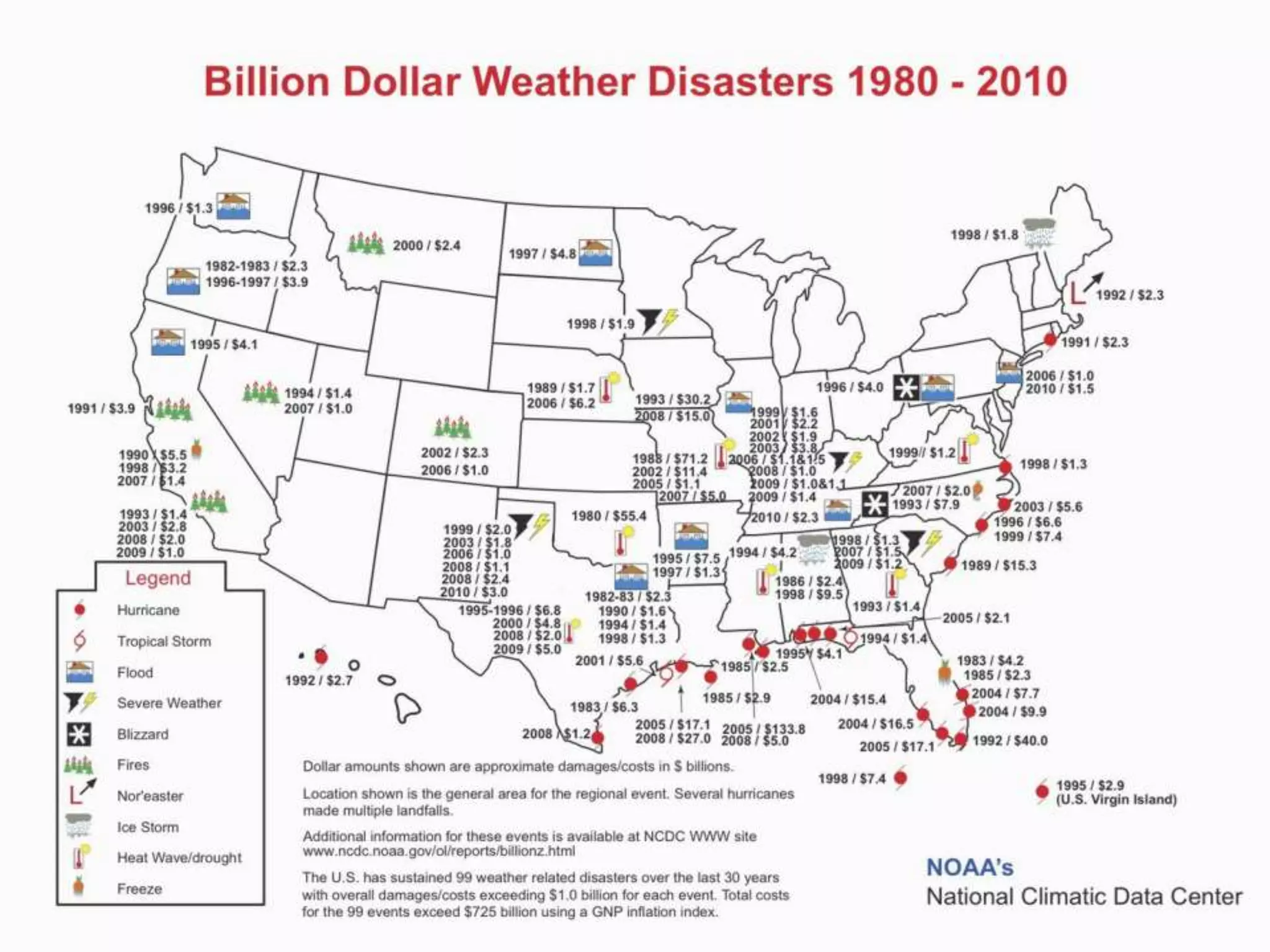
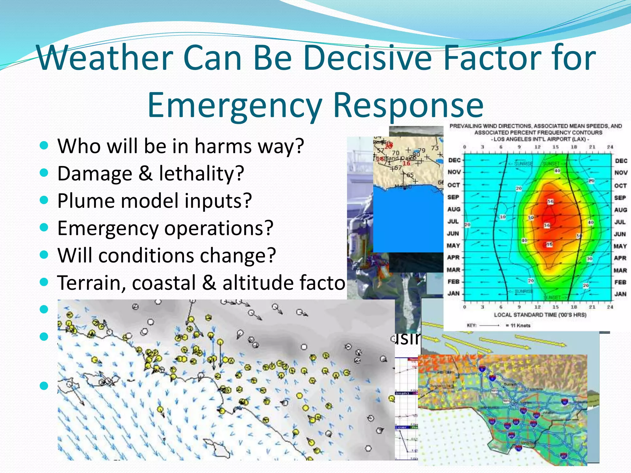
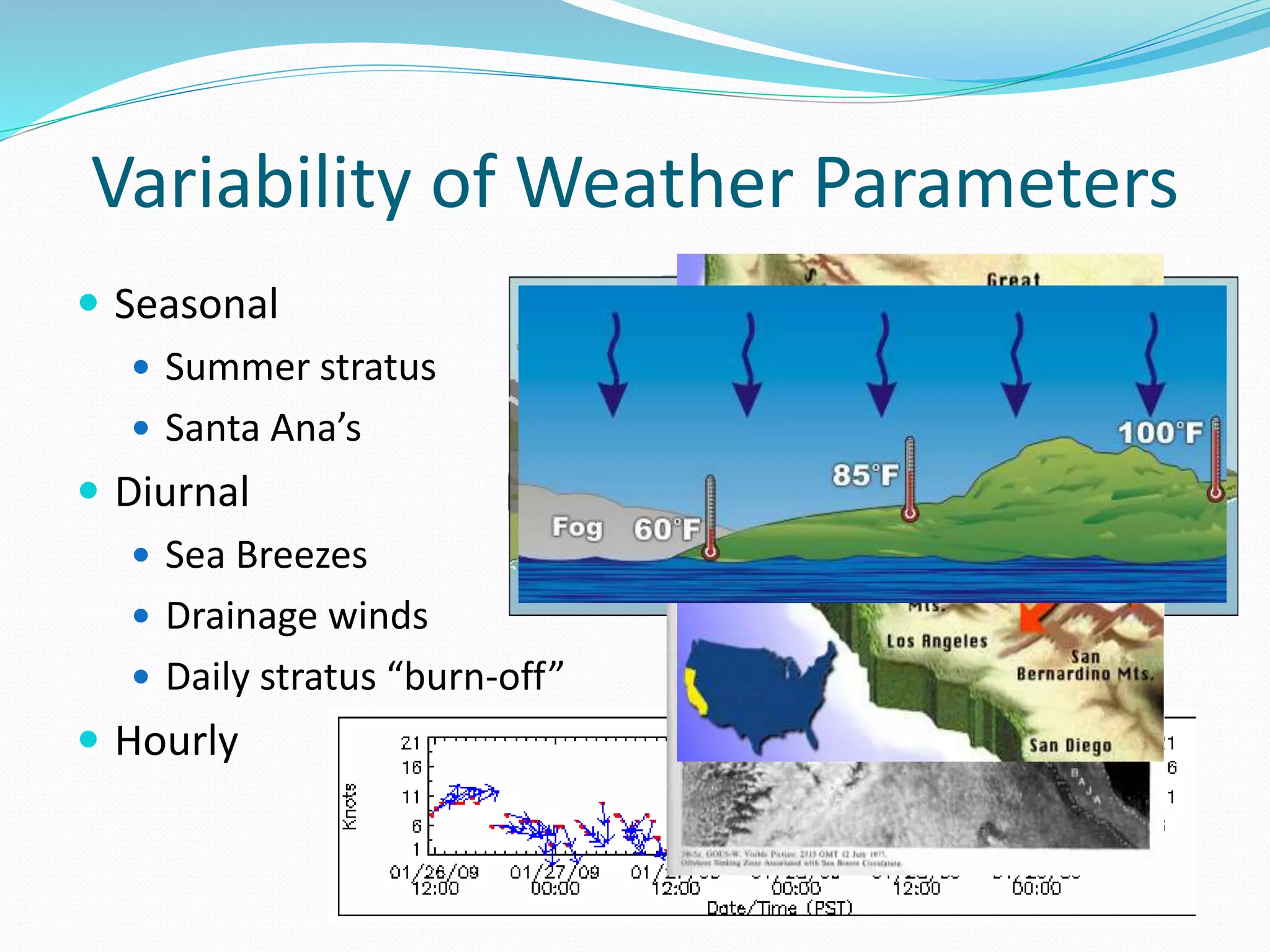
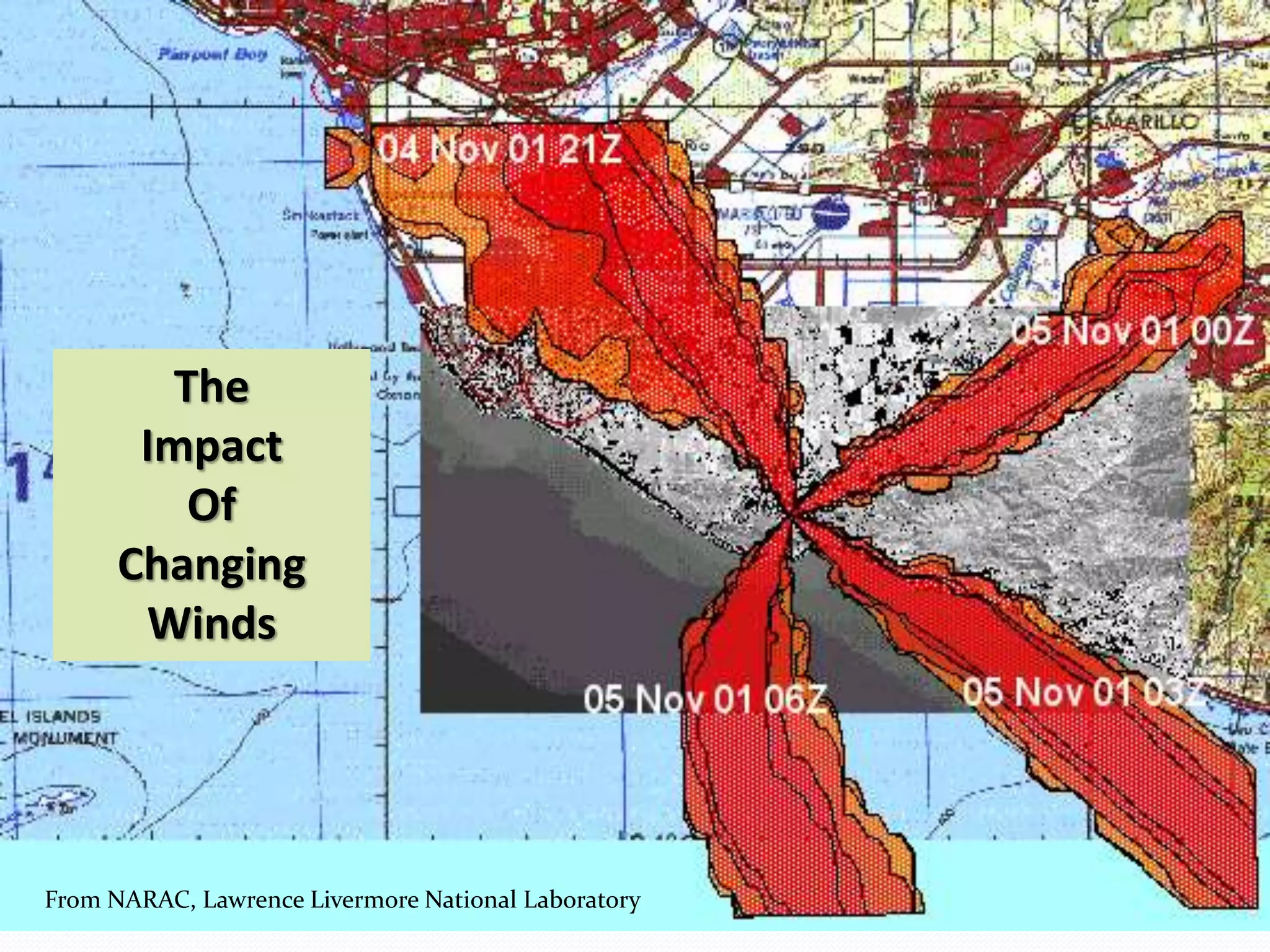
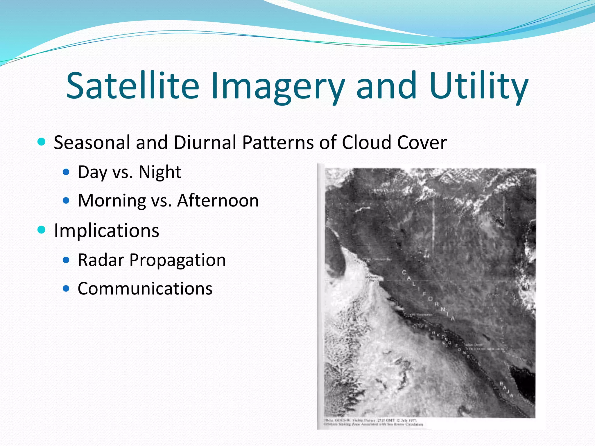
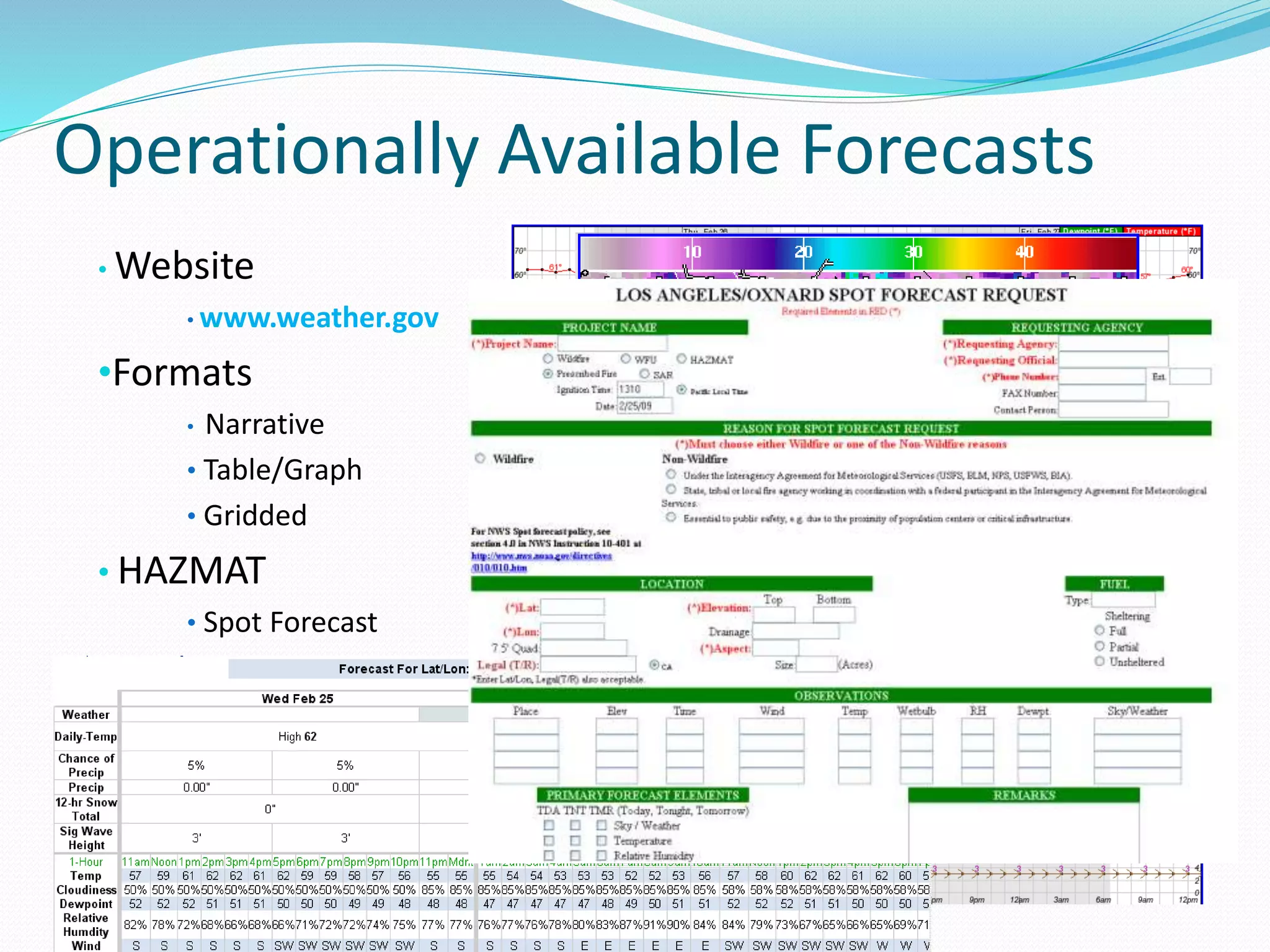
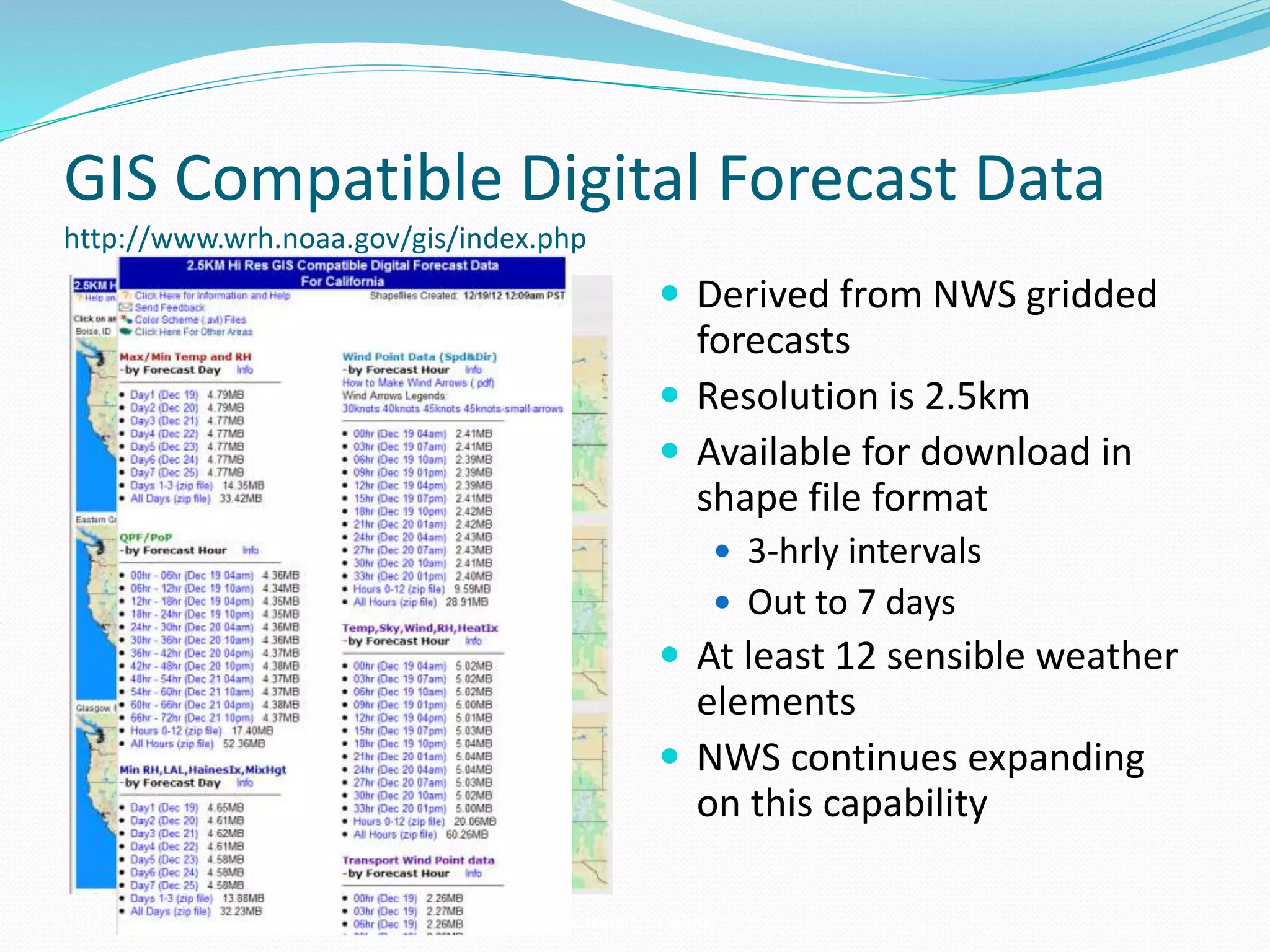
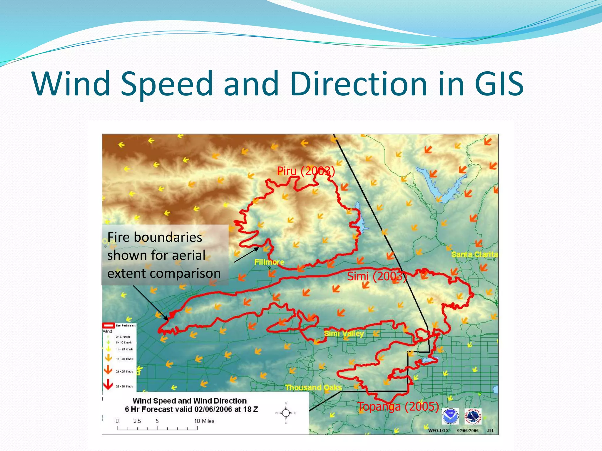
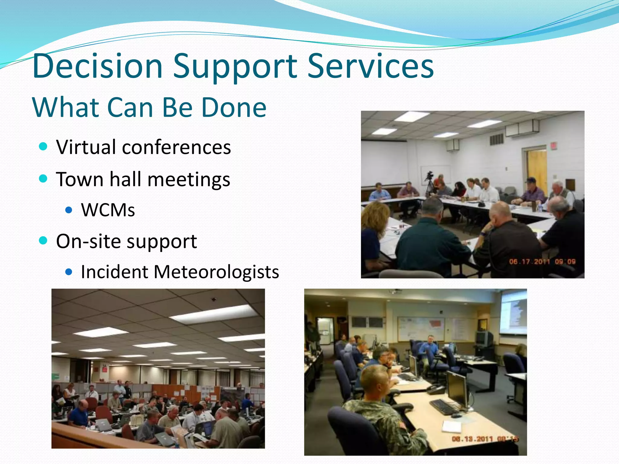
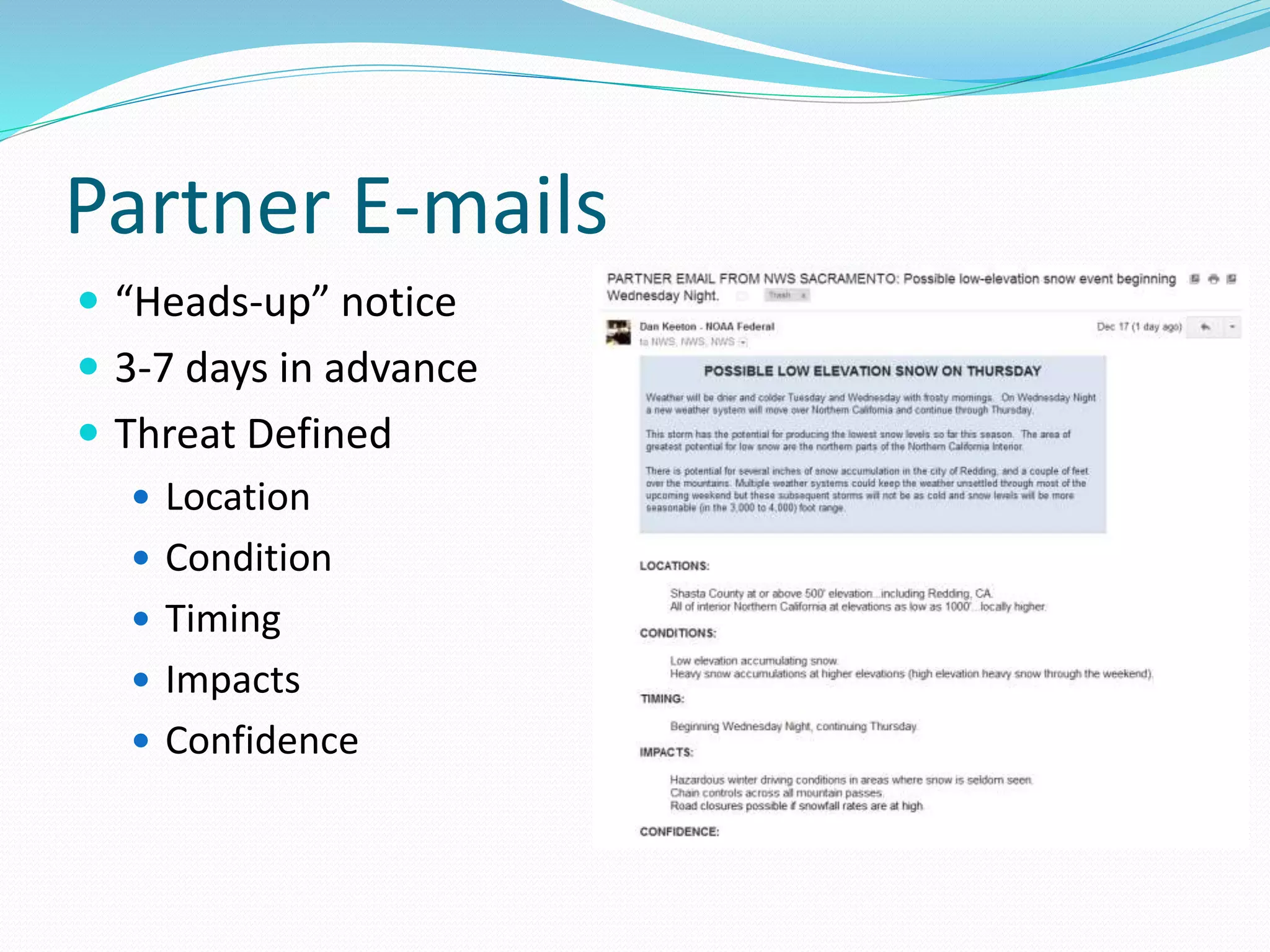
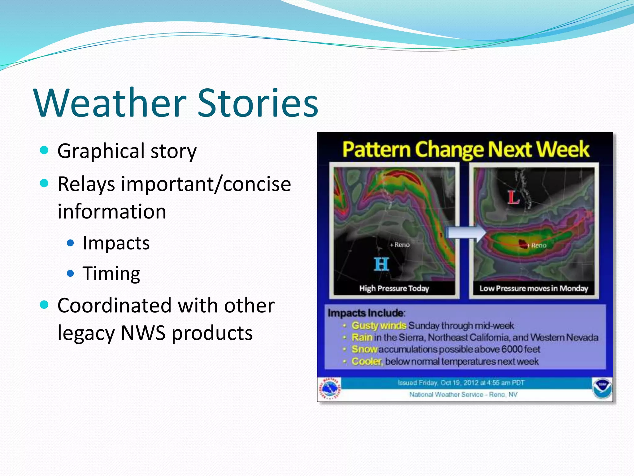
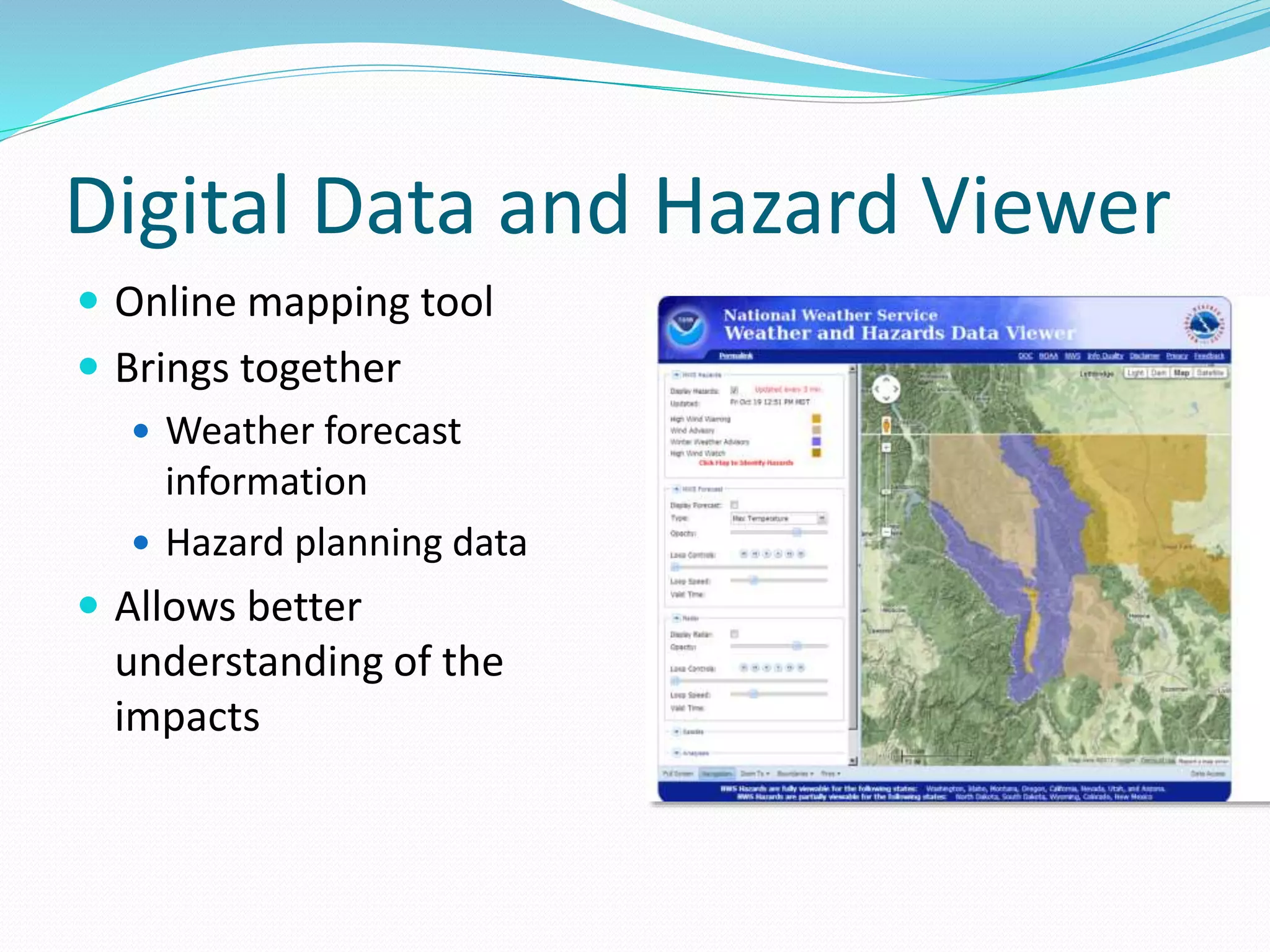
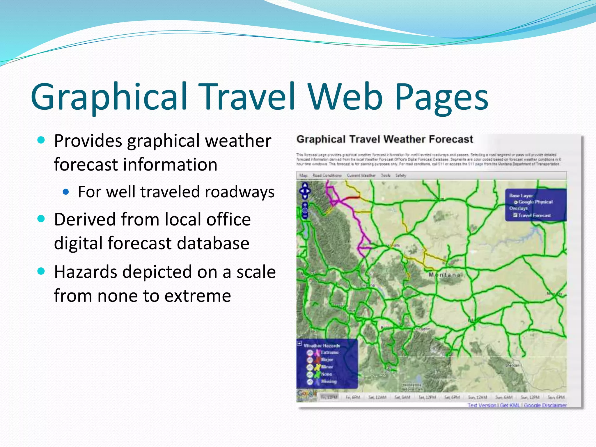
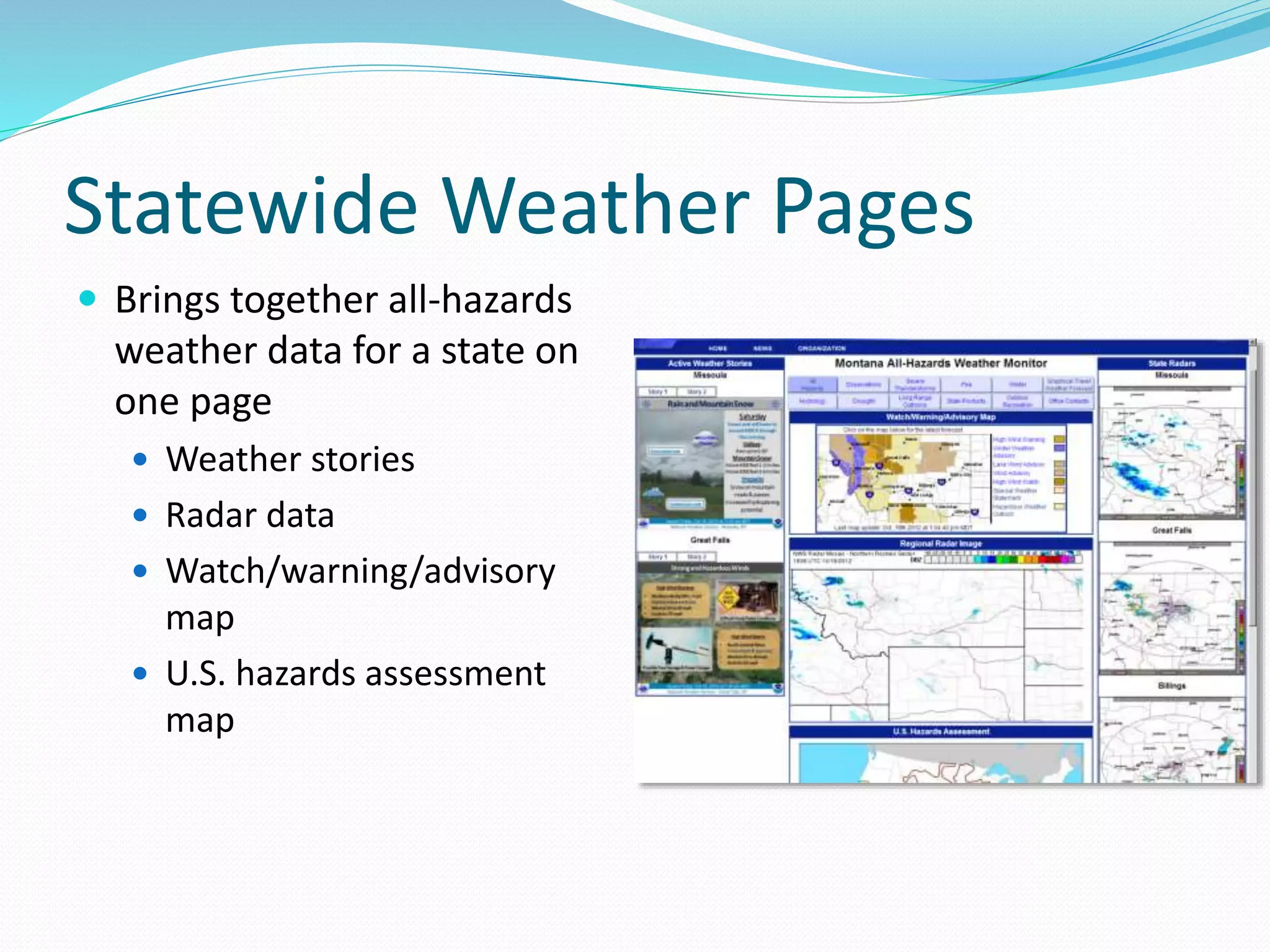
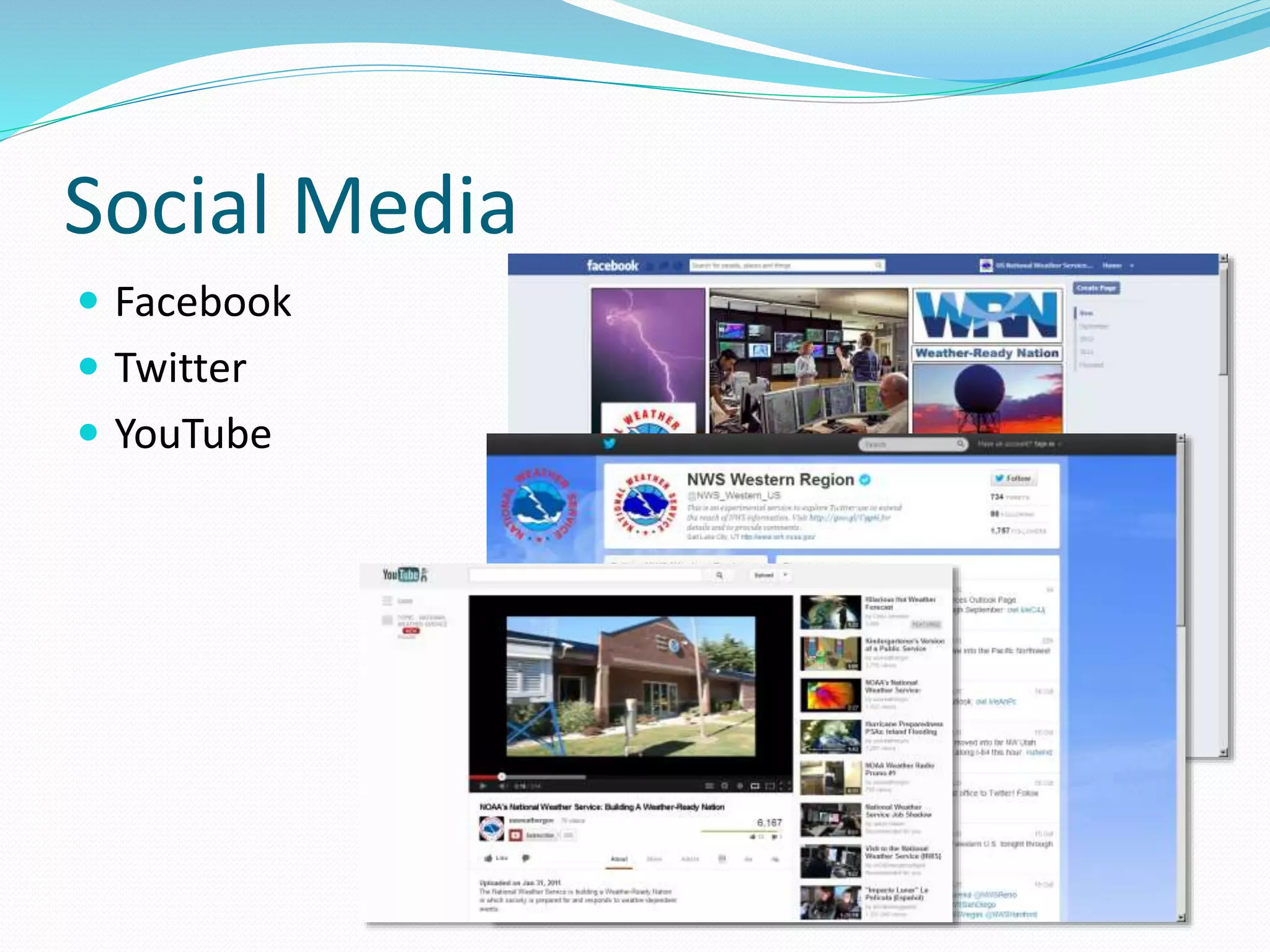
Todd Morris
NOAA/NWS
Salt Lake City, UT
801.803.4011
and
Jay Rosenthal
Air, Weather & Sea Conditions, Inc.
818.645.8632
93rd AMS Annual Meeting
Austin, TX
January 6-10, 2013
SuperStorm Sandy
October 29, 2012
2011 Weather Extremes
Weather Impacts
Motivation for this talk
 Emergency responders/planners know weather is
important but don’t always know, how, why, where, or
when
 The NWS is committed to helping with disaster response,
and has developed many valuable tools and processes for
helping emergency responders
Outline
 Weather – A Decisive Factor for Emergency Response
 Meteorology 101 Concepts for Emergency Managers
 Operationally Available Forecasts & Emergency Response
 Planning/Real-Time Information
Weather Can Be Decisive Factor for
Emergency Response
 Who will be in harms way?
 Damage & lethality?
 Plume model inputs?
 Emergency operations?
 Will conditions change?
 Terrain, coastal & altitude factors?
 Humidity, temp., clouds, wind?
 Are all decision-makers/responders using the same
representative meteorological data?
 Are historical data of value?
Variability of Weather Parameters
 Seasonal
 Summer stratus
 Santa Ana’s
 Diurnal
 Sea Breezes
 Drainage winds
 Daily stratus “burn-off”
 Hourly
The
Impact
Of
Changing
Winds
From NARAC, Lawrence Livermore National Laboratory
Satellite Imagery and Utility
 Seasonal and Diurnal Patterns of Cloud Cover
 Day vs. Night
 Morning vs. Afternoon
 Implications
 Radar Propagation
 Communications
Operationally Available Forecasts
• Website
• www.weather.gov
•Formats
• Narrative
• Table/Graph
• Gridded
• HAZMAT
• Spot Forecast
GIS Compatible Digital Forecast Data
http://www.wrh.noaa.gov/gis/index.php
 Derived from NWS gridded
forecasts
 Resolution is 2.5km
 Available for download in
shape file format
 3-hrly intervals
 Out to 7 days
 At least 12 sensible weather
elements
 NWS continues expanding
on this capability
July 11, 2007 Weather Support to Forensic Intelligence
Fire boundaries
shown for aerial
extent comparison
Piru (2003)
Simi (2003)
Topanga (2005)
Wind Speed and Direction in GIS
Decision Support Services
What Can Be Done
 Virtual conferences
 Town hall meetings
 WCMs
 On-site support
 Incident Meteorologists
Partner E-mails
 “Heads-up” notice
 3-7 days in advance
 Threat Defined
 Location
 Condition
 Timing
 Impacts
 Confidence
Weather Stories
 Graphical story
 Relays important/concise
information
 Impacts
 Timing
 Coordinated with other
legacy NWS products
Digital Data and Hazard Viewer
 Online mapping tool
 Brings together
 Weather forecast
information
 Hazard planning data
 Allows better
understanding of the
impacts
Graphical Travel Web Pages
 Provides graphical weather
forecast information
 For well traveled roadways
 Derived from local office
digital forecast database
 Hazards depicted on a scale
from none to extreme
Statewide Weather Pages
 Brings together all-hazards
weather data for a state on
one page
 Weather stories
 Radar data
 Watch/warning/advisory
map
 U.S. hazards assessment
map
Social Media
 Facebook
 Twitter
 YouTube
Takeaways
 Weather is obviously important to emergency
responders/planners
 Don’t always know, how, why, where, or when
 NWS is committed to helping
 Disaster response
 Real-time on-site support
 Incident meteorologist
 Developed many valuable tools and processes
Questions?

Weather and Decision Support for Emergency Managers

  • 1.
    Todd Morris NOAA/NWS Salt LakeCity, UT 801.803.4011 and Jay Rosenthal Air, Weather & Sea Conditions, Inc. 818.645.8632 93rd AMS Annual Meeting Austin, TX January 6-10, 2013
  • 2.
  • 3.
  • 4.
  • 6.
    Motivation for thistalk  Emergency responders/planners know weather is important but don’t always know, how, why, where, or when  The NWS is committed to helping with disaster response, and has developed many valuable tools and processes for helping emergency responders
  • 7.
    Outline  Weather –A Decisive Factor for Emergency Response  Meteorology 101 Concepts for Emergency Managers  Operationally Available Forecasts & Emergency Response  Planning/Real-Time Information
  • 8.
    Weather Can BeDecisive Factor for Emergency Response  Who will be in harms way?  Damage & lethality?  Plume model inputs?  Emergency operations?  Will conditions change?  Terrain, coastal & altitude factors?  Humidity, temp., clouds, wind?  Are all decision-makers/responders using the same representative meteorological data?  Are historical data of value?
  • 9.
    Variability of WeatherParameters  Seasonal  Summer stratus  Santa Ana’s  Diurnal  Sea Breezes  Drainage winds  Daily stratus “burn-off”  Hourly
  • 10.
  • 11.
    Satellite Imagery andUtility  Seasonal and Diurnal Patterns of Cloud Cover  Day vs. Night  Morning vs. Afternoon  Implications  Radar Propagation  Communications
  • 12.
    Operationally Available Forecasts •Website • www.weather.gov •Formats • Narrative • Table/Graph • Gridded • HAZMAT • Spot Forecast
  • 13.
    GIS Compatible DigitalForecast Data http://www.wrh.noaa.gov/gis/index.php  Derived from NWS gridded forecasts  Resolution is 2.5km  Available for download in shape file format  3-hrly intervals  Out to 7 days  At least 12 sensible weather elements  NWS continues expanding on this capability July 11, 2007 Weather Support to Forensic Intelligence
  • 14.
    Fire boundaries shown foraerial extent comparison Piru (2003) Simi (2003) Topanga (2005) Wind Speed and Direction in GIS
  • 15.
    Decision Support Services WhatCan Be Done  Virtual conferences  Town hall meetings  WCMs  On-site support  Incident Meteorologists
  • 16.
    Partner E-mails  “Heads-up”notice  3-7 days in advance  Threat Defined  Location  Condition  Timing  Impacts  Confidence
  • 17.
    Weather Stories  Graphicalstory  Relays important/concise information  Impacts  Timing  Coordinated with other legacy NWS products
  • 18.
    Digital Data andHazard Viewer  Online mapping tool  Brings together  Weather forecast information  Hazard planning data  Allows better understanding of the impacts
  • 19.
    Graphical Travel WebPages  Provides graphical weather forecast information  For well traveled roadways  Derived from local office digital forecast database  Hazards depicted on a scale from none to extreme
  • 20.
    Statewide Weather Pages Brings together all-hazards weather data for a state on one page  Weather stories  Radar data  Watch/warning/advisory map  U.S. hazards assessment map
  • 21.
    Social Media  Facebook Twitter  YouTube
  • 22.
    Takeaways  Weather isobviously important to emergency responders/planners  Don’t always know, how, why, where, or when  NWS is committed to helping  Disaster response  Real-time on-site support  Incident meteorologist  Developed many valuable tools and processes
  • 23.