![Andrew Bashfield, Stratelead: [email_address]](https://image.slidesharecdn.com/gitacad-gisworkshopnotes-090722004701-phpapp02/75/GITA-CAD-GIS-Workshop-Notes-10-2048.jpg)

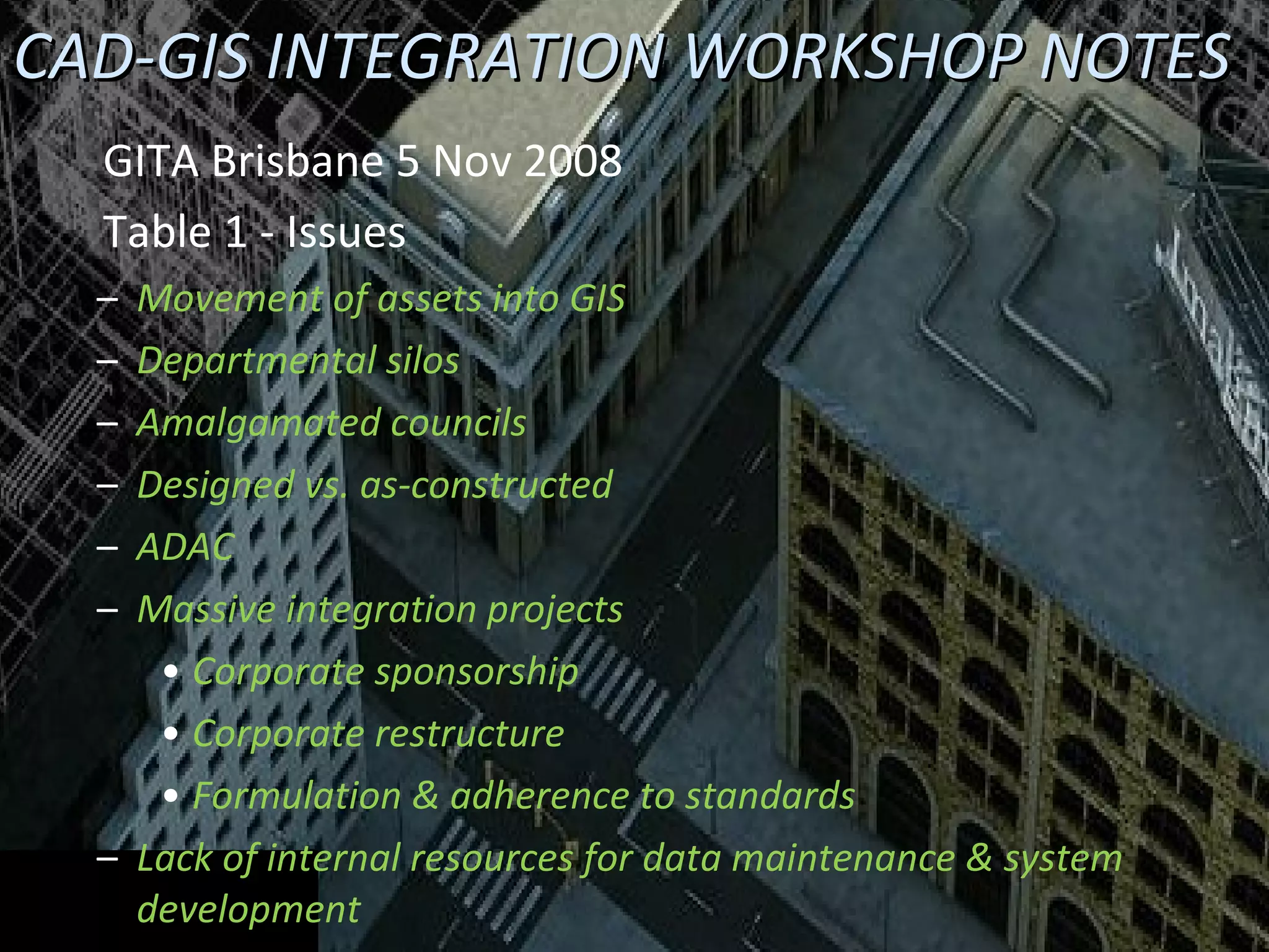
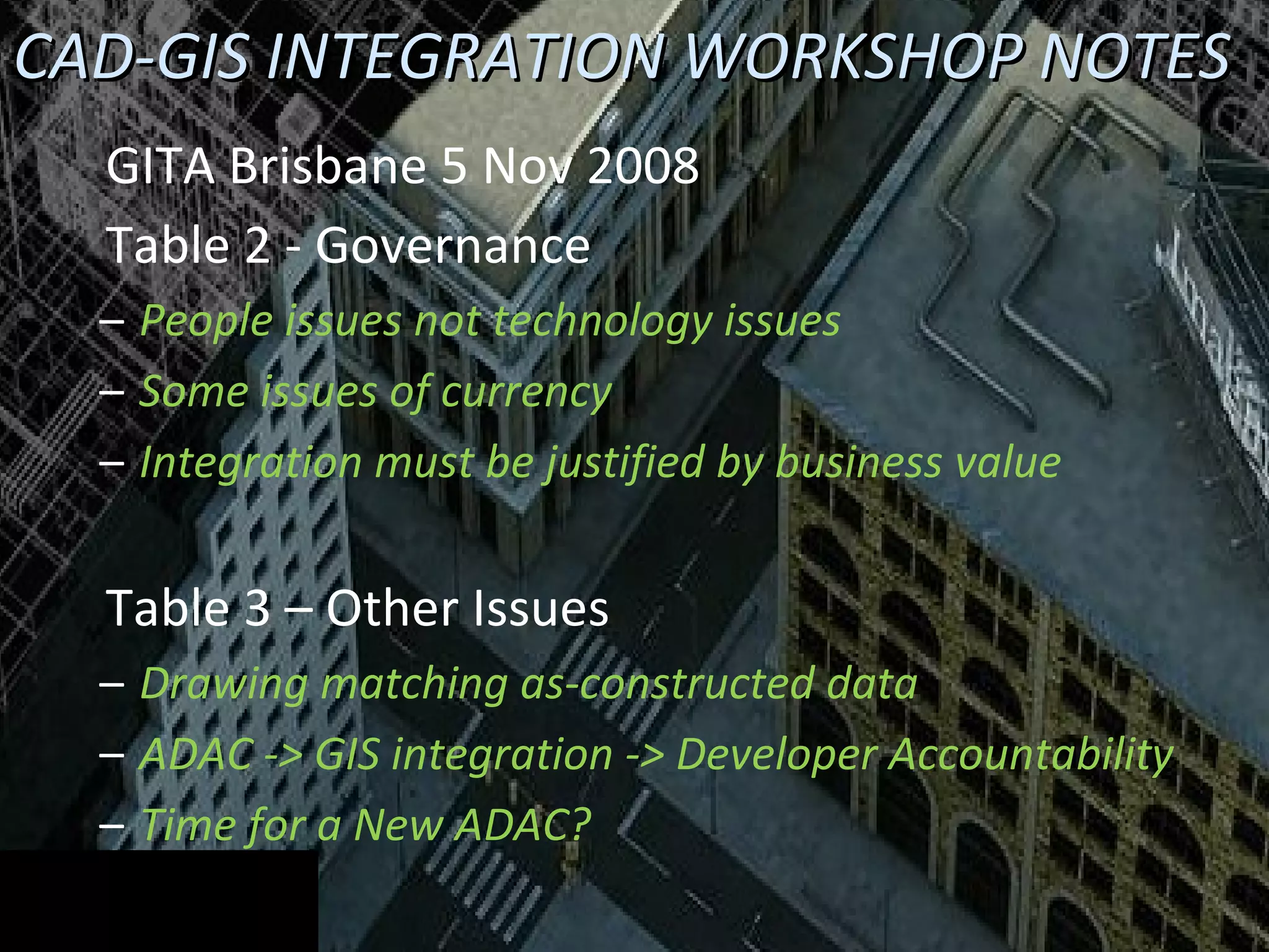
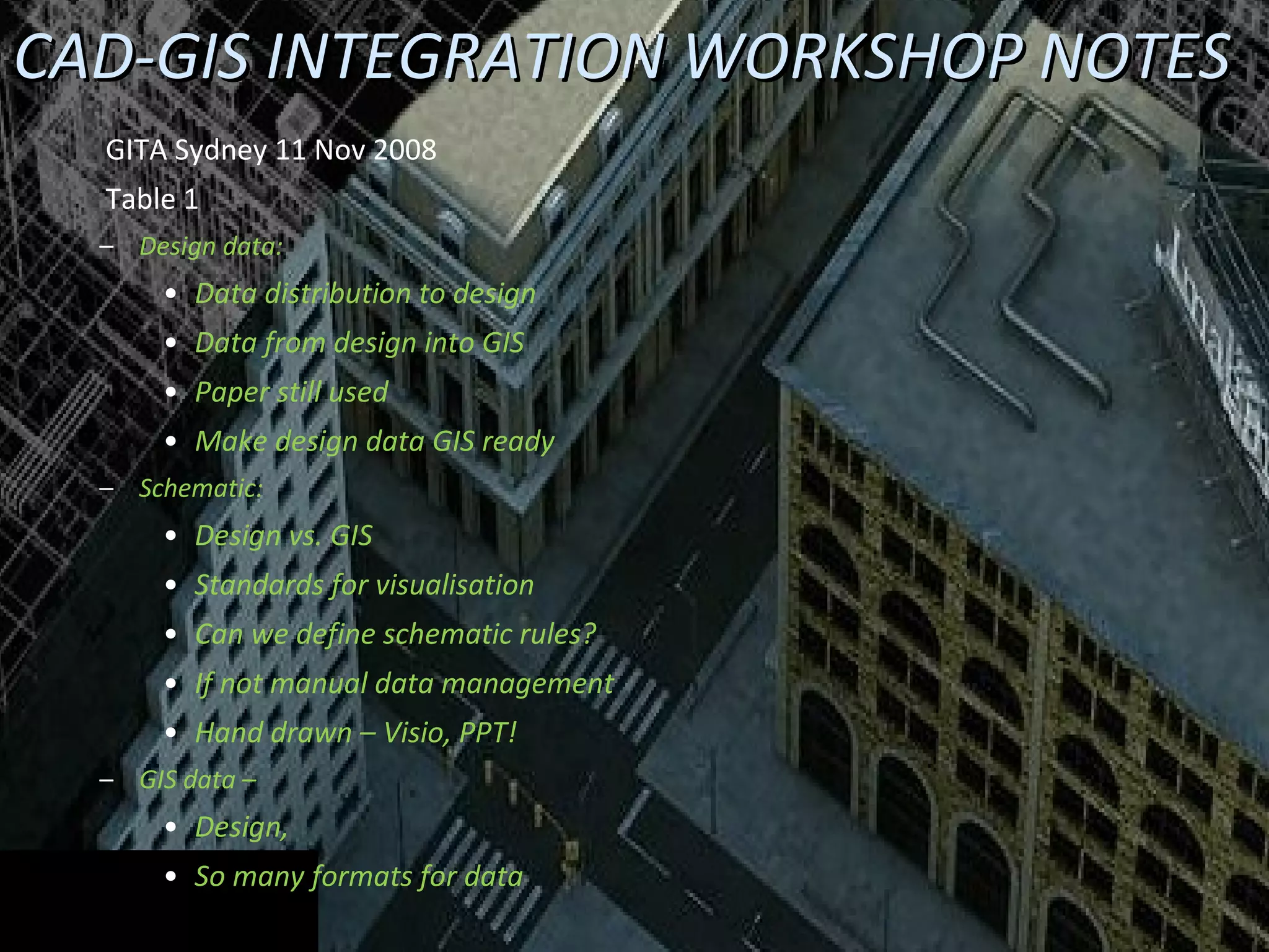
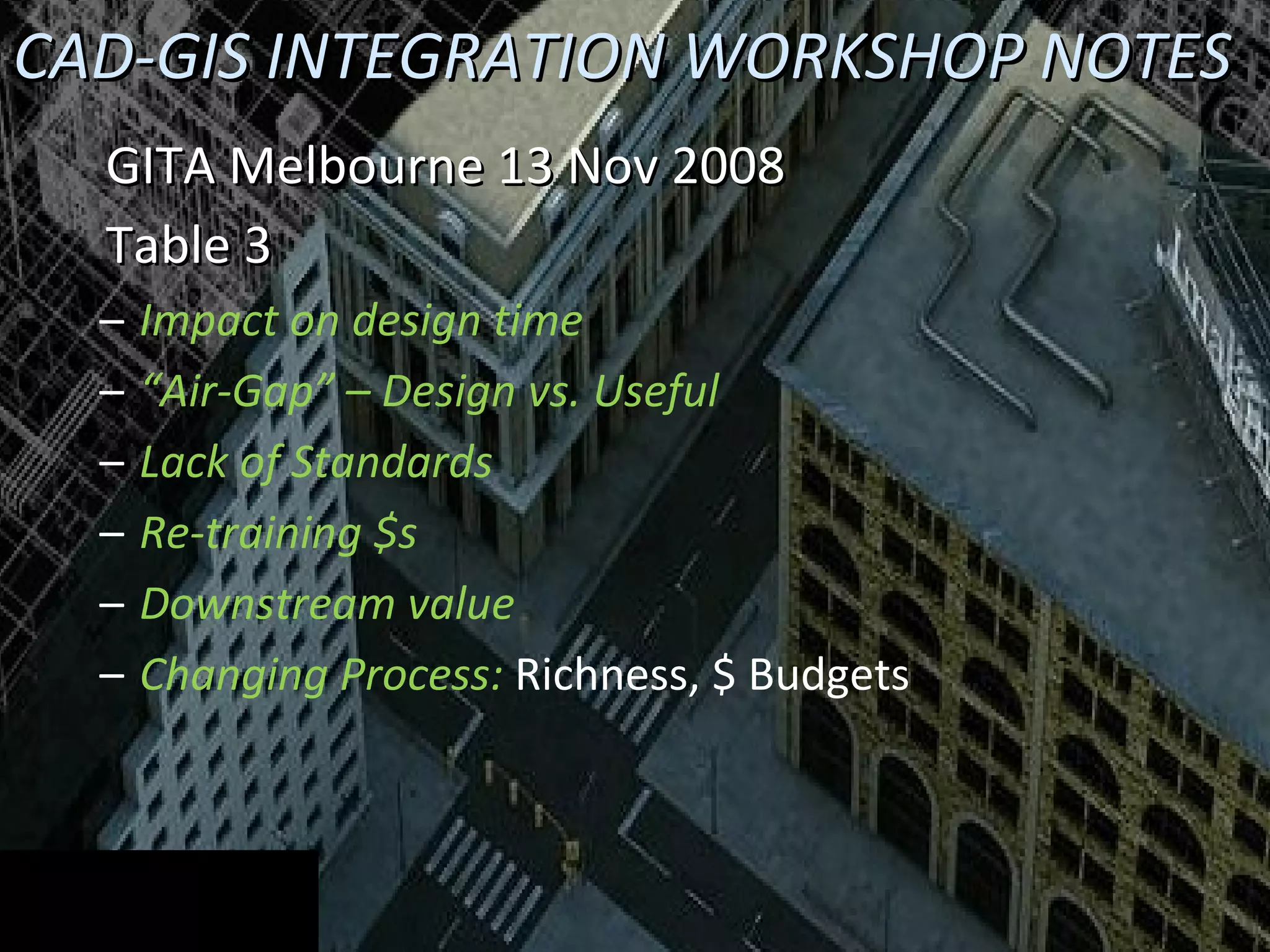
The document outlines workshop notes from GITA events in Australia and New Zealand regarding automated CAD and GIS integration for improved asset management. Key issues identified include governance challenges, data accuracy, lack of integration standards, and the need for standardization across industries. The notes emphasize that the integration challenges are often people-related rather than purely technical, highlighting the importance of business value justifications for integration efforts.


![Vibe Coding vs. Spec-Driven Development [Free Meetup]](https://cdn.slidesharecdn.com/ss_thumbnails/vibecodingvsspecdrivendevelopment-251209105622-43f455e7-thumbnail.jpg?width=640&height=640&fit=bounds)


