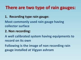
Welcome
B.Ed Course 106
Understanding Disciplines and school subjects:
geography
Topic: geographic Instruments
Presented by- Chaitali Savala
Guidance – kishore ubhe
What's the weather like?
GEOGRAPHIC INSTRUMENTS
• Geography is the study of the physical
features of the earth and the atmosphere
surrounding of the earth
• The instruments used to measure weather
and climate which gives answer like rainfall,
humidity & pressure and many more are
called geographical instruments.
SOME COMMON INSTRUMENT USED
IN PHYSICAL MEASUREMENT
• Thermometer
• Barometer
• Rain Gauge
• Seismograph
What is a thermometer
A thermometer is an instrument that is used to
measure temperature
• Thermo means heat
• Meter means to measure
Types of thermometer
There are various types of Thermometer. Here
are few examples
• Laser
• Probe
• Digital
• Fridge
• Infrared
Diagram of thermometer
Unit use for measuring the temperature
Unit:
1. Degree centigrade (c)
2. Degree Fahrenheit (f)
The function of a thermometer
• Thermometer are primarily used both in
hospitals and household to check and monitor
body temperature
• They are also used to gauge the temperature of
a given day for the meteorological department
• Other uses include checking the temperature of
food items like cake and pastries along with
scientifically measuring heat flow and low
temperatures
What is a barometer
An instrument measuring atmospheric pressure
(the weight of the air in the atmosphere)
How does barometer works
It can measure the pressure exerted by the
atmosphere using:
1. Water
2. Air
3. Mercury
The Barometer works by balancing the weight
of mercury level in the tube up or down against
the atmospheric pressure
What barometer looks like
Air pressure, which is what a barometer
measures, can determine what kind of weather
we are going to suspect.
Example:
High pressure, you suspect colder temperatures
while low pressure, you can look warmer
weather and rain
Function of a barometer
A Barometer measures air pressure
• Low pressure means bad weather because
evaporated water rises easier into the sky
and is turned into rain
• High pressure means good weather because
evaporated weather has difficulty rising
because of the higher air pressure
Rain gauge
Measures the amount of liquid precipitation
over a period of time
What is a rain gauge
• A rain gauge is an artifact used metrological
stations to help measure and collect
precipitations that fall in a certain place
• Precipitations are all hydrometer falling to
the earth from atmosphere including rain,
drizzle, hail, snow and sleet, fog, etc.
There are two type of rain gauges:
1. Recording type rain gauge:
Most commonly used rain gauge having
collector surface
2. Non recording:
A well calibrated system having equipments to
record on its own
Following is the image of non recording rain
gauge installed at Vigyan ashram
What does rain gauge look like
• The gauge look like the funnel on top of a
tube. This tube takes the measurement.
• Some rain gauge may have another tube
outside the first one.
• This part is used to collect the overflow water
from the first tube
Function of rain gauge
• Study of water resources
• Used to design water harvesting structures
• Measure intensity of rainfall
• Helps collecting information of rainfall with
respect to time
Seismograph
Seismograph is an instrument used to detect
and record earthquakes
Seismo, meaning “shock” or “earthquake”
Seismograph
A record written by a Seismograph in response
to ground motions produced by an earthquake,
explosion, or other ground motion sources
How does seismograph works
When the ground shakes, it shakes the base of
the seismograph but the pen stays steady
because the heavy weight will tend to stay still
because of its resistance to motion
Function of seismograph
• Help to record the motion of ground during
the earthquake
• Used in research of earthquakes
• By comparing the discrete seismograph
produced by various stations, researchers can
determine the earthquakes epicenter (the
point on the earths surface directly above the
origin of the quake)
• Study of the earth’s interior has been
directed towards searching for oil deposits,
testing for ground instabilities before
construction and tracking down subterranean
nuclear explosions.
MQC Questions
1. The weather instrument measures air pressure
• Wind wane
• Rain gauge
• Thermometer
• Barometer
2. This type instrument measures amount of precipitation
• Thermometer
• Barometer
• Rain gauge
• Anemometer
3. This type instrument measures in Fahrenheit
• Rain gauge
• Thermometer
• Barometer
• Wind wane
4. This measure instrument is called
• Rain gauge
• Barometer
• Thermometer
• Seismograph
5. What does seismo means
• Heat
• Sound
• Shock
• Rain
6. This instrument used to measure weather and climate are called as
• Rain gauge
• Geographical Instruments
• Thermometer
• Seismograph
Thank you

Geographical instruments presentation .pptx

  • 1.
  • 2.
    B.Ed Course 106 UnderstandingDisciplines and school subjects: geography Topic: geographic Instruments Presented by- Chaitali Savala Guidance – kishore ubhe
  • 3.
  • 4.
    GEOGRAPHIC INSTRUMENTS • Geographyis the study of the physical features of the earth and the atmosphere surrounding of the earth • The instruments used to measure weather and climate which gives answer like rainfall, humidity & pressure and many more are called geographical instruments.
  • 5.
    SOME COMMON INSTRUMENTUSED IN PHYSICAL MEASUREMENT • Thermometer • Barometer • Rain Gauge • Seismograph
  • 6.
    What is athermometer A thermometer is an instrument that is used to measure temperature • Thermo means heat • Meter means to measure
  • 7.
    Types of thermometer Thereare various types of Thermometer. Here are few examples • Laser • Probe • Digital • Fridge • Infrared
  • 8.
    Diagram of thermometer Unituse for measuring the temperature Unit: 1. Degree centigrade (c) 2. Degree Fahrenheit (f)
  • 9.
    The function ofa thermometer • Thermometer are primarily used both in hospitals and household to check and monitor body temperature • They are also used to gauge the temperature of a given day for the meteorological department • Other uses include checking the temperature of food items like cake and pastries along with scientifically measuring heat flow and low temperatures
  • 10.
    What is abarometer An instrument measuring atmospheric pressure (the weight of the air in the atmosphere)
  • 11.
    How does barometerworks It can measure the pressure exerted by the atmosphere using: 1. Water 2. Air 3. Mercury The Barometer works by balancing the weight of mercury level in the tube up or down against the atmospheric pressure
  • 12.
    What barometer lookslike Air pressure, which is what a barometer measures, can determine what kind of weather we are going to suspect. Example: High pressure, you suspect colder temperatures while low pressure, you can look warmer weather and rain
  • 13.
    Function of abarometer A Barometer measures air pressure • Low pressure means bad weather because evaporated water rises easier into the sky and is turned into rain • High pressure means good weather because evaporated weather has difficulty rising because of the higher air pressure
  • 14.
    Rain gauge Measures theamount of liquid precipitation over a period of time
  • 15.
    What is arain gauge • A rain gauge is an artifact used metrological stations to help measure and collect precipitations that fall in a certain place • Precipitations are all hydrometer falling to the earth from atmosphere including rain, drizzle, hail, snow and sleet, fog, etc.
  • 16.
    There are twotype of rain gauges: 1. Recording type rain gauge: Most commonly used rain gauge having collector surface 2. Non recording: A well calibrated system having equipments to record on its own Following is the image of non recording rain gauge installed at Vigyan ashram
  • 17.
    What does raingauge look like • The gauge look like the funnel on top of a tube. This tube takes the measurement. • Some rain gauge may have another tube outside the first one. • This part is used to collect the overflow water from the first tube
  • 18.
    Function of raingauge • Study of water resources • Used to design water harvesting structures • Measure intensity of rainfall • Helps collecting information of rainfall with respect to time
  • 19.
    Seismograph Seismograph is aninstrument used to detect and record earthquakes Seismo, meaning “shock” or “earthquake”
  • 20.
    Seismograph A record writtenby a Seismograph in response to ground motions produced by an earthquake, explosion, or other ground motion sources
  • 21.
    How does seismographworks When the ground shakes, it shakes the base of the seismograph but the pen stays steady because the heavy weight will tend to stay still because of its resistance to motion
  • 22.
    Function of seismograph •Help to record the motion of ground during the earthquake • Used in research of earthquakes • By comparing the discrete seismograph produced by various stations, researchers can determine the earthquakes epicenter (the point on the earths surface directly above the origin of the quake)
  • 23.
    • Study ofthe earth’s interior has been directed towards searching for oil deposits, testing for ground instabilities before construction and tracking down subterranean nuclear explosions.
  • 24.
    MQC Questions 1. Theweather instrument measures air pressure • Wind wane • Rain gauge • Thermometer • Barometer 2. This type instrument measures amount of precipitation • Thermometer • Barometer • Rain gauge • Anemometer 3. This type instrument measures in Fahrenheit • Rain gauge • Thermometer • Barometer • Wind wane
  • 25.
    4. This measureinstrument is called • Rain gauge • Barometer • Thermometer • Seismograph 5. What does seismo means • Heat • Sound • Shock • Rain 6. This instrument used to measure weather and climate are called as • Rain gauge • Geographical Instruments • Thermometer • Seismograph
  • 26.