This document summarizes information about potential earthquake zones in the Indian Ocean, including:
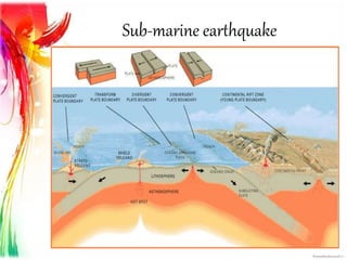
1) It discusses different types of plate boundaries like convergent, transform, and divergent boundaries that can cause submarine earthquakes. The Great Sumatran fault and Owen fracture zone are given as examples.
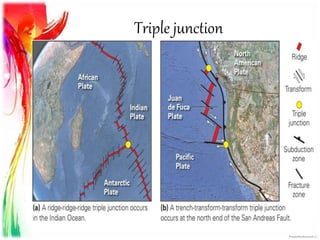
2) It describes triple junctions, which are points where three tectonic plates meet, and aulacogens, which are failed triple junction arms that can cause massive earthquakes. The Rodrigues triple junction in the Indian Ocean is mentioned.
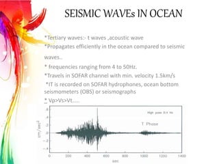
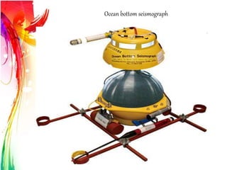
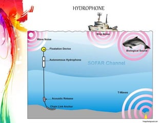
3) It provides an overview of seismic waves that propagate in the ocean, like t waves, and sensors like ocean bottom seismometers, geophones, and


![Polymer [ बहुलक ] Chemistry Notes PDF - Irfanullah Mehar - JJ Sir Chemistry.pdf](https://cdn.slidesharecdn.com/ss_thumbnails/polymerchemistrynotespdf-irfanullahmehar-jjsirchemistry-260210172118-3f9b37f7-thumbnail.jpg?width=640&height=640&fit=bounds)


