EGL MobileMT overview
•
0 likes•336 views

MobileMT general information, tech specifications, deliverables, applications.

Recommended
More Related Content
What's hot
What's hot (20)
Similar to EGL MobileMT overview
Similar to EGL MobileMT overview (20)
More from Expert Geophysics Limited
More from Expert Geophysics Limited (9)
Recently uploaded
Recently uploaded (20)
EGL MobileMT overview
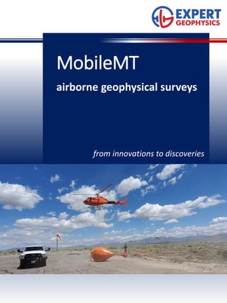
- 1. from innovations to discoveries MobileMT airborne geophysical surveys
- 2. Your airborne geophysics experts with worldwide experience At Expert Geophysics, innovation is essential part of our work. MobileMT is the latest innovation in airborne electromagnetic technology and the most advanced generation of airborne AFMAG technologies. MobileMT combines the latest achievements in electronics, advances of modern airborne system design, and sophisticated signal processing techniques. MobileMT technology utilizes naturally occurring electromagnetic fields in the frequency range of 25 Hz – 20,000 Hz band which are mainly associated with lighting discharges over the planet. Thunderstorms release energy, which is converted to electromagnetic fields that propagate through the ionosphere-Earth interspace. The electromagnetic fields and currents induced by these fields in the subsurface are used in MobileMT to understand the variations in the electrical resistivity of the subsurface. Through the audio-magnetotelluric principles, advanced engineering design and sophisticated mathematical solutions, MobileMT is the only system proven to deliver geoelectrical information from shallow to > 1 km depth range with high spatial (lateral and in-depth) and resistivity resolution. MobileMT system detects resistivity contrasts of geology structures and boundaries of any shape and in any direction due to total field (three components) measurements. Detectible resistivity range is not limited by the range of time-domain principle. 2
- 3. Technical features and specifications FEATURES An airborne bird, towed by a helicopter, measures variations of the magnetic field in the air with three orthogonal induction coils, while a ground station measures variations of the electric field in two orthogonal directions with four pairs of electrodes. The ratio of the magnetic field magnitude and the electric field magnitude provides analytic parameters in selected bands of frequencies. Advanced noise processing technique of both electronic and signal processing levels ensures high data quality. The lightweight, aerodynamic bird is ideal for conducting surveys using small helicopters in a cost-efficient manner. SPECIFICATIONS: ELECTROMAGNETICS Airborne receiver: Three orthogonal induction coils, 1.4 m diameter each Airborne shell: Aerodynamic shaped capsule Digitizing rate: 73,728 Hz Tow cable length: 97 m Weight: 250 kg Ground sensors: 4 pair of electrodes Frequency range: 25 – 20,000 Hz Output frequencies: Selectable and customizable up to 30 frequency windows Output computed parameters: apparent conductivity for selected frequency windows MAGNETICS Sensor: Geometrics cesium magnetometer G- 822A AUXILIARY EQUIPMENT GPS navigation system, radar altimeter, PC-104 data acquisition system. 3
- 4. Deliverable Products Mobile MT deliverable products comprise a full set of processed digital data and visual products: • Database of apparent conductivity for each frequency; • Database of effective resistivity with depth; • Database of magnetic field; • Apparent conductivity maps for selected frequencies; • Apparent resistivity-Depth transformation - 2D sections, depth slices and 3D voxels; • Inversions of apparent conductivity data into conductivity (or resistivity) values with depth (2D sections, depth slices and 3D voxels); • EM and magnetic lineaments maps; • Magnetic field transformation products; • Complex data analysis and targeting. 4
- 5. Applications: Mineral exploration Oil and Gas Geothermal Expert Geophysics has developed and engineered the next generation of airborne EM system to overcome limitations and expand abilities of previous technologies. MobileMT is only one airborne EM technology which provides depth of investigation from shallow to depth > 1 km in most common geoelectrical situations. Even in conductive environment MobileMT significantly exceeds the depth of investigation of time-domain systems. MobileMT is the first system from the AFMAG family which has so high digitizing rate of measurements; both, magnetic and electric components; broad frequency range in four orders divided up to 30 customizable windows- channels. MobileMT is the fast solution for 3D geoelectrical mapping applied to any kind of geologic prospecting project which includes resistivity differentiation even in a narrow range. 5