This document summarizes a geospatial analysis of two watersheds - Bailey's Brook and Maidford River - on Aquidneck Island, Rhode Island. The analysis aimed to identify "critical management zones" with a high risk of generating and transporting pollutants to drinking water reservoirs. The analysis used land use data to identify areas with high pollutant potential, like agriculture and developed areas. It also used soil and topography data to map hydrologically sensitive areas prone to generating runoff. By overlapping these maps, the analysis identified and mapped specific locations where high pollutant risk areas overlapped with high runoff risk areas, representing critical zones for targeted water quality management. Maps and a geospatial database of these results
This research makes use of the remote sensing, simulation modeling and field observations to assess the non-point source pollution load of a Himalayan lake from its catchment.
This research is about an integrated impact analysis of socioeconomic and biophysical processes at the watershed level on the current status of Dal Lake using multi-sensor and
multi-temporal satellite data, simulation modelling together with field data verification. Thirteen watersheds (designated as ‘W1–W13’) were identified and investigated
for land use/land cover change detection, quantification of erosion and sediment loads and socioeconomic analysis (total population, total households, literacy rate and economic development status).
Watershed Characterization And Management Planning In Wular Catchment [www.wr...WriteKraft Dissertations
Writekraft Research and Publications LLP was initially formed, informally, in 2006 by a group of scholars to help fellow students. Gradually, with several dissertations, thesis and assignments receiving acclaim and a good grade, Writekraft was officially founded in 2011 . Since its establishment, Writekraft Research & Publications LLP is Guiding and Mentoring PhD Scholars.
Our Mission
“To provide breakthrough research works to our clients through Perseverant efforts towards creativity and innovation”.
Vision
Writekraft endeavours to be the leading global research and publications company that will fulfil all research needs of our clients. We will achieve this vision through:
Analyzing every customer’s aims, objectives and purpose of research
Using advanced and latest tools and technique of research and analysis
Coordinating and including their own ideas and knowledge
Providing the desired inferences and results of the research
In the past decade, we have successfully assisted students from various universities in India and globally. We at Writekraft Research & Publications LLP head office in Kanpur, India are most trusted and professional Research, Writing, Guidance and Publication Service Provider for PhD. Our services meet all your PhD Admissions, Thesis Preparation and Research Paper Publication needs with highest regards for the quality you prefer.
Our Achievements
NATIONAL AWARD FOR BEST RESEARCH PROJECT (By Hon. President APJ Abdul Kalam)
GOLD MEDAL FOR RESEARCH ON DISABILITY (By Disabled’s Club of India)
NOMINATED FOR BEST MSME AWARDS 2017
5 STAR RATING ON GOOGLE
We have PhD experts from reputed institutions/ organizations like Indian Institute of Technology (IIT), Indian Institute of Management (IIM) and many more apex education institutions in India. Our works are tailored and drafted as per your requirements and are totally unique.
From past years our core advisory members, research team assisted research scholars from various universities from all corners of world
Subjects/Areas We Cover
Management, Commerce, Finance, Marketing, Psychology, Education, Sociology, Mass communications, English Literature, English Language, Law, History, Computer Science & Engineering, Electronics & Communication Engineering, Mechanical Engineering, Civil Engineering, Electrical Engineering, Pharmacy & Healthcare.
Prospects and challenges in development of ground water resources of bangladesh Jahangir Alam
Prospects and Challenges in Development of Ground Water Resources of Bangladesh:
Groundwater is an important resource for livelihoods and the food security of billions of people, and especially in booming Asia’s agricultural economies. Globally, groundwater provides approximately 50% of current potable water supplies, 40% of the industrial water demand, and 20% of the water used for irrigation (UNESCO 2003).
The Groundwater Information Center, California (2003) reported that although surface water and groundwater appeared to be two distinct sources of water but in fact they are not. Surface water and groundwater are basically one singular source of water connected physically in the hydrologic cycle.
Therefore, Development of Ground Water Resources of Bangladesh is an important issue.
OBJECTIVES:
To know the current status of Groundwater in Bangladesh
To find out the challenges of Groundwater problem in Bangladesh
To know the adaptation against Challenges of Groundwater
Why groundwater is important:
Groundwater makes up nearly 30% of all the world’s freshwater; only 0.2% is found in lakes, streams or rivers and 70% is bound up in snow and ice on mountains and in the polar regions.
Groundwater plays a number of very important roles in our environment and in our economies. In the environment it supports rivers, lakes and wetlands, especially through drier months when there is little direct input from rainfall.
The flow of groundwater into rivers as seepage through the river bed, known as base flow, can be essential to the health of wildlife and plants that live in the water.
Groundwater also responds slowly to changes in rainfall, and so it stays available during the summer and during droughts when rivers and streams have dried up.
Groundwater doesn’t require expensive reservoirs to store water in before it is used.
Physical Context:
Bangladesh is located at the lowermost reaches of Ganges – Brahmaputra - Meghna river system which drains 1.72 million km2 of land. Crucially, Bangladesh itself comprises only 8% of the watershed.
Generally, four major physiographic units exist at the surface of Bangladesh. These are:
Tertiary sediments in the northern and eastern hills
Pleistocene Terraces in the Madhupur and Barind Tracts
Recent (Holocene) floodplains of the Ganges, the Brahmaputra and the Meghna rivers and
The Delta covering the rest of the country.
Most of the present land surface of the country covered by the Holocene flood plains deposited by the GBM river systems.
WATERSHED MANAGEMENT - INTRODUCTION
DEFINITION, CONCEPTS OF WATERSHED DEVELOPMENT, OBJECTIVES, INTEGRATED AND MULTI DISCIPLINARY APPROACHES, CHARACTERISTICS OF WATERSHED
A Major Irrigation Project (Accelerated Mahaweli Programme) and the Chronic K...Agriculture Journal IJOEAR
Abstract— The Mahaweli River is the longest river in Sri Lanka. In 1978, the government of Sri Lanka launched the Accelerated Mahaweli Development Programme, under the purview of Mahaweli Authority of Sri Lanka, the largest irrigation program in the country. It is a multi-purpose development scheme designed for the generation of hydroelectricity, irrigation, and water for domestic consumption. Since the mid-1990s, a major, non-infectious epidemic of chronic kidney disease of multifactorial origin (CKDmfo) has been reported in Sri Lanka for which no cause has been identified. This disease predominantly affects dry zonal, agricultural regions, particularly the North Central Province (NCP). During the past two decades, thousands of people have died due to this disease. This article assesses whether there is a relationship between this environmental impact from this major irrigation project and the deadly disease of CKDmfo. Water in the Mahaweli River is known to be polluted with various compounds, including phosphates coming from the excessive use of fertiliser in the hill country. However, the levels of phosphate in the Mahaweli River and in the NCP reservoirs are less than 0.15 mg/L. Such levels can cause ecological harm but are not a threat to human health nor causes renal failure. In addition, there are large regions outside the Mahaweli-fed localities where people are affected with CKDmfo. Thus, it is unlikely that water from the Mahaweli River itself is directly related to the occurrence of CKDmfo, but its harmful environmental impact is noticeable. Nevertheless, excess phosphates can cause algae blooms and cyanobacterial growth in water bodies, which harm aquatic lives and the ecology. Thus, governments and society must take responsibility and initiate actions to minimise environmental harm, protect and preserve the watersheds, curb the overuse of agrochemicals, and preserve water quality and the environment for current and future generations.
Dislocation, Relocation and Root Search: a Study of Bharati Mukherjee’s Desir...iosrjce
Mukherjee’s protagonists are all sensitive and are differently trained in the new ethnic imagination.
They are tossed in an environment of ambivalence regarding their identity, racism, sexism and other social
oppression. They negotiate displacement and face the multicultural reality in the process of cultural
differentiation and assimilation. Bharati Mukherjee has explored many facets of diasporic consciousness and
immigrant experience of dislocations, ruptures and relocation of the migrant women in her fictions. She has
dealt with the ambivalence of their psychic and spatial identity and the trauma of dislocations at multiple levels.
The impact of patriarchy on the Indian society varies from the one in the West and therefore Mukherjee has
tried to evolve her own strand of feminism grounded in the truth of compulsory displacement that they
recurrently undergo. Indian expatriate writers do not write from all exclusive foreignness of their identity but
their writing reflects the perspective of someone caught between two cultures. Migrancy and dislocation, either
consensual or conflictual, is a global and trans-cultural necessity. In her earlier novels, diasporic
transmigration meant new opening and emancipation from the clutches of convention bound society. In these
novels, attachment to one’s own native culture and homeland, living abroad was presented as something to be
spurned and total assimilation into the host culture was hailed. It is to create a location of the presence that
reduces the diasporic individual to delink the past and deconstruct the future. In Desirable Daughters
Mukherjee considers different pattern of belonging in the Global perspectives from in-between temporality to
assimilative permanence and further, hyphenated and unmixed nationness.
TEKDEZ Su deposu temizliği, su deposu dezenfekte, izolasyon hizmetleri, depo izolasyon, su sebili temizliği, su sebil ozonloma, su tesisatı temizliği, soğutma kulesi temizliği hizmeti verir.
TEKDEZ dezenfeksiyon ve izolasyon alanlarında teknik altyapısını, 8 yıllık tecrübesiyle birleştirerek, konusunda uzman deneyimli kadrosu ile Türkiye genelinde sektöründe öncü firmalara hizmet sunmaktadır. TEKDEZ kurulduğu günden bu yana müşterilerine hizmetin en iyisini sağlamakla birlikte kendisini sürekli geliştirmeyi ve yenilemeyi ilke edinmiştir.
www.tekdez.com
“What makes a river so restful to people is that it doesn’t have any doubt - it is sure to get where it is going, and it doesn’t want to go anywhere else.”
IRJET-Towards Conservation of World Famous Dal Lake – A Need of HourIRJET Journal
Mudasir Ahmad Wani, Ashit Dutta, M. Ashraf Wani, Umer Jan Wani, "Towards Conservation of World Famous Dal Lake – A Need of Hour", International Research Journal of Engineering and Technology (IRJET), Vol2,issue-01 March 2015. e-ISSN:2395-0056,p-ISSN:2395-0072. www.irjet.net,published by Fast Track Publications
Abstract
Lakes play an important role in the economy of a region. Dal Lake has historically been the centre of Kashmiri civilization and has played a major role in the economy of Kashmir through its attraction of tourists as well as its utilization as a source of food and water. Preservation of world famous Dal Lake hence, is need of hour. The aim of this study is identification and monitoring of effluent discharge and to suggest strategies for prevention of water pollution of Dal Lake. A descriptive methodology utilizing observational site survey, study of relevant records and interview technique for identification and monitoring of effluent discharge taking place into Dal Lake was carried out. Accordingly, Strategies for treatment of effluents discharged are suggested for prevention of water pollution of Dal Lake. The study revealed that effluent discharge taking place into the Dal Lake pollutes its water on daily basis. Pollutants that enter in Dal Lake are sewage and sullage, agriculture runoff, detergents and soaps, soil erosion from catchment areas, animal waste, solid wastes and wastes from houseboats, hotels and business establishments. The study is unique in that it reports on important issue of environmental degradation of world famous Dal Lake. Various measures proposed for conservation of lake including afforestation and control of grazing animals in the catchment area, removal of house boats and hotels and rehabilitation of their owners and inhabitants living in and around Dal at a suitable place, removal of excess weeds on continuous basis, construction of sanitation latrines for villagers, reducing use of chemical pesticides, avoiding use of commercial fertilizers, installation of STPs, restoring “Nallah Mar” and continuous monitoring of lake environment are expected to reduce the pollution and hence, preservation of the lake.
Adaptation to global change must include prudent management of groundwater as a renewable, but slow-feedback resource in most cases. Groundwater storage is already over-tapped in many regions, yet available subsurface storage may be a key to meeting the combined demands of agriculture, industry, municipal and domestic water supply, and ecosystems during times of shortage.
Water quality modeling of an agricultural watershed with best management prac...eSAT Publishing House
IJRET : International Journal of Research in Engineering and Technology is an international peer reviewed, online journal published by eSAT Publishing House for the enhancement of research in various disciplines of Engineering and Technology. The aim and scope of the journal is to provide an academic medium and an important reference for the advancement and dissemination of research results that support high-level learning, teaching and research in the fields of Engineering and Technology. We bring together Scientists, Academician, Field Engineers, Scholars and Students of related fields of Engineering and Technology
Water quality modeling of an agricultural watershed with best management prac...eSAT Journals
Abstract Simulation of Best Management Practices (BMPs) affecting water quality is necessary while modeling the water quality of agricultural watersheds with BMPs in place to mitigate pollution of river. Previous studies explored methods to represent some of the water quality BMPs. However, there are still gaps in the research to represent some other BMPs such as constructed wetlands, wastewater reuse, residue management and nutrient management. This paper focuses on modeling of BMPs affecting water quality. The study area is a 1692 Km2 cultivated watershed in South Texas, USA where water quality is impaired for dissolved oxygen (DO). The water quality constituents analyzed for the study are sediment, nitrogen, phosphorus, water temperature and dissolved oxygen. Apart from identification of methodology to simulate BMPs, this study estimated extent of pollution mitigation by each type of BMP. Binomial method of water quality analysis was used to judge the compliance of river reach for meeting DO criterion. This manuscript will discuss modeling of water quality constituents and the BMPs that affect water quality. In addition, the estimation of dissolved oxygen compliance of the watershed is also discussed. The results from the study indicate that the agricultural BMPs implemented in the watershed and establishment of stringer water quality criteria have in fact improved the DO trends in the tidal section of the river, which did not meet the stipulated DO criterion before. Index Terms: Arroyo, BMP, dissolved oxygen, residue management, nutrient management, water quality
The Ontario Municipal Board recently ruled against the Region of Waterloo for measures the Region took to curb urban sprawl. Here are the reasons why I believe they should rescind their decision.
Water H₂OECS 1116 September 2016Donald B. OlsonProb.docxcelenarouzie
Water: H₂O
ECS 111
6 September 2016
Donald B. Olson
Problems with Water:
Demise of the Marsh Arabs
What sets the scales for water as a commodity?
What sets the price of water?
How does water quality enter the picture?
Is there a need to protect the price of water for some specific uses?
Does the last question suggest that waters has different worth under free trade?
When does water lead to diplomatic problems including war?
National Geo. Apr. 2010
Water in our Ecosystems: Cont.
Adequate water: Domestic, industrial, agricultural uses, and the rest of nature
Sustainability of water supplies: Future use
Maintenance of water quality: Pollution from natural (salt), industrial/agriculture, domestic sources.
Trans-boundary issues: Sharing water between cities/rural districts, states, countries.
Natural Saline Waters
Colorado River
Sources of fresh water:
Ground water: Aquifers
- Volume (km³), removal rate (km³/sec)
– Issue recharge rates and depletion times
Rivers and streams: Runoff in channels
- Volume transport (km³/sec)
- Downstream water quality
Lakes: Still waters, natural and dam created
- Volume exchange: Residence times
- Water quality and pollution build up
Residence and depletion times:
Residence time:TR Equilibrium (Steady State)
Depletion rates:TD
Rate of resource decay
Problems to consider:
Calculate the residence times for the different water pools in the last lecture (see Tables).
Discuss the assumptions you have to make to turn these global numbers into something that might be useful for policy. (What do you have to assume?)
Choose a lake that you are interested in and work out its water balance.
Calculate a depletion time for an aquifer.
Water Stocks in the Environment
21
From: Chow, Maidment and Mays, Applied Hydrology, McGraw Hill, 1988
Water Fluxes in the Environment
Salinity ~ 35 gm salt/kg sea water; potable water < 19
22
More on freshwater availability
23
Global Water Balance (land)
Rainfall (119,000 km3/yr or 31 in) =
Evapotranspiration (72,000 km3/yr or 19 in) +
Runoff (44,700 km3/yr or 11.7 in) +
Infiltration (2,200 km3/yr or 0.3 in)
Conclusion: the world lives on a “water budget”
24
Stocks and Fluxes
Budgeting of an environmental stock takes place over a period of time (day, month, year, etc).
[Change in Stock] = [Flux In]
- [Flux Out]
+ [Stock created]
- [Stock withdrawn]
25
Rainfall Data
Annual Rainfall in the Continental US, 1895-2003
Source: NOAA (www.noaa.gov)
26
Evaporation
Found by “evaporation pans”
Actual Evaporation =
Pan Evaporation x 0.70
27
Transpiration
Vegetation uptake and release of water for metabolic (growth) purposes
Uptake takes place through the roots
Release takes place through the leaves (stomata)
Vegetation functions as a “pass-through” for water
28
Source: Laio et al., Advances
In Water Resources 24, p. 708,
.
Water H₂OECS 1116 September 2016Donald B. OlsonProb.docx
dustin major paper-final version
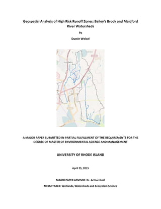
1. Geospatial Analysis of High Risk Runoff Zones: Bailey’s Brook and Maidford
River Watersheds
By
Dustin Weisel
A MAJOR PAPER SUBMITTED IN PARTIAL FULFILLMENT OF THE REQUIREMENTS FOR THE
DEGREE OF MASTER OF ENVIRONMENTAL SCIENCE AND MANAGEMENT
UNIVERSITY OF RHODE ISLAND
April 25, 2015
MAJOR PAPER ADVISOR: Dr. Arthur Gold
MESM TRACK: Wetlands, Watersheds and Ecosystem Science
2. Abstract
Water quality throughout the Bailey’s Brook and Maidford River watersheds poses a problem to
potable drinking water reservoirs and coastal water quality on Aquidneck Island, Rhode Island. This
major paper focused on geospatial analyses to locate critical management zones that have a high risk of
generating and delivering pollutant loads to receiving waters. These locations represent areas worthy of
further consideration for water quality restoration practices. Critical management zones were identified
as the intersection of hydrologically sensitive areas that generate overland runoff with land use
locations areas with high potential for pollutant loading areas. Geospatial coverages of soil wetness,
runoff curve number and wetlands were produced to highlight hydrologically sensitive areas; while
developed land uses, such as agriculture, commercial and dense residential areas were identified as high
risk areas of pollutant generation. Critical management zones are an essential component of strategic
targeting that can promote efficient investments for water quality improvements. Maps and a
documented geospatial database for the two watersheds were produced and made available for future
use to highlight and locate these critical watershed management zones.
Introduction
Pollution from urban non-point sources is one of the main reasons that rivers and receiving
waters (e.g., lakes, reservoirs and estuaries) fail to reach their state and national water quality objectives
(Mitchell, 2004). Non-point source pollution often involves a plethora of pollutants including sediments,
nutrients, pesticides and pathogens (Walter et al., 2000). Although non-point pollution was initially
envisioned as difficult to locate, there has been an increasing recognition that advances in geospatial
3. data can provide insight into the combination of factors can create hotspots of nonpoint pollution.
These hotspots typically include zones that combine a high likelihood for offsite hydrologic transport
with elevated sources of pollutants. If these hotspots can be identified, they can provide a basis for
strategic protection and restoration efforts by local planners and water quality organizations. These
hotspots are also referred to as “Critical Management Zones” by various researchers (Figure 1; Walter et
al., 2000; Gburek et al., 2002).
Hydrologically Sensitive Areas (HSA) is saturated areas in a watershed that generate runoff
creating a potential transport for pollution into nearby waterways (Walter Et al., 2000). Hydrologically
Sensitive Areas are not a nonpoint pollution problem unless they coincide with a Pollutant Loading Area.
Some examples of Pollutant Loading Areas are agricultural fields, residential areas and commercial
properties. Increases in the percent agriculture and percent urban development throughout at
watershed are frequently associated with declining water quality, with increases in the surface water
concentrations of nitrogen, phosphorus and fecal coliform bacteria are related (Mehaffey, Et al., 2005) .
A key strategy for controlling nonpoint source pollution is to minimize the pollutant loading on a HAS
(Frankenberger, Et al., 1999). The management area to focus on is where the HSA and Pollutant Loading
Areas correspond as the Critical Management Area. Critical Management zones are found when field
4. boundaries (Pollutant Loading Area) are spatially overlaid by the saturation area (HSA). Identifying and
reducing offsite pollution from critical management areas within a watershed can be an efficient way to
minimize the amount of pollutants transported in surface runoff (Walter, et al., 2000).
Purpose
In this major paper, I will generate maps and geospatial databases of potential hot spots of
nonpoint pollution for two watersheds, Bailey’s Brook and the Maidford River, that contribute to the
drinking water reservoirs on Aquidneck Island, RI (Figure 2a and 2b – show a map with the watersheds
and the reservoirs). These reservoirs have degraded water quality and require advanced water
treatment to generate potable water for the Aquidneck Island residents (McLaughlin, 2014). I will use
land use to identify high-risk areas of pollution and combine those areas with analyses that predict
locations at high risk for overland runoff. These hotspot maps are intended to assist water quality
managers at the local and state level in their efforts to target restoration efforts in a strategic fashion
and thus reduce watershed pollution in a more cost efficient fashion.
Background
This paper is focused on the attributes of two watersheds Bailey’s Brook and Maidford River, in
Middletown, RI on Aquidneck Island that drain into drinking water reservoirs(North Easton Pond,
Gardiner and Nelson Ponds) that are deemed to be impaired due to issues with excessive nitrates and
bacteria (RIDEM a, 2013). Both of these watersheds are undergoing TMDL studies (McLaughlin, 2014).
Total Maximum Daily Load (TMDL) is a phrase that EPA and State’s use to reflect studies and programs
used to restore impaired waters. Formally, it represents the maximum daily input of a particular
pollutant that will not impair the functions and value of water body. The assumption is that if the
loading (i.e., input) of a pollutant increases over the TMDL, water quality issues will occur. TMDL studies
are now underway on these watersheds.
5. Bailey’s Brook is a 4.8-mile long stream with two flowing branches that join at North Easton
Pond. The southern flowing stream moves through North Easton Pond to South Easton Pond where it
empties into the Atlantic Ocean at Easton’s Beach. North Easton Pond is one of the key water supply
reservoirs serving Aquidneck Island residents. The Bailey’s Brook watershed cover approximately 3.1
square miles and is highly developed with 68% of the total watershed being built up; 32% of the area is
impervious cover (RIDEM a, 2013). Impervious cover is defined as land surface areas that force water to
runoff and not infiltrate into the soils, such as roofs and roads. Currently about 15% of the watershed is
agriculture, 12% is forested or non-developed, and 4% is covered with wetlands. Rhode Island Nursery
is the largest agricultural operation in the watershed. Based on Rhode Island DEM’s study, the nursery is
potentially important for putting phosphorus into Bailey’s Brook (RIDEM a, 2013). The soils of the
watershed are almost all classified as hydrologic group C by the USDA Natural Resource Conservation
Service SSURGO soil maps. Hydrologic C soils cause water to infiltrate slowly and have a hardpan layer
at 2-6 feet that restricts deep percolation and can cause periods of shallow water tables. Most of the
residents have sewers, but a few have septic systems that could fail and cause raw sewage to make its
way into Bailey’s Brook (RIDEMa, 2013).
The other watershed analyzed contains the 0.9-mile stream called the Maidford River. This
stream flows south through agricultural fields to Nelson and Gardiner Pond eventually emptying into the
ocean at Sachuest Beach on Sachuest Point. This is a small watershed that covers 3.5 square miles and
the main land use is agricultural at 39% (RIDEMb, 2013) Forested lands make up about 22% of the
watershed while developed land is 29% with impervious cover at 9%. The main sources of pollution in
the area are from agricultural activities, wildlife and domestic animal waste, storm water runoff from
the developed areas and illicit discharges (RIDEMb, 2013). With animals able to graze near the stream
and spreading manure as fertilizer, there are substantial amounts of bacterial contaminants leaching
into the river.
6.
7. Figure 2b: The Maidford River watershed located in Middletown RI, on Aquidneck Island
8. Identifying Hotspots
High Risk Land Use/Land Cover Areas
Agricultural nutrient loading is expected to be high from annual cropland (e.g., silage
corn), confined animal zones (e.g., paddocks, barnyards), heavily grazed pastures and lands that are
plowed and heavily manured. Agricultural lands that are expected to generate lower pollution include
those in perennially crops such as hay lands, orchards or vineyards. Agriculture can be the major
contributor to concentrations of total nitrogen and total phosphorous in some stream systems
(Mehaffey Et al., 2004). Urban land use areas generate nutrients from domestic pet wastes (the majority
of the nutrient loss comes from urine, rather than feces; Mihelcic et al., 2011); sanity sewer leaks, failing
septic systems and landscape fertilization (Ahearn, et al., 2005). Investigators recognize that human
actions to the landscape are a threat to ecological integrity and water quality of a stream (Allan, 2004).
To identify locations that have the potential to generate elevated non-point pollution, I used the Land
Use- 2011 coverage from RIGIS. The following table includes those LU/LC classes identified as high risk:
9. Table 1: Land use-Land Cover codes with definitions and pollution risks.
10. Figure 3a: The agricultural land uses throughout the Bailey’s Brook Watershed. Red dashes
mean high risk pollutant areas
11. Figure 3b: The agricultural land uses throughout the Maidford River Watershed. Red dashes
mean high risk pollutant areas.
12. Figure 4a: The non- agricultural land uses throughout the Bailey’s Brook Watershed. Red
dashes mean high risk pollutant areas.
13. Figure 4b: The non-agricultural land uses throughout the Maidford River Watershed. Red
dashes mean high risk pollutant areas.
14. High Risk Runoff Locations (Hydrologically Sensitive Areas)
Variable Source Areas
One approach to identify locations with high runoff potential is termed Variable Source Area
Hydrology. Variable Source Area Hydrology is a risk assessment concept that assumes that saturated
areas are the primary source of runoff (Mehta, Et al., 2004). These locations are termed Hydrologically
Sensitive Areas (HSA) and during a storm, these saturated areas are the first to generate overland flow.
Runoff provides a quick transport mechanism for pollutants between the landscape and surface
waterbodies (Walter, et al., 2000).
The common areas for saturation to occur are in shallow soils above a restrictive layer, where
the downhill slope of a hill decreases or in topographically converging areas (Figure 5). HSAs become a
problem when their location coincides with areas of large pollutant loading such as row crop agriculture,
animal operations or septic systems. Figure 5 displays the flow of water on a slope with a restrictive
layer. During the storm, water infiltrates into the soil until it hits the restricting layer. This will cause
interflow down the slope. Interflow avoids the nutrients and pollutants caused from overland flow.
Areas with a thin layer of soil above the restricting layer will become saturated first (Labeled with a
Star). Overland flow will occur at the saturated areas on the slope, picking up nutrients, sediments or
15. pollutants as the water moves to the streams.
Figure 5: 1.) Shallow Soil, 2.) Convergence Area, 3.) Downhill Slope Decreases (Walter et. al, 2000)
Hydrologically Sensitive Areas are identified through geospatial analyses.
Enhanced topographic index
The enhanced topographic index (ETI) provides insight into the pattern and extent of runoff generating
areas within a watershed (Beven and Kirby 1979; Beven, 1986; Sivapalan et al., 1987). It is developed
by first “gridding” the watershed of interest into individual cells (i.e., rasters). For the analysis of the
Maidford and Bailey’s Brook watersheds a 30 x 30 m cell size was used (Figures 6a and 6b, referred to as
Soil Wetness). The ETI for each raster is then calculate from a ratio developed from topographic
attributes and soil transmissivity.
The topographic attributes include the topographic slope of each cell (referred to as “Tanb” ) and a flow
accumulation component based on the number of upslope cells (i.e,. upslope area) that drain into each
cell per unit length of contour (referred to as “a”).
Soil transmissivity is defined as saturated hydraulic conductivity (k; Length/time) times the depth of soil
(d; length) above a restrictive layer. The SSURGO 1:24,000 dataset for RI was used to obtain soil
transmissivity for each cell (i.e., referred as hydraulic conductivity per cell, ki, times depth per cell, di,
resulting in a transmissivity value per cell of kidi). The soil transmissivity index value for each cell is then
obtained from geometric mean of all the grid cells (avg dk) divided by the soil transmissivity of each cell
(kidi).
ETI is then computed for each cell as:
ETI = ln(a/tanb)+ln((avg(dk)/(kidi))
16. One method of finding these areas is the Soil Moisture Routing Model (SMR). The SMR model is
a raster based analysis of the water balance at each time step for each cell of the watershed
(Frankenberg, Et al., 1999). SMR combines elevation, soil, and land use maps, six soil parameters, and
three daily weather parameters. This analysis provides flow throughout the watershed based on the
high saturation areas. Water balance is calculated for each cell in the model and runoff is generated
when the rainfall exceeds the storage capacity of the cell (Johnson et al., 2003). Soil moisture is a key
variable that largely influences rain becoming runoff or infiltrating into ground water (Aubert et al.,
2003). SMR is a water quality tool that effectively simulates variable source areas for rural watersheds
(Johnson et al., 2003).
17. Figure 6a: Pattern of overland runoff generating areas based on the Enhanced Topographic Index for the
Bailey’s Brook Watershed.
18. Figure 6b: Pattern of overland runoff generating areas based on the Enhanced Topographic Index for the
Maidford River Watershed.
19. NRCS CURVE NUMBERS
Soil hydrologic group data can be combined with land use data to identify high-risk runoff area is
through the NRCS Curve-Number Method (Patil et al., 2008). Hydrologic soil groups are created based
on the composition of the soil and the potential runoff when thoroughly wet. The Bailey’s Brook and
Maidford watersheds have an abundance of hydrologic soil group C soils. This type of soil has
moderately high runoff potential when the soil is wet. Curve numbers are based on the land cover,
hydrologic condition (e.g., is the land cover compacted from human or animal activities) and the
hydrologic soil groups.
Soil geospatial soil data collected by the National Cooperative Soil Survey classifies the
hydrologic soil group for each soil map unit (Table 2). Soil geospatial data are available at coarse scales
(e.g., 1:100,000) through STATSGO and at finer resolutions (e.g., 1:20,000) through SSURGO. Areas with
higher curve numbers are predicted to generate more runoff for a given 24-hour rainstorm than areas
with lower curve numbers.
Table 3 is the chart of curve numbers for urban areas and the hydrologic soil groups. The chart
shows that the curve number for an open space with poor conditions is 86; while the curve number for a
Table 2: NRCS Hydrologic Soil Groups with definitions and examples
20. parking lot is 98 even though they still have the same hydrologic soil group (C). Once the curve numbers
are known, they can be put into the curve number graph (figure8) to find the amount of runoff. The
curve numbers in the example are analyzing a 5-inch storm. Find on the X-axis the amount of rain that
has fallen (Blue Line). Then move up that line to the curve with the number that corresponds to the
area of interest. From that curve, move over to the Y-axis to see the amount of runoff that has
occurred. The graph shows that a C hydrologic soil group with a curve number of 98 (Red Line) and 86
(Green Line) has almost a two inch difference based on the same storm event. The more runoff from an
area will have a shorter time that the streams are flooded; this is known as the Time of Concentration.
A shorter time of concentration can cause extreme floods causing erosion, sedimentation and pollution
in the stream.
Table 3: Runoff Curve-Numbers for Urban Areas.
21. Figure 7: Depth of direct overland runoff based off the amount of rainfall
over a 24-hour period and the curve-number. The examples display the
depth of runoff predicted for a 5-inch 24-hour storm.
22. Figure 8a: The curve number areas greater than 85 throughout the Bailey’s Brook Watershed.
23. Figure 8b: The curve number areas greater than 85 throughout the Maidford River Watershed.
24. Wetlands
Wetlands are lands that experience extended periods of saturation (Strecker et al., 2001).
Although Wetlands reduce peak flow rates (i.e., the extent of flooding) by slowing the rate of overland
runoff. However, wetlands have limited capacity to absorb rainwater and are often spots where
overland runoff is generated through a process known as direct precipitation on saturated areas (Dunne
and Leopold, 1978). Wetlands can function as a water quality enhancer in the denitrification process,
nutrient processing and in flood abatement (Moore et al., 2002). These saturated areas are the most
fragile parts of the landscape due to the rapid storm flow runoff produced by them during a storm
(O’Loughlin, 1981). Wetlands are integral parts to the landscape and human values (Mitsch and
Gosselink, 2000), but for our research analyzing the Bailey’s Brook and the Maidford River Watershed,
saturated areas are considered HAS – zones with high risks for generating overland runoff and
contribute to creation of the critical management areas if they are adjacent to sources of pollution
generation. Based on land use, more runoff and pollutants enter the wetland causing ecological damage
to the system (Zedler, 2003). Agriculture fields discharge large amounts of nutrients that are
threatening the wetland plant species and creating nutrient loading in the nearby streams.
25. Wetland Codes Description
Inland
(Freshwater)
1-ROW Riverine Non-tidal Open Water
2-LOW Lacustrine Open Water
3-POW Palustrine Open Water
4-EMA Emergent Wetland: Marsh/Wet Meadow
5-EMB Emergent Wetland: Emergent Fen or Bog
6-SSA Scrub Shrub Swamp
7-SSB Scrub Shrub Wetland: Shrub Fen or Bog
8-FOA Forested Wetland: Coniferous
9-FOB Forested Wetland: Deciduous
10-FOD Forested Wetland: Dead
Coastal (Saltwater)
11-RTW Riverine Tidal Open Water
12-EOW Estuarine Open Water
13-ERS Marine/Estuarine Rocky Shore
14-EUS Marine/Estuarine Unconsolidated Shore
15-EEM Estuarine Emergent Wetland
16- ESS Estuarine Scrub-Shrub Wetland
99- UPL Upland
Table 4: Wetland codes with a description.
26. Figure 9a: The wetlands throughout the Bailey’s Brook Watershed.
27. Figure 9b: The wetlands throughout the Maidford River Watershed.
28. Critical Management Zones
Critical Management Areas are created by the confluence of hydrological sensitive areas with
certain types of agricultural lands (referred to as high intensity). Vineyards and orchards are not
considered to be major pollutant loading areas and are thus excluded from depictions of the critical
management areas. In this study hydrological sensitive areas are defined through a number of
geospatial attributes, including soil hydrologic groups C or D; wetlands and lands with elevated curve
numbers (>85).
Figures 11a and 11b depicts the total area of critical management areas due to high intensity
agriculture in the Bailey’s Brook and Maidford River watersheds using different attributes to define
Hydrological Sensitive Areas.
Wetlands near Agricultural Lands
Wetlands are extremely saturated areas that have a high potential runoff chance. Wetlands
receiving fertilized field runoff experience major shifts in nutrient concentration and variable hydrologic
loading (Poe et al. 2003). Some services that wetlands provide are flood abatement, improved water
quality and help support biodiversity (Zedler, 2003).
29. Figure 10a: The HSAs defined as a CN greater than 85 and wetlands throughout the Bailey’s
Brook watershed.
30. Figure 10b: The HSAs defined as a CN greater than 85 and wetlands throughout the Maidford
River watershed.
31. Figure 11a. Possible Critical Management Zones within the Bailey’s Brook Watershed. These areas are
likely to be an overestimate and will likely be refined through field work that identifies the types of
agricultural practices and urban stormwater best management practices associated with specific parcels.
32. Figure 11b. Possible Critical Management Zones within the Maidford River Watershed.
These areas are likely to be an overestimate and will likely be refined through field work
that identifies the types of agricultural practices and urban stormwater best management
practices associated with specific parcels.
33. Future Work
This study was to create maps and perform an analysis for critical management zones (CMZs) of
the Bailey’s Brook and Maidford River watersheds in Middletown, RI. Our CMZs were defined as the
areas with a curve number greater than 85 or with a wetland. The critical management zones are areas
that are in need of improvement within the watersheds. From the results of Figures 11a and 11b, it can
be observed that both watersheds have substantially high amounts of critical management zones. High
amounts of CMZs can lead to large amounts of pollutants running off into the nearby streams.
Further work is required to refine the critical management zones in each watershed. The
agricultural crops and practices employed on each parcel should be identified and the risk of pollutant
loading should be reevaluated based on those data. Urban parcels should be examined for stormwater
best management practices. Where suitable practices are in place, those parcels should be reclassified
as low risk.
Finally, I suggest that the Enhanced Topographic Indices that display the likelihood of overland
runoff generation (Figures 6a and 6b) be used as another geospatial coverage to identify hydrologic
sensitive areas. These indices can help target management practices to pollutant loading areas that
overlie areas that produce concentrated overland flow.
Acknowledgements
I would like to thank Art Gold for reviewing my paper and maps throughout the research
process. AIso, thank you to Professor Soni Pradhnang for giving me the steps to create a soil wetness
and land use curve number maps for this paper.
Figure 12b: The HSAs dispersed throughout the non- agricultural land uses of Maidford
River Watershed.
34. APPENDIX A: Creating Soil Wetness Map
Soil Transmissivity (Wetness)
1. Obtain SSURGO2 layer for your site.
2. Download soil data viewer tool and add to the ArcGIS
3. Use soil data viewer to extract depth to restrictive layer(desoil) and hydraulic conductivity
layers (ksat) (average area weighted) [Make sure Ksat values are converted to cm/day)
4. Multiply grids [desoil] and [ksat] and 1000 (to get soil depth and hydraulic conductivity product
grid in sq. m per day) using raster calculator in spatial analyst tool; grid name: ZKsat
5. Obtain geometric mean value of this product (ZKsat), for example 11248.841
6. Divide ZKsat grid by mean value , i.e., 11248.841/[ZKsat] using raster calculator
1. Finally use raster calculator to calculate soil transmissivity value. [Spatial Analyst—Raster
Calculator[ log((avg(dk)/(DiKi))--Evaluate] ; grid name: lnZKsat
APPENDIX B: Assigning Curve Numbers to Land use map
Calculating Curve Numbers Using GIS
The Hydrologic Studies Unit (HSU) of Michigan’s Department of Environmental Quality (MDEQ)
has developed a method to compute curve numbers from GIS land use and soils information.
The instructions assume that you have an ArcView project open with a delineated watershed
theme, land use theme, and a soils theme.
The basic technique is to assign a number less than 100 to each land use category and a
number that is a multiple of 100 to each soil category. The two numbers are summed. Curve
numbers are associated with each summed number. A composite curve number is then
calculated using area-weighted averaging. Specific instructions are as follows.
In these instructions, italics are used to highlight ArcView menu items and variables. Bold is used to
highlight Field names in tables.
35.
36.
37.
38.
39.
40.
41.
42.
43.
44. Works Cited
Ahearn, Dylan S., Richard W. Sheibley, Randy A. Dahlgren, Michael Anderson, Joshua Johnson, and
Kenneth W. Tate. "Land Use and Land Cover Influence on Water Quality in the Last Free-flowing River
Draining the Western Sierra Nevada, California." Journal of Hydrology 313.3-4 (2005): 234-47. Print.
Allan, J. David. "Land Scapes of Riverscapes: The Influence of Land Use on Stream Ecosystems." Annual
Review of Ecology, Evolution and Systematics 35 (2004): 257-84. Print.
B, RIDEM. "Maidford River." RIDEM (2013): 1-13. Print.
Beven, K J. 1986 Runoff production and flood frequency in catchments of order n: an alternative
approach, in: Scale Problems in Hydrology, edited by: Gupta, V. K., Rodriguez-Iturbe, I., and Wood, E. F.,
Reidel, Dordrecht, 107–131.
Beven, K. J. and Kirkby, M. J. 1979. A physically based, variable con- tributing area model of basin
hydrology, Hydrol. Sci. J. 24: 43– 69,
Dunne, T. and Leopold, L.B., 1978. Water in Environmental Planning. Freeman, San Francisco, CA,
818 pp
Gburek, W. J., C. C. Drungil, M. S. Srinivasan, B. A. Needelman, and D. E. Woodwork. "Variable Source
Area Controls on Phosphorus Transport; Bridging TheGap between Research and Design." Journal of Soil
and Water Conservation 57.6 (2002): 534-43. Print.
McLaughlin, Dave. "Clean Ocean Access 2008-2013 Water Quality Monitoring Sumary Report." Clean
OCean Access (2014): 1-48. Print.
Mehaffey, M. H., M. S. Nash, T. G. Wade, and D. W. Ebert. "Linking Land Cover and Water Quality in New
York City's Water Supply Watersheds." Environmental Monitoring and Assessment 107 (2005): 29-44.
Print.
Mehta, Vishal K., M. Todd Walter, Erin S. Brooks, and Micheal F. Walter. "Application of SMR to
Modeling Watersheds in the Catskill Mountains." Environmental Modeling and Assessment 9 (2004): 77-
89. Print.
Mihelcic, James R., Lauren M. Fry, and Ryan Shaw. "Global Potential of Phosphorus Recovery from
Human Urine and Feces." Chemosphere 84.6 (2011): 832-39. Print.
Mitchell, Gordon. "Mapping Hazard from Urban Non-point Pollution: A Screening Model to Support
Sustainable Urban Drainage Planning." Journal of Environmental Management 74 (2005): 1-9. Print.
Mitsch, William J., and James G. Gosselink. "The Value of Wetlands: Importance of Scale and Landscape
Setting." Ecological Economics 35.1 (2000): 25-33. Print.
Moore, M. T., R. Shulz, C. M. Cooper, S. Smith, Jr., and J. H. Rodgers, Jr. "Mitigation of Chlorpyrifos
Runoff Using Constructed Wetlands." Chemosphere 46 (2002): 827-35.
45. O'loughlin, E. M. "Saturation Regions in Catchments and Their Relations to Soil and Topographic
Properties." Journal of Hydrology 53 (1981): 229-46. Print.
Patil, J.p., A. Sarangi, A.k. Singh, and T. Ahmad. "Evaluation of Modified CN Methods for Watershed
Runoff Estimation Using a GIS-based Interface." Biosystems Engineering 100.1 (2008): 137-46. Print.
Poe, Amy C., Micheal F. Piehler, Suzanne P. Thompson, and Hans W. Paerl. "Denitrification in a
Construced Wetland Receiving Agricultural Runoff." Wetlands 23.4 (2003): 817-26. Print.
A, RIDEM. "Bailey's Brook." RIDEM (2013): 1-13. Print.
Rogers, G.O., B.B. Defee. “Long-Term Impact of Development on a Watershed: Early Indicators of Future
Problems.” Landscape and Urban Planning 73 2005: 215-233.
Sivapalan, M., K. Beven and E.F. Wood. 1987. “On hydrologic similarity. 2. A scaled model of storm
runoff production,” Water Resources Research. 23:2266-2278.
Strecker, Eric W., Marcus M. Quigley, Ben R. Urbonas, Jonathan E. Jones, and Jane K. Clary. "Determining
Urban Storm Water BMP Effectiveness." Journal of Water Resources Planning and Management 127.3
(2001): 144-49. Print.
Walter, M. T., M. F. Walter, E. S. Brooks, and T. S. Steenhuis. "Hydrologically Sensitive Areas: Variabe
Source Area Hydrology Implications for Water Quality Risk Assessment." Journal of Soil and Water
Conservation 55.3 (2000): 277-84. Print.
Zedler, Joy B. "Wetlands at Your Service: Reducing Impacts of Agriculture at the Watershed Scale."
Frontiers in Ecology and the Environment 1.2 (2003): 65. Print.