
Recommended
More Related Content
Similar to Drone design for agricultural applications
Similar to Drone design for agricultural applications (20)
Recently uploaded
Recently uploaded (20)
Drone design for agricultural applications
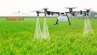
- 1. Design and
- 2. INTRODUCTION Global food hunger affects 815 million people every year. FAO projected that current Agricultural production level need to rise up to 60% by 2050. IPCC warns that crop yield may decrease by 10 to 25% in the fact of climate change by 2050. Farming communities must adopt the various technologies to increase the yield and food grains production. One of such a latest modern technology is the use of small, unmanned aerial vehicles (UAV’s) commonly known as drone.
- 3. CLASSIFICATION OF DRONES I. Based on form, features and functions 1. Fixed wing drone Have two wing design as like aero plane. Operate up to the speed of 50km/hr. Larger field mapping. Transport heavier loads over long distance. They cannot takeoff vertically. 2. Single rotor drone Have only one rotor. Can takeoff and land vertically. More efficient than multi rotor drones. Used for spraying of agrochemicals.
- 4. 3. Multi rotor drone Have four rotors or Eight rotors. Life time only of 10 to 20 minutes. Take off and land vertically. Record pictures and transport light cargo. Mostly used for spraying of agrochemicals. 4. Hybrid drone Equipped with both wings and rotors. Can takeoff and land vertically. Cover far longer distances. carry heavier cargo than multi-rotor drones. 5. Ducted fan drone Can take off and land vertically. Used for crop monitoring.
- 5. II. Based on maximum takeoff weight (including payload) Civil Remotely Piloted Aircraft is categorized in accordance with maximum takeoff weight as 1. Nano: Less than or equal to 250 grams. 2. Micro: Greater than 250 grams and less than or equal to 2 kg. 3. Small: Greater than 2 kg and less than or equal to 25 Kg. 4. Medium: Greater than 25 kg and less than or equal to 150 kg. 5. Large: Greater than 150 kg.
- 6. Proposed Design of Drone
- 8. COMPONENTS OF A DRONE 1. Sensors Silicon based sensors are mostly used. Camera systems Video systems Scanners 2. Mechanical tools Frame Motors Electronic speed controller Battery Radio receiver Spraying systems 3. Cargo Carrying and delivering all kind of things.
- 9. TYPESOF DRONE MOUNTED SENSORS 1. Visible light sensors Red, green, blue (RGB) sensors. Can capture the visible light (400nm-700nm wavelength). Used for aerial mapping and imaging. 2. Broad band color-infrared sensor Modified form of RGB sensors. Notch and band pass filters are used to isolate near infrared (NIR). Excellent indicator of photosynthetic activity of plants.
- 10. 3. Thermal sensor Passive microbolometer image sensors used. Water temperature detection. Water resource detection. Livestock disease detection. Livestock heat sign detection. 4. LiDAR sensor Emits the light, measure the time reflect from the object and return to the sensor. Creates three dimensional points and 3D images. Increase topographical mapping accuracy. Penetrates through vegetation. Calculate the plant canopy volume. Map the flood affected areas.
- 11. 5. Multi spectral sensor Capture 4–10 discrete bands of light. Plant health measurements. Water quality assessment. Vegetation index measurement. Plant counting. 6. Hyper spectral sensor Capture more than 10 to hundreds of discrete bands at narrow wavelength ranges. Plant health measurement. Water quality assessment. Vegetation index calculation. Full spectral sensing. Mineral and surface composition.
- 12. BANDS FORSENSOR IMAGING 1. Red, Green and Blue (RGB) bands Counting the number of plants. Modeling elevation. Visual inspection of crops in the field. 2. Near Infra-Red (NIR) band Water management. Erosion analysis. Plant counting. Soil moisture analysis. Assessment of crop health. 3. Red Edge band (RE) Plant counting. Water management. Crop health assessment. 4. Thermal Infra-Red band Irrigation scheduling. Analysis plant physiology. Yield forecasting.
- 13. Normalized Difference Vegetation Index The Normalized Differential Vegetation Index (NDVI) shows the difference between red light reflected from plants, and near infrared light. Healthy leaves with an active photosynthesis process absorb red light, and strongly reflect near infrared light. Dead, or unhealthy leaves reflect both wavelengths of light. This property can be used to measure the health of crops. NIR - Near Infrared light The range of NDVI lies between -1 and +1. NDVI has been used extensively with remarkable success, for vegetation assessment over a wide range of spatial scales and remote sensingplatforms. (Carlson and Ripley,1997)
- 14. DRONE TECHNOLOGY IN AGRICULTUREIN INDIA The Drone Federation of India (DFI), supports and attempts to build a safer and scalable unmanned aviation industry in India. In India presently, the firms registered in the DIGITAL SKY platform of DGCA (Director General Civil Aviation, GOI) for manufacture of drones are listed in thetable. S. No RPA Name Manufacturer Name Max. take-off weight (kg) Max. height attainable (ft) 1 LookOut VTOL RPAS Throttle Aerospace Systems Private Limited 1.99 400 2 Patang Skylark Drones Pvt Ltd 1.9 1000 3 A200 Asteria Aerospace Pvt Ltd 1.9 200 4 Insight Aarav Unmanned Systems Pvt Ltd 3.6 400 5 Ninja ideaForge Technology Pvt Ltd 1.98 400 6 Agribot UAV (AGUAV) IoTechWorld Avigation Pvt Ltd 23.2 33 7 Prion Mk3 UAVE Limited 42.88 12100 8 Starlite Hubblefly Technologies Pvt Ltd 1.92 9842 9 Freebird Z1 A Ecom Infotech India Limited 4 13123 10 DH-Q4 Dhasksha Unmanned Systems Pvt Ltd 5.18 400 11 WHITE HAWK EDALL SYSTEMS 1.98 11482 12 Staredge Hubblefly Technologies Pvt Limited 4.25 400 13 Model V CBAI Technologies Private Limited 3.33 400 14 A400 Asteria Aerospace Pvt Ltd 3.4 400 15 NOCTUA DS Detect Technologies Pvt Ltd 1.85 2624 16 Insight 2.0 Insight 2.0 3.6 400
- 15. AGRICULTURESOFTWAREPACKAGESFOR AERIALIMAGING PIX4D QGIS DroneDeploy PRECISION HAWK Sentera AgVaultWeb Botlink
- 16. LEGALISSUES,RULESAND REGULATIONS FOR USING DRONES IN INDIA Directorate General of Civil Aviation - Import clearance , Issuance of UIN , Issuance & renewal of UAOP , Suspension / Cancellation of UIN & UAOP in case of violations of regulations. Directorate General of Foreign Trade - Import license Ministry of Home Affairs - Security clearance over the Ministry of Defense - Permission for aerial survey/imageries/ videography/ still photography restricted/prohibited areas. Indian Air Force - Air Defense Clearance, Monitoring of RPAmovements in thecountry Wireless Planning and Coordination Wing, Department of Telecommunication - License for drone Bureau of Civil Aviation Security -Approval of Security Programme. Airport Authority of India - Flight Plan Approval , Monitoring of RPAmovements in thecountry Local Police Office -Enforcement of violators as per applicable IPCs S. No CATEGORY COST (Rs) 1 UIN 1000 2 Fresh UAOP 25,000 3 Renewal of UAOP 10,000
- 17. THANK YOU