SlideShare a Scribd company logo
1 of 71
Download to read offline
redmond@AdaptiveAgroTech.com
For Presentation at
Adaptive AgroTech Consultancy International
Agricultural drone buyer’s guide for farmers and agriculture service professionals
https://www.researchgate.net/profile/Redmond_Shamshiri
https://florida.academia.edu/Redmond
www.adaptiveagrotech.com
redmond@AdaptiveAgroTech.com
redmond.dynamics@gmail.com
Problem statement, Why drones?
© Redmond Ramin Shamshiri
Solution:
 Drones are part of the solution, along with closer collaboration between
governments, technology leaders, and industry.
1. With the world’s population projected to reach 9 billion people by 2050,
experts expect agricultural consumption to increase by nearly 70 percent over
the same time period.
2. Extreme weather events are on the rise, creating additional obstacles to
productivity.
3. Agricultural producers must embrace revolutionary strategies for producing
food, increasing productivity, and making sustainability a priority.
 Expensive piloted aircrafts: Farmers can expect to pay $60,000-
$100,000 per year for the services of a skilled agricultural pilot.
Traditional Scouting
o Traditional scouting requires spending hours and hours of
visualizing
o Involves manual operations, ineffective techniques
o Limitation of human/labor resources (Not on demand)
o Repeated dull tasks (i.e., Palm census)
o Not a pleasant environment to work (hot, humid)
o Hazard/ Safety (Falling from trees, bugs, snakes, etc)
o Generates Inaccurate/biased statistics
o Requires expert knowledge/Post processing (i.e., lab analysis of
data)
o Generates limited information (Does not provide comprehensive
result)
o Ignored parameters due to measurement’s difficulties (i.e., tree
height, canopy diameter, tasks that involves climbing trees)
Why drones?
© Redmond Ramin Shamshiri
Satellite remote sensing
o Cost
o Low resolution
o Difficulties of access (Not on-demand)
Ground sensing
o Time consuming
o Limited field of view
©RedmondRaminShamshiri
Potentials and benefits of UAV Drones for Precision Agriculture,
farming, and crop management
 UAV Drone : A Technology that has revolutionized agriculture from planting to
harvesting (Seeding, Sensing, spraying, fertilizing, etc).
 UAV Drones are Low-cost, widespread available on demand, provide cost-effective
monitoring platform, are easy to use, do not require expert operator
 UAV Drones have solved time and cost problems with Satellite imaging and piloted
aircrafts
 UAV Drones Information can be collected at resolutions measured in just
centimeters per pixel.
 UAV Drones provide live data from a range of sensors (i.e., multispectral, NIR, Lidar,
etc)
 UAV Drones perform in-depth analysis of crop health, inventory management, etc.
 UAV Drones are flexible, both fixed-wing and multi-rotor models can be customized
for functionality in different farming application
© Redmond Ramin Shamshiri
Potentials and benefits of UAV Drones for Precision Agriculture,
farming, and crop management
 Affordable prices, low cost per flight
 Apply the optimal amount of any input (water, fertilizer,
pesticide, fuel, labour) when and where it’s needed to
efficiently produce high crop yields.
 Create further sustainability in crops
 High image detail: Fly over fields taking extremely detailed
photos of crops
 Analyzing the crops to determine how healthy they are.
 Can provide thermal infra-red radiation, or TIR images to
detect the water stress, disease, insect pests, and weeds.
 Can target a specific area for spraying application
 Capable of creating three-dimensional maps of fields
 Identify the nutrient deficiencies
 Identify fertility levels of different parts of individual fields.
© Redmond Ramin Shamshiri
What does a drone can offer?
 Flexible remote sensing platform
 Crop/ Tree Scouting
 Health/growth assessment
 Inventory management
 Yield estimation / Monitoring
 Weed and disease detection
MD4-1000DJI Phantom 4AG550 Ace X88-J2 DJI S1000DJI AGRAS MG-1iMK-8
Trimble UX5Lancaster eBee Phoenix 2 3DR Aero-M 915 DT26X surveillanceAg-wing
Drones offer great opportunities for automation of farming processes, data gathering
through aerial surveillance and data processing software to calculate future crop yields.
The global market
for agricultural UAV drones is
estimated to reach $3.7
billion dollars by the year
2022.
(Source: Radiant Insight Research firm)
© Redmond Ramin Shamshiri
 Mapping (2D, 3D, GIS,
NDVI)
 Risk/Hazard/Safety
management
 Soil condition assessment
 Variable rate technology
 Robotics harvesting
 Academic and Research
application
Typical Applications in Agriculture
©RedmondRaminShamshiri
UAV Drone as Remote Sensing Platform
Remote sensing components
Sensors , Cameras Platform Application software
RGB, Infrared, NIR
NDVI, Multispectral
Hyperspectral
LiDAR, Thermal, Sonar
Airborne Ground-basedFlexible UAV
Satellite Piloted AV Fixed wing Multi-rotor HandheldVehicle mount
Filling the gap between aerial and ground
UAV Setup
Flight Preparation
Test and trials
Mission planning
Image acquisition
Video streaming
Camera/Sensor
setups
Calibration
Image processing
Creating 2D, 3D,
GIS, NDVI Maps
(Pix4Dmapper,
Agisoft)
Image/Map
interpretation
GIS analysis
Custom software
Correlation
analysis
Management
strategies
Decision makings
Recommendations
Data collection Data Processing Data analyzing Results
RGB NIR LiDARNDVI Thermal
HyperspectralMultispectral
© Redmond Ramin Shamshiri
Common Materials in a UAV/Drone Project
© Redmond Ramin Shamshiri
UAV Platform
Sensors
(Cameras)
Application
Software
Programming
(Processing)
Multi-rotorFixed wing
Multi-rotor UAVs
 launch and land vertically
 are favored where space is tight
Fixed-wing UAV
Requires suitable space to launch and land
 Can provide longer flight duration
 Can carry a heavier payload.
In-flight stability, flight-time duration and
payloads are major paramount concerns
RGB
NIR
NDVI
Thermal
Multispectral
Hyperspectral
LiDAR
Onboard GPS Auto flight
Controller
©RedmondRaminShamshiri
1. Platform setup, integrating UAV, sensors and software
2. Creating high quality 2D and 3D maps of the area
3. Developing custom-built programs/algorithms for specific task
UAV Setup
Flight Preparation
Test and trials
Mission planning
Image acquisition
Video streaming
Camera/Sensor
setups
Calibration
Image processing
Creating 2D, 3D,
GIS, NDVI Maps
(Pix4Dmapper,
Agisoft)
Image/Map
interpretation
GIS analysis
Custom software
Correlation
analysis
Management
strategies
Decision makings
Reports
generation
UAV images need to be photogrammetrically processed and translated into accurate 2D
orthomosaics and maps, 3D models and surface models, and other GIS datasets
Orthomosaics, 3D Models and Digital Surface Models, 3D Flythrough Videos, Multispectral
Image Mosaics, Index Maps, (i.e., NDVI) needs to be processed/interpreted
DATA
COLLECTION
Data Processing
Mapping
Modeling Data analyzing
Results /
Reports
Methodology steps
General methodology for using Agricultural Drones as Remote sensing platform
© Redmond Ramin Shamshiri
©RedmondRaminShamshiri
Imaging sensors for UAV Drone
RGB NIR LiDARNDVI Thermal
HyperspectralMultispectral
© Redmond Ramin Shamshiri
©RedmondRaminShamshiri
Imaging sensors for UAV Drone
© Redmond Ramin Shamshiri
©RedmondRaminShamshiri
Visible (RGB), Infrared, NIR sensors
© Redmond Ramin Shamshiri
Sony A6000 Visible Sensor
Focus Points: 179
True Resolution: 24.3Mp
Pixel Size: 15.1 µm²
ISO: 1347 ISO
Image Quality: 82
Dynamic Range: 13.1 EV
Colour Depth:24.1 bits
Resolution (GSD):1.5cm – 4.5cm
Lumix LX7 Sensor Details
True Resolution:10.1Mp
Aperture Range:F1.4 - F2.3
Max Shutter Speed: 1 second
ISO:80 - 6400 ISO
Image Quality: 82
Resolution (GSD): 5cm @400ft
Format:RAW, JPG
Image Stabilisation:roll & anti-shake
Visible (RGB)
Lumix LX7 Infrared Sensor
True Resolution:10.1Mp
Aperture Range:F1.4 - F2.3
Max Shutter Speed: 1 second
ISO:80 - 6400 ISO
Image Quality: 82
Resolution (GSD): 5cm @400ft
Format:RAW, JPG
Image Stabilisation:roll and
anti-shake
Canon S110-NIR, 12 MP, adapted to be
controlled by drones autopilot
Acquires image data in the NIR band
Resolution: 12 MP
Ground resolution at 100 m: 3.5 cm/px
Sensor size: 7.44 x 5.58 mm
Pixel pitch: 1.86 um
Image format: JPEG and/or RAW
Healthy plants have a strong
near infrared reflectivity,
called the "Red Edge".
Infrared Near Infrared
©RedmondRaminShamshiri
NDVI Sensors
© Redmond Ramin Shamshiri
−1 ≤ 𝑁𝐷𝑉𝐼 =
𝑋% − 𝑌%
𝑋% + 𝑌%
≤ +1
SUN
Y%
X%
RGB NIR NDVI
NDVI<0 : Dead plants
NDVI< 𝟎. 𝟑𝟑 Unhealthy plants
0.33< NDVI< 0.66: Healthy plant
NDVI>0.66 Very healthy plants
NDVI - TWIN LUMIX LX7
low cost, rugged, high resolution imaging solution for NDVI,
agricultural and archeological data analysis. provides true R and IR
information from different sensors, providing the clean
photogrammetric information required for vegetation anaysis
processing. Combined with a 5cm resolution at 400ft this sensor
provides a host of benefits for the agronomist and archeaologist .
True Resolution:10.1Mp, Aperture Range:F1.4 - F2.3
Max Shutter Speed: 1 second, ISO:80 - 6400 ISO
Image Quality: 82, Resolution (GSD): 5cm @400ft
Format:RAW, JPG, Image Stabilisation:roll and anti-shake
Canon PowerShot SX260 12.1 MegaPixel
Digital Camera
Models:
XNiteCanonSX260: UV+Visible+IR
XNiteCanonSX260: IR- Only
XNiteCanonSX260NDVI: 3-Band Vegetation
Stress Remote Sensing Camera
Normalized Difference Vegetation
Index (NDVI): measurement of
the amount of live vegetation in
an area
©RedmondRaminShamshiri
NDVI Sensors, Video clip
© Redmond Ramin Shamshiri
©RedmondRaminShamshiri
Thermal and Multispectral Sensors
© Redmond Ramin Shamshiri
High Resolution Uncooled Thermal
Camera: Tau 640
Optris PI450
Temperature range: -20°C to 900°C
Spectral range: 7,5 bis 13 µm
Optical resolution: 382 x 288px
Frame rate 80 Hz
capture single images at a rate one per 2 seconds. Each pixel from each
image has an exact temperature associated with it.
High Resolution thermal imaging can assist disease
detection and water stress in Oil Palms, or for scouting
at nights, fire hazard alarm
Thermal Sensors Multispectral Sensor
 To identify Oil Palm stress factors, soil types, fertilizers, or insecticides
 To identify differentiate plant species or recognize other plant (weeds…)
 To identify soil or chemical conditions that are, in each case, able to be identified by
their unique spectral signature.
 To graphically illustrate vegetation indices such as NDVI that are defined by
relationships of specific narrow-band wavelengths.
 With each exposure, 4 or 6 separate bands of visible or near-infrared radiation move
through each camera's lens and filter to form a separate monochromatic image on
the camera's sensor.
©RedmondRaminShamshiri
RGB Image vs. Hyperspectral image
Pixel: 3 dimensional data at R, G,
B waveband
RGB Color Image
Pixel: dozens or hundreds
dimensional data
0
50
100
150
200
250
0 50 100 150 200
Spectral Band [-]
Intensity[-]
250 50
Waveband [-]
50
100
150
Intensity[-]
200
©RedmondRaminShamshiri
© Redmond Ramin Shamshiri
UAV Hyperspectral Imaging
© Redmond Ramin Shamshiri
Advantages
• Hyperspectral image contains enormous information.
• We can analyze the target in detail.
• We can combine both spatial and spectral analysis.
• We can apply it to the wide area of agricultural sensing.
Disadvantages
• Data structure is complicated and special.
• Data size is large.
• There are few software applications and libraries.
• We have to develop the software by ourselves.
• We have to understand complicated data structure.
Camera
Target
Camera axis
Spatial axis
400 nm
1000 nm
Wavelength
spectral axis
Output from camera
(Sensing line frame)
A-CB-D
A B
C D
©RedmondRaminShamshiri
Hyperspectral Dataflow of Sampling Pixel Spectral Data
© Redmond Ramin Shamshiri
Spectral image
Sensing line frame
y
0
50
100
150
200
250
0 50 100 150 200
Spectral Band [-]
Intensity[-]
Pixel spectral data
x(x, y)
Digital Video Recorder
Personal ComputerIEEE 1394 Interface
Indoor Laboratory
Hyperspectral Camera
Outdoor Fields
Target
Hyperspectral Image Capturing System
©RedmondRaminShamshiri
Implementation of Spectral Processor
© Redmond Ramin Shamshiri
Sugar beet
Waveband No.15(500nm)
Sugar beet
Waveband No.35(750nm)
Soybean (crop row)
Visible rays(R, G, B)
Sugar beet
NIR color (NIR, R, G)
Sugar beet Soybean (crop row)
0: Soil
1: Plant
24.7
26.0
24.7
36.9
40.2
50 - 55
45 -
40 -
35 -
30 -
25 -
20 -
15 -
10 -
5 -
0 -
Estimated SPAD values of sugar beet
Estimated plant ID number (Soil, Sugar beet, Sugina)
2: Sugina
1: Sugar beet
0: Soil
Plant Classification ("PlantClassificationProcessor" object)
Extraction of Desired Waveband Value ("WavebandProcessor" object)
Distinction between Plant and Soil ("PlantSoilProcessor" object)
Composition of 3 Waveband Values as False Color ("FalseColorProcessor" object)
Estimation of Chlorophyll Content (SPAD Value) ("SpadProcessor" object)
©RedmondRaminShamshiri
Example applications of Drones for Precision Agriculture of Oil Palm
Modeling
h
H
D
Yield=func(Age,LAI,NDVI, H, h, D)
Yield monitoring
RGB NIR NDVI
Health/Growth assessment maps, nutrient estimation
Inventory management
Internet
(cloud)
Osprey Drone
1
2
3
4
5
7
19
2110
11
12
13
14
15
16
17
18
25
20
46
22
23
24
9
26
27
28
29
30
31
32
33
34
35
36
37
38
39
40
41
42
43
44
45
8
6
47
FFB QuantificationGeo-referenced Image Yield mapModelingPlatform setup
X: Image pixel
Y=Weight(Kg)
© Redmond Ramin Shamshiri
©RedmondRaminShamshiri
UAV application for palm tree counting
© Redmond Ramin Shamshiri
PLOT B
Palm Tree Counting methods
Training rules Commercial Software Other techniques
©RedmondRaminShamshiri
How Drones Are Revolutionizing Agriculture
©RedmondRaminShamshiri
© Redmond Ramin Shamshiri
 Unmanned aerial vehicles (UAVs), better known as
drones, have been used commercially since the
early 1980s.
 Today, practical applications for drones are
expanding faster than ever in a variety of industries.
 Responding to the rapidly evolving technology,
companies are creating new business and operating
models for UAVs.
 The total addressable value of drone-powered
solutions in all applicable industries is significant,
more than $127 billion, according to a recent PwC
analysis. PwC estimates the market for drone-
powered solutions in agriculture at $32.4 billion.
 Among the most promising areas is agriculture,
where drones offer the potential for addressing
several major challenges.
How Drones Are Revolutionizing Agriculture
©RedmondRaminShamshiri
© Redmond Ramin Shamshiri
1. Soil and field analysis:
 Drones can be instrumental at the start of the crop
cycle.
 They produce precise 3-D maps for early soil
analysis, useful in planning seed planting patterns.
 After planting, drone-driven soil analysis provides
data for irrigation and nitrogen-level management.
2. Planting:
 Drone-planting systems that achieve an uptake rate
of 75 percent
 Decrease planting costs by 85 percent.
 These systems shoot pods with seeds and plant
nutrients into the soil, providing the plant all the
nutrients necessary to sustain life.
How Drones Are Revolutionizing Agriculture
©RedmondRaminShamshiri
© Redmond Ramin Shamshiri
3. Crop spraying from sky:
 In commercial farming, it’s often necessary to take to the
skies to spray pesticides, drop seeds, or spot dying crops.
Drones can drop a much more targeted load of pesticide
than a traditional airplane could.
 Distance-measuring equipment, ultrasonic echoing and
lasers such as those used in the light-detection and
ranging, or LiDAR, method enables a drone to adjust
altitude as the topography and geography vary, and thus
avoid collisions.
 Drones can scan the ground and spray the correct amount
of liquid, modulating distance from the ground and
spraying in real time for even coverage.
 As for the result: increased efficiency with a reduction of in
the amount of chemicals penetrating into groundwater.
 Experts estimate that aerial spraying can be completed up
to five times faster with drones than with traditional
machinery.
How Drones Are Revolutionizing Agriculture
©RedmondRaminShamshiri
© Redmond Ramin Shamshiri
4. Crop and field monitoring:
 Vast fields and low efficiency in crop monitoring together
create farming’s largest obstacle.
 Monitoring challenges are exacerbated by increasingly
unpredictable weather conditions, which drive risk and
field maintenance costs.
 Previously, satellite imagery offered the most advanced
form of monitoring. But there were drawbacks. Images had
to be ordered in advance, could be taken only once a day,
and were imprecise.
 Further, services were extremely costly and the images’
quality typically suffered on certain days.
 Today, time-series animations can show the precise
development of a crop and reveal production inefficiencies,
enabling better crop management.
 Fast Scouting: With drones’ agility and speed, spot-
checking the farm for damaged fences or diseased crops
can take just minutes.
How Drones Are Revolutionizing Agriculture
©RedmondRaminShamshiri
© Redmond Ramin Shamshiri
5. Irrigation:
 Drones with hyperspectral, multispectral, or thermal sensors can
identify which parts of a field are dry or need improvements.
 Once the crop is growing, drones allow the calculation of the
vegetation index, which describes the relative density and health
of the crop, and show the heat signature, the amount of energy or
heat the crop emits.
How Drones Are Revolutionizing Agriculture
©RedmondRaminShamshiri
© Redmond Ramin Shamshiri
6. Health assessment:
 It’s essential to assess crop health and spot bacterial or
fungal infections on trees.
 By scanning a crop using both visible and near-
infrared light, drone-carried devices can identify which
plants reflect different amounts of green light and NIR
light.
 This information can produce multispectral images
that track changes in plants and indicate their health. A
speedy response that can save an entire orchard.
 As soon as a sickness is discovered, farmers can apply
and monitor remedies more precisely.
 Increase a plant’s ability to overcome disease: in the
case of crop failure, the farmer will be able to
document losses more efficiently for insurance claims.
© Redmond Ramin Shamshiri
Guidelines and facts about drones before purchasing
 Agriculture UAV/Drones systems are not for hobbies. They are high-
tech data acquisition tools for professionals.
 Agricultural UAV/drone activity is considered commercial operation
by FAA.
 UAV/Drone operator for Agriculture MUST have a Remote Pilot
Certificate at any time.
 The FactSheet-Small Unmanned Aircraft Regulations (Part 107),
Released on June 21, 2016 is available at this Link
©RedmondRaminShamshiri
© Redmond Ramin Shamshiri
 Prices range for a complete agriculture
UAV/Drone is between $1,500 to over
$25,000
Some facts and guidelines about drones
©RedmondRaminShamshiri
© Redmond Ramin Shamshiri
 Different crop, different scenario:
 Different farms, different crop and plant scenario, trees, leaves, roots,
etc, not to mention different livestock and ranching. Ask yourself what
am I planning to do with the drone?
 Each crop needs to be measured differently to generate actionable data.
 There is no universal crop survey solution, and it will probably be
specialists in each particular crop type who ultimately deliver solutions
to farmers.
Some facts and guidelines about drones
©RedmondRaminShamshiri
© Redmond Ramin Shamshiri
 Multi-copters or fixed wing?
 Do you have landing strips in your farm for takeoff-and-landing? Fixed-wing
drones get battered fast in regular use without dedicated landing areas.
 Multicopters, can take off and land anywhere. They are gaining endurance and
can now fly for as much as 40 minutes and cover miles.
 Fixed wing drones are only suited for the largest farms. They need to be planned
very carefully to find places they can reliably land.
Some facts and guidelines about drones
©RedmondRaminShamshiri
© Redmond Ramin Shamshiri
 Phones/tablets controlled drones are preferred
over laptops:
 Farmers don’t want to drag laptops into the fields.
 Any drone should be entirely operated by a standard
Apple or Android smartphone or tablet.
 Fully autonomous, or pilot flying?
 Farmers don’t want to have to fly things.
 Agricultural UAVs should be fully-autonomous, from
takeoff to landing.
 The experience should be as simple as pressing a
“Start” button on a phone and the drone flies the
entire mission on its own.
Some facts and guidelines about drones
©RedmondRaminShamshiri
© Redmond Ramin Shamshiri
 Fly the camera, not the aircraft:
 What the farmer is interested in is a picture , not
the acquisition of the picture.
 Let sophisticated planning tools figure out
precisely how to gather the right images
 Let autonomy take care of the complicated details
of flight dynamics, and let farmers move the
picture.
 Live Standstill Video
 Sometimes a live standstill view feed will allow
farmers to spot issues and direct the vehicle to
more closely inspect the problem area.
 Live standstill vide feature is only practical with
multicopters UAV.
Some facts and guidelines about drones
©RedmondRaminShamshiri
© Redmond Ramin Shamshiri
 NDVI camera option:
 The gold standard of crop surveying is a
“Normalized Differential Vegetation Index”,
which shows the difference between regular
red light reflected from plants and near-
infrared light.
 A regular camera slightly modified with a
blue bit of plastic becomes a near-IR camera.
 If your drone does not come with NDVI
camera, take a cheap consumer 3D camera
with two lenses, modify one for near-IR, and
you’ve got a NDVI camera for less than $200.
 A ready-to-fly drone equipped for
photography can cost less than $10,000.
Some facts and guidelines about drones
©RedmondRaminShamshiri
© Redmond Ramin Shamshiri
 Money vs. Time
 Time is money, a more expensive drone that can get answers
faster will compensate its cost over a low-cost slow drone. By
doing regular crop surveys, say every day or week, and using
software to highlight differences over time, it’s possible to zero in
on growing differences between areas of a field, which may be
directly correlated to productivity.
Some basic checklist before purchasing a drone
©RedmondRaminShamshiri
© Redmond Ramin Shamshiri
 Check whether you need a pilot license to operate the drone,
 Check the payload (weight) that you want to carry with the drone
 Check flight time
 Check camera options
 Check whether you can learn to operate the drone in a reasonable short time, or if
you should hire experts to fly for you. (The 2nd is now becoming a more realistic
option)
 Check the FAA rules and regulation (Make sure to keep the drone in sight and
under 400 feet)
 Check safety issues
Parrot Disco Pro AG Drone
 Price: $ 6,875.00
 Weight : 780gr | 28oz without Parrot Sequoia
 Take Off Weight : 940g / 33oz with Parrot
Sequoia & mount
 Size : 1150x580x120mm (45x22x5in)
 Wingspan : 1150 mm (45 in)
 Removable wings for transport
©RedmondRaminShamshiri
© Redmond Ramin Shamshiri
 Price : $10,000
 1080p camera
 Autonomous capability with a stand alone
controller system.
 Last up to one hour without requiring a recharge
 It’s equipped with mission planning software so
that a farmer only needs to key in specific
parameters for aerial surveillance and the drone
will take care of the rest.
 It is capable of autonomous landing if it loses
contact with its primary user
 It can collect and analyse data
 It can compare data with previous crop yields to
determine whether revenues will be good or bad.
 Price : $3,000
 1080 HD resolution camera.
 Tablet control system.
 It being able to withstand winds of up to 30mph.
 vertical wings are cheaply replaceable in case of
accidents.
 The aircraft is unique for its special bungee cord
launch feature.
 It’s 18 megapixels Near In fared sensor can allow
to monitor crops on a very detailed level.
 Min Flight Speed : 11 mph
 Land Covereage : 600 average acres per hour on a
single battery
 Housing : Rugged, impact-resistant 2.0 density
expanded polypropylene (EPP) foam
 Storage Payload : 6.5 lbs across four configurable
compartments
 Max Time of Flight: 45 - 60 minutes
RF70 UAV AgDrone UAS
© Redmond Ramin Shamshiri
©RedmondRaminShamshiri
 Price : $120,000
 designed by French tech company Delair
 A battery life of over 1 hour, it could survey large
farms without the need for constant recharging.
 It has a 1080p camera
 A top speed of 110km/hr
 The transmission range of 50km as well as a video
link range of 15km
 A stand alone controller system.
 It requires either hand or catapult force in order
to launch
 It is designed for rough weather so it can sustain
flight even under winds speeds of over 70km/hr.
 Price: $25,000
 Requiring expert handling
 This UAV has a 1080p camera
 Both tablet and stand alone controlling systems.
 It has superior hover capabilities
 The ability to fly at low altitudes safely.
 It comes with a field support kit, gyro sensor
mount as well as training manual.
 It can keep flying for up to 45 minutes without
charge
 It is equipped with both autopilot capability and
autonomous landing should it be necessary.
DT-26 Crop mapper Quad Indigo
© Redmond Ramin Shamshiri
©RedmondRaminShamshiri
E384 Mapping Drone
 Price: $2,400
 Brand name : JJR/C
 The E384 is one of the leading drones in the world
for Agriculture, Surveying, Construction, Mining
and Conservation applications.
 The E384 can fly 1,000 acres in 100 minutes at
5cm resolution completely autonomously.
 Specifications
 Dimensions: 190cm Wingspan, 130cm Length (75
x 51 inches)
 Wings and body disassemble for easy transport
 Weight: 2.5kg (5.6 lbs)
 Endurance: 90 minutes flight time
 Cruise Speed: 13m/s (29 mph)
 Range: 70km (44 miles)
 Map up to 1,000 geo-referenced acres per
flight at 5.0cm/pixel resolution (400 Ha)
 Max Payload: 1kg (2.2 lbs)
 Automatic lens protection for landing
 Complete mission planning and operations
software
 Operating Conditions
 MSL Ceiling: 3,960 meters, (13,000 ft), – auto
take-off tested to 3,100 meters, (10,000 ft)
 Max sustained wind speed: 8 m/sec, (18
mph) for autonomous operation
 Telemetry Range: 5km+ (3.1 mi)
© Redmond Ramin Shamshiri
©RedmondRaminShamshiri
 Price : Not available
 lbs dry weight
 2.2 lb payload
 45 minute flight time
 2km / 1.2 mile range
 300 acres per flight (300 ft altitude)
 Plug-and-Play sensor bay
 5-channel multispectral camera available
 One-button press to launch (cool feature)
 Data resolution down to 1 cm/pixel
PrecisionHawk Lancaster 5 Drone
© Redmond Ramin Shamshiri
 Price : Not available
 The first drone of its class made specifically for
bird control
 Fully Autonomous Flight (program and start –
unit will launch, patrol, and land on its own)
 Set “waypoints” to perfectly customize patrol
areas via GPS technology
 Terrifying physical presence is heightened by
sonic predator sounds
 Camera options available
 Professional-grade carbon fiber construction
 Ideal for commercial applications where a falcon
or manual drone would be used
ProHawk® UAV
©RedmondRaminShamshiri
 Price : Not available
 The XENA Observer is a professional, robust and
versatile system, embedding a dual camera
gimbal offering both day and night vision.
 With a powerful zoom (up to 40x), it allows to
identify subjects at more than 2 Km of distance.
 The infrared camera allows to operate in night
time or low visibility environment.
 Flight time: Up to 27 min
 Take-Off Weight: 5 Kg
 Max continuous wind: 50 Km/h
 Max altitude: 5000 m
 Power: 1 x LiPo Battery.
 Price: Not available
 The XENA Thermo is a professional, robust and
versatile system
 Able to easily embark the FLIR Vue Pro R (640) or
the Optris PI 640 with PI LightWeight
 Two highly efficient and qualitative thermal
cameras. They allow to record high quality
radiometric thermal data
 Perfectly suitable for UAV operations.
 Flight time: Up to 32 min
 Take-Off Weight: 4.6 Kg
 Max continuous wind: 50 Km/h
 Max altitude: 5000 m
 Power: 1 x LiPo Battery.
XENA OBSERVER - COMPLETE RTF
SOLUTION FOR AERIAL SURVEILLANCE
XENA THERMO - COMPLETE RTF SOLUTION
FOR THERMOGRAPHY
© Redmond Ramin Shamshiri
©RedmondRaminShamshiri
 Price: $299.00
 1080P Full HD Video at 60 FPS, 16MP Still Images, 90 degree capable
vertical tilt camera with live first person view streaming, GPS auto
stability semi-autonomous flight (Automatic position hold and hover),
maximum flight range of 500 meters.
 10 inch propellers for maximum flight stability and maneuverability, 44
MPH maximum speed, 22 - 33 MPH cruising velocity, all weather body
for light to medium rain and snow, Class 4 wind resistance rating.
 5300 mAh intelligent LiPo battery for up to 25 minute flying time, fail
safe protocol with auto return home feature (returns to takeoff point).
 Mini-B USB input for hassle free firmware updates, mobile App available
on iOS and Android store for FPV, telemetry data, camera zoom, and
other useful flight and camera control features.
AEE Technology AP10 Pro GPS Drone Quadcopter Full HD 1080P 60 FPS 16MP Camera
Sentera NDVI Upgrade for DJI Phantom 4 PRO
 Price: $3,698
 Seamlessly retain the Phantom 4 Pro camera functionality while
collecting NIR imagery and producing NDVI maps
 Easily identify crops under stress
 Quickly focus inputs while maximizing outputs
 Confidently fly with standard 5-direction obstacle sensing system
 Seamlessly leverage AgVault™ software so data can be viewed at the
field edge and immediate action can be taken
© Redmond Ramin Shamshiri
©RedmondRaminShamshiri
UAV drone crop sprayer water pump spray
 Price: US$ 1450 - 5600
 Model: F4
 Size: 800(L)*800(W)*700mm(H)
 Rotor length: 410mm
 Material: Carbon fiber
 Weight: 9KG
 Max. Takeoff weight: 13KG
 Max. Load: 10KG
 Light load endurance: >=16 Minutes
 Max. flight Altitude: 1KM
 Battery: >16 000mAh Lithium
 Cooling method: Air cooling
 Maximum take-off height above sea level: 4500m
 Price: $ 15,000
 Spraying crops to cover between 7 and 10 acres
an hour and holds 10 liters (about 2.6 gallons) of
liquid.
 It flies up to 8 meters per second, modulating its
spraying for even coverage.
 It can be used in automatic, semi-automatic, or
manual operation,
 It is designed for durability with dustproofing,
water resistance, and an anti-corrosive build.
 The Agras folds down into a compact package
after use.
DJI announces $15,000 agricultural drone designed to spray crops
©RedmondRaminShamshiri
© Redmond Ramin Shamshiri
©RedmondRaminShamshiri
 Price: US$ 130,000
 Model: Fazer R
 Capable of carrying 30 kg (66 lb) in its seed
hoppers, or 32 liters (8.5 gallon) in spray tanks,
which is enough to cover 4 hectares (10 acres)
according to Yamaha.
 Output : a slight bump from 19.1 kW to 20.6 kW
without increasing the RPM .
 Widened exhaust and a better compression
ratio.
 The UAV tips the scales at 71 kg (156.5 lb).
 wireless control range : 7 to 10 frequencies in
order to reduce crosstalk
 Price: US$ 665.00 - 3,799.05
 Model: 5L hexa UAV JMR-V1000
 Size (without prop): 87.5x110x48cm
 Folding size:50x50x48cm
 Maximum takeoff weight: 18KG
 Economic load: 5KG, Remote radius: 800m
 Operating speed: 3-6m / s (adjustable)
 No flight time: 14-18min,
 Operation flight time 8-13min
 Flight mode: ATT / work mode/ GPS mode
 Operating temperature: 0°C-50°C
 Net weight: 6.5KG ,
 Spray width: 3-5m, Operating speed: 3-8m / s
Yamaha's latest unmanned helicopters ready to spray or survey
JMR-V1000 6-rotor 5L Payload Spraying Drone
©RedmondRaminShamshiri
AG-UAV Sprayers
 Price: Not available
 Model : AG-6A
 Hex Configuration (6 motors)
 Capacity: 6 kg
 Spray flow: 0.5--1.1 L/min
 Endurance: 8-15 min
 High efficiency
 Wheelbase diameter : 1100mm
 Height : 650mm
 Empty weight : 8kg
 Max payload : 6kg
 Price: Not available
 Model : AG-8A
 Octo Configuration (8 motors)
 Capacity: 10 kg
 Spray flow: 0.8--1.8 L/min
 Endurance: 10-20 min
 High efficiency
 Wheelbase diameter : 1360mm
 Height : 650mm
 Empty weight : 9.5kg
 Max payload : 10kg
 Price: Not available
 Model : AG-6A+ v2
 Hex Configuration (6 motors)
 Capacity: 20 kg
 Spray flow: 0.9--2.4 L/min
 Endurance: 15-30 min
 High efficiency
 Wheelbase diameter : 1450mm
 Height : 650mm
 Empty weight : 14.2kg
 Max payload : 20kg
© Redmond Ramin Shamshiri
©RedmondRaminShamshiri
 Price: US $ 8,999
 Complete AgStar Drone,
 custom built and tested at Rise Above
 Vulcan Black widow folding frame
 Highest Quality Heavy lift Aerial Photography Motors
 Simonk Flashed Speed controllers
 smooth stable flight and fast throttle response
 DJI Naza V2 Flight Controller
 Futaba 10J flight radio
 2.4ghz Ipad waypoint module (DJI)
 Tattu 12500mah 6S LiPo Battery x 2
 80W Lipo Charger
 2 x Lipo Tester/alarms
 Rise Above folding landing gear with 12mm carbon
tubes
 Price: US $5,500-6,500
 Type: Gyroplane
 Condition: New
 Year Built : 2017
 Place of Origin : Jiangsu, China (Mainland)
 Model Number: ZJ-6N-10L, ZJ-6N-10L
 Material: Carbon Fiber
 Spraying width: 4 m
 Tank Capacity :10L
 Wheelbase: 1400 mm
 Function: uav drone crop sprayer
AgStar X8 - The Complete Precision Agriculture Drone Solution
10L Agricultural Drone Sprayer Uav For Plant Protection Crop Duster
©RedmondRaminShamshiri
RedmondRaminShamshiri
AgStar Bird Scarer Payload
 Price: $1,500.00
 Vulcan quick release plate - for quick and easy
installation/removal from your drone
 Bird Gard Bird Scarer System integrated for UAV
usage
 Additional speaker for Bird Scarer system
 Price: $7,999.95
 Platform For Application Of Liquid Pesticides,
Fertilizers, Herbicides
 Powerful Stable Octocopter Design
 Can Cover 7-10 Acres Per Hour
 40-60 Times Faster Than Manual Spraying
 Payload Capacity Of 10KG
 Various Intelligent Flight Modes
 Professional Agricultural Applications
DJI AGRAS MG-1 Professional Crop Sprayer
© Redmond Ramin Shamshiri
©RedmondRaminShamshiri
Hercules Heavy Lift UAV
 Price: Not available
 Model: Hercules HL6
 6 Rotors
 Payload: 13 lbs
 Endurance: 30 minutes (Depending on wind,
flight speed, payload)
 Max Speed 23 mph
 Wheelbase diameter : 43 inches
 Height : 26 inches
 Empty weight : 18 lbs
 Max payload : 13 lbs
 Price: Not available
 Model: Hercules HL20
 6 Rotors
 Payload: 44 lbs
 Endurance: 60 minutes (Depending on wind,
flight speed, payload)
 Max Speed 23 mph
 Wheelbase diameter : 57 inches
 Height : 26 inches
 Empty weight : 31 lbs
 Max payload : 44 lbs
 Price: Not available
 Model: Hercules HL10
 8 Rotors
 Payload: 22 lbs
 Endurance: 30 minutes (Depending on wind,
flight speed, payload)
 Max Speed 23 mph
 Wheelbase diameter : 54 inches
 Height : 26 inches
 Empty weight : 21 lbs
 Max payload : 22 lbs
© Redmond Ramin Shamshiri
©RedmondRaminShamshiri
Multirotor UAVs
 Price: Not available
 GPS flight assistance: Unique GPS flight assistance
for manual or fully autonomous flying
 Flighttime : The flight time is 10min to 40min
depending on equipment and UAV.
 Interfaces : Free interfaces for future sensore
technology (radar, laser, collision avoidance)
 Photo : Aerial photographs of all heights, angles
and perspectives.
 Made in Germany : Inhouse development and
production makes also your special applications
possible.
 Price: Not available
 Available in Japan currently
 The new model AC 1500 is for larger agriculture
operations then its current AC940-D model.
 It can carry up to 9 liters of liquid agent
 It can spray up to 1 ha in 10 minutes.
 It supports not only liquid but also granular agent
spraying can be supported.
enRoute (Japan) Zion AC 1500
© Redmond Ramin Shamshiri
©RedmondRaminShamshiri
AgStar GoPro FPV Camera Payload ROA Parkour 280 Racer FPV Quadcopter
 Price: Not available
 Item name: Parkour 280 Racer
 Length: 251mm
 Width: 228mm
 Height: 78mm
 Diameter: 280mm
 Main material: carbon fiber
 Plastic canopy: Parkour 280 comes with red
canopy
 Motor: ROA 2204 2300KV brushless motor
 ESC: Hobbywing 20A
 FPV image transmission: 5.8G 200MW 32 Channel
 Price: $1,950.00
 Vulcan quick release plate - for quick and easy
installation/removal from your drone
 H4-3D Gimbal - 3 axis stabilised brushless camera
gimbal to keep your footage perfectly stable, and
allow 90 degrees of tilt control
 Iosd Mini - Intelligent On Screen Display to feed
telemtry data from your drone to you on the
ground.
 Immersion 25mw 5.8ghz - SD video transmission
for live video feed to the operator. Restricted to
25mw to comply with Australian Regulation.
 Black Pearl Monitor - 7" LCD screen with folding
sunshade for viewing live video feed. Mounts
directly to the operator controller.
 Long Range Antenna set - We have included an
upgraded antenna set for increased range and
penetration on the video system (up to 1km)
© Redmond Ramin Shamshiri
©RedmondRaminShamshiri
 Price of Quadcopter only : Used from $469.99
 Easy to Fly: An intelligent flight system
automatically keeps your Phantom 3 Standard in
the air and under your control.
 Amazing Images: Take stunning 2.7K HD videos
and 12 Megapixel photos with the integrated
aerial camera.
 Stable Footage: DJI’s advanced gimbal
stabilization technology gives you movie-quality
results no matter how you fly.
 Enjoy the View: A live video feed gives you a 720p
HD real-time view of what your camera sees right
on your mobile device.
 Peace of Mind: Fly up to 25 minutes on a single
charge, and the Intelligent Flight Battery will
automatically remind you when power is running
low.
 Price: Not available
 Immediate deployment and use
 Fully automated flights
 Instantaneous results
 Stabilised drone – no need for a gimbal
 Follows ground and slopes
 Hover mode, also with angle for panoramic shots
 Low sensitivity to wind intake
 Covers twice as much surface area as multi-
copters
 No minimal flight altitude compared to fixed
wings
 Respects no-fly zones set
 Unique system under two patents protection
EZ|MANTA DJI Phantom 3 Standard Quadcopter dron
© Redmond Ramin Shamshiri
©RedmondRaminShamshiri
Professional Multifunctional Fixed Wing
Mapping UAV drone UG-II Series
 Price : Not available
 Machine Size : 860*860*540mm(spread)
520*520*540mm(fold)
 Machine weight : 3.2kg
 Maximum task load : 3kg
 Battery : LiPo6s(10000~20000mAH, 20C)
 Wheelbase : 860mm
 Arm length : 300mm
 Diameter : 300mm
 Maximum horizontal velocity : 16m/s
 Cruising speed : 10m/s
 Maximum speed of climb : 8m/s
 Wind resistance grade : Lv 5(10m/s)
 Maximum flight radius : 5 km
 Maximum endurance time : 28Min
 Price: Not available
 Machine Size : 2240*1600*650mm
 Machine material : Compound material
 Fuel volume : 3 L
 Machine weight : 11kg
 Maximum takeoff weight : 15kg
 Maximum task load : 2kg
 Ceiling : 3500m
 Maximum power : 3.5HP
 Ambient temperature : -20℃~50℃
 Wind resistance grade : LV 5
 Maximum endurance time : 3h
 Cruising speed : 65~110km/h
 Maximum range : 200km
 Recycling methods : PLF、downhill race
Professional Electric Six Rotor Application
Level Polie UAV Drone UA-8 Series
© Redmond Ramin Shamshiri
©RedmondRaminShamshiri
Professional Eight Rotor Smart Police
UAV drone US8-Mini Series
 Price: Not available
 Endurance time : 36min
 Length : 58cm
 Wheelbase : 74cm
 Weight : 3kg
Professional Eight Rotors
Police UAV UP8 Series
 Price: Not available
 Cruising time : 30min
 Safe loading : 8kg
 Remote radius : 10km
 Route planning : Yes
 Air relay : Yes
 Communication relay : Yes
Professional Petrochemical
Application UAV UC6 Series
 Price: Not available
 Patrol time: 45min
 Chart transmission distance : 10km
 Diamagnetic interference : 1000A/m
 Patrol efficiency : ≥30km/h
© Redmond Ramin Shamshiri
©RedmondRaminShamshiri
 Price: vary from $2,499 to $4,499, and it will depend on the camera options and Real Sense
 The sUAS is the perfect solution for long flight times.
 A proven and robust technology in an all-in-one package.
 The H520 is built for inspection, law enforcement, security, construction, surveying, and mapping
applications.
 Offering cinematic or broadcast-ready imaging payload systems.
 Six-rotor systems that allow for stable, precise flight, long focal-length lenses.
 Allow the sUAS to fly at greater distance from an object and data storage that may be shared instantly from
the ST16S Ground Station or delivered directly in 4K/2K/HD video or 20Mp still images.
 In high-wind environments, the Yuneec H520 sUAS system is able to hold position.
 Allowing the solution to fly even when a manned inspection would be deemed unsafe.
 Exclusive flight speed control offers slowest speed above stall flight for maximum precision in challenging
environments.
Yuneec H520 Hexacopter
© Redmond Ramin Shamshiri
©RedmondRaminShamshiri
 Price : US $5000.00
 Product name : Agriculture UAV
 Wheelbase : 1200mm
 Working Speed : 5-10m/s
 Max Take-off Weight : 21.9kg
 Max Payload : 10kg
 Working Altitude : 0.5-5m
 Payload : 10l
 Wind Resistance : 5Level
 Duration of Flight : 10-15min
 Working Temperature : -15℃-50℃
 Spray Width : 4-6m(adjustable)
 Nozzle Type : Pressure Nozzle
 Number of Nozzles : 2
 Battery : 2 Pcs 12000mAh Li-Po batteries
 Color : Customized
 Logo : Customized
 Price : US $6999.00
 Product Name : Agriculture UAV
 Wheelbase : 1350MM
 Working Speed : 5-10m/s
 Max Take off Weight : 22KG
 Max Payload : 10Kg
 Working Altitude : 0.5-5m
 Payload : 10L
 Wind Risistance : 5Level
 Duration of Flight : 10-15min
 Working Temperature : -15℃-50℃
 Spray Width : 4-6m(adjustable)
 Nozzle Type : Pressure Nozzle
 Number of Nozzles : 2
 Battery : 2 Pcs 12000m Ah Li-Po batteries
 Color : Yellow
 Logo : Digital Eagle
Agricultural drone AK-61 YM-6160
© Redmond Ramin Shamshiri
©RedmondRaminShamshiri
 Price : US$ 32.99 ~ 52.99
 Brand : Skytech
 Model : TK110HW
 Suit Version Type : RTF
 Frequency : 2.4GHz
 Channels : 4CH
 WiFi Control Distance : 50m
 Flight Time : 6-7 mins
 Charge Time : 100 mins
 Quadcopter Battery : 3.7V 850mAh
 Transmitter Battery : 4 x 1.5V AA Batteries (Not
Included)
 Motor : Brushed
 Camera Pixel : 0.3MP
 App Download : QR Code on the User Manual
 Control Mode : Mode 2 (Left Hand Throttle)
 Color : Black
 Price: Not available
 Model : DJI Inspire
 Aerial HD comes from a remote control obsession
 Commonly setup with dual batteries this gives it a
flight time of around 20 minutes safely
 It features a full GPS system that allows us to hold
a hovering position accurate to within about
400mm in the wind.
 The GPS system is a fully integrated fail safe, this
allows to flick one switch if we are ever in trouble
and the helicopter will fly itself back to the take
off location and land within 1m squared without
touching the remote.
 This machine fantastically with the Panasonic
GH4 shooting 4k UHD footage which is stabilised
by a DJI Ronin and DJI OSMO for the closeup
chase shots.
Aerial HD Skytech TK110HW Specification
© Redmond Ramin Shamshiri
©RedmondRaminShamshiri
JJRC H8D 5.8G FPV Drone 2.0MP Camera RC
Quadcopter
 Price : US $4,000-6,500
 Type: Helicopter
 Condition : New
 Year Built : 2017
 Place of Origin : Shandong, China (Mainland)
 Model Number : X81 06
 Name : uav
 Material : Aviation carbon fiber
 Usage : Pesticide Spraying
 Max safe load : 10kg
 Function : Spraying Pesticides Smartly
 Control system : Remote Control
 Flight duration : 25-40 minutes
 Spray width of t_46 meters
 Product size: 2490mm*1645mm*845mm
 Feature: High Efficient
 Price: $169.99 ~ $175.00
 Brand name : JJR/C
 Brand model : H8D
 Frequency: 2.4G
 Channel : 4CH
 Gyro : 6 axis
 FPV transmission frequency : 5.8G
 Function:ascend/descend/forward/backward/si
de flying/360°rolling
action/hover/LED/camera/5.8G transmission/CF
mode/One key return
 Flight duration : 8 Minutes
 Remote control distance : 300 meters
 Charging time : 110mins
 Battery for quadcopter : 7.4V 500mAh (included)
 Battery for transmiter : 4 * 1.5V AA Battery (not
included)
 Battery dimension : 43 * 25 * 12mm
 Quadcopter dimension : 330 * 330 * 115mm
 Quadcopter weight : 23g
X810 Long Range Uav Drone Crop Sprayer
For Agriculture
© Redmond Ramin Shamshiri
©RedmondRaminShamshiri
 Price: 68.99 $
 6 AXIS GYRO Equipped with the latest 6-axis flight control systems,
 3D lock, More scheduled flight, operating more to the force!
 360° Eversion A key 360°roll,continuous roll
 2MP HD Camera X8C equipped with HD camera,
 Blade Protector Highly elastic plastic protective circle,
 Colorful flashing light, keep your Aircraft at night Flying is quite excellent.
 Size Body Length:
 20 in / 508 mm Body Width:
 Body Height: 6.5 in/165 mm
 Frequency: 2.4Ghz
 Channel: 4 Channel
 Battery for Transmitter: 4 x AA battery (not included)
 Product Size: 20 x 20 x 6.5 in
 Control Mode: Remote Control
 Control Distance: about 50m
 Battery for RC Quad Copter: 7.4V 2000mAh Li-on
 Charging Mode: USB charging
 Charging Time: About 180 mins
 Play Time: 5-8 mins
Syma X8C Venture with 2MP Wide Angle Camera 2.4G 4CH RC Quadcopter
© Redmond Ramin Shamshiri
©RedmondRaminShamshiri
Agriculture Spraying drones
© Redmond Ramin Shamshiri
©RedmondRaminShamshiri
Agriculture Spraying drones
© Redmond Ramin Shamshiri
5 LITERS, $5,299 10 LITERS, $8,399 15 LITERS, $10,399
©RedmondRaminShamshiri
Agriculture Spraying drones
© Redmond Ramin Shamshiri
©RedmondRaminShamshiri
Agriculture Spraying drones
© Redmond Ramin Shamshiri
©RedmondRaminShamshiri
Future of Drones
© Redmond Ramin Shamshiri
 UAVs might involve fleets, or swarms, of autonomous drones that Could tackle
agricultural monitoring tasks collectively,
 Hybrid aerial-ground drone actors that could collect data and perform a variety of other
tasks.
 What’s slowing the progress of drones in agriculture?
 Beyond the barriers to widespread drone adoption in all industries, safety of drone
operations, privacy issues, and insurance, coverage questions. The biggest agricultural
concern is the type and quality of data that can be captured.
 Need for more sophisticated sensors and cameras
 Need for drones that require minimal training and are highly automated.
©RedmondRaminShamshiri
Video clip No. 1: Parrot professional
© Redmond Ramin Shamshiri
©RedmondRaminShamshiri
Video clip No. 2: Precision agriculture and the use of drones
© Redmond Ramin Shamshiri
©RedmondRaminShamshiri
Video clip No. 3: UAV for Precision agriculture of oil palm
© Redmond Ramin Shamshiri
©RedmondRaminShamshiri
Video clip No. 6: Spraying oil palm trees with UAV
© Redmond Ramin Shamshiri
©RedmondRaminShamshiri
Video clip No. 7: UAV for spraying application in agriculture
© Redmond Ramin Shamshiri
©RedmondRaminShamshiri
Choosing the Best UAV Drones for Precision Agriculture and Smart Farming
Agricultural drone buyer’s guide for farmers and agriculture service professionals
Best Drones For Agriculture
Exploring agricultural drones
Agricultural Drone Technology
Agricultural Drones for Sale
Choosing the Right Drone for the Job
Ramin Shamshiri
Redmond Ramin Shamshiri
Dr. Redmond Ramin Shamshiri
Adaptive AgroTech Research Group International.
Adaptive AgroTech Consultancy and Research Group International.
senseFly eBee SQ: The eBee series has been a popular choice for farmers, and the biggest selling point is the company's
proprietary eMotion software, which makes designing a flight plan incredibly simple. The drone boasts the ability to capture
500 acres of footage in a single flight. Price: $10,490
PrecisionHawk Lancaster 5: PrecisionHawk is another popular drone choice for farmers, and this latest model features a
body more capable of enduring hard landings, a redesigned tail, longer wingspan for greater stability in flight, and an
improved flight control. Price: $12,000
Honeycomb AgDrone: This drone features a 55-minute flying time, with an additional 11 minutes of reserve time that
activates as long as there is not too much wind. The wings are made of a durable Kevlar fiber composite. The drone also
comes with dual cameras. Price: $10,000
DJI Matrice 100: Dual batteries in this drone allow for a 40-minute flight time. It also packs the standard suite of DJI systems,
such as GPS and flight controller. Price: $3,299
Acknowledgement
© Redmond Ramin ShamshiriThis presentation was prepared at Adaptive AgroTech Consultancy and Research Group International. www.AdaptiveAgroTech.com
Specials thanks to:
 Mrs. Zahra Karimi, Research and executive assistant at Adaptive AgroTech
 Ms. Mojgan Shad, Research assistant at Adaptive AgroTech
For the contributions and inputs in preparing these slides.

More Related Content

What's hot

Unmanned ariel vehicles(uav) in agriculture
Unmanned ariel vehicles(uav) in agricultureUnmanned ariel vehicles(uav) in agriculture
Unmanned ariel vehicles(uav) in agricultureyogi1296
 
Agrl. Drones.ppt
Agrl.  Drones.pptAgrl.  Drones.ppt
Agrl. Drones.pptKHARIKARAN
 
6 agricultural drones ca
6 agricultural drones ca6 agricultural drones ca
6 agricultural drones casUAS News
 
Drone technology in agriculture
Drone technology in agricultureDrone technology in agriculture
Drone technology in agriculturerohinsaji
 
Drone technology is Improving Agriculture Industry
Drone technology is Improving Agriculture IndustryDrone technology is Improving Agriculture Industry
Drone technology is Improving Agriculture IndustryJone Smith
 
SKyClaim: Using Drones for Crop Insurance
SKyClaim: Using Drones for Crop InsuranceSKyClaim: Using Drones for Crop Insurance
SKyClaim: Using Drones for Crop InsuranceCassidy Rankine
 
Agricultural drone
Agricultural droneAgricultural drone
Agricultural droneashishya30
 
Pesticides sprinkler drone (syed saif)
Pesticides sprinkler drone (syed saif)Pesticides sprinkler drone (syed saif)
Pesticides sprinkler drone (syed saif)SYEDSAIF45
 
Day 24 Dronefly Agriculture Drones
Day 24 Dronefly Agriculture DronesDay 24 Dronefly Agriculture Drones
Day 24 Dronefly Agriculture DronesSuyog Khose
 
Role of drone in crops protection.pptx
Role of drone in crops protection.pptxRole of drone in crops protection.pptx
Role of drone in crops protection.pptxParmeshwarSahu11
 
Applications of drones in Agriculture
Applications of drones in AgricultureApplications of drones in Agriculture
Applications of drones in AgricultureSreedhara B
 
Multispectral Imagery Data for Agricultural Surveying
Multispectral Imagery Data for Agricultural SurveyingMultispectral Imagery Data for Agricultural Surveying
Multispectral Imagery Data for Agricultural SurveyingMuhammad Aleem Siddiqui
 
Drones for early pest detection
Drones for early pest detectionDrones for early pest detection
Drones for early pest detectionNithyaNeerumalla
 
APPLICATIONS OF DRONES IN AGRICULTURE IN INDIA
APPLICATIONS OF DRONES IN AGRICULTURE IN INDIAAPPLICATIONS OF DRONES IN AGRICULTURE IN INDIA
APPLICATIONS OF DRONES IN AGRICULTURE IN INDIASGowriShankar5
 
Agriculture drone technology
Agriculture drone technologyAgriculture drone technology
Agriculture drone technologyMuhammad Shahbaz
 
An Autonomous UAV for Pesticide Spraying
An Autonomous UAV for Pesticide SprayingAn Autonomous UAV for Pesticide Spraying
An Autonomous UAV for Pesticide Sprayingijtsrd
 
Agriculture drone for spraying fertilizer and pesticides
Agriculture drone for spraying fertilizer and pesticidesAgriculture drone for spraying fertilizer and pesticides
Agriculture drone for spraying fertilizer and pesticidesVivek Bhakta
 

What's hot (20)

Unmanned ariel vehicles(uav) in agriculture
Unmanned ariel vehicles(uav) in agricultureUnmanned ariel vehicles(uav) in agriculture
Unmanned ariel vehicles(uav) in agriculture
 
Agrl. Drones.ppt
Agrl.  Drones.pptAgrl.  Drones.ppt
Agrl. Drones.ppt
 
6 agricultural drones ca
6 agricultural drones ca6 agricultural drones ca
6 agricultural drones ca
 
Drone technology in agriculture
Drone technology in agricultureDrone technology in agriculture
Drone technology in agriculture
 
Drone technology is Improving Agriculture Industry
Drone technology is Improving Agriculture IndustryDrone technology is Improving Agriculture Industry
Drone technology is Improving Agriculture Industry
 
SKyClaim: Using Drones for Crop Insurance
SKyClaim: Using Drones for Crop InsuranceSKyClaim: Using Drones for Crop Insurance
SKyClaim: Using Drones for Crop Insurance
 
Agricultural drone
Agricultural droneAgricultural drone
Agricultural drone
 
Pesticides sprinkler drone (syed saif)
Pesticides sprinkler drone (syed saif)Pesticides sprinkler drone (syed saif)
Pesticides sprinkler drone (syed saif)
 
Day 24 Dronefly Agriculture Drones
Day 24 Dronefly Agriculture DronesDay 24 Dronefly Agriculture Drones
Day 24 Dronefly Agriculture Drones
 
Role of drone in crops protection.pptx
Role of drone in crops protection.pptxRole of drone in crops protection.pptx
Role of drone in crops protection.pptx
 
Applications of drones in Agriculture
Applications of drones in AgricultureApplications of drones in Agriculture
Applications of drones in Agriculture
 
Multispectral Imagery Data for Agricultural Surveying
Multispectral Imagery Data for Agricultural SurveyingMultispectral Imagery Data for Agricultural Surveying
Multispectral Imagery Data for Agricultural Surveying
 
Drones for early pest detection
Drones for early pest detectionDrones for early pest detection
Drones for early pest detection
 
Agriculture
AgricultureAgriculture
Agriculture
 
use of drones.pptx
use of drones.pptxuse of drones.pptx
use of drones.pptx
 
Awit
AwitAwit
Awit
 
APPLICATIONS OF DRONES IN AGRICULTURE IN INDIA
APPLICATIONS OF DRONES IN AGRICULTURE IN INDIAAPPLICATIONS OF DRONES IN AGRICULTURE IN INDIA
APPLICATIONS OF DRONES IN AGRICULTURE IN INDIA
 
Agriculture drone technology
Agriculture drone technologyAgriculture drone technology
Agriculture drone technology
 
An Autonomous UAV for Pesticide Spraying
An Autonomous UAV for Pesticide SprayingAn Autonomous UAV for Pesticide Spraying
An Autonomous UAV for Pesticide Spraying
 
Agriculture drone for spraying fertilizer and pesticides
Agriculture drone for spraying fertilizer and pesticidesAgriculture drone for spraying fertilizer and pesticides
Agriculture drone for spraying fertilizer and pesticides
 

Similar to Choosing the Best UAV Drones for Precision Agriculture and Smart Farming: Agricultural drone buyer’s guide for farmers and agriculture service professionals

Technical Paper ppt.pptx
Technical Paper ppt.pptxTechnical Paper ppt.pptx
Technical Paper ppt.pptxSudeepgowda16
 
Smart Management of Oil Palm Plantations with Autonomous UAV Imagery and Robu...
Smart Management of Oil Palm Plantations with Autonomous UAV Imagery and Robu...Smart Management of Oil Palm Plantations with Autonomous UAV Imagery and Robu...
Smart Management of Oil Palm Plantations with Autonomous UAV Imagery and Robu...Redmond R. Shamshiri
 
AGRICULTURE DRONES.pptx
AGRICULTURE DRONES.pptxAGRICULTURE DRONES.pptx
AGRICULTURE DRONES.pptxDOuLIKEit
 
Drones in Agriculture | EquiAgra
Drones in Agriculture | EquiAgra Drones in Agriculture | EquiAgra
Drones in Agriculture | EquiAgra EquinoxsdronesSEO
 
Fundamental Research on Unmanned Aerial Vehicles to Support Precision Agricul...
Fundamental Research on Unmanned Aerial Vehicles to Support Precision Agricul...Fundamental Research on Unmanned Aerial Vehicles to Support Precision Agricul...
Fundamental Research on Unmanned Aerial Vehicles to Support Precision Agricul...Redmond R. Shamshiri
 
Unmanned Aerial Vehicles (UAV) In.pptx
Unmanned Aerial Vehicles (UAV) In.pptxUnmanned Aerial Vehicles (UAV) In.pptx
Unmanned Aerial Vehicles (UAV) In.pptxZulfiqarAli373406
 
Maverick Pro Overview
Maverick Pro OverviewMaverick Pro Overview
Maverick Pro OverviewAdam Shaw
 
iaetsd Unmanned aerial vehicle in the field of agriculture
iaetsd Unmanned aerial vehicle in the field of agricultureiaetsd Unmanned aerial vehicle in the field of agriculture
iaetsd Unmanned aerial vehicle in the field of agricultureIaetsd Iaetsd
 
Agriculture Drone and types.pdf
Agriculture Drone and types.pdfAgriculture Drone and types.pdf
Agriculture Drone and types.pdfzahidjanjua160
 
10 Major Pros of Unmanned Aerial Vehicle(UAV) Drones.pptx
10 Major Pros of Unmanned Aerial Vehicle(UAV) Drones.pptx10 Major Pros of Unmanned Aerial Vehicle(UAV) Drones.pptx
10 Major Pros of Unmanned Aerial Vehicle(UAV) Drones.pptxFALCON 3D
 
Benefits of Drone Software for Agriculture.pdf
Benefits of Drone Software for Agriculture.pdfBenefits of Drone Software for Agriculture.pdf
Benefits of Drone Software for Agriculture.pdfInventcolabs
 
Remote Sensing (RS), UAV/drones, and Machine Learning (ML) as powerful techni...
Remote Sensing (RS), UAV/drones, and Machine Learning (ML) as powerful techni...Remote Sensing (RS), UAV/drones, and Machine Learning (ML) as powerful techni...
Remote Sensing (RS), UAV/drones, and Machine Learning (ML) as powerful techni...nitinrane33
 
Parrot pro agro - Agro Innovations Forum 2018 by DroneUA
Parrot pro agro - Agro Innovations Forum 2018 by DroneUAParrot pro agro - Agro Innovations Forum 2018 by DroneUA
Parrot pro agro - Agro Innovations Forum 2018 by DroneUADroneUA Iakovenko
 
IRJET- Drone Delivery System
IRJET- Drone Delivery SystemIRJET- Drone Delivery System
IRJET- Drone Delivery SystemIRJET Journal
 
Drone design for agricultural applications
Drone design for agricultural applicationsDrone design for agricultural applications
Drone design for agricultural applicationsturbomachinesproject
 
artificialintelligenceinagriculture-bydr-201028091539.pptx
artificialintelligenceinagriculture-bydr-201028091539.pptxartificialintelligenceinagriculture-bydr-201028091539.pptx
artificialintelligenceinagriculture-bydr-201028091539.pptxSajibChowdhury18
 
Digital Agriculture, Virtual reality, Agricultural Robotics
Digital Agriculture, Virtual reality, Agricultural RoboticsDigital Agriculture, Virtual reality, Agricultural Robotics
Digital Agriculture, Virtual reality, Agricultural RoboticsRedmond R. Shamshiri
 
Drones for Livestock Management- Best Practices to Follow.
Drones for Livestock Management- Best Practices to Follow.Drones for Livestock Management- Best Practices to Follow.
Drones for Livestock Management- Best Practices to Follow.Techugo
 
Drones for Livestock Management- Best Practices to Follow.
Drones for Livestock Management- Best Practices to Follow.Drones for Livestock Management- Best Practices to Follow.
Drones for Livestock Management- Best Practices to Follow.Techugo
 
Saura, Reyes-Menendez & Palos-Sanchez, 2019 Helyon.pdf
Saura, Reyes-Menendez & Palos-Sanchez, 2019 Helyon.pdfSaura, Reyes-Menendez & Palos-Sanchez, 2019 Helyon.pdf
Saura, Reyes-Menendez & Palos-Sanchez, 2019 Helyon.pdfppalos
 

Similar to Choosing the Best UAV Drones for Precision Agriculture and Smart Farming: Agricultural drone buyer’s guide for farmers and agriculture service professionals (20)

Technical Paper ppt.pptx
Technical Paper ppt.pptxTechnical Paper ppt.pptx
Technical Paper ppt.pptx
 
Smart Management of Oil Palm Plantations with Autonomous UAV Imagery and Robu...
Smart Management of Oil Palm Plantations with Autonomous UAV Imagery and Robu...Smart Management of Oil Palm Plantations with Autonomous UAV Imagery and Robu...
Smart Management of Oil Palm Plantations with Autonomous UAV Imagery and Robu...
 
AGRICULTURE DRONES.pptx
AGRICULTURE DRONES.pptxAGRICULTURE DRONES.pptx
AGRICULTURE DRONES.pptx
 
Drones in Agriculture | EquiAgra
Drones in Agriculture | EquiAgra Drones in Agriculture | EquiAgra
Drones in Agriculture | EquiAgra
 
Fundamental Research on Unmanned Aerial Vehicles to Support Precision Agricul...
Fundamental Research on Unmanned Aerial Vehicles to Support Precision Agricul...Fundamental Research on Unmanned Aerial Vehicles to Support Precision Agricul...
Fundamental Research on Unmanned Aerial Vehicles to Support Precision Agricul...
 
Unmanned Aerial Vehicles (UAV) In.pptx
Unmanned Aerial Vehicles (UAV) In.pptxUnmanned Aerial Vehicles (UAV) In.pptx
Unmanned Aerial Vehicles (UAV) In.pptx
 
Maverick Pro Overview
Maverick Pro OverviewMaverick Pro Overview
Maverick Pro Overview
 
iaetsd Unmanned aerial vehicle in the field of agriculture
iaetsd Unmanned aerial vehicle in the field of agricultureiaetsd Unmanned aerial vehicle in the field of agriculture
iaetsd Unmanned aerial vehicle in the field of agriculture
 
Agriculture Drone and types.pdf
Agriculture Drone and types.pdfAgriculture Drone and types.pdf
Agriculture Drone and types.pdf
 
10 Major Pros of Unmanned Aerial Vehicle(UAV) Drones.pptx
10 Major Pros of Unmanned Aerial Vehicle(UAV) Drones.pptx10 Major Pros of Unmanned Aerial Vehicle(UAV) Drones.pptx
10 Major Pros of Unmanned Aerial Vehicle(UAV) Drones.pptx
 
Benefits of Drone Software for Agriculture.pdf
Benefits of Drone Software for Agriculture.pdfBenefits of Drone Software for Agriculture.pdf
Benefits of Drone Software for Agriculture.pdf
 
Remote Sensing (RS), UAV/drones, and Machine Learning (ML) as powerful techni...
Remote Sensing (RS), UAV/drones, and Machine Learning (ML) as powerful techni...Remote Sensing (RS), UAV/drones, and Machine Learning (ML) as powerful techni...
Remote Sensing (RS), UAV/drones, and Machine Learning (ML) as powerful techni...
 
Parrot pro agro - Agro Innovations Forum 2018 by DroneUA
Parrot pro agro - Agro Innovations Forum 2018 by DroneUAParrot pro agro - Agro Innovations Forum 2018 by DroneUA
Parrot pro agro - Agro Innovations Forum 2018 by DroneUA
 
IRJET- Drone Delivery System
IRJET- Drone Delivery SystemIRJET- Drone Delivery System
IRJET- Drone Delivery System
 
Drone design for agricultural applications
Drone design for agricultural applicationsDrone design for agricultural applications
Drone design for agricultural applications
 
artificialintelligenceinagriculture-bydr-201028091539.pptx
artificialintelligenceinagriculture-bydr-201028091539.pptxartificialintelligenceinagriculture-bydr-201028091539.pptx
artificialintelligenceinagriculture-bydr-201028091539.pptx
 
Digital Agriculture, Virtual reality, Agricultural Robotics
Digital Agriculture, Virtual reality, Agricultural RoboticsDigital Agriculture, Virtual reality, Agricultural Robotics
Digital Agriculture, Virtual reality, Agricultural Robotics
 
Drones for Livestock Management- Best Practices to Follow.
Drones for Livestock Management- Best Practices to Follow.Drones for Livestock Management- Best Practices to Follow.
Drones for Livestock Management- Best Practices to Follow.
 
Drones for Livestock Management- Best Practices to Follow.
Drones for Livestock Management- Best Practices to Follow.Drones for Livestock Management- Best Practices to Follow.
Drones for Livestock Management- Best Practices to Follow.
 
Saura, Reyes-Menendez & Palos-Sanchez, 2019 Helyon.pdf
Saura, Reyes-Menendez & Palos-Sanchez, 2019 Helyon.pdfSaura, Reyes-Menendez & Palos-Sanchez, 2019 Helyon.pdf
Saura, Reyes-Menendez & Palos-Sanchez, 2019 Helyon.pdf
 

More from Redmond R. Shamshiri

Development and Field Evaluation of a Multichannel LoRa Sensor for IoT Monito...
Development and Field Evaluation of a Multichannel LoRa Sensor for IoT Monito...Development and Field Evaluation of a Multichannel LoRa Sensor for IoT Monito...
Development and Field Evaluation of a Multichannel LoRa Sensor for IoT Monito...Redmond R. Shamshiri
 
SunBot: Autonomous Nursing Assistant for Emission-Free Berry Production, Gene...
SunBot: Autonomous Nursing Assistant for Emission-Free Berry Production, Gene...SunBot: Autonomous Nursing Assistant for Emission-Free Berry Production, Gene...
SunBot: Autonomous Nursing Assistant for Emission-Free Berry Production, Gene...Redmond R. Shamshiri
 
Development of a Field Robot Platform for Mechanical Weed Control in Greenhou...
Development of a Field Robot Platform for Mechanical Weed Control in Greenhou...Development of a Field Robot Platform for Mechanical Weed Control in Greenhou...
Development of a Field Robot Platform for Mechanical Weed Control in Greenhou...Redmond R. Shamshiri
 
A perspective of Digital Farming, Robotics for Virtual Orchards
A perspective of Digital Farming, Robotics for Virtual OrchardsA perspective of Digital Farming, Robotics for Virtual Orchards
A perspective of Digital Farming, Robotics for Virtual OrchardsRedmond R. Shamshiri
 
Research and development in agricultural robotics: A perspective of digital f...
Research and development in agricultural robotics: A perspective of digital f...Research and development in agricultural robotics: A perspective of digital f...
Research and development in agricultural robotics: A perspective of digital f...Redmond R. Shamshiri
 
An Overview of the System of Rice Intensification for Paddy Fields of Malaysia
An Overview of the System of Rice Intensification for Paddy Fields of MalaysiaAn Overview of the System of Rice Intensification for Paddy Fields of Malaysia
An Overview of the System of Rice Intensification for Paddy Fields of MalaysiaRedmond R. Shamshiri
 
Robotic Harvesting of Fruiting Vegetables: A Simulation Approach in V-REP, RO...
Robotic Harvesting of Fruiting Vegetables: A Simulation Approach in V-REP, RO...Robotic Harvesting of Fruiting Vegetables: A Simulation Approach in V-REP, RO...
Robotic Harvesting of Fruiting Vegetables: A Simulation Approach in V-REP, RO...Redmond R. Shamshiri
 
Adaptive AgroTech Report 2017: visiting AutoGrow Intelligent Automation for I...
Adaptive AgroTech Report 2017: visiting AutoGrow Intelligent Automation for I...Adaptive AgroTech Report 2017: visiting AutoGrow Intelligent Automation for I...
Adaptive AgroTech Report 2017: visiting AutoGrow Intelligent Automation for I...Redmond R. Shamshiri
 
An Introduction to Controlled Greenhouse Plant Production Systems For Tropica...
An Introduction to Controlled Greenhouse Plant Production Systems For Tropica...An Introduction to Controlled Greenhouse Plant Production Systems For Tropica...
An Introduction to Controlled Greenhouse Plant Production Systems For Tropica...Redmond R. Shamshiri
 
Acceleration of Robotic Harvesting by Simulation
Acceleration of Robotic Harvesting by SimulationAcceleration of Robotic Harvesting by Simulation
Acceleration of Robotic Harvesting by SimulationRedmond R. Shamshiri
 
Robotic Harvesting of Fruiting Vegetables, “Acceleration by Simulation”
Robotic Harvesting of Fruiting Vegetables, “Acceleration by Simulation”Robotic Harvesting of Fruiting Vegetables, “Acceleration by Simulation”
Robotic Harvesting of Fruiting Vegetables, “Acceleration by Simulation”Redmond R. Shamshiri
 
Dynamic Assessment of Air Temperature for Tomato (Lycopersicon Esculentum) Cu...
Dynamic Assessment of Air Temperature for Tomato (Lycopersicon Esculentum) Cu...Dynamic Assessment of Air Temperature for Tomato (Lycopersicon Esculentum) Cu...
Dynamic Assessment of Air Temperature for Tomato (Lycopersicon Esculentum) Cu...Redmond R. Shamshiri
 
Global Positioning System in Precision Agriculture
Global Positioning System in Precision AgricultureGlobal Positioning System in Precision Agriculture
Global Positioning System in Precision AgricultureRedmond R. Shamshiri
 
Analysis of reflectance spectra for identification of vegetation substance
Analysis of reflectance spectra for identification of vegetation substanceAnalysis of reflectance spectra for identification of vegetation substance
Analysis of reflectance spectra for identification of vegetation substanceRedmond R. Shamshiri
 

More from Redmond R. Shamshiri (14)

Development and Field Evaluation of a Multichannel LoRa Sensor for IoT Monito...
Development and Field Evaluation of a Multichannel LoRa Sensor for IoT Monito...Development and Field Evaluation of a Multichannel LoRa Sensor for IoT Monito...
Development and Field Evaluation of a Multichannel LoRa Sensor for IoT Monito...
 
SunBot: Autonomous Nursing Assistant for Emission-Free Berry Production, Gene...
SunBot: Autonomous Nursing Assistant for Emission-Free Berry Production, Gene...SunBot: Autonomous Nursing Assistant for Emission-Free Berry Production, Gene...
SunBot: Autonomous Nursing Assistant for Emission-Free Berry Production, Gene...
 
Development of a Field Robot Platform for Mechanical Weed Control in Greenhou...
Development of a Field Robot Platform for Mechanical Weed Control in Greenhou...Development of a Field Robot Platform for Mechanical Weed Control in Greenhou...
Development of a Field Robot Platform for Mechanical Weed Control in Greenhou...
 
A perspective of Digital Farming, Robotics for Virtual Orchards
A perspective of Digital Farming, Robotics for Virtual OrchardsA perspective of Digital Farming, Robotics for Virtual Orchards
A perspective of Digital Farming, Robotics for Virtual Orchards
 
Research and development in agricultural robotics: A perspective of digital f...
Research and development in agricultural robotics: A perspective of digital f...Research and development in agricultural robotics: A perspective of digital f...
Research and development in agricultural robotics: A perspective of digital f...
 
An Overview of the System of Rice Intensification for Paddy Fields of Malaysia
An Overview of the System of Rice Intensification for Paddy Fields of MalaysiaAn Overview of the System of Rice Intensification for Paddy Fields of Malaysia
An Overview of the System of Rice Intensification for Paddy Fields of Malaysia
 
Robotic Harvesting of Fruiting Vegetables: A Simulation Approach in V-REP, RO...
Robotic Harvesting of Fruiting Vegetables: A Simulation Approach in V-REP, RO...Robotic Harvesting of Fruiting Vegetables: A Simulation Approach in V-REP, RO...
Robotic Harvesting of Fruiting Vegetables: A Simulation Approach in V-REP, RO...
 
Adaptive AgroTech Report 2017: visiting AutoGrow Intelligent Automation for I...
Adaptive AgroTech Report 2017: visiting AutoGrow Intelligent Automation for I...Adaptive AgroTech Report 2017: visiting AutoGrow Intelligent Automation for I...
Adaptive AgroTech Report 2017: visiting AutoGrow Intelligent Automation for I...
 
An Introduction to Controlled Greenhouse Plant Production Systems For Tropica...
An Introduction to Controlled Greenhouse Plant Production Systems For Tropica...An Introduction to Controlled Greenhouse Plant Production Systems For Tropica...
An Introduction to Controlled Greenhouse Plant Production Systems For Tropica...
 
Acceleration of Robotic Harvesting by Simulation
Acceleration of Robotic Harvesting by SimulationAcceleration of Robotic Harvesting by Simulation
Acceleration of Robotic Harvesting by Simulation
 
Robotic Harvesting of Fruiting Vegetables, “Acceleration by Simulation”
Robotic Harvesting of Fruiting Vegetables, “Acceleration by Simulation”Robotic Harvesting of Fruiting Vegetables, “Acceleration by Simulation”
Robotic Harvesting of Fruiting Vegetables, “Acceleration by Simulation”
 
Dynamic Assessment of Air Temperature for Tomato (Lycopersicon Esculentum) Cu...
Dynamic Assessment of Air Temperature for Tomato (Lycopersicon Esculentum) Cu...Dynamic Assessment of Air Temperature for Tomato (Lycopersicon Esculentum) Cu...
Dynamic Assessment of Air Temperature for Tomato (Lycopersicon Esculentum) Cu...
 
Global Positioning System in Precision Agriculture
Global Positioning System in Precision AgricultureGlobal Positioning System in Precision Agriculture
Global Positioning System in Precision Agriculture
 
Analysis of reflectance spectra for identification of vegetation substance
Analysis of reflectance spectra for identification of vegetation substanceAnalysis of reflectance spectra for identification of vegetation substance
Analysis of reflectance spectra for identification of vegetation substance
 

Recently uploaded

VIP Call Girls Service Hitech City Hyderabad Call +91-8250192130
VIP Call Girls Service Hitech City Hyderabad Call +91-8250192130VIP Call Girls Service Hitech City Hyderabad Call +91-8250192130
VIP Call Girls Service Hitech City Hyderabad Call +91-8250192130Suhani Kapoor
 
High Profile Call Girls Nagpur Meera Call 7001035870 Meet With Nagpur Escorts
High Profile Call Girls Nagpur Meera Call 7001035870 Meet With Nagpur EscortsHigh Profile Call Girls Nagpur Meera Call 7001035870 Meet With Nagpur Escorts
High Profile Call Girls Nagpur Meera Call 7001035870 Meet With Nagpur EscortsCall Girls in Nagpur High Profile
 
main PPT.pptx of girls hostel security using rfid
main PPT.pptx of girls hostel security using rfidmain PPT.pptx of girls hostel security using rfid
main PPT.pptx of girls hostel security using rfidNikhilNagaraju
 
HARMONY IN THE NATURE AND EXISTENCE - Unit-IV
HARMONY IN THE NATURE AND EXISTENCE - Unit-IVHARMONY IN THE NATURE AND EXISTENCE - Unit-IV
HARMONY IN THE NATURE AND EXISTENCE - Unit-IVRajaP95
 
Architect Hassan Khalil Portfolio for 2024
Architect Hassan Khalil Portfolio for 2024Architect Hassan Khalil Portfolio for 2024
Architect Hassan Khalil Portfolio for 2024hassan khalil
 
Past, Present and Future of Generative AI
Past, Present and Future of Generative AIPast, Present and Future of Generative AI
Past, Present and Future of Generative AIabhishek36461
 
Decoding Kotlin - Your guide to solving the mysterious in Kotlin.pptx
Decoding Kotlin - Your guide to solving the mysterious in Kotlin.pptxDecoding Kotlin - Your guide to solving the mysterious in Kotlin.pptx
Decoding Kotlin - Your guide to solving the mysterious in Kotlin.pptxJoão Esperancinha
 
What are the advantages and disadvantages of membrane structures.pptx
What are the advantages and disadvantages of membrane structures.pptxWhat are the advantages and disadvantages of membrane structures.pptx
What are the advantages and disadvantages of membrane structures.pptxwendy cai
 
Call Girls Narol 7397865700 Independent Call Girls
Call Girls Narol 7397865700 Independent Call GirlsCall Girls Narol 7397865700 Independent Call Girls
Call Girls Narol 7397865700 Independent Call Girlsssuser7cb4ff
 
CCS355 Neural Network & Deep Learning UNIT III notes and Question bank .pdf
CCS355 Neural Network & Deep Learning UNIT III notes and Question bank .pdfCCS355 Neural Network & Deep Learning UNIT III notes and Question bank .pdf
CCS355 Neural Network & Deep Learning UNIT III notes and Question bank .pdfAsst.prof M.Gokilavani
 
Call Girls Delhi {Jodhpur} 9711199012 high profile service
Call Girls Delhi {Jodhpur} 9711199012 high profile serviceCall Girls Delhi {Jodhpur} 9711199012 high profile service
Call Girls Delhi {Jodhpur} 9711199012 high profile servicerehmti665
 
Microscopic Analysis of Ceramic Materials.pptx
Microscopic Analysis of Ceramic Materials.pptxMicroscopic Analysis of Ceramic Materials.pptx
Microscopic Analysis of Ceramic Materials.pptxpurnimasatapathy1234
 
microprocessor 8085 and its interfacing
microprocessor 8085  and its interfacingmicroprocessor 8085  and its interfacing
microprocessor 8085 and its interfacingjaychoudhary37
 
College Call Girls Nashik Nehal 7001305949 Independent Escort Service Nashik
College Call Girls Nashik Nehal 7001305949 Independent Escort Service NashikCollege Call Girls Nashik Nehal 7001305949 Independent Escort Service Nashik
College Call Girls Nashik Nehal 7001305949 Independent Escort Service NashikCall Girls in Nagpur High Profile
 
IVE Industry Focused Event - Defence Sector 2024
IVE Industry Focused Event - Defence Sector 2024IVE Industry Focused Event - Defence Sector 2024
IVE Industry Focused Event - Defence Sector 2024Mark Billinghurst
 
Sheet Pile Wall Design and Construction: A Practical Guide for Civil Engineer...
Sheet Pile Wall Design and Construction: A Practical Guide for Civil Engineer...Sheet Pile Wall Design and Construction: A Practical Guide for Civil Engineer...
Sheet Pile Wall Design and Construction: A Practical Guide for Civil Engineer...Dr.Costas Sachpazis
 
Model Call Girl in Narela Delhi reach out to us at 🔝8264348440🔝
Model Call Girl in Narela Delhi reach out to us at 🔝8264348440🔝Model Call Girl in Narela Delhi reach out to us at 🔝8264348440🔝
Model Call Girl in Narela Delhi reach out to us at 🔝8264348440🔝soniya singh
 

Recently uploaded (20)

VIP Call Girls Service Hitech City Hyderabad Call +91-8250192130
VIP Call Girls Service Hitech City Hyderabad Call +91-8250192130VIP Call Girls Service Hitech City Hyderabad Call +91-8250192130
VIP Call Girls Service Hitech City Hyderabad Call +91-8250192130
 
High Profile Call Girls Nagpur Meera Call 7001035870 Meet With Nagpur Escorts
High Profile Call Girls Nagpur Meera Call 7001035870 Meet With Nagpur EscortsHigh Profile Call Girls Nagpur Meera Call 7001035870 Meet With Nagpur Escorts
High Profile Call Girls Nagpur Meera Call 7001035870 Meet With Nagpur Escorts
 
9953056974 Call Girls In South Ex, Escorts (Delhi) NCR.pdf
9953056974 Call Girls In South Ex, Escorts (Delhi) NCR.pdf9953056974 Call Girls In South Ex, Escorts (Delhi) NCR.pdf
9953056974 Call Girls In South Ex, Escorts (Delhi) NCR.pdf
 
young call girls in Rajiv Chowk🔝 9953056974 🔝 Delhi escort Service
young call girls in Rajiv Chowk🔝 9953056974 🔝 Delhi escort Serviceyoung call girls in Rajiv Chowk🔝 9953056974 🔝 Delhi escort Service
young call girls in Rajiv Chowk🔝 9953056974 🔝 Delhi escort Service
 
main PPT.pptx of girls hostel security using rfid
main PPT.pptx of girls hostel security using rfidmain PPT.pptx of girls hostel security using rfid
main PPT.pptx of girls hostel security using rfid
 
HARMONY IN THE NATURE AND EXISTENCE - Unit-IV
HARMONY IN THE NATURE AND EXISTENCE - Unit-IVHARMONY IN THE NATURE AND EXISTENCE - Unit-IV
HARMONY IN THE NATURE AND EXISTENCE - Unit-IV
 
Architect Hassan Khalil Portfolio for 2024
Architect Hassan Khalil Portfolio for 2024Architect Hassan Khalil Portfolio for 2024
Architect Hassan Khalil Portfolio for 2024
 
Past, Present and Future of Generative AI
Past, Present and Future of Generative AIPast, Present and Future of Generative AI
Past, Present and Future of Generative AI
 
Decoding Kotlin - Your guide to solving the mysterious in Kotlin.pptx
Decoding Kotlin - Your guide to solving the mysterious in Kotlin.pptxDecoding Kotlin - Your guide to solving the mysterious in Kotlin.pptx
Decoding Kotlin - Your guide to solving the mysterious in Kotlin.pptx
 
Call Us -/9953056974- Call Girls In Vikaspuri-/- Delhi NCR
Call Us -/9953056974- Call Girls In Vikaspuri-/- Delhi NCRCall Us -/9953056974- Call Girls In Vikaspuri-/- Delhi NCR
Call Us -/9953056974- Call Girls In Vikaspuri-/- Delhi NCR
 
What are the advantages and disadvantages of membrane structures.pptx
What are the advantages and disadvantages of membrane structures.pptxWhat are the advantages and disadvantages of membrane structures.pptx
What are the advantages and disadvantages of membrane structures.pptx
 
Call Girls Narol 7397865700 Independent Call Girls
Call Girls Narol 7397865700 Independent Call GirlsCall Girls Narol 7397865700 Independent Call Girls
Call Girls Narol 7397865700 Independent Call Girls
 
CCS355 Neural Network & Deep Learning UNIT III notes and Question bank .pdf
CCS355 Neural Network & Deep Learning UNIT III notes and Question bank .pdfCCS355 Neural Network & Deep Learning UNIT III notes and Question bank .pdf
CCS355 Neural Network & Deep Learning UNIT III notes and Question bank .pdf
 
Call Girls Delhi {Jodhpur} 9711199012 high profile service
Call Girls Delhi {Jodhpur} 9711199012 high profile serviceCall Girls Delhi {Jodhpur} 9711199012 high profile service
Call Girls Delhi {Jodhpur} 9711199012 high profile service
 
Microscopic Analysis of Ceramic Materials.pptx
Microscopic Analysis of Ceramic Materials.pptxMicroscopic Analysis of Ceramic Materials.pptx
Microscopic Analysis of Ceramic Materials.pptx
 
microprocessor 8085 and its interfacing
microprocessor 8085  and its interfacingmicroprocessor 8085  and its interfacing
microprocessor 8085 and its interfacing
 
College Call Girls Nashik Nehal 7001305949 Independent Escort Service Nashik
College Call Girls Nashik Nehal 7001305949 Independent Escort Service NashikCollege Call Girls Nashik Nehal 7001305949 Independent Escort Service Nashik
College Call Girls Nashik Nehal 7001305949 Independent Escort Service Nashik
 
IVE Industry Focused Event - Defence Sector 2024
IVE Industry Focused Event - Defence Sector 2024IVE Industry Focused Event - Defence Sector 2024
IVE Industry Focused Event - Defence Sector 2024
 
Sheet Pile Wall Design and Construction: A Practical Guide for Civil Engineer...
Sheet Pile Wall Design and Construction: A Practical Guide for Civil Engineer...Sheet Pile Wall Design and Construction: A Practical Guide for Civil Engineer...
Sheet Pile Wall Design and Construction: A Practical Guide for Civil Engineer...
 
Model Call Girl in Narela Delhi reach out to us at 🔝8264348440🔝
Model Call Girl in Narela Delhi reach out to us at 🔝8264348440🔝Model Call Girl in Narela Delhi reach out to us at 🔝8264348440🔝
Model Call Girl in Narela Delhi reach out to us at 🔝8264348440🔝
 

Choosing the Best UAV Drones for Precision Agriculture and Smart Farming: Agricultural drone buyer’s guide for farmers and agriculture service professionals

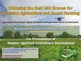
  • 1. redmond@AdaptiveAgroTech.com For Presentation at Adaptive AgroTech Consultancy International Agricultural drone buyer’s guide for farmers and agriculture service professionals https://www.researchgate.net/profile/Redmond_Shamshiri https://florida.academia.edu/Redmond www.adaptiveagrotech.com redmond@AdaptiveAgroTech.com redmond.dynamics@gmail.com
  • 2. Problem statement, Why drones? © Redmond Ramin Shamshiri Solution:  Drones are part of the solution, along with closer collaboration between governments, technology leaders, and industry. 1. With the world’s population projected to reach 9 billion people by 2050, experts expect agricultural consumption to increase by nearly 70 percent over the same time period. 2. Extreme weather events are on the rise, creating additional obstacles to productivity. 3. Agricultural producers must embrace revolutionary strategies for producing food, increasing productivity, and making sustainability a priority.  Expensive piloted aircrafts: Farmers can expect to pay $60,000- $100,000 per year for the services of a skilled agricultural pilot.
  • 3. Traditional Scouting o Traditional scouting requires spending hours and hours of visualizing o Involves manual operations, ineffective techniques o Limitation of human/labor resources (Not on demand) o Repeated dull tasks (i.e., Palm census) o Not a pleasant environment to work (hot, humid) o Hazard/ Safety (Falling from trees, bugs, snakes, etc) o Generates Inaccurate/biased statistics o Requires expert knowledge/Post processing (i.e., lab analysis of data) o Generates limited information (Does not provide comprehensive result) o Ignored parameters due to measurement’s difficulties (i.e., tree height, canopy diameter, tasks that involves climbing trees) Why drones? © Redmond Ramin Shamshiri Satellite remote sensing o Cost o Low resolution o Difficulties of access (Not on-demand) Ground sensing o Time consuming o Limited field of view ©RedmondRaminShamshiri
  • 4. Potentials and benefits of UAV Drones for Precision Agriculture, farming, and crop management  UAV Drone : A Technology that has revolutionized agriculture from planting to harvesting (Seeding, Sensing, spraying, fertilizing, etc).  UAV Drones are Low-cost, widespread available on demand, provide cost-effective monitoring platform, are easy to use, do not require expert operator  UAV Drones have solved time and cost problems with Satellite imaging and piloted aircrafts  UAV Drones Information can be collected at resolutions measured in just centimeters per pixel.  UAV Drones provide live data from a range of sensors (i.e., multispectral, NIR, Lidar, etc)  UAV Drones perform in-depth analysis of crop health, inventory management, etc.  UAV Drones are flexible, both fixed-wing and multi-rotor models can be customized for functionality in different farming application © Redmond Ramin Shamshiri
  • 5. Potentials and benefits of UAV Drones for Precision Agriculture, farming, and crop management  Affordable prices, low cost per flight  Apply the optimal amount of any input (water, fertilizer, pesticide, fuel, labour) when and where it’s needed to efficiently produce high crop yields.  Create further sustainability in crops  High image detail: Fly over fields taking extremely detailed photos of crops  Analyzing the crops to determine how healthy they are.  Can provide thermal infra-red radiation, or TIR images to detect the water stress, disease, insect pests, and weeds.  Can target a specific area for spraying application  Capable of creating three-dimensional maps of fields  Identify the nutrient deficiencies  Identify fertility levels of different parts of individual fields. © Redmond Ramin Shamshiri
  • 6. What does a drone can offer?  Flexible remote sensing platform  Crop/ Tree Scouting  Health/growth assessment  Inventory management  Yield estimation / Monitoring  Weed and disease detection MD4-1000DJI Phantom 4AG550 Ace X88-J2 DJI S1000DJI AGRAS MG-1iMK-8 Trimble UX5Lancaster eBee Phoenix 2 3DR Aero-M 915 DT26X surveillanceAg-wing Drones offer great opportunities for automation of farming processes, data gathering through aerial surveillance and data processing software to calculate future crop yields. The global market for agricultural UAV drones is estimated to reach $3.7 billion dollars by the year 2022. (Source: Radiant Insight Research firm) © Redmond Ramin Shamshiri  Mapping (2D, 3D, GIS, NDVI)  Risk/Hazard/Safety management  Soil condition assessment  Variable rate technology  Robotics harvesting  Academic and Research application Typical Applications in Agriculture ©RedmondRaminShamshiri
  • 7. UAV Drone as Remote Sensing Platform Remote sensing components Sensors , Cameras Platform Application software RGB, Infrared, NIR NDVI, Multispectral Hyperspectral LiDAR, Thermal, Sonar Airborne Ground-basedFlexible UAV Satellite Piloted AV Fixed wing Multi-rotor HandheldVehicle mount Filling the gap between aerial and ground UAV Setup Flight Preparation Test and trials Mission planning Image acquisition Video streaming Camera/Sensor setups Calibration Image processing Creating 2D, 3D, GIS, NDVI Maps (Pix4Dmapper, Agisoft) Image/Map interpretation GIS analysis Custom software Correlation analysis Management strategies Decision makings Recommendations Data collection Data Processing Data analyzing Results RGB NIR LiDARNDVI Thermal HyperspectralMultispectral © Redmond Ramin Shamshiri
  • 8. Common Materials in a UAV/Drone Project © Redmond Ramin Shamshiri UAV Platform Sensors (Cameras) Application Software Programming (Processing) Multi-rotorFixed wing Multi-rotor UAVs  launch and land vertically  are favored where space is tight Fixed-wing UAV Requires suitable space to launch and land  Can provide longer flight duration  Can carry a heavier payload. In-flight stability, flight-time duration and payloads are major paramount concerns RGB NIR NDVI Thermal Multispectral Hyperspectral LiDAR Onboard GPS Auto flight Controller ©RedmondRaminShamshiri
  • 9. 1. Platform setup, integrating UAV, sensors and software 2. Creating high quality 2D and 3D maps of the area 3. Developing custom-built programs/algorithms for specific task UAV Setup Flight Preparation Test and trials Mission planning Image acquisition Video streaming Camera/Sensor setups Calibration Image processing Creating 2D, 3D, GIS, NDVI Maps (Pix4Dmapper, Agisoft) Image/Map interpretation GIS analysis Custom software Correlation analysis Management strategies Decision makings Reports generation UAV images need to be photogrammetrically processed and translated into accurate 2D orthomosaics and maps, 3D models and surface models, and other GIS datasets Orthomosaics, 3D Models and Digital Surface Models, 3D Flythrough Videos, Multispectral Image Mosaics, Index Maps, (i.e., NDVI) needs to be processed/interpreted DATA COLLECTION Data Processing Mapping Modeling Data analyzing Results / Reports Methodology steps General methodology for using Agricultural Drones as Remote sensing platform © Redmond Ramin Shamshiri ©RedmondRaminShamshiri
  • 10. Imaging sensors for UAV Drone RGB NIR LiDARNDVI Thermal HyperspectralMultispectral © Redmond Ramin Shamshiri ©RedmondRaminShamshiri
  • 11. Imaging sensors for UAV Drone © Redmond Ramin Shamshiri ©RedmondRaminShamshiri
  • 12. Visible (RGB), Infrared, NIR sensors © Redmond Ramin Shamshiri Sony A6000 Visible Sensor Focus Points: 179 True Resolution: 24.3Mp Pixel Size: 15.1 µm² ISO: 1347 ISO Image Quality: 82 Dynamic Range: 13.1 EV Colour Depth:24.1 bits Resolution (GSD):1.5cm – 4.5cm Lumix LX7 Sensor Details True Resolution:10.1Mp Aperture Range:F1.4 - F2.3 Max Shutter Speed: 1 second ISO:80 - 6400 ISO Image Quality: 82 Resolution (GSD): 5cm @400ft Format:RAW, JPG Image Stabilisation:roll & anti-shake Visible (RGB) Lumix LX7 Infrared Sensor True Resolution:10.1Mp Aperture Range:F1.4 - F2.3 Max Shutter Speed: 1 second ISO:80 - 6400 ISO Image Quality: 82 Resolution (GSD): 5cm @400ft Format:RAW, JPG Image Stabilisation:roll and anti-shake Canon S110-NIR, 12 MP, adapted to be controlled by drones autopilot Acquires image data in the NIR band Resolution: 12 MP Ground resolution at 100 m: 3.5 cm/px Sensor size: 7.44 x 5.58 mm Pixel pitch: 1.86 um Image format: JPEG and/or RAW Healthy plants have a strong near infrared reflectivity, called the "Red Edge". Infrared Near Infrared ©RedmondRaminShamshiri
  • 13. NDVI Sensors © Redmond Ramin Shamshiri −1 ≤ 𝑁𝐷𝑉𝐼 = 𝑋% − 𝑌% 𝑋% + 𝑌% ≤ +1 SUN Y% X% RGB NIR NDVI NDVI<0 : Dead plants NDVI< 𝟎. 𝟑𝟑 Unhealthy plants 0.33< NDVI< 0.66: Healthy plant NDVI>0.66 Very healthy plants NDVI - TWIN LUMIX LX7 low cost, rugged, high resolution imaging solution for NDVI, agricultural and archeological data analysis. provides true R and IR information from different sensors, providing the clean photogrammetric information required for vegetation anaysis processing. Combined with a 5cm resolution at 400ft this sensor provides a host of benefits for the agronomist and archeaologist . True Resolution:10.1Mp, Aperture Range:F1.4 - F2.3 Max Shutter Speed: 1 second, ISO:80 - 6400 ISO Image Quality: 82, Resolution (GSD): 5cm @400ft Format:RAW, JPG, Image Stabilisation:roll and anti-shake Canon PowerShot SX260 12.1 MegaPixel Digital Camera Models: XNiteCanonSX260: UV+Visible+IR XNiteCanonSX260: IR- Only XNiteCanonSX260NDVI: 3-Band Vegetation Stress Remote Sensing Camera Normalized Difference Vegetation Index (NDVI): measurement of the amount of live vegetation in an area ©RedmondRaminShamshiri
  • 14. NDVI Sensors, Video clip © Redmond Ramin Shamshiri ©RedmondRaminShamshiri
  • 15. Thermal and Multispectral Sensors © Redmond Ramin Shamshiri High Resolution Uncooled Thermal Camera: Tau 640 Optris PI450 Temperature range: -20°C to 900°C Spectral range: 7,5 bis 13 µm Optical resolution: 382 x 288px Frame rate 80 Hz capture single images at a rate one per 2 seconds. Each pixel from each image has an exact temperature associated with it. High Resolution thermal imaging can assist disease detection and water stress in Oil Palms, or for scouting at nights, fire hazard alarm Thermal Sensors Multispectral Sensor  To identify Oil Palm stress factors, soil types, fertilizers, or insecticides  To identify differentiate plant species or recognize other plant (weeds…)  To identify soil or chemical conditions that are, in each case, able to be identified by their unique spectral signature.  To graphically illustrate vegetation indices such as NDVI that are defined by relationships of specific narrow-band wavelengths.  With each exposure, 4 or 6 separate bands of visible or near-infrared radiation move through each camera's lens and filter to form a separate monochromatic image on the camera's sensor. ©RedmondRaminShamshiri
  • 16. RGB Image vs. Hyperspectral image Pixel: 3 dimensional data at R, G, B waveband RGB Color Image Pixel: dozens or hundreds dimensional data 0 50 100 150 200 250 0 50 100 150 200 Spectral Band [-] Intensity[-] 250 50 Waveband [-] 50 100 150 Intensity[-] 200 ©RedmondRaminShamshiri © Redmond Ramin Shamshiri
  • 17. UAV Hyperspectral Imaging © Redmond Ramin Shamshiri Advantages • Hyperspectral image contains enormous information. • We can analyze the target in detail. • We can combine both spatial and spectral analysis. • We can apply it to the wide area of agricultural sensing. Disadvantages • Data structure is complicated and special. • Data size is large. • There are few software applications and libraries. • We have to develop the software by ourselves. • We have to understand complicated data structure. Camera Target Camera axis Spatial axis 400 nm 1000 nm Wavelength spectral axis Output from camera (Sensing line frame) A-CB-D A B C D ©RedmondRaminShamshiri
  • 18. Hyperspectral Dataflow of Sampling Pixel Spectral Data © Redmond Ramin Shamshiri Spectral image Sensing line frame y 0 50 100 150 200 250 0 50 100 150 200 Spectral Band [-] Intensity[-] Pixel spectral data x(x, y) Digital Video Recorder Personal ComputerIEEE 1394 Interface Indoor Laboratory Hyperspectral Camera Outdoor Fields Target Hyperspectral Image Capturing System ©RedmondRaminShamshiri
  • 19. Implementation of Spectral Processor © Redmond Ramin Shamshiri Sugar beet Waveband No.15(500nm) Sugar beet Waveband No.35(750nm) Soybean (crop row) Visible rays(R, G, B) Sugar beet NIR color (NIR, R, G) Sugar beet Soybean (crop row) 0: Soil 1: Plant 24.7 26.0 24.7 36.9 40.2 50 - 55 45 - 40 - 35 - 30 - 25 - 20 - 15 - 10 - 5 - 0 - Estimated SPAD values of sugar beet Estimated plant ID number (Soil, Sugar beet, Sugina) 2: Sugina 1: Sugar beet 0: Soil Plant Classification ("PlantClassificationProcessor" object) Extraction of Desired Waveband Value ("WavebandProcessor" object) Distinction between Plant and Soil ("PlantSoilProcessor" object) Composition of 3 Waveband Values as False Color ("FalseColorProcessor" object) Estimation of Chlorophyll Content (SPAD Value) ("SpadProcessor" object) ©RedmondRaminShamshiri
  • 20. Example applications of Drones for Precision Agriculture of Oil Palm Modeling h H D Yield=func(Age,LAI,NDVI, H, h, D) Yield monitoring RGB NIR NDVI Health/Growth assessment maps, nutrient estimation Inventory management Internet (cloud) Osprey Drone 1 2 3 4 5 7 19 2110 11 12 13 14 15 16 17 18 25 20 46 22 23 24 9 26 27 28 29 30 31 32 33 34 35 36 37 38 39 40 41 42 43 44 45 8 6 47 FFB QuantificationGeo-referenced Image Yield mapModelingPlatform setup X: Image pixel Y=Weight(Kg) © Redmond Ramin Shamshiri ©RedmondRaminShamshiri
  • 21. UAV application for palm tree counting © Redmond Ramin Shamshiri PLOT B Palm Tree Counting methods Training rules Commercial Software Other techniques ©RedmondRaminShamshiri
  • 22. How Drones Are Revolutionizing Agriculture ©RedmondRaminShamshiri © Redmond Ramin Shamshiri  Unmanned aerial vehicles (UAVs), better known as drones, have been used commercially since the early 1980s.  Today, practical applications for drones are expanding faster than ever in a variety of industries.  Responding to the rapidly evolving technology, companies are creating new business and operating models for UAVs.  The total addressable value of drone-powered solutions in all applicable industries is significant, more than $127 billion, according to a recent PwC analysis. PwC estimates the market for drone- powered solutions in agriculture at $32.4 billion.  Among the most promising areas is agriculture, where drones offer the potential for addressing several major challenges.
  • 23. How Drones Are Revolutionizing Agriculture ©RedmondRaminShamshiri © Redmond Ramin Shamshiri 1. Soil and field analysis:  Drones can be instrumental at the start of the crop cycle.  They produce precise 3-D maps for early soil analysis, useful in planning seed planting patterns.  After planting, drone-driven soil analysis provides data for irrigation and nitrogen-level management. 2. Planting:  Drone-planting systems that achieve an uptake rate of 75 percent  Decrease planting costs by 85 percent.  These systems shoot pods with seeds and plant nutrients into the soil, providing the plant all the nutrients necessary to sustain life.
  • 24. How Drones Are Revolutionizing Agriculture ©RedmondRaminShamshiri © Redmond Ramin Shamshiri 3. Crop spraying from sky:  In commercial farming, it’s often necessary to take to the skies to spray pesticides, drop seeds, or spot dying crops. Drones can drop a much more targeted load of pesticide than a traditional airplane could.  Distance-measuring equipment, ultrasonic echoing and lasers such as those used in the light-detection and ranging, or LiDAR, method enables a drone to adjust altitude as the topography and geography vary, and thus avoid collisions.  Drones can scan the ground and spray the correct amount of liquid, modulating distance from the ground and spraying in real time for even coverage.  As for the result: increased efficiency with a reduction of in the amount of chemicals penetrating into groundwater.  Experts estimate that aerial spraying can be completed up to five times faster with drones than with traditional machinery.
  • 25. How Drones Are Revolutionizing Agriculture ©RedmondRaminShamshiri © Redmond Ramin Shamshiri 4. Crop and field monitoring:  Vast fields and low efficiency in crop monitoring together create farming’s largest obstacle.  Monitoring challenges are exacerbated by increasingly unpredictable weather conditions, which drive risk and field maintenance costs.  Previously, satellite imagery offered the most advanced form of monitoring. But there were drawbacks. Images had to be ordered in advance, could be taken only once a day, and were imprecise.  Further, services were extremely costly and the images’ quality typically suffered on certain days.  Today, time-series animations can show the precise development of a crop and reveal production inefficiencies, enabling better crop management.  Fast Scouting: With drones’ agility and speed, spot- checking the farm for damaged fences or diseased crops can take just minutes.
  • 26. How Drones Are Revolutionizing Agriculture ©RedmondRaminShamshiri © Redmond Ramin Shamshiri 5. Irrigation:  Drones with hyperspectral, multispectral, or thermal sensors can identify which parts of a field are dry or need improvements.  Once the crop is growing, drones allow the calculation of the vegetation index, which describes the relative density and health of the crop, and show the heat signature, the amount of energy or heat the crop emits.
  • 27. How Drones Are Revolutionizing Agriculture ©RedmondRaminShamshiri © Redmond Ramin Shamshiri 6. Health assessment:  It’s essential to assess crop health and spot bacterial or fungal infections on trees.  By scanning a crop using both visible and near- infrared light, drone-carried devices can identify which plants reflect different amounts of green light and NIR light.  This information can produce multispectral images that track changes in plants and indicate their health. A speedy response that can save an entire orchard.  As soon as a sickness is discovered, farmers can apply and monitor remedies more precisely.  Increase a plant’s ability to overcome disease: in the case of crop failure, the farmer will be able to document losses more efficiently for insurance claims.
  • 28. © Redmond Ramin Shamshiri
  • 29. Guidelines and facts about drones before purchasing  Agriculture UAV/Drones systems are not for hobbies. They are high- tech data acquisition tools for professionals.  Agricultural UAV/drone activity is considered commercial operation by FAA.  UAV/Drone operator for Agriculture MUST have a Remote Pilot Certificate at any time.  The FactSheet-Small Unmanned Aircraft Regulations (Part 107), Released on June 21, 2016 is available at this Link ©RedmondRaminShamshiri © Redmond Ramin Shamshiri  Prices range for a complete agriculture UAV/Drone is between $1,500 to over $25,000
  • 30. Some facts and guidelines about drones ©RedmondRaminShamshiri © Redmond Ramin Shamshiri  Different crop, different scenario:  Different farms, different crop and plant scenario, trees, leaves, roots, etc, not to mention different livestock and ranching. Ask yourself what am I planning to do with the drone?  Each crop needs to be measured differently to generate actionable data.  There is no universal crop survey solution, and it will probably be specialists in each particular crop type who ultimately deliver solutions to farmers.
  • 31. Some facts and guidelines about drones ©RedmondRaminShamshiri © Redmond Ramin Shamshiri  Multi-copters or fixed wing?  Do you have landing strips in your farm for takeoff-and-landing? Fixed-wing drones get battered fast in regular use without dedicated landing areas.  Multicopters, can take off and land anywhere. They are gaining endurance and can now fly for as much as 40 minutes and cover miles.  Fixed wing drones are only suited for the largest farms. They need to be planned very carefully to find places they can reliably land.
  • 32. Some facts and guidelines about drones ©RedmondRaminShamshiri © Redmond Ramin Shamshiri  Phones/tablets controlled drones are preferred over laptops:  Farmers don’t want to drag laptops into the fields.  Any drone should be entirely operated by a standard Apple or Android smartphone or tablet.  Fully autonomous, or pilot flying?  Farmers don’t want to have to fly things.  Agricultural UAVs should be fully-autonomous, from takeoff to landing.  The experience should be as simple as pressing a “Start” button on a phone and the drone flies the entire mission on its own.
  • 33. Some facts and guidelines about drones ©RedmondRaminShamshiri © Redmond Ramin Shamshiri  Fly the camera, not the aircraft:  What the farmer is interested in is a picture , not the acquisition of the picture.  Let sophisticated planning tools figure out precisely how to gather the right images  Let autonomy take care of the complicated details of flight dynamics, and let farmers move the picture.  Live Standstill Video  Sometimes a live standstill view feed will allow farmers to spot issues and direct the vehicle to more closely inspect the problem area.  Live standstill vide feature is only practical with multicopters UAV.
  • 34. Some facts and guidelines about drones ©RedmondRaminShamshiri © Redmond Ramin Shamshiri  NDVI camera option:  The gold standard of crop surveying is a “Normalized Differential Vegetation Index”, which shows the difference between regular red light reflected from plants and near- infrared light.  A regular camera slightly modified with a blue bit of plastic becomes a near-IR camera.  If your drone does not come with NDVI camera, take a cheap consumer 3D camera with two lenses, modify one for near-IR, and you’ve got a NDVI camera for less than $200.  A ready-to-fly drone equipped for photography can cost less than $10,000.
  • 35. Some facts and guidelines about drones ©RedmondRaminShamshiri © Redmond Ramin Shamshiri  Money vs. Time  Time is money, a more expensive drone that can get answers faster will compensate its cost over a low-cost slow drone. By doing regular crop surveys, say every day or week, and using software to highlight differences over time, it’s possible to zero in on growing differences between areas of a field, which may be directly correlated to productivity.
  • 36. Some basic checklist before purchasing a drone ©RedmondRaminShamshiri © Redmond Ramin Shamshiri  Check whether you need a pilot license to operate the drone,  Check the payload (weight) that you want to carry with the drone  Check flight time  Check camera options  Check whether you can learn to operate the drone in a reasonable short time, or if you should hire experts to fly for you. (The 2nd is now becoming a more realistic option)  Check the FAA rules and regulation (Make sure to keep the drone in sight and under 400 feet)  Check safety issues
  • 37.
  • 38. Parrot Disco Pro AG Drone  Price: $ 6,875.00  Weight : 780gr | 28oz without Parrot Sequoia  Take Off Weight : 940g / 33oz with Parrot Sequoia & mount  Size : 1150x580x120mm (45x22x5in)  Wingspan : 1150 mm (45 in)  Removable wings for transport ©RedmondRaminShamshiri © Redmond Ramin Shamshiri
  • 39.  Price : $10,000  1080p camera  Autonomous capability with a stand alone controller system.  Last up to one hour without requiring a recharge  It’s equipped with mission planning software so that a farmer only needs to key in specific parameters for aerial surveillance and the drone will take care of the rest.  It is capable of autonomous landing if it loses contact with its primary user  It can collect and analyse data  It can compare data with previous crop yields to determine whether revenues will be good or bad.  Price : $3,000  1080 HD resolution camera.  Tablet control system.  It being able to withstand winds of up to 30mph.  vertical wings are cheaply replaceable in case of accidents.  The aircraft is unique for its special bungee cord launch feature.  It’s 18 megapixels Near In fared sensor can allow to monitor crops on a very detailed level.  Min Flight Speed : 11 mph  Land Covereage : 600 average acres per hour on a single battery  Housing : Rugged, impact-resistant 2.0 density expanded polypropylene (EPP) foam  Storage Payload : 6.5 lbs across four configurable compartments  Max Time of Flight: 45 - 60 minutes RF70 UAV AgDrone UAS © Redmond Ramin Shamshiri ©RedmondRaminShamshiri
  • 40.  Price : $120,000  designed by French tech company Delair  A battery life of over 1 hour, it could survey large farms without the need for constant recharging.  It has a 1080p camera  A top speed of 110km/hr  The transmission range of 50km as well as a video link range of 15km  A stand alone controller system.  It requires either hand or catapult force in order to launch  It is designed for rough weather so it can sustain flight even under winds speeds of over 70km/hr.  Price: $25,000  Requiring expert handling  This UAV has a 1080p camera  Both tablet and stand alone controlling systems.  It has superior hover capabilities  The ability to fly at low altitudes safely.  It comes with a field support kit, gyro sensor mount as well as training manual.  It can keep flying for up to 45 minutes without charge  It is equipped with both autopilot capability and autonomous landing should it be necessary. DT-26 Crop mapper Quad Indigo © Redmond Ramin Shamshiri ©RedmondRaminShamshiri
  • 41. E384 Mapping Drone  Price: $2,400  Brand name : JJR/C  The E384 is one of the leading drones in the world for Agriculture, Surveying, Construction, Mining and Conservation applications.  The E384 can fly 1,000 acres in 100 minutes at 5cm resolution completely autonomously.  Specifications  Dimensions: 190cm Wingspan, 130cm Length (75 x 51 inches)  Wings and body disassemble for easy transport  Weight: 2.5kg (5.6 lbs)  Endurance: 90 minutes flight time  Cruise Speed: 13m/s (29 mph)  Range: 70km (44 miles)  Map up to 1,000 geo-referenced acres per flight at 5.0cm/pixel resolution (400 Ha)  Max Payload: 1kg (2.2 lbs)  Automatic lens protection for landing  Complete mission planning and operations software  Operating Conditions  MSL Ceiling: 3,960 meters, (13,000 ft), – auto take-off tested to 3,100 meters, (10,000 ft)  Max sustained wind speed: 8 m/sec, (18 mph) for autonomous operation  Telemetry Range: 5km+ (3.1 mi) © Redmond Ramin Shamshiri ©RedmondRaminShamshiri
  • 42.  Price : Not available  lbs dry weight  2.2 lb payload  45 minute flight time  2km / 1.2 mile range  300 acres per flight (300 ft altitude)  Plug-and-Play sensor bay  5-channel multispectral camera available  One-button press to launch (cool feature)  Data resolution down to 1 cm/pixel PrecisionHawk Lancaster 5 Drone © Redmond Ramin Shamshiri  Price : Not available  The first drone of its class made specifically for bird control  Fully Autonomous Flight (program and start – unit will launch, patrol, and land on its own)  Set “waypoints” to perfectly customize patrol areas via GPS technology  Terrifying physical presence is heightened by sonic predator sounds  Camera options available  Professional-grade carbon fiber construction  Ideal for commercial applications where a falcon or manual drone would be used ProHawk® UAV ©RedmondRaminShamshiri
  • 43.  Price : Not available  The XENA Observer is a professional, robust and versatile system, embedding a dual camera gimbal offering both day and night vision.  With a powerful zoom (up to 40x), it allows to identify subjects at more than 2 Km of distance.  The infrared camera allows to operate in night time or low visibility environment.  Flight time: Up to 27 min  Take-Off Weight: 5 Kg  Max continuous wind: 50 Km/h  Max altitude: 5000 m  Power: 1 x LiPo Battery.  Price: Not available  The XENA Thermo is a professional, robust and versatile system  Able to easily embark the FLIR Vue Pro R (640) or the Optris PI 640 with PI LightWeight  Two highly efficient and qualitative thermal cameras. They allow to record high quality radiometric thermal data  Perfectly suitable for UAV operations.  Flight time: Up to 32 min  Take-Off Weight: 4.6 Kg  Max continuous wind: 50 Km/h  Max altitude: 5000 m  Power: 1 x LiPo Battery. XENA OBSERVER - COMPLETE RTF SOLUTION FOR AERIAL SURVEILLANCE XENA THERMO - COMPLETE RTF SOLUTION FOR THERMOGRAPHY © Redmond Ramin Shamshiri ©RedmondRaminShamshiri
  • 44.  Price: $299.00  1080P Full HD Video at 60 FPS, 16MP Still Images, 90 degree capable vertical tilt camera with live first person view streaming, GPS auto stability semi-autonomous flight (Automatic position hold and hover), maximum flight range of 500 meters.  10 inch propellers for maximum flight stability and maneuverability, 44 MPH maximum speed, 22 - 33 MPH cruising velocity, all weather body for light to medium rain and snow, Class 4 wind resistance rating.  5300 mAh intelligent LiPo battery for up to 25 minute flying time, fail safe protocol with auto return home feature (returns to takeoff point).  Mini-B USB input for hassle free firmware updates, mobile App available on iOS and Android store for FPV, telemetry data, camera zoom, and other useful flight and camera control features. AEE Technology AP10 Pro GPS Drone Quadcopter Full HD 1080P 60 FPS 16MP Camera Sentera NDVI Upgrade for DJI Phantom 4 PRO  Price: $3,698  Seamlessly retain the Phantom 4 Pro camera functionality while collecting NIR imagery and producing NDVI maps  Easily identify crops under stress  Quickly focus inputs while maximizing outputs  Confidently fly with standard 5-direction obstacle sensing system  Seamlessly leverage AgVault™ software so data can be viewed at the field edge and immediate action can be taken © Redmond Ramin Shamshiri ©RedmondRaminShamshiri
  • 45. UAV drone crop sprayer water pump spray  Price: US$ 1450 - 5600  Model: F4  Size: 800(L)*800(W)*700mm(H)  Rotor length: 410mm  Material: Carbon fiber  Weight: 9KG  Max. Takeoff weight: 13KG  Max. Load: 10KG  Light load endurance: >=16 Minutes  Max. flight Altitude: 1KM  Battery: >16 000mAh Lithium  Cooling method: Air cooling  Maximum take-off height above sea level: 4500m  Price: $ 15,000  Spraying crops to cover between 7 and 10 acres an hour and holds 10 liters (about 2.6 gallons) of liquid.  It flies up to 8 meters per second, modulating its spraying for even coverage.  It can be used in automatic, semi-automatic, or manual operation,  It is designed for durability with dustproofing, water resistance, and an anti-corrosive build.  The Agras folds down into a compact package after use. DJI announces $15,000 agricultural drone designed to spray crops ©RedmondRaminShamshiri © Redmond Ramin Shamshiri ©RedmondRaminShamshiri
  • 46.  Price: US$ 130,000  Model: Fazer R  Capable of carrying 30 kg (66 lb) in its seed hoppers, or 32 liters (8.5 gallon) in spray tanks, which is enough to cover 4 hectares (10 acres) according to Yamaha.  Output : a slight bump from 19.1 kW to 20.6 kW without increasing the RPM .  Widened exhaust and a better compression ratio.  The UAV tips the scales at 71 kg (156.5 lb).  wireless control range : 7 to 10 frequencies in order to reduce crosstalk  Price: US$ 665.00 - 3,799.05  Model: 5L hexa UAV JMR-V1000  Size (without prop): 87.5x110x48cm  Folding size:50x50x48cm  Maximum takeoff weight: 18KG  Economic load: 5KG, Remote radius: 800m  Operating speed: 3-6m / s (adjustable)  No flight time: 14-18min,  Operation flight time 8-13min  Flight mode: ATT / work mode/ GPS mode  Operating temperature: 0°C-50°C  Net weight: 6.5KG ,  Spray width: 3-5m, Operating speed: 3-8m / s Yamaha's latest unmanned helicopters ready to spray or survey JMR-V1000 6-rotor 5L Payload Spraying Drone ©RedmondRaminShamshiri ©RedmondRaminShamshiri
  • 47. AG-UAV Sprayers  Price: Not available  Model : AG-6A  Hex Configuration (6 motors)  Capacity: 6 kg  Spray flow: 0.5--1.1 L/min  Endurance: 8-15 min  High efficiency  Wheelbase diameter : 1100mm  Height : 650mm  Empty weight : 8kg  Max payload : 6kg  Price: Not available  Model : AG-8A  Octo Configuration (8 motors)  Capacity: 10 kg  Spray flow: 0.8--1.8 L/min  Endurance: 10-20 min  High efficiency  Wheelbase diameter : 1360mm  Height : 650mm  Empty weight : 9.5kg  Max payload : 10kg  Price: Not available  Model : AG-6A+ v2  Hex Configuration (6 motors)  Capacity: 20 kg  Spray flow: 0.9--2.4 L/min  Endurance: 15-30 min  High efficiency  Wheelbase diameter : 1450mm  Height : 650mm  Empty weight : 14.2kg  Max payload : 20kg © Redmond Ramin Shamshiri ©RedmondRaminShamshiri
  • 48.  Price: US $ 8,999  Complete AgStar Drone,  custom built and tested at Rise Above  Vulcan Black widow folding frame  Highest Quality Heavy lift Aerial Photography Motors  Simonk Flashed Speed controllers  smooth stable flight and fast throttle response  DJI Naza V2 Flight Controller  Futaba 10J flight radio  2.4ghz Ipad waypoint module (DJI)  Tattu 12500mah 6S LiPo Battery x 2  80W Lipo Charger  2 x Lipo Tester/alarms  Rise Above folding landing gear with 12mm carbon tubes  Price: US $5,500-6,500  Type: Gyroplane  Condition: New  Year Built : 2017  Place of Origin : Jiangsu, China (Mainland)  Model Number: ZJ-6N-10L, ZJ-6N-10L  Material: Carbon Fiber  Spraying width: 4 m  Tank Capacity :10L  Wheelbase: 1400 mm  Function: uav drone crop sprayer AgStar X8 - The Complete Precision Agriculture Drone Solution 10L Agricultural Drone Sprayer Uav For Plant Protection Crop Duster ©RedmondRaminShamshiri RedmondRaminShamshiri
  • 49. AgStar Bird Scarer Payload  Price: $1,500.00  Vulcan quick release plate - for quick and easy installation/removal from your drone  Bird Gard Bird Scarer System integrated for UAV usage  Additional speaker for Bird Scarer system  Price: $7,999.95  Platform For Application Of Liquid Pesticides, Fertilizers, Herbicides  Powerful Stable Octocopter Design  Can Cover 7-10 Acres Per Hour  40-60 Times Faster Than Manual Spraying  Payload Capacity Of 10KG  Various Intelligent Flight Modes  Professional Agricultural Applications DJI AGRAS MG-1 Professional Crop Sprayer © Redmond Ramin Shamshiri ©RedmondRaminShamshiri
  • 50. Hercules Heavy Lift UAV  Price: Not available  Model: Hercules HL6  6 Rotors  Payload: 13 lbs  Endurance: 30 minutes (Depending on wind, flight speed, payload)  Max Speed 23 mph  Wheelbase diameter : 43 inches  Height : 26 inches  Empty weight : 18 lbs  Max payload : 13 lbs  Price: Not available  Model: Hercules HL20  6 Rotors  Payload: 44 lbs  Endurance: 60 minutes (Depending on wind, flight speed, payload)  Max Speed 23 mph  Wheelbase diameter : 57 inches  Height : 26 inches  Empty weight : 31 lbs  Max payload : 44 lbs  Price: Not available  Model: Hercules HL10  8 Rotors  Payload: 22 lbs  Endurance: 30 minutes (Depending on wind, flight speed, payload)  Max Speed 23 mph  Wheelbase diameter : 54 inches  Height : 26 inches  Empty weight : 21 lbs  Max payload : 22 lbs © Redmond Ramin Shamshiri ©RedmondRaminShamshiri
  • 51. Multirotor UAVs  Price: Not available  GPS flight assistance: Unique GPS flight assistance for manual or fully autonomous flying  Flighttime : The flight time is 10min to 40min depending on equipment and UAV.  Interfaces : Free interfaces for future sensore technology (radar, laser, collision avoidance)  Photo : Aerial photographs of all heights, angles and perspectives.  Made in Germany : Inhouse development and production makes also your special applications possible.  Price: Not available  Available in Japan currently  The new model AC 1500 is for larger agriculture operations then its current AC940-D model.  It can carry up to 9 liters of liquid agent  It can spray up to 1 ha in 10 minutes.  It supports not only liquid but also granular agent spraying can be supported. enRoute (Japan) Zion AC 1500 © Redmond Ramin Shamshiri ©RedmondRaminShamshiri
  • 52. AgStar GoPro FPV Camera Payload ROA Parkour 280 Racer FPV Quadcopter  Price: Not available  Item name: Parkour 280 Racer  Length: 251mm  Width: 228mm  Height: 78mm  Diameter: 280mm  Main material: carbon fiber  Plastic canopy: Parkour 280 comes with red canopy  Motor: ROA 2204 2300KV brushless motor  ESC: Hobbywing 20A  FPV image transmission: 5.8G 200MW 32 Channel  Price: $1,950.00  Vulcan quick release plate - for quick and easy installation/removal from your drone  H4-3D Gimbal - 3 axis stabilised brushless camera gimbal to keep your footage perfectly stable, and allow 90 degrees of tilt control  Iosd Mini - Intelligent On Screen Display to feed telemtry data from your drone to you on the ground.  Immersion 25mw 5.8ghz - SD video transmission for live video feed to the operator. Restricted to 25mw to comply with Australian Regulation.  Black Pearl Monitor - 7" LCD screen with folding sunshade for viewing live video feed. Mounts directly to the operator controller.  Long Range Antenna set - We have included an upgraded antenna set for increased range and penetration on the video system (up to 1km) © Redmond Ramin Shamshiri ©RedmondRaminShamshiri
  • 53.  Price of Quadcopter only : Used from $469.99  Easy to Fly: An intelligent flight system automatically keeps your Phantom 3 Standard in the air and under your control.  Amazing Images: Take stunning 2.7K HD videos and 12 Megapixel photos with the integrated aerial camera.  Stable Footage: DJI’s advanced gimbal stabilization technology gives you movie-quality results no matter how you fly.  Enjoy the View: A live video feed gives you a 720p HD real-time view of what your camera sees right on your mobile device.  Peace of Mind: Fly up to 25 minutes on a single charge, and the Intelligent Flight Battery will automatically remind you when power is running low.  Price: Not available  Immediate deployment and use  Fully automated flights  Instantaneous results  Stabilised drone – no need for a gimbal  Follows ground and slopes  Hover mode, also with angle for panoramic shots  Low sensitivity to wind intake  Covers twice as much surface area as multi- copters  No minimal flight altitude compared to fixed wings  Respects no-fly zones set  Unique system under two patents protection EZ|MANTA DJI Phantom 3 Standard Quadcopter dron © Redmond Ramin Shamshiri ©RedmondRaminShamshiri
  • 54. Professional Multifunctional Fixed Wing Mapping UAV drone UG-II Series  Price : Not available  Machine Size : 860*860*540mm(spread) 520*520*540mm(fold)  Machine weight : 3.2kg  Maximum task load : 3kg  Battery : LiPo6s(10000~20000mAH, 20C)  Wheelbase : 860mm  Arm length : 300mm  Diameter : 300mm  Maximum horizontal velocity : 16m/s  Cruising speed : 10m/s  Maximum speed of climb : 8m/s  Wind resistance grade : Lv 5(10m/s)  Maximum flight radius : 5 km  Maximum endurance time : 28Min  Price: Not available  Machine Size : 2240*1600*650mm  Machine material : Compound material  Fuel volume : 3 L  Machine weight : 11kg  Maximum takeoff weight : 15kg  Maximum task load : 2kg  Ceiling : 3500m  Maximum power : 3.5HP  Ambient temperature : -20℃~50℃  Wind resistance grade : LV 5  Maximum endurance time : 3h  Cruising speed : 65~110km/h  Maximum range : 200km  Recycling methods : PLF、downhill race Professional Electric Six Rotor Application Level Polie UAV Drone UA-8 Series © Redmond Ramin Shamshiri ©RedmondRaminShamshiri
  • 55. Professional Eight Rotor Smart Police UAV drone US8-Mini Series  Price: Not available  Endurance time : 36min  Length : 58cm  Wheelbase : 74cm  Weight : 3kg Professional Eight Rotors Police UAV UP8 Series  Price: Not available  Cruising time : 30min  Safe loading : 8kg  Remote radius : 10km  Route planning : Yes  Air relay : Yes  Communication relay : Yes Professional Petrochemical Application UAV UC6 Series  Price: Not available  Patrol time: 45min  Chart transmission distance : 10km  Diamagnetic interference : 1000A/m  Patrol efficiency : ≥30km/h © Redmond Ramin Shamshiri ©RedmondRaminShamshiri
  • 56.  Price: vary from $2,499 to $4,499, and it will depend on the camera options and Real Sense  The sUAS is the perfect solution for long flight times.  A proven and robust technology in an all-in-one package.  The H520 is built for inspection, law enforcement, security, construction, surveying, and mapping applications.  Offering cinematic or broadcast-ready imaging payload systems.  Six-rotor systems that allow for stable, precise flight, long focal-length lenses.  Allow the sUAS to fly at greater distance from an object and data storage that may be shared instantly from the ST16S Ground Station or delivered directly in 4K/2K/HD video or 20Mp still images.  In high-wind environments, the Yuneec H520 sUAS system is able to hold position.  Allowing the solution to fly even when a manned inspection would be deemed unsafe.  Exclusive flight speed control offers slowest speed above stall flight for maximum precision in challenging environments. Yuneec H520 Hexacopter © Redmond Ramin Shamshiri ©RedmondRaminShamshiri
  • 57.  Price : US $5000.00  Product name : Agriculture UAV  Wheelbase : 1200mm  Working Speed : 5-10m/s  Max Take-off Weight : 21.9kg  Max Payload : 10kg  Working Altitude : 0.5-5m  Payload : 10l  Wind Resistance : 5Level  Duration of Flight : 10-15min  Working Temperature : -15℃-50℃  Spray Width : 4-6m(adjustable)  Nozzle Type : Pressure Nozzle  Number of Nozzles : 2  Battery : 2 Pcs 12000mAh Li-Po batteries  Color : Customized  Logo : Customized  Price : US $6999.00  Product Name : Agriculture UAV  Wheelbase : 1350MM  Working Speed : 5-10m/s  Max Take off Weight : 22KG  Max Payload : 10Kg  Working Altitude : 0.5-5m  Payload : 10L  Wind Risistance : 5Level  Duration of Flight : 10-15min  Working Temperature : -15℃-50℃  Spray Width : 4-6m(adjustable)  Nozzle Type : Pressure Nozzle  Number of Nozzles : 2  Battery : 2 Pcs 12000m Ah Li-Po batteries  Color : Yellow  Logo : Digital Eagle Agricultural drone AK-61 YM-6160 © Redmond Ramin Shamshiri ©RedmondRaminShamshiri
  • 58.  Price : US$ 32.99 ~ 52.99  Brand : Skytech  Model : TK110HW  Suit Version Type : RTF  Frequency : 2.4GHz  Channels : 4CH  WiFi Control Distance : 50m  Flight Time : 6-7 mins  Charge Time : 100 mins  Quadcopter Battery : 3.7V 850mAh  Transmitter Battery : 4 x 1.5V AA Batteries (Not Included)  Motor : Brushed  Camera Pixel : 0.3MP  App Download : QR Code on the User Manual  Control Mode : Mode 2 (Left Hand Throttle)  Color : Black  Price: Not available  Model : DJI Inspire  Aerial HD comes from a remote control obsession  Commonly setup with dual batteries this gives it a flight time of around 20 minutes safely  It features a full GPS system that allows us to hold a hovering position accurate to within about 400mm in the wind.  The GPS system is a fully integrated fail safe, this allows to flick one switch if we are ever in trouble and the helicopter will fly itself back to the take off location and land within 1m squared without touching the remote.  This machine fantastically with the Panasonic GH4 shooting 4k UHD footage which is stabilised by a DJI Ronin and DJI OSMO for the closeup chase shots. Aerial HD Skytech TK110HW Specification © Redmond Ramin Shamshiri ©RedmondRaminShamshiri
  • 59. JJRC H8D 5.8G FPV Drone 2.0MP Camera RC Quadcopter  Price : US $4,000-6,500  Type: Helicopter  Condition : New  Year Built : 2017  Place of Origin : Shandong, China (Mainland)  Model Number : X81 06  Name : uav  Material : Aviation carbon fiber  Usage : Pesticide Spraying  Max safe load : 10kg  Function : Spraying Pesticides Smartly  Control system : Remote Control  Flight duration : 25-40 minutes  Spray width of t_46 meters  Product size: 2490mm*1645mm*845mm  Feature: High Efficient  Price: $169.99 ~ $175.00  Brand name : JJR/C  Brand model : H8D  Frequency: 2.4G  Channel : 4CH  Gyro : 6 axis  FPV transmission frequency : 5.8G  Function:ascend/descend/forward/backward/si de flying/360°rolling action/hover/LED/camera/5.8G transmission/CF mode/One key return  Flight duration : 8 Minutes  Remote control distance : 300 meters  Charging time : 110mins  Battery for quadcopter : 7.4V 500mAh (included)  Battery for transmiter : 4 * 1.5V AA Battery (not included)  Battery dimension : 43 * 25 * 12mm  Quadcopter dimension : 330 * 330 * 115mm  Quadcopter weight : 23g X810 Long Range Uav Drone Crop Sprayer For Agriculture © Redmond Ramin Shamshiri ©RedmondRaminShamshiri
  • 60.  Price: 68.99 $  6 AXIS GYRO Equipped with the latest 6-axis flight control systems,  3D lock, More scheduled flight, operating more to the force!  360° Eversion A key 360°roll,continuous roll  2MP HD Camera X8C equipped with HD camera,  Blade Protector Highly elastic plastic protective circle,  Colorful flashing light, keep your Aircraft at night Flying is quite excellent.  Size Body Length:  20 in / 508 mm Body Width:  Body Height: 6.5 in/165 mm  Frequency: 2.4Ghz  Channel: 4 Channel  Battery for Transmitter: 4 x AA battery (not included)  Product Size: 20 x 20 x 6.5 in  Control Mode: Remote Control  Control Distance: about 50m  Battery for RC Quad Copter: 7.4V 2000mAh Li-on  Charging Mode: USB charging  Charging Time: About 180 mins  Play Time: 5-8 mins Syma X8C Venture with 2MP Wide Angle Camera 2.4G 4CH RC Quadcopter © Redmond Ramin Shamshiri ©RedmondRaminShamshiri
  • 61. Agriculture Spraying drones © Redmond Ramin Shamshiri ©RedmondRaminShamshiri
  • 62. Agriculture Spraying drones © Redmond Ramin Shamshiri 5 LITERS, $5,299 10 LITERS, $8,399 15 LITERS, $10,399 ©RedmondRaminShamshiri
  • 63. Agriculture Spraying drones © Redmond Ramin Shamshiri ©RedmondRaminShamshiri
  • 64. Agriculture Spraying drones © Redmond Ramin Shamshiri ©RedmondRaminShamshiri
  • 65. Future of Drones © Redmond Ramin Shamshiri  UAVs might involve fleets, or swarms, of autonomous drones that Could tackle agricultural monitoring tasks collectively,  Hybrid aerial-ground drone actors that could collect data and perform a variety of other tasks.  What’s slowing the progress of drones in agriculture?  Beyond the barriers to widespread drone adoption in all industries, safety of drone operations, privacy issues, and insurance, coverage questions. The biggest agricultural concern is the type and quality of data that can be captured.  Need for more sophisticated sensors and cameras  Need for drones that require minimal training and are highly automated. ©RedmondRaminShamshiri
  • 66. Video clip No. 1: Parrot professional © Redmond Ramin Shamshiri ©RedmondRaminShamshiri
  • 67. Video clip No. 2: Precision agriculture and the use of drones © Redmond Ramin Shamshiri ©RedmondRaminShamshiri
  • 68. Video clip No. 3: UAV for Precision agriculture of oil palm © Redmond Ramin Shamshiri ©RedmondRaminShamshiri
  • 69. Video clip No. 6: Spraying oil palm trees with UAV © Redmond Ramin Shamshiri ©RedmondRaminShamshiri
  • 70. Video clip No. 7: UAV for spraying application in agriculture © Redmond Ramin Shamshiri ©RedmondRaminShamshiri
  • 71. Choosing the Best UAV Drones for Precision Agriculture and Smart Farming Agricultural drone buyer’s guide for farmers and agriculture service professionals Best Drones For Agriculture Exploring agricultural drones Agricultural Drone Technology Agricultural Drones for Sale Choosing the Right Drone for the Job Ramin Shamshiri Redmond Ramin Shamshiri Dr. Redmond Ramin Shamshiri Adaptive AgroTech Research Group International. Adaptive AgroTech Consultancy and Research Group International. senseFly eBee SQ: The eBee series has been a popular choice for farmers, and the biggest selling point is the company's proprietary eMotion software, which makes designing a flight plan incredibly simple. The drone boasts the ability to capture 500 acres of footage in a single flight. Price: $10,490 PrecisionHawk Lancaster 5: PrecisionHawk is another popular drone choice for farmers, and this latest model features a body more capable of enduring hard landings, a redesigned tail, longer wingspan for greater stability in flight, and an improved flight control. Price: $12,000 Honeycomb AgDrone: This drone features a 55-minute flying time, with an additional 11 minutes of reserve time that activates as long as there is not too much wind. The wings are made of a durable Kevlar fiber composite. The drone also comes with dual cameras. Price: $10,000 DJI Matrice 100: Dual batteries in this drone allow for a 40-minute flight time. It also packs the standard suite of DJI systems, such as GPS and flight controller. Price: $3,299 Acknowledgement © Redmond Ramin ShamshiriThis presentation was prepared at Adaptive AgroTech Consultancy and Research Group International. www.AdaptiveAgroTech.com Specials thanks to:  Mrs. Zahra Karimi, Research and executive assistant at Adaptive AgroTech  Ms. Mojgan Shad, Research assistant at Adaptive AgroTech For the contributions and inputs in preparing these slides.