Distribution and geospatial analytics
•
1 like•58 views
Speaker @at geosmart asia / locate18 on 10th Apr 18 in ADL. Topic was "Distribution and geospatial analytics," covering use cases across: vehicle routing and fleet sizing 2) inventory management for mobile sales reps 3) automated B2B prospecting
Report
Share
Report
Share
Download to read offline

Recommended
TfL - How GIS is Helping to Deliver Healthy Streets for Londoners - Enterpris...
London is facing an inactivity crisis and the shift to a more sedentary lifestyle is now one of the biggest threats to our health. With the need to design physical activity back into our everyday lives, join Henry and Joe to find out how TfL use GIS to support ‘The Healthy Streets Approach.’ You will see how the city planner tool is used to analyse a vast library of spatial data to help inform investment decisions in our walking, cycling and public transport infrastructure to transform London and improve the lives of everyone who lives in, works in and visits this great city.
Mapsco NextGen Proposal and GIS/GPS/Cellular Technology Convergence
Proposal I developed for Mapsco, Inc. "NextGen" concept of internet based mapping applications using ESRI shp files, TeleAtlas databases, with Mapsco DGN base map files. With a note on the convergence of mapping technology i.e. GPS, GIS, Cellular Networks (3/4g), and mobile devices.
Embedding Location Intelligence in Web Apps that Enhance User Experience [Air...
This document discusses embedding location intelligence in web applications using CARTO VL and Airship. It introduces CARTO VL as a new map library for fast and flexible vector rendering in web apps. Airship is introduced as a new UI library for intuitive location intelligence apps. The document provides information on the advantages of CARTO VL and Airship, examples of code, and resources for learning more.
Innovative Ideas: Collaboration + Data Data Data = Smarter Cities - Bibiana ...
Innovative Ideas: Collaboration + Data Data Data = Smarter Cities - Bibiana ...WRI Ross Center for Sustainable Cities
Bibiana Mchugh presented on big data and smart cities at Transforming Transportation 2015.
Transforming Transportation 2015: Smart Cities for Shared Prosperity is the annual conference co-organized by the World Resources Institute and the World Bank.Understanding short term rental & tourism trends through geospatial data [CAR...
In this webinar, Transparent's and CARTO's teams discuss how leaders in Real Estate and Travel are leveraging Location Intelligence to drive investment analysis and geomarketing decisions.
Open Data Hub
A global open source platform enabling any organization
(public or private) to upload, update, validate the quality, store and share open transport data
(google+uber)(services) = servi.ca
This document discusses using microservices and service compilers to build smart markets of services that can optimize business processes and workflows. It proposes combining Google and Uber style services into a single market by representing business contexts and requirements as graphs connected by annotated microservices. The goal is to use this representation to search for and assemble optimal sequences of microservices to solve business problems and evolve processes.
Market analysis through Consumer Behavior Pattern Insights
In this webinar in partnership with Safegraph, you learn how to use spatial analysis and leading POI data to drive superior market analysis workflows.
Watch the recorded webinar at: https://go.carto.com/webinars/safegraph-market-analysis-recorded
Location Intelligence & Data Visualization
This document discusses location intelligence and data visualization using Carto. It notes that by 2020, 25 billion devices will generate location data and that location data provides opportunities for new insights. Carto provides solutions to analyze large amounts of location data and gain insights through intuitive dashboards. Key features include self-service tools, extensive datasets, and capabilities to integrate location intelligence into other applications. The document outlines Carto's products and shares examples of how various organizations have used Carto's tools.
Tips and tricks for Working with Demographic Data [CARTOframes & Python]
This webinar focuses on working with our Data Observatory using the CARTOframes library for Python.
Our speakers, Holly Orr, and Alex Roth, present tips and solutions to common problems encountered when working with demographic data. Watch it now at https://go.carto.com/tips-working-demographic-data-webinar-recorded
Ubiwhere - Suiting the Future of Smart Cities
Presentation given by Ricardo Vitorino, Ubiwhere, at Open & Agile Smart Cities' annual Connected Smart Cities & Communities Conference 2020 on 23 January in Brussels, Belgium
Bentley latest v8i_applications-selec_tseries_0319
This document lists various modeling, visualization, and engineering applications that are included in the V8i SELECTseries 10 software package from Bentley Systems. It includes applications for MicroStation design and drafting, Civil 3D design with InRoads and GEOPAK, rail design with RailTrack, mapping with Bentley Map, and other specialized applications for surveying, transportation, and infrastructure project delivery.
CARTO ENGINE
CARTO provides a location intelligence platform that helps organizations use and understand location data. It offers three main products: Builder for self-service analysis, Engine for developing location applications, and Location Data Services for augmenting data. CARTO runs on PostgreSQL/PostGIS and exposes data and tools through APIs that can be used to build maps, perform analysis, and develop mobile apps. It has over 1,200 customers worldwide.
Arc
This document discusses setting up a new department within a company called ARC to capitalize on data by selling it to data brokers and how to market this. It also mentions creating a car rental division and packages to sell.
PlaceTech Trend Talk Nordics - VTS
The document summarizes key points from a PlaceTech conference in Stockholm in January 2019. It discusses how transportation, relationships, and travel have changed with mobile technology. It also outlines five irreversible industry changes impacting commercial real estate and forces of change in CRE technology, including cloud, big data, consumerization, and mobility. Finally, it provides an overview of the VTS platform and its growth, with predictions that structured data and analytics will become more important and skillsets will need to change.
Re-Using Open Data for Smart e-Mobility
The document discusses the need for a new approach to open data integration for smart e-mobility applications. There are billions of data sources and formats from IoT devices that need to be integrated, verified and incentivized for use by data consumers and providers. A proposed solution is the Open Charging Cloud that would use blockchains and smart contracts to track data provenance, ensure transparency of updates, and facilitate micropayments to incentivize open data sharing. This could help applications like automatic vehicle charging and integrate renewable energy sources into the power grid.
Open Charging Cloud @ E-World 2017 in Essen
The document discusses sharing and incentivizing e-mobility data through an Open Charging Cloud. It aims to integrate billions of data sources in multiple formats through an open data approach and using blockchain and smart contracts. This will allow for verified, incentivized data sharing between data consumers and providers. The Open Charging Cloud has organized open e-mobility data for projects and is working with retailers on pilot projects starting in late 2017.
Shift Remote: DevOps: Autodesks research into digital twins for AEC - Kean W...
Autodesk Research has been exploring the intersection of BIM (Building Information Modeling) and Internet of Things (IoT) for the last decade. Project Dasher (http://dasher360.com) integrates sensor data with model data from Autodesk’s Forge platform to contextualize IoT data in 3D. This session will look at the history of Dasher, as well as how some of its capabilities are now being integrated into Forge, allowing web developers to build digital twins integrating real-world performance data with 3D geometry.
Build subservient to operate geobim 2014
BIM and GEO are merging 'religions'. How do market parties and governmental parties work together to get this job done.
Singapore 3D Map for a Smart Nation
This presentation accompanied a joint keynote address given by AAM's Brian Nicholls and Singapore Land Authority's (SLA) Dr Victor Khoo at the Locate17 Conference. AAM and the SLA are working together to capture and deliver an accurate and up-to-date 3D digital map for the entire country of Singapore, providing the digital framework for Singapore's visionary Smart Nation program. This presentation outlines the processes and technologies used to create the 3D digital map and highlights the many applications stemming from it such as Property Management systems, Solar Potential Studies, the development of Driverless Vehicle systems and more (many yet to be discovered!).
Asset management with gis
Asset tracking refers to tracking the method of physical assets, either by scanning barcode labels attached to the assets or by using tags using GPS or RFID which broadcast their location. (Definition from wiki)
The geography of geospatial
This document discusses the rise of geospatial data science and the differences between geospatial data science and traditional GIS. It notes that everyday 2.5 quintillion bytes of data are generated, 80% of which has a geospatial component. Geospatial data science bridges data science and GIS by treating location as core to the data. This field has grown due to increasing data availability, geospatial libraries, cloud computing, and the need to combine GIS and data science skills. The future of geospatial data science involves increased AI/ML use, more industry applications, and significant market and job growth.
Data Visualisation - Bulgaria 2012
This document discusses best practices for visualizing data. It recommends (1) considering your audience and using colors, shapes, and proportions wisely to contextualize data for impact, (2) using basic visualizations like traffic lights, matrices, and maps to visualize numeric, regional, and geographical data respectively, and (3) telling a clear story with your data visualizations by avoiding empty cells and using different visualizations if the current one is not conveying your intended message.
Encuentro Aporta 2016 - Mesa 2 - Miguel Arias
This document discusses Carto's open source and open data approach to business decision making. It highlights that by 2020, 25 billion devices will generate location data, and that location unlocks insights from big data. Carto uses open source code and open data to democratize location intelligence and build communities. This allows for faster development at lower costs. The future is in services rather than code lines. Carto has over 250,000 users creating over 5,000 visualizations per month, and offers tools like Builder, Engine, and location data services to help organizations leverage location data.
Workshop why open bim for clients tokyo oct 23 2018
1) Alex Worp is a strategic advisor for asset management at Schiphol Airport who has been working to implement Building Information Management (BIM) for 5 years.
2) He discusses the challenges of managing complex airport assets with many stakeholders and seeks to improve information exchange through his vision of openBIM - using common data standards, clear agreements on protocols and requirements, and collaborating across the entire asset lifecycle.
3) The opportunity lies in moving from a closed, redundant system to a shared digital environment where parties work together using open standards to gain more knowledge, improve efficiency, and enable better decision-making.
Taking 3D to the next Level with 3D Streaming Maps
Taking 3D to the next Level with 3D Streaming MapsHawaii Geographic Information Coordinating Council
This document discusses streaming 3D maps as a high return, low risk investment for cities. Streaming 3D maps are 100% web-based solutions that enable maximum communication and awareness. They have benefits such as being browser-based so no additional software is needed, turnkey assembly of content is available, and superior 3D technologies can be used in an open architecture with minimal costs, training needs, and risks.New Challenges, New Data: The Power of Location Data in Utilities
In this webinar, our experts discuss how leading energy companies are turning to innovative new location data streams and new location platforms. Watch it now at: https://go.carto.com/power-location-data-utilities-recorded
Supercharging Site Planning in Retail & Real Estate [CARTO Reveal]
In this webinar, our speakers, Flo Broderick, Javier Pérez Trufero and Iñigo Medina discuss how Retailers and Real Estate companies can speed up their geospatial journey with third party data.
Watch it now at: https://go.carto.com/supercharging-site-planning-monitoring-retail-real-estate-recorded
Harnessing transportation big data with analytics in the age of digital busin...
This presentation includes the following main points:-
Basic Concepts & Definitions
Digital Business
Business Intelligence
Real-time Operational Intelligence
Big Data
Advanced Analytics
Big Data Analytics
Formulating your Big Data Strategy
Building your Digital Business and Analytic Platforms
Case Study
Big Data Platform Integration Options & Cost Benefit Trade-off
Harnessing transportation big data with analytics in the age of digital busin...
This presentation covers the following main points:
1- Basic Concepts & Definitions of:
- Digital Business
- Business Intelligence
- Real-time Operational Intelligence
- Big Data
- Advanced Analytics
- Big Data Analytics
2- How to Formulating your Big Data Strategy
3- How to Build your Digital Business and Analytic Platforms
4- Case Study on point 2 and 3
5- Big Data Platform Integration Options & Cost Benefit
Trade off
More Related Content
What's hot
Location Intelligence & Data Visualization
This document discusses location intelligence and data visualization using Carto. It notes that by 2020, 25 billion devices will generate location data and that location data provides opportunities for new insights. Carto provides solutions to analyze large amounts of location data and gain insights through intuitive dashboards. Key features include self-service tools, extensive datasets, and capabilities to integrate location intelligence into other applications. The document outlines Carto's products and shares examples of how various organizations have used Carto's tools.
Tips and tricks for Working with Demographic Data [CARTOframes & Python]
This webinar focuses on working with our Data Observatory using the CARTOframes library for Python.
Our speakers, Holly Orr, and Alex Roth, present tips and solutions to common problems encountered when working with demographic data. Watch it now at https://go.carto.com/tips-working-demographic-data-webinar-recorded
Ubiwhere - Suiting the Future of Smart Cities
Presentation given by Ricardo Vitorino, Ubiwhere, at Open & Agile Smart Cities' annual Connected Smart Cities & Communities Conference 2020 on 23 January in Brussels, Belgium
Bentley latest v8i_applications-selec_tseries_0319
This document lists various modeling, visualization, and engineering applications that are included in the V8i SELECTseries 10 software package from Bentley Systems. It includes applications for MicroStation design and drafting, Civil 3D design with InRoads and GEOPAK, rail design with RailTrack, mapping with Bentley Map, and other specialized applications for surveying, transportation, and infrastructure project delivery.
CARTO ENGINE
CARTO provides a location intelligence platform that helps organizations use and understand location data. It offers three main products: Builder for self-service analysis, Engine for developing location applications, and Location Data Services for augmenting data. CARTO runs on PostgreSQL/PostGIS and exposes data and tools through APIs that can be used to build maps, perform analysis, and develop mobile apps. It has over 1,200 customers worldwide.
Arc
This document discusses setting up a new department within a company called ARC to capitalize on data by selling it to data brokers and how to market this. It also mentions creating a car rental division and packages to sell.
PlaceTech Trend Talk Nordics - VTS
The document summarizes key points from a PlaceTech conference in Stockholm in January 2019. It discusses how transportation, relationships, and travel have changed with mobile technology. It also outlines five irreversible industry changes impacting commercial real estate and forces of change in CRE technology, including cloud, big data, consumerization, and mobility. Finally, it provides an overview of the VTS platform and its growth, with predictions that structured data and analytics will become more important and skillsets will need to change.
Re-Using Open Data for Smart e-Mobility
The document discusses the need for a new approach to open data integration for smart e-mobility applications. There are billions of data sources and formats from IoT devices that need to be integrated, verified and incentivized for use by data consumers and providers. A proposed solution is the Open Charging Cloud that would use blockchains and smart contracts to track data provenance, ensure transparency of updates, and facilitate micropayments to incentivize open data sharing. This could help applications like automatic vehicle charging and integrate renewable energy sources into the power grid.
Open Charging Cloud @ E-World 2017 in Essen
The document discusses sharing and incentivizing e-mobility data through an Open Charging Cloud. It aims to integrate billions of data sources in multiple formats through an open data approach and using blockchain and smart contracts. This will allow for verified, incentivized data sharing between data consumers and providers. The Open Charging Cloud has organized open e-mobility data for projects and is working with retailers on pilot projects starting in late 2017.
Shift Remote: DevOps: Autodesks research into digital twins for AEC - Kean W...
Autodesk Research has been exploring the intersection of BIM (Building Information Modeling) and Internet of Things (IoT) for the last decade. Project Dasher (http://dasher360.com) integrates sensor data with model data from Autodesk’s Forge platform to contextualize IoT data in 3D. This session will look at the history of Dasher, as well as how some of its capabilities are now being integrated into Forge, allowing web developers to build digital twins integrating real-world performance data with 3D geometry.
Build subservient to operate geobim 2014
BIM and GEO are merging 'religions'. How do market parties and governmental parties work together to get this job done.
Singapore 3D Map for a Smart Nation
This presentation accompanied a joint keynote address given by AAM's Brian Nicholls and Singapore Land Authority's (SLA) Dr Victor Khoo at the Locate17 Conference. AAM and the SLA are working together to capture and deliver an accurate and up-to-date 3D digital map for the entire country of Singapore, providing the digital framework for Singapore's visionary Smart Nation program. This presentation outlines the processes and technologies used to create the 3D digital map and highlights the many applications stemming from it such as Property Management systems, Solar Potential Studies, the development of Driverless Vehicle systems and more (many yet to be discovered!).
Asset management with gis
Asset tracking refers to tracking the method of physical assets, either by scanning barcode labels attached to the assets or by using tags using GPS or RFID which broadcast their location. (Definition from wiki)
The geography of geospatial
This document discusses the rise of geospatial data science and the differences between geospatial data science and traditional GIS. It notes that everyday 2.5 quintillion bytes of data are generated, 80% of which has a geospatial component. Geospatial data science bridges data science and GIS by treating location as core to the data. This field has grown due to increasing data availability, geospatial libraries, cloud computing, and the need to combine GIS and data science skills. The future of geospatial data science involves increased AI/ML use, more industry applications, and significant market and job growth.
Data Visualisation - Bulgaria 2012
This document discusses best practices for visualizing data. It recommends (1) considering your audience and using colors, shapes, and proportions wisely to contextualize data for impact, (2) using basic visualizations like traffic lights, matrices, and maps to visualize numeric, regional, and geographical data respectively, and (3) telling a clear story with your data visualizations by avoiding empty cells and using different visualizations if the current one is not conveying your intended message.
Encuentro Aporta 2016 - Mesa 2 - Miguel Arias
This document discusses Carto's open source and open data approach to business decision making. It highlights that by 2020, 25 billion devices will generate location data, and that location unlocks insights from big data. Carto uses open source code and open data to democratize location intelligence and build communities. This allows for faster development at lower costs. The future is in services rather than code lines. Carto has over 250,000 users creating over 5,000 visualizations per month, and offers tools like Builder, Engine, and location data services to help organizations leverage location data.
Workshop why open bim for clients tokyo oct 23 2018
1) Alex Worp is a strategic advisor for asset management at Schiphol Airport who has been working to implement Building Information Management (BIM) for 5 years.
2) He discusses the challenges of managing complex airport assets with many stakeholders and seeks to improve information exchange through his vision of openBIM - using common data standards, clear agreements on protocols and requirements, and collaborating across the entire asset lifecycle.
3) The opportunity lies in moving from a closed, redundant system to a shared digital environment where parties work together using open standards to gain more knowledge, improve efficiency, and enable better decision-making.
Taking 3D to the next Level with 3D Streaming Maps
Taking 3D to the next Level with 3D Streaming MapsHawaii Geographic Information Coordinating Council
This document discusses streaming 3D maps as a high return, low risk investment for cities. Streaming 3D maps are 100% web-based solutions that enable maximum communication and awareness. They have benefits such as being browser-based so no additional software is needed, turnkey assembly of content is available, and superior 3D technologies can be used in an open architecture with minimal costs, training needs, and risks.New Challenges, New Data: The Power of Location Data in Utilities
In this webinar, our experts discuss how leading energy companies are turning to innovative new location data streams and new location platforms. Watch it now at: https://go.carto.com/power-location-data-utilities-recorded
Supercharging Site Planning in Retail & Real Estate [CARTO Reveal]
In this webinar, our speakers, Flo Broderick, Javier Pérez Trufero and Iñigo Medina discuss how Retailers and Real Estate companies can speed up their geospatial journey with third party data.
Watch it now at: https://go.carto.com/supercharging-site-planning-monitoring-retail-real-estate-recorded
What's hot (20)
Tips and tricks for Working with Demographic Data [CARTOframes & Python]
Tips and tricks for Working with Demographic Data [CARTOframes & Python]
Bentley latest v8i_applications-selec_tseries_0319
Bentley latest v8i_applications-selec_tseries_0319
Shift Remote: DevOps: Autodesks research into digital twins for AEC - Kean W...
Shift Remote: DevOps: Autodesks research into digital twins for AEC - Kean W...
Workshop why open bim for clients tokyo oct 23 2018
Workshop why open bim for clients tokyo oct 23 2018
Taking 3D to the next Level with 3D Streaming Maps
Taking 3D to the next Level with 3D Streaming Maps
New Challenges, New Data: The Power of Location Data in Utilities
New Challenges, New Data: The Power of Location Data in Utilities
Supercharging Site Planning in Retail & Real Estate [CARTO Reveal]
Supercharging Site Planning in Retail & Real Estate [CARTO Reveal]
Similar to Distribution and geospatial analytics
Harnessing transportation big data with analytics in the age of digital busin...
This presentation includes the following main points:-
Basic Concepts & Definitions
Digital Business
Business Intelligence
Real-time Operational Intelligence
Big Data
Advanced Analytics
Big Data Analytics
Formulating your Big Data Strategy
Building your Digital Business and Analytic Platforms
Case Study
Big Data Platform Integration Options & Cost Benefit Trade-off
Harnessing transportation big data with analytics in the age of digital busin...
This presentation covers the following main points:
1- Basic Concepts & Definitions of:
- Digital Business
- Business Intelligence
- Real-time Operational Intelligence
- Big Data
- Advanced Analytics
- Big Data Analytics
2- How to Formulating your Big Data Strategy
3- How to Build your Digital Business and Analytic Platforms
4- Case Study on point 2 and 3
5- Big Data Platform Integration Options & Cost Benefit
Trade off
A Journey to a Serverless Business Intelligence, Machine Learning and Big Dat...
In this talk we will describe the journey we made with one of our customers, Volotea, to deploy a serverless Business Intelligence (BI), Machine Learning (ML) and Big Data (BD) platform on the Cloud. The new platform leverages Platform-as-a-Service (PaaS) Cloud services, and it is the result of the reengineering and extension of an existing platform based on Cloud Infrastructure-as-a-Service (IaaS) services and bare-metal systems. Managing and maintaining BI, ML and BD platforms based on bare-metal or IaaS deployments is not a straightforward task, and as size and complexity grow, we often find ourselves spending more and more time in tasks that are rather administrative, more than of a development or analytics nature. That is exactly what Volotea realized, and together we envisioned and executed a plan to lift and reengineer their platform into a new solution that leverages Microsoft Azure PaaS services. We have delivered a solution that manages to greatly reduce the administrative burden as well as the technical complexity when implementing new use cases. The new platform is based on the Microsoft Azure stack and it includes Azure Data Lake, Azure Data Lake Analytics, Azure Data Factory, Azure Machine Learning and Azure SQL Database. Join us in this talk where we will share our lessons learned and we will discuss how to plan and execute such an endeavor.
IoT digital disruption and new IoT business models
Selected presentation slides from a talk presented by Padraig Scully, VP Market Research at IoT Analytics GmbH at a technology conference in May 2017
Splunk - BMW connects business and IT with data driven operations SRE and O11y
BMW is defining the next level of mobility - digital interactions and technology are the backbone to continued success with its customers. Discover how an IT team is tackling the journey of business transformation at scale whilst maintaining (and showing the importance of) business and IT service availability. Learn how BMW introduced frameworks to connect business and IT, using real-time data to mitigate customer impact, as Michael and Mark share their experience in building operations for a resilient future.
Improve Store Expansion (Territory Management Featuring)
This document discusses SAP Spatial and its integration across SAP applications and with Esri ArcGIS. It highlights how SAP Spatial can provide maps and spatial analysis within SAP applications or custom apps. It also discusses how SAP HANA serves as a platform to seamlessly integrate spatial and enterprise data to enable spatial capabilities across organizations. Examples are provided of how SAP Spatial has been used in retail for tasks like in-store consumer behavioral analytics and demand forecasting. Competition and key trends in retail are also mentioned.
Open Source for GIS - EiTESAL Digital Transformation "Role of Open Source" Ev...
EiTESAL Digital Transformation "Role of Open Source" Event 29/11/2017
Open Source for GIS presentation
by :Haitham Harras
EZtoTrack - Tracking Rolloffs - Bransys - Larry Colvin
Do you know what EZtoTrack is?
There is a solution that works!
Take control of your assets and eliminate human error in a click.
Fleet & Asset Management Solution.
Smallworld and Google: the best of both worlds
Presentation at the Smallworld User Conference in Baltimore, September 2010. Discusses work we have done to integrate Smallworld with Google Maps and create a very easy to use application which can access complex utility network data in a simple way. Also discusses advantages of running in the cloud and usability.
Smallworld and Google: the best of both worlds
My presentation at the Smallworld User Conference in Baltimore, talking about the benefits of combining the strengths of Smallworld and Google Maps (the work we are doing with Ubisense myWorld).
Lucidata Titan geo-server data container and services
Titan geoserver is a server that deploys data and services to implement analytics and automate data integration. It is loaded with open source software like PostgreSQL, PostGIS and pgRouting as well as open datasets and optional analytics modules. Titan aims to standardize, automate and focus data, analytics and data science on freight and logistics to cut costs associated with data cleaning and integration. It can provide answers to business and technical questions for pricing analysts, data scientists and technical personnel.
Industry 4.0 in the cloud - SVC214 - Chicago AWS Summit
The document discusses Industry 4.0 and manufacturing in the cloud. It begins with an overview of manufacturing industry trends and challenges. It then discusses how AWS solutions can help manufacturers address issues like connecting products, leveraging data insights, and global collaboration. The presentation then shifts to discussing Spireon, a customer that provides vehicle tracking and fleet management solutions. It describes how Spireon uses AWS services like IoT, SageMaker, and Lambda to power its solutions and gain insights from sensor data.
Open source experiences in AI and DataViz for manufacturing market
1) The document discusses three cases using AI and data visualization in smart manufacturing. The first case involves real-time monitoring and early warning systems using anomaly detection and forecasting. The second case uses connected car and spare parts history data to predict future operations and costs. The third case applies algorithms like clustering and decomposition to disaggregate building energy consumption data from appliances.
2) Grazia Cazzin leads the Knowage Labs and Data & Analytics competency center at Engineering Group, with experience in enterprise applications, data warehousing, BI, and big data analytics for industries, finance, and public sectors.
3) Usability and reducing complexity are emphasized for effective data visualization and AI applications.
Cloud computing and business landscape 2019
The document provides an overview of the cloud computing business landscape in 2019. Some key points:
- ICT is becoming a general purpose technology and cloud computing will be integral to digital transformation over the next decade.
- By 2025, 85% of enterprise applications will be cloud-based as core applications, AI, and IoT drive cloud migration.
- Companies will be the primary users of cloud technology in the next phase of cloud adoption (Cloud 2.0).
Big Data Scotland 2017
Big Data & Analytics continues to redefine business. Data has transitioned from an underused asset to the lifeblood of the organisation, and a critical component of business intelligence, insight and strategy.
Big Data Scotland is the largest annual data analytics conference held in Scotland: it is supported by ScotlandIS and The Data Lab and free for delegates to attend. The conference is geared towards senior technologists and business leaders and aims to provide a unique forum for knowledge exchange, discussion and cross-pollination.
The programme will explore the evolution of data analytics; looking at key tools and techniques and how these can be applied to deliver practical insight and value. Presentations will span a wide array of topics from Data Wrangling and Visualisation to AI, Chatbots and Industry 4.0.
Key Topics
• Tools and techniques
• Corporate data culture, business processes, digital transformation
• Business intelligence, trends, decision making
• AI, Real-time Analytics, IoT, Industry 4.0, Robotics
• Security, regulation, privacy, consent, anonymization
• Data visualisation, interpretation and communication
• CRM and Personalisation
20200507 industrial i3-market-final
Big Data PPP Industrial Data Platforms - Towards cross-sectorial optimization and traceability
To start identifying synergies and to learn how different projects will address key data collection, sharing, integration, and exploitation challenges, a series of webinars have been organized under the umbrella of this Big Data Value PPP. These webinars are also organized by BDVA, BDVe project, and other projects which are part of this PPP.
‘Edge’ Technologies: a new language of innovation
Microsoft Dynamics 365: Continue Your Transformation Journey.
‘Edge’ Technologies: a new language of innovation .
We will demystify the new language of ‘Edge’ Technologies – Common Data Service, Power Apps, Flow, Cortana Intelligence Suite, BOT Framework.
Presented by Henrik Mozart - Senior Technology Specialist, DXC Eclipse
IBM Spain BP Storage Day Inigo Osoro
1) Data is being generated at unprecedented rates, with over 1 trillion gigabytes created every day from sources like social media, sensors, and business transactions.
2) IBM's strategy is to help clients leverage this data by providing solutions across the spectrum from data management and analytics to cognitive systems.
3) IBM has invested over $1 billion to build its big data and analytics capabilities, including acquisitions of companies to expand these technologies.
GAION Intro-EN
GAION is a South Korean company established in 2007 that specializes in big data solutions. It has successfully completed many big data projects for clients in e-commerce, manufacturing, and securities using technologies from Oracle and Splunk. GAION develops its own big data products like BigShark, a Hadoop-based analytics platform, and solutions tailored for marketing, manufacturing, and dashboards. The company aims to provide optimized big data solutions and lead in technology to satisfy customers, shareholders, and employees.
Edge2AI delivered by Cloudera Edge Management(CEM)
This document discusses managing data collection at the edge using Cloudera Edge Management (CEM). CEM allows users to develop edge data collection flows using a NiFi-like interface, deploy those flows to thousands of edge devices grouped by class or manufacturer, and monitor all the edge agents and flows centrally. The document provides an example of using CEM to deploy a new edge flow to a class of Freightliner trucks to ingest data from a new speed sensor and filter events where speed is over 50.
Similar to Distribution and geospatial analytics (20)
Harnessing transportation big data with analytics in the age of digital busin...
Harnessing transportation big data with analytics in the age of digital busin...
Harnessing transportation big data with analytics in the age of digital busin...
Harnessing transportation big data with analytics in the age of digital busin...
A Journey to a Serverless Business Intelligence, Machine Learning and Big Dat...
A Journey to a Serverless Business Intelligence, Machine Learning and Big Dat...
IoT digital disruption and new IoT business models
IoT digital disruption and new IoT business models
Splunk - BMW connects business and IT with data driven operations SRE and O11y
Splunk - BMW connects business and IT with data driven operations SRE and O11y
Improve Store Expansion (Territory Management Featuring)
Improve Store Expansion (Territory Management Featuring)
Open Source for GIS - EiTESAL Digital Transformation "Role of Open Source" Ev...
Open Source for GIS - EiTESAL Digital Transformation "Role of Open Source" Ev...
EZtoTrack - Tracking Rolloffs - Bransys - Larry Colvin
EZtoTrack - Tracking Rolloffs - Bransys - Larry Colvin
Lucidata Titan geo-server data container and services
Lucidata Titan geo-server data container and services
Industry 4.0 in the cloud - SVC214 - Chicago AWS Summit
Industry 4.0 in the cloud - SVC214 - Chicago AWS Summit
Open source experiences in AI and DataViz for manufacturing market
Open source experiences in AI and DataViz for manufacturing market
Edge2AI delivered by Cloudera Edge Management(CEM)
Edge2AI delivered by Cloudera Edge Management(CEM)
Recently uploaded
Global Situational Awareness of A.I. and where its headed
You can see the future first in San Francisco.
Over the past year, the talk of the town has shifted from $10 billion compute clusters to $100 billion clusters to trillion-dollar clusters. Every six months another zero is added to the boardroom plans. Behind the scenes, there’s a fierce scramble to secure every power contract still available for the rest of the decade, every voltage transformer that can possibly be procured. American big business is gearing up to pour trillions of dollars into a long-unseen mobilization of American industrial might. By the end of the decade, American electricity production will have grown tens of percent; from the shale fields of Pennsylvania to the solar farms of Nevada, hundreds of millions of GPUs will hum.
The AGI race has begun. We are building machines that can think and reason. By 2025/26, these machines will outpace college graduates. By the end of the decade, they will be smarter than you or I; we will have superintelligence, in the true sense of the word. Along the way, national security forces not seen in half a century will be un-leashed, and before long, The Project will be on. If we’re lucky, we’ll be in an all-out race with the CCP; if we’re unlucky, an all-out war.
Everyone is now talking about AI, but few have the faintest glimmer of what is about to hit them. Nvidia analysts still think 2024 might be close to the peak. Mainstream pundits are stuck on the wilful blindness of “it’s just predicting the next word”. They see only hype and business-as-usual; at most they entertain another internet-scale technological change.
Before long, the world will wake up. But right now, there are perhaps a few hundred people, most of them in San Francisco and the AI labs, that have situational awareness. Through whatever peculiar forces of fate, I have found myself amongst them. A few years ago, these people were derided as crazy—but they trusted the trendlines, which allowed them to correctly predict the AI advances of the past few years. Whether these people are also right about the next few years remains to be seen. But these are very smart people—the smartest people I have ever met—and they are the ones building this technology. Perhaps they will be an odd footnote in history, or perhaps they will go down in history like Szilard and Oppenheimer and Teller. If they are seeing the future even close to correctly, we are in for a wild ride.
Let me tell you what we see.
一比一原版(BCU毕业证书)伯明翰城市大学毕业证如何办理
原版定制【微信:41543339】【(BCU毕业证书)伯明翰城市大学毕业证】【微信:41543339】成绩单、外壳、offer、留信学历认证(永久存档真实可查)采用学校原版纸张、特殊工艺完全按照原版一比一制作(包括:隐形水印,阴影底纹,钢印LOGO烫金烫银,LOGO烫金烫银复合重叠,文字图案浮雕,激光镭射,紫外荧光,温感,复印防伪)行业标杆!精益求精,诚心合作,真诚制作!多年品质 ,按需精细制作,24小时接单,全套进口原装设备,十五年致力于帮助留学生解决难题,业务范围有加拿大、英国、澳洲、韩国、美国、新加坡,新西兰等学历材料,包您满意。
【我们承诺采用的是学校原版纸张(纸质、底色、纹路),我们拥有全套进口原装设备,特殊工艺都是采用不同机器制作,仿真度基本可以达到100%,所有工艺效果都可提前给客户展示,不满意可以根据客户要求进行调整,直到满意为止!】
【业务选择办理准则】
一、工作未确定,回国需先给父母、亲戚朋友看下文凭的情况,办理一份就读学校的毕业证【微信41543339】文凭即可
二、回国进私企、外企、自己做生意的情况,这些单位是不查询毕业证真伪的,而且国内没有渠道去查询国外文凭的真假,也不需要提供真实教育部认证。鉴于此,办理一份毕业证【微信41543339】即可
三、进国企,银行,事业单位,考公务员等等,这些单位是必需要提供真实教育部认证的,办理教育部认证所需资料众多且烦琐,所有材料您都必须提供原件,我们凭借丰富的经验,快捷的绿色通道帮您快速整合材料,让您少走弯路。
留信网认证的作用:
1:该专业认证可证明留学生真实身份
2:同时对留学生所学专业登记给予评定
3:国家专业人才认证中心颁发入库证书
4:这个认证书并且可以归档倒地方
5:凡事获得留信网入网的信息将会逐步更新到个人身份内,将在公安局网内查询个人身份证信息后,同步读取人才网入库信息
6:个人职称评审加20分
7:个人信誉贷款加10分
8:在国家人才网主办的国家网络招聘大会中纳入资料,供国家高端企业选择人才
留信网服务项目:
1、留学生专业人才库服务(留信分析)
2、国(境)学习人员提供就业推荐信服务
3、留学人员区块链存储服务
→ 【关于价格问题(保证一手价格)】
我们所定的价格是非常合理的,而且我们现在做得单子大多数都是代理和回头客户介绍的所以一般现在有新的单子 我给客户的都是第一手的代理价格,因为我想坦诚对待大家 不想跟大家在价格方面浪费时间
对于老客户或者被老客户介绍过来的朋友,我们都会适当给一些优惠。
选择实体注册公司办理,更放心,更安全!我们的承诺:客户在留信官方认证查询网站查询到认证通过结果后付款,不成功不收费!
一比一原版(UofS毕业证书)萨省大学毕业证如何办理
原版定制【微信:41543339】【(UofS毕业证书)萨省大学毕业证】【微信:41543339】成绩单、外壳、offer、留信学历认证(永久存档真实可查)采用学校原版纸张、特殊工艺完全按照原版一比一制作(包括:隐形水印,阴影底纹,钢印LOGO烫金烫银,LOGO烫金烫银复合重叠,文字图案浮雕,激光镭射,紫外荧光,温感,复印防伪)行业标杆!精益求精,诚心合作,真诚制作!多年品质 ,按需精细制作,24小时接单,全套进口原装设备,十五年致力于帮助留学生解决难题,业务范围有加拿大、英国、澳洲、韩国、美国、新加坡,新西兰等学历材料,包您满意。
【我们承诺采用的是学校原版纸张(纸质、底色、纹路),我们拥有全套进口原装设备,特殊工艺都是采用不同机器制作,仿真度基本可以达到100%,所有工艺效果都可提前给客户展示,不满意可以根据客户要求进行调整,直到满意为止!】
【业务选择办理准则】
一、工作未确定,回国需先给父母、亲戚朋友看下文凭的情况,办理一份就读学校的毕业证【微信41543339】文凭即可
二、回国进私企、外企、自己做生意的情况,这些单位是不查询毕业证真伪的,而且国内没有渠道去查询国外文凭的真假,也不需要提供真实教育部认证。鉴于此,办理一份毕业证【微信41543339】即可
三、进国企,银行,事业单位,考公务员等等,这些单位是必需要提供真实教育部认证的,办理教育部认证所需资料众多且烦琐,所有材料您都必须提供原件,我们凭借丰富的经验,快捷的绿色通道帮您快速整合材料,让您少走弯路。
留信网认证的作用:
1:该专业认证可证明留学生真实身份
2:同时对留学生所学专业登记给予评定
3:国家专业人才认证中心颁发入库证书
4:这个认证书并且可以归档倒地方
5:凡事获得留信网入网的信息将会逐步更新到个人身份内,将在公安局网内查询个人身份证信息后,同步读取人才网入库信息
6:个人职称评审加20分
7:个人信誉贷款加10分
8:在国家人才网主办的国家网络招聘大会中纳入资料,供国家高端企业选择人才
留信网服务项目:
1、留学生专业人才库服务(留信分析)
2、国(境)学习人员提供就业推荐信服务
3、留学人员区块链存储服务
→ 【关于价格问题(保证一手价格)】
我们所定的价格是非常合理的,而且我们现在做得单子大多数都是代理和回头客户介绍的所以一般现在有新的单子 我给客户的都是第一手的代理价格,因为我想坦诚对待大家 不想跟大家在价格方面浪费时间
对于老客户或者被老客户介绍过来的朋友,我们都会适当给一些优惠。
选择实体注册公司办理,更放心,更安全!我们的承诺:客户在留信官方认证查询网站查询到认证通过结果后付款,不成功不收费!
Natural Language Processing (NLP), RAG and its applications .pptx
1. In the realm of Natural Language Processing (NLP), knowledge-intensive tasks such as question answering, fact verification, and open-domain dialogue generation require the integration of vast and up-to-date information. Traditional neural models, though powerful, struggle with encoding all necessary knowledge within their parameters, leading to limitations in generalization and scalability. The paper "Retrieval-Augmented Generation for Knowledge-Intensive NLP Tasks" introduces RAG (Retrieval-Augmented Generation), a novel framework that synergizes retrieval mechanisms with generative models, enhancing performance by dynamically incorporating external knowledge during inference.
STATATHON: Unleashing the Power of Statistics in a 48-Hour Knowledge Extravag...
"Join us for STATATHON, a dynamic 2-day event dedicated to exploring statistical knowledge and its real-world applications. From theory to practice, participants engage in intensive learning sessions, workshops, and challenges, fostering a deeper understanding of statistical methodologies and their significance in various fields."
一比一原版(GWU,GW文凭证书)乔治·华盛顿大学毕业证如何办理
毕业原版【微信:176555708】【(GWU,GW毕业证书)乔治·华盛顿大学毕业证】【微信:176555708】成绩单、外壳、offer、留信学历认证(永久存档真实可查)采用学校原版纸张、特殊工艺完全按照原版一比一制作(包括:隐形水印,阴影底纹,钢印LOGO烫金烫银,LOGO烫金烫银复合重叠,文字图案浮雕,激光镭射,紫外荧光,温感,复印防伪)行业标杆!精益求精,诚心合作,真诚制作!多年品质 ,按需精细制作,24小时接单,全套进口原装设备,十五年致力于帮助留学生解决难题,业务范围有加拿大、英国、澳洲、韩国、美国、新加坡,新西兰等学历材料,包您满意。
【我们承诺采用的是学校原版纸张(纸质、底色、纹路),我们拥有全套进口原装设备,特殊工艺都是采用不同机器制作,仿真度基本可以达到100%,所有工艺效果都可提前给客户展示,不满意可以根据客户要求进行调整,直到满意为止!】
【业务选择办理准则】
一、工作未确定,回国需先给父母、亲戚朋友看下文凭的情况,办理一份就读学校的毕业证【微信176555708】文凭即可
二、回国进私企、外企、自己做生意的情况,这些单位是不查询毕业证真伪的,而且国内没有渠道去查询国外文凭的真假,也不需要提供真实教育部认证。鉴于此,办理一份毕业证【微信176555708】即可
三、进国企,银行,事业单位,考公务员等等,这些单位是必需要提供真实教育部认证的,办理教育部认证所需资料众多且烦琐,所有材料您都必须提供原件,我们凭借丰富的经验,快捷的绿色通道帮您快速整合材料,让您少走弯路。
留信网认证的作用:
1:该专业认证可证明留学生真实身份
2:同时对留学生所学专业登记给予评定
3:国家专业人才认证中心颁发入库证书
4:这个认证书并且可以归档倒地方
5:凡事获得留信网入网的信息将会逐步更新到个人身份内,将在公安局网内查询个人身份证信息后,同步读取人才网入库信息
6:个人职称评审加20分
7:个人信誉贷款加10分
8:在国家人才网主办的国家网络招聘大会中纳入资料,供国家高端企业选择人才
留信网服务项目:
1、留学生专业人才库服务(留信分析)
2、国(境)学习人员提供就业推荐信服务
3、留学人员区块链存储服务
→ 【关于价格问题(保证一手价格)】
我们所定的价格是非常合理的,而且我们现在做得单子大多数都是代理和回头客户介绍的所以一般现在有新的单子 我给客户的都是第一手的代理价格,因为我想坦诚对待大家 不想跟大家在价格方面浪费时间
对于老客户或者被老客户介绍过来的朋友,我们都会适当给一些优惠。
选择实体注册公司办理,更放心,更安全!我们的承诺:客户在留信官方认证查询网站查询到认证通过结果后付款,不成功不收费!
一比一原版(Adelaide毕业证书)阿德莱德大学毕业证如何办理
原版定制【微信:41543339】【(Adelaide毕业证书)阿德莱德大学毕业证】【微信:41543339】成绩单、外壳、offer、留信学历认证(永久存档真实可查)采用学校原版纸张、特殊工艺完全按照原版一比一制作(包括:隐形水印,阴影底纹,钢印LOGO烫金烫银,LOGO烫金烫银复合重叠,文字图案浮雕,激光镭射,紫外荧光,温感,复印防伪)行业标杆!精益求精,诚心合作,真诚制作!多年品质 ,按需精细制作,24小时接单,全套进口原装设备,十五年致力于帮助留学生解决难题,业务范围有加拿大、英国、澳洲、韩国、美国、新加坡,新西兰等学历材料,包您满意。
【我们承诺采用的是学校原版纸张(纸质、底色、纹路),我们拥有全套进口原装设备,特殊工艺都是采用不同机器制作,仿真度基本可以达到100%,所有工艺效果都可提前给客户展示,不满意可以根据客户要求进行调整,直到满意为止!】
【业务选择办理准则】
一、工作未确定,回国需先给父母、亲戚朋友看下文凭的情况,办理一份就读学校的毕业证【微信41543339】文凭即可
二、回国进私企、外企、自己做生意的情况,这些单位是不查询毕业证真伪的,而且国内没有渠道去查询国外文凭的真假,也不需要提供真实教育部认证。鉴于此,办理一份毕业证【微信41543339】即可
三、进国企,银行,事业单位,考公务员等等,这些单位是必需要提供真实教育部认证的,办理教育部认证所需资料众多且烦琐,所有材料您都必须提供原件,我们凭借丰富的经验,快捷的绿色通道帮您快速整合材料,让您少走弯路。
留信网认证的作用:
1:该专业认证可证明留学生真实身份
2:同时对留学生所学专业登记给予评定
3:国家专业人才认证中心颁发入库证书
4:这个认证书并且可以归档倒地方
5:凡事获得留信网入网的信息将会逐步更新到个人身份内,将在公安局网内查询个人身份证信息后,同步读取人才网入库信息
6:个人职称评审加20分
7:个人信誉贷款加10分
8:在国家人才网主办的国家网络招聘大会中纳入资料,供国家高端企业选择人才
留信网服务项目:
1、留学生专业人才库服务(留信分析)
2、国(境)学习人员提供就业推荐信服务
3、留学人员区块链存储服务
→ 【关于价格问题(保证一手价格)】
我们所定的价格是非常合理的,而且我们现在做得单子大多数都是代理和回头客户介绍的所以一般现在有新的单子 我给客户的都是第一手的代理价格,因为我想坦诚对待大家 不想跟大家在价格方面浪费时间
对于老客户或者被老客户介绍过来的朋友,我们都会适当给一些优惠。
选择实体注册公司办理,更放心,更安全!我们的承诺:客户在留信官方认证查询网站查询到认证通过结果后付款,不成功不收费!
4th Modern Marketing Reckoner by MMA Global India & Group M: 60+ experts on W...
The Modern Marketing Reckoner (MMR) is a comprehensive resource packed with POVs from 60+ industry leaders on how AI is transforming the 4 key pillars of marketing – product, place, price and promotions.
一比一原版(UO毕业证)渥太华大学毕业证如何办理
UO毕业证录取书【微信95270640】购买(渥太华大学毕业证成绩单硕士学历)Q微信95270640代办UO学历认证留信网伪造渥太华大学学位证书精仿渥太华大学本科/硕士文凭证书补办渥太华大学 diplomaoffer,Transcript购买渥太华大学毕业证成绩单购买UO假毕业证学位证书购买伪造渥太华大学文凭证书学位证书,专业办理雅思、托福成绩单,学生ID卡,在读证明,海外各大学offer录取通知书,毕业证书,成绩单,文凭等材料:1:1完美还原毕业证、offer录取通知书、学生卡等各种在读或毕业材料的防伪工艺(包括 烫金、烫银、钢印、底纹、凹凸版、水印、防伪光标、热敏防伪、文字图案浮雕,激光镭射,紫外荧光,温感光标)学校原版上有的工艺我们一样不会少,不论是老版本还是最新版本,都能保证最高程度还原,力争完美以求让所有同学都能享受到完美的品质服务。
文凭办理流程:
1客户提供办理信息:姓名生日专业学位毕业时间等(如信息不确定可以咨询顾问:微信95270640我们有专业老师帮你查询);
2开始安排制作毕业证成绩单电子图;
3毕业证成绩单电子版做好以后发送给您确认;
4毕业证成绩单电子版您确认信息无误之后安排制作成品;
5成品做好拍照或者视频给您确认;
6快递给客户(国内顺丰国外DHLUPS等快读邮寄)。
7完成交易删除客户资料
高精端提供以下服务:
一:渥太华大学渥太华大学毕业证文凭证书全套材料从防伪到印刷水印底纹到钢印烫金
二:真实使馆认证(留学人员回国证明)使馆存档
三:真实教育部认证教育部存档教育部留服网站可查
四:留信认证留学生信息网站可查
五:与学校颁发的相关证件1:1纸质尺寸制定(定期向各大院校毕业生购买最新版本毕,业证成绩单保证您拿到的是鲁昂大学内部最新版本毕业证成绩单微信95270640)
A.为什么留学生需要操作留信认证?
留信认证全称全国留学生信息服务网认证,隶属于北京中科院。①留信认证门槛条件更低,费用更美丽,并且包过,完单周期短,效率高②留信认证虽然不能去国企,但是一般的公司都没有问题,因为国内很多公司连基本的留学生学历认证都不了解。这对于留学生来说,这就比自己光拿一个证书更有说服力,因为留学学历可以在留信网站上进行查询!
B.为什么我们提供的毕业证成绩单具有使用价值?
查询留服认证是国内鉴别留学生海外学历的唯一途径但认证只是个体行为不是所有留学生都操作所以没有办理认证的留学生的学历在国内也是查询不到的他们也仅仅只有一张文凭。所以这时候我们提供的和学校颁发的一模一样的毕业证成绩单就有了使用价值。只硕大的蛇皮袋手里拎着长铁钩正站在门口朝黑色的屋内张望不好坏人小偷山娃一怔却也灵机一动立马仰起头双手拢在嘴边朝楼上大喊:“爸爸爸——有人找——那人一听朝山娃尴尬地笑笑悻悻地走了山娃立马“嘭的一声将铁门锁死心却咚咚地乱跳当山娃跟父亲说起这事时父亲很吃惊抚摸着山娃的头说还好醒得及时要不家早被人掏空了到时连电视也没得看啰不过父亲还是夸山娃能临危不乱随机应变有胆有谋山娃笑笑说那都是书上学的看童话和小说时多
一比一原版(Dalhousie毕业证书)达尔豪斯大学毕业证如何办理
原版定制【微信:41543339】【(Dalhousie毕业证书)达尔豪斯大学毕业证】【微信:41543339】成绩单、外壳、offer、留信学历认证(永久存档真实可查)采用学校原版纸张、特殊工艺完全按照原版一比一制作(包括:隐形水印,阴影底纹,钢印LOGO烫金烫银,LOGO烫金烫银复合重叠,文字图案浮雕,激光镭射,紫外荧光,温感,复印防伪)行业标杆!精益求精,诚心合作,真诚制作!多年品质 ,按需精细制作,24小时接单,全套进口原装设备,十五年致力于帮助留学生解决难题,业务范围有加拿大、英国、澳洲、韩国、美国、新加坡,新西兰等学历材料,包您满意。
【我们承诺采用的是学校原版纸张(纸质、底色、纹路),我们拥有全套进口原装设备,特殊工艺都是采用不同机器制作,仿真度基本可以达到100%,所有工艺效果都可提前给客户展示,不满意可以根据客户要求进行调整,直到满意为止!】
【业务选择办理准则】
一、工作未确定,回国需先给父母、亲戚朋友看下文凭的情况,办理一份就读学校的毕业证【微信41543339】文凭即可
二、回国进私企、外企、自己做生意的情况,这些单位是不查询毕业证真伪的,而且国内没有渠道去查询国外文凭的真假,也不需要提供真实教育部认证。鉴于此,办理一份毕业证【微信41543339】即可
三、进国企,银行,事业单位,考公务员等等,这些单位是必需要提供真实教育部认证的,办理教育部认证所需资料众多且烦琐,所有材料您都必须提供原件,我们凭借丰富的经验,快捷的绿色通道帮您快速整合材料,让您少走弯路。
留信网认证的作用:
1:该专业认证可证明留学生真实身份
2:同时对留学生所学专业登记给予评定
3:国家专业人才认证中心颁发入库证书
4:这个认证书并且可以归档倒地方
5:凡事获得留信网入网的信息将会逐步更新到个人身份内,将在公安局网内查询个人身份证信息后,同步读取人才网入库信息
6:个人职称评审加20分
7:个人信誉贷款加10分
8:在国家人才网主办的国家网络招聘大会中纳入资料,供国家高端企业选择人才
留信网服务项目:
1、留学生专业人才库服务(留信分析)
2、国(境)学习人员提供就业推荐信服务
3、留学人员区块链存储服务
→ 【关于价格问题(保证一手价格)】
我们所定的价格是非常合理的,而且我们现在做得单子大多数都是代理和回头客户介绍的所以一般现在有新的单子 我给客户的都是第一手的代理价格,因为我想坦诚对待大家 不想跟大家在价格方面浪费时间
对于老客户或者被老客户介绍过来的朋友,我们都会适当给一些优惠。
选择实体注册公司办理,更放心,更安全!我们的承诺:客户在留信官方认证查询网站查询到认证通过结果后付款,不成功不收费!
University of New South Wales degree offer diploma Transcript
澳洲UNSW毕业证书制作新南威尔士大学假文凭定制Q微168899991做UNSW留信网教留服认证海牙认证改UNSW成绩单GPA做UNSW假学位证假文凭高仿毕业证申请新南威尔士大学University of New South Wales degree offer diploma Transcript
一比一原版(Glasgow毕业证书)格拉斯哥大学毕业证如何办理
毕业原版【微信:41543339】【(Glasgow毕业证书)格拉斯哥大学毕业证】【微信:41543339】成绩单、外壳、offer、留信学历认证(永久存档真实可查)采用学校原版纸张、特殊工艺完全按照原版一比一制作(包括:隐形水印,阴影底纹,钢印LOGO烫金烫银,LOGO烫金烫银复合重叠,文字图案浮雕,激光镭射,紫外荧光,温感,复印防伪)行业标杆!精益求精,诚心合作,真诚制作!多年品质 ,按需精细制作,24小时接单,全套进口原装设备,十五年致力于帮助留学生解决难题,业务范围有加拿大、英国、澳洲、韩国、美国、新加坡,新西兰等学历材料,包您满意。
【我们承诺采用的是学校原版纸张(纸质、底色、纹路),我们拥有全套进口原装设备,特殊工艺都是采用不同机器制作,仿真度基本可以达到100%,所有工艺效果都可提前给客户展示,不满意可以根据客户要求进行调整,直到满意为止!】
【业务选择办理准则】
一、工作未确定,回国需先给父母、亲戚朋友看下文凭的情况,办理一份就读学校的毕业证【微信41543339】文凭即可
二、回国进私企、外企、自己做生意的情况,这些单位是不查询毕业证真伪的,而且国内没有渠道去查询国外文凭的真假,也不需要提供真实教育部认证。鉴于此,办理一份毕业证【微信41543339】即可
三、进国企,银行,事业单位,考公务员等等,这些单位是必需要提供真实教育部认证的,办理教育部认证所需资料众多且烦琐,所有材料您都必须提供原件,我们凭借丰富的经验,快捷的绿色通道帮您快速整合材料,让您少走弯路。
留信网认证的作用:
1:该专业认证可证明留学生真实身份
2:同时对留学生所学专业登记给予评定
3:国家专业人才认证中心颁发入库证书
4:这个认证书并且可以归档倒地方
5:凡事获得留信网入网的信息将会逐步更新到个人身份内,将在公安局网内查询个人身份证信息后,同步读取人才网入库信息
6:个人职称评审加20分
7:个人信誉贷款加10分
8:在国家人才网主办的国家网络招聘大会中纳入资料,供国家高端企业选择人才
留信网服务项目:
1、留学生专业人才库服务(留信分析)
2、国(境)学习人员提供就业推荐信服务
3、留学人员区块链存储服务
→ 【关于价格问题(保证一手价格)】
我们所定的价格是非常合理的,而且我们现在做得单子大多数都是代理和回头客户介绍的所以一般现在有新的单子 我给客户的都是第一手的代理价格,因为我想坦诚对待大家 不想跟大家在价格方面浪费时间
对于老客户或者被老客户介绍过来的朋友,我们都会适当给一些优惠。
选择实体注册公司办理,更放心,更安全!我们的承诺:客户在留信官方认证查询网站查询到认证通过结果后付款,不成功不收费!
06-04-2024 - NYC Tech Week - Discussion on Vector Databases, Unstructured Dat...
06-04-2024 - NYC Tech Week - Discussion on Vector Databases, Unstructured Data and AI
Round table discussion of vector databases, unstructured data, ai, big data, real-time, robots and Milvus.
A lively discussion with NJ Gen AI Meetup Lead, Prasad and Procure.FYI's Co-Found
State of Artificial intelligence Report 2023
Artificial intelligence (AI) is a multidisciplinary field of science and engineering whose goal is to create intelligent machines.
We believe that AI will be a force multiplier on technological progress in our increasingly digital, data-driven world. This is because everything around us today, ranging from culture to consumer products, is a product of intelligence.
The State of AI Report is now in its sixth year. Consider this report as a compilation of the most interesting things we’ve seen with a goal of triggering an informed conversation about the state of AI and its implication for the future.
We consider the following key dimensions in our report:
Research: Technology breakthroughs and their capabilities.
Industry: Areas of commercial application for AI and its business impact.
Politics: Regulation of AI, its economic implications and the evolving geopolitics of AI.
Safety: Identifying and mitigating catastrophic risks that highly-capable future AI systems could pose to us.
Predictions: What we believe will happen in the next 12 months and a 2022 performance review to keep us honest.
一比一原版(UCSB文凭证书)圣芭芭拉分校毕业证如何办理
毕业原版【微信:176555708】【(UCSB毕业证书)圣芭芭拉分校毕业证】【微信:176555708】成绩单、外壳、offer、留信学历认证(永久存档真实可查)采用学校原版纸张、特殊工艺完全按照原版一比一制作(包括:隐形水印,阴影底纹,钢印LOGO烫金烫银,LOGO烫金烫银复合重叠,文字图案浮雕,激光镭射,紫外荧光,温感,复印防伪)行业标杆!精益求精,诚心合作,真诚制作!多年品质 ,按需精细制作,24小时接单,全套进口原装设备,十五年致力于帮助留学生解决难题,业务范围有加拿大、英国、澳洲、韩国、美国、新加坡,新西兰等学历材料,包您满意。
【我们承诺采用的是学校原版纸张(纸质、底色、纹路),我们拥有全套进口原装设备,特殊工艺都是采用不同机器制作,仿真度基本可以达到100%,所有工艺效果都可提前给客户展示,不满意可以根据客户要求进行调整,直到满意为止!】
【业务选择办理准则】
一、工作未确定,回国需先给父母、亲戚朋友看下文凭的情况,办理一份就读学校的毕业证【微信176555708】文凭即可
二、回国进私企、外企、自己做生意的情况,这些单位是不查询毕业证真伪的,而且国内没有渠道去查询国外文凭的真假,也不需要提供真实教育部认证。鉴于此,办理一份毕业证【微信176555708】即可
三、进国企,银行,事业单位,考公务员等等,这些单位是必需要提供真实教育部认证的,办理教育部认证所需资料众多且烦琐,所有材料您都必须提供原件,我们凭借丰富的经验,快捷的绿色通道帮您快速整合材料,让您少走弯路。
留信网认证的作用:
1:该专业认证可证明留学生真实身份
2:同时对留学生所学专业登记给予评定
3:国家专业人才认证中心颁发入库证书
4:这个认证书并且可以归档倒地方
5:凡事获得留信网入网的信息将会逐步更新到个人身份内,将在公安局网内查询个人身份证信息后,同步读取人才网入库信息
6:个人职称评审加20分
7:个人信誉贷款加10分
8:在国家人才网主办的国家网络招聘大会中纳入资料,供国家高端企业选择人才
留信网服务项目:
1、留学生专业人才库服务(留信分析)
2、国(境)学习人员提供就业推荐信服务
3、留学人员区块链存储服务
→ 【关于价格问题(保证一手价格)】
我们所定的价格是非常合理的,而且我们现在做得单子大多数都是代理和回头客户介绍的所以一般现在有新的单子 我给客户的都是第一手的代理价格,因为我想坦诚对待大家 不想跟大家在价格方面浪费时间
对于老客户或者被老客户介绍过来的朋友,我们都会适当给一些优惠。
选择实体注册公司办理,更放心,更安全!我们的承诺:客户在留信官方认证查询网站查询到认证通过结果后付款,不成功不收费!
一比一原版(牛布毕业证书)牛津布鲁克斯大学毕业证如何办理
毕业原版【微信:41543339】【(牛布毕业证书)牛津布鲁克斯大学毕业证】【微信:41543339】成绩单、外壳、offer、留信学历认证(永久存档真实可查)采用学校原版纸张、特殊工艺完全按照原版一比一制作(包括:隐形水印,阴影底纹,钢印LOGO烫金烫银,LOGO烫金烫银复合重叠,文字图案浮雕,激光镭射,紫外荧光,温感,复印防伪)行业标杆!精益求精,诚心合作,真诚制作!多年品质 ,按需精细制作,24小时接单,全套进口原装设备,十五年致力于帮助留学生解决难题,业务范围有加拿大、英国、澳洲、韩国、美国、新加坡,新西兰等学历材料,包您满意。
【我们承诺采用的是学校原版纸张(纸质、底色、纹路),我们拥有全套进口原装设备,特殊工艺都是采用不同机器制作,仿真度基本可以达到100%,所有工艺效果都可提前给客户展示,不满意可以根据客户要求进行调整,直到满意为止!】
【业务选择办理准则】
一、工作未确定,回国需先给父母、亲戚朋友看下文凭的情况,办理一份就读学校的毕业证【微信41543339】文凭即可
二、回国进私企、外企、自己做生意的情况,这些单位是不查询毕业证真伪的,而且国内没有渠道去查询国外文凭的真假,也不需要提供真实教育部认证。鉴于此,办理一份毕业证【微信41543339】即可
三、进国企,银行,事业单位,考公务员等等,这些单位是必需要提供真实教育部认证的,办理教育部认证所需资料众多且烦琐,所有材料您都必须提供原件,我们凭借丰富的经验,快捷的绿色通道帮您快速整合材料,让您少走弯路。
留信网认证的作用:
1:该专业认证可证明留学生真实身份
2:同时对留学生所学专业登记给予评定
3:国家专业人才认证中心颁发入库证书
4:这个认证书并且可以归档倒地方
5:凡事获得留信网入网的信息将会逐步更新到个人身份内,将在公安局网内查询个人身份证信息后,同步读取人才网入库信息
6:个人职称评审加20分
7:个人信誉贷款加10分
8:在国家人才网主办的国家网络招聘大会中纳入资料,供国家高端企业选择人才
留信网服务项目:
1、留学生专业人才库服务(留信分析)
2、国(境)学习人员提供就业推荐信服务
3、留学人员区块链存储服务
→ 【关于价格问题(保证一手价格)】
我们所定的价格是非常合理的,而且我们现在做得单子大多数都是代理和回头客户介绍的所以一般现在有新的单子 我给客户的都是第一手的代理价格,因为我想坦诚对待大家 不想跟大家在价格方面浪费时间
对于老客户或者被老客户介绍过来的朋友,我们都会适当给一些优惠。
选择实体注册公司办理,更放心,更安全!我们的承诺:客户在留信官方认证查询网站查询到认证通过结果后付款,不成功不收费!
Enhanced Enterprise Intelligence with your personal AI Data Copilot.pdf
Recently we have observed the rise of open-source Large Language Models (LLMs) that are community-driven or developed by the AI market leaders, such as Meta (Llama3), Databricks (DBRX) and Snowflake (Arctic). On the other hand, there is a growth in interest in specialized, carefully fine-tuned yet relatively small models that can efficiently assist programmers in day-to-day tasks. Finally, Retrieval-Augmented Generation (RAG) architectures have gained a lot of traction as the preferred approach for LLMs context and prompt augmentation for building conversational SQL data copilots, code copilots and chatbots.
In this presentation, we will show how we built upon these three concepts a robust Data Copilot that can help to democratize access to company data assets and boost performance of everyone working with data platforms.
Why do we need yet another (open-source ) Copilot?
How can we build one?
Architecture and evaluation
Beyond the Basics of A/B Tests: Highly Innovative Experimentation Tactics You...
This webinar will explore cutting-edge, less familiar but powerful experimentation methodologies which address well-known limitations of standard A/B Testing. Designed for data and product leaders, this session aims to inspire the embrace of innovative approaches and provide insights into the frontiers of experimentation!
06-04-2024 - NYC Tech Week - Discussion on Vector Databases, Unstructured Dat...
06-04-2024 - NYC Tech Week - Discussion on Vector Databases, Unstructured Data and AI
Discussion on Vector Databases, Unstructured Data and AI
https://www.meetup.com/unstructured-data-meetup-new-york/
This meetup is for people working in unstructured data. Speakers will come present about related topics such as vector databases, LLMs, and managing data at scale. The intended audience of this group includes roles like machine learning engineers, data scientists, data engineers, software engineers, and PMs.This meetup was formerly Milvus Meetup, and is sponsored by Zilliz maintainers of Milvus.
Recently uploaded (20)
Global Situational Awareness of A.I. and where its headed
Global Situational Awareness of A.I. and where its headed
Natural Language Processing (NLP), RAG and its applications .pptx
Natural Language Processing (NLP), RAG and its applications .pptx
STATATHON: Unleashing the Power of Statistics in a 48-Hour Knowledge Extravag...
STATATHON: Unleashing the Power of Statistics in a 48-Hour Knowledge Extravag...
4th Modern Marketing Reckoner by MMA Global India & Group M: 60+ experts on W...
4th Modern Marketing Reckoner by MMA Global India & Group M: 60+ experts on W...
University of New South Wales degree offer diploma Transcript
University of New South Wales degree offer diploma Transcript
06-04-2024 - NYC Tech Week - Discussion on Vector Databases, Unstructured Dat...
06-04-2024 - NYC Tech Week - Discussion on Vector Databases, Unstructured Dat...
Challenges of Nation Building-1.pptx with more important
Challenges of Nation Building-1.pptx with more important
Enhanced Enterprise Intelligence with your personal AI Data Copilot.pdf
Enhanced Enterprise Intelligence with your personal AI Data Copilot.pdf
Beyond the Basics of A/B Tests: Highly Innovative Experimentation Tactics You...
Beyond the Basics of A/B Tests: Highly Innovative Experimentation Tactics You...
06-04-2024 - NYC Tech Week - Discussion on Vector Databases, Unstructured Dat...
06-04-2024 - NYC Tech Week - Discussion on Vector Databases, Unstructured Dat...
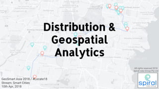
Distribution and geospatial analytics
- 1. GeoSmart Asia 2018 / #Locate18 Stream: Smart Cities 10th Apr, 2018 Distribution & Geospatial Analytics All rights reserved 2018 Spiral Data Group Pty Ltd
- 2. Agenda OUR STORY Build custom geospatial analytics for distribution networks SaaS product in beta for automated B2B prospecting
- 3. Agenda CASE STUDIES 1. Vehicle routing and fleet sizing 2. Inventory management for reps 3. Find B2B prospects that match your business
- 5. Agenda MAPS
- 6. Success Stories DISTRIBUTION HORSE AUTOMOBILE FLEET MGT TELEMATICS 1893 1950 19933500 BC CART MobileInternetPCsMainframes Change of landscape in distribution due to external innovation. Cloud 2000 BC
- 7. Success Stories DISTRIBUTION HORSE AUTOMOBILE FLEET MGT TELEMATICS DATA ANALYTICS 1893 1950 19932000 BC CART MobileInternetPCsMainframes The next phase of Data Analytics has already begun. Cloud Connectivity AI 20103500 BC
- 9. Agenda THE PROBLEM(S) Prospecting Warehousing/ Service Training Marketing Sales Transportation/ Service Delivery Distribution network Support
- 10. Agenda CASE STUDY #1 Route & Fleet sizing optimisation
- 11. Agenda CASE STUDY #1 Route & Fleet sizing optimisation
- 12. Agenda CASE STUDY #1 Route & Fleet sizing optimisation
- 13. Agenda CASE STUDY #2 Days since last visited
- 14. Success Stories CASE STUDY #3
- 15. Agenda CONCLUSION ● Convergence of enablers ● Unstructured data provides “infinite contextual layer” ● Time is now for data analytics or lose competitive advantage
- 16. Agenda THE END Kale Needham | CEO & Founder E kjn@spiraldatagroup.com.au spiraldatagroup.com.au Thank you.