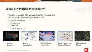
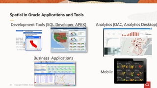
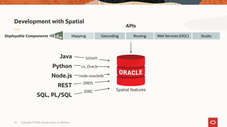
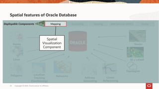
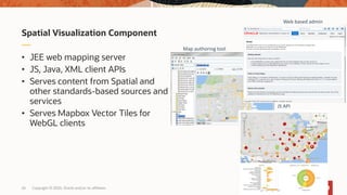
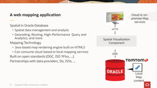
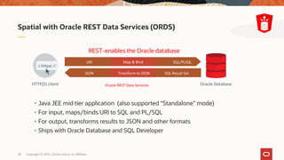
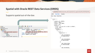
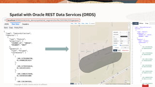
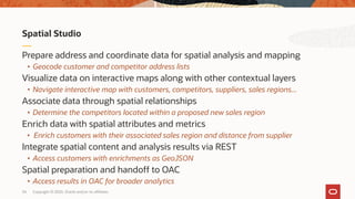
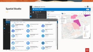
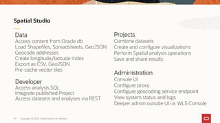
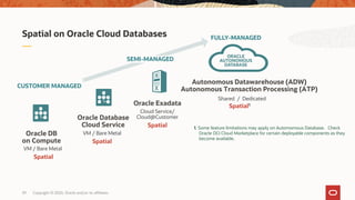
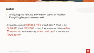
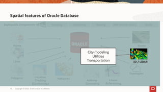
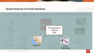
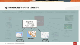
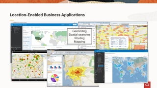
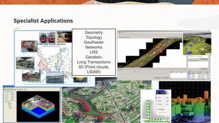
The document discusses Oracle's spatial and graph technologies, highlighting their integration into the Oracle Cloud and various applications within databases, big data, and analytics. It outlines spatial capabilities such as geocoding, routing, and analysis based on location, emphasizing their use in business contexts. Additionally, it introduces Spatial Studio, a tool for managing and analyzing spatial data, and provides resources for further learning and community engagement.
![Copyright © 2020, Oracle and/or its affiliates [Date]
Spatial Technologies - @Home
and Everywhere Else on the Map
Tim Vlamis
VP and Analytics Strategist
Vlamis Software Solutions
David Lapp
Product Manager, Spatial and Graph
Oracle
(spatial-technologies)](https://image.slidesharecdn.com/spatial-databaseathome-2-200512220317/85/dbhouseparty-Spatial-Technologies-Home-and-Everywhere-Else-on-the-Map-1-320.jpg)
![Copyright © 2020, Oracle and/or its affiliates [Date]
Spatial Technologies - @Home
and Everywhere Else on the Map
Tim Vlamis
VP and Analytics Strategist
Vlamis Software Solutions
David Lapp
Product Manager, Spatial and Graph
Oracle
(spatial-technologies)](https://image.slidesharecdn.com/spatial-databaseathome-2-200512220317/75/dbhouseparty-Spatial-Technologies-Home-and-Everywhere-Else-on-the-Map-1-2048.jpg)
![2 Copyright © 2020, Oracle and/or its affiliates [Date]
David Lapp
David is a Product Manager at Oracle, and works on
strategy and planning for Oracle's Spatial and Graph
technologies, and their use across the Oracle Cloud
including database, big data and analytics.
About your presenters:
Tim Vlamis
Tim is an Oracle ACE, and expert in data visualization
and designing business analytics strategies, based in
Kansas City. He has expertise in Oracle-based machine
learning, and business modeling and valuation analysis.
He co-authored several books and teaches Oracle
University courses.](https://image.slidesharecdn.com/spatial-databaseathome-2-200512220317/85/dbhouseparty-Spatial-Technologies-Home-and-Everywhere-Else-on-the-Map-2-320.jpg)
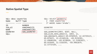
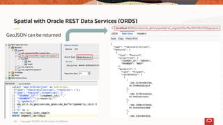
![Copyright © 2020, Oracle and/or its affiliates21
Spatial support for JSON/GeoJSON
• In-database JSON extended to support
Spatial operations
• SDO_GEOMETRY constructors extended to
take JSON as input
• Spatial index and queries extended to
operate on JSON documents
• SQL utility functions for conversion between
SDO_GEOMETRY and JSON/GeoJSON
SQL> SELECT json_value(
2 '{"type":"Point", "coordinates":
3 [-122.1, 22.1]}', '$’
4 RETURNING sdo_geometry)
5 FROM dual;
GEOMETRY
------------------------------------
MDSYS.SDO_GEOMETRY(2001, 4326,
MDSYS.SDO_POINT_TYPE(-122.1, 22.1,
NULL), NULL, NULL)](https://image.slidesharecdn.com/spatial-databaseathome-2-200512220317/85/dbhouseparty-Spatial-Technologies-Home-and-Everywhere-Else-on-the-Map-21-320.jpg)