
Recommended
More Related Content
Similar to Cyclone and Earthquake and different types of Cyclone and Earthquake
Similar to Cyclone and Earthquake and different types of Cyclone and Earthquake (20)
Recently uploaded
Recently uploaded (20)
Cyclone and Earthquake and different types of Cyclone and Earthquake
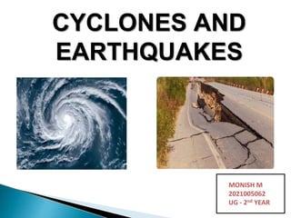
- 1. CYCLONES AND EARTHQUAKES MONISH M 2021005062 UG - 2nd YEAR
- 2. ⦁ Cyclones are huge revolving storms caused by winds blowing around a central area of low atmospheric pressure. Wind blows anti-clockwise in the NH and clockwise in the SH Typhoon- termed used when it formed in the Pacific ocean Hurricane- termed used when it formed in the Atlantic ocean Cyclone- termed used when it formed in the southern ocean and Indian ocean Willy-willy- termed used in Australia
- 3. ⦁ Classification of cyclone according to synoptic scale ⦁ 1. Polar cyclone (polar regions, vast) ⦁ 2. Polar lows (polar regions, short) ⦁ 3. Extratropical cyclone (mid-latitude cyclone) ⦁ 4. Subtropical cyclone (between the equator and 50o N and S) ⦁ 5. Mesocyclone (associated with tornado formation) ⦁ 6. Tropical cyclone (tropics)
- 4. ⦁ Tropical cyclone is non-frontal synoptic scale low- pressure system over tropical waters with organized convection (i.e. Thunderstorm activity) and cyclonic surface circulation. This low pressure creates violent storms that are characterised by winds over 100km/h and heavy rainfall. They have caused the loss of life on a number of occasions due to there intensity.
- 5. ⦁ TC has synoptic scales of 100’s km
- 6. ⦁ The lifetime of a cyclone is determined by how favourable the atmospheric environment is, movement, sea surface temperatures. ⦁ While most cyclones undergo a life-cycle of 3-7 days some weak ones only briefly reach gale force while others can be sustained for weeks if they remain in a favourable environment. ⦁ The longest being Hurricane Ginger (1971) that lasted for 30 days.
- 7. ⦁ Winds of 30-60 kph is expected. ⦁ Sea condition ◦ Wave Height: 1.25-4.0 meters ⦁ Damage to structures Very light or no damage to high risk structures, Light to medium and low risk structures Slight damage to some houses of very light materials or makeshift structures in exposed communities. ⦁ Damage to vegetations Some banana plants are tilted, a few downed and leaves are generally damaged Twigs of small trees may be broken. Rice crops, however, may suffer significant damage when it is in its flowering stage.
- 8. ⦁ Winds of greater than 61 kph and up to 120 kph may be expected in at least 24 hours. ⦁ Sea condition ⦁ Wave Height: 4.1-14.0 m Storm surge possible at coastal areas Damage to structures Light to Moderate damage to high risk structures; · Very light to light damage to medium-risk structures; ·No damage to very light damage to low risk structures Unshielded, old dilapidated schoolhouses, makeshift shanties, and other structures of light materials are partially damaged or unroofed. ⦁ Damage to vegetations Most banana plants, a few mango trees, ipil-ipil and similar types of trees are downed or broken Some coconut trees may be tilted with few others broken Rice and corn may be adversely affected Considerable damage to shrubbery and trees with some heavy-foliaged trees blown down.
- 9. ⦁ Winds of greater than 121 kph up to 170 kph may be expected in at least 18 hours. ⦁ Sea condition ⦁ Wave Height: > 14.0 meters Storm surge possible at coastal areas ⦁ Damage to structures Heavy damage to high–risk structures; ·Moderate damage to medium- risk structures; · Light damage to low-risk structures Increasing damage to old, dilapidated residential structures and houses of light materials (up to 50% in a community) ⦁ Damage to vegetations Almost all banana plants are downed, some big trees (acacia, mango, etc.) are broken or uprooted, Dwarf-type or hybrid coconut trees are tilted or downed Considerable damage to shrubbery and trees with heavy foliage blown off; some large trees blown down.
- 10. ⦁ Very strong winds of greater than 171 kph up to 220 kph may be expected in at least 12 hours. ⦁ Sea condition ⦁ Wave Height: more than 14.0 meters Storm surge2-3m possible at coastal areas ⦁ Damage to structures Very heavy damage to high –risk structures · Heavy damage to medium risk structures; ·Moderate damageto low-risk structures Considerable damage to structures of light materials (up to 75% are totally and partially destroyed); complete roof structure failures. ⦁ Damage to vegetations There is almost total damage to banana plantation, Most mango trees, ipil-ipil and similar types of large trees are downed or broken. Coconut plantation may suffer extensive damage. Rice and corn plantation may suffer severe losses.
- 11. ⦁ more than 220kph Expected in12hrs on 1stissuance. ⦁ Sea condition ⦁ Wave Height: more than 14.0 m Storm surge more than 3 meters possible at coastal areas ⦁ Damage to structures Widespread damage to high-risk structures · Very heavy damage to medium-risk structures ·Heavy damage to low-risk structures; Almost total damage to structures of light materials, especially in highly exposed coastal areas. ⦁ Damage to vegetations Total damage to banana plantation Most tall trees are broken, uprooted or defoliated; Coconut trees are stooped, broken or uprooted. Few plants and trees survived
- 12. 1. Bring precipitation. Rainfall increases groundwater and the water levels of dams that provide drinking water, irrigation water and power generation. 2. Rains mean water for plants. About 50% of our water supply comes from rainfall brought by tropical cyclones. 3. Decreases the level of pollutants. 4. Tropical cyclones also help maintain the global heat balance by moving warm, moist tropical air to the middle latitudes and polar regions. 5. The storm surge and winds of hurricanes may be destructive to human-made structures, but they also stir up the waters of coastal estuaries, which are typically important fish breeding locales.
- 13. 1. Tropical cyclones out at sea cause large waves, heavy rain, and high winds, disrupting international shipping and, at times, causing shipwrecks. 2. Tropical cyclones stir up water, leaving a cool wake behind them, which causes the region to be less favourable for subsequent tropical cyclones. 3. On land, strong winds can damage or destroy vehicles, buildings, bridges, and other outside objects, turning loose debris into deadly flying projectiles. 4. The storm surge, is typically the worst effect from landfalling tropical cyclones, historically resulting in 90% of tropical cyclone deaths 5. The broad rotation of a landfalling tropical cyclone, and vertical wind shear at its periphery, spawns tornadoes.
- 14. EARTHQUAKE
- 15. ⦁ Earthquake also known as quake , tremor or temblor is the phenomenon where there is a sudden release of extreme energy from the earth crust resulting in shaking and displacement of the ground along with the creation of sesmic waves. ⦁ If the Epicenter of a larger earthquake is situated in the offsore (sea/ocean) seabed may be displaced sufficiently to cause Tsunami. ⦁ It also triggers land slides and occassionally volcanic eruptions.
- 16. ⦁ Earthquake shaking may cause loss of life and destruction of property. ⦁ In a strong earthquake the ground shakes violently. ⦁ Buildings may fall or sink into the soil. Rocks and soil may move downhill at a rapid rate. ⦁ Such landslides can bury houses and people.
- 17. ⦁ Earthquake = Vibration of the Earth produced by the rapid release of energy ⦁ Seismic waves = Energy moving outward from the focus of an earthquake ⦁ Focus= location of initial slip on the fault; where the earthquake origins ⦁ Epicenter= spot on Earth’s surface directly above the focus focus epicenter
- 19. ⦁ Geological Faults. ⦁ Volcanic Eruptions. ⦁ Mine Blasts. ⦁ Nuclear Tests.
- 20. ⦁ Based on Magnitude: MAGNITUDE CLASSIFICATION M ≥ 8.0 Great Earthquake 7.0 ≥ M < 8.0 Major / Large Earthquake 5.0 ≥ M < 7.0 Moderate Earthquake 3.0 ≥ M < 5.0 Small Earthquake 1.0 ≥ M < 3.0 Microearthquake M < 1.0 Ultra Microearthquake
- 21. CLASSIFICATION DISTANCE Teleseismic Earthquake > 1000 km Regional Earthquake > 500 km Local Earthquake < 500 km
- 22. Primary Earthquake Hazards: Rapid Ground Shaking Structural Damage Buckled roads and rail tracks
- 24. Alterations to Water Courses Fire resulting from an earthquake
- 26. ⦁Seismometers: instruments that detect seismic waves. ⦁ Seismographs:Record intensity, height and amplitude of seismic waves
- 27. 1. Magnitude: Richter Scale a) Measures the energy released by fault movement. b) Logarithmic-scale; quantitative measure.
- 28. 2) Intensity: Mercalli Scale: What did you feel? ⦁ Assigns an intensity or rating to measure an earthquake at a particular location (qualitative) ⦁ Measures the destructive effect Intensity is a function of: ⦁ Energy released by fault ⦁ Geology of the location ⦁ Surface substrate: can magnify shock waves
- 29. Remote Seismograph Positioning. Scientists consider seismic activity as it is registered on a seismometer. A volcano will usually register some small earthquakes as the magma pushes its way up through cracks and vents in rocks. As a volcano gets closer to erupting, the pressure builds up in the earth under the volcano and the earthquake activity becomes more and more frequent
- 30. Analog Image: This is an image of an analog recording of an earthquake. The relatively flat lines are periods of quiescence and the large and squiggly line is an earthquake.
- 31. Digital Seismogram. Below is a digital seismogram. The data is stored electronically, easy to access and manipulate, and much more accurate and detailed than the analog recordings.
- 32. Tiltmeter: Tilt meters attached to the sides of a volcano detect small changes in the slope of a volcano. When a volcano is about to erupt, the earth may bulge or swell up a bit. Installing a tiltmeter
- 33. Changes in Groundwater Levels. Hydro geological responses to large distant earthquakes have important scientific implications with regard to our earth’s intricate plumbing system. Improves our insights into the responsible mechanisms, and may improve our frustratingly imprecise ability to forecast the timing, magnitude, and impact of earthquakes.
- 34. Observations of Strange Behaviors in Animals. The cause of unusual animal behavior seconds before humans feel an earthquake can be easily explain-ed. Very few humans notice the smaller P wave that travels the fastest from the earthquake source and arrives before the larger S wave. But many animals with more keen senses are able to feel the P wave seconds before the S wave arrives. indeed it’s possible that some animals could sense these signals and connect the perception with an impending earthquake.