The use of two rapidly evolving approaches, the Unmanned Aerial Vehicles (UAVs) and Dense Image Matching (DIM) techniques is an attractive solution to extract high quality photogrammetric products like 3D point clouds and orthoimages.
3d Modelling of Structures using terrestrial laser scanning techniqueIJAEMSJORNAL
In recent times, interest in the study of engineering structures has been on the rise as a result of improvement in the tools used for operations such as, As-built mapping, deformation studies to modeling for navigation etc. There is a need to be able to model structure in such way that accurate needed information about positions of structures, features, points and dimensions can be easily extracted without having to pay physical visits to site to obtain measurement of the various components of structures. In this project, the data acquisition system used is the terrestrial laser scanner, High Definition Surveying (HDS) equipment; the methodology employed is similar to Close Range Photogrammetry (CRP). CRP is a budding technique or field used for data acquisition in Geomatics. It is a subset of the general photogrammetry; it is often loosely tagged terrestrial photogrammetry. The terrestrial laser scanning technology is a data acquisition system similar to CRP in terms of deigning the positioning of instrument and targets, calibration, ground control point, speed of data acquisition, data processing (interior, relative and absolute orientation) and the accuracy obtainable. The aim of this project was to generate the three-dimensional model of structures in the Faculty of Engineering, University of Lagos using High Definition Surveying, the Leica Scan Station 2 HDS equipment was used along with Cyclone software for data acquisition and processing. The result was a 3D view (of point clouds) of the structure that was studied, from which features were measured from the model generated and compared with physical measurement on site. The technology of the laser scanner proved to be quite useful and reliable in generating three dimensional models without compromising accuracy and precision. The generation of the 3D models is the replica of reality of the structures with accurate dimensions and location.
This presentation shows how drones have been used successfully in construction and infrastructure asset management as aerial image and data capture devices thus far, review competitive and traditional approaches using incumbent technology, discuss the opportunities and challenges posed by the technology itself, outline the lessons learned, and discuss what’s next for drones in civil engineering.
Satellite Image Processing technique to enhance raw images received from cameras or sensors placed on satellites, space probes and aircrafts or pictures taken in normal day to day life in various applications.
REMOTE SENSING AND GEOGRAPHIC INFORMATION SYSTEMS AM Publications
Remote sensing technology's increasing accessibility helps us observe research and learn about our globe in ways we could only imagine a generation ago. Guides to profound knowledge of historical, conceptual and practical uses of remote sensing which is increasing GIS technology. This paper will go briefly through remote sensing benefits, history, technology and the GIS and remote sensing integration and their applications. Remote sensing (RS) is used in mapping the predicted and actual species and dominates the ecosystem canopy.
Digital Heritage Documentation Via TLS And Photogrammetry Case Studytheijes
In the last decade, several manual tradition measurement techniques were used to document the heritage buildings around the word; however, some of these techniques take a long time, often lack completeness, and may sometimes give unreliable information. In contrast, terrestrial laser scanning “TLS” surveys and Photogrammetry have already been undertaken in several heritage sites in the United Kingdom and other countries of Europe as a new method of documenting heritagesites. This paper focuses on using the TLS and Photogrammetry methods to document one of the important houses in Historic Jeddah, Saudi Arabia, which is Nasif Historical House, as an example of Digital Heritage Documentation (DHD).
DimEye Corp Presents Revolutionary VLS (Video Laser Scan) at SS IMMR 2013Patrick Raymond
DimEye Corp. Introduces the Revolutionary VLS (Video Laser Scan) to the Subsea Survey IMMR audience in Galveston Texas (November 2013).
VLS™ (Video Laser Scan) by DimEye Corp. is a revolution in Optical 3D Measurement. VLS Provides High Definition Visual Inspection, As-Built 3D Modeling of Industrial/Subsea Equipment, 3D High Density Mapping of Deformations and Defects (for example: Cracks, Dents, Bulges, Corrosion)
VLS™ is a unique combination of photogrammetry and Laser Techniques which provides the Advantages of both technologies without the disadvantages. VLS™ can also be operated by your existing technicians.
VLS™ is a High Accuracy Metrology Tool Linked to NIST (National Industry of Standards and Technology) that provides High Redundancy through volume of data collected (1000s of stills can be captured from HD video in seconds rather than individual photos taken manually at each location). VLS™ provides Reliable Accuracy Estimates (thanks to advanced processing and calibration algorithms developed by DimEye after years of industry experience in multiple measurement environments and scenarios).
International Journal of Modern Engineering Research (IJMER) is Peer reviewed, online Journal. It serves as an international archival forum of scholarly research related to engineering and science education.
International Journal of Modern Engineering Research (IJMER) covers all the fields of engineering and science: Electrical Engineering, Mechanical Engineering, Civil Engineering, Chemical Engineering, Computer Engineering, Agricultural Engineering, Aerospace Engineering, Thermodynamics, Structural Engineering, Control Engineering, Robotics, Mechatronics, Fluid Mechanics, Nanotechnology, Simulators, Web-based Learning, Remote Laboratories, Engineering Design Methods, Education Research, Students' Satisfaction and Motivation, Global Projects, and Assessment…. And many more.
Aerial photogrammetry is a cutting-edge technique revolutionizing
mapping and surveying through the use of aerial imagery. This
infographic provides a concise overview of the key elements and
benefits of aerial photogrammetry.
Digital Heritage Documentation Via TLS And Photogrammetry Case Studytheijes
In the last decade, several manual tradition measurement techniques were used to document the heritage buildings around the word; however, some of these techniques take a long time, often lack completeness, and may sometimes give unreliable information. In contrast, terrestrial laser scanning “TLS” surveys and Photogrammetry have already been undertaken in several heritage sites in the United Kingdom and other countries of Europe as a new method of documenting heritagesites. This paper focuses on using the TLS and Photogrammetry methods to document one of the important houses in Historic Jeddah, Saudi Arabia, which is Nasif Historical House, as an example of Digital Heritage Documentation (DHD)
High Exposure strives to provide developers with accurate data that ensures you can have a solid understanding of the land, property, and potential of the terrain being mapped.
For more details you can visit athttps://www.highexposure.com.au/aerial-photography-for-aerial-mapping/
Elios 3 and GeoSLAM
GeoSLAM has been an innovator and a leader in the Simultaneous Localization and
Mapping ( market. Having developed the first commercial handheld SLAM mobile
mapping
system in 2012, GeoSLAM has extended skills and experience in the industry, improving SLAM
robustness and developing customer driven solutions for traditionally challenging SLAM environments.
An Efficient System for Forward Collison Avoidance Using Low Cost Camera & Em...aciijournal
Forward Collision Avoidance (FCA) systems in automobiles is an essential part of Advanced Driver Assistance System (ADAS) and autonomous vehicles. These devices currently use, radars as the main sensor. The increasing resolution of camera sensors, processing capability of hardware chipsets and advances in image processing algorithms, have been pushing the camera based features recently.
An Efficient System for Forward Collison Avoidance Using Low Cost Camera & Em...aciijournal
Forward Collision Avoidance (FCA) systems in automobiles is an essential part of Advanced Driver
Assistance System (ADAS) and autonomous vehicles. These devices currently use, radars as the main
sensor. The increasing resolution of camera sensors, processing capability of hardware chipsets and
advances in image processing algorithms, have been pushing the camera based features recently.
Monocular cameras face the challenge of accurate scale estimation which limits it use as a stand-alone
sensor for this application. This paper proposes an efficient system which can perform multi scale object
detection which is being patent granted and efficient 3D reconstruction using structure from motion (SFM)
framework. While the algorithms need to be accurate it also needs to operate real time in low cost
embedded hardware. The focus of the paper is to discuss how the proposed algorithms are designed in such
a way that it can be provide real time performance on low cost embedded CPU’s which makes use of only
Digital Signal processors (DSP) and vector processing cores.
AN EFFICIENT SYSTEM FOR FORWARD COLLISION AVOIDANCE USING LOW COST CAMERA & E...aciijournal
Forward Collision Avoidance (FCA) systems in automobiles is an essential part of Advanced Driver Assistance System (ADAS) and autonomous vehicles. These devices currently use, radars as the main sensor. The increasing resolution of camera sensors, processing capability of hardware chipsets and advances in image processing algorithms, have been pushing the camera based features recently. Monocular cameras face the challenge of accurate scale estimation which limits it use as a stand-alone sensor for this application. This paper proposes an efficient system which can perform multi scale object
detection which is being patent granted and efficient 3D reconstruction using structure from motion (SFM)
framework. While the algorithms need to be accurate it also needs to operate real time in low cost
embedded hardware. The focus of the paper is to discuss how the proposed algorithms are designed in such
a way that it can be provide real time performance on low cost embedded CPU’s which makes use of only Digital Signal processors (DSP) and vector processing cores.
An Efficient System for Forward Collison Avoidance Using Low Cost Camera & Em...aciijournal
Forward Collision Avoidance (FCA) systems in automobiles is an essential part of Advanced Driver Assistance System (ADAS) and autonomous vehicles. These devices currently use, radars as the main sensor. The increasing resolution of camera sensors, processing capability of hardware chipsets and advances in image processing algorithms, have been pushing the camera based features recently. Monocular cameras face the challenge of accurate scale estimation which limits it use as a stand-alone sensor for this application. This paper proposes an efficient system which can perform multi scale object detection which is being patent granted and efficient 3D reconstruction using structure from motion (SFM) framework. While the algorithms need to be accurate it also needs to operate real time in low cost embedded hardware. The focus of the paper is to discuss how the proposed algorithms are designed in such a way that it can be provide real time performance on low cost embedded CPU’s which makes use of only Digital Signal processors (DSP) and vector processing cores.
An Efficient System for Forward Collison Avoidance Using Low Cost Camera & Em...aciijournal
Forward Collision Avoidance (FCA) systems in automobiles is an essential part of Advanced Driver
Assistance System (ADAS) and autonomous vehicles. These devices currently use, radars as the main
sensor. The increasing resolution of camera sensors, processing capability of hardware chipsets and
advances in image processing algorithms, have been pushing the camera based features recently.
Monocular cameras face the challenge of accurate scale estimation which limits it use as a stand-alone
sensor for this application.
An Efficient System for Forward Collison Avoidance Using Low Cost Camera & Em...aciijournal
Forward Collision Avoidance (FCA) systems in automobiles is an essential part of Advanced Driver Assistance System (ADAS) and autonomous vehicles. These devices currently use, radars as the main sensor. The increasing resolution of camera sensors, processing capability of hardware chipsets and
advances in image processing algorithms, have been pushing the camera based features recently. Monocular cameras face the challenge of accurate scale estimation which limits it use as a stand-alone
sensor for this application. This paper proposes an efficient system which can perform multi scale object
detection which is being patent granted and efficient 3D reconstruction using structure from motion (SFM) framework. While the algorithms need to be accurate it also needs to operate real time in low cost embedded hardware. The focus of the paper is to discuss how the proposed algorithms are designed in such a way that it can be provide real time performance on low cost embedded CPU’s which makes use of only Digital Signal processors (DSP) and vector processing cores.
Surveyors already have access to ground-based, manned flight, and satellite data, so will they embrace this new technology in earnest?
By Bill McNeil, Contributor/Advisor, and Colin Snow, CEO and Founder, Skylogic Research, LLC
This presentation, created by Syed Faiz ul Hassan, explores the profound influence of media on public perception and behavior. It delves into the evolution of media from oral traditions to modern digital and social media platforms. Key topics include the role of media in information propagation, socialization, crisis awareness, globalization, and education. The presentation also examines media influence through agenda setting, propaganda, and manipulative techniques used by advertisers and marketers. Furthermore, it highlights the impact of surveillance enabled by media technologies on personal behavior and preferences. Through this comprehensive overview, the presentation aims to shed light on how media shapes collective consciousness and public opinion.
Acorn Recovery: Restore IT infra within minutesIP ServerOne
Introducing Acorn Recovery as a Service, a simple, fast, and secure managed disaster recovery (DRaaS) by IP ServerOne. A DR solution that helps restore your IT infra within minutes.
This presentation by Morris Kleiner (University of Minnesota), was made during the discussion “Competition and Regulation in Professions and Occupations” held at the Working Party No. 2 on Competition and Regulation on 10 June 2024. More papers and presentations on the topic can be found out at oe.cd/crps.
This presentation was uploaded with the author’s consent.
Have you ever wondered how search works while visiting an e-commerce site, internal website, or searching through other types of online resources? Look no further than this informative session on the ways that taxonomies help end-users navigate the internet! Hear from taxonomists and other information professionals who have first-hand experience creating and working with taxonomies that aid in navigation, search, and discovery across a range of disciplines.
0x01 - Newton's Third Law: Static vs. Dynamic AbusersOWASP Beja
f you offer a service on the web, odds are that someone will abuse it. Be it an API, a SaaS, a PaaS, or even a static website, someone somewhere will try to figure out a way to use it to their own needs. In this talk we'll compare measures that are effective against static attackers and how to battle a dynamic attacker who adapts to your counter-measures.
About the Speaker
===============
Diogo Sousa, Engineering Manager @ Canonical
An opinionated individual with an interest in cryptography and its intersection with secure software development.
Sharpen existing tools or get a new toolbox? Contemporary cluster initiatives...Orkestra
UIIN Conference, Madrid, 27-29 May 2024
James Wilson, Orkestra and Deusto Business School
Emily Wise, Lund University
Madeline Smith, The Glasgow School of Art
Announcement of 18th IEEE International Conference on Software Testing, Verif...
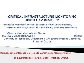
Critical Infrastructure Monitoring Using UAV Imagery
1. CRITICAL INFRASTRUCTURE MONITORING
USING UAV IMAGERY
Evangelos Maltezosa, Michael Skitsasb, Elisavet Charalambousb,
Nikolaos Koutrasb, Dimitris Bliziotisa and Kyriacos Themistocleousc
aGeosystems Hellas, Athens, Greece
bADITESS Ltd, Nicosia, Cyprus cCyprus
University of Technology, Department of Civil Engineering and Geomatics,
Limassol, Cyprus
nternational Conference on Remote Sensing and Geoinformation
of Environment, 4-8 April, 2016 - Paphos, Cyprus
2. 2
The use of two rapidly evolving approaches, the Unmanned Aerial
Vehicles (UAVs) and Dense Image Matching (DIM) techniques is
an attractive solution to extract high quality photogrammetric products like
3D point clouds and orthoimages. The combination of the UAVs and
DIM constitute a useful tool for several applications such as:
Geometric documentation of a cultural heritage site
Cadastre
Urban studies
3D modeling,
Change detection
Emergency response
Critical infrastructure monitoring
INTRODUCTION
3. 3
The main advantages of the use of the UAVs are:
High navigation accuracy
High-risk flight potentials
Low operational cost
Ability to integrate several type of sensors (e.g. hyperspectral, push
room)
Large scale images
High overlapping of collected images
INTRODUCTION
The aforementioned characteristics offer applicability to a wide range of
applications providing accuracy, economy, rapidity and automation
during operation.
4. 4
INTRODUCTION
In the literature, interesting studies have been implemented that exploit the
advantages of the UAVs. Concerning the emergency response
applications:
Development of a rapid aerial mapping system based on a UAV, whose key
features are the effective acquisition of the sensory data, real-time
transmission and processing of the data (Choi and Lee, 2011).
Integration of geospatial video server with a UAS and fire brigades crisis
management system, so that real-time geospatial airborne video and derived
products can be made available at all levels during a fire incident (van Persie
et al., 2011). Two scenarios were exercised, the first considered a car
accident with multiple cars including a truck with chemicals while the second
considered a fire in an industrial complex next to a railway.
Development of procedures of using remote sensing by UAV to aid in the
rapid evaluation and monitoring of environmental impacts caused by
accidents involving transport of dangerous cargoes on highways (Longhitano
and Quintanilha, 2013).
5. 5
INTRODUCTION
Concerning the infrastructure inspection:
Field-based investigation and inspection using mobile devices and base
maps (Nakagawa et al., 2015). The base maps were generated by a UAV
and a terrestrial laser scanner aiming at assisting investigators in
infrastructure asset monitoring with location-based applications.
Usage of a low-cost lightweight laser scanner onboard a UAV for an
infrastructure project, and more specifically, a bridge (Mader et al., 2015).
The 3D laser point cloud was compared with the corresponding DIM point
cloud that extracted using the UAV imagery in conjunction with the
Structure from Motion (SfM) technique which is utilized to obtain the
image orientations.
In this study, the benefits of the use of the UAVs in critical
infrastructure monitoring applying DIM are highlighted
extracting a 3D point cloud and orthomosaic for an Olympic
venue in Attica, Greece.
6. 6
Critical infrastructure protection is an important issue of European
perspective in trying to identify a holistic framework for the protection
against multiple types of risks. In order to ensure a high level protection of
the designated European Critical Infrastructures, concrete actions are
required to be established within a holistic protection framework. Besides
technological and operational measures, the establishment of effective and
endured partnerships between involved organizations that employ
integrated, collaborative engagement and interaction between public – and
private – sector partners act as vital components to these actions.
Modern tools should fuse Earth Observation data with in-situ data streams
such as automated monitoring stations, radar, aircrafts, intelligence
information and other sources for enhancing protection of critical
infrastructures through monitoring and surveillance of critical components,
risk mapping and management products.
CRITICAL INFRASTRUCTURES PROTECTION
7. 7
A critical parameter for success is the introduction of the data, both
primary and processed satellite images, risk and impact assessment into
common format, and subsequently into a geographical (GIS) entity. This
would allow for defragmentation and homogenization of data sets from
different type of sources and at different geographical scales and
elimination of the duplication of information collection.
Establishment of a high resolution 3-D mapping platform and development
of relevant CAD and GIS records concerning security aspects of critical
infrastructure plants and installations is being discussed. Information may
be extracted from synthetic aperture radar (SAR) and electro-optical (EO)
imagery, intelligence and surveillance of Critical infrastructure with
particular emphasis to remote and isolated assets. Access to information
will be protected with full security credentials.
CRITICAL INFRASTRUCTURES PROTECTION
8. 8
STUDY WORKFLOW
Implementation:
The ERDAS IMAGINE UAV software package provided by Geosystems
Hellas was used on a workstation computer (CPU with dual Xeon E5 and 64Gb
Memory) for the extraction of the DIM point cloud and the orthomosaic of the
area of interest, in the premises of ADITESS LTD.
9. 9
The application area is an Olympic venue that used during the Olympic
Games in Athens (2004), at an area of 400 acres.
DESCRIPTION OF THE AREA OF INTEREST AND IMAGE
COLLECTION PROCEDURES
10. 10
• A Multicopter type UAV (owned by ADITESS LTD), the AP-M – S800
was used, equipped with a Panasonic DMC-GH4 camera and a 12 mm
High Quality lens.
• The area of interest was covered by 585 overlapped NADIR-looking
RGB digital aerial images with a ground sample distance (GSD) of 2 cm.
Additionally 215 oblique images were acquired covering specific building
blocks.
• The GPS/INS of the UAV data is used for the bundle adjustment.
Additionally, Ground Control Points (GCPs) were used to improve the
accuracy measured by Leica GPS station with accuracy better than 1 cm.
The flight duration was 90 minutes and the height flight approximately 70
m.
DESCRIPTION OF THE AREA OF INTEREST AND IMAGE
COLLECTION PROCEDURES
11. 11
For a considerable period, the acquisition of a quality and accurate dense
3D point cloud of an area or of an object was mainly based on using Aerial
Laser Scanning (ALS) or Terrestrial Laser Scanning (TLS) systems. Over
the past years more and more researchers have developed robust
matching cost functions and stereo matching algorithms used in Dense
Image Matching (DIM).
DENSE IMAGE MATCHING
The DIM is an image matching process which can identify homologies for
the total number of pixels of the reference image. The final product is a
3D point cloud of the area or object of interest.
In stereo matching methods, a reference and a matching image are
required at the minimum. To fully cover the area or the object of interest
and therefore to eliminate occluded areas and mismatches, a Multi-View
Stereo (MVS) approach is utilized.
12. 12
Unlike laser systems requirements, the use of DIM technique does not
require expensive hardware…
…However, DIM point clouds suffer from occlusions, complex scenes,
radiometric differences, shadows, texture-less areas,
repetitive pattern of objects, etc. To eliminate occlusions and
mismatches as well as to achieve accurate and reliable results:
Overlaps of 80% along track and 60% across track (instead of the
typical 60% forward and 20% sideward overlap of airborne image blocks)
are used.
A variety of constraints and assumptions such epipolar geometry,
left-right consistency, image brightness constancy, surface
smoothness etc., are applied.
DENSE IMAGE MATCHING
13. 13
More than 85% of the images, are subject to overlap with at
least 9 other images increase of the redundancy compared
to traditional photogrammetric blocks with one stereo-pair
improvement of the accuracy of the image based 3D point
cloud generation.
DENSE IMAGE MATCHING POINT CLOUD
In this study, the DIM point cloud of the area of interest is extracted taking
into consideration the previous mentioned concerns...
Camera locations and image
overlap from UAV-flight
14. 14
DENSE IMAGE MATCHING POINT CLOUD
DIM point cloud using the NADIR-looking
The computational time for the extraction of a 13 million points was 2.5
hours approximately, while the achieved accuracies were better than 4 cm.
19. 19
This study leverages the benefits of the two increasing technological
approaches of the UAV systems and DIM techniques for critical
infrastructure monitoring and protection.
The results are considered to be satisfactory and they demonstrate that
accurate and reliable photogrammetric products such 3D point cloud
and orthomosaic of the area of interest can be generated using a
UAV+DIM approach.
Surpassing the expectations of other methodologies that aim to find only
“appropriate” points or discrete homologous points between the captured
images, the DIM technique gives promising results even in demanding
scenes such as critical infrastructures.
…In this context, it seems that the DIM has the potential to become an
alternative process, worthy of the laser scanning systems, which in
conjunction with the UAVs can extract accurate and high quality
dense 3D point clouds of an area of interest with lower cost production.
CONCLUSIONS