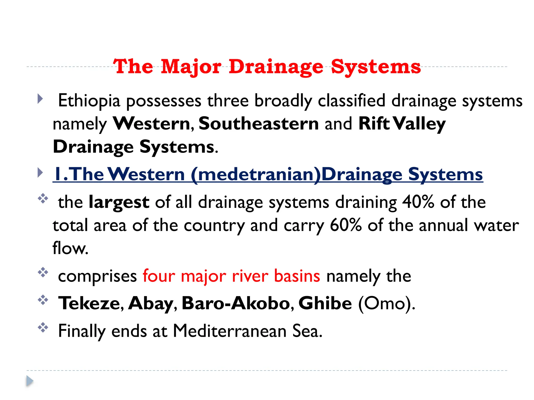
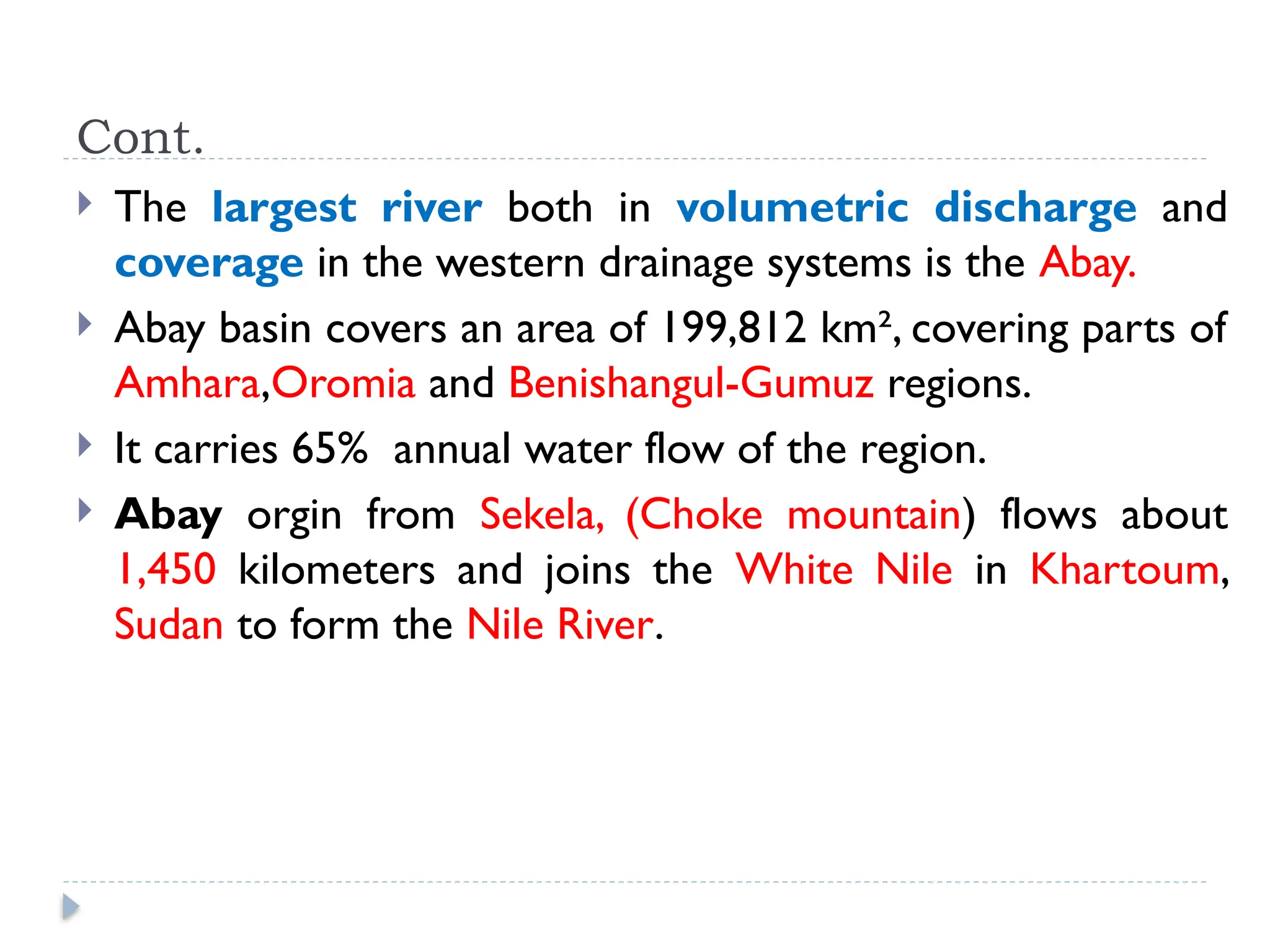
Chapter-4
Drainage Systems AndWater Resource Of
Ethiopia And the Horn
 71% of the earth’s total surface is covered by water
bodies majorly occupied by seas and oceans.
97.5% is alkaline(Basic ph >7). accumulated in seas and
oceans.
Only 2.5% is fresh water, of which nearly 68.7% is
deposited in glaciers, 30.1% in ground water, 0.8% in
permafrost and 0.4% in surface waters.
 Water in lakes, rivers, atmosphere, soils and
wetlands are considered as surface waters.
Major Drainage System of Ethiopia
 The flow of water through well-defined channel is known as
drainage.
 A drainage system is made up of a principal river and its
tributaries.
 A river system begins at a place called the source or
headwater and ends at a point called mouth.
 The drainage pattern/shape of a given area is the outcome of
the geological processes, nature and structure of
rocks, topography, slope, amount and the periodicity
of the flow.
Cont..
 A drainage basin/ catchement area is the topographic region
from which a river and its tributaries collect both the surface runoff
and subsurface flow.
 The general patterns of major river basins in Ethiopia are
determined by topographical structures which can be
clarified as:
 A.The topography of the outward sloping of the Western and South
eastern plateaus
 B.The structural formation of the Rift Valley with its in-ward-sloping
escarpments resulting mainly in an inland drainage system.
 C. Faults and joints that structurally influence part of the courses or
paths of many rivers.
The Major Drainage Systems
 Ethiopia possesses three broadly classified drainage systems
namely Western, Southeastern and RiftValley
Drainage Systems.
 1.The Western (medetranian)Drainage Systems
 the largest of all drainage systems draining 40% of the
total area of the country and carry 60% of the annual water
flow.
 comprises four major river basins namely the
 Tekeze, Abay, Baro-Akobo, Ghibe (Omo).
 Finally ends at Mediterranean Sea.
Cont.
 The largest river both in volumetric discharge and
coverage in the western drainage systems is the Abay.
 Abay basin covers an area of 199,812 km², covering parts of
Amhara,Oromia and Benishangul-Gumuz regions.
 It carries 65% annual water flow of the region.
 Abay orgin from Sekela, (Choke mountain) flows about
1,450 kilometers and joins the White Nile in Khartoum,
Sudan to form the Nile River.
Cont.
 Tekeze and its tributaries, carrying 12 % of the annual
water flow of the region drains 82,350 Km² of land
surface.
 The basin has two main tributaries (Angereb and
Goang) which rises in the central highlands of
Ethiopia.
 Tekeze named Atbara in Sudan, which is a tributary of
the Nile.
 The total mean annual flow from the basin is estimated
to be 8.2 billion metric cubes.
Cont..
 The Baro-Akobo and Ghibe / Omo rivers drain the wettest
highlands in the south and southwestern Ethiopia.
 They carry 17% and 6 % of the annual water flow respectively.
 The Ghibe/ Omo river basin drains an area of 79,000 km²
with an estimated mean annual flow of 16.6 billion metric
cubes.
 Baro Akobo river basin has an area of 75,912 km2, covering
parts of the Benishangul Gumuz, Gambella, Oromia, and
SNNPR.
 The total mean annual flow from the river basin is estimated to
be 23.6 BMC.
Cont..
 The Baro together with Akobo forms the Sobat
River in South Sudan.
 The Ghibe / Omo River finally empties in to the Chew-
Bahir at the mouth of LakeTurkana.
 N.B 1cubic meter is equivalent to 1000 litres.
2.The Southeastern (Indian ocean)Drainage Systems
 The basin which is mainly drained by Wabishebelle
and Ghenale.
 The Major highlands of this basin include plateaus of
Arsi, Bale, Sidama and Harerghe.
 Wabshebelle and Ghenale carrying 25 % of the annual
water flow of Ethiopia.
 Ghenale river basin has an area of 171,042 km²,
covering parts of Oromia, SNNPR, and Somali regions.
Cont..
 The Ghenale basin flows estimated to be 5.8 BMC of
water within elevation ranging between 171-4385
meters above sea level.
 In Somalia it is named the Juba River.
 Wabishebelle is the largest river in terms
catchment area 202,697 km² and
 longest river in Ethiopia.
3.The Rift Valley Drainage System
It is an area of small amount of rainfall, high evaporation
and small catchment area.
The only major river basin is that of the Awash.
Awash river basin has a catchment area of 114,123 km²
and has an average annual discharge of 4.9 billion cubic
meters.
The Awash River originates from Shewan plateau in
central highlands of Ethiopia, and flows 1250 kms.
Awash is the most utilized or exploited river in the
country.
Cont.
In the Rift Valley drainage systems, there is no one
general flow direction, as the streams flow in all
directions.
The Awash river flows in a northeast direction.
It finally ends in a maze of small lakes and marshy area;
the largest of which is Lake Abe on the Ethio-Djibouti
border.
Cont.
The Southern part of the RiftValley sub-basin is
characterized by a number of lakes and small streams.
 It is also described as lakes region.
4.3. Water Resources: Rivers, Lakes and
Sub-Surface Water
1. The Ethiopian Rivers
 Different from many other African countries, Ethiopia is
gifted with many rivers.
 Majority of the rivers originate from highland areas
and cross the Ethiopian boundary.
Characteristics Ethiopian rivers
 steep profiles; they arise from very high places and
flow to the country’s borders across lowlands.
 they show seasonal fluctuation in water volume.
 they run through steep-sided river valleys and
gorges.
 they serve as boundaries, both international and
domestic.
2. The Ethiopian Lakes
 Relatively Ethiopia is rich in lakes.
 Almost all Ethiopian lakes are result of tectonic process
that took place during Quaternary period of Cenozoic
era.
 Except few Ethiopian lakes, most of them are located
within the RiftValley System.
 Lake Tana, the largest lake in Ethiopia occupies a shallow
depression in the highlands.
Crater lakes of Ethiopia:
 Ethiopia is also gifted with crater lakes.
 formed after an explosive volcano breaks a mountain open ,
 Bishoftu, Kuruftu, Babbo Gaya, and Arsedi, all around Bishoftu
 Wonchi and Dendi around Ambo, Ginchi and Wellisso
 Zequala near Bishoftu
 Hashenge near Korum in Tigray
 Haik, (some 30 kilometers away from Desse on the road to
Woldiya.
Man made lakes
Koka, Fincha and Melka Wakena, and others dammed to
hydroelectric power generation projects.
Cluster of lakes are lined up within main Ethiopian rift.
Lake Abaya is the largest of all the lakes in the R.V system.
The southern tip of the RiftValley forms the marshy land
called the Chew Bahir which is drained by Segan and
Woito rivers.
Shala and Ziway are the deepest and the shallowest
lakes in the central Ethiopian Rift.
Rift valley lakes
3. Subsurface (Ground) Water Resource of
Ethiopia .
compared to surface water, Ethiopia has lower ground water
potential.
However, there exists higher total exploitable groundwater
potential.
Climatic and geophysical conditions determine the availability
of groundwater resource.
Considering various separate studies, Ethiopian potential of
groundwater is believed to range between 12-30 BMC.
Water Resources Potentials and
Development in Ethiopia
I. The potential of exploitable water in Ethiopia is huge,
so why is our agriculture still rain fed?
II. What do you think are reasons that diminish the
irrelevance of Ethiopian rivers for transportation?
 The followings are some of potential development
uses of water resource of Ethiopia.
a. Hydro-electric Potential
 Ethiopian rivers have a very high potential for generating
electricity.
 The exploitable potential of Hydroelectric power is
estimated at about 45,000 megawatts.
 The first hydroelectric power generation plant was
installed on Akaki River (Aba Samuel) in 1932.
 Currently many hydroelectric power dams are operating
and many others are under construction.
Cont..
 GERD will be generate 6400 megawatts.
 Gilgel Gibe III generating 1870 megawatts.
 Currently Ethiopia is administering 14 hydroelectric
power plants constructed on lake Aba Samuel,
Koka, Tis Abay, Awash, Melka Wakena, Sor,
Fincha, Gibe/Omo, Tana Beles and Tekeze,
generating close to 4000 megawatts of energy.
 At the end of GERD ethiopia will be generate
4000+6400=10,400 megawatts of energy.
b. Irrigation and Transportation
 The highlands of Ethiopia are obstacles for both
irrigation and transportation.
 But on the lowlands, their demand for irrigation is
high.
 Ethiopia’s potential of irrigation is estimated to be 5.3
million hectares.
 The Baro-Akobo and Genale Dawa river systems have
large irrigation potential compared to other basins.
 more than 60% of the area under irrigation so far is
located in RiftValley Drainage System.
Cont..
Ethiopian rivers are not suitable for transportation.
The Baro at its lower course is the only navigable river.
Ethiopian lakes are much suitable for transportation than
rivers.
Lake Tana and Abaya are relatively the most used for
transportation.
c. Fishing and Recreation
 Ethiopian lakes are rich in fish.
 The annual fish production is estimated to be 31.5
thousand tons.
 However, the exploitable potential is far greater than
the current production.
 Exploitable fish potential in lakes varies.
 Lake Tana leads the potential by estimated 8,000-
10,000 tons per year.
Cont..
Lake Chamo is estimated at 4,500 tons of fish per year.
However, more than 60% of fish supplies are coming from
Ethiopian main RiftValley lakes.
However, some of the lakes are currently threatened by
sedimentation, invasive species (water hyacinth), over
exploitation and expansion of investments around
lakes.
CHAPTER-5
THE CLIMATE OF ETHIOPIA ANDTHE HORN
 Ethiopia as a large country and characterized by a
wide variety of altitudinal ranges and diverse climatic
conditions.
 The closeness to equator and the Indian Ocean, the
country is subjected to large temporal and spatial
variations in elements of weather and climate.
Cont…..
 The climate of Ethiopia is mainly controlled by the
seasonal migration of the (ITCZ) and associated
atmospheric circulations as well as by the complex
topography of the country.
 ITCZ is a low pressure zone formed by the convergence
of Northeast Trade winds and the Equatorial Westerly's.
Cont..
 Weather: is the current state of the:- atmosphere,
composing temperature, atmospheric pressure, humidity,
wind speed and direction, cloudiness and precipitation.
 Climate:- It is the composite of daily weather conditions
recorded for long periods of time.
5.2. Elements and Controls of Weather and Climate
Here are lists of major elements and controls of weather
and climate.
Cont..
 Latitudinal location of Ethiopia and the Horn
resulted in;
• high average temperatures,
• high daily and small annual ranges of temperature(the
temp. difference between hottest and coldest months of
the year)
• no significant variation in length of day and night between
summer and winter.
Equinoxes and Solstices
 An equinox is the instant of time when the sun strikes the
plane of the Earth's equator.
 During this passage the length of day and night are equal.
 it appears twice a year.
 1,The Vernal (spring) equinox: is the day when the point
of verticality of sun’s rays crosses the equator northwards.
 This equinox experiences in Northern Hemisphere when the
sun is exactly above the equator.
 It is beginning of Spring season in the northern hemisphere.
 March 21 is the beginning of the vernal equinox.
Cont..
2.The Autumn equinox:
 It appears to happen when the visible sun moves south
across the equator on 23rd
of September.
 It is the beginning of Autumn season in southern
hemisphere.
Solstice
 Solstice is an event when the overhead sun appears to
cross northern or southern points relative to the equator.
 It resulting unequal length of days and nights in the
hemispheres.
1.The summer Solstice: on June 21st
, the northern
hemisphere has maximum tilt towards the sun experiencing
longest daylight of the year.
- It is the first day of summer in the Northern Hemisphere.
- The sun is at its highest position directly above 23 ½ in
the Tropic of Cancer.
Cont..
2.The winter solstice: December 22nd
is the day when the
maximum southward inclination is attained in the Southern
Hemisphere.
 It causes longest night and shortest daylight In the
Northern Hemisphere.
Types of lapse rate
 The rate of change of an atmospheric variable, usually
temperature, with height is known as lapse rate.
 Three types of lapse rates are identified;
 1. Dry adiabatic laps rate
 An adiabatic lapse rate is the rate at which the
temperature of an air parcel changes in response to the
expansion or compression process associated with a
change in altitude.
 When air rises, it expands because there is less weight
of air upon it.
Cont..
 The rate of heating or cooling is about 10°C for every
1000 m of change in elevation.
 This rate applies only to unsaturated air, and thus it is
called the dry adiabatic laps rate.
ii. Wet Adiabatic laps rate
 As a parcel of air which rise from the earth contains
water vapor.
 And this water vapor reduced and release heat on it
from ground to the higher atmosphere.
 When the altitude increase the parcel of air cools more
slowly.
 Approximately there is 6 c
⁰ of air cools for every 1000
meter altitude rise.
iii. Environmental lapse rate or Atmospheric
lapse late
 This refers to the actual, observed change of
temperature with altitude.
 The fact that air temperature is normally highest at
low elevations the temperature decreases with altitude
increase.
 The rate of change is 6.5 C
⁰ ,per altitude rise by 1000
meters.
5.3. Spatio temporal Patterns and Distribution
of temperature and rainfall in Ethiopia
 5.3.1. Spatiotemporal Distribution of
Temperature
 The spatial distribution of temperature in Ethiopia is
mainly determined by altitude and latitude.
 The location of Ethiopia at close proximity to equator, a
zone of maximum insolation, resulted for every part
of the country to experience overhead sun twice a
year.
 Altitude: the height of location above sea-level.
 Latitude: the distance of location from the equator.
Cont..
 Mean annual temperature varies from >30⁰C tropical
lowlands to <10⁰c at very high altitudes.
 The Bale Mountains are among highlands where lowest
mean annual temperatures are recorded.
 The highest mean maximum temperature in the
country is recorded in the Afar Depression.
Cont..
 Daily maximum temperature varies from a high of more
than 37⁰C over the lowlands in northeast and
southeast to a low of about 10⁰C-15⁰C over the
northwestern and southwestern highlands.
 In Ethiopia and elsewhere in the Horn, temperature
shows seasonal variations.
 months from March(megabit) to June(sene) in
Ethiopia have records of highest temperatures.
 On the other hand, low temperatures are recorded
from November(hidar) to February (yekatit).
Cont..
 Southern part of Ethiopia receives highest records
of temperature in autumn/meher and spring/tseday
following the relative shift of the sun;
 whereas in the northern part of the country,
summer season is characterized by higher temperature.
5.3.2. Spatiotemporal Distribution of Rainfall
 Rainfall in Ethiopia is the result is influenced by the position
of Inter tropical Convergence Zone(ITCZ).
 The convergence of Northeast Trade winds and the
Equatorial Westerlies forms the ITCZ, which is a low-
pressure zone.
 The inter-annual fluctuation of the surface position of the
ITCZ causes a variation in the Wind flow patterns over
Ethiopia and the Horn.
 Following the position of the overhead sun, the ITCZ also
shifts north to south of the equator.
Cont..
 As the shift takes place, equatorial westerlies from the
south and southwest invade most parts of Ethiopia
bringing moist winds.
 This happens in July in Ethiopia and the Horn causing
variability and seasonality of R.F.
Cont..
 The ITCZ shifts towards south of equator (Tropic of
Capricorn) in January(tir).
 During this period, the Northeast Trade Winds carrying non-
moisture dominates the region.
 Afar and parts of Eritrean coastal areas experience rainfall
in this period.
 Following the directness of the Sun in March(megabit) and
September around the equator, the ITCZ shifts towards
equator.
 During this time, the central highlands, southeastern
highlands and lowlands receives rainfall as the south
easterlies bring moist winds to this areas.
Seasonal or Temporal Variabilities of R.F
 The temporal variabilities of rainfall are characterized by;
 i. Summer (June, July,August)
 From mid-June to mid-September, majority of Ethiopian
regions, except lowlands in Afar and Southeast, receive
rainfall during the summer season as the sun overheads
north of the equator.
 Autumn(tseday)(sep,oct,nov,) is the season of the
year between summer and winter.
 In autumn the ITCZ shifts towards the equator
weakening the of equatorial westerlies.
 During this season, the south easterlies winds from
Indian ocean sprays or little rains in the lowlands of
south-eastern part of Ethiopia.
iii. Winter (bega) (December, January and
February)
 During this season, Northeasterly winds originating from
the landmass of Asia dominantly conquer Ethiopian
landmass.
 However, it has no significant coverage of R.F compared
to other seasons.
 The northeasterly winds crossing the Red Sea carry very
little moisture and supplies rain only to the Afar lowlands
and the Red Sea coastal areas.
iv. Spring(Belg) (March, April and May)
 In this season, the sun is shining directly on the equator
and the effect of the northeast trade wind is very much
reduced.
 On the other hand, the south easterlies from the Indian
Ocean provide rain to the highlands of Somalia, and to
the central and southeastern lowlands and highlands of
Ethiopia.
5.4 Agro-ecological Zones of Ethiopia
 The five major climatic zones of Ethiopia, namely Bereha,
Kolla, Woina Dega, Dega and Wurch.
 1.The Wurch Zone
 Altitude >3,200 masl and mean annual temperature of
<10°C.
 Mt.Ras Dashen, Guna, Megezez in North Shoa, Batu,
Choke,AbuneYoseph .
2.Dega Zone
 This is a zone of highlands having relatively higher
temperature and lower altitude compared to the wurch
Zones.
 In Ethiopia, the Dega-zone is long inhabited and has
densely populated, reliable rainfall for agriculture and
absence of vector-borne diseases such as malaria.
3. Weyna Dega Zone
 has warmer temperature and moderate rainfall.
 lies between 1500-2,300 masl .
 It is the second largest zone covering more than 26% of
the landmass of Ethiopia.
 The temperature and rainfall of this category is highly
suitable for majority of crops grown in Ethiopia.
 Hence, the zone includes most of the agricultural land.
The Weyna Dega zone has also two growing seasons.
4.Kolla Zone
 In Ethiopia the south, southeast, west and northeastern
part are mainly in this category.
 Kolla is the climate of the hot lowlands with an altitudinal
range of 500 to 1500 masl.
 Average annual temperature ranges b/n20°C and 30°C.
mean annual R.F is erratic,/unpredictable it can be as high
as 1500 mm in the wet western lowlands of Gambella.
 Rainfall is highly variable from year to year.
 The region is boundary between the hot arid (Bereha) and
the humid climates (Woina Dega).
5.Bereha Zone
 Bereha is the hot arid climate of the desert lowlands.
 The Bereha agro-climatic zone is largely confined to
lowland areas with altitude of lower than 500 meters.
 Around Danakil depression, the elevation goes below
the sea level.
 Its average annual rainfall is less than 200 mm, and
Cont..
 average annual temperature is over 27.5°C.
 Strong wind, high temperature, low relative humidity, and
little cloud cover usually characterize Bereha.
 Evapotranspiration is always in excess of rainfall.
 Djibouti, majority of Somalia, and coastal areas of Eritrea
are categorized under Kolla and Bereha zones.
5.5. Climate Change/Global Warming:
Causes, Consequences and Response
Mechanisms
 Climate change refers to any change in climate over
time, due to either natural variability or human
activities.
 In this section of this chapter the concept of climate
change, causes, consequences and response
mechanisms in relation to the Ethiopia’s past, present
and future situations will be discussed.
5.5.1. Current Trends of Climate in Ethiopia
 The Ethiopian climate includes the extremes such as drought,
flood and other hazards .
 Ethiopia ranked 5th
out of 184 countries in terms of its risk of
drought.
 In the country, 12 extreme drought events were recorded
between 1900 and 2010.
 Among the 12, seven of the drought events occurred since 1980.
 The majority of these resulted in famines.
 The severe drought of 2015-2016 was exacerbated by the
strongest El Nino that caused successive harvest failures and
widespread livestock deaths in some regions.
Trends in Temperature Variability
 Over the last decades, Ethiopia has experienced climatic changes.
 Mean annual temperature has shown 0.2°C to 0.28°C rise per
decade over the last 40-50 years.
 A rise in average temperature of about 1.3°C has been observed
between 1960 and 2006. The rise has spatial and temporal
variation.
 Higher rise in temperature was noted in drier areas in northeast
and southeast part of the country.
 Notably the variability is higher in July-September.
 The number of ‘hot days’ and ‘hot nights’ has also shown
increment.
 Consequently, the country’s minimum temperature has increased
with 0.37°C to 0.4°C per decade.
Trends in Rainfall Variability
 Precipitation has remained fairly stable over the last 50 years
when averaged over the country.
 Rainfall variability is increasing from time to time and place to
place.
 In some regions, total average rainfall is showing decline.
 For example, parts of southern, southwestern and south-
eastern regions receiving Spring/tseday and Summer rainfall
have shown decline by 15-20%between 1975 and 2010.
 Changes in temperature and rainfall increase the frequency
and severity of extreme events.
 Major floods have been a common occurrence, leading to loss
of life and property in parts of the country.
5.5.2. Causes of Climate Chang
 A. Natural Causes
 Earth orbital changes: The earth is tilted at an
angle of 23.5° to the perpendicular plane of its
orbital path. Changes in the inclination of the earth
can lead to small but climatically important changes
in the strength of the seasons.
 More incline means warmer summers and colder
winters.
cont..
 Volcanic eruptions: volcanic eruption releases large
volumes of sulphur dioxide, carbon dioxide, water
vapor, dust, and ash into the atmosphere.
 The release of large volume of gases and ash can
increase planetary reflectivity causing atmospheric
cooling.
B. Anthropogenic Causes
 The warming of earth planet in the past 50 years is
majorly driven by human activities.
 The industrial activities that our modern civilization
depends upon have raised atmospheric carbon dioxide.
 Human induced greenhouse gases such as carbon
dioxide, methane and nitrous oxide have caused much
of the observed increase in Earth's temperatures over
the past 50 years.
5.5.3. Consequences of Climate Change
 In many parts of the world it caused:-
 loss of life,
 damaging property and
 affecting livelihoods.
 The impact of climate change is higher in low income
countries, since they have limited capacity to cope with
the changes.
Impacts on human health:
 It cause increased heat related mortality and disease,
 infectious disease increases following floods and storms,
and
 substantial health effects following population
displacement to escape extreme weather events.
Impact on water resources:
 Climate change is leading to melting of snow and
glaciers that increases rise in sea level.
 increase drought and floods, distorts wind flow pattern,
decreases water table.
 More frequent and longer droughts reduce the amount
of run-off into rivers, streams and lakes.
Cont..
 Impact on Agriculture: changes in temperature and
rainfall patterns as well as significantly affect agricultural
production.
 Climate change increases stress on fodder quality and
availability.
 Impact on Ecosystem: climate change affects the
success of species, population, and community
adaptation.
 The rate of climatic warming may exceed the rate of
shifts in certain range species, these species could be
seriously affected or even disappear because they are
unable to resist.
5.5.4. Climate Response Mechanisms
 There are three major response mechanisms to climate
change namely mitigation, adaptation and resilience.
 Mitigation and its Strategies: Mitigation measures are
those actions that are taken to reduce and control
greenhouse gas emissions changing the climate.
 There are some mitigation measures that can be taken to
avoid the increase of pollutant emissions.
 Practice Energy efficiency.
Cont….
Increase the use of renewable energy sources such as
solar energy.
Efficient means of transport implementation: electric
public transport, bicycle, public cars etc.
Greenhouse gases (also known as GHGs) are gases in the
earth's atmosphere that trap heat.
Adaptation and its Strategies
 Adaptation: actions that help to reduce vulnerability to
current or expected impacts of climate change.
 The goal is to reduce our vulnerability to the harmful
effects of climate change.
 For example diversify our livelihoods.
Some of the major adaptation strategies
include:
building flood defenses,
plan for heat waves and higher temperatures,
installing water-permeable roadways to better deal with
floods and storm water.
landscape restoration and reforestation,
flexible and diverse cultivation to be prepared for
natural catastrophes.
preventive and safety measures (evacuation plans, health
issues, etc.)
Resilience
Capacity to anticipate, manage or recover from climate
related disruptions with minimal damage.
Some of the measures are:-
Mass flood insurance resources for disaster preparedness
such as emergency response training.
building strong community net works
Diversifying livelihoods
THE END!!

chapter 4-5 FRESHMAN Geography ppt..pptx

  • 1.
    Chapter-4 Drainage Systems AndWaterResource Of Ethiopia And the Horn  71% of the earth’s total surface is covered by water bodies majorly occupied by seas and oceans. 97.5% is alkaline(Basic ph >7). accumulated in seas and oceans. Only 2.5% is fresh water, of which nearly 68.7% is deposited in glaciers, 30.1% in ground water, 0.8% in permafrost and 0.4% in surface waters.  Water in lakes, rivers, atmosphere, soils and wetlands are considered as surface waters.
  • 2.
    Major Drainage Systemof Ethiopia  The flow of water through well-defined channel is known as drainage.  A drainage system is made up of a principal river and its tributaries.  A river system begins at a place called the source or headwater and ends at a point called mouth.  The drainage pattern/shape of a given area is the outcome of the geological processes, nature and structure of rocks, topography, slope, amount and the periodicity of the flow.
  • 3.
    Cont..  A drainagebasin/ catchement area is the topographic region from which a river and its tributaries collect both the surface runoff and subsurface flow.  The general patterns of major river basins in Ethiopia are determined by topographical structures which can be clarified as:  A.The topography of the outward sloping of the Western and South eastern plateaus  B.The structural formation of the Rift Valley with its in-ward-sloping escarpments resulting mainly in an inland drainage system.  C. Faults and joints that structurally influence part of the courses or paths of many rivers.
  • 4.
    The Major DrainageSystems  Ethiopia possesses three broadly classified drainage systems namely Western, Southeastern and RiftValley Drainage Systems.  1.The Western (medetranian)Drainage Systems  the largest of all drainage systems draining 40% of the total area of the country and carry 60% of the annual water flow.  comprises four major river basins namely the  Tekeze, Abay, Baro-Akobo, Ghibe (Omo).  Finally ends at Mediterranean Sea.
  • 5.
    Cont.  The largestriver both in volumetric discharge and coverage in the western drainage systems is the Abay.  Abay basin covers an area of 199,812 km², covering parts of Amhara,Oromia and Benishangul-Gumuz regions.  It carries 65% annual water flow of the region.  Abay orgin from Sekela, (Choke mountain) flows about 1,450 kilometers and joins the White Nile in Khartoum, Sudan to form the Nile River.
  • 6.
    Cont.  Tekeze andits tributaries, carrying 12 % of the annual water flow of the region drains 82,350 Km² of land surface.  The basin has two main tributaries (Angereb and Goang) which rises in the central highlands of Ethiopia.  Tekeze named Atbara in Sudan, which is a tributary of the Nile.  The total mean annual flow from the basin is estimated to be 8.2 billion metric cubes.
  • 7.
    Cont..  The Baro-Akoboand Ghibe / Omo rivers drain the wettest highlands in the south and southwestern Ethiopia.  They carry 17% and 6 % of the annual water flow respectively.  The Ghibe/ Omo river basin drains an area of 79,000 km² with an estimated mean annual flow of 16.6 billion metric cubes.  Baro Akobo river basin has an area of 75,912 km2, covering parts of the Benishangul Gumuz, Gambella, Oromia, and SNNPR.  The total mean annual flow from the river basin is estimated to be 23.6 BMC.
  • 8.
    Cont..  The Barotogether with Akobo forms the Sobat River in South Sudan.  The Ghibe / Omo River finally empties in to the Chew- Bahir at the mouth of LakeTurkana.  N.B 1cubic meter is equivalent to 1000 litres.
  • 9.
    2.The Southeastern (Indianocean)Drainage Systems  The basin which is mainly drained by Wabishebelle and Ghenale.  The Major highlands of this basin include plateaus of Arsi, Bale, Sidama and Harerghe.  Wabshebelle and Ghenale carrying 25 % of the annual water flow of Ethiopia.  Ghenale river basin has an area of 171,042 km², covering parts of Oromia, SNNPR, and Somali regions.
  • 10.
    Cont..  The Ghenalebasin flows estimated to be 5.8 BMC of water within elevation ranging between 171-4385 meters above sea level.  In Somalia it is named the Juba River.  Wabishebelle is the largest river in terms catchment area 202,697 km² and  longest river in Ethiopia.
  • 11.
    3.The Rift ValleyDrainage System It is an area of small amount of rainfall, high evaporation and small catchment area. The only major river basin is that of the Awash. Awash river basin has a catchment area of 114,123 km² and has an average annual discharge of 4.9 billion cubic meters. The Awash River originates from Shewan plateau in central highlands of Ethiopia, and flows 1250 kms. Awash is the most utilized or exploited river in the country.
  • 12.
    Cont. In the RiftValley drainage systems, there is no one general flow direction, as the streams flow in all directions. The Awash river flows in a northeast direction. It finally ends in a maze of small lakes and marshy area; the largest of which is Lake Abe on the Ethio-Djibouti border.
  • 13.
    Cont. The Southern partof the RiftValley sub-basin is characterized by a number of lakes and small streams.  It is also described as lakes region.
  • 14.
    4.3. Water Resources:Rivers, Lakes and Sub-Surface Water 1. The Ethiopian Rivers  Different from many other African countries, Ethiopia is gifted with many rivers.  Majority of the rivers originate from highland areas and cross the Ethiopian boundary.
  • 15.
    Characteristics Ethiopian rivers steep profiles; they arise from very high places and flow to the country’s borders across lowlands.  they show seasonal fluctuation in water volume.  they run through steep-sided river valleys and gorges.  they serve as boundaries, both international and domestic.
  • 16.
    2. The EthiopianLakes  Relatively Ethiopia is rich in lakes.  Almost all Ethiopian lakes are result of tectonic process that took place during Quaternary period of Cenozoic era.  Except few Ethiopian lakes, most of them are located within the RiftValley System.  Lake Tana, the largest lake in Ethiopia occupies a shallow depression in the highlands.
  • 17.
    Crater lakes ofEthiopia:  Ethiopia is also gifted with crater lakes.  formed after an explosive volcano breaks a mountain open ,  Bishoftu, Kuruftu, Babbo Gaya, and Arsedi, all around Bishoftu  Wonchi and Dendi around Ambo, Ginchi and Wellisso  Zequala near Bishoftu  Hashenge near Korum in Tigray  Haik, (some 30 kilometers away from Desse on the road to Woldiya.
  • 18.
    Man made lakes Koka,Fincha and Melka Wakena, and others dammed to hydroelectric power generation projects. Cluster of lakes are lined up within main Ethiopian rift. Lake Abaya is the largest of all the lakes in the R.V system. The southern tip of the RiftValley forms the marshy land called the Chew Bahir which is drained by Segan and Woito rivers. Shala and Ziway are the deepest and the shallowest lakes in the central Ethiopian Rift.
  • 19.
  • 20.
    3. Subsurface (Ground)Water Resource of Ethiopia . compared to surface water, Ethiopia has lower ground water potential. However, there exists higher total exploitable groundwater potential. Climatic and geophysical conditions determine the availability of groundwater resource. Considering various separate studies, Ethiopian potential of groundwater is believed to range between 12-30 BMC.
  • 21.
    Water Resources Potentialsand Development in Ethiopia I. The potential of exploitable water in Ethiopia is huge, so why is our agriculture still rain fed? II. What do you think are reasons that diminish the irrelevance of Ethiopian rivers for transportation?  The followings are some of potential development uses of water resource of Ethiopia.
  • 22.
    a. Hydro-electric Potential Ethiopian rivers have a very high potential for generating electricity.  The exploitable potential of Hydroelectric power is estimated at about 45,000 megawatts.  The first hydroelectric power generation plant was installed on Akaki River (Aba Samuel) in 1932.  Currently many hydroelectric power dams are operating and many others are under construction.
  • 23.
    Cont..  GERD willbe generate 6400 megawatts.  Gilgel Gibe III generating 1870 megawatts.  Currently Ethiopia is administering 14 hydroelectric power plants constructed on lake Aba Samuel, Koka, Tis Abay, Awash, Melka Wakena, Sor, Fincha, Gibe/Omo, Tana Beles and Tekeze, generating close to 4000 megawatts of energy.  At the end of GERD ethiopia will be generate 4000+6400=10,400 megawatts of energy.
  • 24.
    b. Irrigation andTransportation  The highlands of Ethiopia are obstacles for both irrigation and transportation.  But on the lowlands, their demand for irrigation is high.  Ethiopia’s potential of irrigation is estimated to be 5.3 million hectares.  The Baro-Akobo and Genale Dawa river systems have large irrigation potential compared to other basins.  more than 60% of the area under irrigation so far is located in RiftValley Drainage System.
  • 25.
    Cont.. Ethiopian rivers arenot suitable for transportation. The Baro at its lower course is the only navigable river. Ethiopian lakes are much suitable for transportation than rivers. Lake Tana and Abaya are relatively the most used for transportation.
  • 26.
    c. Fishing andRecreation  Ethiopian lakes are rich in fish.  The annual fish production is estimated to be 31.5 thousand tons.  However, the exploitable potential is far greater than the current production.  Exploitable fish potential in lakes varies.  Lake Tana leads the potential by estimated 8,000- 10,000 tons per year.
  • 27.
    Cont.. Lake Chamo isestimated at 4,500 tons of fish per year. However, more than 60% of fish supplies are coming from Ethiopian main RiftValley lakes. However, some of the lakes are currently threatened by sedimentation, invasive species (water hyacinth), over exploitation and expansion of investments around lakes.
  • 28.
    CHAPTER-5 THE CLIMATE OFETHIOPIA ANDTHE HORN  Ethiopia as a large country and characterized by a wide variety of altitudinal ranges and diverse climatic conditions.  The closeness to equator and the Indian Ocean, the country is subjected to large temporal and spatial variations in elements of weather and climate.
  • 29.
    Cont…..  The climateof Ethiopia is mainly controlled by the seasonal migration of the (ITCZ) and associated atmospheric circulations as well as by the complex topography of the country.  ITCZ is a low pressure zone formed by the convergence of Northeast Trade winds and the Equatorial Westerly's.
  • 30.
    Cont..  Weather: isthe current state of the:- atmosphere, composing temperature, atmospheric pressure, humidity, wind speed and direction, cloudiness and precipitation.  Climate:- It is the composite of daily weather conditions recorded for long periods of time.
  • 31.
    5.2. Elements andControls of Weather and Climate Here are lists of major elements and controls of weather and climate.
  • 32.
    Cont..  Latitudinal locationof Ethiopia and the Horn resulted in; • high average temperatures, • high daily and small annual ranges of temperature(the temp. difference between hottest and coldest months of the year) • no significant variation in length of day and night between summer and winter.
  • 33.
    Equinoxes and Solstices An equinox is the instant of time when the sun strikes the plane of the Earth's equator.  During this passage the length of day and night are equal.  it appears twice a year.  1,The Vernal (spring) equinox: is the day when the point of verticality of sun’s rays crosses the equator northwards.  This equinox experiences in Northern Hemisphere when the sun is exactly above the equator.  It is beginning of Spring season in the northern hemisphere.  March 21 is the beginning of the vernal equinox.
  • 34.
    Cont.. 2.The Autumn equinox: It appears to happen when the visible sun moves south across the equator on 23rd of September.  It is the beginning of Autumn season in southern hemisphere.
  • 35.
    Solstice  Solstice isan event when the overhead sun appears to cross northern or southern points relative to the equator.  It resulting unequal length of days and nights in the hemispheres. 1.The summer Solstice: on June 21st , the northern hemisphere has maximum tilt towards the sun experiencing longest daylight of the year. - It is the first day of summer in the Northern Hemisphere. - The sun is at its highest position directly above 23 ½ in the Tropic of Cancer.
  • 36.
    Cont.. 2.The winter solstice:December 22nd is the day when the maximum southward inclination is attained in the Southern Hemisphere.  It causes longest night and shortest daylight In the Northern Hemisphere.
  • 37.
    Types of lapserate  The rate of change of an atmospheric variable, usually temperature, with height is known as lapse rate.  Three types of lapse rates are identified;  1. Dry adiabatic laps rate  An adiabatic lapse rate is the rate at which the temperature of an air parcel changes in response to the expansion or compression process associated with a change in altitude.  When air rises, it expands because there is less weight of air upon it.
  • 38.
    Cont..  The rateof heating or cooling is about 10°C for every 1000 m of change in elevation.  This rate applies only to unsaturated air, and thus it is called the dry adiabatic laps rate.
  • 39.
    ii. Wet Adiabaticlaps rate  As a parcel of air which rise from the earth contains water vapor.  And this water vapor reduced and release heat on it from ground to the higher atmosphere.  When the altitude increase the parcel of air cools more slowly.  Approximately there is 6 c ⁰ of air cools for every 1000 meter altitude rise.
  • 40.
    iii. Environmental lapserate or Atmospheric lapse late  This refers to the actual, observed change of temperature with altitude.  The fact that air temperature is normally highest at low elevations the temperature decreases with altitude increase.  The rate of change is 6.5 C ⁰ ,per altitude rise by 1000 meters.
  • 41.
    5.3. Spatio temporalPatterns and Distribution of temperature and rainfall in Ethiopia  5.3.1. Spatiotemporal Distribution of Temperature  The spatial distribution of temperature in Ethiopia is mainly determined by altitude and latitude.  The location of Ethiopia at close proximity to equator, a zone of maximum insolation, resulted for every part of the country to experience overhead sun twice a year.  Altitude: the height of location above sea-level.  Latitude: the distance of location from the equator.
  • 42.
    Cont..  Mean annualtemperature varies from >30⁰C tropical lowlands to <10⁰c at very high altitudes.  The Bale Mountains are among highlands where lowest mean annual temperatures are recorded.  The highest mean maximum temperature in the country is recorded in the Afar Depression.
  • 43.
    Cont..  Daily maximumtemperature varies from a high of more than 37⁰C over the lowlands in northeast and southeast to a low of about 10⁰C-15⁰C over the northwestern and southwestern highlands.  In Ethiopia and elsewhere in the Horn, temperature shows seasonal variations.  months from March(megabit) to June(sene) in Ethiopia have records of highest temperatures.  On the other hand, low temperatures are recorded from November(hidar) to February (yekatit).
  • 44.
    Cont..  Southern partof Ethiopia receives highest records of temperature in autumn/meher and spring/tseday following the relative shift of the sun;  whereas in the northern part of the country, summer season is characterized by higher temperature.
  • 45.
    5.3.2. Spatiotemporal Distributionof Rainfall  Rainfall in Ethiopia is the result is influenced by the position of Inter tropical Convergence Zone(ITCZ).  The convergence of Northeast Trade winds and the Equatorial Westerlies forms the ITCZ, which is a low- pressure zone.  The inter-annual fluctuation of the surface position of the ITCZ causes a variation in the Wind flow patterns over Ethiopia and the Horn.  Following the position of the overhead sun, the ITCZ also shifts north to south of the equator.
  • 46.
    Cont..  As theshift takes place, equatorial westerlies from the south and southwest invade most parts of Ethiopia bringing moist winds.  This happens in July in Ethiopia and the Horn causing variability and seasonality of R.F.
  • 47.
    Cont..  The ITCZshifts towards south of equator (Tropic of Capricorn) in January(tir).  During this period, the Northeast Trade Winds carrying non- moisture dominates the region.  Afar and parts of Eritrean coastal areas experience rainfall in this period.  Following the directness of the Sun in March(megabit) and September around the equator, the ITCZ shifts towards equator.  During this time, the central highlands, southeastern highlands and lowlands receives rainfall as the south easterlies bring moist winds to this areas.
  • 48.
    Seasonal or TemporalVariabilities of R.F  The temporal variabilities of rainfall are characterized by;  i. Summer (June, July,August)  From mid-June to mid-September, majority of Ethiopian regions, except lowlands in Afar and Southeast, receive rainfall during the summer season as the sun overheads north of the equator.
  • 49.
     Autumn(tseday)(sep,oct,nov,) isthe season of the year between summer and winter.  In autumn the ITCZ shifts towards the equator weakening the of equatorial westerlies.  During this season, the south easterlies winds from Indian ocean sprays or little rains in the lowlands of south-eastern part of Ethiopia.
  • 50.
    iii. Winter (bega)(December, January and February)  During this season, Northeasterly winds originating from the landmass of Asia dominantly conquer Ethiopian landmass.  However, it has no significant coverage of R.F compared to other seasons.  The northeasterly winds crossing the Red Sea carry very little moisture and supplies rain only to the Afar lowlands and the Red Sea coastal areas.
  • 51.
    iv. Spring(Belg) (March,April and May)  In this season, the sun is shining directly on the equator and the effect of the northeast trade wind is very much reduced.  On the other hand, the south easterlies from the Indian Ocean provide rain to the highlands of Somalia, and to the central and southeastern lowlands and highlands of Ethiopia.
  • 52.
    5.4 Agro-ecological Zonesof Ethiopia  The five major climatic zones of Ethiopia, namely Bereha, Kolla, Woina Dega, Dega and Wurch.  1.The Wurch Zone  Altitude >3,200 masl and mean annual temperature of <10°C.  Mt.Ras Dashen, Guna, Megezez in North Shoa, Batu, Choke,AbuneYoseph .
  • 53.
    2.Dega Zone  Thisis a zone of highlands having relatively higher temperature and lower altitude compared to the wurch Zones.  In Ethiopia, the Dega-zone is long inhabited and has densely populated, reliable rainfall for agriculture and absence of vector-borne diseases such as malaria.
  • 54.
    3. Weyna DegaZone  has warmer temperature and moderate rainfall.  lies between 1500-2,300 masl .  It is the second largest zone covering more than 26% of the landmass of Ethiopia.  The temperature and rainfall of this category is highly suitable for majority of crops grown in Ethiopia.  Hence, the zone includes most of the agricultural land. The Weyna Dega zone has also two growing seasons.
  • 55.
    4.Kolla Zone  InEthiopia the south, southeast, west and northeastern part are mainly in this category.  Kolla is the climate of the hot lowlands with an altitudinal range of 500 to 1500 masl.  Average annual temperature ranges b/n20°C and 30°C. mean annual R.F is erratic,/unpredictable it can be as high as 1500 mm in the wet western lowlands of Gambella.  Rainfall is highly variable from year to year.  The region is boundary between the hot arid (Bereha) and the humid climates (Woina Dega).
  • 56.
    5.Bereha Zone  Berehais the hot arid climate of the desert lowlands.  The Bereha agro-climatic zone is largely confined to lowland areas with altitude of lower than 500 meters.  Around Danakil depression, the elevation goes below the sea level.  Its average annual rainfall is less than 200 mm, and
  • 57.
    Cont..  average annualtemperature is over 27.5°C.  Strong wind, high temperature, low relative humidity, and little cloud cover usually characterize Bereha.  Evapotranspiration is always in excess of rainfall.  Djibouti, majority of Somalia, and coastal areas of Eritrea are categorized under Kolla and Bereha zones.
  • 58.
    5.5. Climate Change/GlobalWarming: Causes, Consequences and Response Mechanisms  Climate change refers to any change in climate over time, due to either natural variability or human activities.  In this section of this chapter the concept of climate change, causes, consequences and response mechanisms in relation to the Ethiopia’s past, present and future situations will be discussed.
  • 59.
    5.5.1. Current Trendsof Climate in Ethiopia  The Ethiopian climate includes the extremes such as drought, flood and other hazards .  Ethiopia ranked 5th out of 184 countries in terms of its risk of drought.  In the country, 12 extreme drought events were recorded between 1900 and 2010.  Among the 12, seven of the drought events occurred since 1980.  The majority of these resulted in famines.  The severe drought of 2015-2016 was exacerbated by the strongest El Nino that caused successive harvest failures and widespread livestock deaths in some regions.
  • 60.
    Trends in TemperatureVariability  Over the last decades, Ethiopia has experienced climatic changes.  Mean annual temperature has shown 0.2°C to 0.28°C rise per decade over the last 40-50 years.  A rise in average temperature of about 1.3°C has been observed between 1960 and 2006. The rise has spatial and temporal variation.  Higher rise in temperature was noted in drier areas in northeast and southeast part of the country.  Notably the variability is higher in July-September.  The number of ‘hot days’ and ‘hot nights’ has also shown increment.  Consequently, the country’s minimum temperature has increased with 0.37°C to 0.4°C per decade.
  • 61.
    Trends in RainfallVariability  Precipitation has remained fairly stable over the last 50 years when averaged over the country.  Rainfall variability is increasing from time to time and place to place.  In some regions, total average rainfall is showing decline.  For example, parts of southern, southwestern and south- eastern regions receiving Spring/tseday and Summer rainfall have shown decline by 15-20%between 1975 and 2010.  Changes in temperature and rainfall increase the frequency and severity of extreme events.  Major floods have been a common occurrence, leading to loss of life and property in parts of the country.
  • 62.
    5.5.2. Causes ofClimate Chang  A. Natural Causes  Earth orbital changes: The earth is tilted at an angle of 23.5° to the perpendicular plane of its orbital path. Changes in the inclination of the earth can lead to small but climatically important changes in the strength of the seasons.  More incline means warmer summers and colder winters.
  • 63.
    cont..  Volcanic eruptions:volcanic eruption releases large volumes of sulphur dioxide, carbon dioxide, water vapor, dust, and ash into the atmosphere.  The release of large volume of gases and ash can increase planetary reflectivity causing atmospheric cooling.
  • 64.
    B. Anthropogenic Causes The warming of earth planet in the past 50 years is majorly driven by human activities.  The industrial activities that our modern civilization depends upon have raised atmospheric carbon dioxide.  Human induced greenhouse gases such as carbon dioxide, methane and nitrous oxide have caused much of the observed increase in Earth's temperatures over the past 50 years.
  • 65.
    5.5.3. Consequences ofClimate Change  In many parts of the world it caused:-  loss of life,  damaging property and  affecting livelihoods.  The impact of climate change is higher in low income countries, since they have limited capacity to cope with the changes.
  • 66.
    Impacts on humanhealth:  It cause increased heat related mortality and disease,  infectious disease increases following floods and storms, and  substantial health effects following population displacement to escape extreme weather events.
  • 67.
    Impact on waterresources:  Climate change is leading to melting of snow and glaciers that increases rise in sea level.  increase drought and floods, distorts wind flow pattern, decreases water table.  More frequent and longer droughts reduce the amount of run-off into rivers, streams and lakes.
  • 68.
    Cont..  Impact onAgriculture: changes in temperature and rainfall patterns as well as significantly affect agricultural production.  Climate change increases stress on fodder quality and availability.  Impact on Ecosystem: climate change affects the success of species, population, and community adaptation.  The rate of climatic warming may exceed the rate of shifts in certain range species, these species could be seriously affected or even disappear because they are unable to resist.
  • 69.
    5.5.4. Climate ResponseMechanisms  There are three major response mechanisms to climate change namely mitigation, adaptation and resilience.  Mitigation and its Strategies: Mitigation measures are those actions that are taken to reduce and control greenhouse gas emissions changing the climate.  There are some mitigation measures that can be taken to avoid the increase of pollutant emissions.  Practice Energy efficiency.
  • 70.
    Cont…. Increase the useof renewable energy sources such as solar energy. Efficient means of transport implementation: electric public transport, bicycle, public cars etc. Greenhouse gases (also known as GHGs) are gases in the earth's atmosphere that trap heat.
  • 71.
    Adaptation and itsStrategies  Adaptation: actions that help to reduce vulnerability to current or expected impacts of climate change.  The goal is to reduce our vulnerability to the harmful effects of climate change.  For example diversify our livelihoods.
  • 72.
    Some of themajor adaptation strategies include: building flood defenses, plan for heat waves and higher temperatures, installing water-permeable roadways to better deal with floods and storm water. landscape restoration and reforestation, flexible and diverse cultivation to be prepared for natural catastrophes. preventive and safety measures (evacuation plans, health issues, etc.)
  • 73.
    Resilience Capacity to anticipate,manage or recover from climate related disruptions with minimal damage. Some of the measures are:- Mass flood insurance resources for disaster preparedness such as emergency response training. building strong community net works Diversifying livelihoods
  • 74.