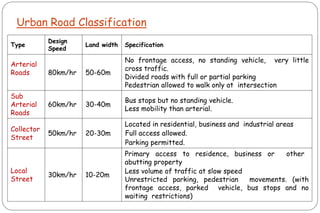
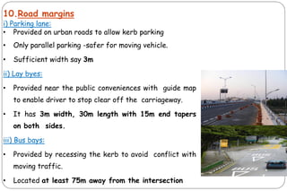
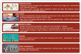
This document provides an overview of transportation engineering and highway classification systems. It discusses the following key points in 3 sentences:
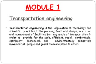
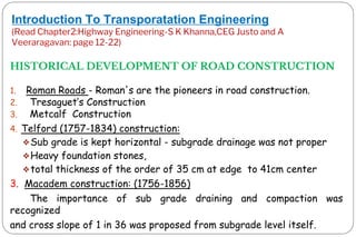
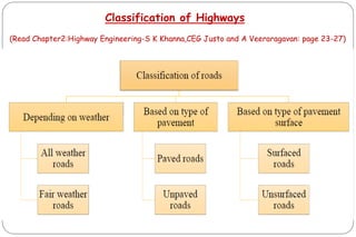
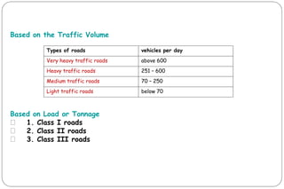
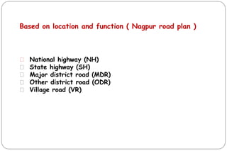
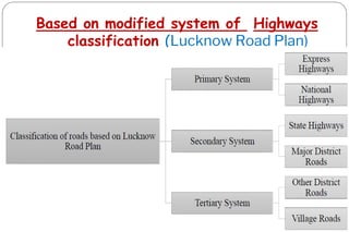
The syllabus covers introduction to transportation engineering, classification of roads, geometric design of highways, and horizontal and vertical alignment design. Module 1 defines transportation engineering and its importance, and discusses the historical development of road construction including Roman, Macadam, and Telford constructions. Highway classification systems are described based on traffic volume, location and function, and as primary, secondary, and tertiary routes according to the Lucknow Road Plan.